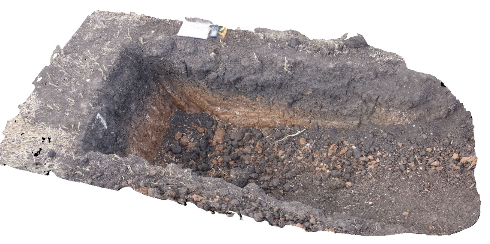
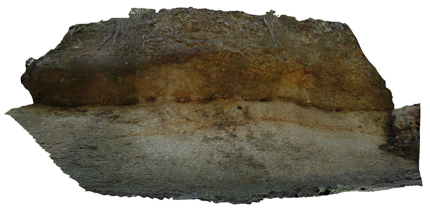
DaisyBanksPit9 Map
 |
20 |
03/17/2015 12:49 p.m. |
3D |
~80cm deep pit into soil and clays overlying late Cenozoic alluvial terrace deposits. Richmond, Tas. |
2.00 |
-42.72983600000 |
147.42554400000 |
-9999.000 |
clay, alluvial, regolith |
Clay |
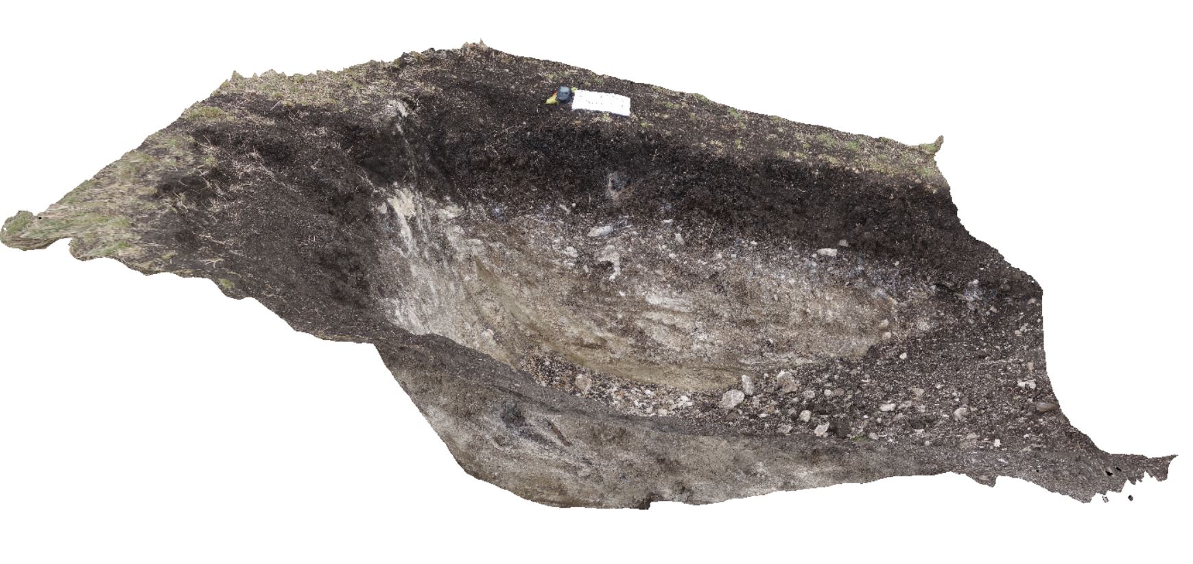
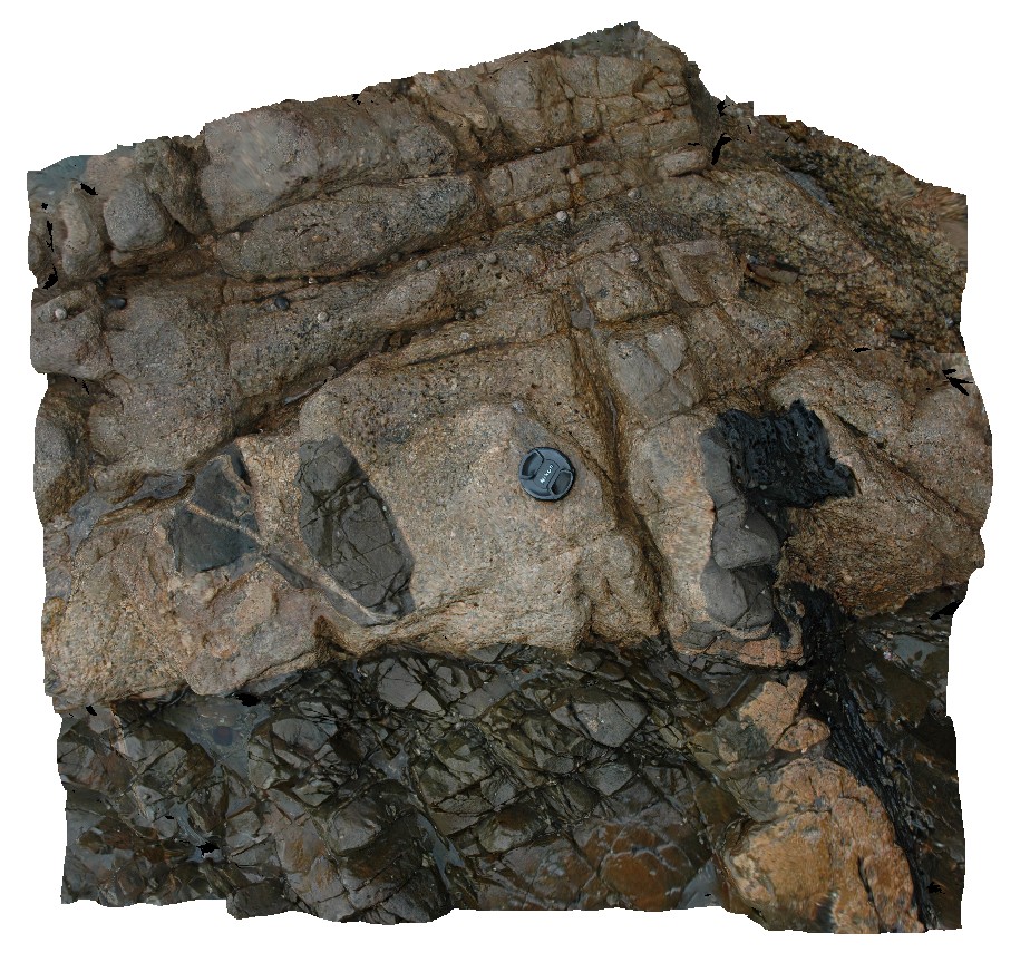
DaisyBanksPit13 Map
 |
20 |
03/23/2015 12:07 p.m. |
3D |
~80cm pit into dark grey sandy soils and white-brown sandy clay overlying Jurassic Dolerite. Richmond, Tas. |
2.00 |
-42.72961200000 |
147.42258600000 |
-9999.000 |
clay, Jurassic Dolerite, regolith |
clay |
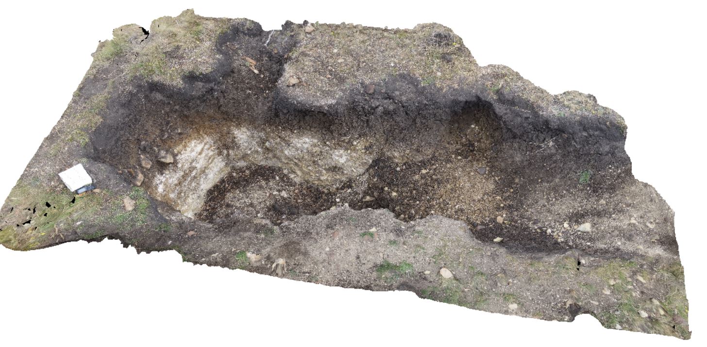
DaisyBanksPit12 Map
 |
20 |
03/23/2015 12:11 p.m. |
3D |
~80cm pit into dark grey sandy soils and white-brown sandy clay overlying Jurassic Dolerite. Richmond, Tas. |
2.00 |
-42.72939600000 |
147.42269500000 |
-9999.000 |
clay, Jurassic Dolerite, regolith |
clay |
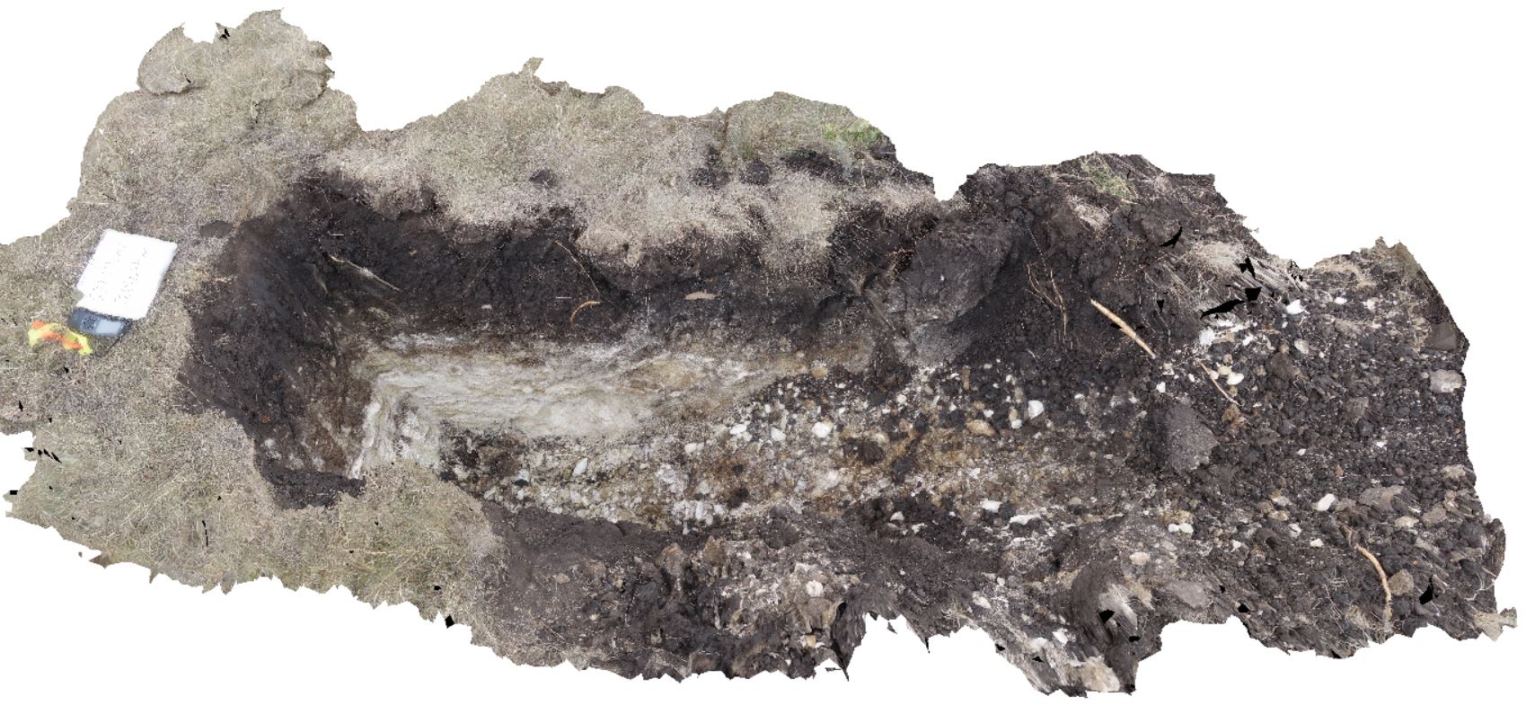
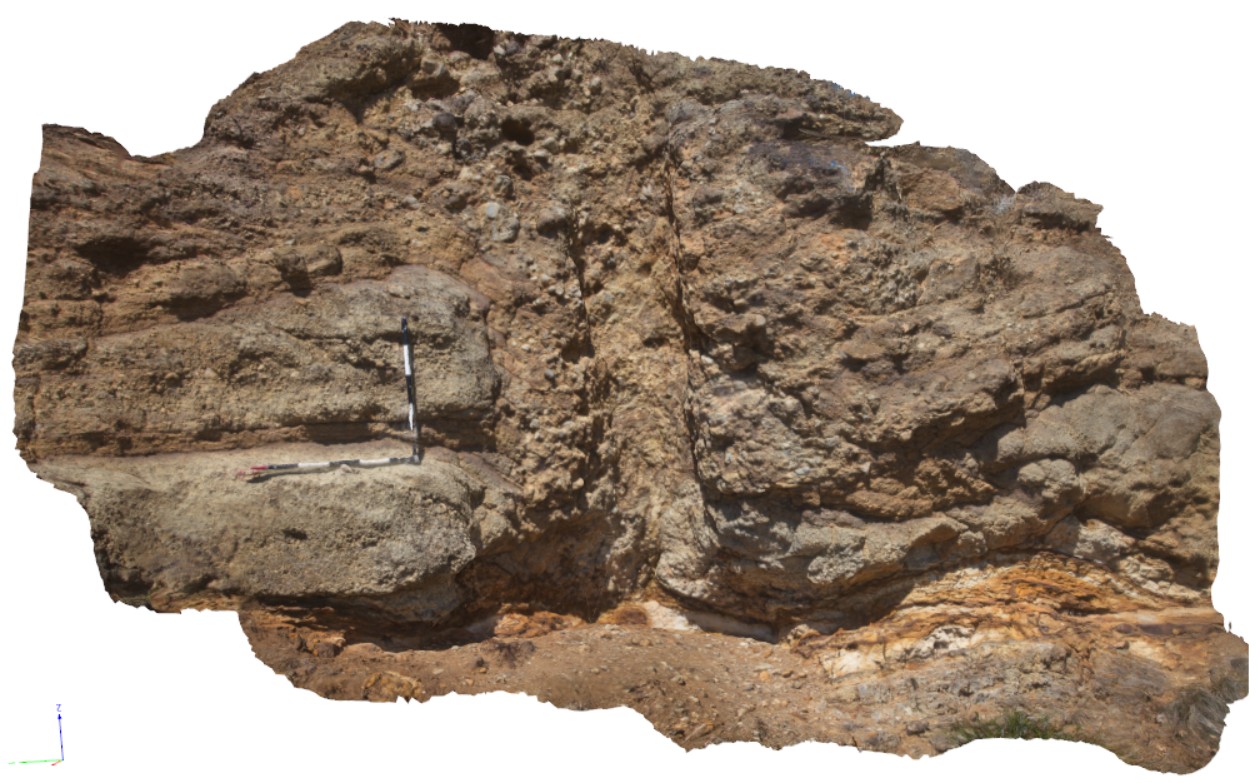
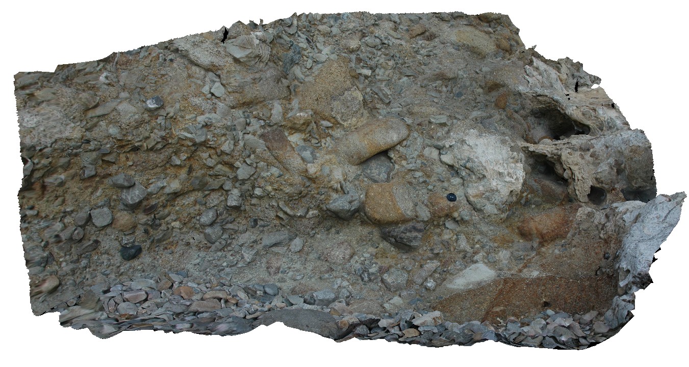
DaisyBanksPit11 Map
 |
20 |
03/23/2015 11:25 a.m. |
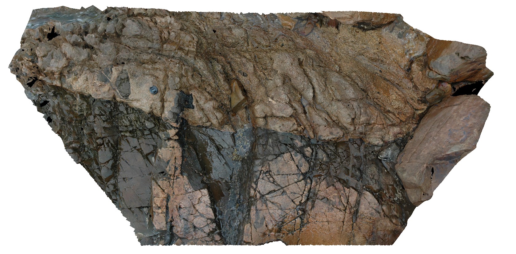
3D |
~80cm pit into dark grey sandy soils and white-brown sandy clay overlying Triassic interbedded micaceous brown, red-purple, green and grey carbonaceous siltstone, shale, mudstone and sandstone. Richmond, Tas. |
2.00 |
-42.72936200000 |
147.42457600000 |
-9999.000 |
clay, regolith |
clay |
MacquariePlains2 Map
 |
0 |
02/23/2016 9:23 a.m. |
3D |
detail from location MacquariePlanes1. detail of pyroclastic deposits and tree mould. Macquarie Plains, Tas. |
3.00 |
-42.70333000000 |
146.91592000000 |
-9999.000 |
pyroclastic, basalt |
basalt |
MacquariePlains1 Map
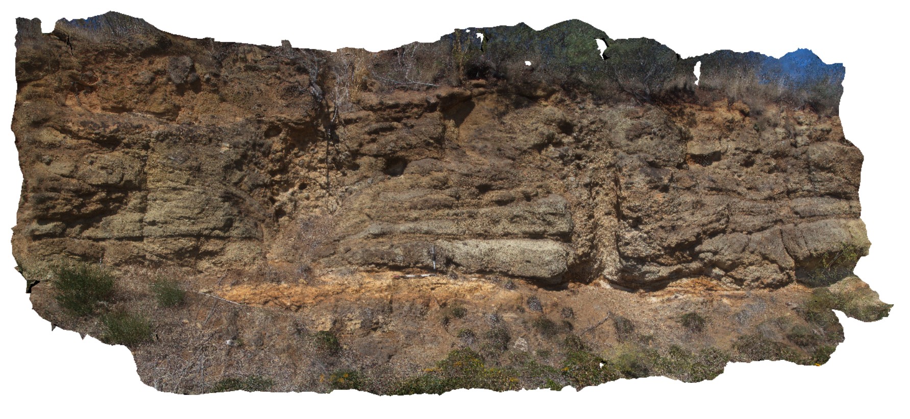 |
0 |
02/23/2016 9:22 a.m. |
3D |
vesicular basalt with overlying palaeosoil? and pyroclastics. Pyroclastics have cross-bedding. Cylindrical cavity is a tree cast. Macquarie Plains, Tas. |
5.00 |
-42.70333000000 |
146.91592000000 |
-9999.000 |
vesicular basalt, pyroclastics |
basalt |
Brighton2 Map
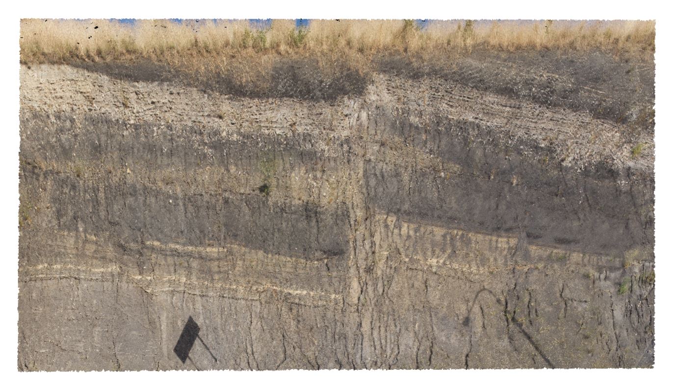 |
5 |
01/01/9999 midnight |
3D |
faulting in Triassic age rocks, with overall outcrop dipping towards the S/SW. Brighton, Tas. |
0.00 |
-42.70312000000 |
147.27122000000 |
-9999.000 |
fault, dip, structure |
siltstone |
Brighton1 Map
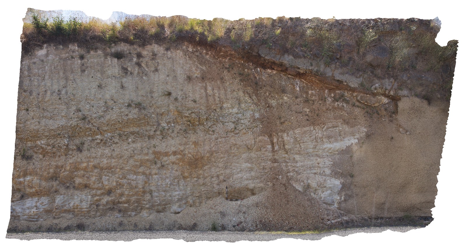 |
5 |
01/01/9999 midnight |
3D |
unconformable contact between Triassic sediments and Tertiary basalt - in paleo soil. Brighton, Tas. |
14.00 |
-42.69681000000 |
147.27692000000 |
-9999.000 |
unconformity, geological contact |
sandstone, basalt |
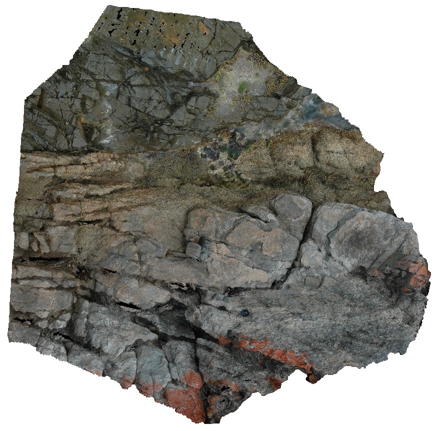
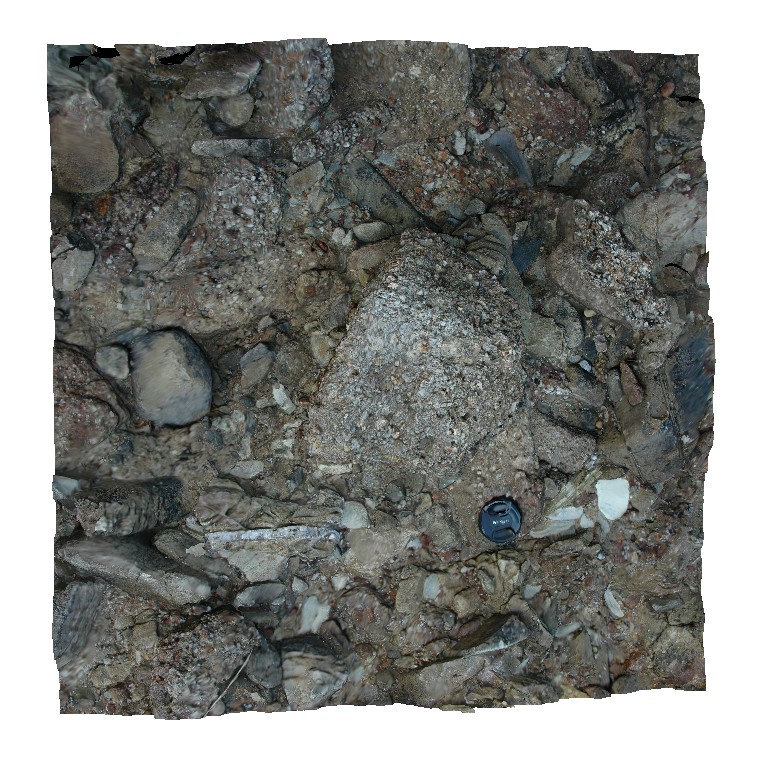
Maria14 Map
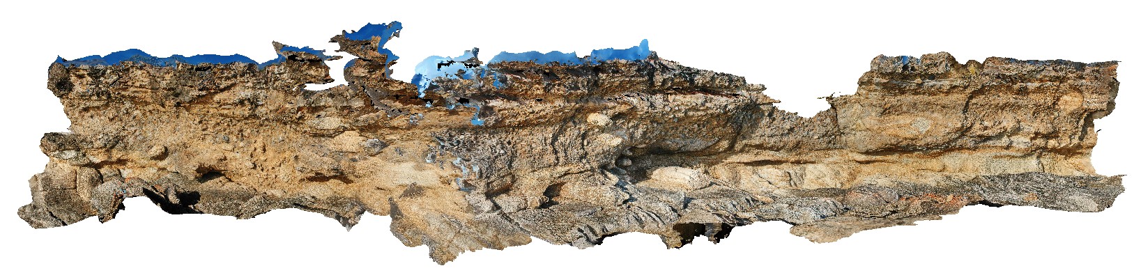 |
20 |
03/16/2015 2:31 p.m. |
3D |
Unconformity and basal contact showing rip-up clasts of the underlying basement granite incorporated into the overlying tillite. Maria Island, Tas. |
5.00 |
-42.68617478000 |
148.08275828000 |
5.000 |
unconformity, tillite |
granite, tillite |
Maria13 Map
 |
20 |
03/16/2015 2:31 p.m. |
3D |
Unconformity and basal contact showing rip-up clasts of the underlying basement granite incorporated into the overlying tillite. Maria Island, Tas. |
8.00 |
-42.68598066000 |
148.08261102000 |
1.000 |
unconformity, tillite, granite |
granite, tillite |
Maria12 Map
 |
20 |
03/16/2015 2:31 p.m. |
3D |
unconformity between basement porphyritic granite and Permian basal tillite / conglomerate. Maria Island, Tas. |
4.00 |
-42.68581998000 |
148.08240742000 |
2.000 |
unconformity, sedimentological |
granite, tillite |
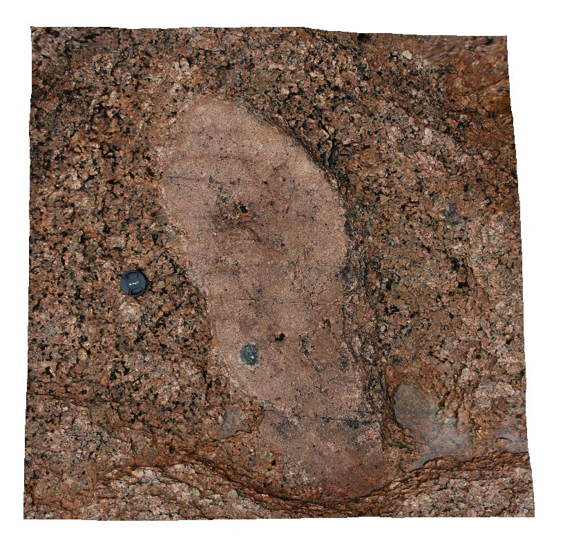
Maria1 Map
 |
20 |
03/16/2015 2:30 p.m. |
3D |
'The Great Unconformity'. Contact between metamorphic psammite and spotted pelite and Permian sediments. Maria Island, Tas. |
7.00 |
-42.68504467000 |
148.08062372000 |
0.000 |
contact, structure, unconformity |
pelite, siltstone |
Maria2 Map
 |
20 |
03/16/2015 2:32 p.m. |
3D |
dolerite igneous intrusion into basement psammites and pelites with abundant jointing. Maria Island, Tas. |
3.00 |
-42.68498498000 |
148.08069893000 |
1.000 |
igneous intrusion, metasediments, jointing |
dolerite, psammite |
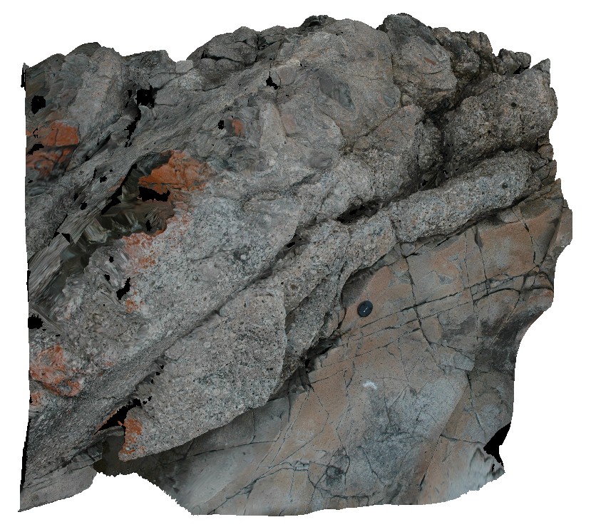
Maria4 Map
 |
20 |
03/16/2015 2:32 p.m. |
3D |
igneous contact between the fine grained Jurassic dolerite and coarse grained granite. Maria Island, Tas. |
2.00 |
-42.68495836000 |
148.08074554000 |
2.000 |
igneous contact, dolerite |
dolerite, granite |
Maria3 Map
 |
20 |
03/16/2015 2:32 p.m. |
3D |
Jurassic dolerite dyke intruding granite basement. Maria Island, Tas. |
1.00 |
-42.68494814000 |
148.08071719000 |
1.000 |
dyke, intrusion |
granite, dolerite |
Maria5 Map
 |
20 |
03/16/2015 2:32 p.m. |
3D |
igneous contact between granite and hornfels Siluro-Devonian sediments. Maria Island, Tas. |
2.00 |
-42.68485460000 |
148.08078901000 |
5.000 |
igneous contact, igneous intrusion, hornfels |
metasediments |
Maria7 Map
 |
20 |
03/16/2015 2:32 p.m. |
3D |
tourmaline aggregates in fine-grained bleb in coarse-grained granite. Maria Island, Tas. |
1.00 |
-42.66205155000 |
148.09875694000 |
0.000 |
granite, tourmaline aggregate |
granite |
Maria6 Map
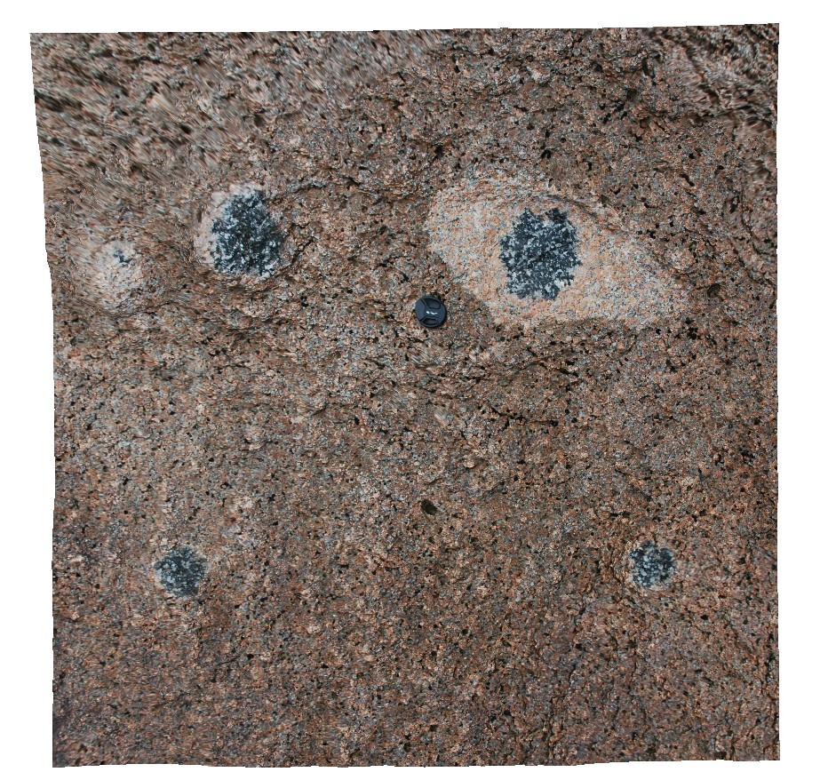 |
20 |
03/16/2015 2:32 p.m. |
3D |
tourmaline aggregates in granite. Maria Island, Tas. |
1.00 |
-42.66200672000 |
148.09867370000 |
5.000 |
mineralogy, tourmaline |
granite |
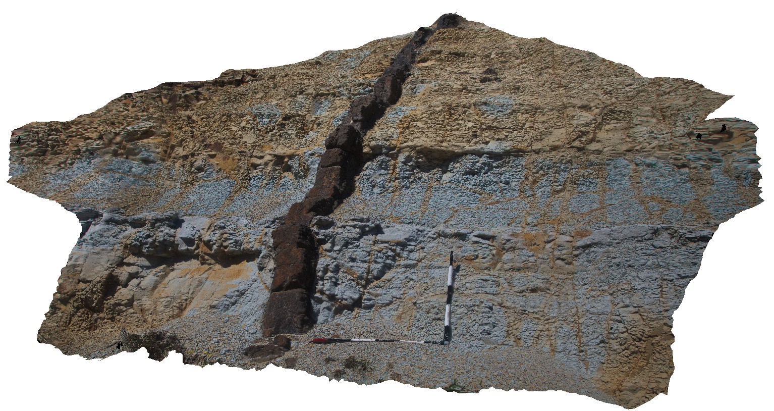
Maria8 Map
 |
20 |
03/16/2015 2:32 p.m. |
3D |
view of Unconformity between underlying Maria Island Granite and overlying flat-lying sediments of the Parmeener Supergroup. Maria Island, Tas. |
10.00 |
-42.66130222000 |
148.09977179000 |
5.000 |
unconformity, granite |
granite, sandstone |
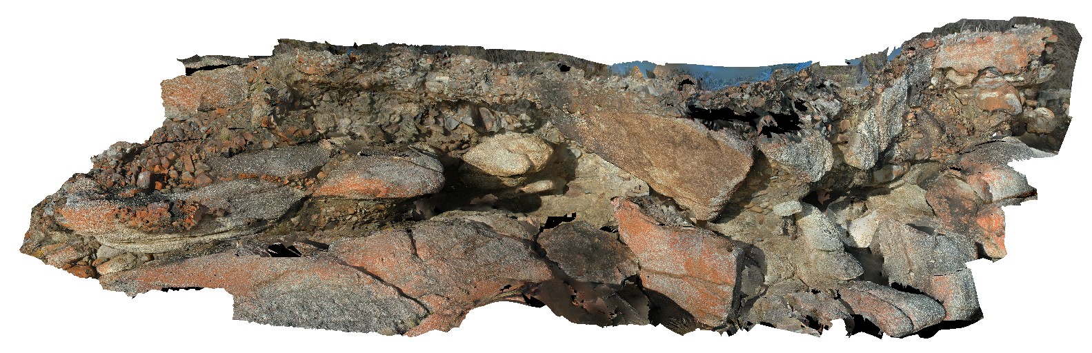
Maria10 Map
 |
20 |
03/16/2015 2:31 p.m. |
3D |
Porphyritic granite boulder. Maria Island, Tas. |
0.40 |
-42.66116768000 |
148.10437289000 |
1.000 |
porphyritic, granite |
granite |
Maria9 Map
 |
20 |
03/16/2015 2:33 p.m. |
3D |
matrix supported Pleistocene talus deposit with predominantly dolerite clasts. Maria Island, Tas. |
5.00 |
-42.66113564000 |
148.10395542000 |
2.000 |
talus deposit, Pleistocene |
talus |
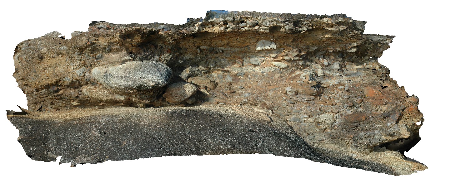
Maria11 Map
 |
20 |
04/27/2015 11:54 a.m. |
3D |
contact between granite basement and overlying basal Permian conglomerate. Maria Island, Tas. |
3.00 |
-42.65806526000 |
148.11054913000 |
5.000 |
contact |
granite, tillite |
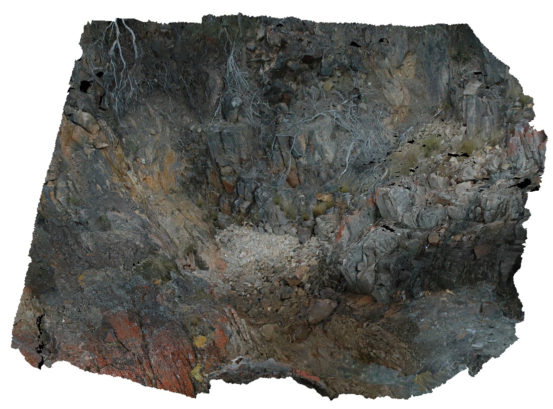
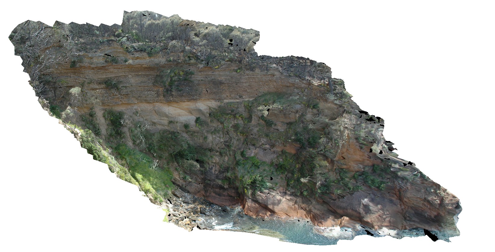
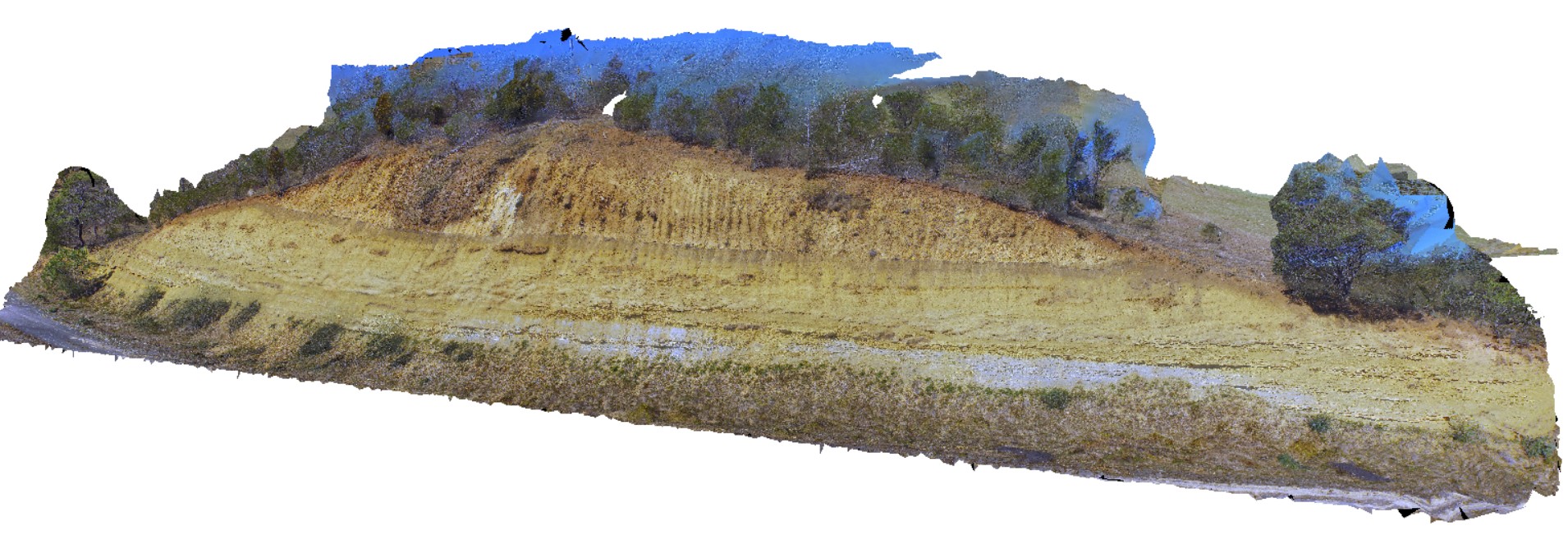
OatlandsGiga1 Map
 |
0 |
02/23/2016 9:26 a.m. |
GIGA |
unconformity, showing Triassic Sediments overlain by younger, unconsolidated sediments. Oatlands, Tasmania. |
0.00 |
-42.42698000000 |
147.25957000000 |
-9999.000 |
unconformity |
sandstone, talus |
OatlandsUAV1 Map
 |
20 |
04/04/2016 3:03 p.m. |
UAV |
unconformity, showing Triassic Sediments overlain by younger, unconsolidated sediments. Oatlands, Tasmania. |
20.00 |
-42.42698000000 |
147.25957000000 |
-9999.000 |
unconformity |
sandstone, talus |
Oatlands2 Map
 |
0 |
02/23/2016 9:26 a.m. |
3D |
Jurassic? Dyke cross-cutting fine-grained Triassic sediments. Oatlands, Tasmania. |
2.50 |
-42.34642000000 |
147.33798000000 |
-9999.000 |
intrusive contact, dyke |
mudstone, dolerite |