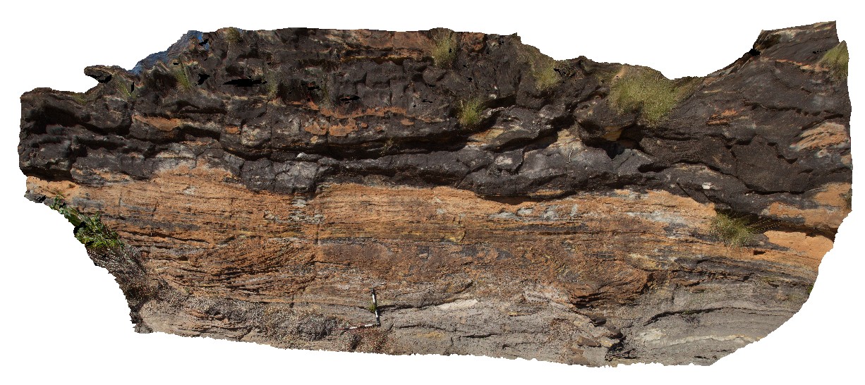
Purnululu3 Map
 |
0 |
06/12/2016 noon |
3D |
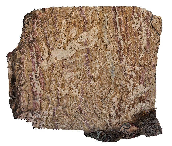
series of cross-beds in dolomitic sandstone at the base of the Bungle Bungles. Purnululu National Park, W.A. |
8.00 |
-17.48252000000 |
128.38123000000 |
-9999.000 |
cross bedding, sandstone, Purnululu National Park |
sandstone |
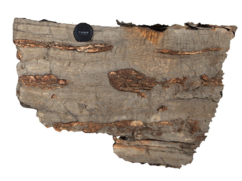
Purnululu4 Map
 |
0 |
06/12/2016 noon |
3D |
chert nodules (or lenses) in wavy, laminated carbonate. Purnululu National Park, W.A. |
0.60 |
-17.40906000000 |
128.31898000000 |
-9999.000 |
chert nodules, carbonate, Bungle Bungles |
limestone |
Purnululu5 Map
 |
0 |
06/12/2016 noon |
3D |
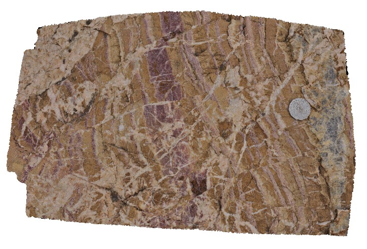
fault contact between interbedded conglomerate and cross-bedded sandstone and overlying massive conglomerate. Quartz veins intruding along fault. Purnululu National Park, W.A. |
0.00 |
-17.33442000000 |
128.38440000000 |
-9999.000 |
fault, quartz vein, structure, conglomerate, cross-beds, sandstone |
conglomerate |
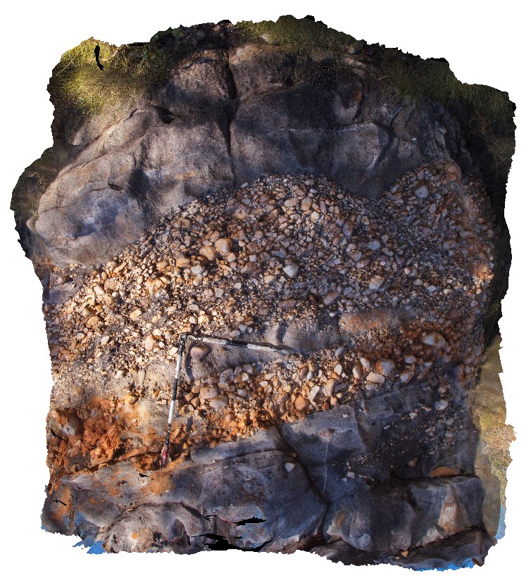
Purnululu6 Map
 |
0 |
06/12/2016 noon |
3D |
clast supported conglomerate lense / paleo channel in sandstone. Conglomerate has rounded, to sub-rounded clasts. Purnululu National Park, W.A. |
3.00 |
-17.33389000000 |
128.38441000000 |
-9999.000 |
sandstone, paleo channel, conglomerate |
sandstone |
Purnululu7 Map
 |
0 |
06/12/2016 noon |
3D |
calcite-cemented breccia in red (hematitic) and buff coloured dolostone. Steep grey quartz vein and small (cm scale) fault offsets. Purnululu National Park, W.A. |
1.00 |
-17.40933000000 |
128.20367000000 |
-9999.000 |
dolostone, breccia |
dolostone |
Purnululu8 Map
 |
0 |
06/12/2016 noon |
3D |
detail of cm scale fault offsets in calcite-cemented breccia in red (hematitic) and buff coloured dolostone. Purnululu National Park, W.A. |
0.40 |
-17.40933000000 |
128.20367000000 |
-9999.000 |
fault offset, dolostone, vein |
dolostone |
Purnululu9 Map
 |
0 |
06/12/2016 noon |
3D |
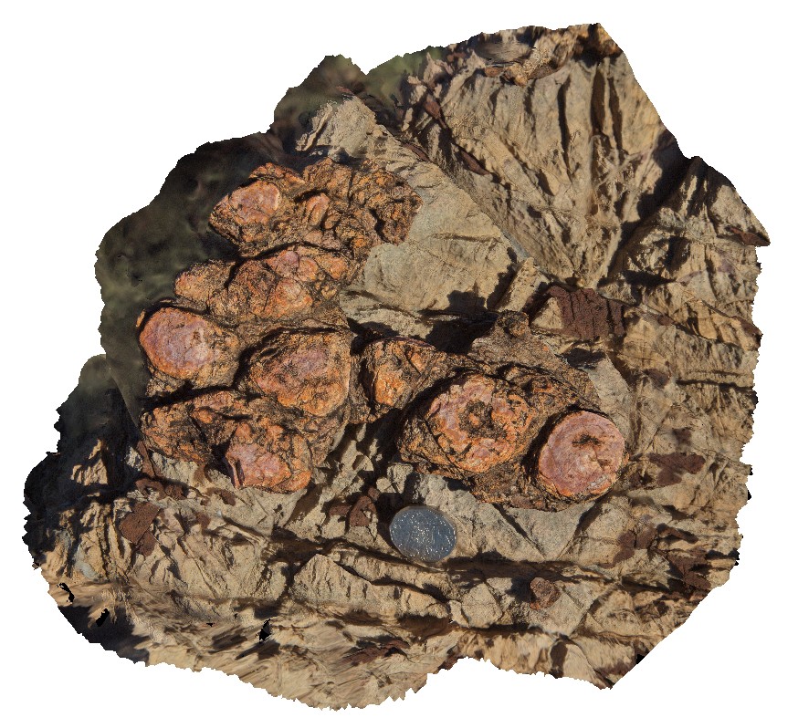
layer of stromatolites within dolomitic rock. Purnululu National Park, W.A. |
0.30 |
-17.40900000000 |
128.20374000000 |
-9999.000 |
calcite cement, stromatolite, fossil, sedimentology, dolostone |
dolostone |
PurnululuFSP1 Map
 |
0 |
06/12/2016 noon |
FSP |
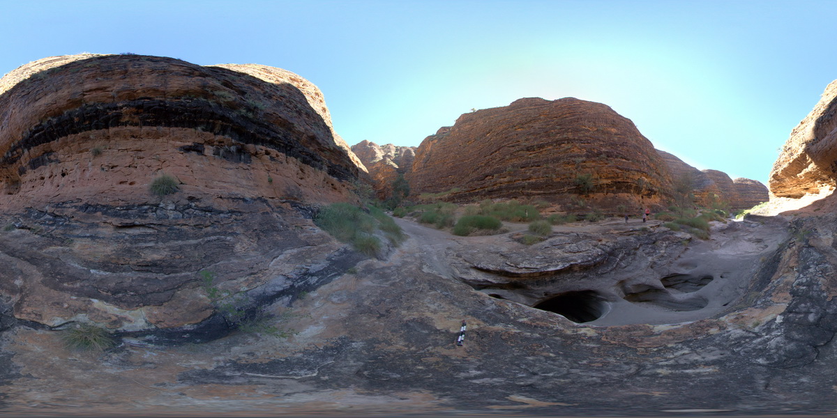
End of Cathedral Gorge track, showing view of sandstone cliffs. Purnululu National Park. W.A. |
100.00 |
-17.48218000000 |
128.37589000000 |
-9999.000 |
Purnululu National Park, The Bungle Bungles, sandstone, weathering |
sandstone |
PurnululuFSP10 Map
 |
0 |
06/12/2016 noon |
FSP |
Echidna Chasm track, view from within chasm. Showing bedded cobble beds and coarse sandstones. Purnululu National Park. W.A. |
100.00 |
-17.32853400000 |
128.41690800000 |
-9999.000 |
sandstone, Purnululu National Park, The Bungle Bungles, weathering |
conglomerate |
PurnululuFSP11 Map
 |
0 |
06/12/2016 noon |
FSP |
Echidna Chasm track, view from within chasm. Showing bedded cobble beds and coarse sandstones. Purnululu National Park. W.A. |
50.00 |
-17.32853400000 |
128.41690800000 |
-9999.000 |
conglomerate, sandstone, Purnululu National Park, The Bungle Bungles |
conglomerate |
PurnululuFSP12 Map
 |
0 |
06/12/2016 noon |
FSP |
Echidna Chasm track, view from within chasm. Showing bedded cobble beds and coarse sandstones. Purnululu National Park. W.A. |
50.00 |
-17.32853400000 |
128.41690800000 |
-9999.000 |
Purnululu National Park, conglomerate, weathering, The Bungle Bungles |
conglomerate |
PurnululuFSP13 Map
 |
0 |
06/12/2016 noon |
FSP |
Echidna Chasm track, view from within chasm. Showing bedded cobble beds and coarse sandstones. Purnululu National Park. W.A. |
100.00 |
-17.32853400000 |
128.41690800000 |
-9999.000 |
conglomerate, coarse-grained sandstone, Purnululu National Park, The Bungle Bungles |
conglomerate |
PurnululuFSP14 Map
 |
0 |
06/12/2016 noon |
FSP |
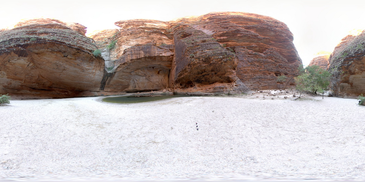
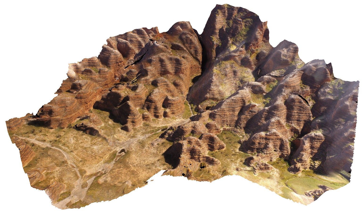
aerial view of the start of the Echidna Chasm trail, showing cliff of Glass Hill Sandstone. Osmand Range Lookout, Purnululu National Park, W.A. |
1000.00 |
-17.32185000000 |
128.41403000000 |
-9999.000 |
The Bungle Bungles, Sandstone, sedimentology, Purnululu National Park |
sandstone |
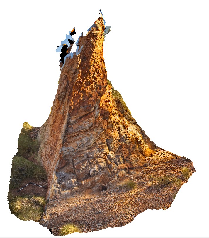
PurnululuFSP15 Map
 |
0 |
06/12/2016 noon |
FSP |
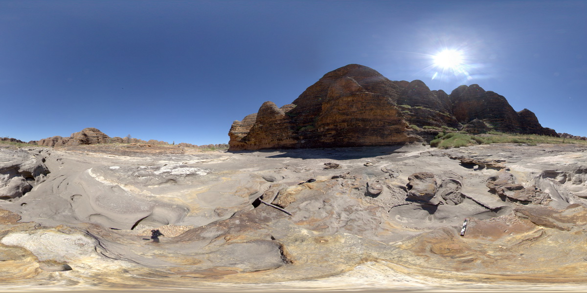
calcite-cemented breccia in red (hematitic) and buff coloured dolostone. Knife-edge ridge, Purnululu National Park, W.A. |
3000.00 |
-17.40892000000 |
128.20384000000 |
-9999.000 |
dolostone, breccia, structure, sedimentology |
dolostone |
PurnululuFSP16 Map
 |
0 |
06/12/2016 noon |
FSP |
finely banded red (hematitic) and buff coloured dolostone of knife-edge ridge, Purnululu National Park, W.A. |
3000.00 |
-17.40900000000 |
128.20374000000 |
-9999.000 |
Purnululu National Park, dolostone, sedimentology |
dolostone |
PurnululuFSP2 Map
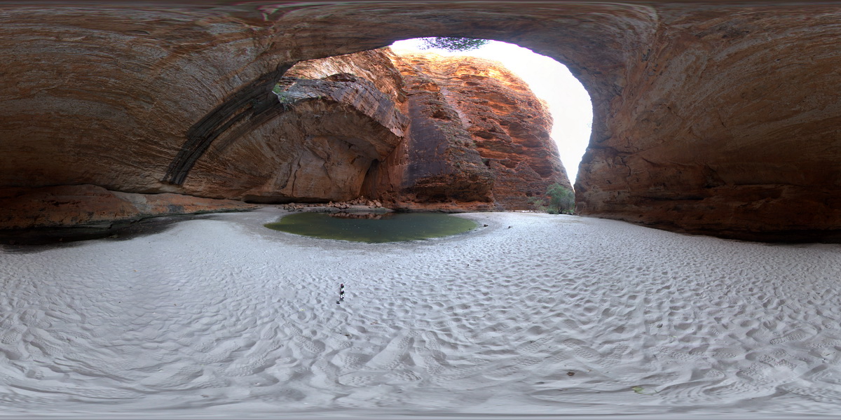 |
0 |
06/12/2016 noon |
FSP |
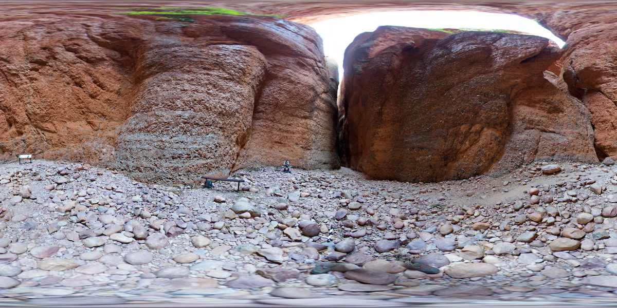
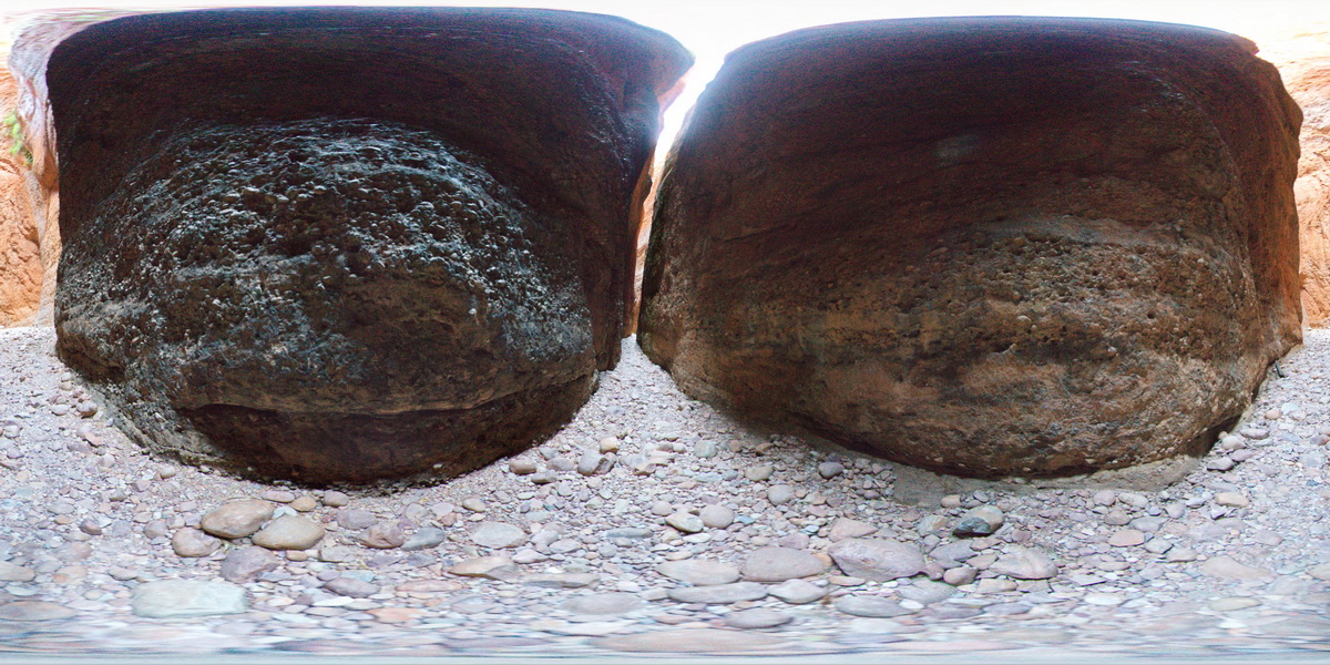
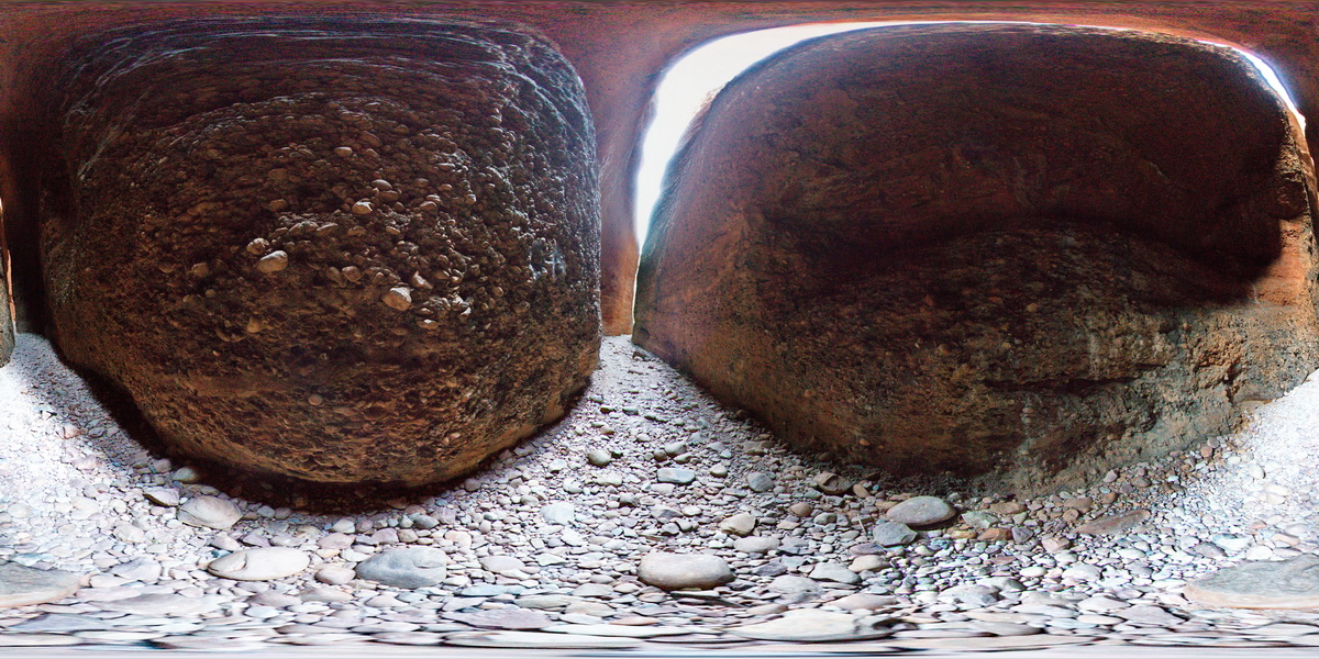
End of Cathedral Gorge track, showing view of gorge and cliffs from under overhang. Purnululu National Park. W.A. |
100.00 |
-17.48218000000 |
128.37589000000 |
-9999.000 |
Purnululu National Park, The Bungle Bungles |
sandstone |
PurnululuFSP3 Map
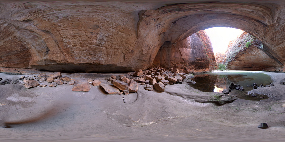 |
0 |
06/12/2016 noon |
FSP |
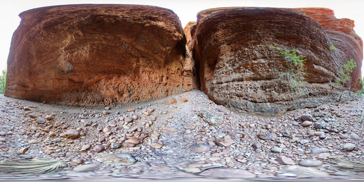
Cathedral Gorge, showing view of gorge and cliffs from under overhang. Purnululu National Park. W.A. |
100.00 |
-17.48218000000 |
128.37589000000 |
-9999.000 |
Purnululu National Park, The Bungle Bungles, sandstone |
sandstone |
PurnululuFSP4 Map
 |
0 |
06/12/2016 noon |
FSP |
Cathedral Gorge track at pot holes. Purnululu National Park. W.A. |
100.00 |
-17.48218000000 |
128.37589000000 |
-9999.000 |
Purnululu National Park, The Bungle Bungles, pot holes |
sandstone |
PurnululuFSP5 Map
 |
0 |
06/12/2016 noon |
FSP |
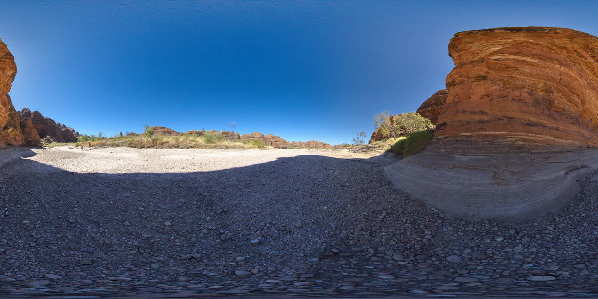
Piccaninny Creek bed, with view of bedded sandstones in 'Beehive' weathering structures. Purnululu National Park. W.A. |
100.00 |
-17.48113000000 |
128.38275000000 |
-9999.000 |
Purnululu National Park, The Bungle Bungles, Beehive, weathering |
sandstone |
PurnululuFSP6 Map
 |
0 |
06/12/2016 noon |
FSP |
Piccaninny Creek bed, with view of bedded sandstones in 'Beehive' weathering structures. Purnululu National Park. W.A. |
300.00 |
-17.48041000000 |
128.38127000000 |
-9999.000 |
Beehive, weathering structures, Purnululu National Park, The Bungle Bungles |
sandstone |
PurnululuFSP7 Map
 |
0 |
06/12/2016 noon |
FSP |
Piccaninny Creek bed, with view of bedded sandstones in 'Beehive' weathering structures. Purnululu National Park. W.A. |
200.00 |
-17.48109000000 |
128.38074000000 |
-9999.000 |
Purnululu National Park, The Bungle Bungles, Beehive, weathering |
sandstone |
PurnululuFSP8 Map
 |
0 |
06/12/2016 noon |
FSP |
Piccaninny Creek, showing pot hole weathering in sandstone. Purnululu National Park. W.A. |
200.00 |
-17.48235000000 |
128.38110000000 |
-9999.000 |
pot hole, Purnululu National Park, The Bungle Bungles |
sandstone |
PurnululuFSP9 Map
 |
0 |
06/12/2016 noon |
FSP |
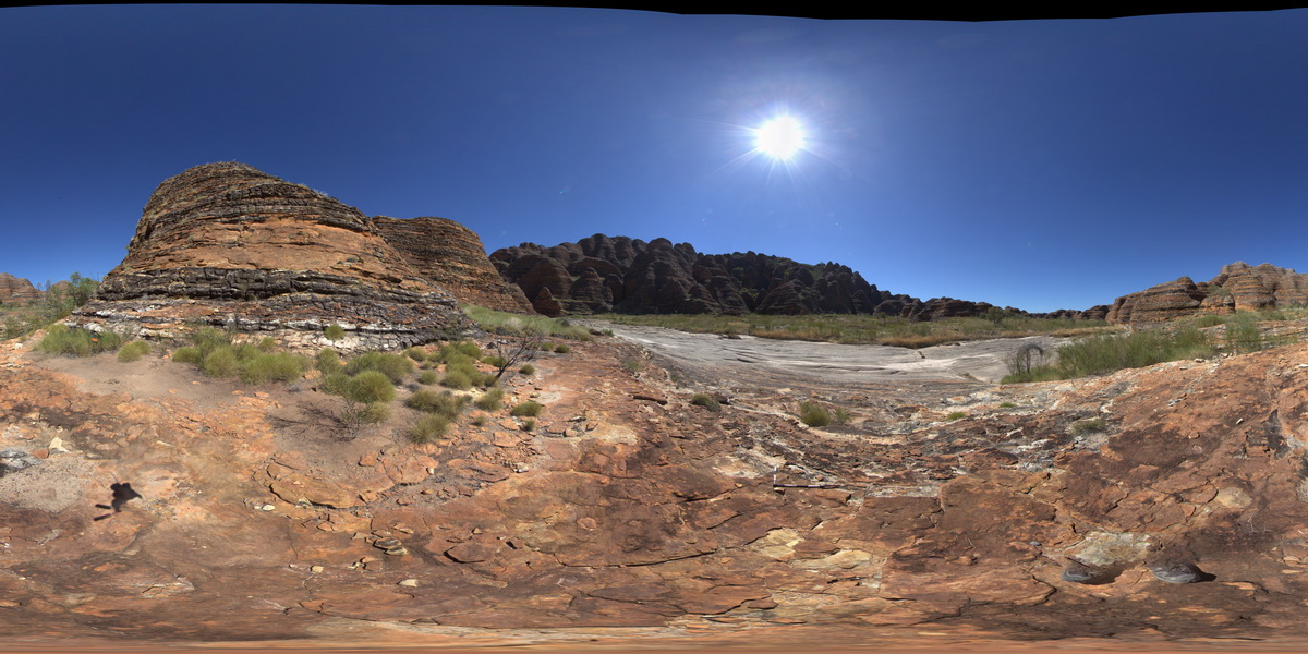
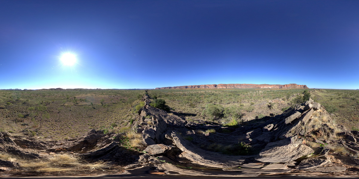
view of 'The Bungle Bungles' sandstone escarpment from small carbonate ridge. Faults crosscutting thinly bedded carbonate rocks in foreground. Purnululu National Park, W.A. |
2000.00 |
-17.40924000000 |
128.31894000000 |
-9999.000 |
sedimentology, fault, Purnululu National Park, The Bungle Bungles |
limestone |
PurnululuUAV1 Map
 |
0 |
06/12/2016 noon |
UAV |
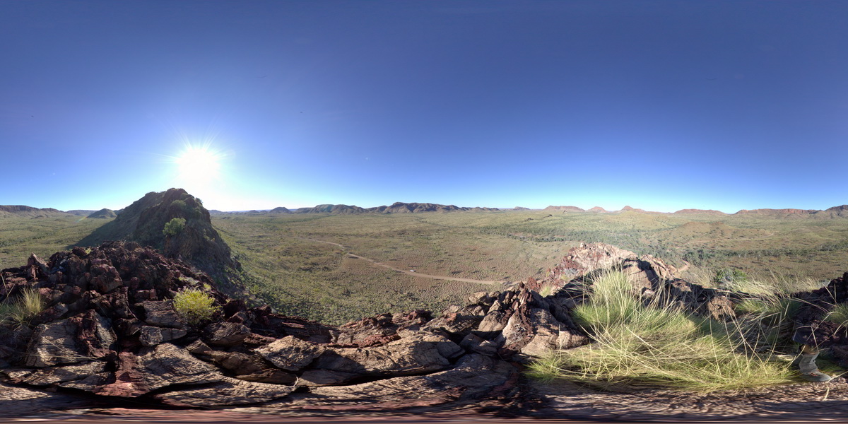
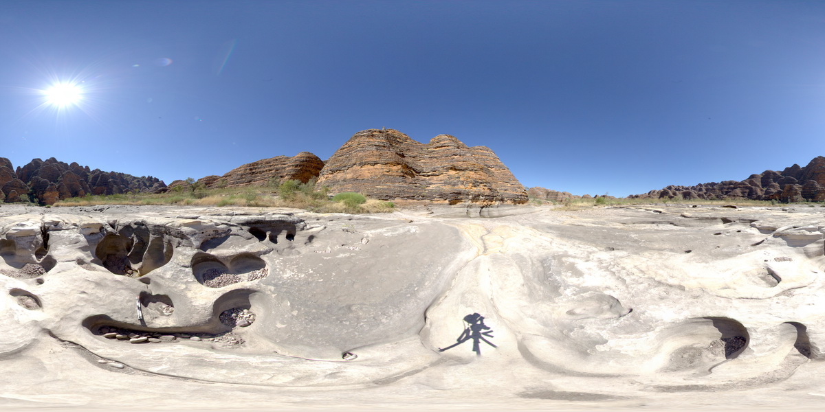
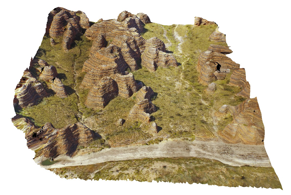
aerial view of 'bee Hive' formations at the Bungle Bungles. Purnululu National Park, W.A. |
50.00 |
-17.48400500000 |
128.38151400000 |
-9999.000 |
Bee Hive, Bungle Bungles, weathering formation, sandstone |
sandstone |
PurnululuUAV2 Map
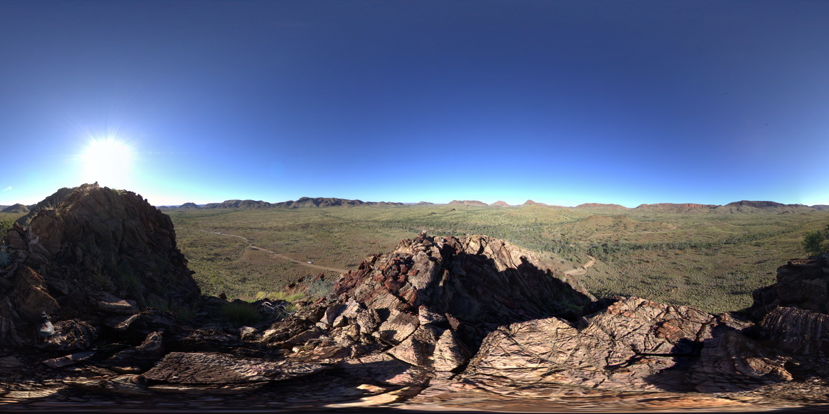
 |
0 |
06/12/2016 noon |
UAV |
aerial view of 'bee Hive' formations at the Bungle Bungles. Purnululu National Park, W.A. |
50.00 |
-17.48472000000 |
128.37810600000 |
-9999.000 |
weathering feature, Bungle Bungles, Purnululu |
sandstone |