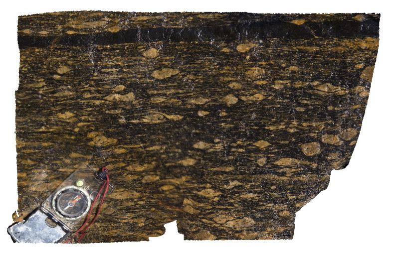
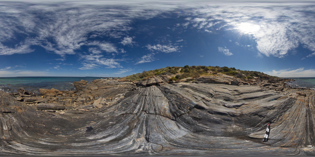
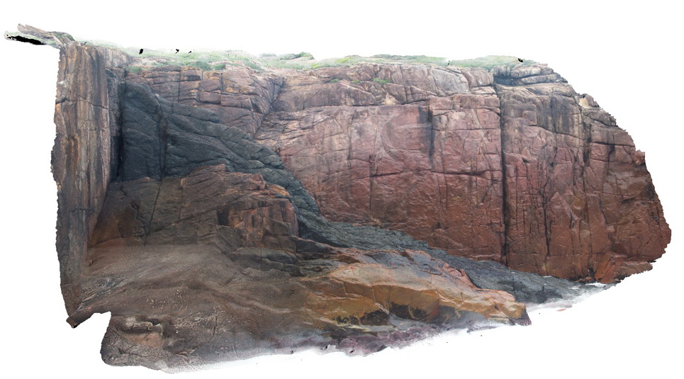
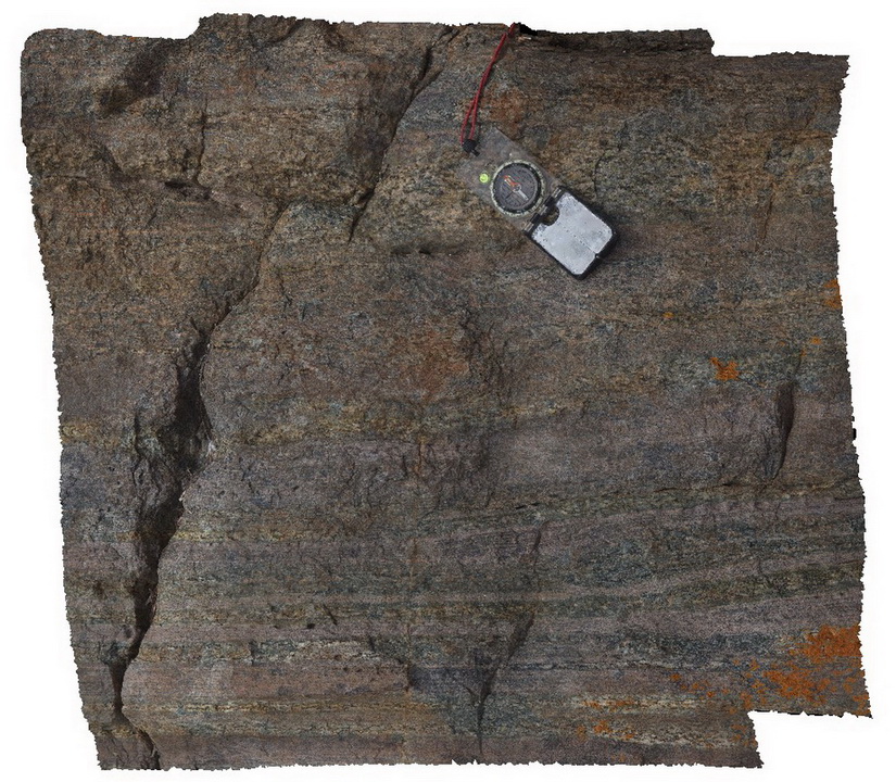
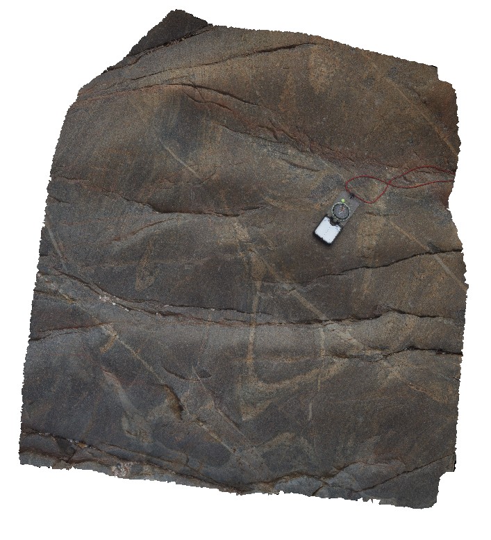
PtNeill6 Map
 |
0 |
10/20/2015 3:17 p.m. |
3D |
sheared augen in mylonite, showing well developed textures, Point Neill. |
0.20 |
-34.10682000000 |
136.35039000000 |
-9999.000 |
augen, mylonite |
mylonite |
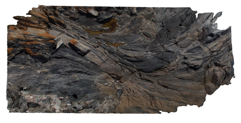
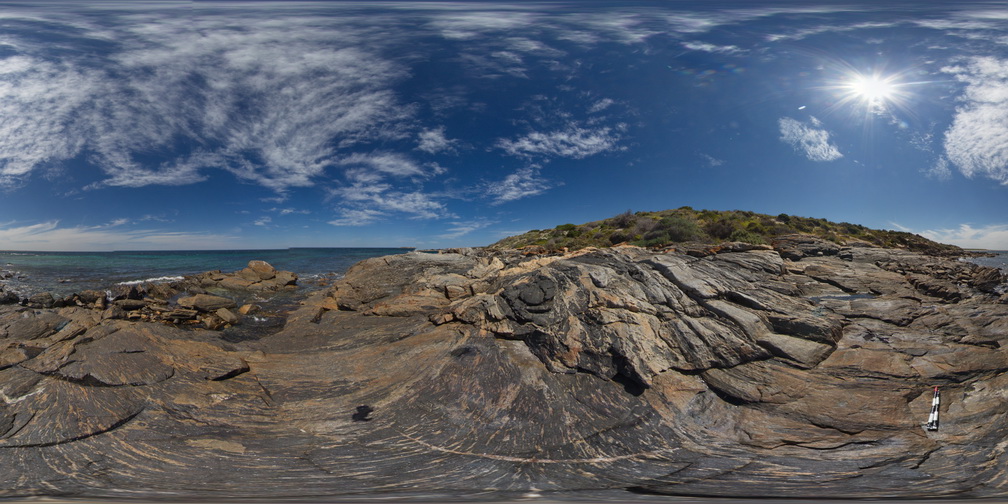
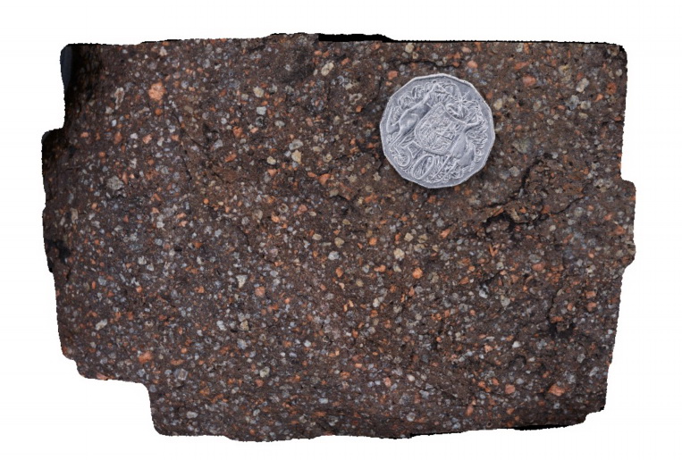
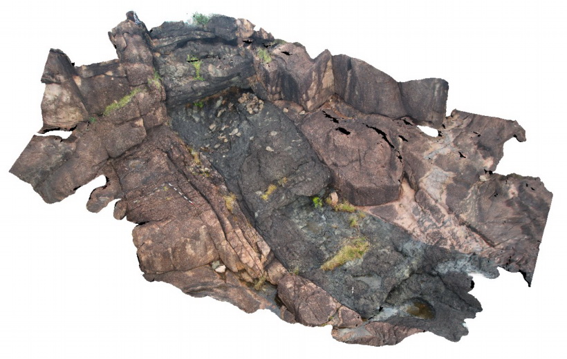
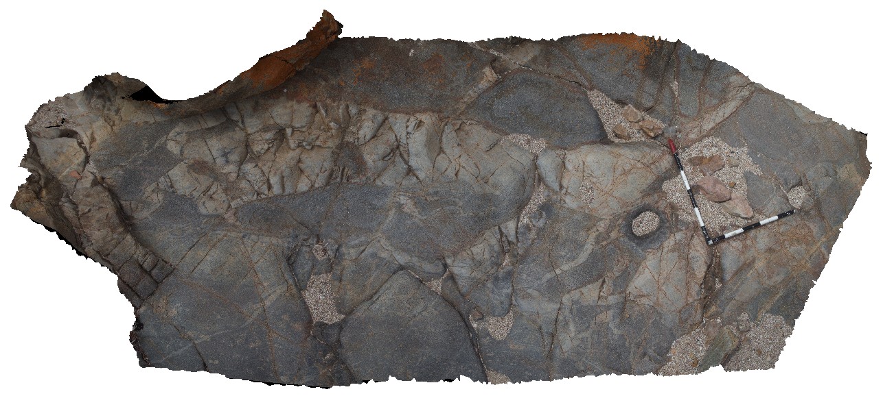
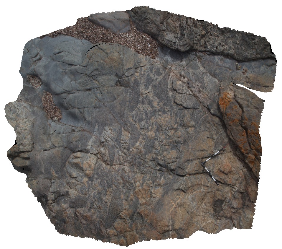
PtNeill7 Map
 |
0 |
10/20/2015 3:17 p.m. |
3D |
large pavement of mylonite and boudinaged dykes, with folding. Point Neill. |
9.00 |
-34.10590000000 |
136.35065000000 |
-9999.000 |
mylonite, boudinaged |
mylonite |
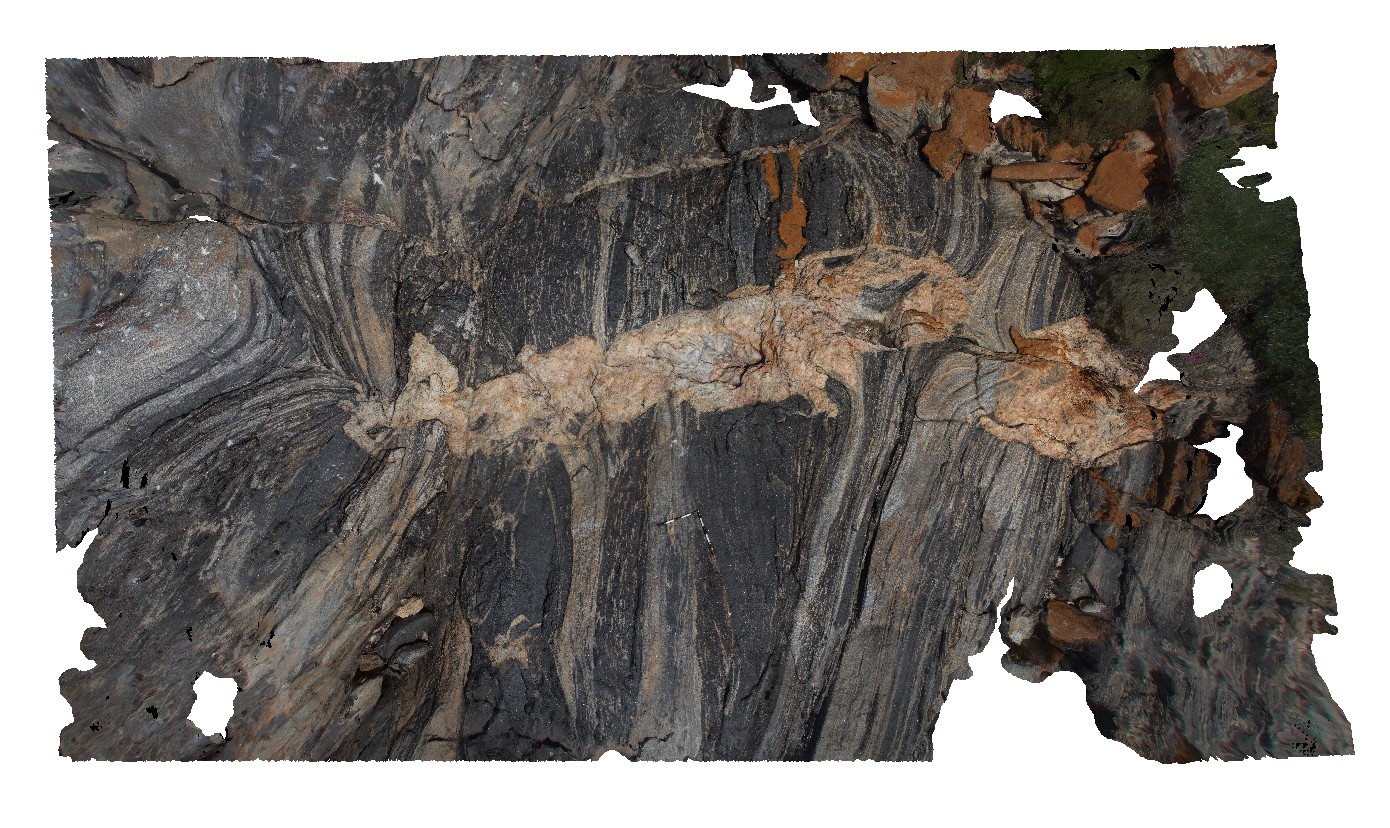
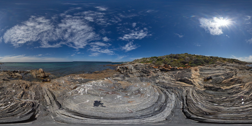
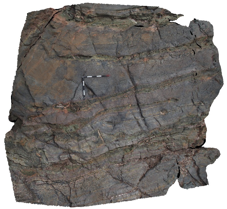
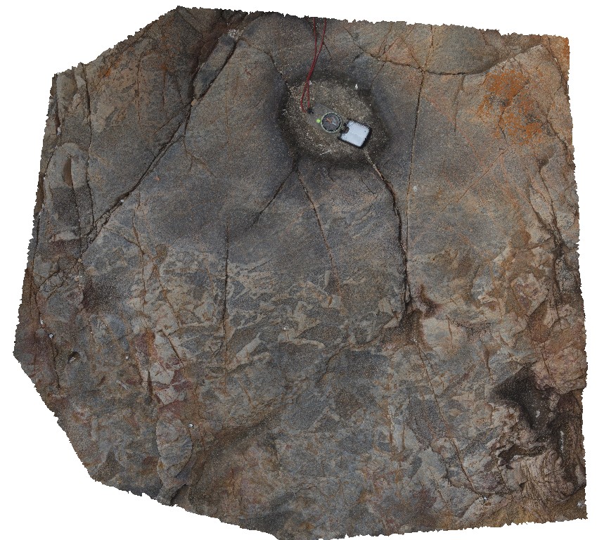
PtNeill8 Map
 |
0 |
10/20/2015 3:19 p.m. |
3D |
complex sheared banded mylonite, with partially sheared pegmatite. Point Neill. |
10.00 |
-34.10557000000 |
136.35065000000 |
-9999.000 |
pegmatite, mylonite, pegmatitic contact |
mylonite |
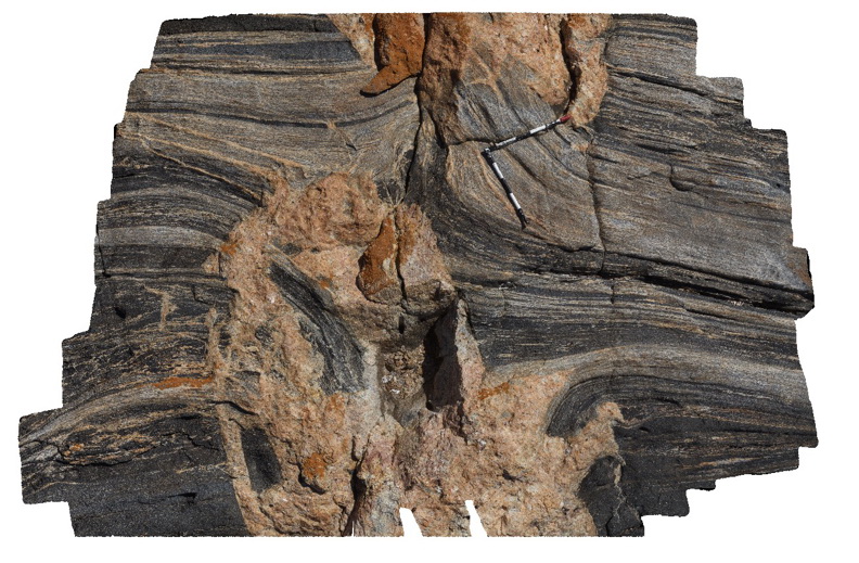
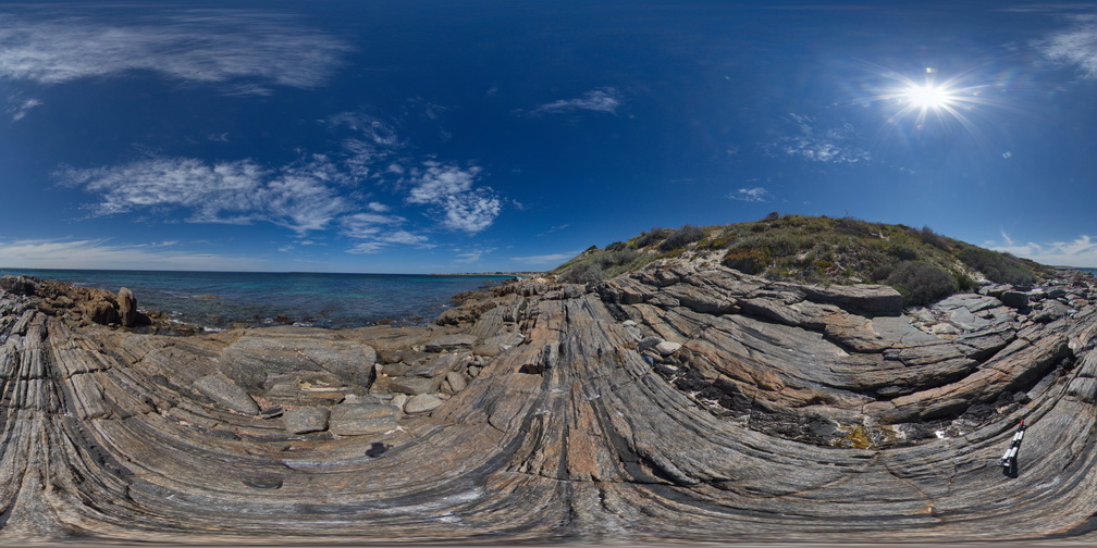
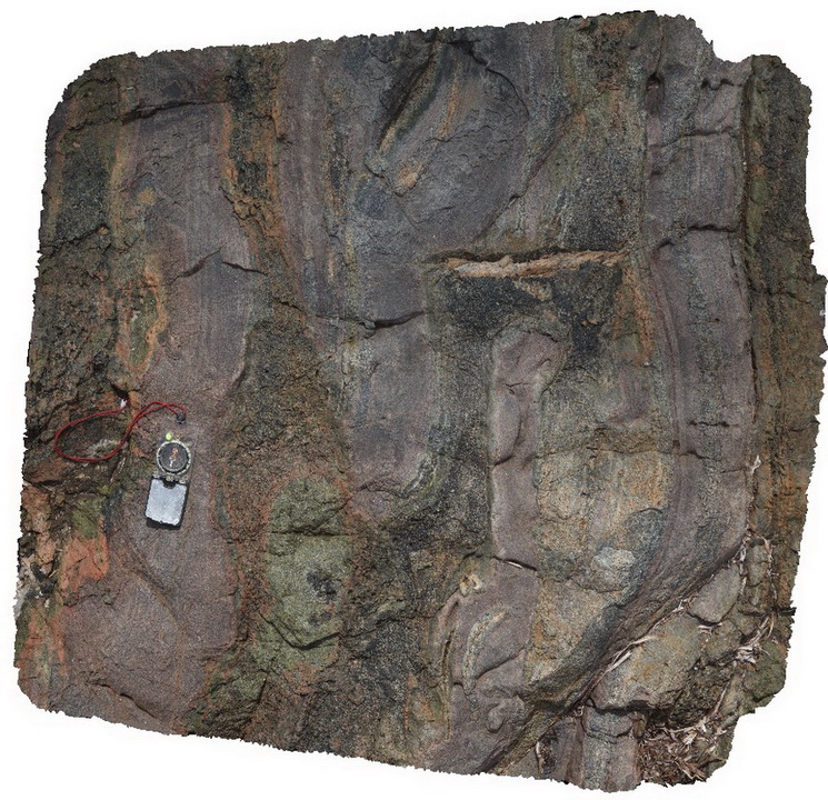
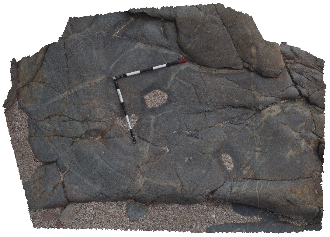
PtNeill9 Map
 |
0 |
10/20/2015 3:20 p.m. |
3D |
detail of banded mylonite being cross cut / intruded by pegmatite dyke. Point Neill. |
3.50 |
-34.10553000000 |
136.35063000000 |
-9999.000 |
mylonite, pegmatite, intrusive contact |
mylonite |
PtNeillFSP1 Map
 |
0 |
10/20/2015 3:21 p.m. |
FSP |
shore platform showing granitic and mafic banded mylonite, Point Neill. |
0.00 |
-34.10535000000 |
136.35066000000 |
-9999.000 |
mylonite |
mylonite |
PtNeillFSP2 Map
 |
0 |
10/20/2015 3:21 p.m. |
FSP |
view of mylonite shore platform, showing granitic and mafic bands, Point Neill. |
100.00 |
-34.10548000000 |
136.35069000000 |
-9999.000 |
mylonite |
mylonite |
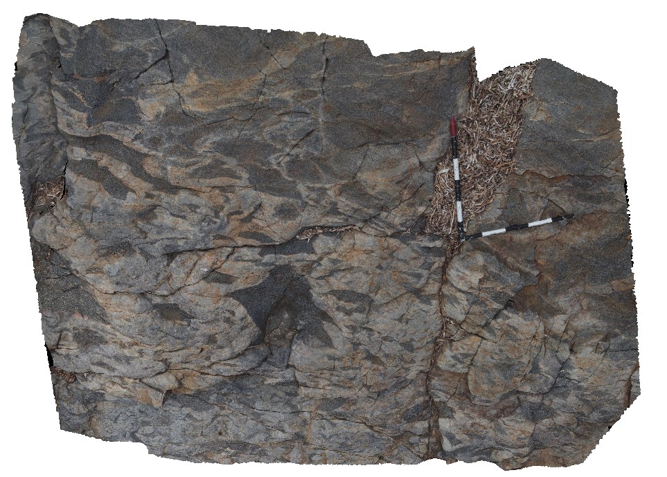
PtNeillFSP3 Map
 |
0 |
10/20/2015 3:21 p.m. |
FSP |
view of shore platform exposure of granitic and mafic banded mylonite, showing intrusive contact with pegmatite, Point Neill. |
100.00 |
-34.10555000000 |
136.35071000000 |
-9999.000 |
mylonite, pegmatite, intrusive contact |
mylonite |
PtNeillFSP5 Map
 |
0 |
10/20/2015 3:21 p.m. |
FSP |
shore platform exposure of banded granitic and mafic mylonite / gneiss. Point Neill. |
100.00 |
-34.10618000000 |
136.35052000000 |
-9999.000 |
gneiss, mylonite |
mylonite |
PtNeillFSP6 Map
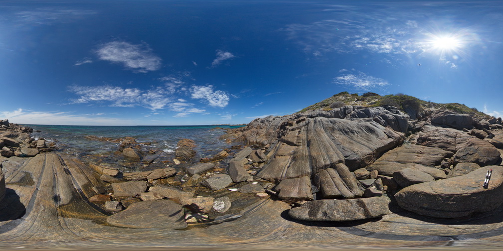 |
0 |
10/20/2015 3:21 p.m. |
FSP |
shore platform exposure showing granitic and mafic differentiated bands in mylonite. |
100.00 |
-34.10661000000 |
136.35039000000 |
-9999.000 |
mylonite |
mylonite |
PtNeillFSP7 Map
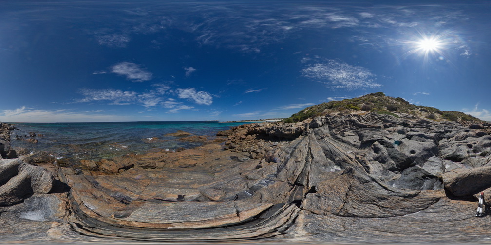 |
0 |
10/20/2015 3:21 p.m. |
FSP |
shore platform exposure showing granitic and mafic differentiated bands in mylonite. |
0.00 |
-34.10677000000 |
136.35036000000 |
-9999.000 |
mylonite |
mylonite |
PtStephens1 Map
 |
5 |
06/16/2015 5:30 p.m. |
3D |
Mafic dyke in coastal exposure cross cutting felsic lava/ignimbrite of the Carboniferous Nerong Volcanics. Port Stephens, N.S.W. |
30.00 |
-32.78745000000 |
152.11860000000 |
6.000 |
dyke, igneous, structure |
ignimbrite, dolerite |
PtStephens2 Map
 |
5 |
06/16/2015 5:30 p.m. |
3D |
Mafic dyke in felsic ignimbrite - dyke shows clear joint control on emplacement and dilation directions. Port Stephens, N.S.W. |
8.00 |
-32.78760000000 |
152.11960000000 |
5.000 |
igneous, structure, dilation, joints |
ignimbrite, dolerite |
PtStephens3 Map
 |
5 |
06/16/2015 5:32 p.m. |
3D |
Detailed view of the texture of ignimbrite from the Nerong Volcanics. Port Stephens, N.S.W. |
0.20 |
-32.78760000000 |
152.11960000000 |
5.000 |
igneous |
ignimbrite |
PtStephens4 Map
 |
5 |
06/16/2015 5:32 p.m. |
3D |
Mafic dyke cross cutting red pyroclastic rocks of the Nerong Volcanics. Port Stephens, N.S.W. |
8.00 |
-32.78739000000 |
152.11961000000 |
5.000 |
igneous, structure, dyke |
ignimbrite, dolerite |
PtVic1 Map
 |
0 |
02/16/2016 12:11 p.m. |
3D |
sandy/silty layered sediment with calc-silicate layers. Port Victoria. S.A. |
4.00 |
-34.50449000000 |
137.47971000000 |
-9999.000 |
metasandstone |
sandstone |
PtVic2 Map
 |
0 |
02/16/2016 12:20 p.m. |
3D |
detail of calc-silicate layers in metasediment, Port Victoria. S.A. |
1.50 |
-34.50448000000 |
137.47972000000 |
-9999.000 |
calc-silicate |
sandstone |
PtVic3 Map
 |
0 |
02/16/2016 12:29 p.m. |
3D |
hyaloclastite. Located immediately below calc-silicate rock of ptVic2. Port Victoria. S.A. |
2.00 |
-34.50457000000 |
137.47978000000 |
-9999.000 |
hyaloclastite, lava |
hyaloclastite |
PtVic4 Map
 |
0 |
02/16/2016 12:36 p.m. |
3D |
calc-silicate layers in sandy metasediments. Port Victoria. S.A. |
0.40 |
-34.50392000000 |
137.47975000000 |
-9999.000 |
calc-silicate, metasediment |
sandstone |
PtVic5 Map
 |
0 |
02/16/2016 12:44 p.m. |
3D |
Hyaloclastite contact with coherent lavas? Port Victoria. S.A. |
1.00 |
-34.50383000000 |
137.47990000000 |
-9999.000 |
hyaloclastic |
hyaloclastite |
PtVic6 Map
 |
0 |
02/16/2016 12:52 p.m. |
3D |
sediments? In fragmented lava? Port Victoria. S.A. |
3.00 |
-34.50378000000 |
137.47986000000 |
-9999.000 |
lava |
sediments, igneous |
PtVic7 Map
 |
0 |
02/16/2016 12:58 p.m. |
3D |
folded flow banding in lavas at Port Victoria. S.A. |
2.00 |
-34.50380000000 |
137.47983000000 |
-9999.000 |
lava, flow banding |
igneous |
PtVic8 Map
 |
0 |
02/16/2016 1:07 p.m. |
3D |
detail of folded flow banding in lava at Port Victoria. S.A. |
0.50 |
-34.50377000000 |
137.47984000000 |
-9999.000 |
flow banding, lava |
igneous |
PtVic9 Map
 |
0 |
02/16/2016 1:12 p.m. |
3D |
hyaloclastite zone in lava, Port Victoria. S.A. |
4.00 |
-34.50354000000 |
137.47987000000 |
-9999.000 |
hyaloclastite, lava |
hyaloclastite |
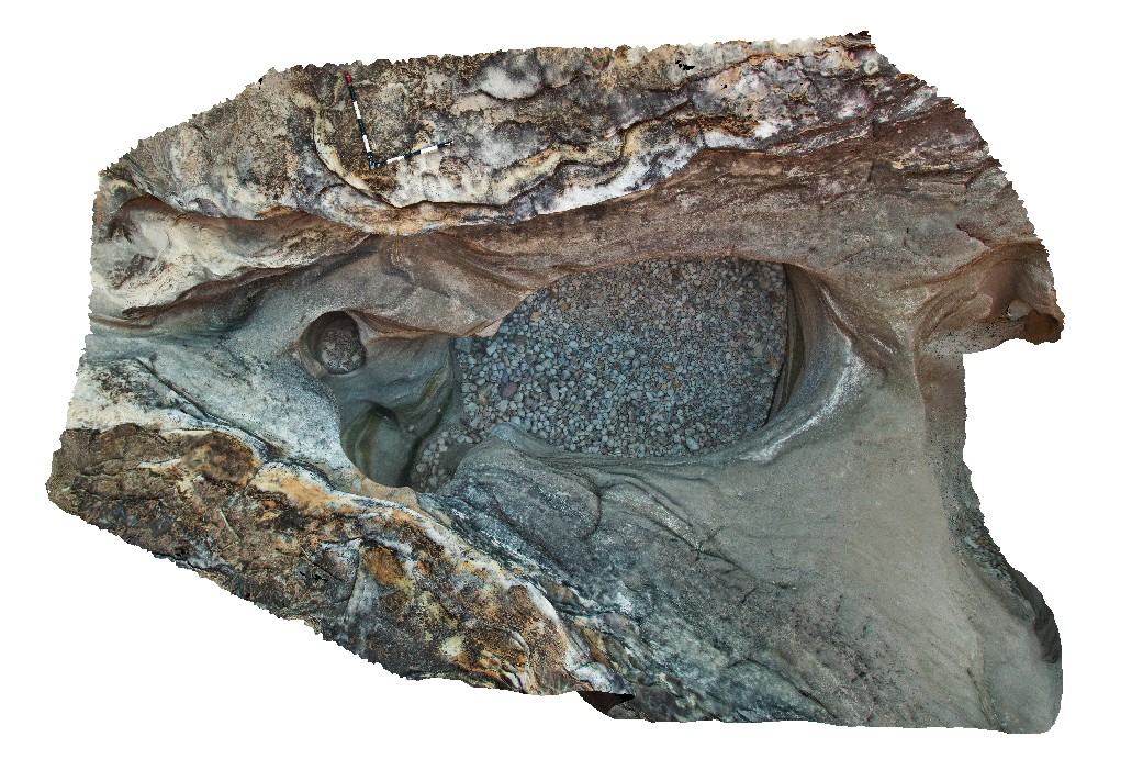
Purnululu1 Map
 |
0 |
06/12/2016 noon |
3D |
pot holes in cross-bedded dolomitic sandstone with pebbly layers. End of Cathedral Gorge Track. Purnululu National Park, W.A. |
5.50 |
-17.48218000000 |
128.37589000000 |
-9999.000 |
cross-beds, dolomitic sandstone, pot hole |
sandstone |
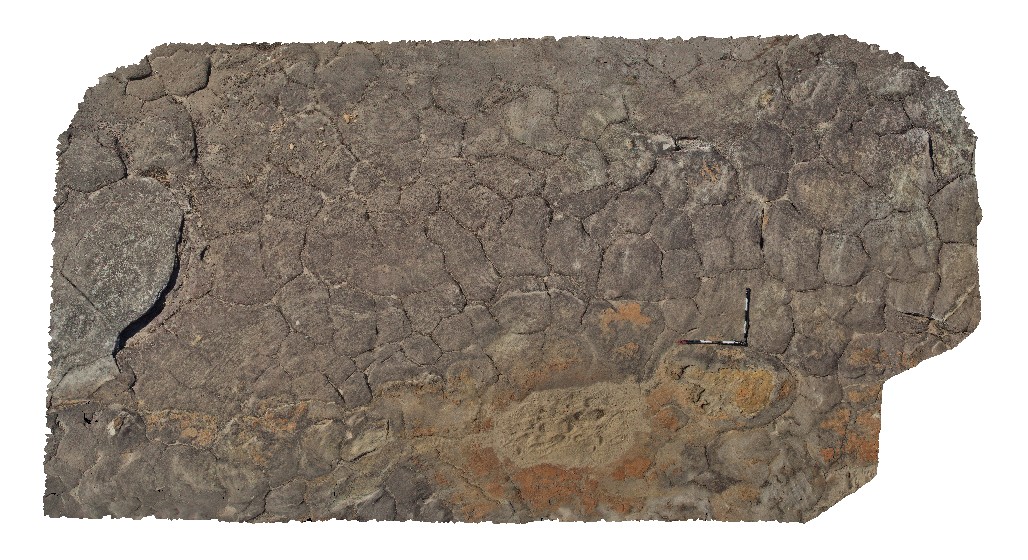
Purnululu2 Map
 |
0 |
06/12/2016 noon |
3D |
polygonal jointing in interlayered dolomitic sandstone. Purnululu National Park, W.A. |
6.20 |
-17.48427000000 |
128.37714000000 |
-9999.000 |
polygonal joints, dolomitic sandstone, sedimentology |
sandstone |