Remarkable1 Map
 |
0 |
10/20/2015 3:48 p.m. |
3D |
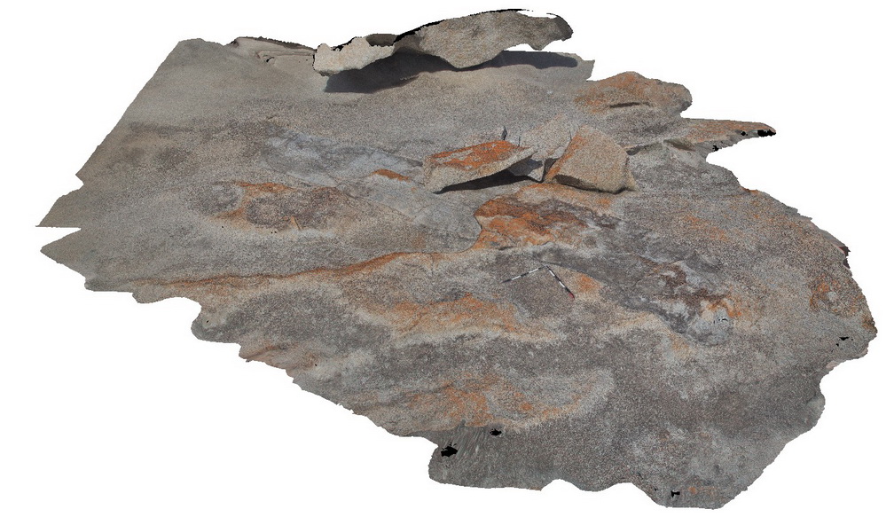
large bedded xenolith of Kanmantoo sediments in the Remarkable Granite, Remarkable Rocks, Kangaroo Island. |
7.00 |
-36.04782000000 |
136.75682000000 |
-9999.000 |
granite, xenolith, intrusive |
granite, sediment |
Remarkable2 Map
 |
0 |
10/20/2015 3:49 p.m. |
3D |
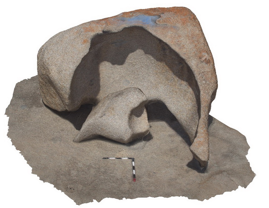
granite core stone, Remarkable Rocks, ,Kangaroo Island. |
4.00 |
-36.04810000000 |
136.75693000000 |
-9999.000 |
core stone, granite, weathering |
granite |
Remarkable3 Map
 |
0 |
10/20/2015 3:52 p.m. |
3D |
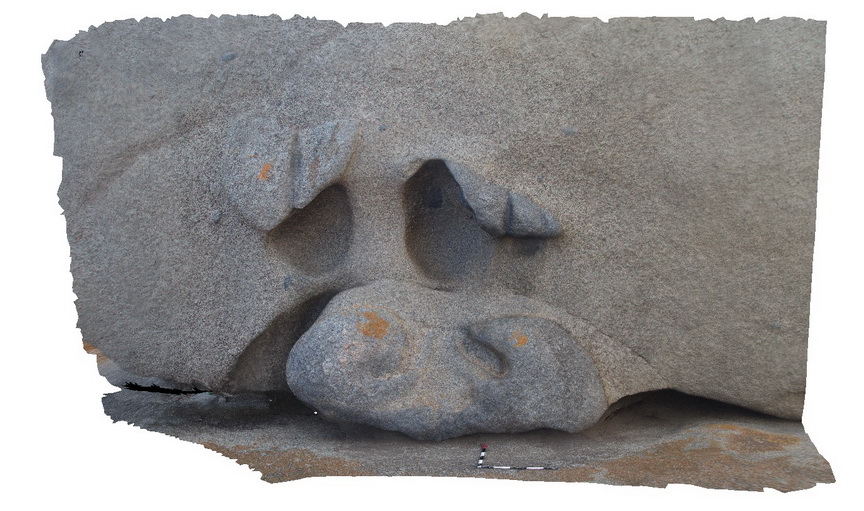
large xenolith of diorite? And granodiorite in granite, Remarkable Rocks, ,Kangaroo Island. |
5.50 |
-36.04815000000 |
136.75706000000 |
-9999.000 |
xenolith, granite |
granite |
Remarkable5 Map
 |
0 |
10/20/2015 3:53 p.m. |
3D |
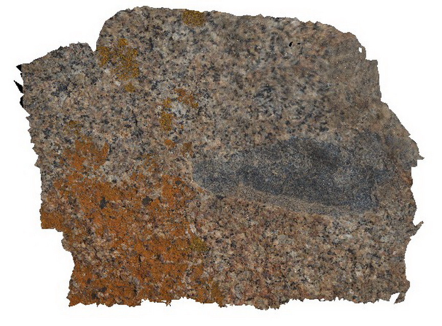
xenolith with folds in Remarkable Granite, Remarkable Rocks, Kangaroo Island. |
0.50 |
-36.04814000000 |
136.75725000000 |
-9999.000 |
xenolith, granite, folds |
granite |
RemarkableFSP1 Map
 |
0 |
10/20/2015 3:54 p.m. |
FSP |
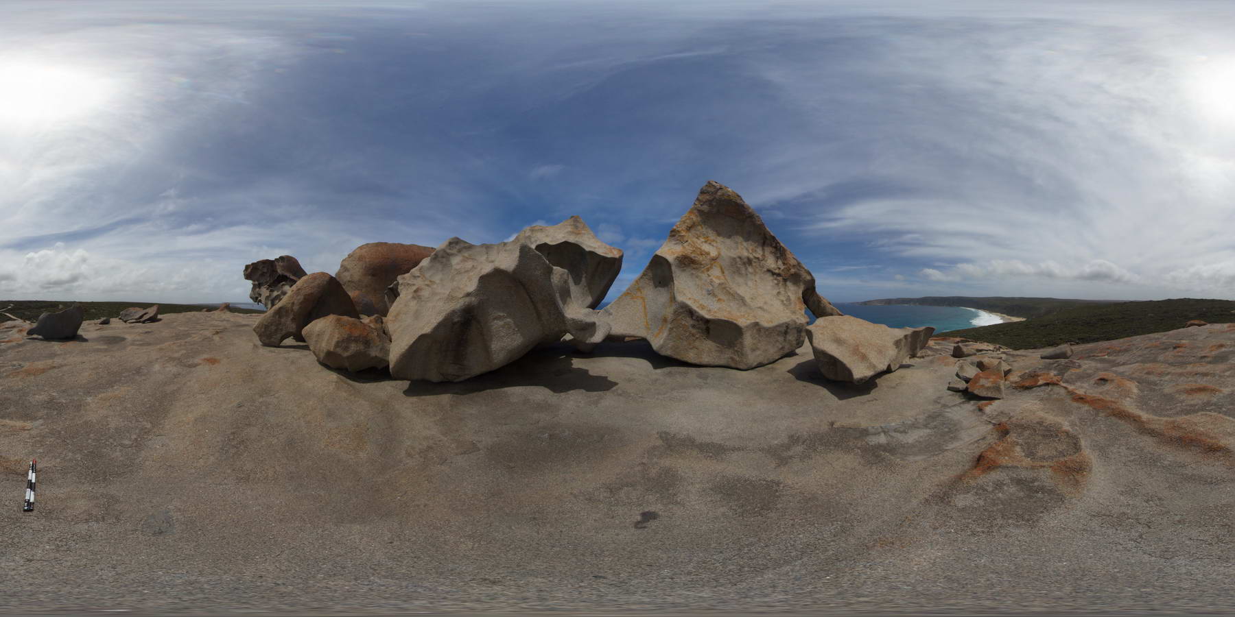
shore exposure of Remarkable Granite, showing large Kanmantoo metasedimentary xenolith and weathered granite boulders. Remarkable Rocks, Kangaroo Island. |
200.00 |
-36.04805000000 |
136.75685000000 |
-9999.000 |
granite, xenolith, weathering |
granite, sediment |
RemarkableFSP2 Map
 |
0 |
10/20/2015 3:54 p.m. |
FSP |
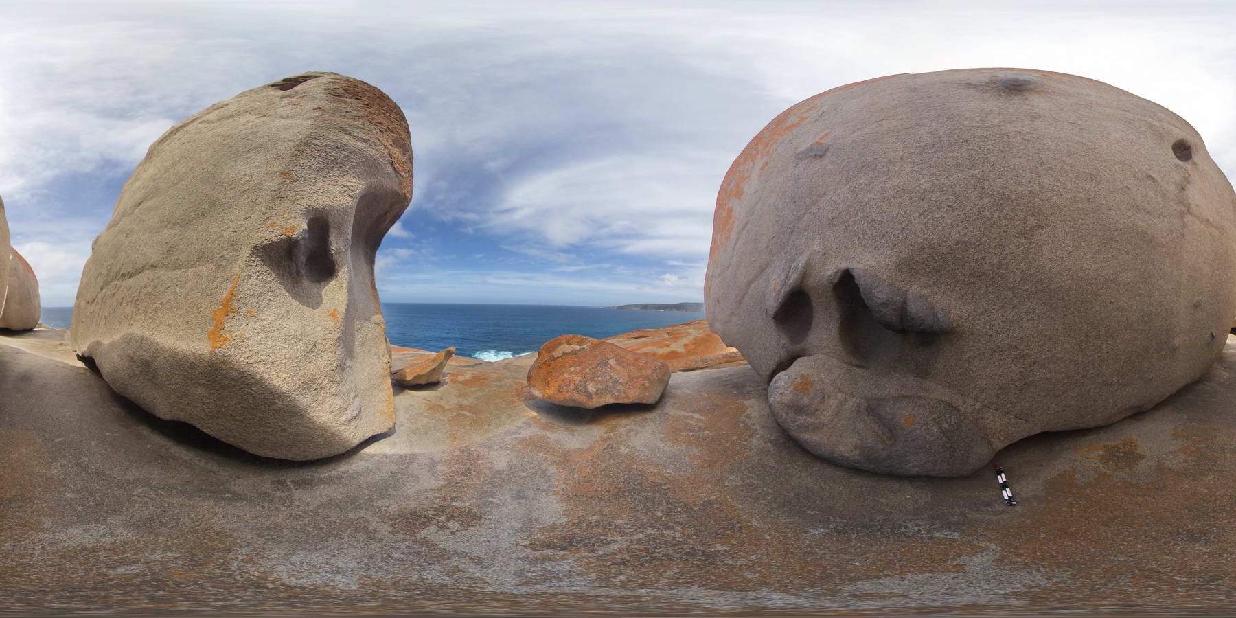
shore exposure of diorite and granodiorite xenoliths in large weathered granite boulder, Remarkable Rocks, Kangaroo Island. |
2000.00 |
-36.04832000000 |
136.75716000000 |
-9999.000 |
granite, xenolith, weathering |
granite |
RemarkableFSP3 Map
 |
0 |
10/20/2015 3:54 p.m. |
FSP |
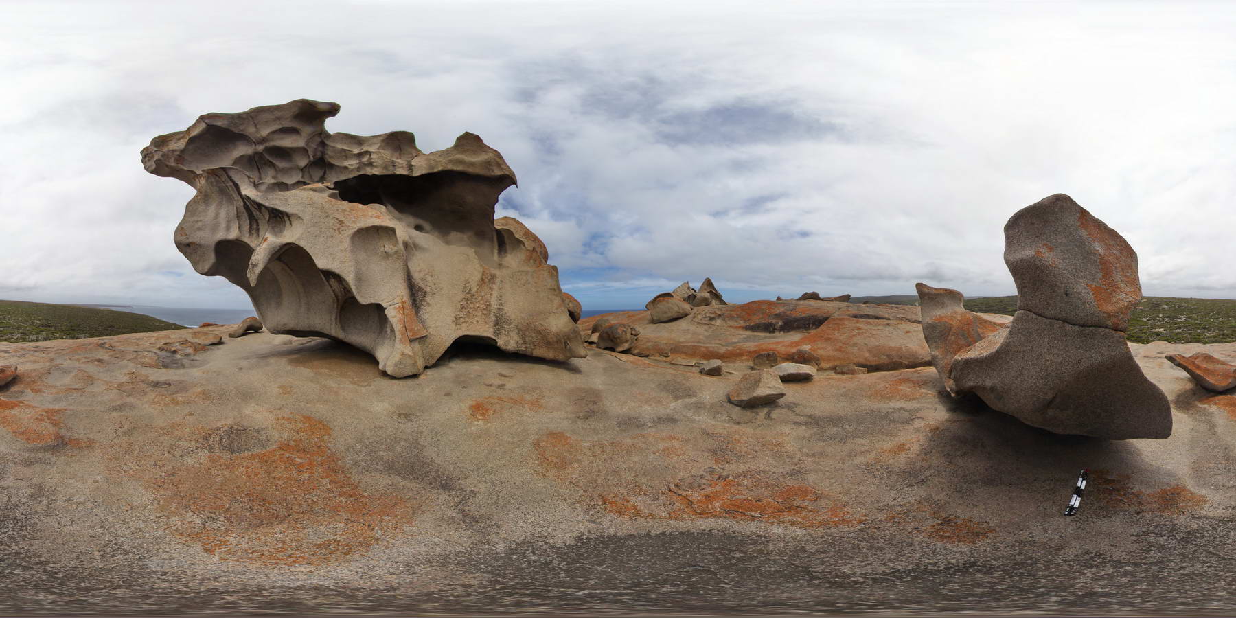
shore exposure of xenoliths in large weathered granite boulder, Remarkable Rocks, Kangaroo Island. |
2000.00 |
-36.04801000000 |
136.75714000000 |
-9999.000 |
xenoliths, granite, weathering |
granite |
RemarkableFSP4 Map
 |
0 |
10/20/2015 3:54 p.m. |
FSP |
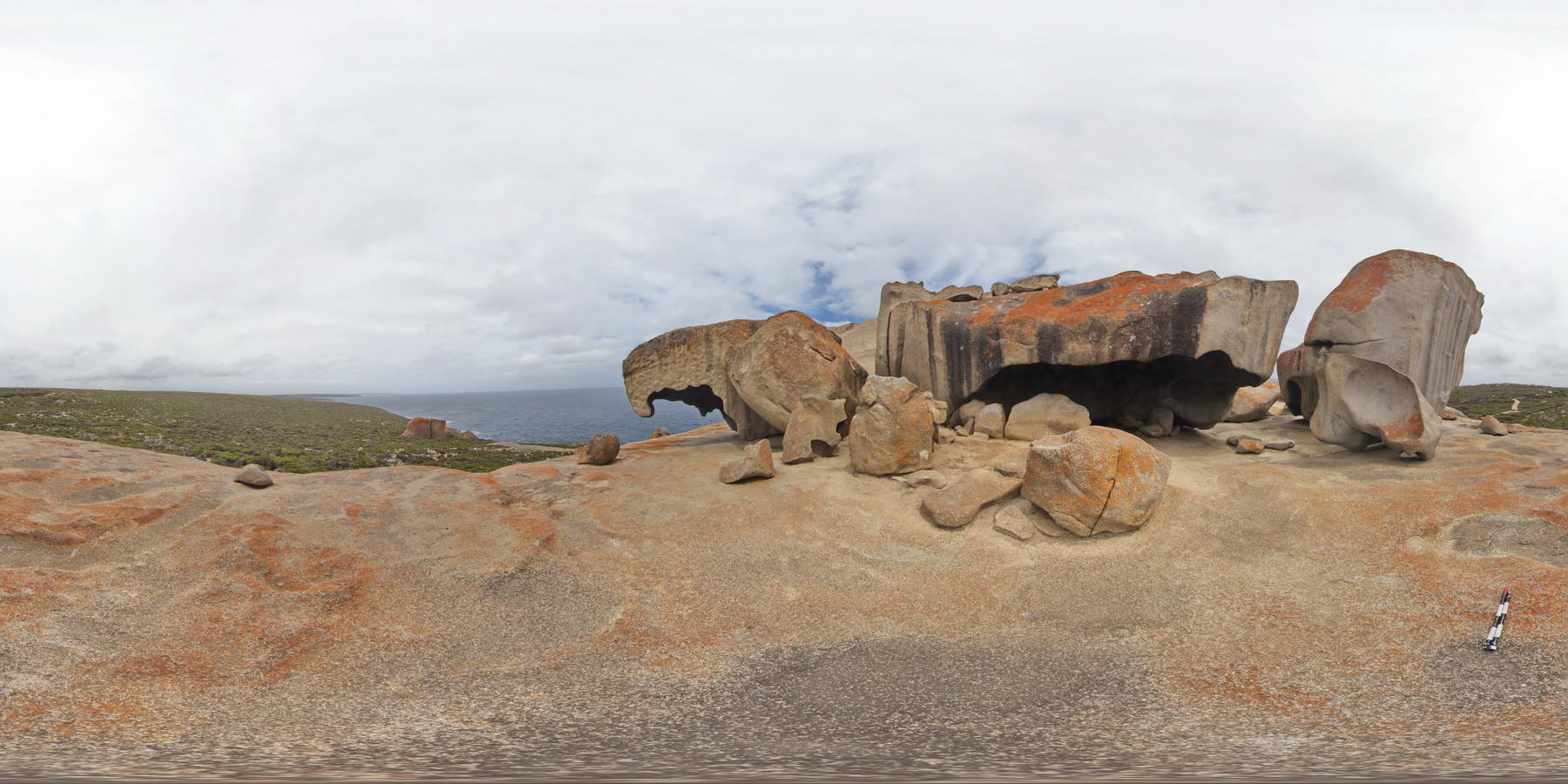
shore exposure of the Remarkable Granite with xenoliths of granite? and weathered boulders. Remarkable Rocks, Kangaroo Island. |
2000.00 |
-36.04832000000 |
136.75728000000 |
-9999.000 |
granite, xenolith, weathering |
granite |
REYN1 Map
 |
0 |
07/24/2016 12:07 p.m. |
3D |
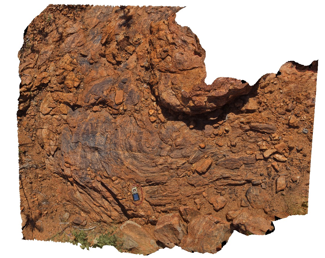
large re-folded fold in intermingled mafic/felsic orthogneiss. Mount Boothby, Reynolds Range. Next to Stuart Highway. N.T. |
3.00 |
-22.57866600000 |
133.29625800000 |
870.747 |
orthogneiss, metamorphic, refolded fold, structure, fold |
orthogneiss |
REYN2 Map
 |
5 |
01/01/9999 midnight |
3D |
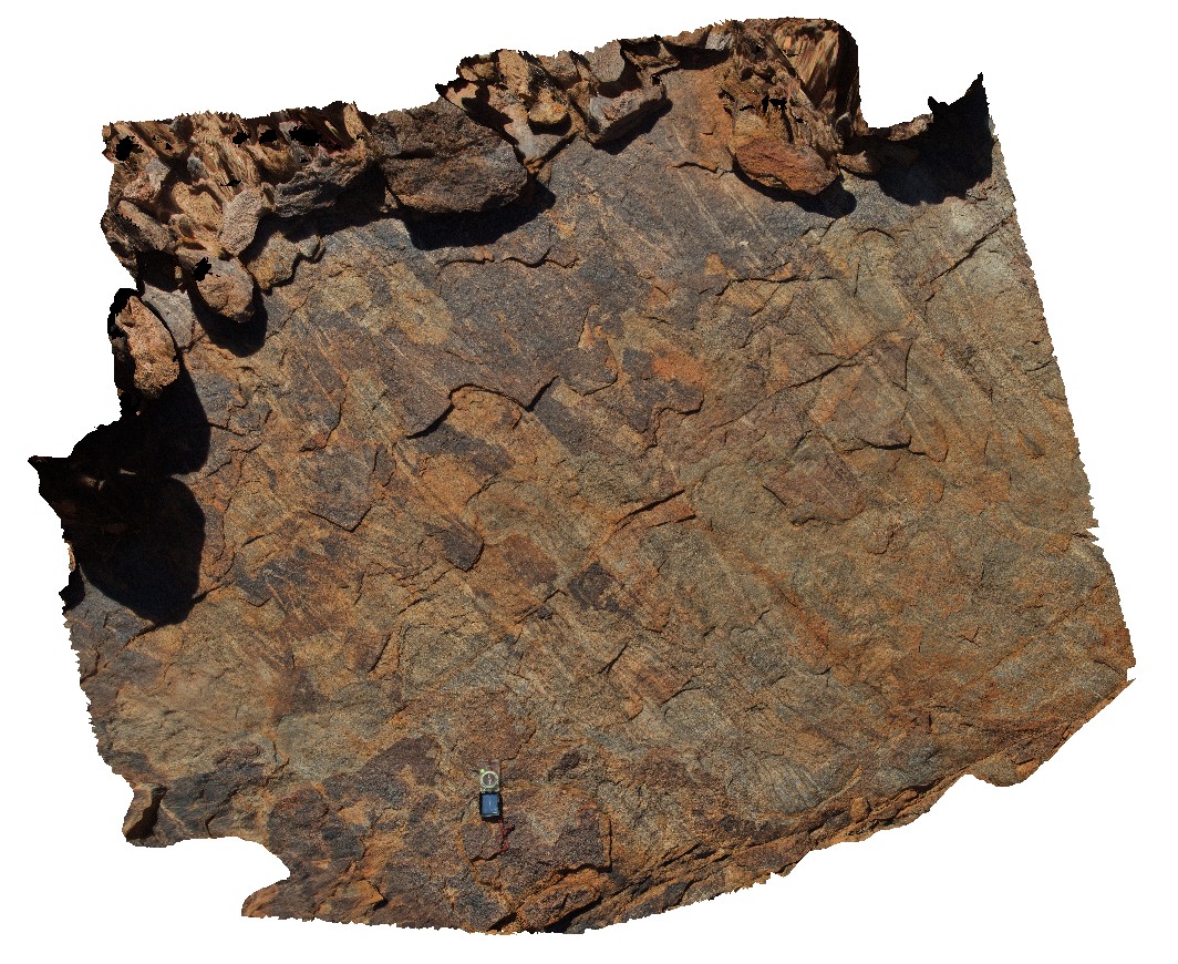
close up view of parasitic, isoclinal folds in migmatite. Mount Boothby, Reynolds Range. Next to Stuart Highway. N.T. |
3.00 |
-22.57896100000 |
133.29551700000 |
-9999.000 |
parasitic fold, isoclinal fold, fold, migmatite, metamorphic |
orthogneiss |
REYN3 Map
 |
0 |
07/24/2016 12:55 p.m. |
3D |
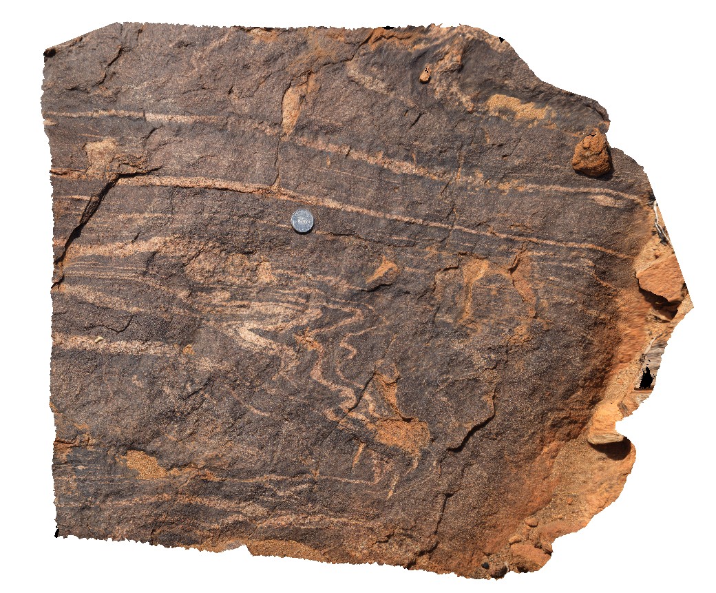
parasitic folds in mafic granulite, Mount Boothby, Reynolds Range. Next to Stuart Highway. N.T. |
0.70 |
-22.57826100000 |
133.29663600000 |
863.448 |
parasitic fold, fold, structure, granulate, metamorphic |
granulite |
REYN4 Map
 |
0 |
07/24/2016 1:21 p.m. |
3D |
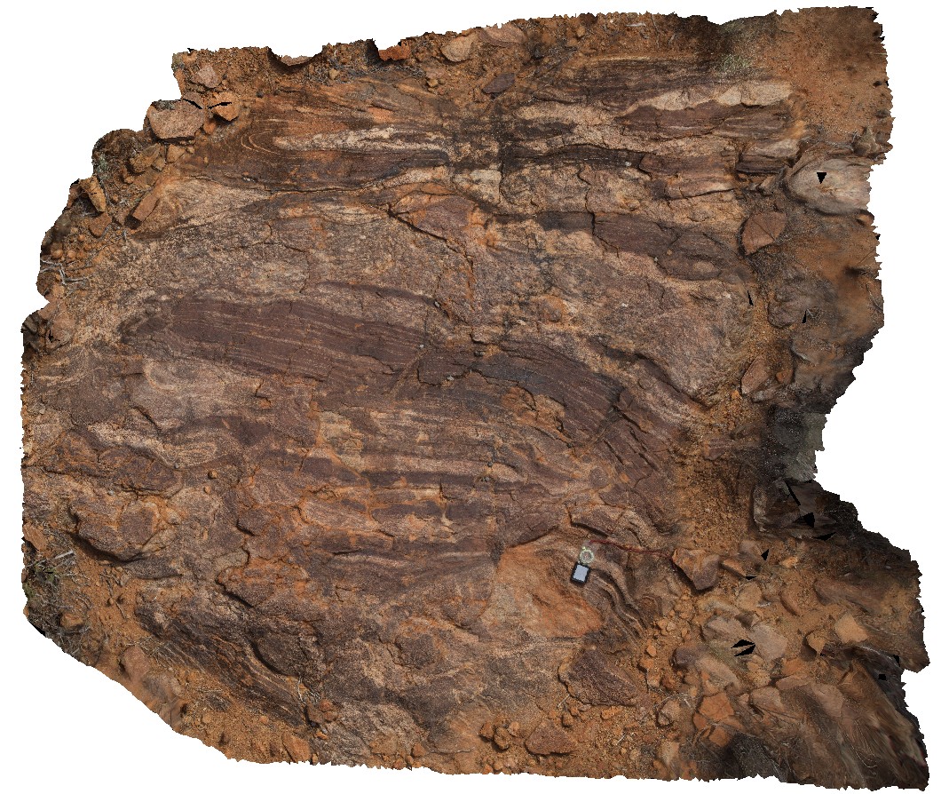
isoclinal folds and quartz augen in migmatite. Mount Boothby, Reynolds Range. Next to Stuart Highway. N.T. |
2.50 |
-22.57620700000 |
133.29957700000 |
729.320 |
isoclinal fold, fold, structure, migmatite, metamorphic, augen |
migmatite |
REYN5 Map
 |
0 |
07/24/2016 1:38 p.m. |
3D |
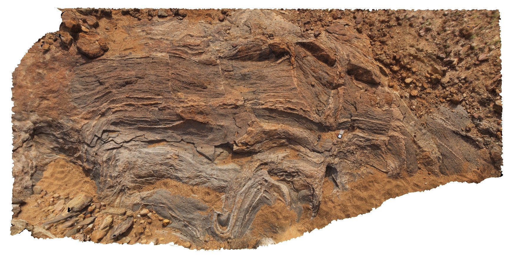
felsic and mafic melt-mixing in granulite orthogneiss. Bands off-set by small faults. Mount Boothby, Reynolds Range. Next to Stuart Highway. N.T. |
5.00 |
-22.57545800000 |
133.30218300000 |
703.812 |
orthogneiss, metamorphic, melt-mixing |
granulite |
REYN6 Map
 |
0 |
07/24/2016 1:49 p.m. |
3D |
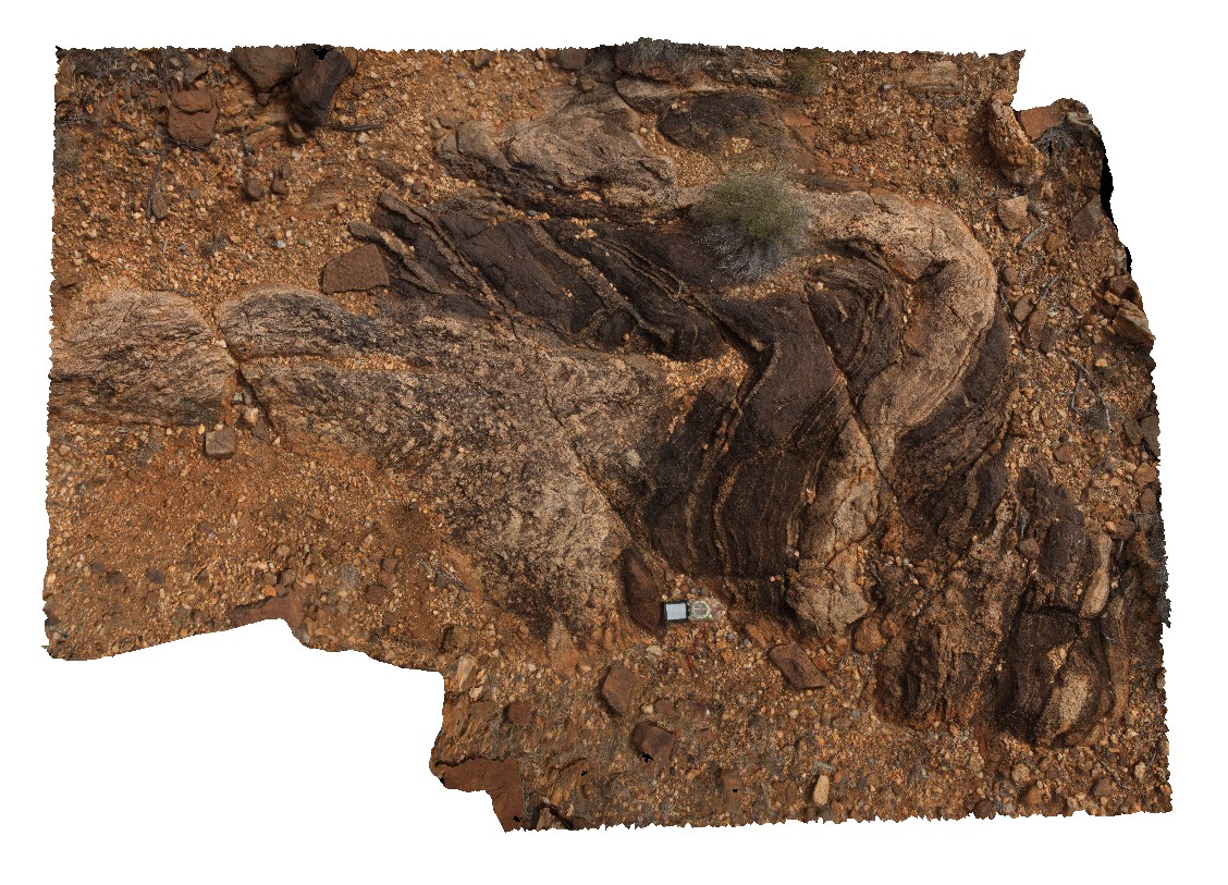
felsic and mafic melt-mixing in granulite orthogneiss with isoclinal folds. Bands off-set by small faults. Mount Boothby, Reynolds Range. Next to Stuart Highway. N.T. |
3.00 |
-22.57467100000 |
133.30243100000 |
704.799 |
melt-mixing, granulite orthogneiss, metamorphic, isoclinal fold, fold, structure |
orthogneiss |
REYN7 Map
 |
0 |
07/24/2016 2 p.m. |
3D |
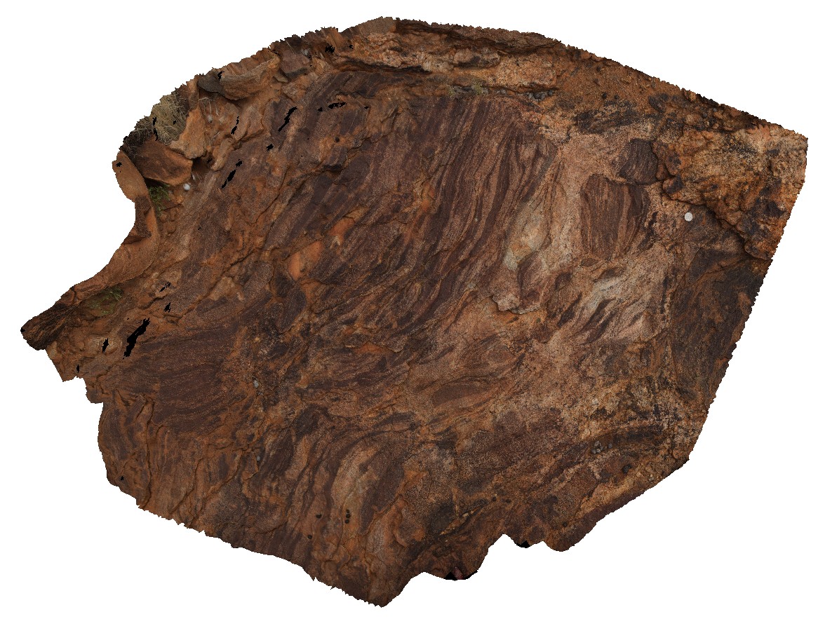
felsic and mafic melt-mixing in granulite orthogneiss with isoclinal folds. Mount Boothby, Reynolds Range. Next to Stuart Highway. N.T. |
1.50 |
-22.57456800000 |
133.30322500000 |
704.529 |
granulite orthogneiss, isoclinal folds, structure, migmatite, metamorphic |
orthogneiss |
REYNFSP1 Map
 |
0 |
07/24/2016 11:35 a.m. |
FSP |
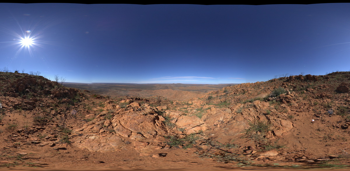
view from south side of Mount Boothby, showing felsic ortho gneiss on the ground and surrounding landscape. Reynolds Range. Next to Stuart Highway. N.T. |
3000.00 |
-22.57954400000 |
133.29694100000 |
881.272 |
gneiss, Aileron Provence, metamorphic |
orthogneiss |
REYNFSP2 Map
 |
0 |
07/24/2016 11:43 a.m. |
FSP |
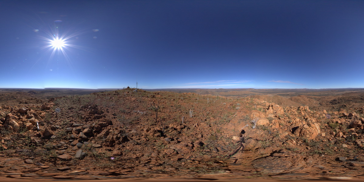
view from west side of Mount Boothby, showing gneiss (foreground) and surrounding landscape. Reynolds Range. Next to Stuart Highway. N.T. |
3000.00 |
-22.57917700000 |
133.29637600000 |
887.075 |
Aileron Metamorphics, Boothby Orthogneiss, metamorphics |
gneiss, gneiss |
REYNFSP3 Map
 |
0 |
07/24/2016 11:51 a.m. |
FSP |
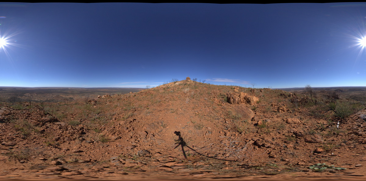
view from North East side of Mount Boothby, showing gneiss (foreground) and surrounding landscape. Reynolds Range. Next to Stuart Highway. N.T. |
0.00 |
-22.57900900000 |
133.29726800000 |
882.999 |
metamorphic, gneiss, Boothby Orthogneiss, Aileron Metamorphics |
gneiss, gneiss |
REYNUAV1 Map
 |
0 |
07/24/2016 12:20 p.m. |
UAV |
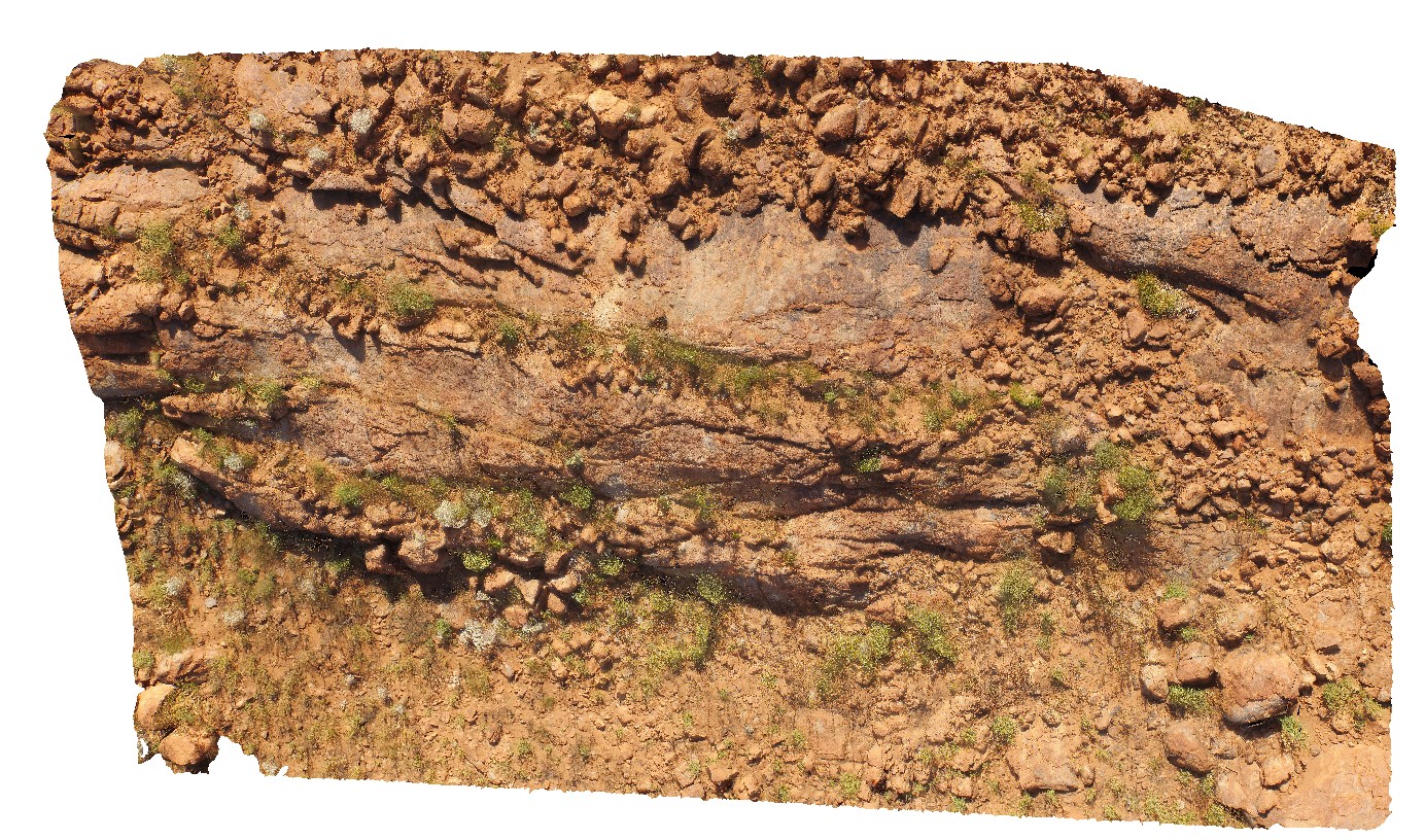
aerial view of folded migmatitic ortho gneiss with parasitic, isoclinal folds. North West side of Mount Boothby, Reynolds Range. Next to Stuart Highway. N.T. |
20.00 |
-22.57896100000 |
133.29551700000 |
848.040 |
metamorphic, gneiss, fold, structure |
gneiss, gneiss |
REYNUAV2 Map
 |
0 |
07/24/2016 2:07 p.m. |
UAV |
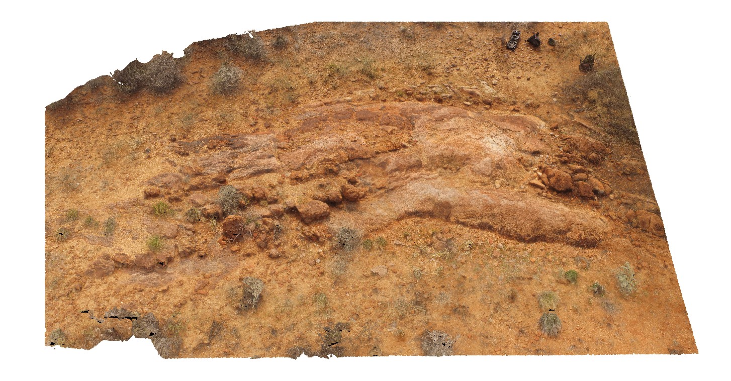
aerial view of parasitic folds in mixed mafic-felsic orthogneiss. North West side of Mount Boothby, Reynolds Range. Next to Stuart Highway. N.T. |
50.00 |
-22.57375700000 |
133.30383400000 |
688.246 |
orthogneiss, metamorphic |
orthogneiss |
RHead1 Map
 |
5 |
01/01/9999 midnight |
3D |
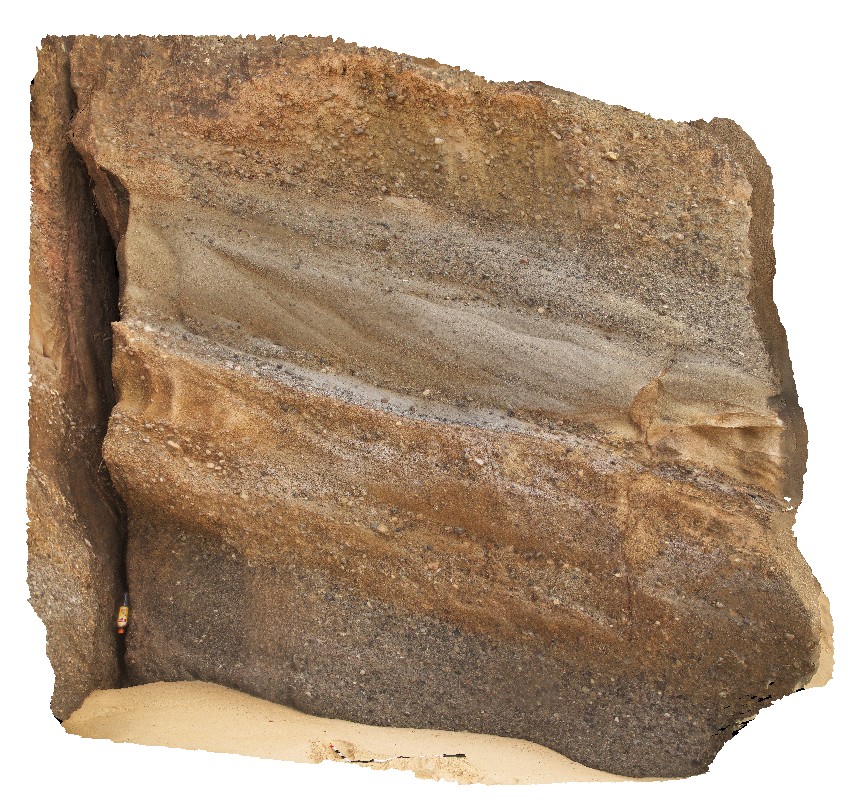
high energy fluvial sediments of the Newcastle Coal Measures, showing cross bedding and varied grain size. Redhead, N.S.W. |
0.00 |
-33.01357000000 |
151.72153000000 |
-9999.000 |
high energy sediments, fluvial sediments |
sediments |
RHead2 Map
 |
5 |
01/01/9999 midnight |
3D |
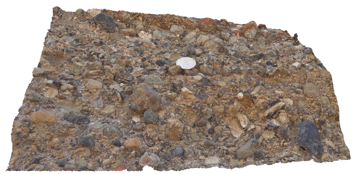
detail of polymict, clast-supported conglomerate lense in Newcastle coal measures. Semi-rounded clasts. Redhead, N.S.W. |
0.00 |
-33.01356000000 |
151.72147000000 |
-9999.000 |
conglomerate, clast-supported, polymict, sedimentology |
conglomerate |
RHead3 Map
 |
5 |
01/01/9999 midnight |
3D |
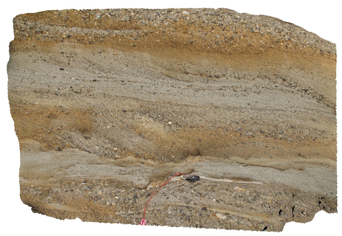
sandy lenses in conglomerate with cross bedding and coaly fragments. Redhead, N.S.W. |
0.00 |
-33.01354000000 |
151.72142000000 |
-9999.000 |
conglomerate, cross bedding, coal, sedimentology |
conglomerate |
RHead4 Map
 |
5 |
01/01/9999 midnight |
3D |
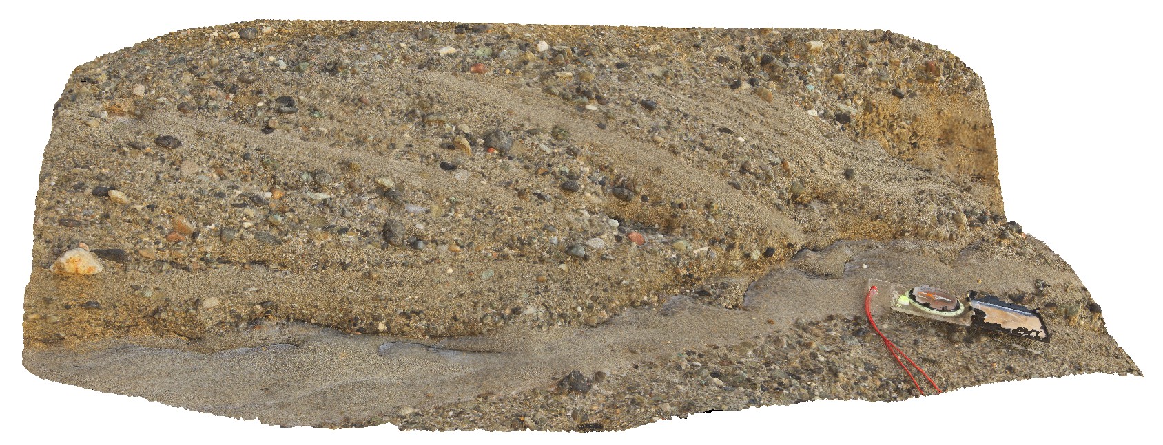
conglomerate layer with sandy cross-beds and erosional lower contact. Redhead, N.S.W. |
0.00 |
-33.01352000000 |
151.72142000000 |
-9999.000 |
conglomerate, cross bedding, erosional contact, sedimentology, high-energy sediments |
sandstone |
RHead5 Map
 |
5 |
01/01/9999 midnight |
3D |
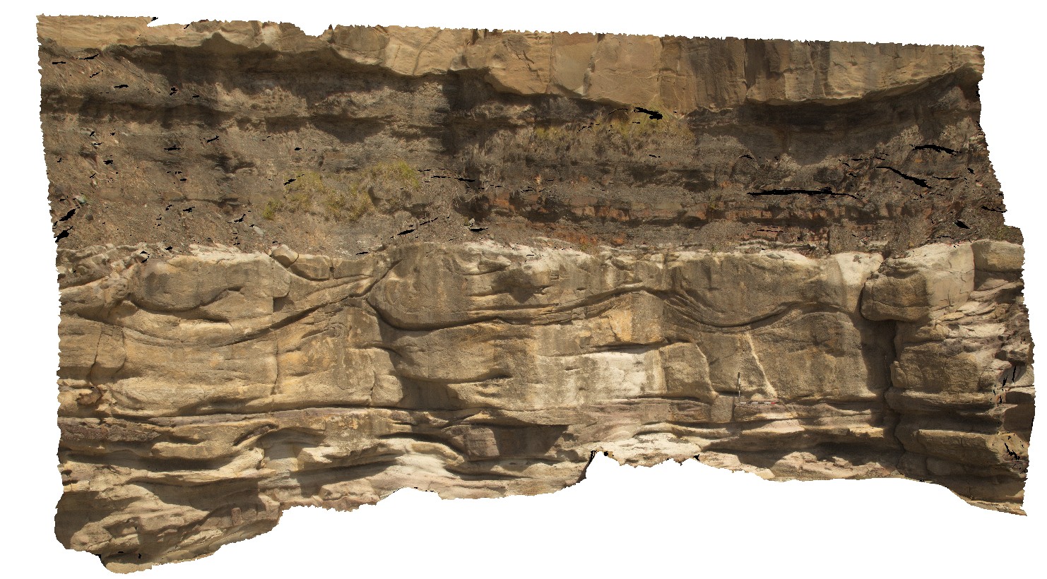
wavy bedforms in the Nobbys Tuff and overlying floodplain sediments. Redhead, N.S.W. |
15.00 |
-33.00492000000 |
151.73006000000 |
-9999.000 |
tuff, floodplain sediments, wavy bedforms, sedimentology |
tuff |


