PurnululuUAV3 Map
 |
0 |
06/12/2016 noon |
UAV |
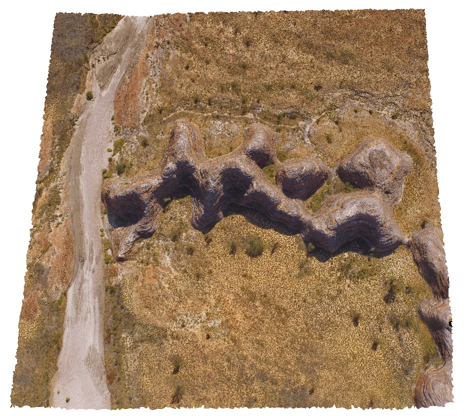
aerial view of 'C' group of 'bee Hive' formations at the Bungle Bungles, near Piccaninny Creek. Purnululu National Park, W.A. |
50.00 |
-17.49130800000 |
128.38355900000 |
-9999.000 |
Bee Hive, weathering features, sandstone, Bungle Bungles |
sandstone |
PurnululuUAV4 Map
 |
0 |
06/12/2016 noon |
UAV |
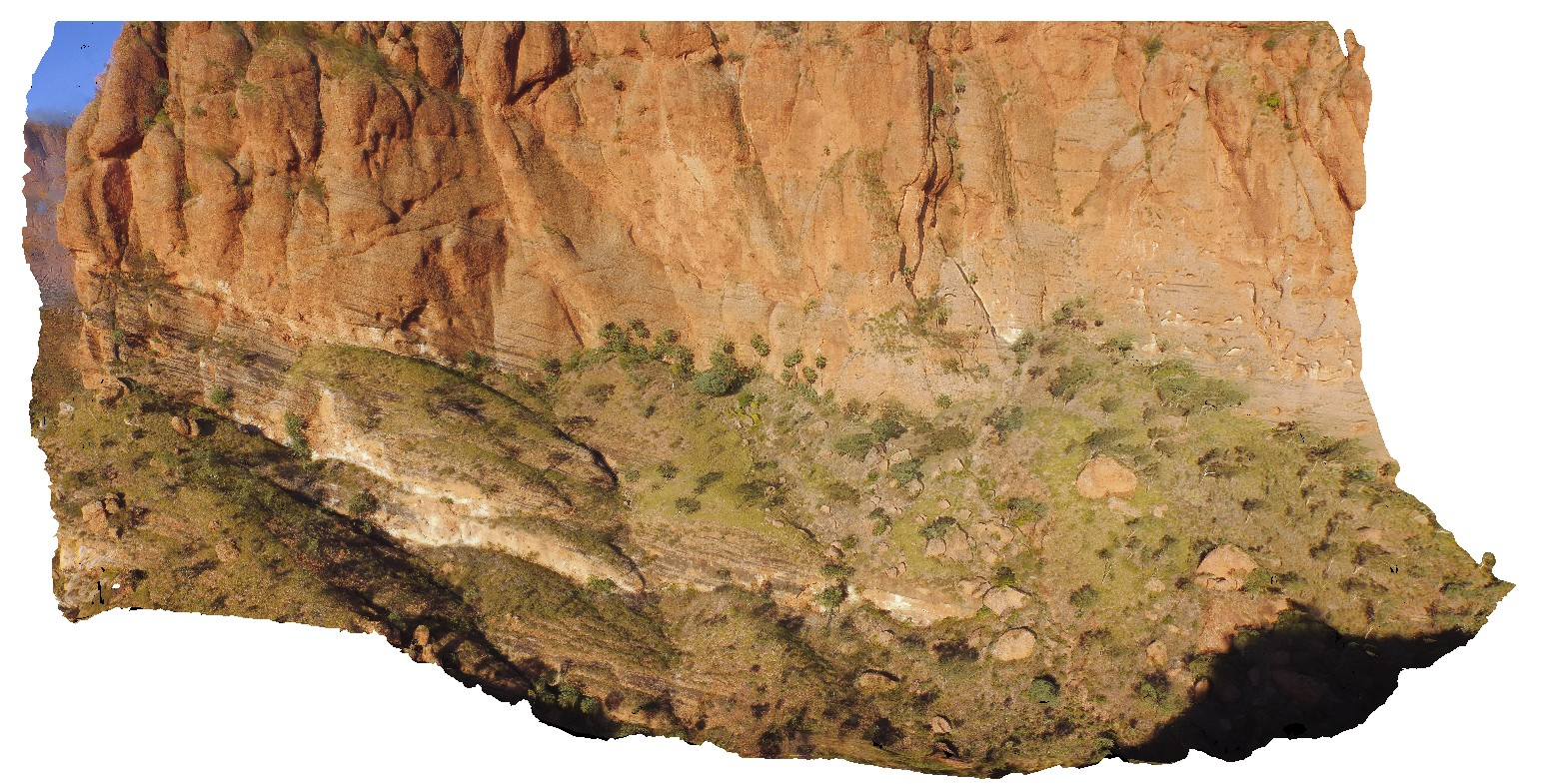
aerial view of the start of the Echidna Chasm trail, showing cliff of Glass Hill Sandstone. Purnululu National Park, W.A. |
50.00 |
-17.32394600000 |
128.41405700000 |
-9999.000 |
Glass Hill Sandstone, sandstone, Bungle Bungles |
sandstone |
PurnululuUAV5 Map
 |
0 |
06/12/2016 noon |
UAV |
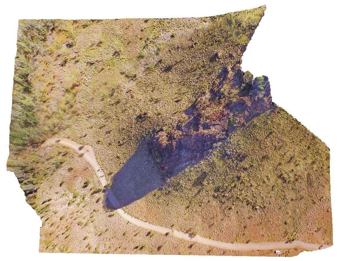
aerial view of knife-edge ridge in with carbonate cemented breccias. Purnululu National Park, W.A. |
50.00 |
-17.41007000000 |
128.20453000000 |
-9999.000 |
weathering feature, knife-edge ridge, carbonate, Bungle Bungles, Purnululu National Park |
dolostone |
Quagi1 Map
 |
0 |
06/05/2016 10:39 a.m. |
3D |
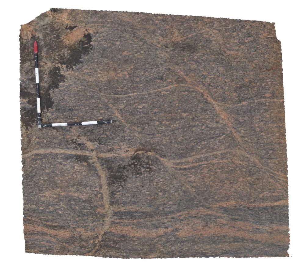
view of leucosomes and shear zones in augen gneiss. Quagi Beach, W.A. |
1.80 |
-33.83947000000 |
121.29591000000 |
-9999.000 |
leucosomes, S - C fabric, shear zone |
gneiss |
Quagi2 Map
 |
0 |
06/05/2016 10:40 a.m. |
3D |
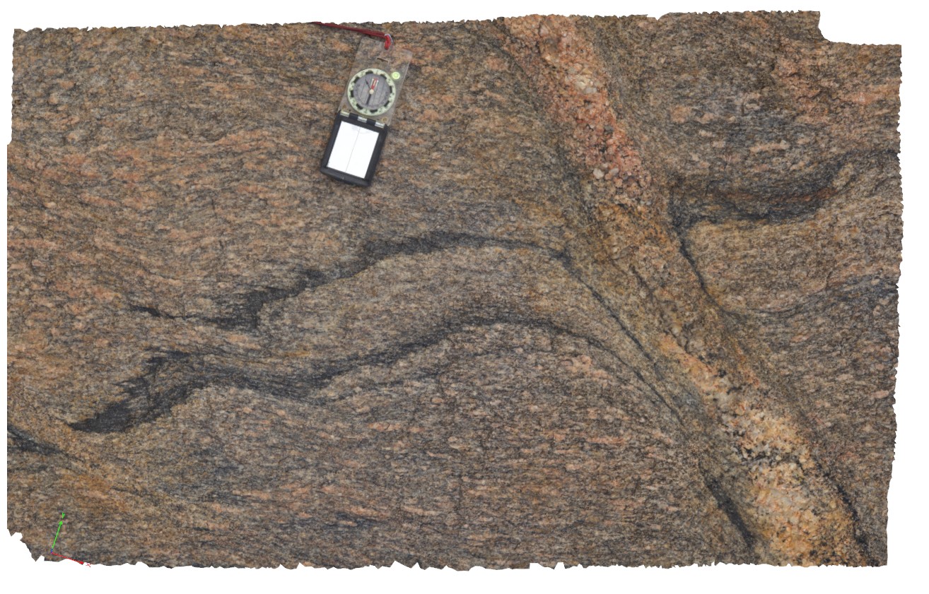
view of folded mafic layer, with 2 generations of folding, but by later shear zone with associated pegmatite. Quagi Beach, W.A. |
1.60 |
-33.83956000000 |
121.29591000000 |
-9999.000 |
gneiss, shear zone, structure |
gneiss, mafic |
Quagi3 Map
 |
0 |
06/05/2016 10:40 a.m. |
3D |
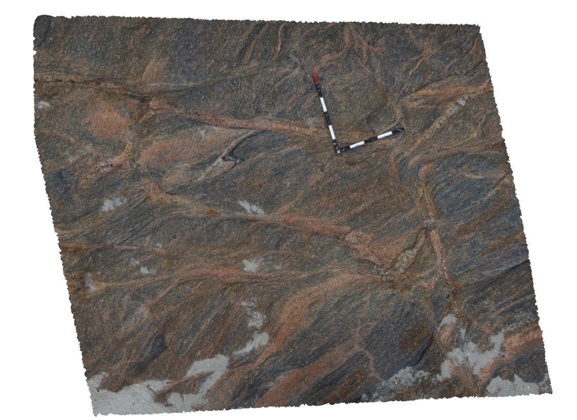
shear zones disrupting folded gneissic laying in augen gneiss. Possibly proximal to the Red Island Shear Zone. Quagi Beach, W.A. |
3.00 |
-33.83959000000 |
121.29589000000 |
-9999.000 |
shear zone, structure, augen gneiss |
gneiss |
Quagi4 Map
 |
0 |
06/05/2016 10:40 a.m. |
3D |
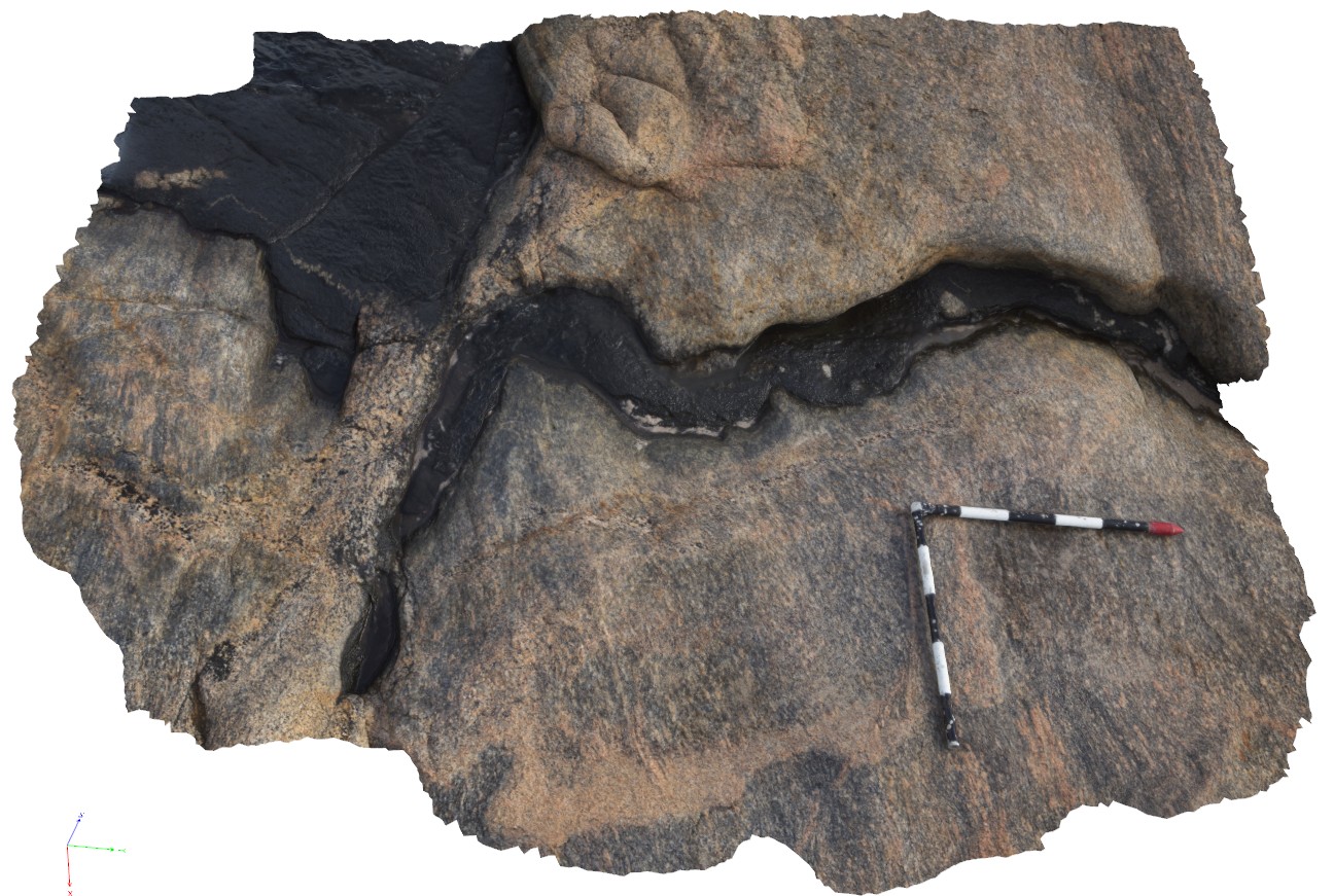
ptygmatic folding in leucosome and amphibolite rich band in gneiss. Quagi Beach, W.A. |
2.20 |
-33.83952000000 |
121.29587000000 |
-9999.000 |
leucosome, amphibolite, ptygmatic folding, structure |
amphibolite gneiss |
Quagi5 Map
 |
0 |
06/05/2016 10:43 a.m. |
3D |
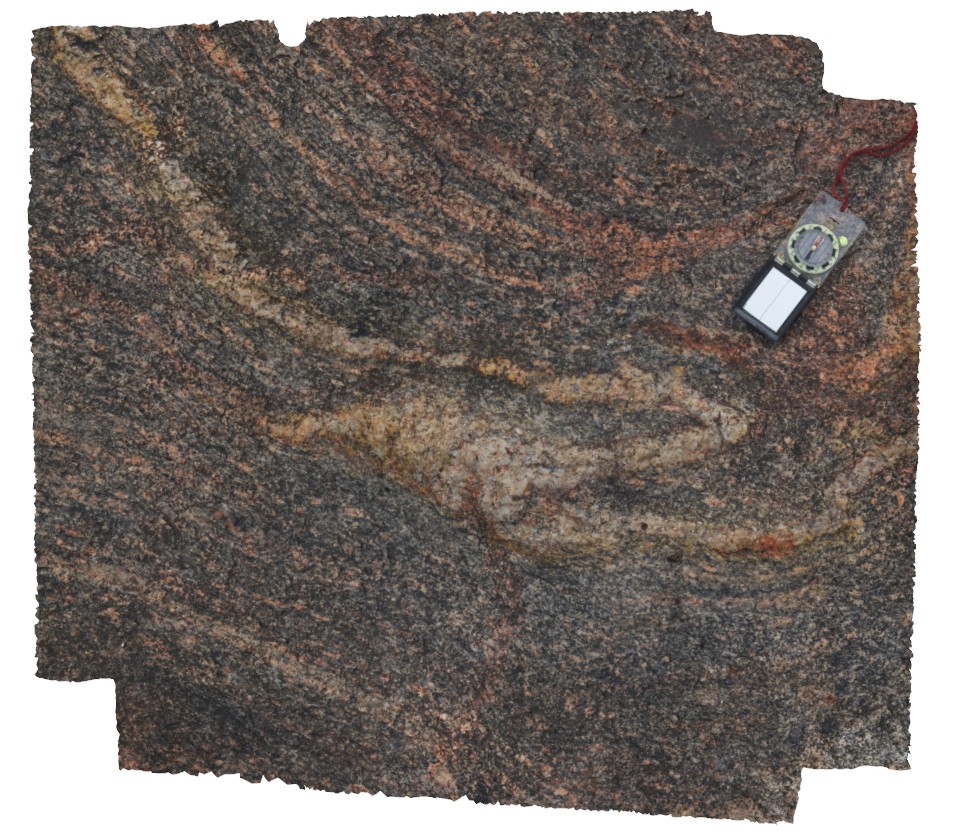
tight to isoclinally folded quartz vein / leucosome in garnet gneiss. Quagi Beach, W.A. |
0.90 |
-33.83943000000 |
121.29590000000 |
-9999.000 |
isoclinal fold, leucosome, structure |
garnet gneiss |
Quagi6 Map
 |
0 |
06/05/2016 10:43 a.m. |
3D |
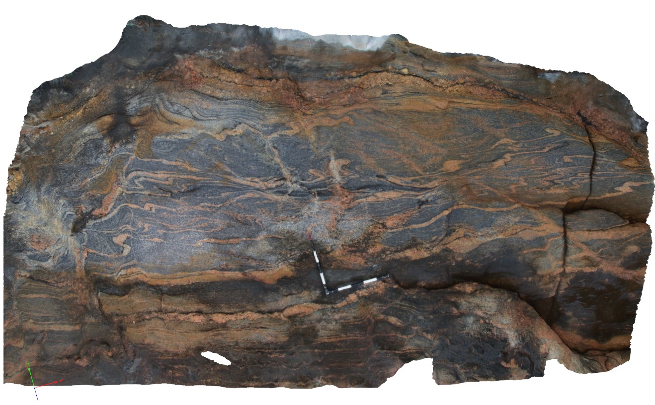
folded gneissic layering and leucosomes in gneiss. Quagi Beach, W.A. |
4.20 |
-33.83300000000 |
121.29560000000 |
-9999.000 |
fold, gneiss, structure, leucosome |
gneiss |
Quagi7 Map
 |
0 |
06/05/2016 10:43 a.m. |
3D |
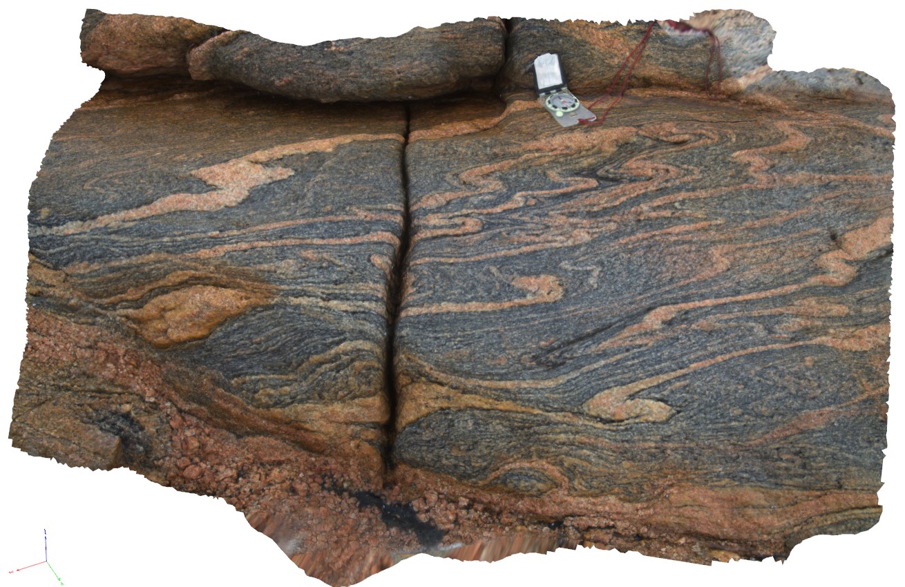
detail of folding from site Quagi6, showing asymmetric folding in leucosomes and banded gneiss. Quagi Beach, W.A. |
0.70 |
-33.83301000000 |
121.29561000000 |
-9999.000 |
asymmetric folding, leucosome, structure |
gneiss |
QuarryBeach1 Map
 |
5 |
01/01/9999 midnight |
3D |
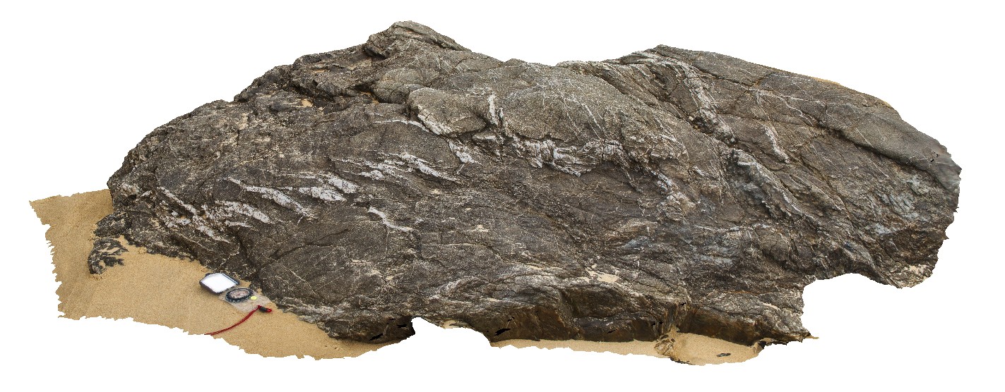
en echelon quartz veins in Mallacoota Beds. Mallacoota, Vic. |
1.50 |
-37.60242500000 |
149.72654600000 |
-9999.000 |
en echelon vein, vein, structure |
turbidite |
RailtonUAV1 Map
 |
20 |
01/01/9999 midnight |
UAV |
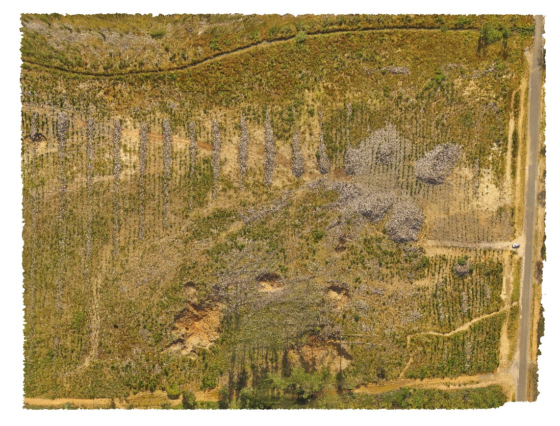
aerial view of logging coupe, showing sink holes in the 'Goliath Limestone' near the cement works, Dulverton Road, Railton. Northern Tasmania. |
480.00 |
-41.31009900000 |
146.40432500000 |
37.500 |
sink hole, logging coupe, Goliath Limestone |
limestone |
Redbanks1 Map
 |
0 |
10/20/2015 4:49 p.m. |
3D |
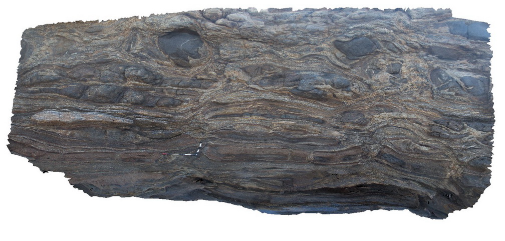
mafic inclusions in garnet-bi schist, Red Banks. |
6.50 |
-34.92324000000 |
135.61687000000 |
-9999.000 |
schist |
schist |
Redbanks2 Map
 |
0 |
10/20/2015 4:49 p.m. |
3D |
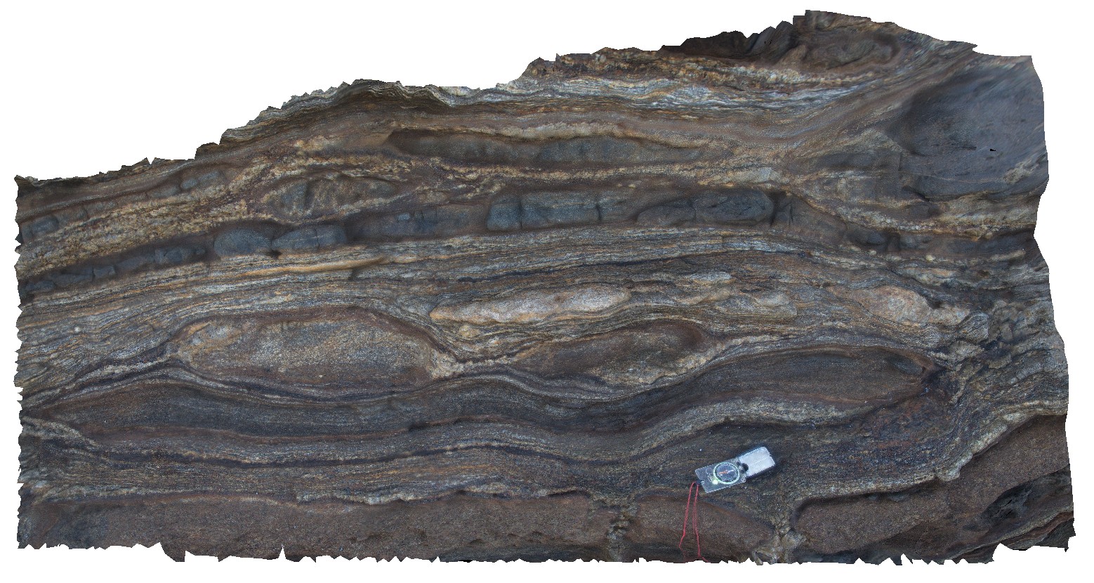
detail of boudins in garnet-bi gneiss, Red Banks. |
1.10 |
-34.92332000000 |
135.61681000000 |
-9999.000 |
gneiss, boudinage |
gneiss |
Redbanks3 Map
 |
0 |
10/20/2015 4:49 p.m. |
3D |
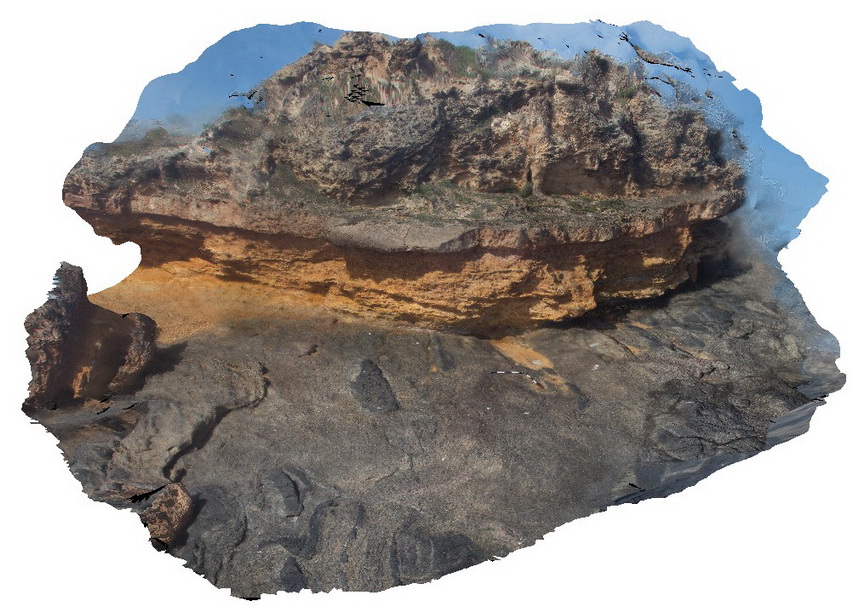
folded mafic inclusions in Charnockite, unconformably overlain by recent sands. Red Banks. |
9.00 |
-34.92381000000 |
135.61641000000 |
-9999.000 |
unconformity, sand, gneiss |
gneiss, sand |
Redbanks4 Map
 |
0 |
10/20/2015 4:50 p.m. |
3D |
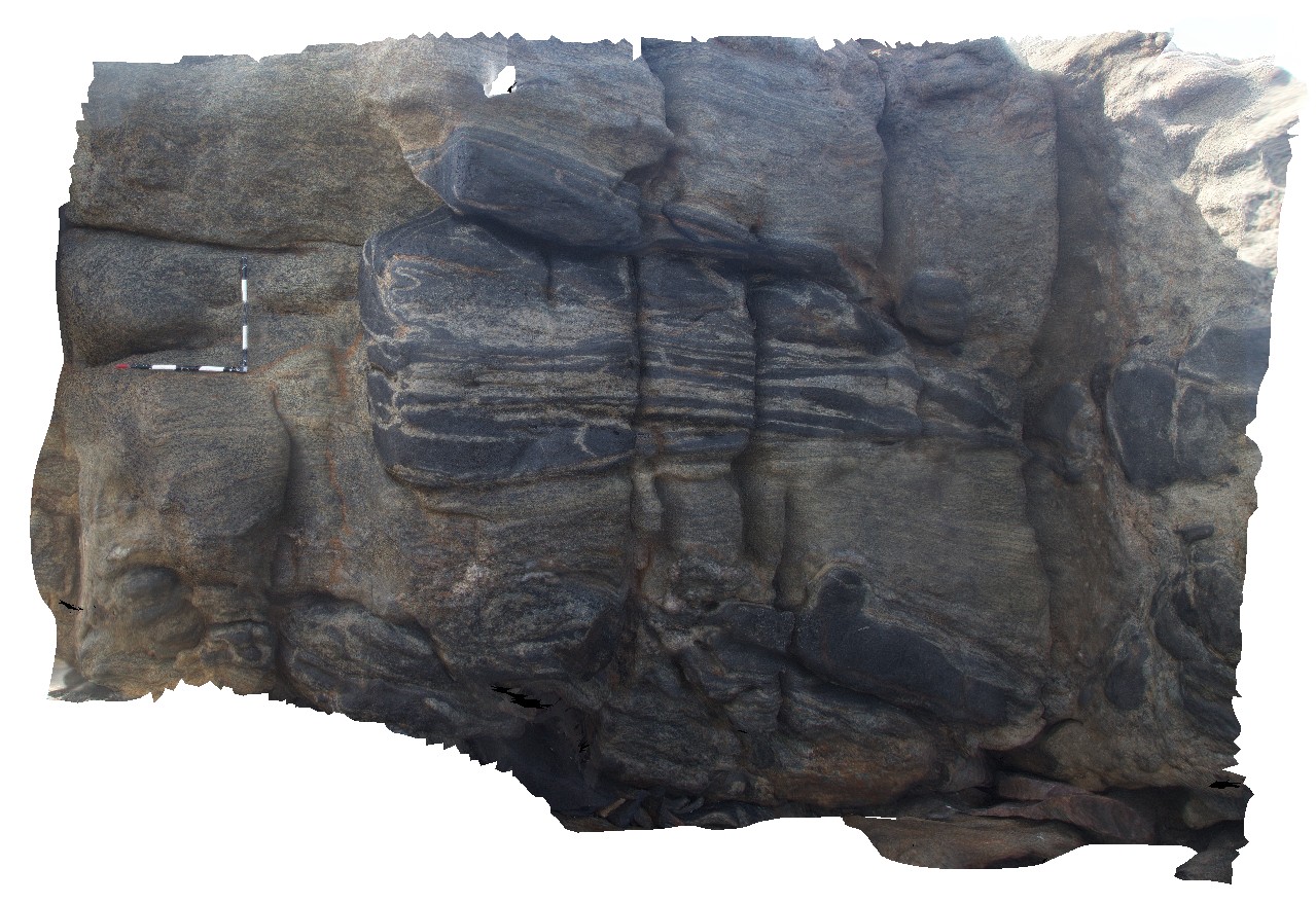
folded mafic blocks in Charnockite? Red Banks. |
3.50 |
-34.92388000000 |
135.61617000000 |
-9999.000 |
gneiss, fold, metamorphic |
gneiss |
Redbanks5 Map
 |
0 |
10/20/2015 4:50 p.m. |
3D |
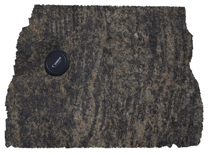
detail of mafic-rich layering in Charnockite, Red Banks. |
0.30 |
-34.92388000000 |
135.61617000000 |
-9999.000 |
Charnockite, metamorphic |
Charnockite |
Redgate1 Map
 |
10 |
01/01/9999 midnight |
3D |
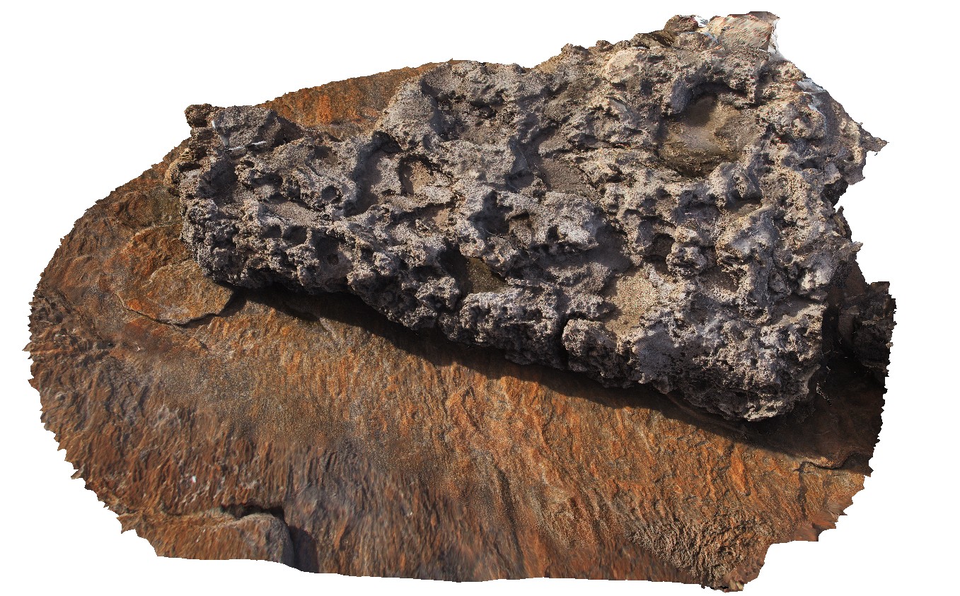
small outlier of Tamala Limestone unconformably overlying gneissic basement. Redmans beach, W.A. |
5.00 |
-34.03934000000 |
114.99867000000 |
-9999.000 |
geological unconformity, limestone |
gneiss, limestone |
Redgate2 Map
 |
10 |
01/01/9999 midnight |
3D |
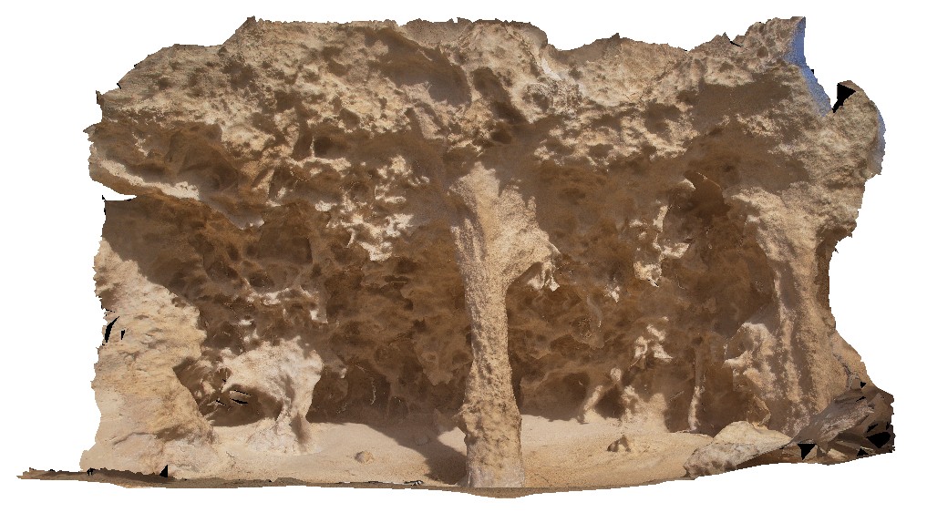
solution tubes in Tamala Limestone, Redmans Beach. Redmans, W.A. |
4.50 |
-34.03826000000 |
114.99981000000 |
-9999.000 |
solution tube, limestone |
limestone |
Redhead1 Map
 |
5 |
06/16/2015 5:33 p.m. |
3D |
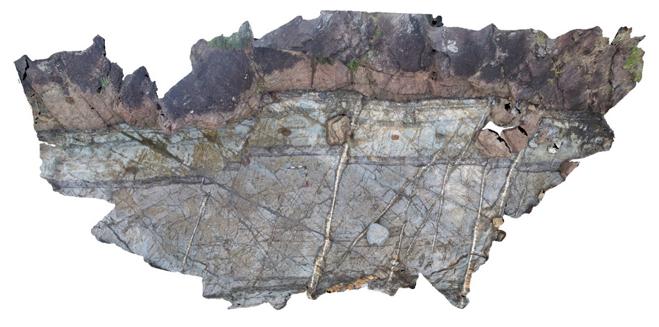
Kiwarrak Beds - contact between conglomerate and siltstone sequence with numerous veins and small faults |
8.00 |
-32.05809000000 |
152.54756000000 |
0.000 |
bedding, faults, veins, structure |
conglomerate, siltstone |
Redhead2 Map
 |
5 |
06/16/2015 5:36 p.m. |
3D |
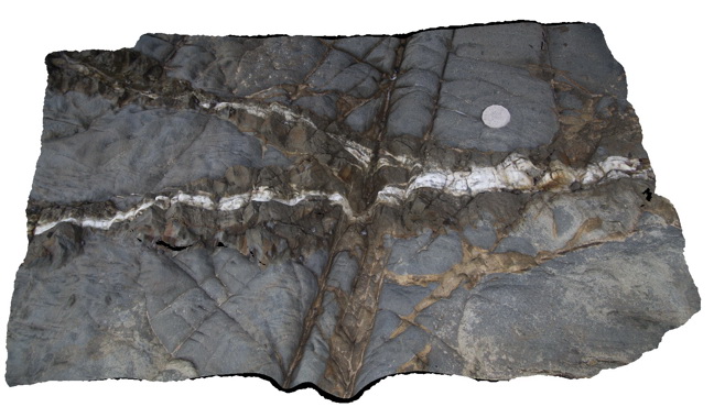
Detail of silica alteration around quartz veins in fine sandstone of the Carboniferous-Devonian Kiwarrak Beds |
1.00 |
-32.05809000000 |
152.54759000000 |
0.000 |
silica alteration, quartz vein, joints, structure, hydrothermal |
sandstone, quartz |
Redhead3 Map
 |
5 |
06/16/2015 5:37 p.m. |
3D |
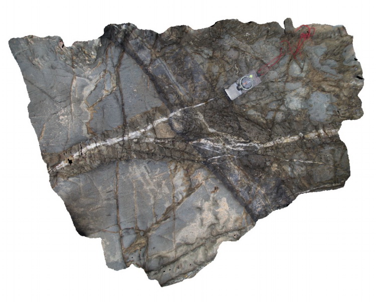
Detail of quartz vein with prominent silica alteration zone cutting siltstone of the Devonian to Carboniferous Kiwarrak Beds |
1.00 |
-32.05807000000 |
152.54762000000 |
0.000 |
quartz vein, silica alteration, fault, structure, hydrothermal |
siltstone, quartz |
Redhead4 Map
 |
5 |
06/16/2015 5:37 p.m. |
3D |
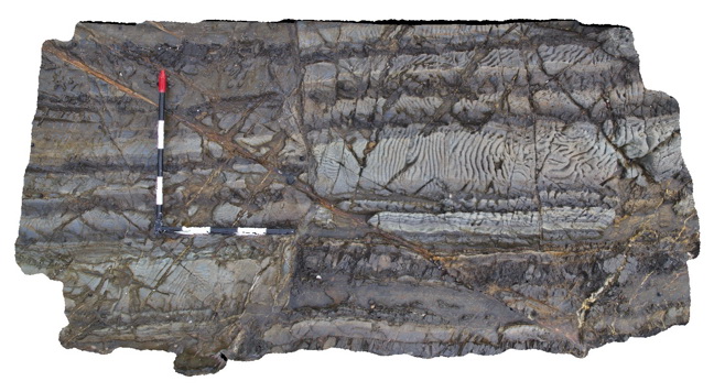
micro-faulting, joints and veins in siltstone and fine sandstone of the Devonian to Carboniferous Kiwarrak Beds. Unusual weathering patterns in the sandy units |
2.00 |
-32.05803000000 |
152.54761000000 |
0.000 |
bedding, joints, faults, structure, sedimentology |
siltstone |
Redhead5 Map
 |
5 |
06/16/2015 5:38 p.m. |
3D |
Detail of unusual weathering texture in rocks depicted in Redhead4. Irregular surface features cross-cut bedding and seem to be controlled in part by en-echelon micro arrays of carbonate? Veins. Devonian to Carboniferous Kiwarrak Beds. |
0.30 |
-32.05803000000 |
152.54760000000 |
0.000 |
en-echelon veins, carbonate, structure |
sandstone |
Redhead6 Map
 |
5 |
06/16/2015 5:38 p.m. |
3D |
Chert clasts with alteration envelopes in veined sandstone of the Devonian to Carboniferous Kiwarrak Beds |
1.00 |
-32.05792000000 |
152.54762000000 |
0.000 |
chert, veins, sedimentology |
sandstone |


