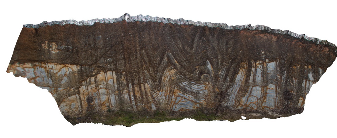
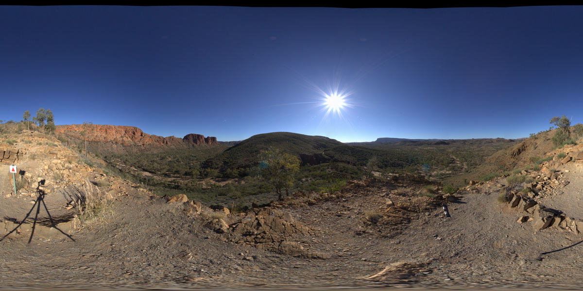
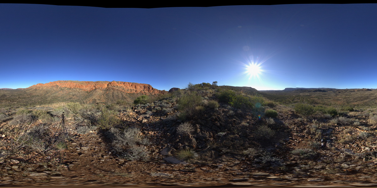
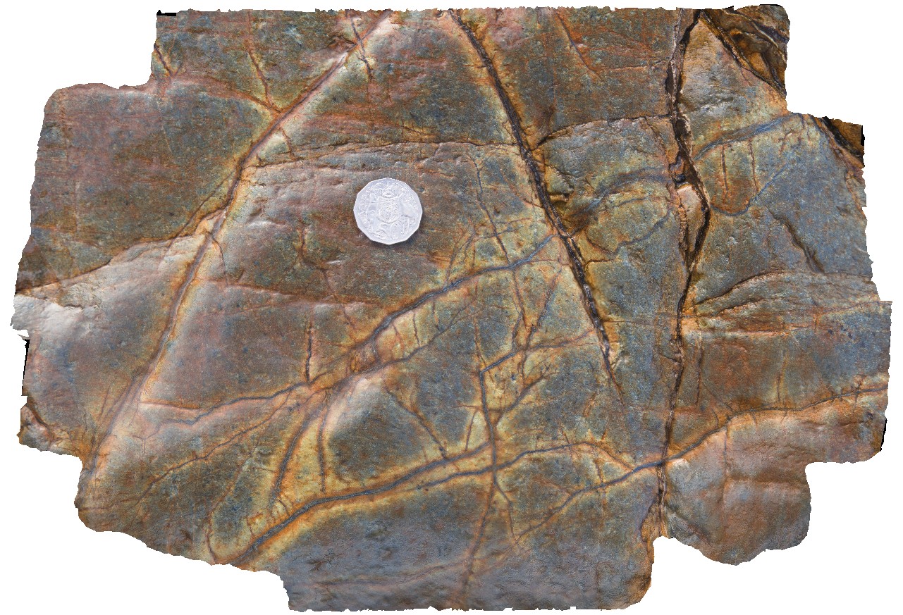
TomPriceGIGa1 Map
 |
0 |
05/29/2016 noon |
GIGA |
360 degree view from near the summit of Mount Nameless, showing Mount Tom Price mine operations and surrounding country. Tom Price, W.A. |
5000.00 |
-22.71881000000 |
117.76555000000 |
-9999.000 |
banded iron formation, chert |
BIF |
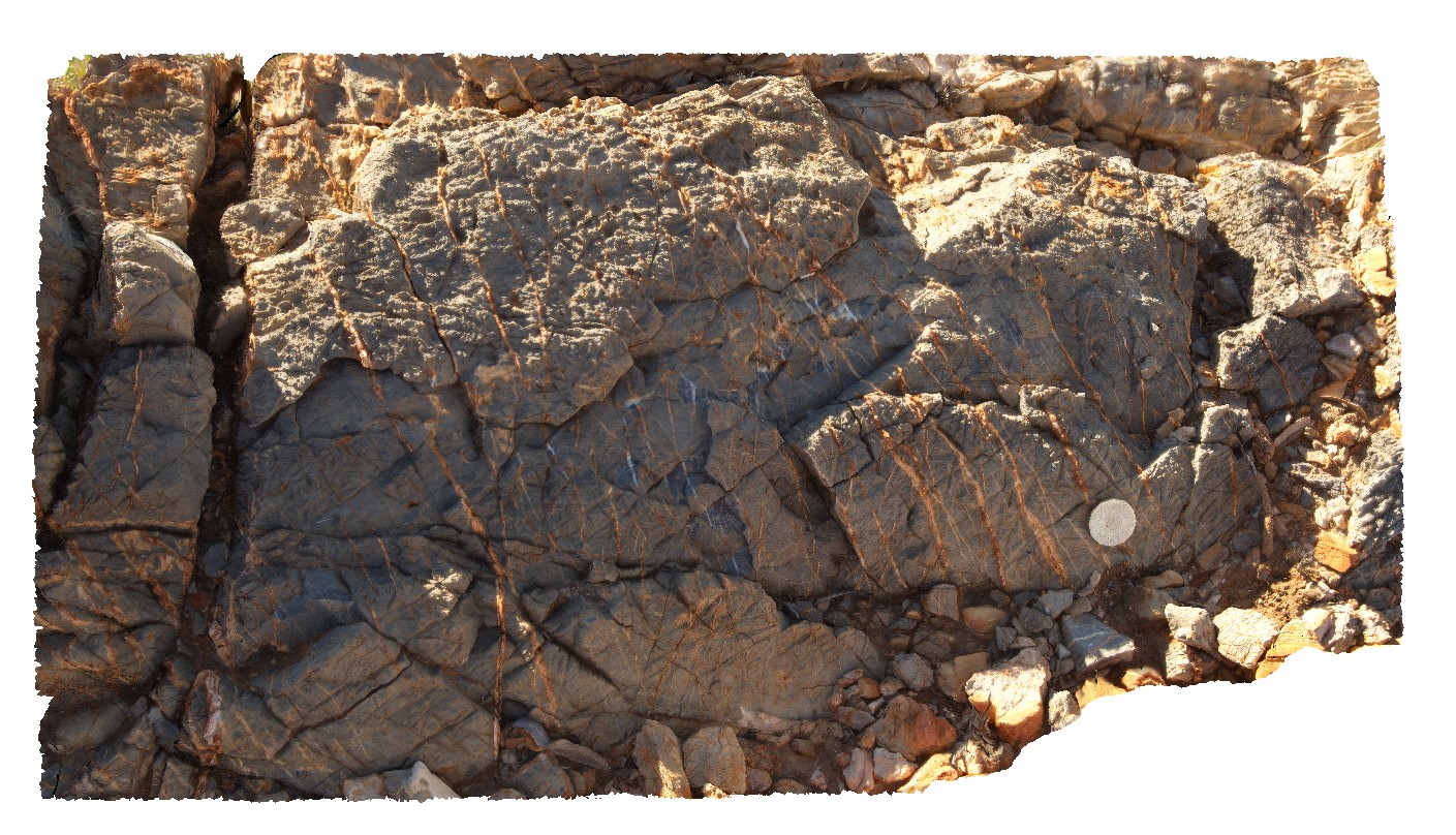
Tooborac1 Map
 |
5 |
06/17/2015 11:11 a.m. |
3D |
folds and faults in fine grained sandstone units of the Silurian Wapentake Formation. Tooborac, Vic. |
15.00 |
-37.02139008000 |
144.88988392000 |
290.000 |
folds, faults, structure |
sandstone |
Tooborac1 Map
|
5 |
06/17/2015 11:11 a.m. |
3D |
view of folding in sandstone. Toobarac, Vic. |
300.00 |
-37.02139000000 |
144.88989000000 |
-9999.000 |
fold, fault, structure |
sandstone |
TooboracGiga1 Map
 |
5 |
06/17/2015 11:12 a.m. |
GIGA |
folds and faults in fine grained sandstone units of the Silurian Wapentake Formation. Tooborac, Vic. |
15.00 |
-37.02139000000 |
144.88989000000 |
290.000 |
folds, faults, structure |
sandstone |
TowerHill1 Map
 |
10 |
06/05/2016 10:42 a.m. |
3D |
over view of finely layered tuffaceous rocks on rim of Tower Hill. Tower Hill, Vic. |
16.00 |
-38.32485000000 |
142.37242000000 |
-9999.000 |
tuffaceous sediments, volcano |
tuff |
TowerHill10 Map
 |
10 |
06/05/2016 10:43 a.m. |
3D |
detail of infilled scour in tuff unit with wavy bedforms and cross beds. Tower Hill, Vic. |
1.50 |
-38.32696000000 |
142.36830000000 |
-9999.000 |
tuffaceous, volcanic |
tuff |
TowerHill11 Map
 |
10 |
06/05/2016 10:44 a.m. |
3D |
detail of unfilled scour in tuff layer with wavy bedding. Tower Hill, Vic. |
1.20 |
-38.32692000000 |
142.36833000000 |
-9999.000 |
tuff, volcanics |
tuff |
TowerHill12 Map
 |
10 |
06/05/2016 10:44 a.m. |
3D |
detail of cross bedding in thinly layered, fine-grained tuffaceous deposits. Tower Hill, Vic. |
3.20 |
-38.32697000000 |
142.36827000000 |
-9999.000 |
tuff, cross bedding |
tuff |
TowerHill13 Map
 |
10 |
06/05/2016 10:44 a.m. |
3D |
detailed view of wavy pebble layer in tuff deposits. Tower Hill, Vic. |
0.50 |
-38.32708000000 |
142.36807000000 |
-9999.000 |
tuff, volcanics |
tuff |
TowerHill14 Map
 |
10 |
06/05/2016 10:44 a.m. |
3D |
overview of layered tuff deposits, Tower Hill, Vic. |
10.00 |
-38.32714000000 |
142.36807000000 |
-9999.000 |
tuff, bedding |
tuff |
TowerHill2 Map
 |
10 |
06/05/2016 10:42 a.m. |
3D |
medium scale view of tuffaceous outcrop, showing finely layered beds. Tower Hill, Vic. |
4.00 |
-38.32485000000 |
142.37242000000 |
-9999.000 |
tuffaceous, volcanic, sedimentology |
tuff |
TowerHill3 Map
 |
10 |
06/05/2016 10:42 a.m. |
3D |
detailed view of tuffaceous layers, showing coarse-grained and fine-grained layers. Tower Hill, Vic. |
1.20 |
-38.32485000000 |
142.37242000000 |
-9999.000 |
tuffaceous, volcanics, sedimentology |
tuff |
TowerHill4 Map
 |
10 |
06/05/2016 10:42 a.m. |
3D |
truncated layering in tuff deposits, showing fine layering. Tower Hill, Vic. |
2.00 |
-38.32484000000 |
142.37291000000 |
-9999.000 |
tuffaceous, truncated bedding |
tuff |
TowerHill5 Map
 |
10 |
06/05/2016 10:43 a.m. |
3D |
view of cross-section through a scoria rich layer in tuffaceous sediment package, Tower Hill, Vic. |
6.00 |
-38.32721000000 |
142.36809000000 |
-9999.000 |
tuff, scoria |
tuff |
TowerHill6 Map
 |
10 |
06/05/2016 10:43 a.m. |
3D |
detail from site TowerHill5 of cross-bedding around an altered volcanic bomb. Tower Hill, Vic. |
0.45 |
-38.32721000000 |
142.36809000000 |
-9999.000 |
cross-bedding, tuffaceous, volcanic bomb |
tuff |
TowerHill7 Map
 |
10 |
06/05/2016 10:43 a.m. |
3D |
convoluted bedding in tuffaceous layers, Tower Hill, Vic. |
4.00 |
-38.32701000000 |
142.36813000000 |
-9999.000 |
tuffaceous, convoluted bedding |
tuff |
TowerHill8 Map
 |
10 |
06/05/2016 10:43 a.m. |
3D |
detail of pebble-sized tuff layers in tuffaceous deposits. Tower Hill, Vic. |
2.00 |
-38.32703000000 |
142.36818000000 |
-9999.000 |
tuffaceous, bedding |
tuff |
TowerHill9 Map
 |
10 |
06/05/2016 10:43 a.m. |
3D |
detail of small-scale cross beds in tuffaceous deposits. Tower Hill, Vic. |
1.40 |
-38.32702000000 |
142.36830000000 |
-9999.000 |
cross bedding, tuff |
tuff |
TowerHillGIGA1 Map
 |
10 |
01/01/9999 midnight |
GIGA |
— |
0.00 |
-38.32723000000 |
142.36790000000 |
-9999.000 |
|
tuff |
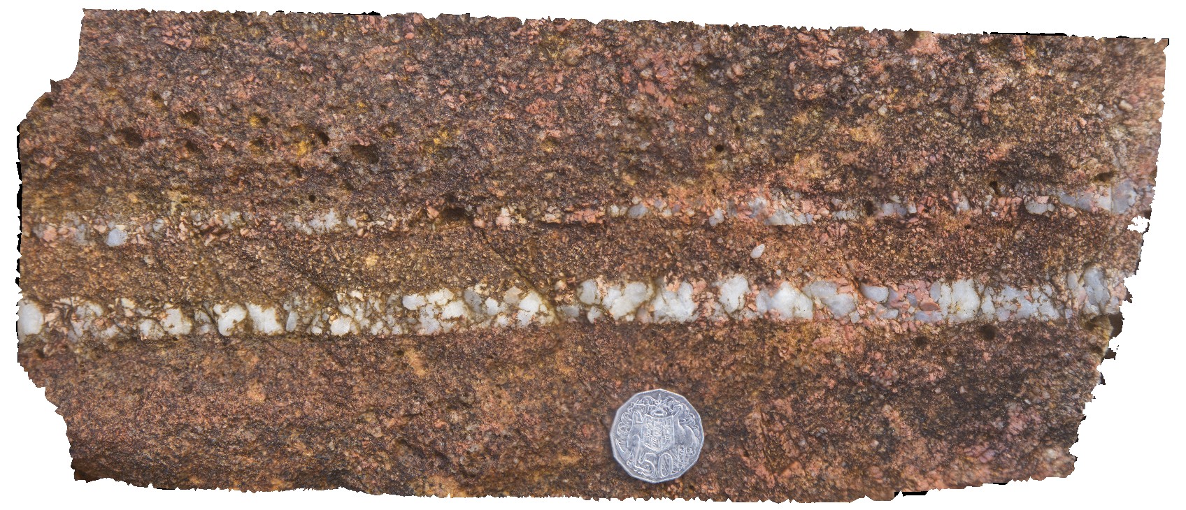
TREPH1 Map
 |
0 |
07/27/2016 4:42 p.m. |
3D |
calcite vein array in dolostone. Trephina Gorge, Mordor Pound. N.T. |
1.00 |
-23.51889200000 |
134.40061900000 |
651.572 |
vein, array, dolostone, sedimentology |
dolostone |
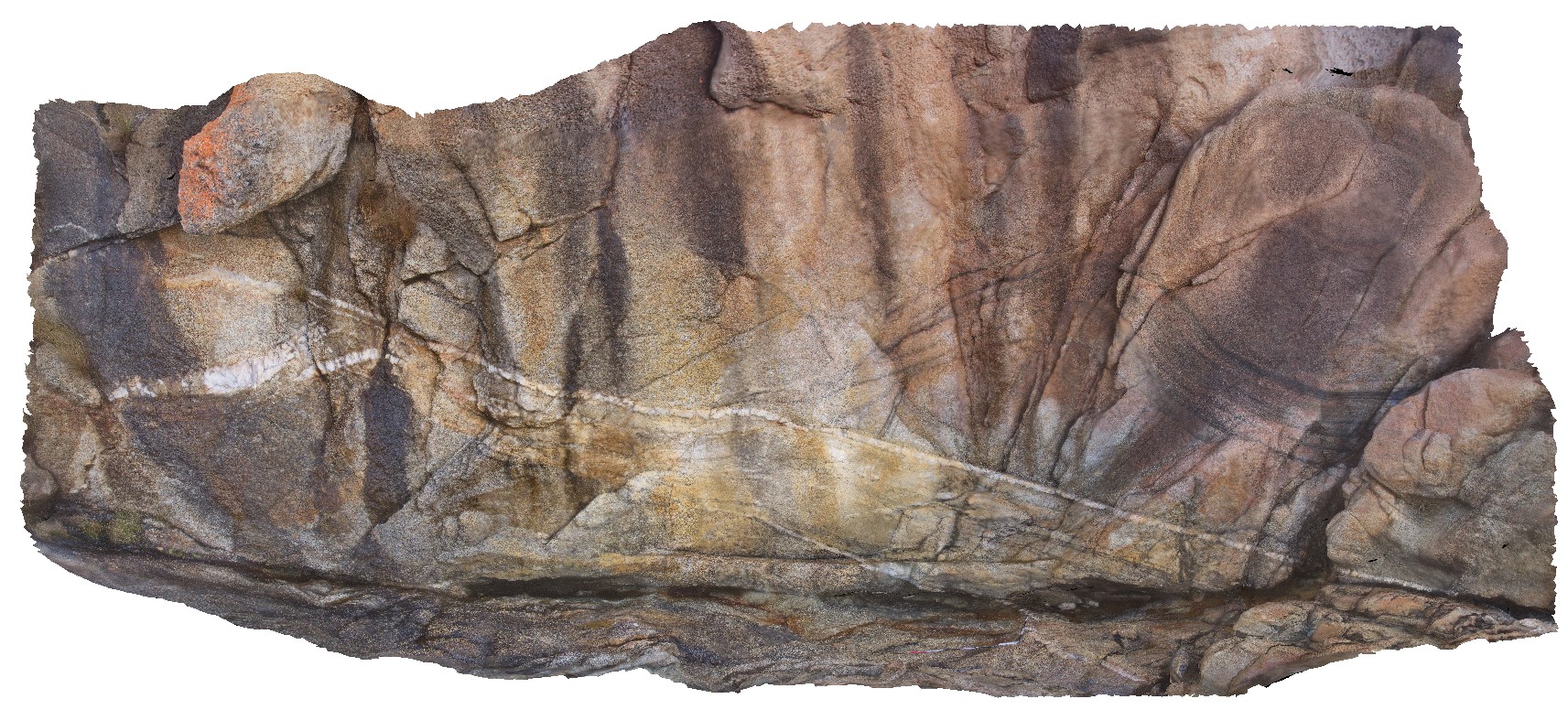
TREPHFSP1 Map
 |
0 |
07/27/2016 4:26 p.m. |
FSP |
view of 'The Bluff', with tight folding. Trephina Gorge, Mordor Pound. N.T. |
1000.00 |
-23.51895600000 |
134.39911100000 |
642.214 |
tight folds, folds, structure, sedimentology, Trephina Gorge |
sandstone |
TREPHFSP2 Map
 |
0 |
07/27/2016 4:53 p.m. |
FSP |
view toward Mordor igneous Complex (north) and dipping sandstone red beds. Trephina Gorge, Mordor Pound. N.T. |
1000.00 |
-23.51885700000 |
134.40191500000 |
636.194 |
sandstone, Trephina Gorge, structure |
dolostone |
Trial1 Map
 |
0 |
08/11/2016 noon |
3D |
Magnetite veins in mafic / ultramafic Cambrian? Rocks. Possibly with serpentinite selvages? Trial Harbour, West Coast Tas. |
0.30 |
-41.92640000000 |
145.16794000000 |
-9999.000 |
ultramafic, allochthonous blocks, serpentinite |
serpentinite |
Trial10 Map
 |
5 |
08/11/2016 noon |
3D |
Vein showing UST textures in boulder. Trial Harbour, West Coast Tas. |
0.20 |
-41.92337000000 |
145.15874000000 |
-9999.000 |
UST texture, granite4 |
granite |
Trial11 Map
 |
0 |
08/11/2016 noon |
3D |
vertical face at contact between white and red granite with UST and 'aplite' at contact. Biotite zoning truncated at contact. Trial Harbour, West Coast Tas. |
7.00 |
-41.92319000000 |
145.15849000000 |
-9999.000 |
geological contact, red granite, white granite, UST zone, aplite |
granite, granite |