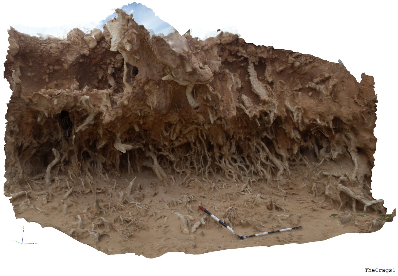
TheCrags1 Map
 |
5 |
06/14/2016 11:45 a.m. |
3D |
view of solution tubes and nodular carbonate in Pleistocene sediments. The Crags, Vic. |
3.00 |
-38.37184000000 |
142.11079000000 |
2.000 |
solution tubes, calcareous sediments |
carbonate |
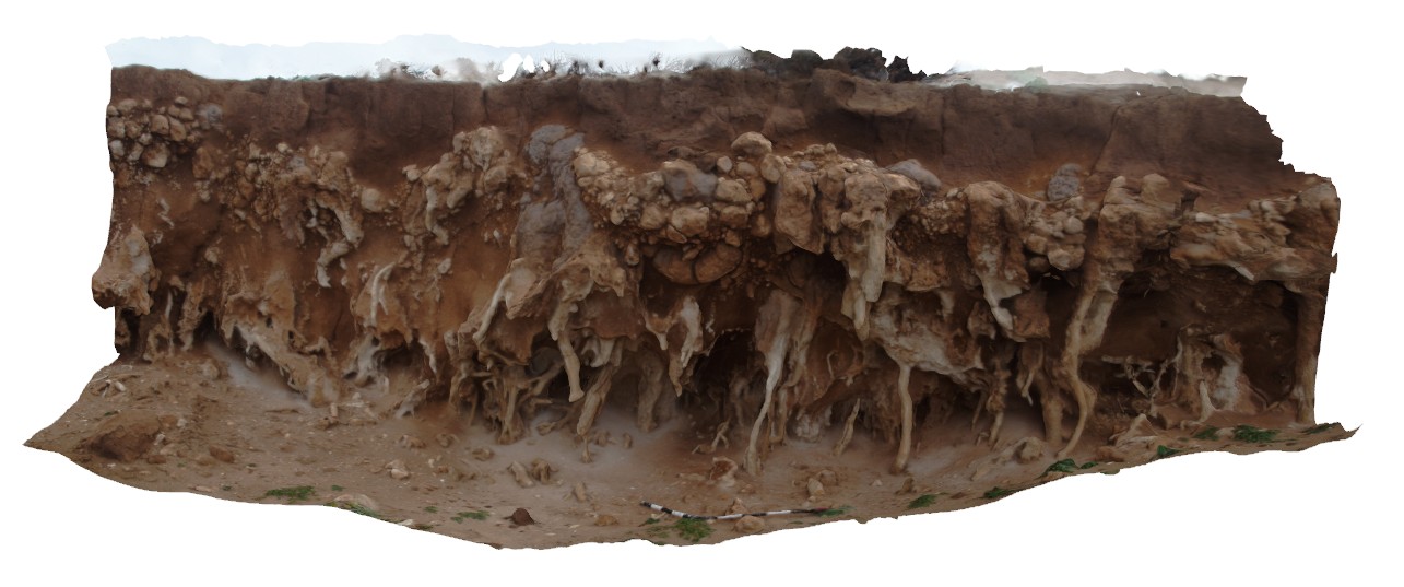
TheCrags2 Map
 |
5 |
06/14/2016 11:50 a.m. |
3D |
view of solution tubes in nodular carbonate, The Crags, Vic. |
4.00 |
-38.37184000000 |
142.11092000000 |
2.000 |
nodular carbonate, solution tubes |
carbonate |
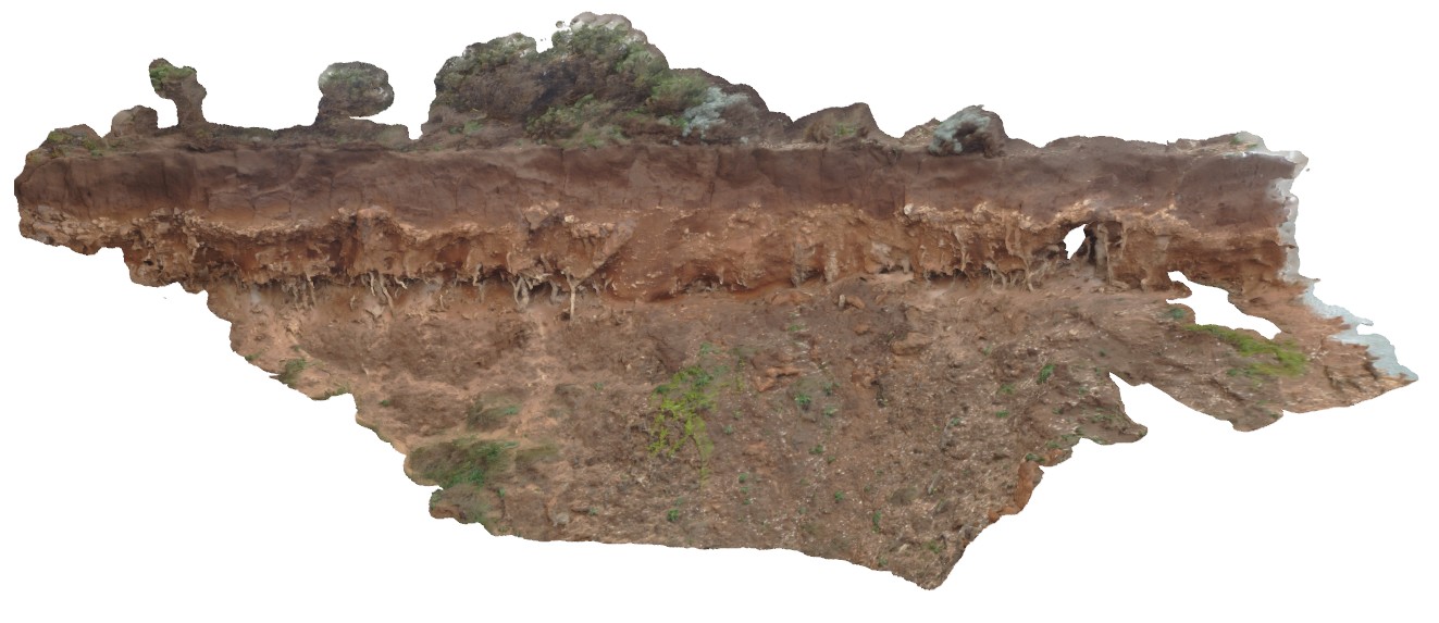
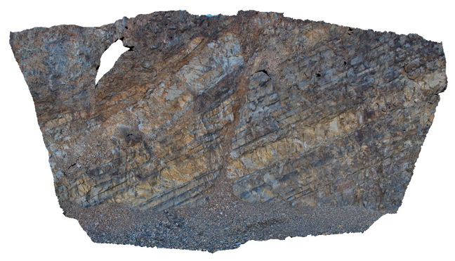
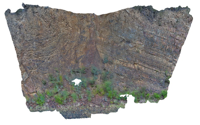
TheCrags3 Map
 |
5 |
06/14/2016 12:39 p.m. |
3D |
profile with multiple layers of solution tubes and an upper midden? Layer. The Crags, Vic. |
7.00 |
-38.37178000000 |
142.11110000000 |
2.000 |
solution tubes, carbonate |
carbonate |
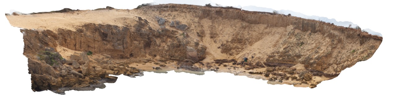
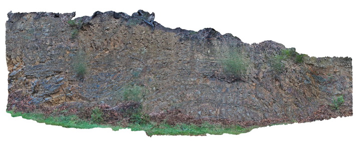
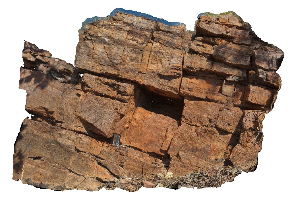
TheCrags5 Map
 |
20 |
01/01/9999 midnight |
3D |
overview of aeolian calcareous sandstone overlain by brown sand with solution tubes. The Crags, Vic. |
30.00 |
-38.37184000000 |
142.11092000000 |
2.000 |
unconformity, solution tubes |
sandstone |
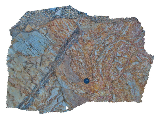
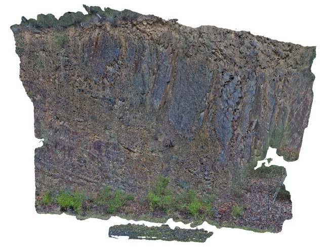
Thomson1 Map
 |
5 |
05/18/2015 2:17 p.m. |
3D |
normal? fault in dipping turbidites near the Thomson Dam - fault zone approx. 30 cm wide. Thomson Dam, Walhalla, Vic. |
8.00 |
-37.84397000000 |
146.39761000000 |
-9999.000 |
fault, turbidite, structure, sedimentology |
turbidite |
Thomson10 Map
 |
5 |
05/18/2015 2:17 p.m. |
3D |
Open anticline and fault in turbiditic metasediments of the Devonian Norton Gully Sandstone. Thomson Dam, Walhalla, Vic. |
20.00 |
-37.85572000000 |
146.39941000000 |
531.000 |
fold, fault, turbidite, structure |
turbidite |
Thomson2 Map
 |
5 |
05/18/2015 2:17 p.m. |
3D |
Detail of mudstone rip up clasts in sandstone matrix - same exposure as Thomson1. Thomson Dam, Walhalla, Vic. |
0.50 |
-37.84397000000 |
146.39761000000 |
-9999.000 |
sandstone, siltstone, turbidite, rip-up clasts, sedimentology |
sandstone |
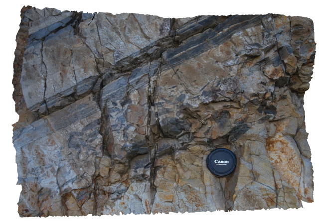
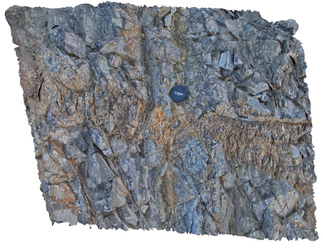
Thomson3 Map
 |
5 |
05/18/2015 2:18 p.m. |
3D |
Faults cutting turbiditic sediments of the Devonian Norton Gully Sandstone - main fault zone up to 1m thick. Thomson Dam, Walhalla, Vic. |
10.00 |
-37.84430000000 |
146.39732000000 |
-9999.000 |
turbidite, fault, sedimentology, structure |
turbidite |
Thomson4 Map
 |
5 |
05/18/2015 2:19 p.m. |
3D |
Detail of the fault zone in Devonian Norton Gully Sandstone depicted in Thomson3 - possible drag of layers? Suggesting that the fault may have a reverse sense of movement. Thomson Dam, Walhalla, Vic. |
2.00 |
-37.84430000000 |
146.39732000000 |
-9999.000 |
turbidite, fault zone, structure |
turbidite |
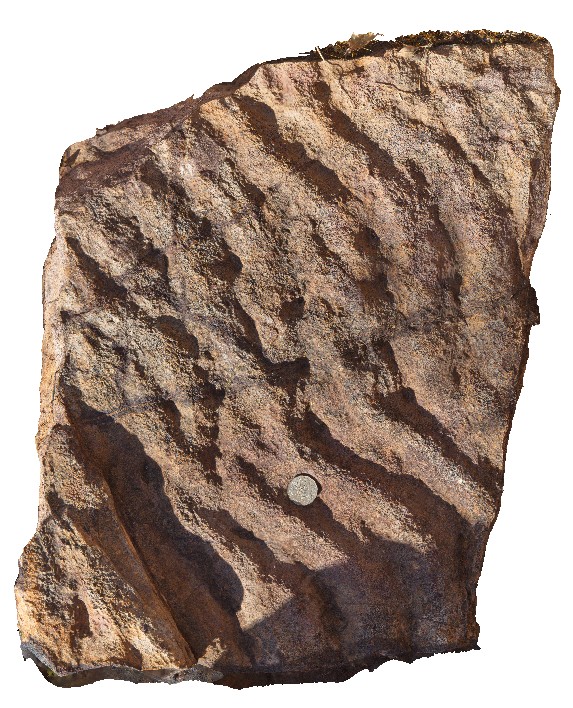
Thomson5 Map
 |
5 |
05/18/2015 2:19 p.m. |
3D |
Kink bands in turbiditic sediments of the Devonian Norton Gully Sandstone. Thomson Dam, Walhalla, Vic. |
1.00 |
-37.84430000000 |
146.39732000000 |
-9999.000 |
kink band, turbidite, structure |
turbidite |
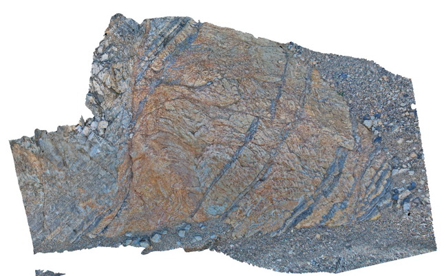
Thomson6 Map
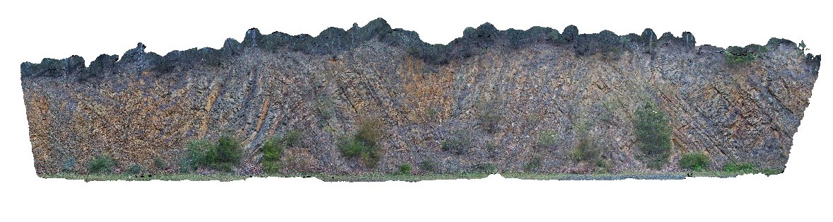 |
5 |
05/18/2015 2:19 p.m. |
3D |
Chevron style synclines and anticlines in turbiditic metasediments of the Devonian Norton Gully Sandstone. Thomson Dam, Walhalla, Vic. |
25.00 |
-37.85546000000 |
146.39876000000 |
-9999.000 |
turbidite, chevron fold, anticline, syncline, structure |
turbidite |
Thomson7 Map
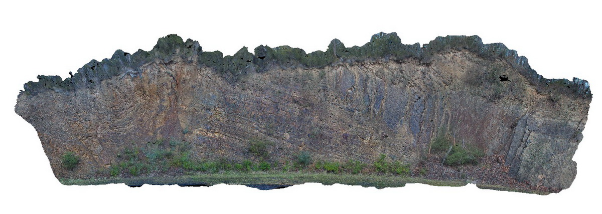 |
5 |
05/18/2015 2:20 p.m. |
3D |
Folds and associated faults cutting turbiditic metasediments of the Devonian Norton Gully Sandstone. Thomson Dam, Walhalla, Vic. |
25.00 |
-37.85506000000 |
146.39720000000 |
530.000 |
turbidite, fault, fold, structure |
turbidite |
Thomson8 Map
 |
5 |
05/18/2015 2:21 p.m. |
3D |
Detail of one of the faults depicted in Thomson 7. The fault cuts turbiditic metasediments of the Devonian Norton Gully Sandstone. Thomson Dam, Walhalla, Vic. |
10.00 |
-37.85513000000 |
146.39734000000 |
530.000 |
turbidite, fault, structure |
turbidite |
Thomson9 Map
 |
5 |
05/18/2015 2:22 p.m. |
3D |
Detail of one of the faults depicted in Thomson 7. The fault cuts turbiditic metasediments of the Devonian Norton Gully Sandstone. Thomson Dam, Walhalla, Vic. |
10.00 |
-37.85505000000 |
146.39711000000 |
530.000 |
turbidite, fault, structure |
turbidite |
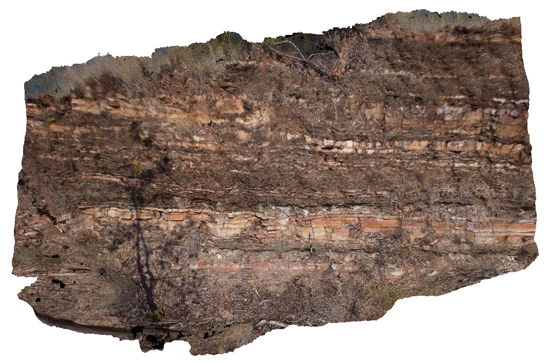
TibrogargunUAV1 Map
 |
0 |
04/18/2016 10:22 a.m. |
UAV |
location inferred from Google Earth |
0.00 |
-26.92724900000 |
152.94669600000 |
-9999.000 |
|
|
TimberCreek1 Map
 |
0 |
06/18/2016 noon |
3D |
view of shallowly dipping sandstone with thick beds at the bottom and laminated siltstone at the top. Cliff exposure near water tanks, Timber Creek settlement, N.T. |
8.50 |
-15.65278000000 |
130.46318000000 |
-9999.000 |
bedded sandstone, shallow dip, sedimentology, facies grading, graded bedding |
sandstone |
TimberCreek2 Map
 |
0 |
06/18/2016 noon |
3D |
cross beds in quartzite. Cliff exposure near water tanks, Timber Creek settlement, N.T. |
1.40 |
-15.65414000000 |
130.46182000000 |
-9999.000 |
cross bedding, quartzite, sedimentology |
quartzite |
TimberCreek3 Map
 |
0 |
06/18/2016 noon |
3D |
view of preserved ripple marks on sandstone bedding plane. Cliff exposure near water tanks, Timber Creek settlement, N.T. |
0.60 |
-15.65383000000 |
130.46185000000 |
-9999.000 |
ripple marks, sandstone, sedimentology |
sandstone |
TimberCreekFSP1 Map
 |
0 |
06/18/2016 noon |
FSP |
view from hill of surrounding valley, showing flat-lying cross bedded quartzite unit and overlying interbedded sandstone and siltstones. Timber Creek, W.A. |
2000.00 |
-15.65412000000 |
130.46182000000 |
-9999.000 |
quartzite, sedimentology |
quartzite |
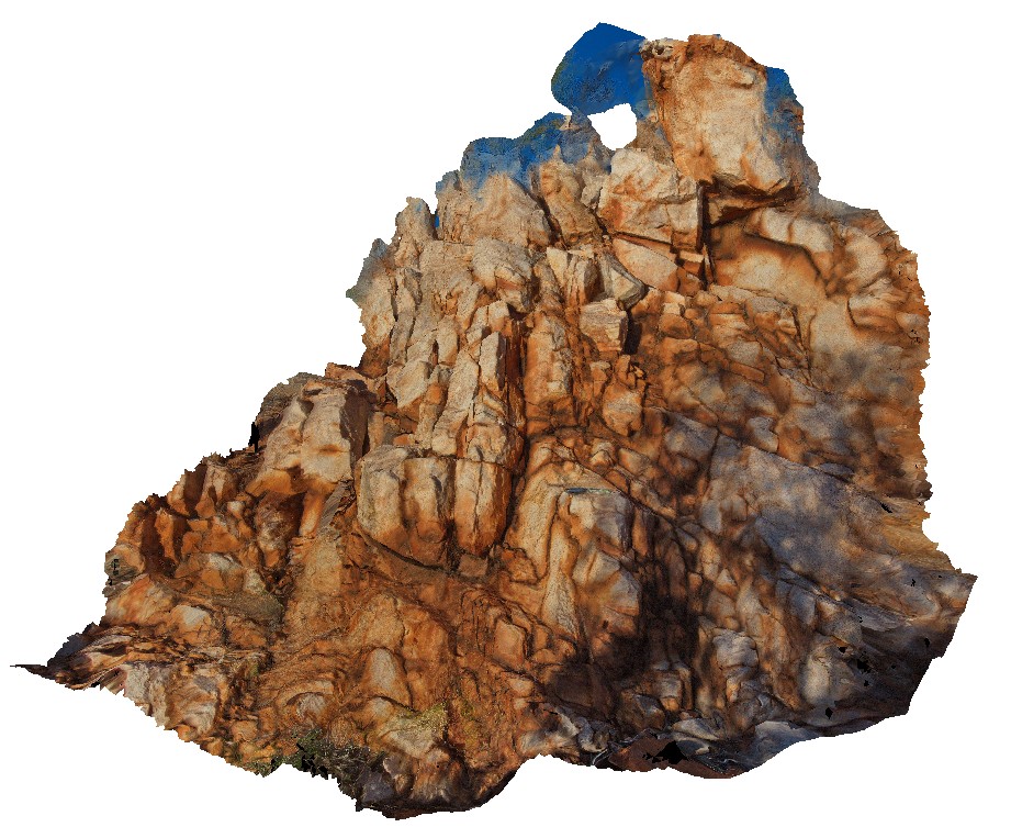
TOM1 Map
 |
0 |
07/21/2016 4:53 p.m. |
3D |
brecciated quartzite unit at Bunka Bunka Station. Cherty, cement in breccia. Monomict quartzite clastic. Stuart Highway, Bunka Bunka Station. N.T. |
2.20 |
-18.79355300000 |
134.02839200000 |
319.490 |
quartzite, breccia, sedimentology, metamorphic |
quartzite |
TOM2 Map
 |
5 |
01/01/9999 midnight |
3D |
weathering fractures on massive quartzite outcrop. Stuart Highway, N.T. |
2.50 |
-19.08544000000 |
134.17419000000 |
-9999.000 |
quartzite, joint, structure, metamorphic, weathering |
quartzite |
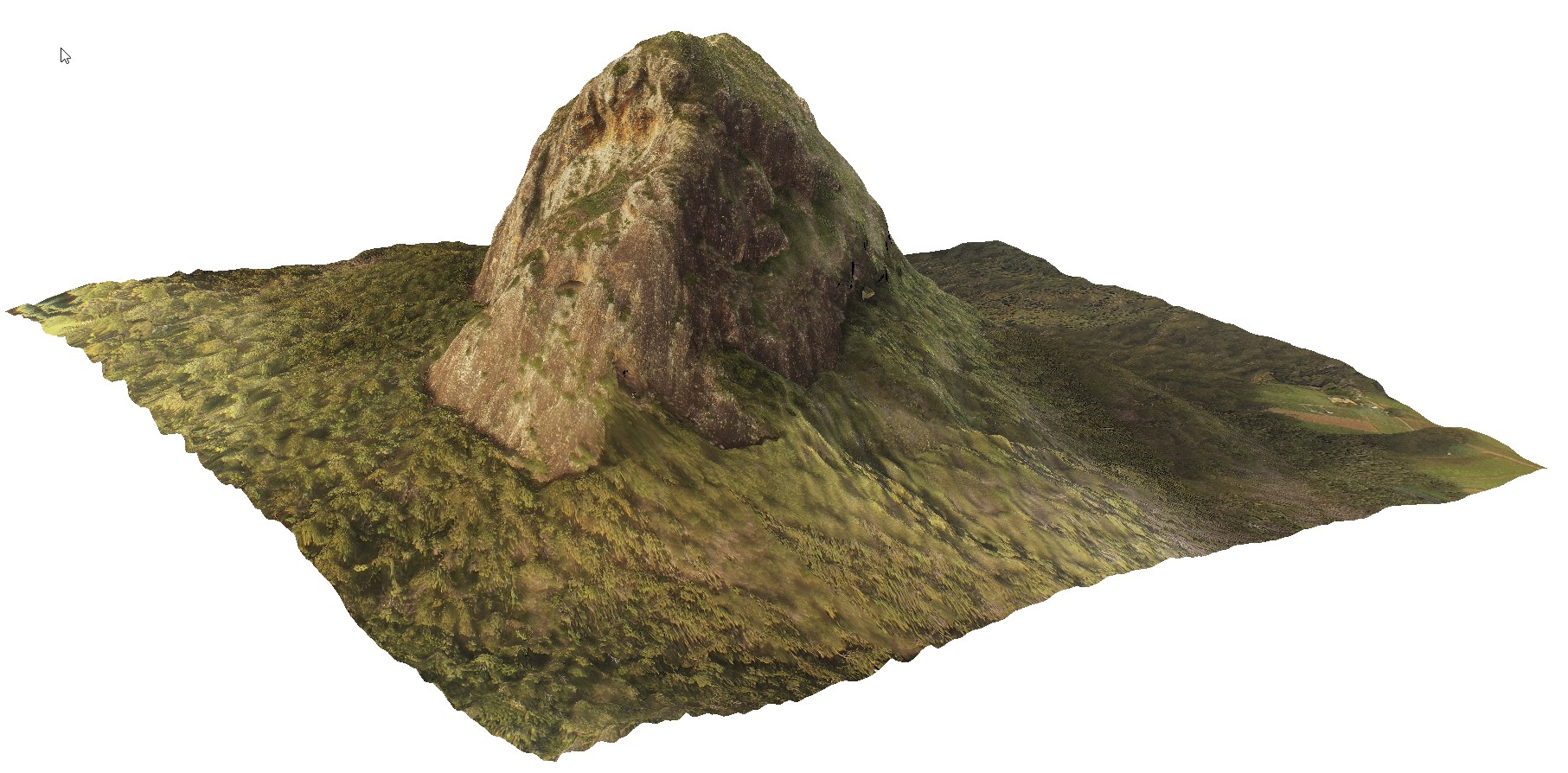
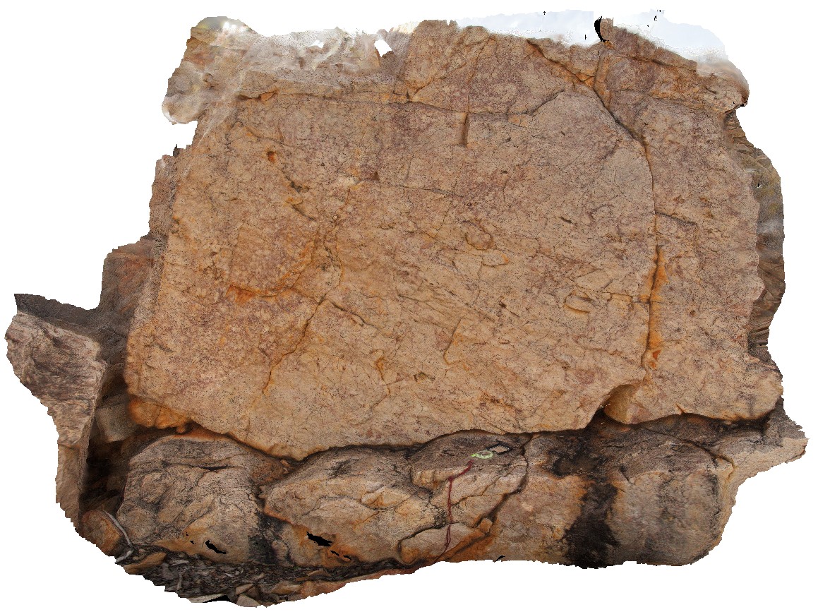
TomPrice1 Map
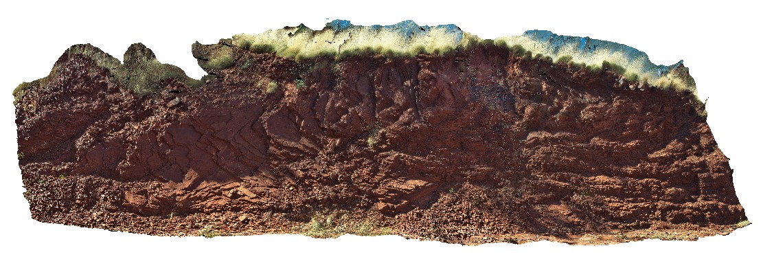 |
0 |
05/29/2016 noon |
3D |
oblique section through open folds in the Mount McRae Shale on the western side of Mount Nameless, Tom Price. W.A. |
16.00 |
-22.72532000000 |
117.74970000000 |
-9999.000 |
open folds, Hamersley Group, Mount McRae Shale, structure |
shale |
TomPrice2 Map
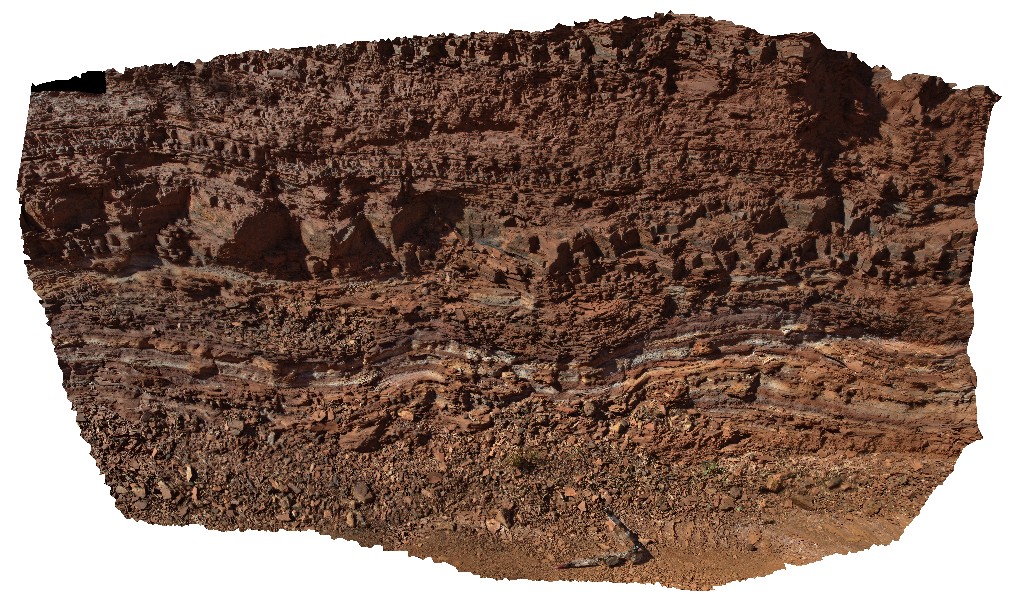 |
0 |
05/29/2016 noon |
3D |
view of open folds in interbedded Shale and banded Iron on the western side of Mount Nameless, Tom Price. W.A. |
5.50 |
-22.72650000000 |
117.74983000000 |
-9999.000 |
shale, open folds, structure, folding, Hamersley Group |
shale |
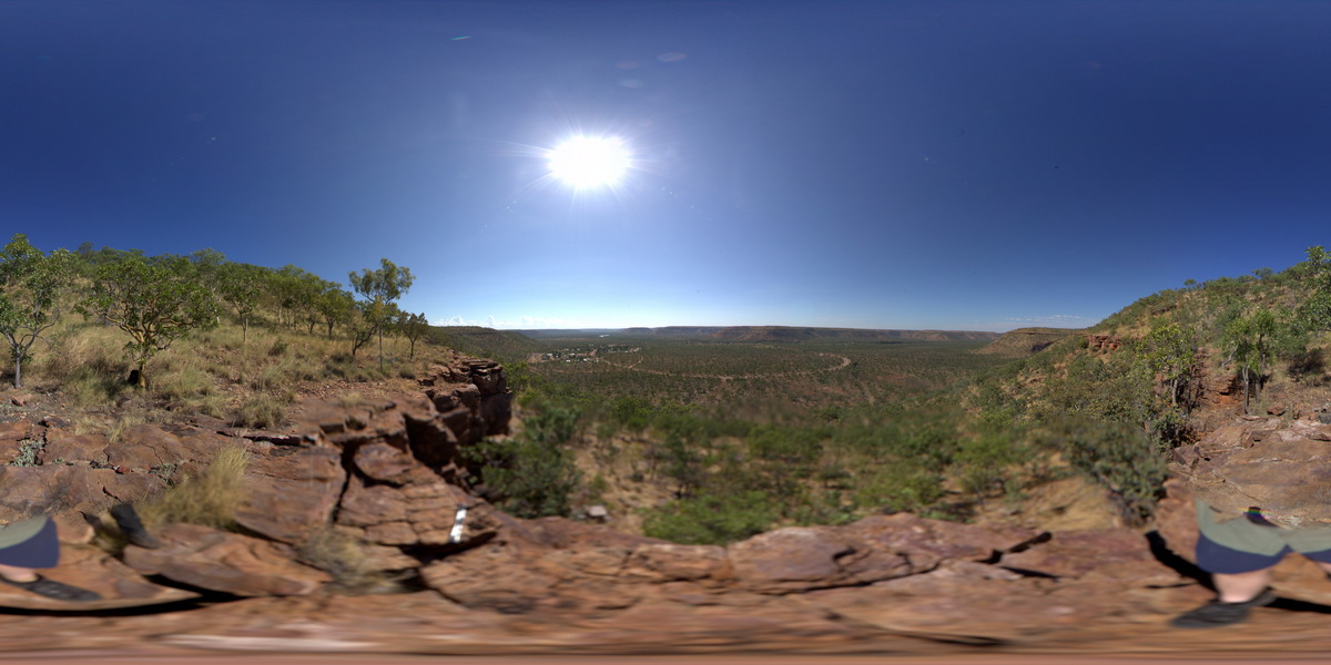
TomPriceFSP1 Map
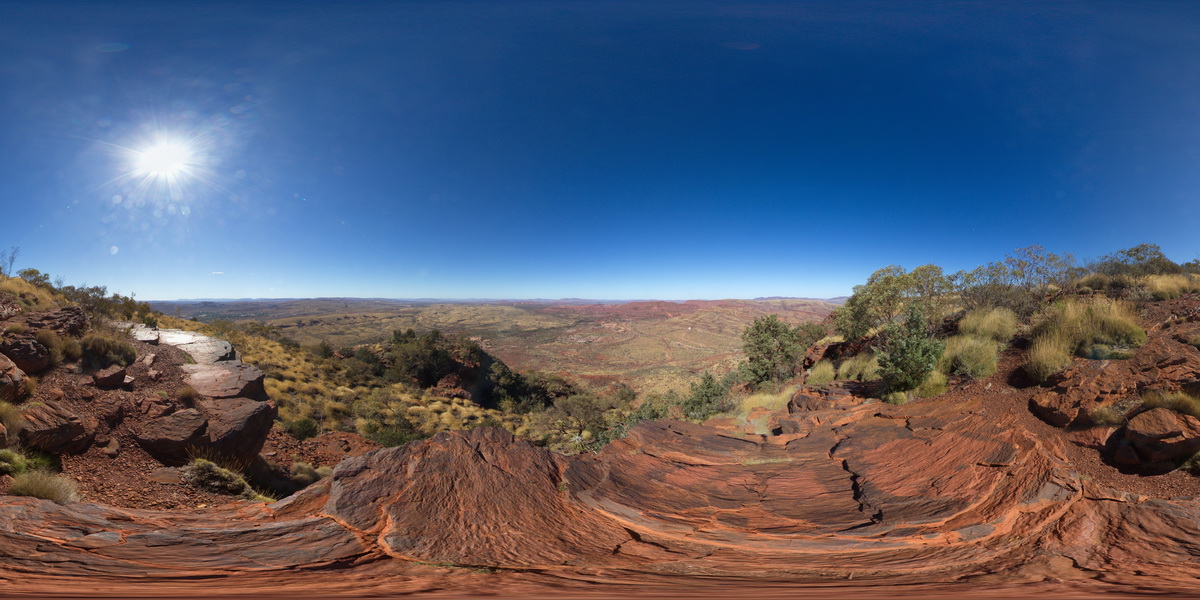 |
0 |
05/29/2016 noon |
FSP |
360 degree view from near the summat of Mount Nameless, showing Mount Tom Price mine operations and surrounding country. Tom Price, W.A. |
5000.00 |
-22.71881000000 |
117.76555000000 |
-9999.000 |
Brockman Iron Formation, Tom Price |
BIF |
TomPriceFSP2 Map
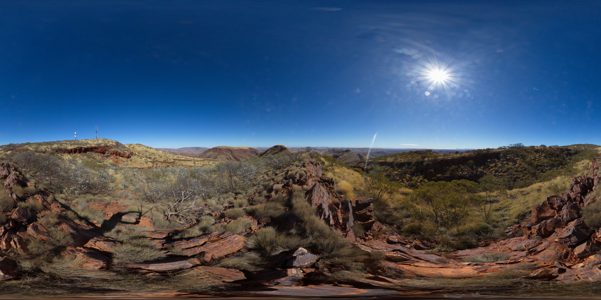 |
0 |
05/29/2016 noon |
FSP |
360 degree view from near the summit of Mount Nameless, showing surrounding ridge dominated landscape of sedimentary geology. Tom Price, W.A. |
5000.00 |
-22.71666000000 |
117.76108000000 |
-9999.000 |
Brockman Iron Formation, Pilbara, Hamersley Basin |
BIF |