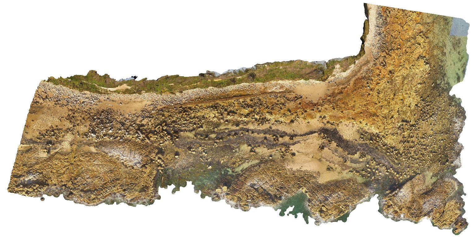
SwanseaFSP4 Map
 |
5 |
06/17/2015 10:01 a.m. |
FSP |
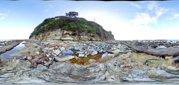
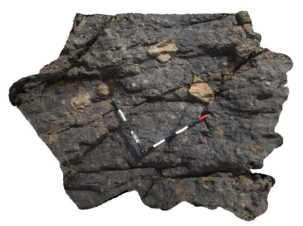
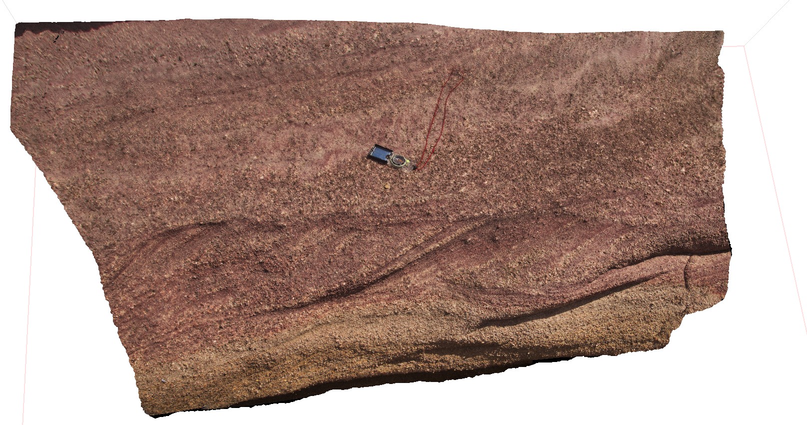
View of tuffaceous rocks of the Permian Boolaroo Formation and blocks of coal from the underlying Lower Pilot Seam. Linear feature is concrete covering a pipe. Swansea, N.S.W. |
50.00 |
-33.08834000000 |
151.66476000000 |
0.000 |
volcanology, coal |
tuff |
SwanseaFSP5 Map
 |
5 |
06/17/2015 10:02 a.m. |
FSP |
View of tuffaceous rocks of the Permian Boolaroo Formation and blocks of coal from the underlying Lower Pilot Seam. Linear feature is concrete covering a pipe. Swansea, N.S.W. |
50.00 |
-33.08834000000 |
151.66476000000 |
0.000 |
volcanology, sedimentology |
tuff |
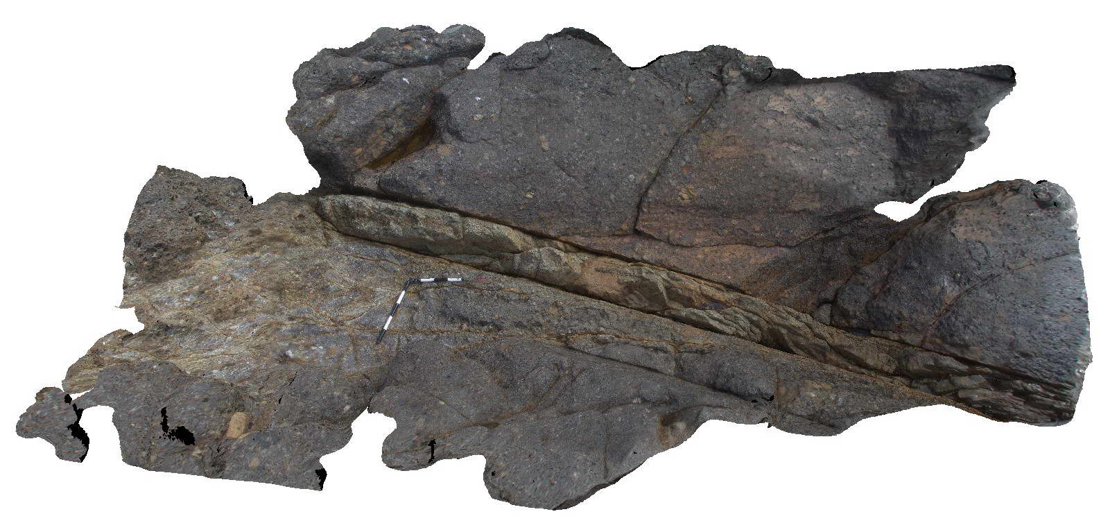
SwanseaFSP6 Map
 |
5 |
06/17/2015 10:02 a.m. |
FSP |
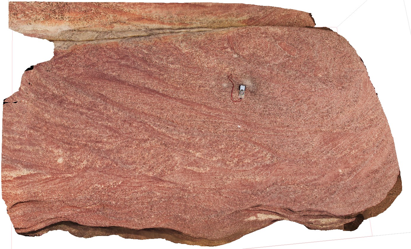
View of tuffaceous rocks of the Permian Boolaroo Formation and blocks of coal from the underlying Lower Pilot Seam (which crops out in the water). Horizontal petrified/coalified trees are apparent on a bedding surface. Swansea, N.S.W. |
50.00 |
-33.08834000000 |
151.66476000000 |
0.000 |
coalified log, petrified log, palaeontology, volcanology |
tuff |
SwanseaFSP7 Map
 |
5 |
06/17/2015 10:03 a.m. |
FSP |
View of tuffaceous rocks of the Permian Boolaroo Formation. The underlying Lower Pilot Seam crops out in the water. Horizontal petrified/coalified trees are apparent on a bedding surface as well as an in-situ petrified tree stump. Swansea, N.S.W. |
50.00 |
-33.08834000000 |
151.66476000000 |
0.000 |
Dadoxylon, palaeontology, volcanology, petrified log, coalified log |
tuff |
SwanseaFSP8 Map
 |
5 |
06/17/2015 10:03 a.m. |
FSP |
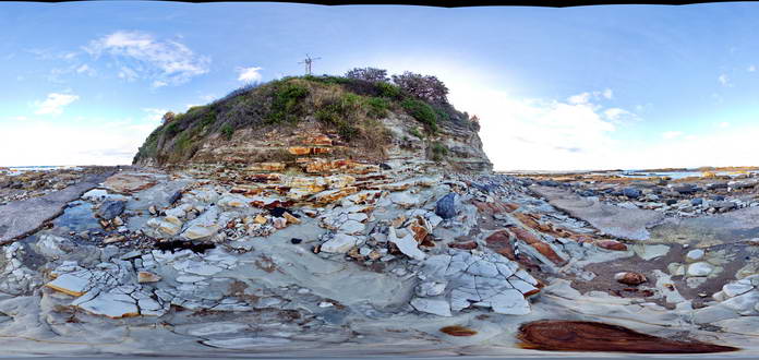
View of tuffaceous rocks of the Permian Boolaroo Formation. The underlying Lower Pilot Seam crops out in the water. In-situ petrified tree stumps up to 0.3m in diameter. Swansea, N.S.W. |
50.00 |
-33.08834000000 |
151.66476000000 |
0.000 |
volcanology, petrified stump, palaeontology |
tuff |
SwanseaFSP9 Map
 |
5 |
06/17/2015 10:04 a.m. |
FSP |
View of tuffaceous rocks of the Permian Boolaroo Formation. The underlying Lower Pilot Seam crops out in the water. In-situ petrified tree stumps up to 0.3m in diameter. Swansea, N.S.W. |
50.00 |
-33.08834000000 |
151.66476000000 |
0.000 |
volcanology |
tuff |
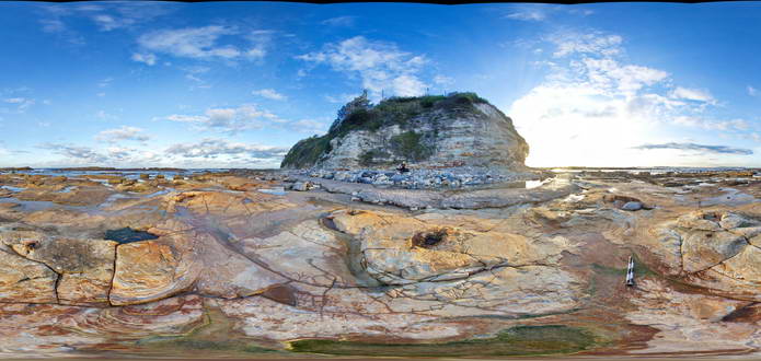
SwanseaPole1 Map
 |
20 |
10/13/2015 12:30 p.m. |
3D |
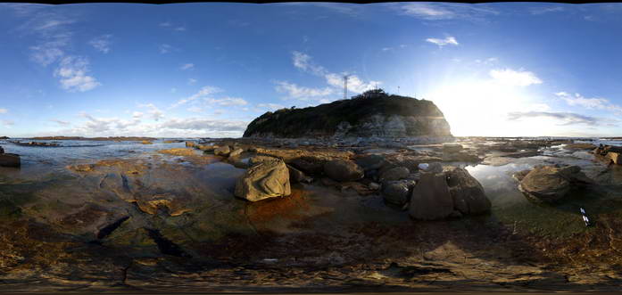
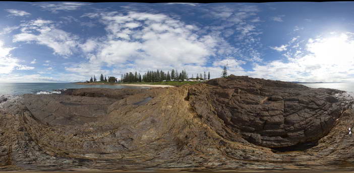
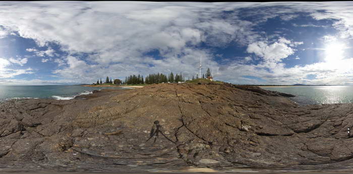
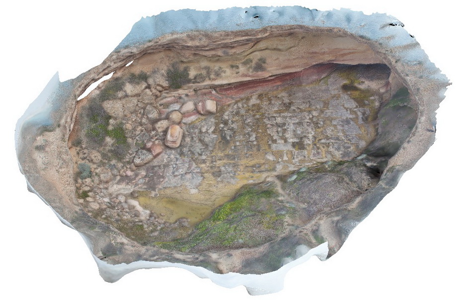
Coastal platform with numerous petrified/coalified tree stumps within tuffaceous rocks of the Permian Boolaroo Formation. Swansea, N.S.W. |
70.00 |
-33.08800000000 |
151.66470000000 |
0.000 |
petrified stumps, coalified stumps, volcanology, palaeontology |
tuff |
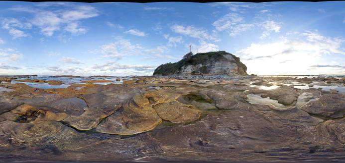
SwanseaUAV1 Map
 |
20 |
01/01/9999 midnight |
3D |
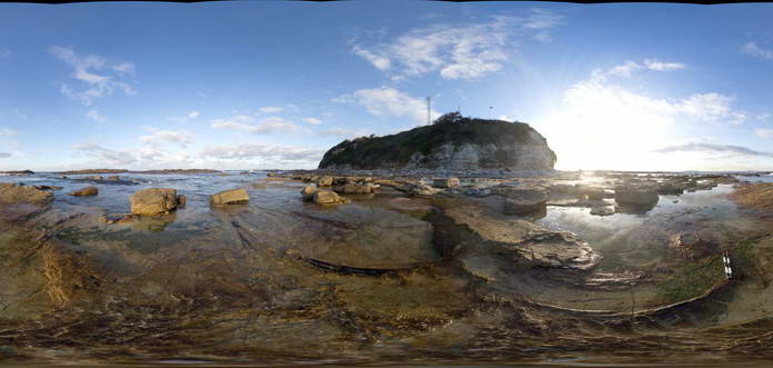
Coastal platform with numerous petrified/coalified tree stumps within tuffaceous rocks of the Permian Boolaroo Formation. Swansea, N.S.W. |
500.00 |
-33.08807500000 |
151.66484200000 |
17.500 |
tuff, petrified forest |
tuff |
SWRocks1 Map
 |
5 |
06/16/2015 5:41 p.m. |
3D |
Fault zone cutting conglomerate of the Permo Carboniferous Kempsey Beds. South West Rocks, N.S.W. |
4.00 |
-30.88236000000 |
153.03902000000 |
1.000 |
fault zone, structure |
conglomerate |
SWRocks2 Map
 |
0 |
06/16/2015 5:41 p.m. |
3D |
detail of polymict conglomerate of the Permo Carboniferous Kempsey Beds. South West Rocks, N.S.W. |
0.60 |
-30.88236000000 |
153.03902000000 |
-9999.000 |
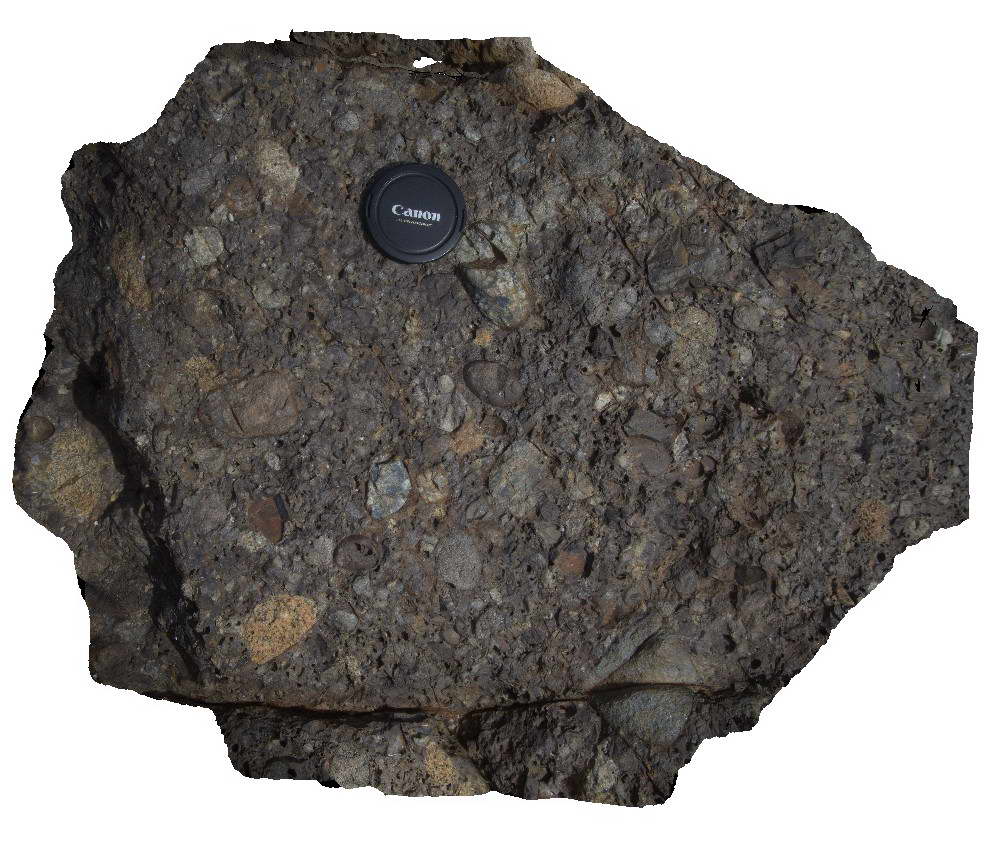
polymict conglomerate, conglomerate, sedimentology |
conglomerate |
SWRocks2 Map
|
5 |
06/16/2015 5:41 p.m. |
3D |
Detail of polymict pebble conglomerate in the Permo-Carboniferous Kempsey Beds. South West Rocks, N.S.W. |
0.50 |
-30.88236000000 |
153.03902000000 |
1.000 |
polymictic conglomerate, sedimentology |
conglomerate |
SWRocks3 Map
 |
5 |
06/16/2015 5:41 p.m. |
3D |
Polymict pebble to cobble conglomerate of the Permo-Carboniferous Kempsey Beds showing diffuse E-W striking layering. South West Rocks, N.S.W. |
5.00 |
-30.88239000000 |
153.03943000000 |
1.000 |
polymictic, sedimentology |
conglomerate |
SWRocks4 Map
 |
5 |
06/16/2015 5:42 p.m. |
3D |
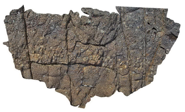
Detail view of fault zone breccia with quartz veins cutting conglomerate of the Permo-Carboniferous Kempsey Beds. South West Rocks, N.S.W. |
1.00 |
-30.88293000000 |
153.03951000000 |
1.000 |
fault zone, quartz veins, structure |
conglomerate |
SWRocks5 Map
 |
5 |
06/16/2015 5:42 p.m. |
3D |
Poorly sorted polymict conglomerate with angular and rounded fragments - Permo-Carboniferous kempsey Beds. South West Rocks, N.S.W. |
2.00 |
-30.88263000000 |
153.03967000000 |
1.000 |
polymictic, poorly sorted, sedimentology |
conglomerate |
SWRocksFSP1 Map
 |
5 |
06/16/2015 5:42 p.m. |
FSP |
View of pebble to cobble conglomerate of the Permo-Carboniferous Kempsey Beds with cross cutting fault zones. South West Rocks, N.S.W. |
50.00 |
-30.88248000000 |
153.03951000000 |
1.000 |
fault, structure, sedimentology |
conglomerate |
SWRocksFSP2 Map
 |
5 |
06/16/2015 5:43 p.m. |
FSP |
View of pebble to cobble conglomerate of the Permo-Carboniferous Kempsey Beds. South West Rocks, N.S.W. |
50.00 |
-30.88236000000 |
153.03935000000 |
1.000 |
polymictic, sedimentology |
conglomerate |
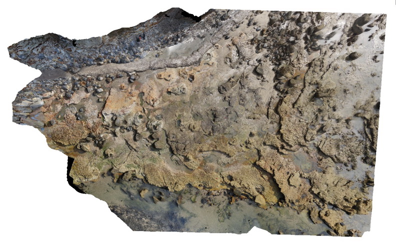
TableHillUAV1 Map
 |
0 |
05/28/2016 noon |
UAV |
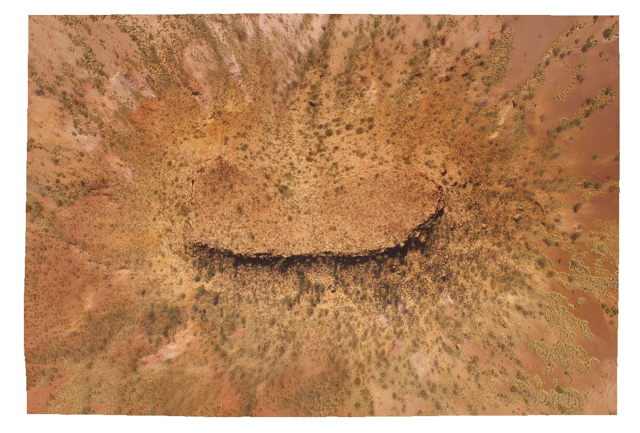
aerial view of a Mesa, capped by calcrete - Tertiary land surface. Ashburton Downs - Meekatharra Road, W.A. |
100.00 |
-23.64748200000 |
117.45549200000 |
-9999.000 |
mesa, tertiary land surface |
sediments, calcrete |
Talia1 Map
 |
0 |
10/20/2015 4:50 p.m. |
3D |
cross bedded pebbly sand stone of shore platform near Talia Caves site. Talia. |
1.00 |
-33.31670000000 |
134.78386000000 |
-9999.000 |
calcareous sand stone, cross bedding |
sand stone |
Talia2 Map
 |
0 |
10/20/2015 4:50 p.m. |
3D |
view of cross bedding pink sand stone. Exposed shore platform, Talia. |
2.00 |
-33.31681000000 |
134.78467000000 |
-9999.000 |
cross bedding, sand stone |
sand stone |
Talia3 Map
 |
0 |
10/20/2015 4:51 p.m. |
3D |
view of 'The Tub' sinkhole at Talia Caves locality. Showing an unconformity with the older Blue Range Beds overlain by the Bridgewater Formation. Talia. |
50.00 |
-33.32420000000 |
134.79155000000 |
-9999.000 |
sink hole, unconformity |
sandstone, sandstone |
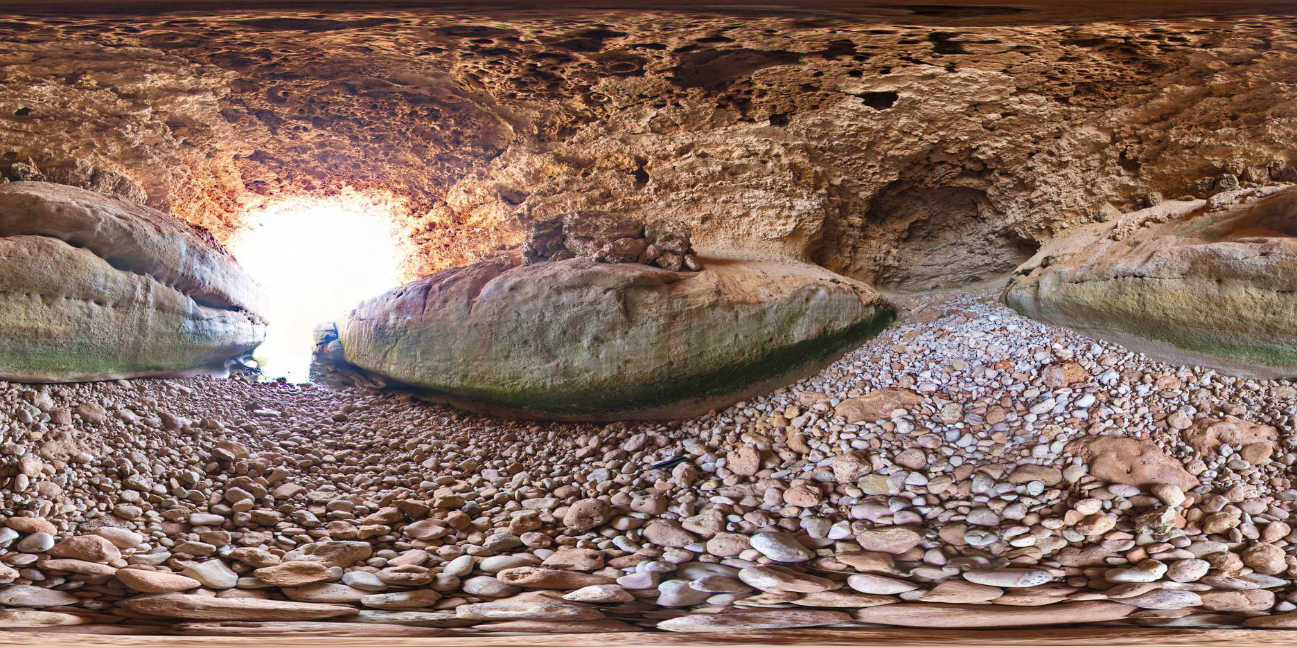
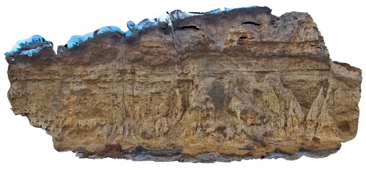
TaliaFSP1 Map
 |
0 |
10/20/2015 4:51 p.m. |
FSP |
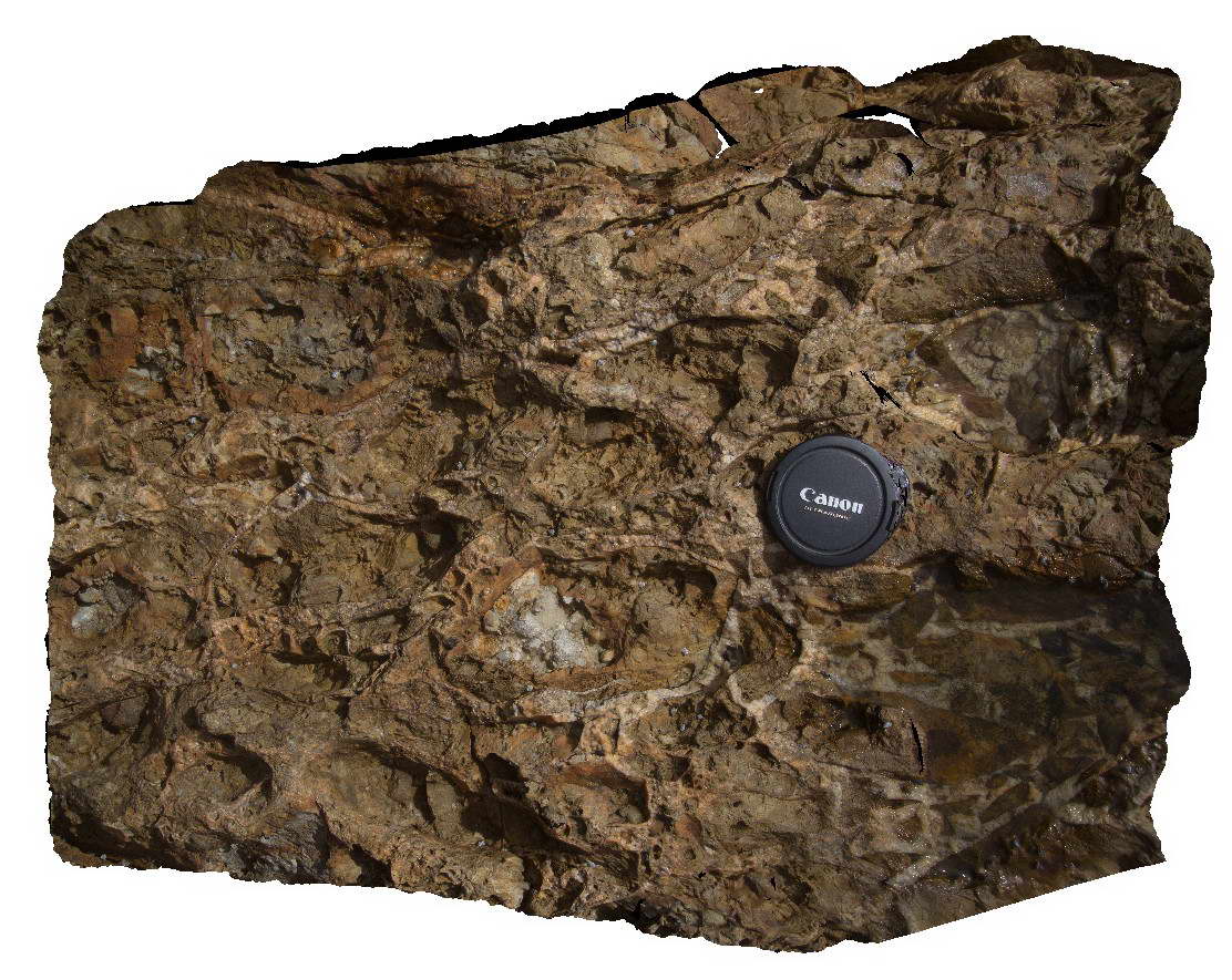
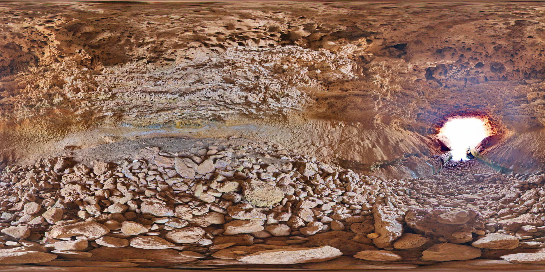
view from inside the Woolshed Cave, formed in the calcarenite Bridgewater Formation. Tallia Caves. |
20.00 |
-33.31695000000 |
134.78482000000 |
-9999.000 |
cave, calcarenite |
calcarenite |
TaliaFSP2 Map
 |
0 |
10/20/2015 4:51 p.m. |
FSP |
View inside the Woolshed cave at Talia, showing bedding and other features. Talia. |
20.00 |
-33.31695000000 |
134.78482000000 |
-9999.000 |
calcarenite, cave |
calcarenite |
TaliaUAV1 Map
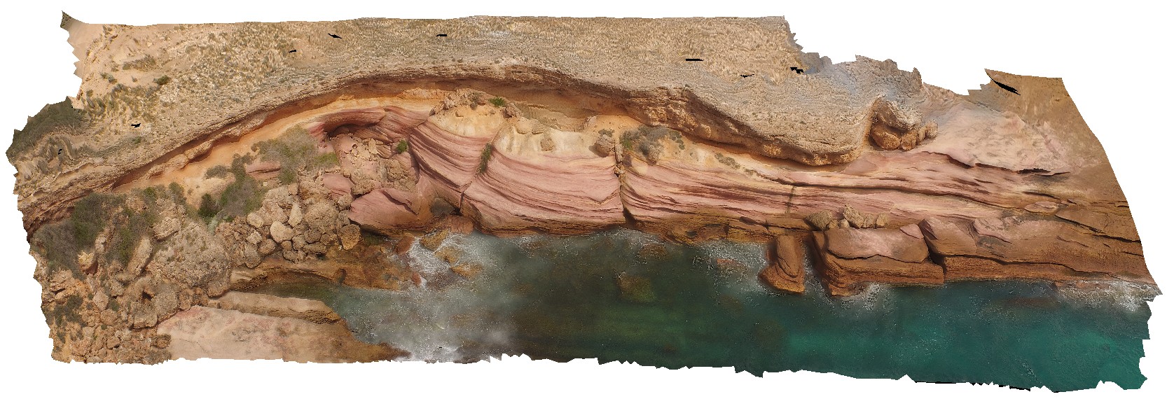 |
0 |
10/20/2015 4:52 p.m. |
UAV |
aerial view of unconformity between the Bridgewater Formation and the underlying Blue Range Beds, Near Talia Caves. Talia. |
50.00 |
-33.32410000000 |
134.78482000000 |
-9999.000 |
unconformity |
sandstone, sandstone |
TaliaUAV2 Map
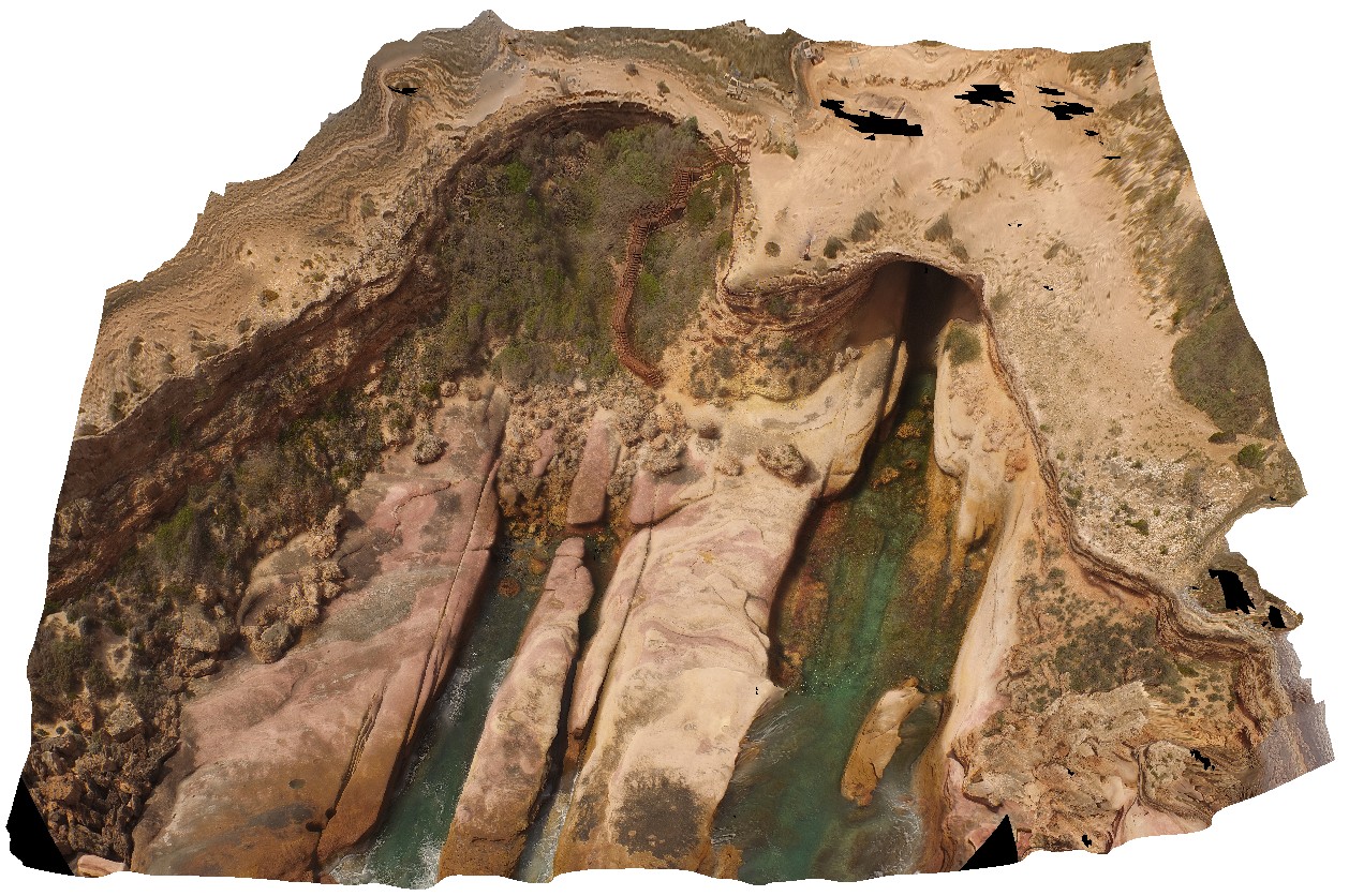 |
0 |
10/20/2015 4:52 p.m. |
UAV |
aerial view, showing access and shore entrance to the Woolshed Cave at Talia. Images shows geological unconformity between the Blue Range Beds and the overlying Bridgewater Formation. Talia. |
100.00 |
-33.32420000000 |
134.78483000000 |
-9999.000 |
unconformity, cave |
sandstone, sandstone |
Tambo1 Map
 |
5 |
05/18/2015 2:16 p.m. |
3D |
Sandstone of the Pliocene Seaspray Group disconformably overlain by Quaternary gravel. Metung, Vic. |
15.00 |
-37.88462000000 |
147.82196000000 |
-9999.000 |
sandstone, gravel, disconformity, unconformity, sedimentology |
sandstone, gravel |