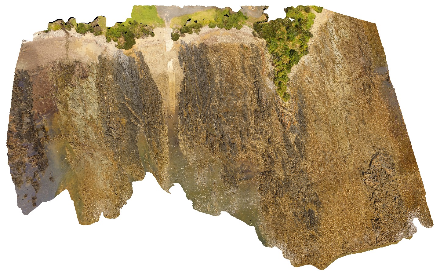
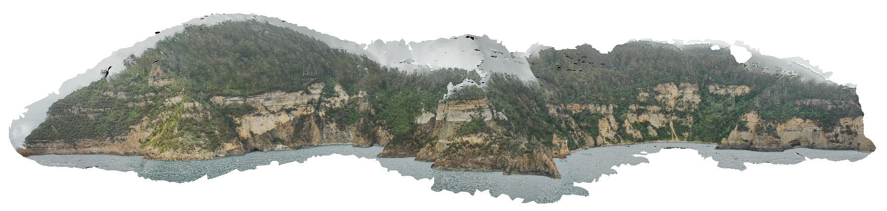
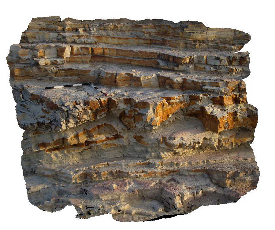
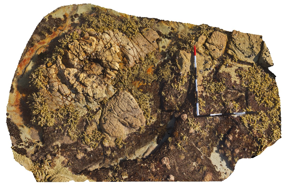
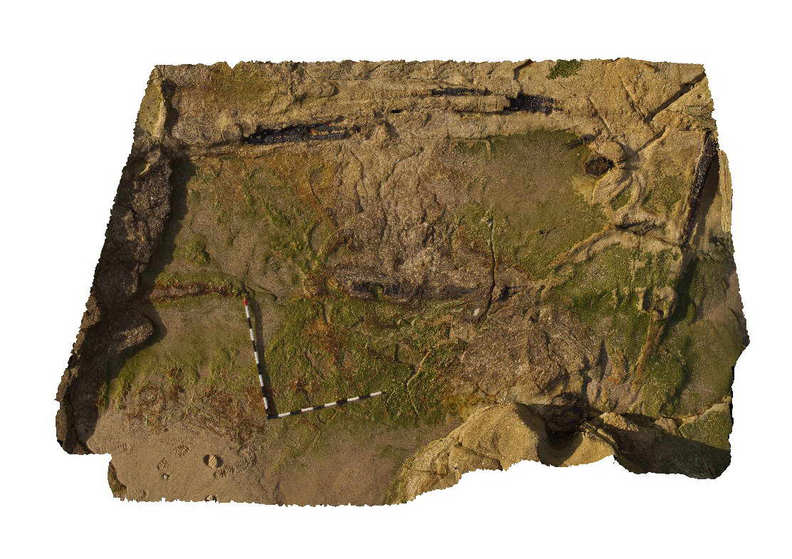
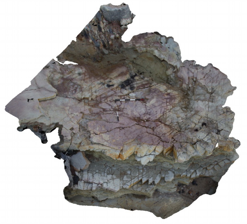
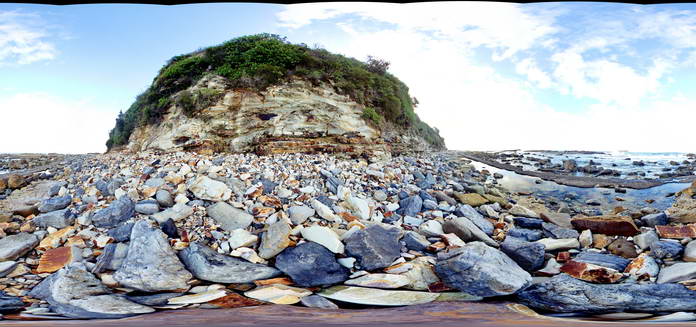
SulphurCreekUAV1 Map
 |
20 |
01/01/9999 midnight |
UAV |
aerial view of shore outcrop, showing region of folded metasediments in contact with altered basalts. Sulphur Creek, north Tas. |
232.00 |
-41.09104300000 |
146.02016600000 |
108.600 |
metasediments, basalt, fold, fault |
metasediments, basalt |
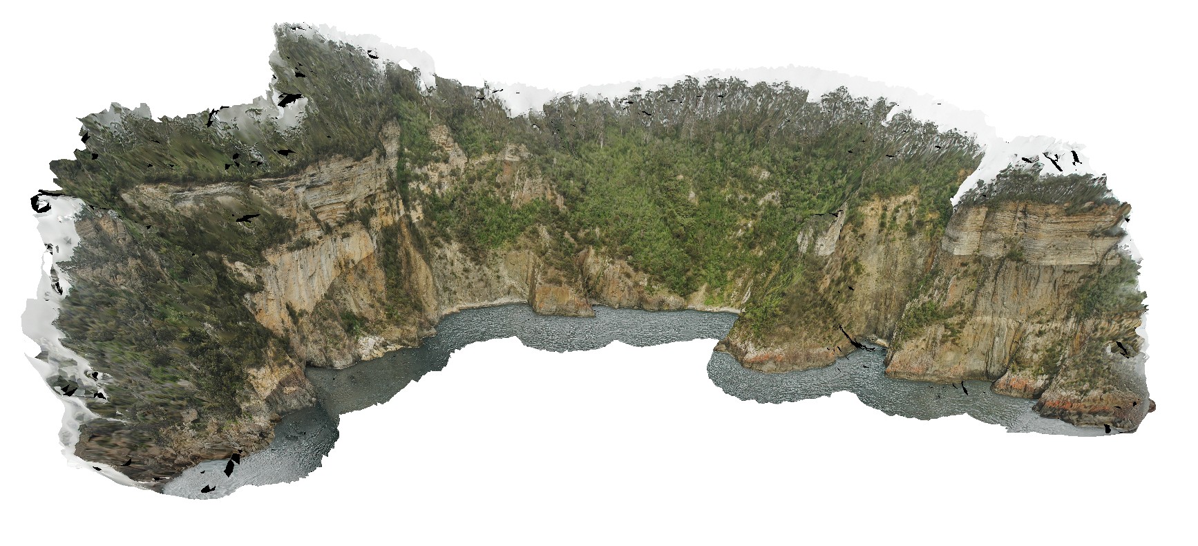
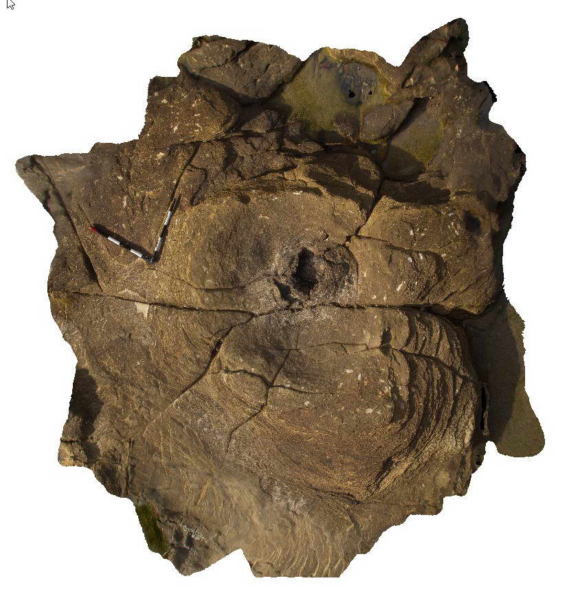
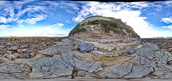
Surville1 Map
 |
50 |
03/16/2015 2:21 p.m. |
3D |
view form off-shore of cliff exposure, showing basement unconformable contact between Devonian Granite and the overlying sedimentary Parmeener Supergroup. Cape Surville, Tasman Peninsula. Tasmania. |
500.00 |
-42.97529481000 |
147.98872815000 |
0.500 |
basement unconformity, Devonian granite, Parmeener Supergroup, basement geology |
granite, siltstone |
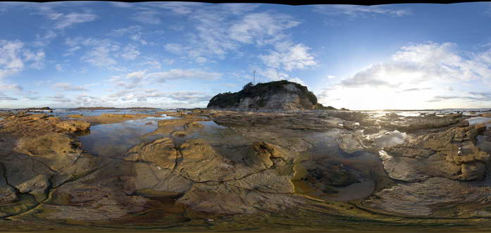
Surville2 Map
 |
50 |
03/16/2015 2:21 p.m. |
3D |
view form off-shore of cliff exposure, showing basement unconformable contact between Devonian Granite and the overlying sedimentary Parmeener Supergroup with intrusive Jurassic dolerite contact (darker rock). Cape Surville, Tasman Peninsula. Tasmania. |
500.00 |
-42.95779432000 |
147.99290997000 |
0.500 |
basement unconformity, unconformity, intrusive contact, igneous intrusion |
granite, siltstone, dolerite |
Surville3 Map
 |
50 |
01/01/9999 midnight |
3D |
view form off-shore of cliff exposure, showing basement unconformable contact between Devonian Granite and the overlying sedimentary Parmeener Supergroup with intrusive Jurassic dolerite contact (darker rock). Cape Surville, Tasman Peninsula. Tasmania. |
200.00 |
-37.66467900000 |
144.77204400000 |
1.000 |
contact |
granite, siltstone, dolerite |
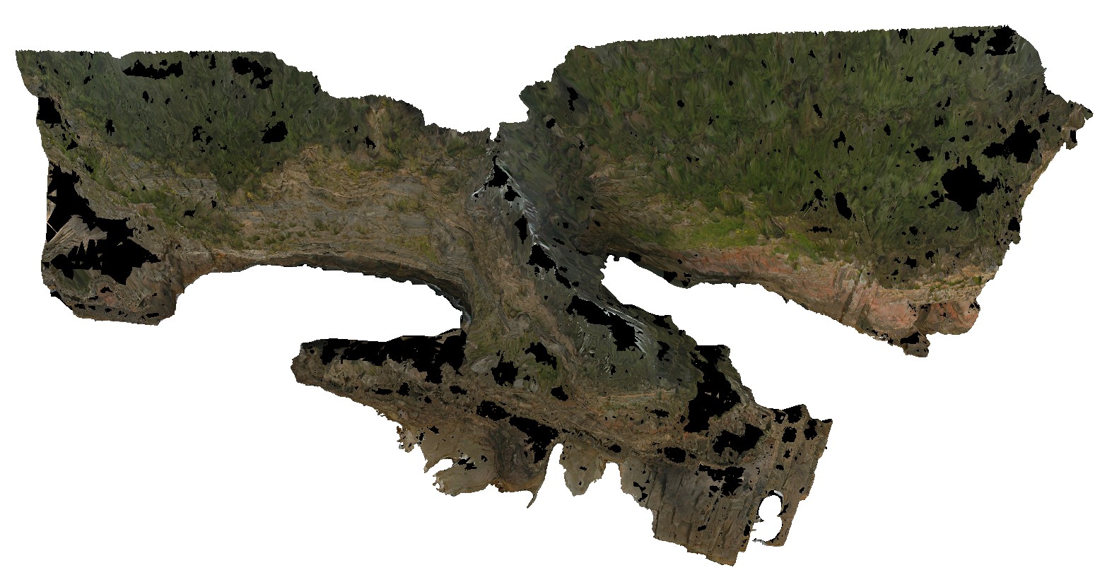
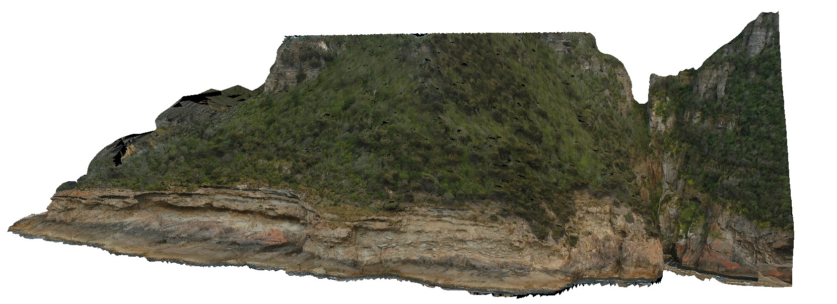
Surville4 Map
 |
50 |
01/01/9999 midnight |
3D |
view of cliff exposure, showing basement unconformable contact between Devonian Granite, metasediments and the overlying sedimentary Parmeener Supergroup with intrusive Jurassic dolerite contact (darker rock). Cape Surville, Tasman Peninsula. Tasmania. |
500.00 |
-37.66467900000 |
144.77204400000 |
1.000 |
unconformity, intrusion |
granite, metasediments, siltstone, dolerite |
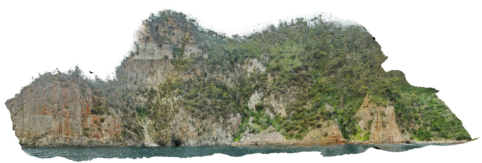
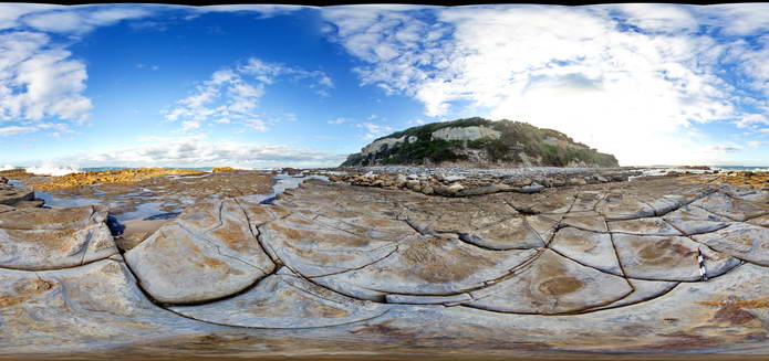
Surville5 Map
 |
50 |
03/16/2015 2:22 p.m. |
3D |
view form off-shore of cliff exposure, showing basement unconformable contact between Devonian Granite and the overlying sedimentary Parmeener Supergroup. Cape Surville, Tasman Peninsula. Tasmania. |
250.00 |
-42.97067641000 |
147.99550099000 |
0.500 |
unconformity, contact, basement unconformity |
granite, siltstone |
Swansea1 Map
 |
5 |
06/17/2015 9:19 a.m. |
3D |
Dadoxylon stumps in tuffaceous rocks of the Permian Boolaroo Formation (formerly Reid's Mistake Formation). Swansea, N.S.W. |
4.00 |
-33.08780000000 |
151.66469000000 |
0.000 |
Dadoxylon, stumps, palaeontology, volcanology |
tuff |
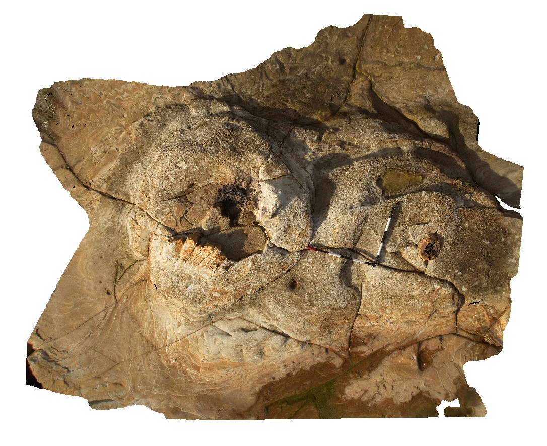
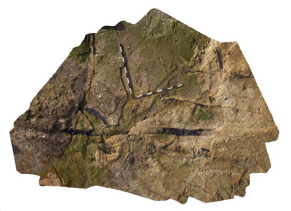
Swansea10 Map
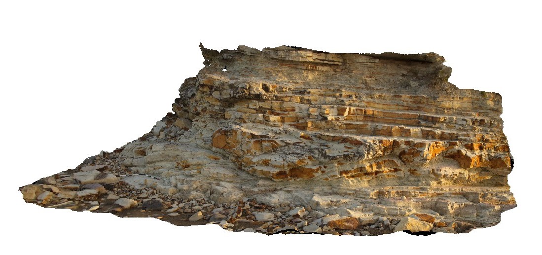 |
20 |
06/17/2015 9:21 a.m. |
3D |
Tuffaceous rocks of the Permian Boolaroo Formation with bedforms suggestive of depositional a surge deposit. Swansea, N.S.W. |
6.00 |
-33.08769000000 |
151.66450000000 |
1.000 |
surge, volcanology |
tuff |
Swansea11 Map
 |
20 |
06/17/2015 9:28 a.m. |
3D |
Tuffaceous rocks of the Permian Boolaroo Formation with bedforms suggestive of depositional a surge deposit. Swansea, N.S.W. |
3.00 |
-33.08769000000 |
151.66450000000 |
1.000 |
surge, volcanology, sedimentology, mega ripples |
tuff |
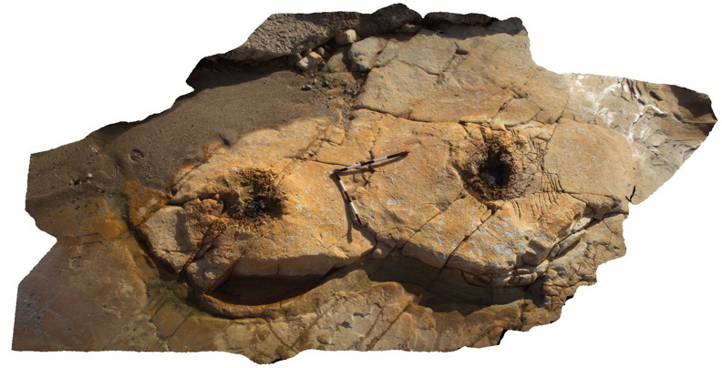
Swansea12 Map
 |
5 |
01/01/9999 midnight |
3D |
view of part of the Lower Pilot coal seam. Swansea, N.S.W. |
0.00 |
-33.08762000000 |
151.66502000000 |
-9999.000 |
coal, sedimentology |
coal |
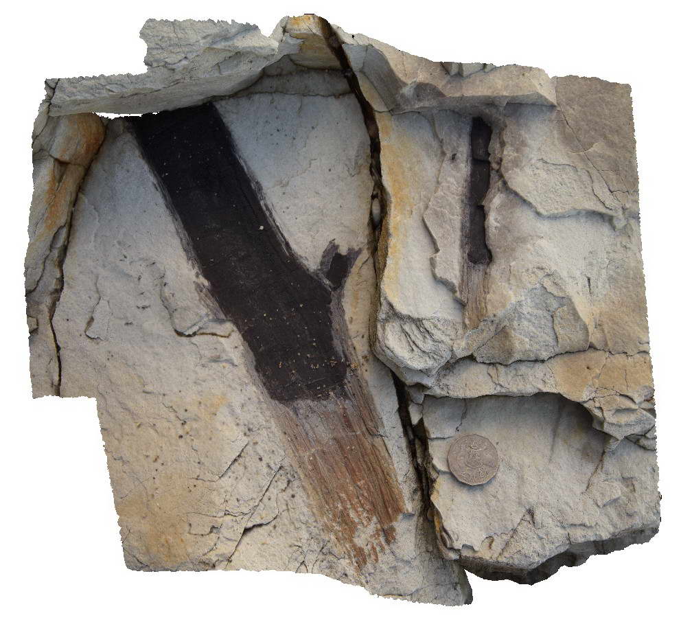
Swansea13 Map
 |
5 |
01/01/9999 midnight |
3D |
contact between the Lower Pilot Coal Seam and tuff, showing fine laminations in coal seam. Swansea, N.S.W. |
0.00 |
-33.08777000000 |
151.66492000000 |
-9999.000 |
coal seam, tuff, sedimentology |
coal |
Swansea14 Map
 |
5 |
01/01/9999 midnight |
3D |
view of 2 tree stumps in tuff. Swansea, N.S.W. |
0.00 |
-33.08766000000 |
151.66481000000 |
-9999.000 |
tree stump, weathering, fossil, tuff, sedimentology |
tuff |
Swansea15 Map
 |
5 |
01/01/9999 midnight |
3D |
view of tree stump in tuff rock pool. Swansea, N.S.W. |
0.00 |
-33.08747000000 |
151.66487000000 |
-9999.000 |
tree stump, fossil, tuff, sedimentology |
tuff |
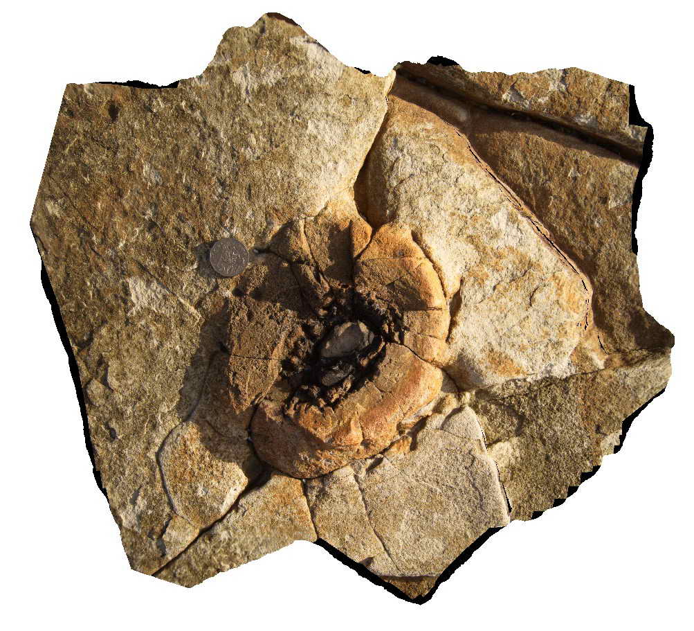
Swansea2 Map
 |
5 |
06/17/2015 9:34 a.m. |
3D |
Dadoxylon stump in tuffaceous rocks of the Permian Boolaroo Formation (formerly Reid's Mistake Formation). Swansea, N.S.W. |
3.00 |
-33.08773000000 |
151.66476000000 |
0.000 |
Dadoxylon, stump, palaeontology, volcanology |
tuff |
Swansea3 Map
 |
5 |
06/17/2015 9:38 a.m. |
3D |
Dadoxylon stump in tuffaceous rocks of the Permian Boolaroo Formation (formerly Reid's Mistake Formation). Swansea, N.S.W. |
2.00 |
-33.08767000000 |
151.66463000000 |
0.000 |
Dadoxylon, stump, palaeontology, volcanology |
tuff |
Swansea4 Map
 |
5 |
06/17/2015 9:42 a.m. |
3D |
Dadoxylon stump in tuffaceous rocks of the Permian Boolaroo Formation (formerly Reid's Mistake Formation). Swansea, N.S.W. |
3.00 |
-33.08778000000 |
151.66472000000 |
0.000 |
Dadoxylon, stumps, palaeontology, volcanology |
tuff |
Swansea5 Map
 |
5 |
06/17/2015 9:46 a.m. |
3D |
Dadoxylon stump in tuffaceous rocks of the Permian Boolaroo Formation (formerly Reid's Mistake Formation). Swansea, N.S.W. |
0.60 |
-33.08778000000 |
151.66472000000 |
0.000 |
Dadoxylon, stump, palaeontology, volcanology |
tuff |
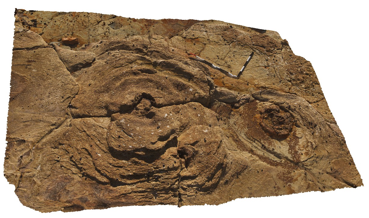
Swansea6 Map
 |
5 |
06/17/2015 9:49 a.m. |
3D |
Pavement showing aligned petrified/coalified logs in tuffaceous rocks of the Permian Boolaroo Formation. Swansea, N.S.W. |
4.00 |
-33.08787000000 |
151.66484000000 |
0.000 |
petrified logs, coalified logs, palaeontology, volcanology |
tuff |
Swansea7 Map
 |
5 |
06/17/2015 9:52 a.m. |
3D |
Pavement showing aligned petrified/coalified logs in tuffaceous rocks of the Permian Boolaroo Formation. Swansea, N.S.W. |
3.00 |
-33.08792000000 |
151.66489000000 |
0.000 |
petrified log, coalified log, palaeontology, volcanology |
tuff |
Swansea8 Map
 |
5 |
06/17/2015 9:55 a.m. |
3D |
petrified/coalified logs in tuffaceous rocks of the Permian Boolaroo Formation. Swansea, N.S.W. |
0.40 |
-33.09070000000 |
151.66484000000 |
0.000 |
petrified log, coalified log, palaeontology, volcanology |
tuff |
Swansea9 Map
 |
5 |
06/17/2015 9:56 a.m. |
3D |
tuffaceous rocks of the Permian Boolaroo Formation with large-scale 'ripples' at the base of the sandy unit - surge deposit? Swansea, N.S.W. |
5.00 |
-33.08899000000 |
151.66486000000 |
1.000 |
volcanology, ripples |
tuff |
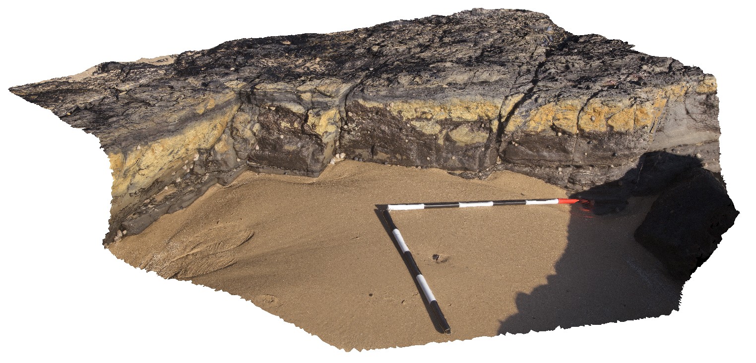
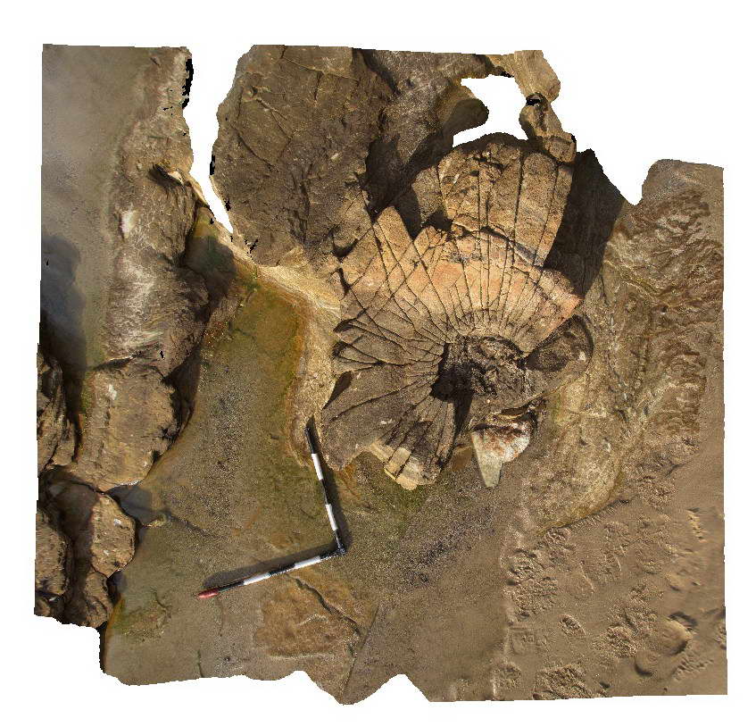
SwanseaFSP1 Map
 |
5 |
06/17/2015 9:59 a.m. |
FSP |
View of tuffaceous rocks of the Permian Boolaroo Formation and blocks of coal from the underlying Lower Pilot Seam. Swansea, N.S.W. |
50.00 |
-33.08901000000 |
151.66493000000 |
0.000 |
volcanology, coal, surge |
tuff |
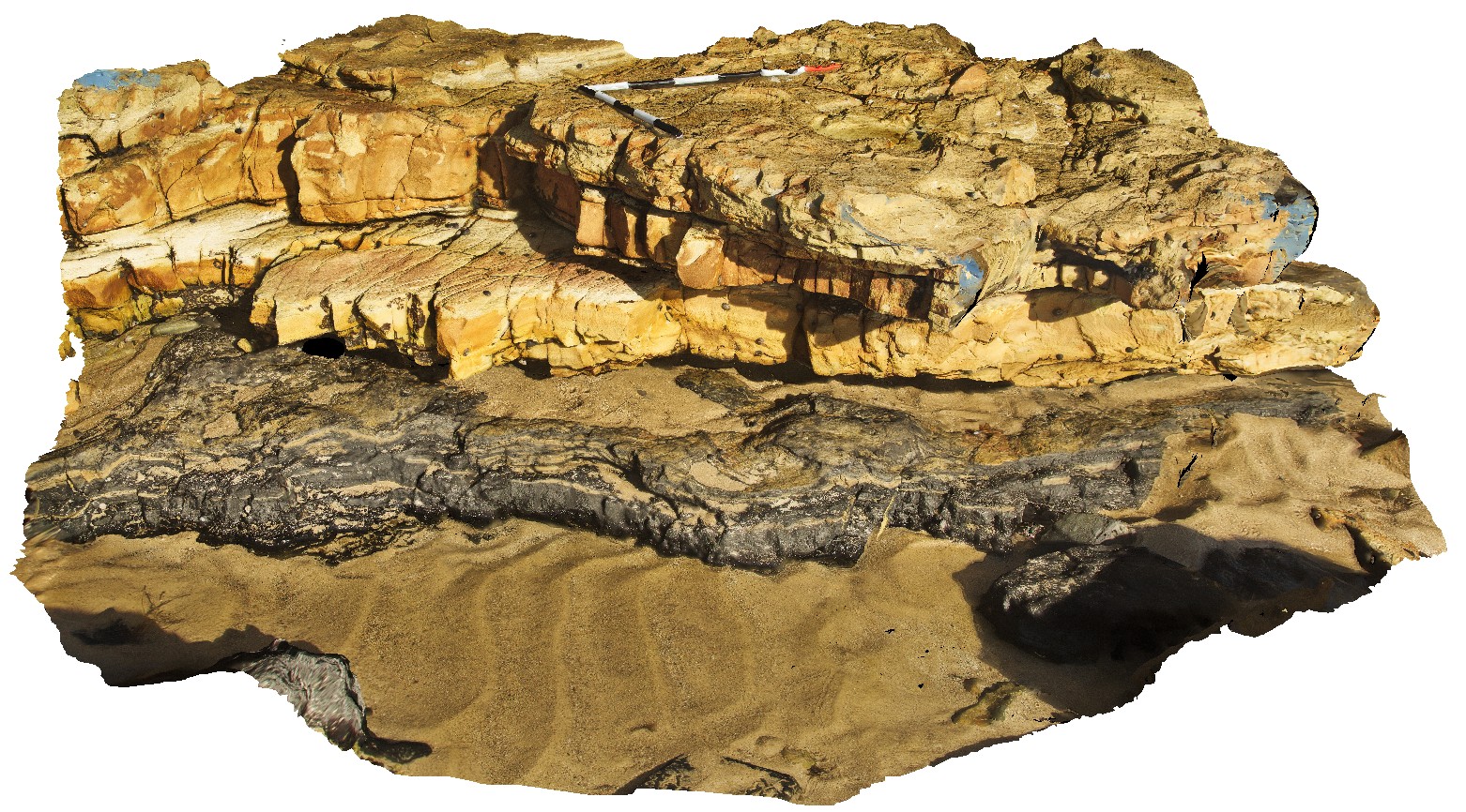
SwanseaFSP10 Map
 |
5 |
06/17/2015 10 a.m. |
FSP |
View of tuffaceous rocks of the Permian Boolaroo Formation. The underlying Lower Pilot Seam crops out in the water. In-situ petrified tree stumps up to 0.3m in diameter. Swansea, N.S.W. |
50.00 |
-33.08834000000 |
151.66476000000 |
0.000 |
volcanology, palaeontology, petrified stumps |
tuff |
SwanseaFSP2 Map
 |
5 |
06/17/2015 10 a.m. |
FSP |
Pavement of jointed tuff within the Permian Boolaroo Formation. Swansea, N.S.W. |
50.00 |
-33.08905000000 |
151.66481000000 |
0.000 |
volcanology, joints, structure |
tuff |
SwanseaFSP3 Map
 |
5 |
06/17/2015 10:01 a.m. |
FSP |
View of tuffaceous rocks of the Permian Boolaroo Formation and blocks of coal from the underlying Lower Pilot Seam. Swansea, N.S.W. |
50.00 |
-33.08854000000 |
151.66481000000 |
0.000 |
volcanology, coal |
tuff |