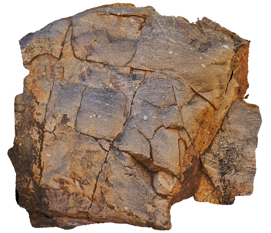
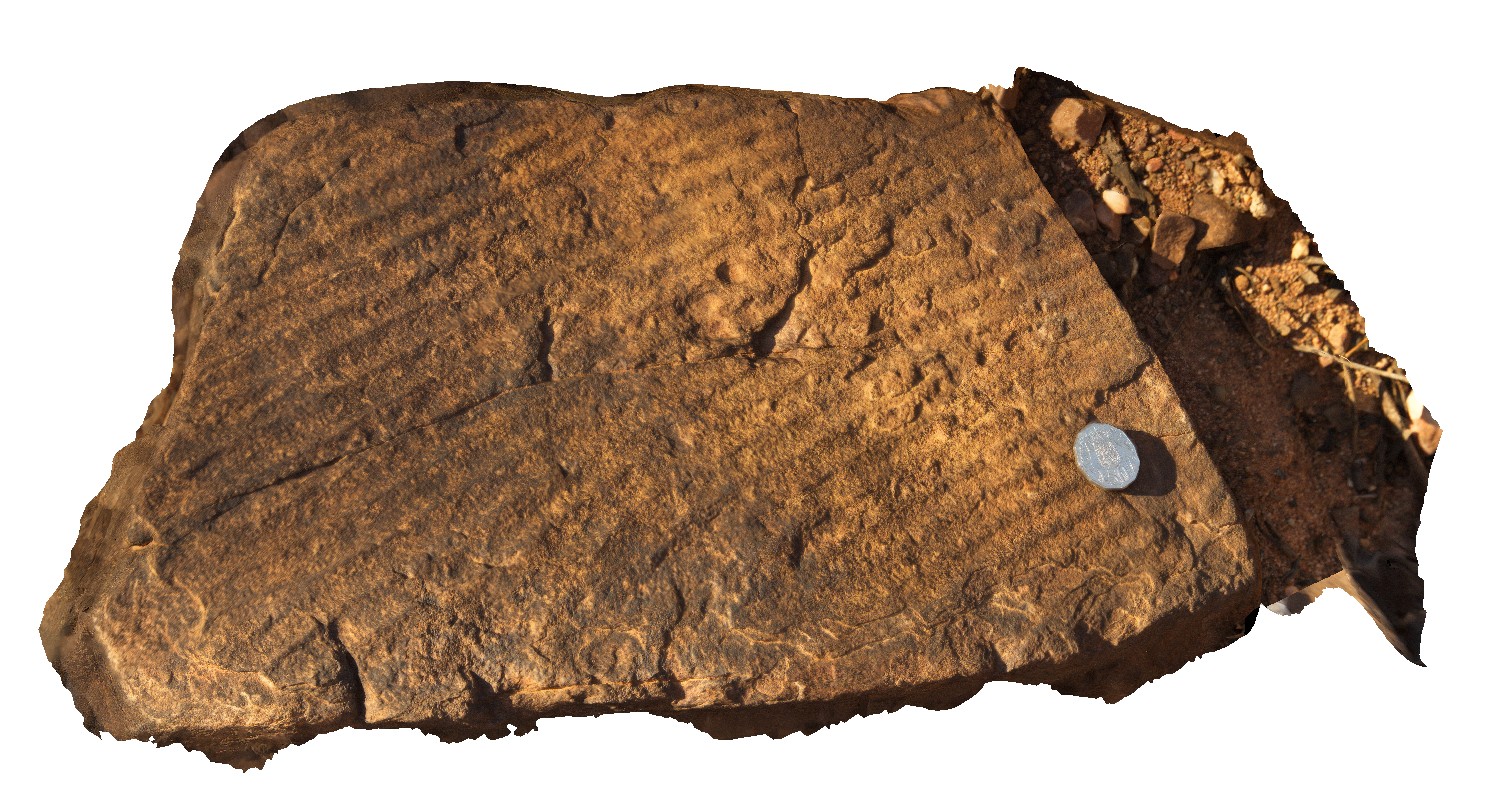
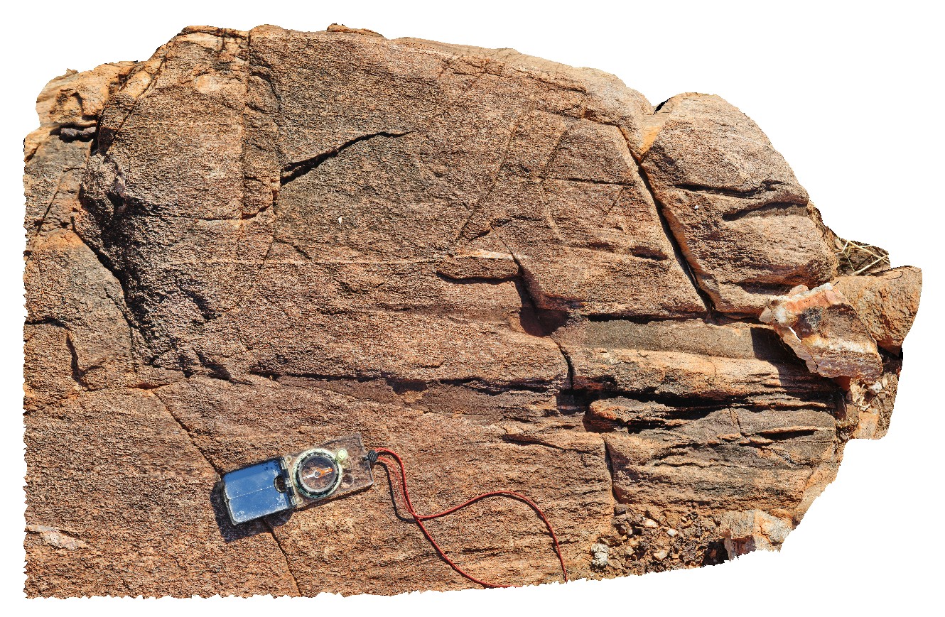
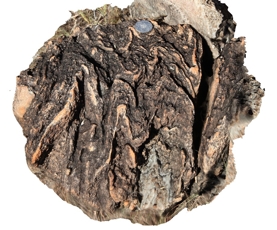
DAVP1 Map
 |
5 |
07/22/2016 2:50 p.m. |
3D |
cross cutting beds in sandstone outcrop. Near Kurangi Station. N.T. |
1.50 |
-20.49633000000 |
134.68023300000 |
395.700 |
sandstone, cross bedding |
sandstone |
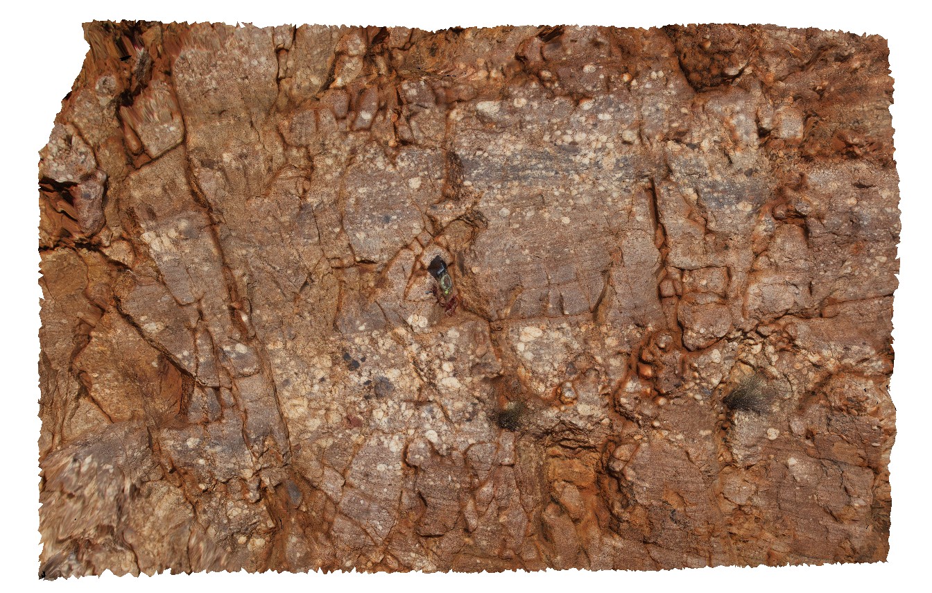
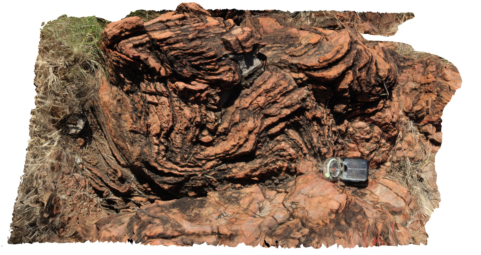
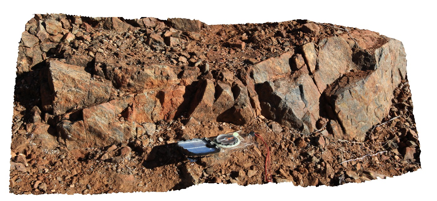
DAVP2 Map
 |
0 |
07/22/2016 3:07 p.m. |
3D |
bedded and foliated conglomerate sandstone contact. Conglomerate is polymict. Possibly volcaniclastic. Near Kurangi Station. N.T. |
2.50 |
-20.45934000000 |
134.69343700000 |
388.577 |
bedding, foliation, structure, conglomerate, sedimentology |
conglomerate |
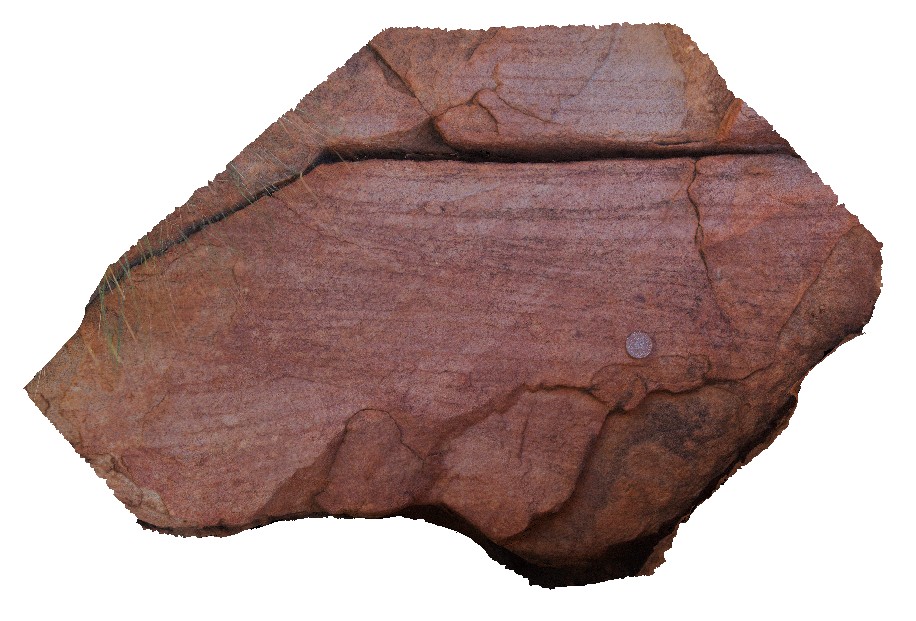
DAVP3 Map
 |
0 |
07/22/2016 9:14 a.m. |
3D |
cross bedded sandstone outcrop. Davenport Provence. Near Irmweng rock hole. N.T. |
0.60 |
-20.61427300000 |
134.79338300000 |
422.351 |
cross bedding, sandstone, sedimentology |
sandstone |
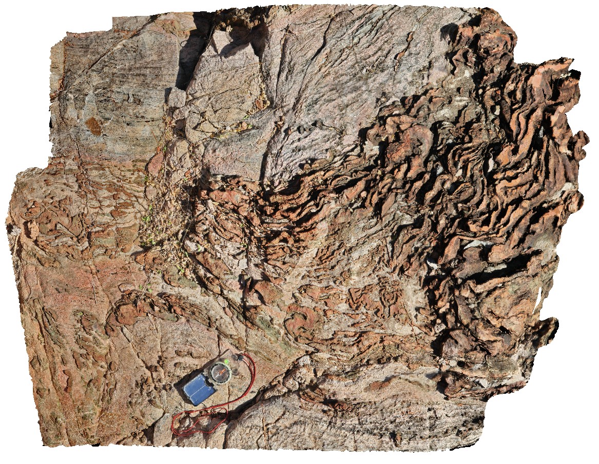
DAVP4 Map
 |
0 |
07/23/2016 10:07 a.m. |
3D |
foliated volcaniclastic units, with hematite alteration. Davenport Provence. Near Irmweng rock hole. N.T. |
4.00 |
-20.47535800000 |
134.79593000000 |
404.434 |
volcaniclastics, foliation, structure |
volcaniclastic |
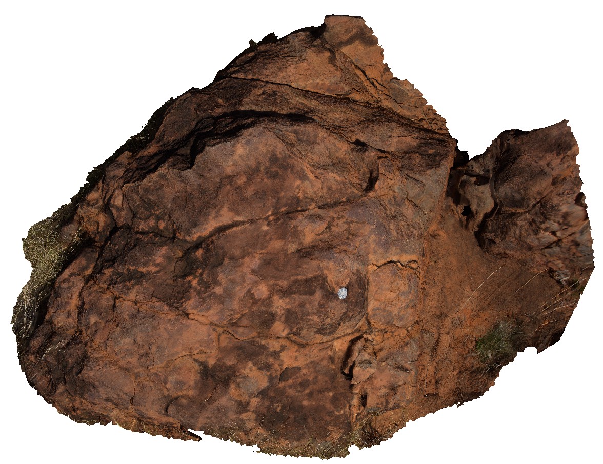
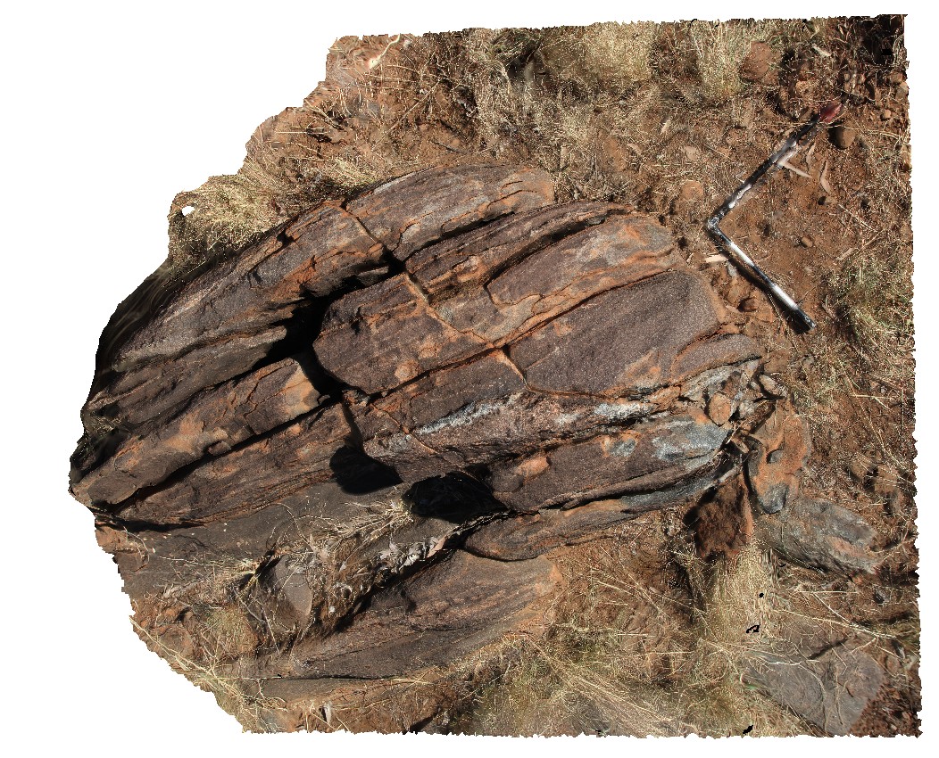
DAVP5 Map
 |
0 |
07/23/2016 10:57 a.m. |
3D |
ripple marks in sandstone float in creek bed. North East of Kurangi Station. N.T. |
0.40 |
-20.47732400000 |
134.68434500000 |
391.831 |
ripple marks, sedimentology, bedding plane, sandstone |
sandstone |
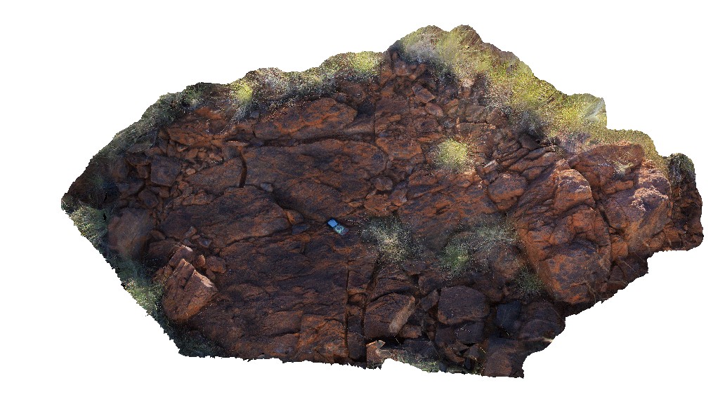
DAVP6 Map
 |
5 |
07/23/2016 12:52 p.m. |
3D |
outcrop of Epenarra Volcanics, SW of Kurangi Station. N.T. |
1.00 |
-20.52780400000 |
134.65386000000 |
423.653 |
volcanics |
basalt |
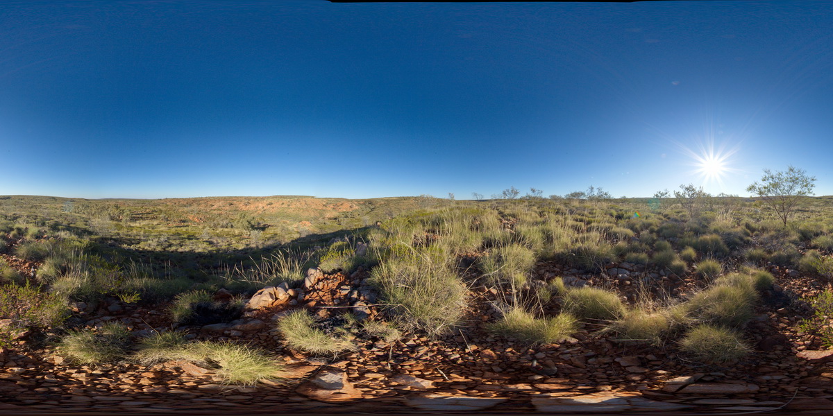
DAVPFSP2 Map
 |
0 |
07/22/2016 5:20 p.m. |
FSP |
view of Irmweng rock hole, showing bedded quartzite outcrops. South of Whistle Duck Creek. N.T. |
2000.00 |
-20.65046400000 |
134.77071400000 |
445.115 |
bedding, quartzite, metamorphic |
quartzite |
DAVPFSP3 Map
 |
0 |
07/23/2016 11:37 a.m. |
FSP |
sandstone hills North East of Kurangi Station. N.T. |
0.00 |
-20.48105800000 |
134.69117400000 |
418.975 |
|
sandstone |
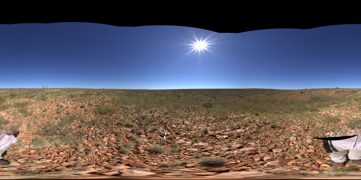
DAVPFSP4 Map
 |
5 |
01/01/9999 midnight |
FSP |
view of basalt outcrop in foreground and sandstone hills in distance. Near |
0.00 |
-20.52780400000 |
134.65386000000 |
-9999.000 |
|
basalt |
DeepBay1 Map
 |
0 |
02/29/2016 9:28 a.m. |
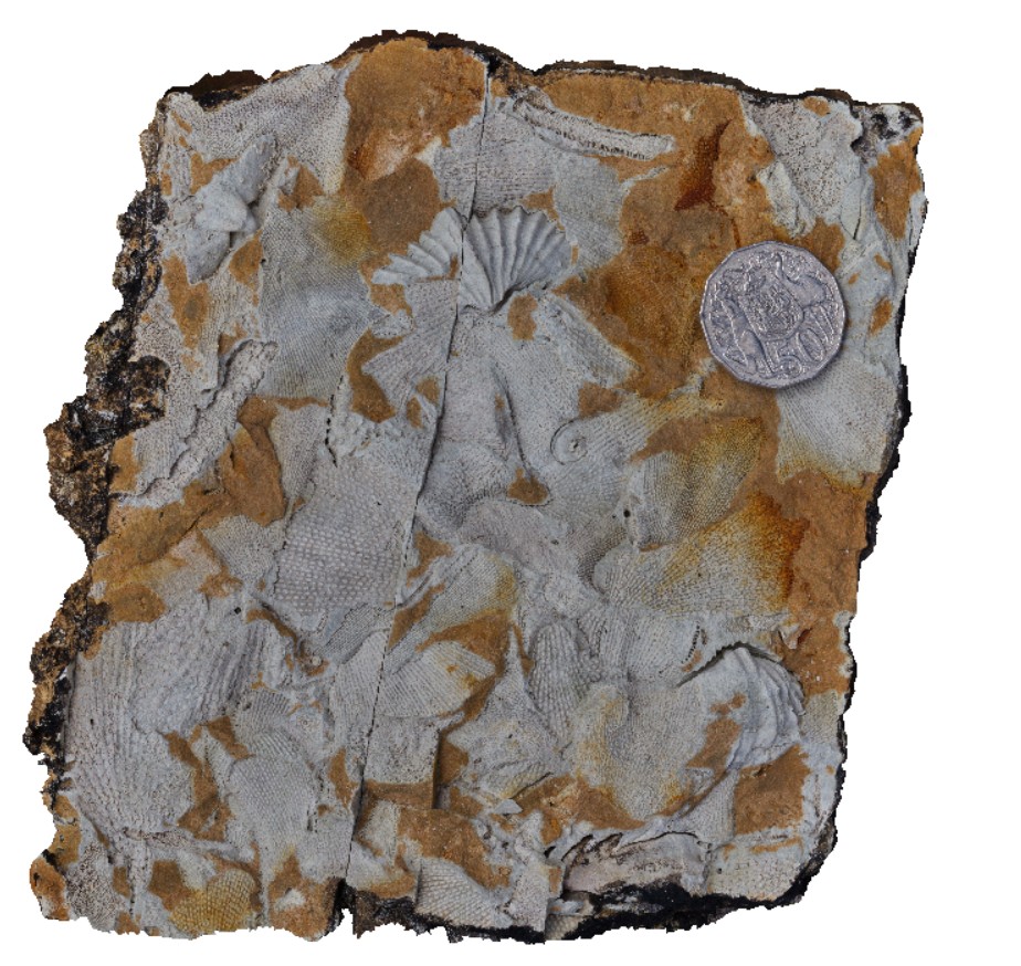
3D |
Permian fossils in Deep Bay Formation, including bryozoa and brachiopods. Ables Bay Road, Tasmania. |
0.30 |
-43.21928000000 |
147.09190000000 |
-9999.000 |
fossil, brachiopod, bryozoa, palaeontology |
siltstone |
DeepBay2 Map
 |
0 |
02/29/2016 9:29 a.m. |
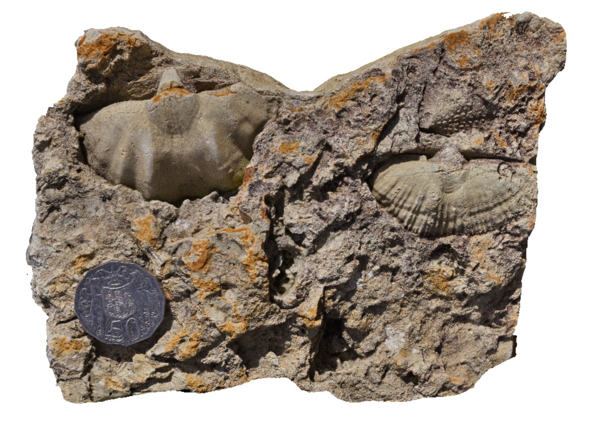
3D |
brachiopod Permian fossils in Deep Bay Formation. Ables Bay Road, Tasmania. |
0.15 |
-43.21928000000 |
147.09190000000 |
-9999.000 |
fossil, brachiopods, palaeontology |
siltstone |
DeepBay3 Map
 |
0 |
02/29/2016 9:31 a.m. |
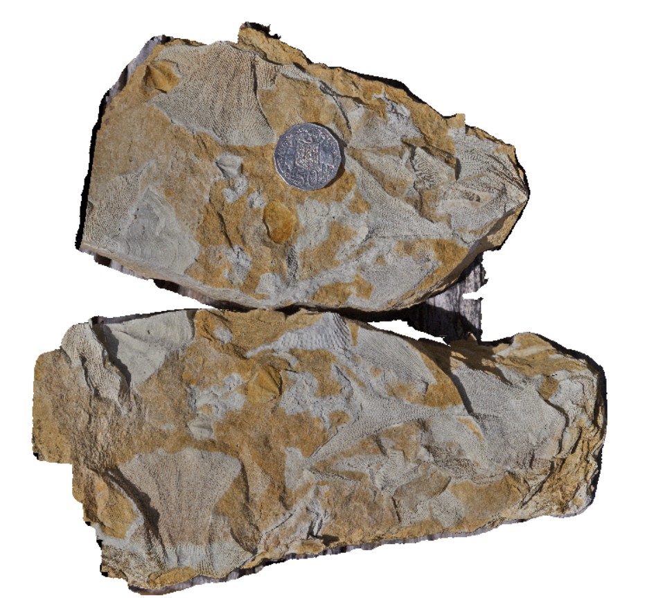
3D |
Permian fossils in Deep Bay Formation, including bryozoa and brachiopods. Ables Bay Road, Tasmania. |
0.20 |
-43.21928000000 |
147.09190000000 |
-9999.000 |
fossil, bryozoa, brachiopods, palaeontology |
siltstone |
Denham1 Map
 |
0 |
05/23/2016 noon |
3D |
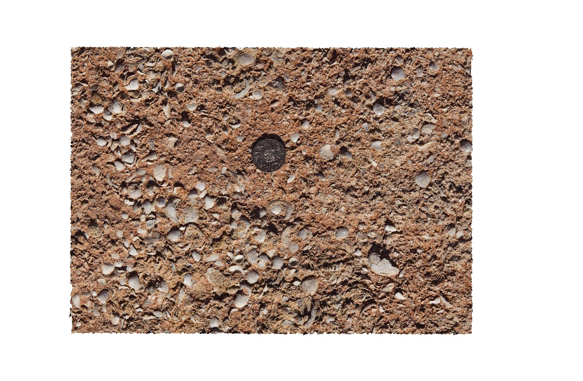
detail of shells and texture within the Pleistocene to Holocene Denham limestone. Shark Bay, W.A. |
0.40 |
-26.19567000000 |
113.72114000000 |
-9999.000 |
limey sand, Fragum erugatum, fossil, palaeontology |
limestone |
DevmFSP1 Map
 |
5 |
07/22/2016 12:52 p.m. |
FSP |
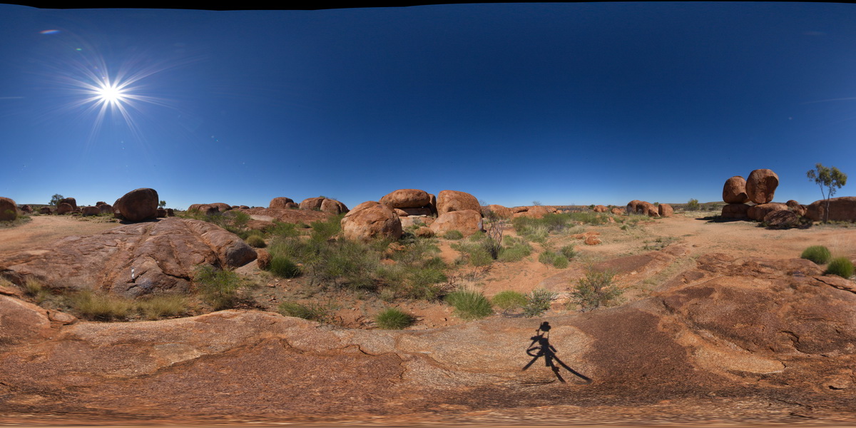
view of Devils Marbles granite outcrop. Karlu Karlu / Devils Marbles Conservation Reserve. N.T. |
0.00 |
-20.55961100000 |
134.26470100000 |
412.342 |
Devils Marbles, granite, weathering |
granite |
DevmUAV1 Map
 |
5 |
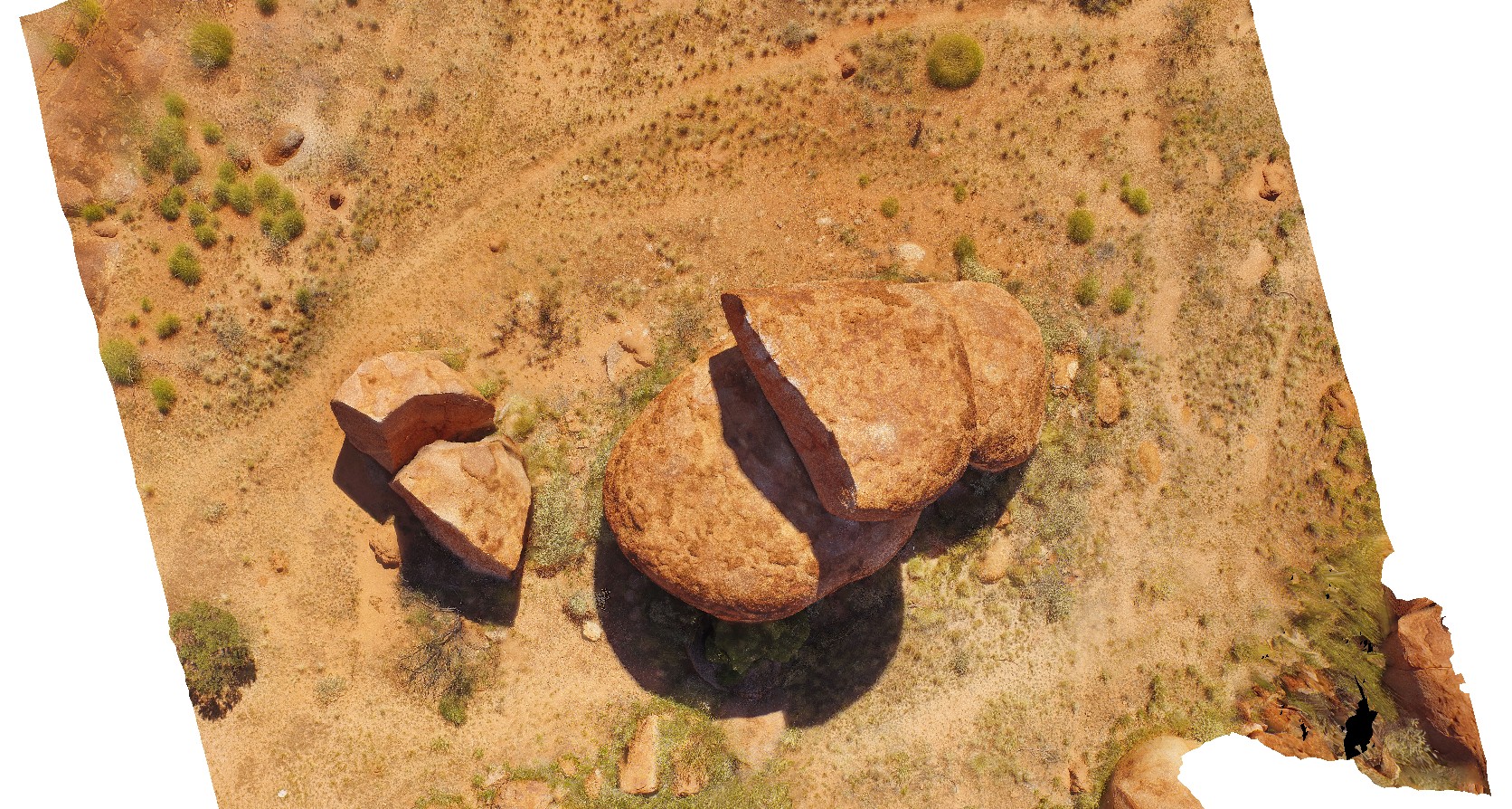
07/22/2016 12:22 p.m. |
UAV |
aerial view of Devil's Marbles granite outcrop. Karlu Karlu / Devils Marbles Conservation Reserve. N.T. |
50.00 |
-20.55873500000 |
134.26646600000 |
410.176 |
Devils Marbles, granite, weathering |
granite |
DianasBasinUAV1 Map
 |
20 |
01/01/9999 midnight |
UAV |
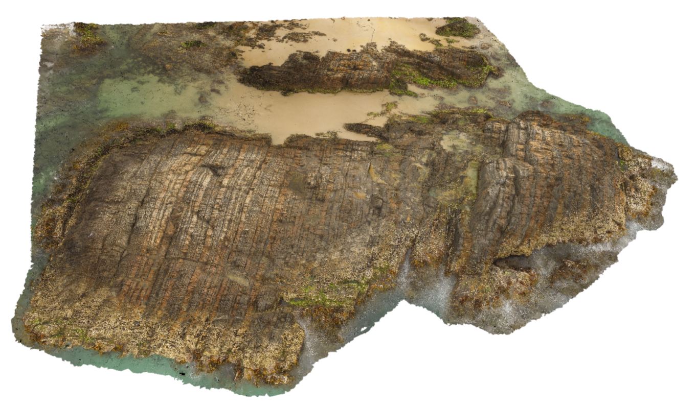
aerial view of steeply dipping Mathinna Supergroup turbidite package. St Helens, Tasmania. |
77.40 |
-41.36620600000 |
148.30181600000 |
100.000 |
turbidite, steep dip, dip |
turbidite |
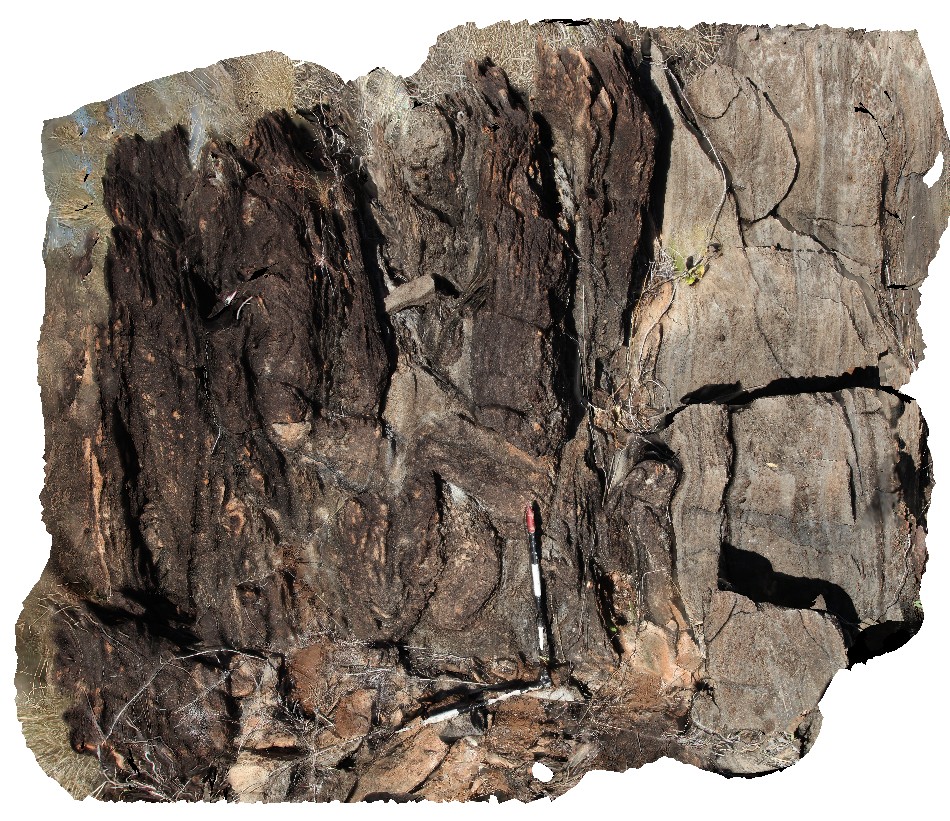
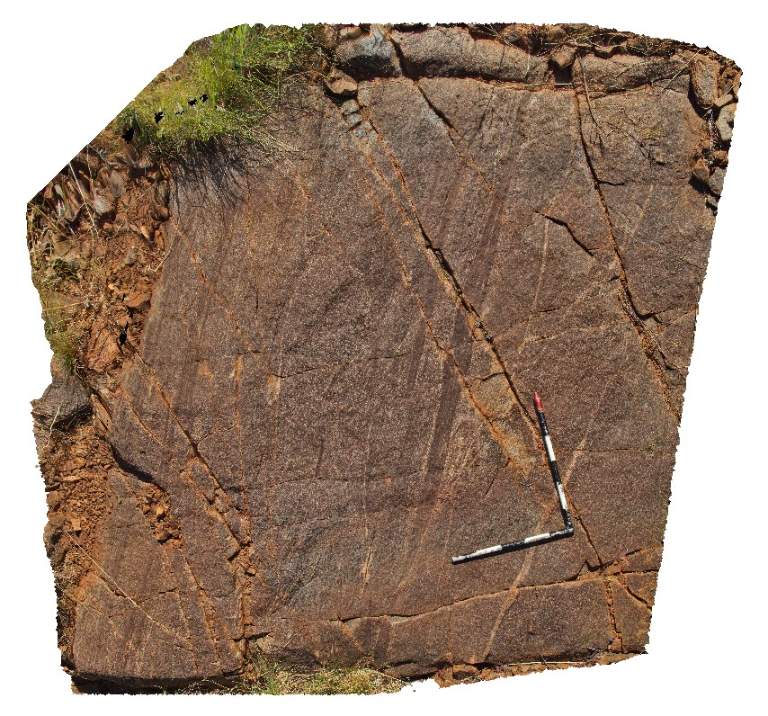
DixonRange1 Map
 |
0 |
06/13/2016 noon |
3D |
schist with small mafic dykes and quartz veins with tight folds. Road to Dixon Range, W.A. |
1.00 |
-17.17853000000 |
128.24756000000 |
-9999.000 |
schist, tight fold, structure, mafic dyke |
schist |
DixonRange10 Map
 |
0 |
06/14/2016 noon |
3D |
interlayered marble and calc-silicate, showing two generations of folding. Folds are tight to isoclinal. Hill above road to Dixon Range. North W.A. |
1.00 |
-17.22547000000 |
128.25275000000 |
-9999.000 |
fold calc-silicate, marble, isoclinal fold, metamorphic, structure |
calc-silicate |
DixonRange11 Map
 |
0 |
06/14/2016 noon |
3D |
folded calc-silicate and marble outcrop. Hill above road to Dixon Range, north W.A. |
120.00 |
-17.22520000000 |
128.25299000000 |
-9999.000 |
calc-silicate, marble, metamorphic, structure |
calc-silicate |
DixonRange12 Map
 |
0 |
06/14/2016 noon |
3D |
steeply dipping carbonates near road to Dixon Range, North W.A. |
2.50 |
-17.19787000000 |
128.24109000000 |
-9999.000 |
carbonate, metamorphics, dip |
carbonate |
DixonRange13 Map
 |
0 |
06/14/2016 noon |
3D |
tightly folded carbonate float near road to Dixon Range, North W.A. |
0.35 |
-17.19787000000 |
128.24109000000 |
-9999.000 |
fold, structure, carbonate |
carbonate |
DixonRange14 Map
 |
0 |
06/14/2016 noon |
3D |
low-lying amphibolite outcrop with apparent cleavage parallel to adjacent road. Road to Dixon Range, North W.A. |
0.90 |
-17.19775000000 |
128.24126000000 |
-9999.000 |
amphibolite, apparent cleavage, metamorphics |
amphibolite |
DixonRange15 Map
 |
0 |
06/14/2016 noon |
3D |
biotite schist with layers of coarse-grained quartz and biotite. Dixon Range road, W.A. |
3.00 |
-17.17705000000 |
128.24669000000 |
-9999.000 |
biotite schist, metamorphic, structure |
schist |
DixonRange16 Map
 |
0 |
06/14/2016 noon |
3D |
foliated granite. Dixon Range road, W.A. |
2.50 |
-17.14565000000 |
128.26024000000 |
-9999.000 |
foliation, granite, structure |
granite |
DixonRange2 Map
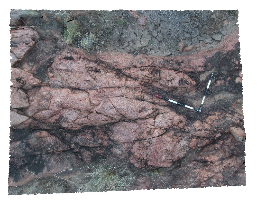 |
0 |
06/14/2016 noon |
3D |
medium-grained red granite. Dixon Range road. Dixon Range, W.A. |
2.50 |
-17.21555500000 |
128.23648000000 |
-9999.000 |
granite |
granite |