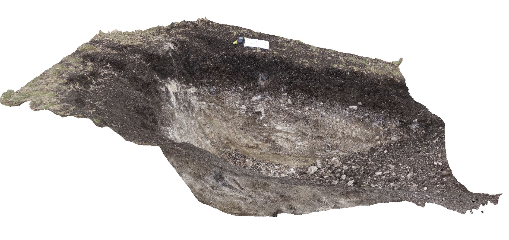
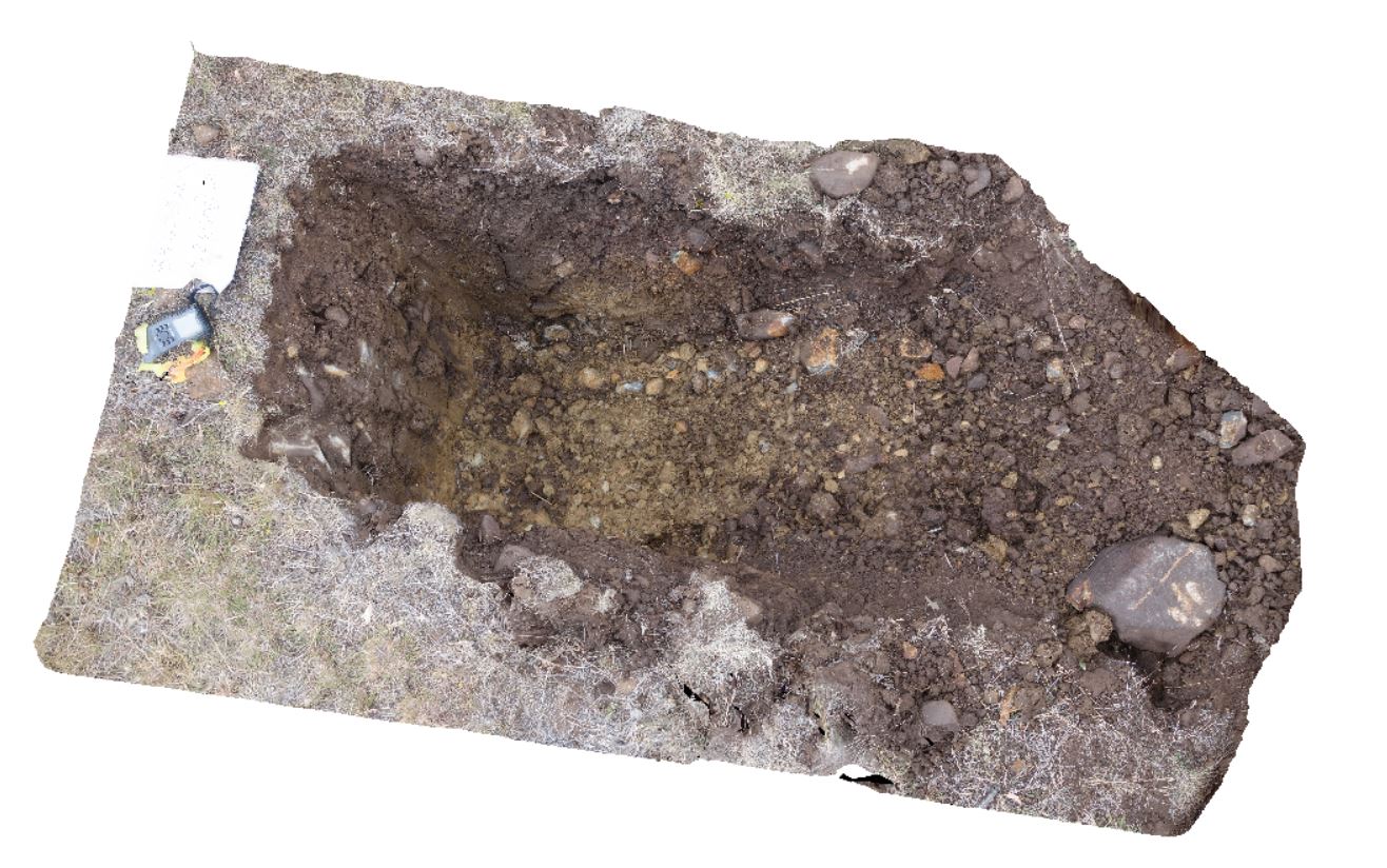
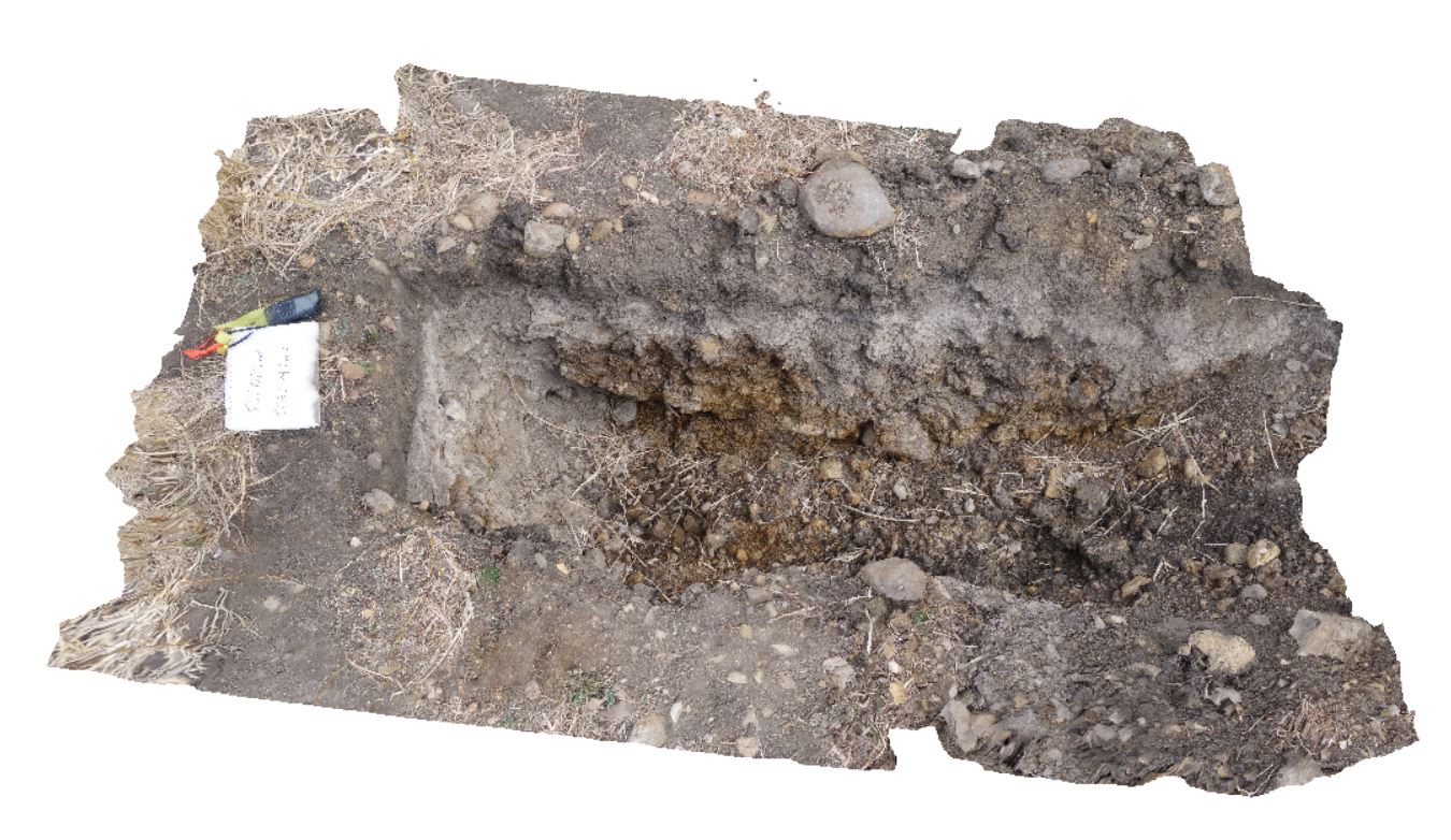
DaisyBanksPit11 Map
 |
20 |
03/23/2015 11:25 a.m. |
3D |
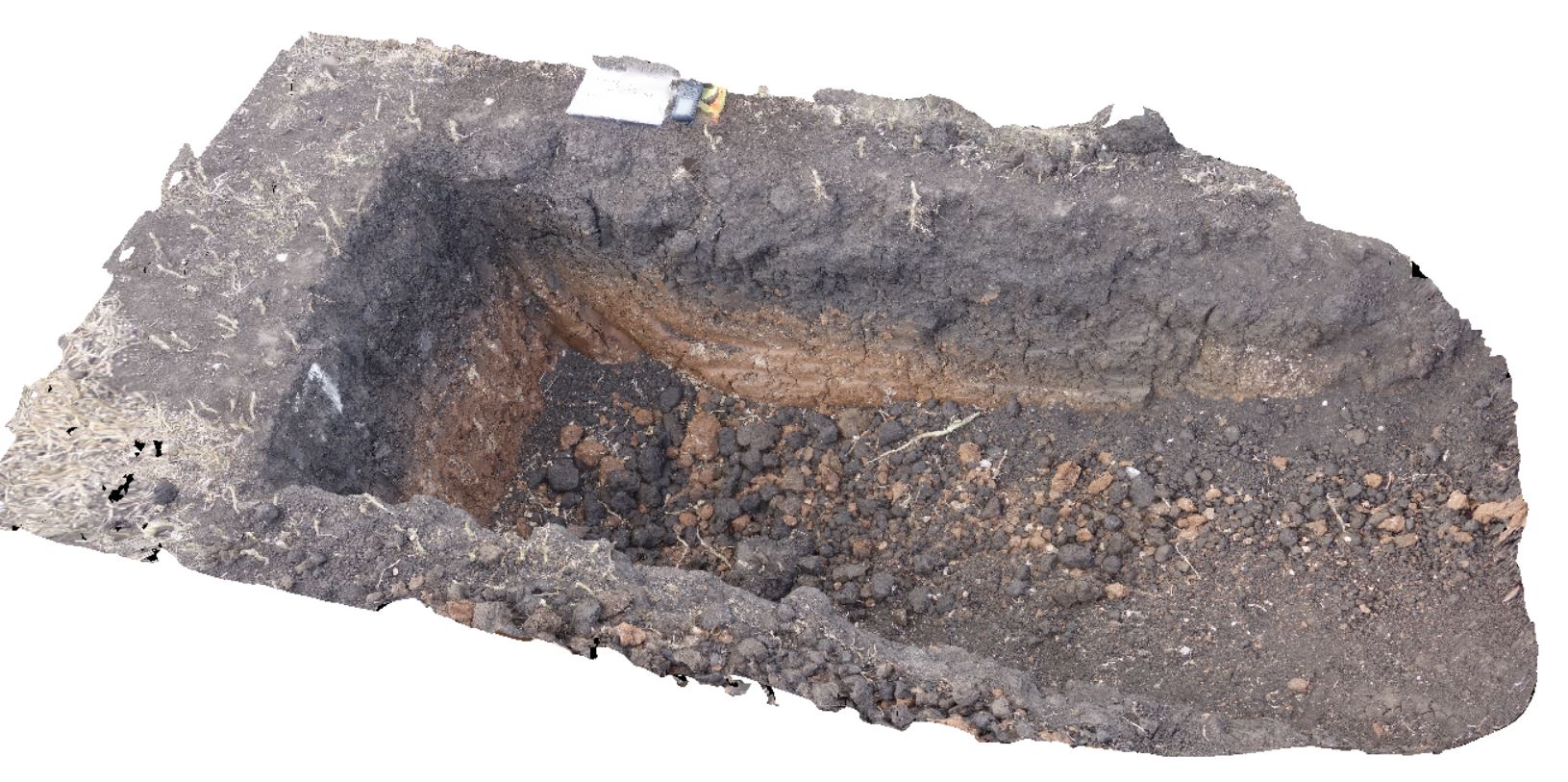
~80cm pit into dark grey sandy soils and white-brown sandy clay overlying Triassic interbedded micaceous brown, red-purple, green and grey carbonaceous siltstone, shale, mudstone and sandstone. Richmond, Tas. |
2.00 |
-42.72936200000 |
147.42457600000 |
-9999.000 |
clay, regolith |
clay |
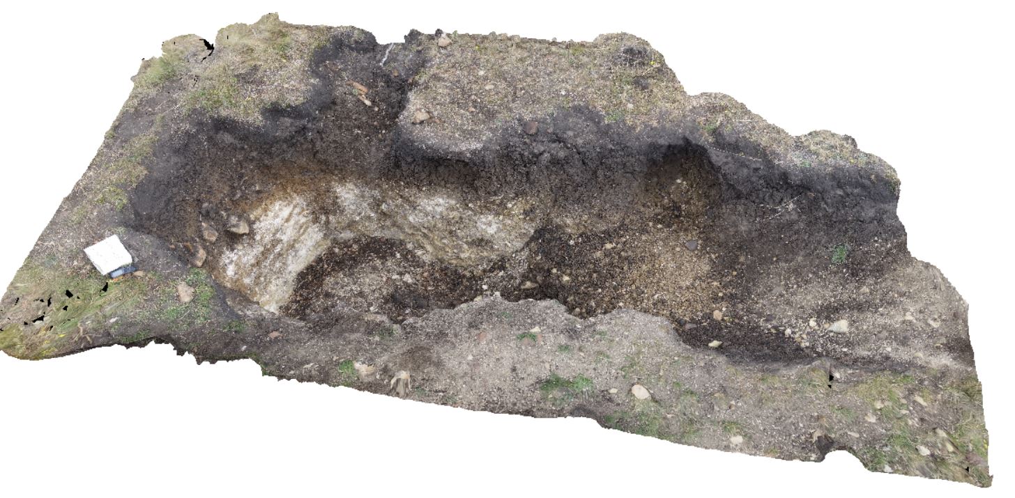
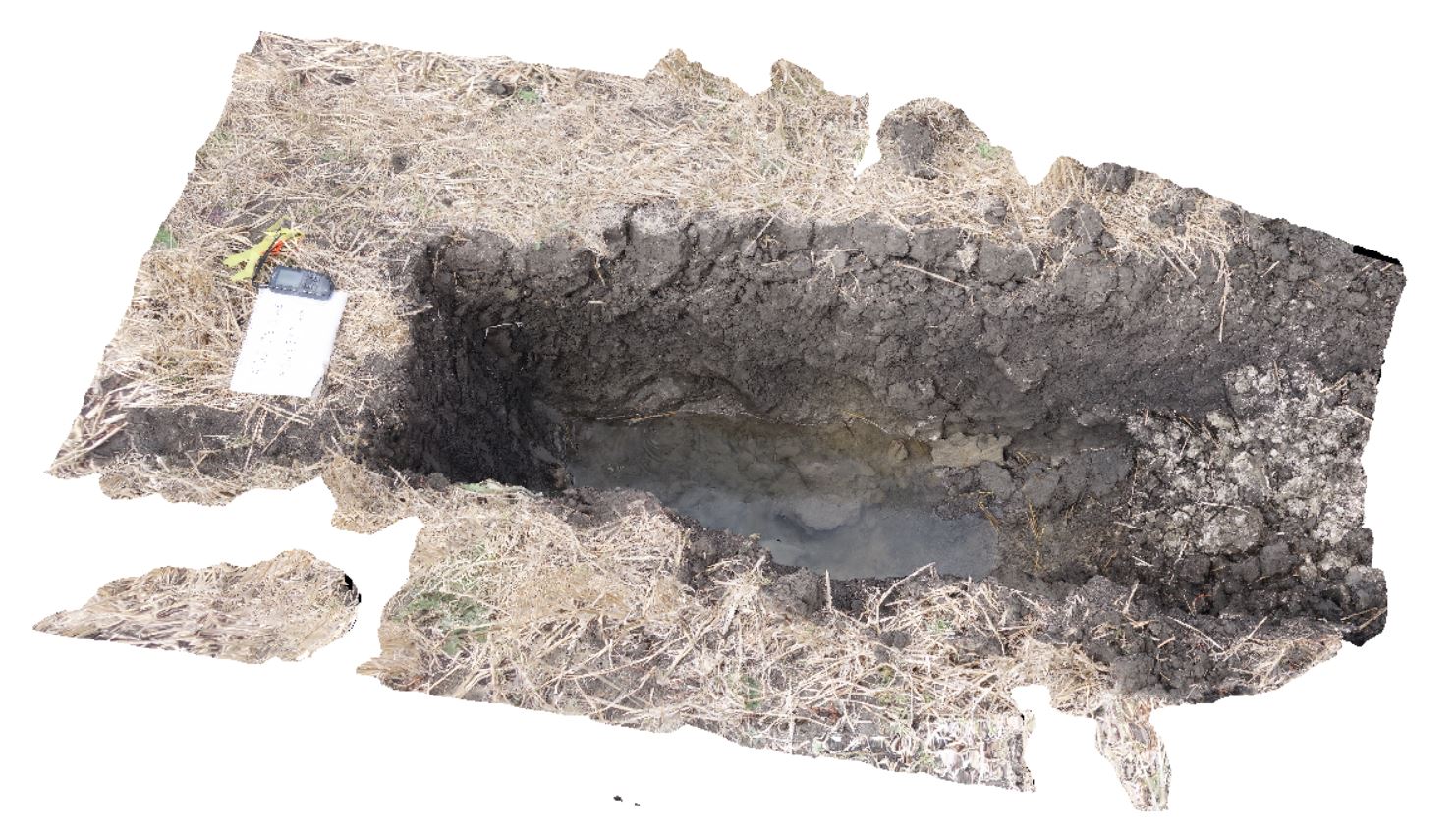
DaisyBanksPit12 Map
 |
20 |
03/23/2015 12:11 p.m. |
3D |
~80cm pit into dark grey sandy soils and white-brown sandy clay overlying Jurassic Dolerite. Richmond, Tas. |
2.00 |
-42.72939600000 |
147.42269500000 |
-9999.000 |
clay, Jurassic Dolerite, regolith |
clay |
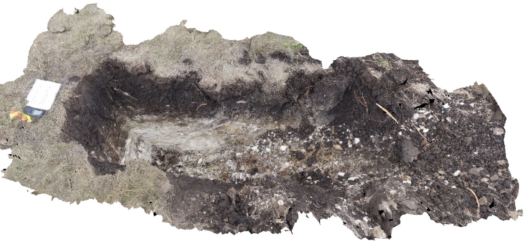
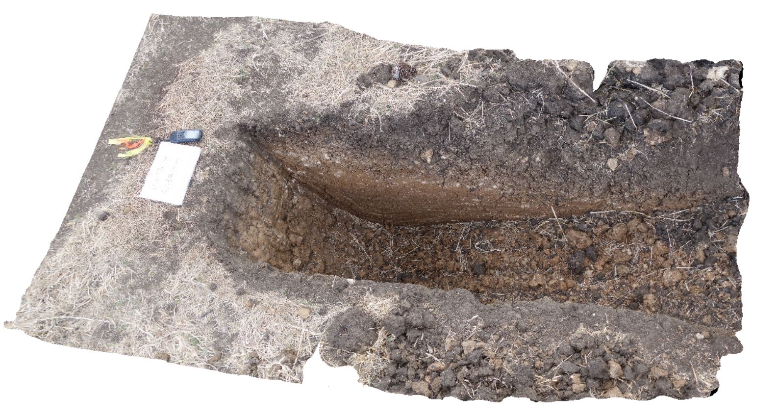
DaisyBanksPit13 Map
 |
20 |
03/23/2015 12:07 p.m. |
3D |
~80cm pit into dark grey sandy soils and white-brown sandy clay overlying Jurassic Dolerite. Richmond, Tas. |
2.00 |
-42.72961200000 |
147.42258600000 |
-9999.000 |
clay, Jurassic Dolerite, regolith |
clay |
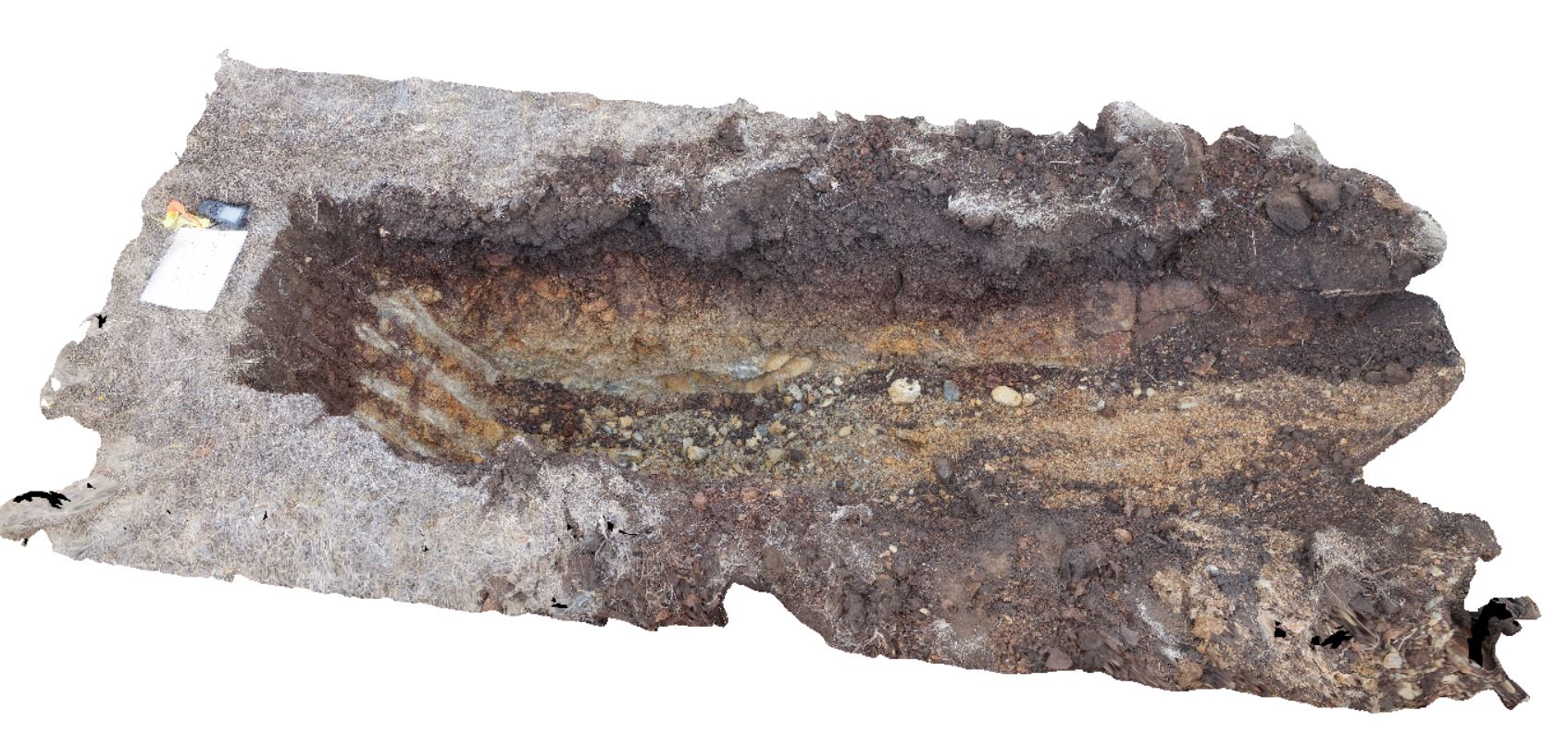
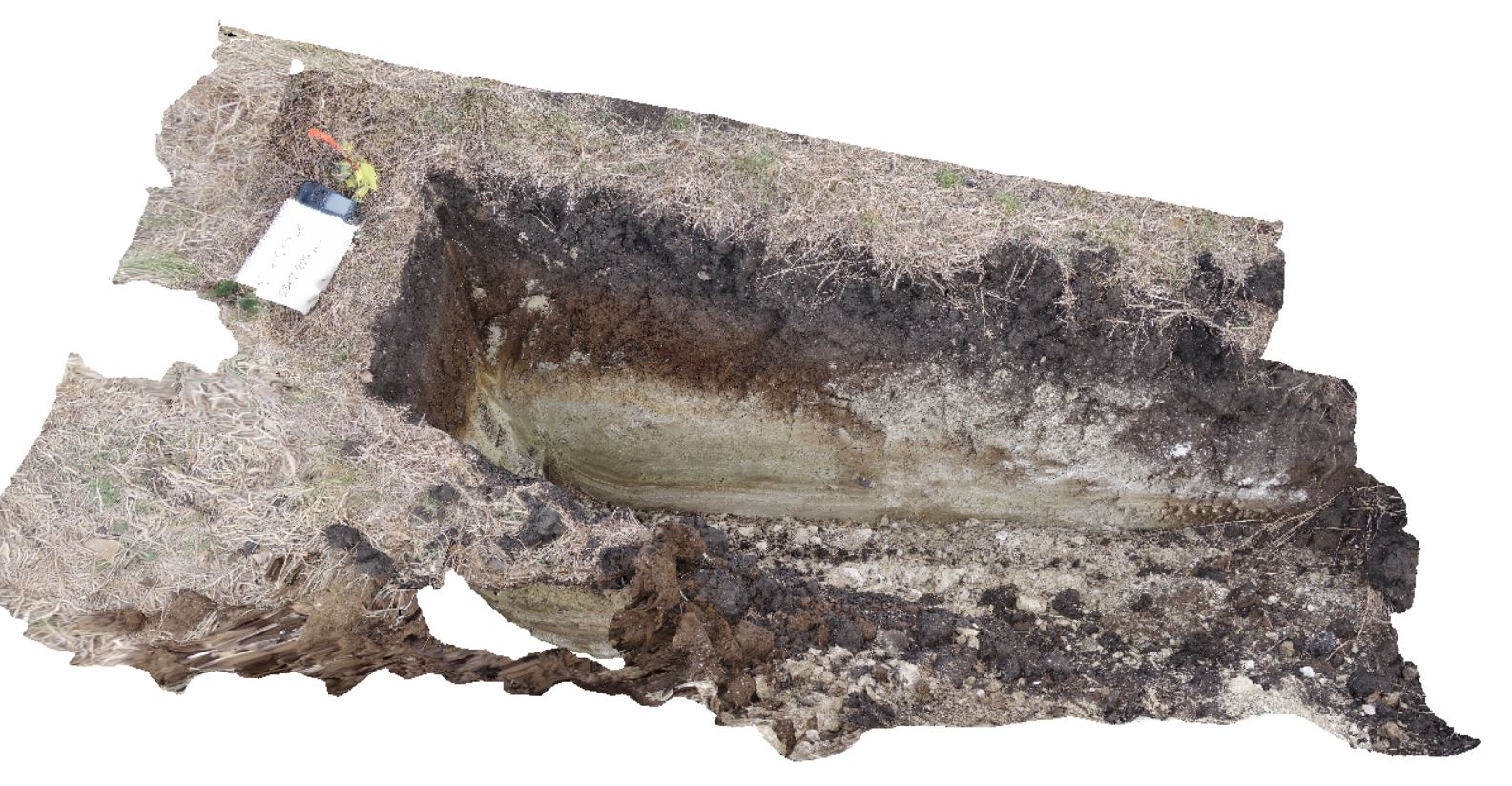
DaisyBanksPit14 Map
 |
20 |
03/24/2015 10:06 a.m. |
3D |
~80cm pit into dark grey sandy soils and white-brown sandy clay overlying Jurassic Dolerite. Richmond, Tas. |
2.00 |
-42.73006300000 |
147.42246700000 |
-9999.000 |
Clay, Jurassic Dolerite, regolith |
Clay |
DaisyBanksPit15 Map
 |
20 |
03/24/2015 9:47 a.m. |
3D |
~80cm pit into dark grey sandy soils and white-brown sandy clay overlying Jurassic Dolerite. Richmond, Tas. |
2.00 |
-42.73051200000 |
147.42269000000 |
-9999.000 |
Clay, Jurassic Dolerite, regolith |
clay |
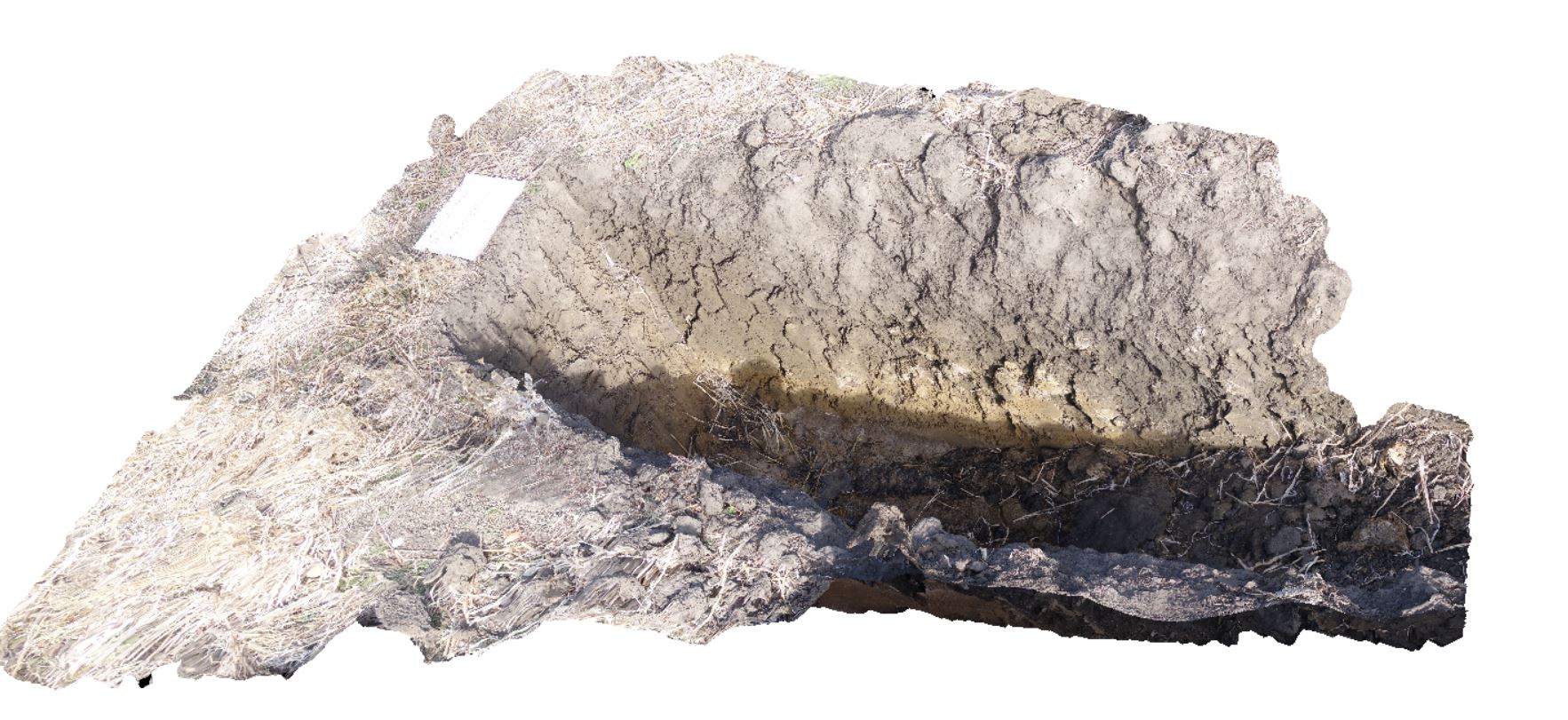
DaisyBanksPit2 Map
 |
20 |
03/17/2015 1:33 p.m. |
3D |
~80cm deep pit into soil and clays overlying quaternary alluvial deposits. Richmond, Tas. |
2.00 |
-42.73141700000 |
147.43138200000 |
-9999.000 |
clay, alluvium, regolith |
clay |
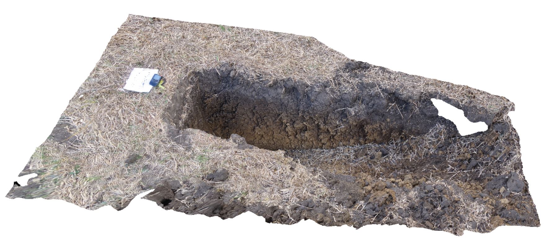
DaisyBanksPit3 Map
 |
20 |
03/17/2015 1:37 p.m. |
3D |
~80cm deep pit into soil and clays overlying Quaternary alluvial and marsh deposits of modern flood plains; of gravel, sand, silt and clay. Richmond, Tas. |
2.00 |
-42.73071600000 |
147.42842100000 |
-9999.000 |
clay, alluvium, regolith |
Clay |
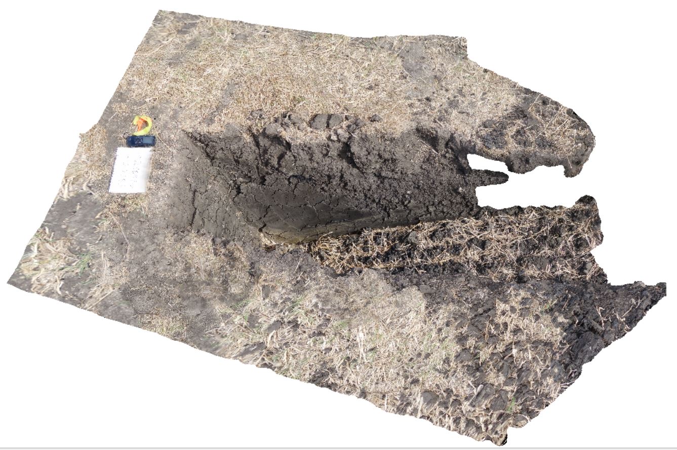
DaisyBanksPit4 Map
 |
20 |
03/17/2015 1:45 p.m. |
3D |
~80cm deep pit into soil and clays overlying Quaternary alluvial and marsh deposits of modern flood plains; of gravel, sand, silt and clay. Richmond, Tas. |
2.00 |
-42.73176200000 |
147.42817100000 |
-9999.000 |
Clay, alluvium, regolith |
Clay |
DaisyBanksPit5 Map
 |
20 |
03/17/2015 1:50 p.m. |
3D |
~80cm wide pit into recent sediments overlying Quaternary alluvial and marsh deposits of modern flood plains; of gravel, sand, silt and clay. Richmond, Tas. |
2.00 |
-42.73253700000 |
147.42790800000 |
-9999.000 |
palaeochannel, alluvial, regolith |
Gravel |
DaisyBanksPit6 Map
 |
20 |
03/17/2015 1:54 p.m. |
3D |
~80cm deep pit into soil and clays overlying Quaternary alluvial and marsh deposits of modern flood plains; of gravel, sand, silt and clay. Richmond, Tas. |
2.00 |
-42.73310300000 |
147.43077000000 |
-9999.000 |
clay, alluvial, regolith |
clay |
DaisyBanksPit7 Map
 |
20 |
03/17/2015 2 p.m. |
3D |
Undifferentiated alluvial soils and clays developed on Quaternary alluvial terrace gravel deposits predominantly derived from Parmeener and Palaeogene-Neogene units with clasts commonly of basalt and in places dolerite. Richmond, Tas. |
2.00 |
-42.73247900000 |
147.42657600000 |
-9999.000 |
clay, alluvial, regolith |
clay |
DaisyBanksPit8 Map
 |
20 |
03/17/2015 2:03 p.m. |
3D |
~80cm deep pit into soil and clays overlying Paleogene-Neogene silicified rock. Richmond, Tas. |
2.00 |
-42.73246200000 |
147.42641700000 |
-9999.000 |
clay, alluvial, regolith |
clay |
DaisyBanksPit9 Map
 |
20 |
03/17/2015 12:49 p.m. |
3D |
~80cm deep pit into soil and clays overlying late Cenozoic alluvial terrace deposits. Richmond, Tas. |
2.00 |
-42.72983600000 |
147.42554400000 |
-9999.000 |
clay, alluvial, regolith |
Clay |
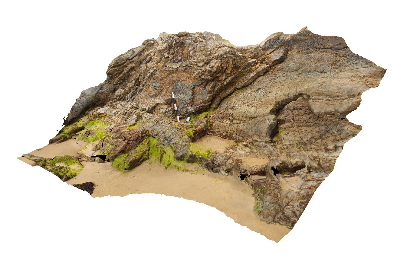
DarkBch1 Map
 |
5 |
07/08/2015 11:22 a.m. |
3D |
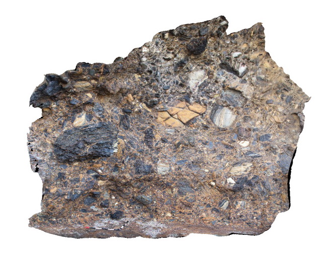
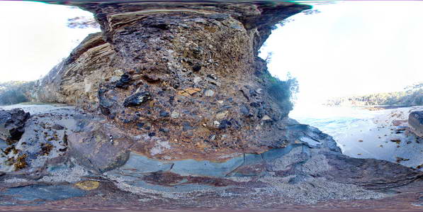
mega breccia in Permian Snapper Point Formation immediately above Permian unconformity. Dark Beach, N.S.W. |
4.00 |
-35.67775000000 |
150.30070000000 |
-9999.000 |
mega breccia, sedimentology |
breccia |
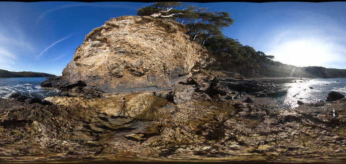
DarkBch2 Map
 |
5 |
07/08/2015 11:23 a.m. |
3D |
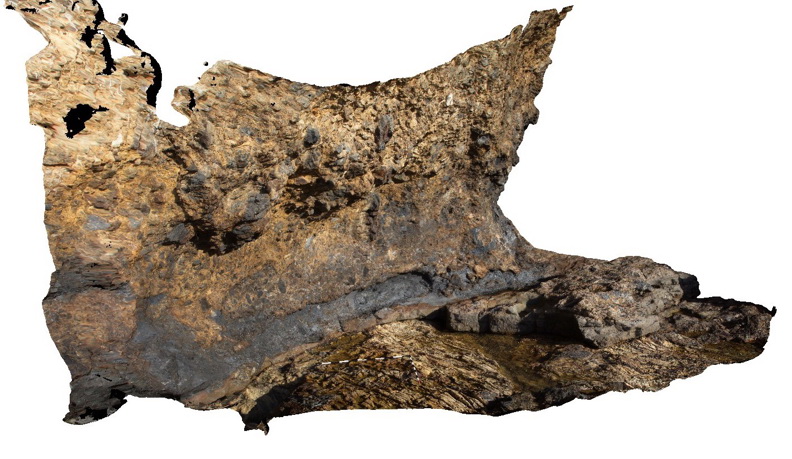
Basal Permian unconformity with sandstone and mega breccia/conglomerate of the Permian Snapper Point Formation overlying steeply dipping fine grained meta sandstones of the Cambrian-Silurian Wagonga Group. Dark Beach, N.S.W. |
5.00 |
-35.67947000000 |
150.30000000000 |
1.000 |
breccia, conglomerate, sandstone, unconformity, sedimentology, structure |
breccia, sandstone |
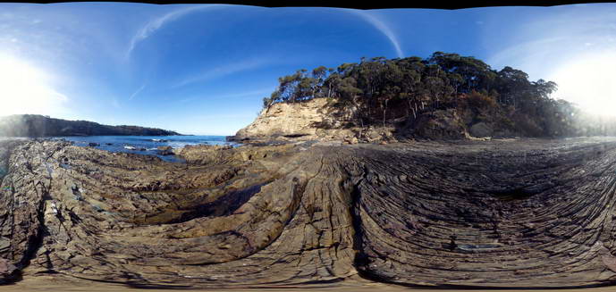
DarkBch3 Map
 |
5 |
07/08/2015 11:24 a.m. |
3D |
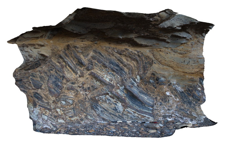
Top of 'mega breccia' layer showing clasts up to 2m in diameter overlain by cross bedded sandstone. Dark Beach, N.S.W. |
8.00 |
-35.68077000000 |
150.30096000000 |
1.000 |
sandstone, mega breccia, sedimentology, cross bedding |
breccia, sandstone |
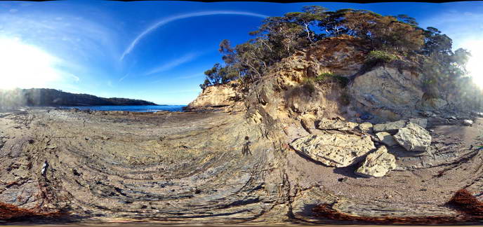
DarkBch4 Map
 |
5 |
07/08/2015 11:25 a.m. |
3D |
top of 'mega breccia' layer near the base of the Permian Snapper Point Formation. Clasts of low grade metasediments up to 1.2m in diameter. Dark Beach, N.S.W. |
4.00 |
-35.68075000000 |
150.30080000000 |
1.000 |
breccia, sandstone, sedimentology |
breccia |
DarkBchFSP1 Map
 |
5 |
08/27/2015 1:01 p.m. |
FSP |
mega breccia in Permian Snapper Point Formation immediately above the basal Permian unconformity. Poor image - very high contrast. Dark Beach, N.S.W. |
50.00 |
-35.67775000000 |
150.30070000000 |
0.000 |
mega breccia, sedimentology |
breccia |
DarkBchFSP2 Map
 |
5 |
08/27/2015 2:20 p.m. |
FSP |
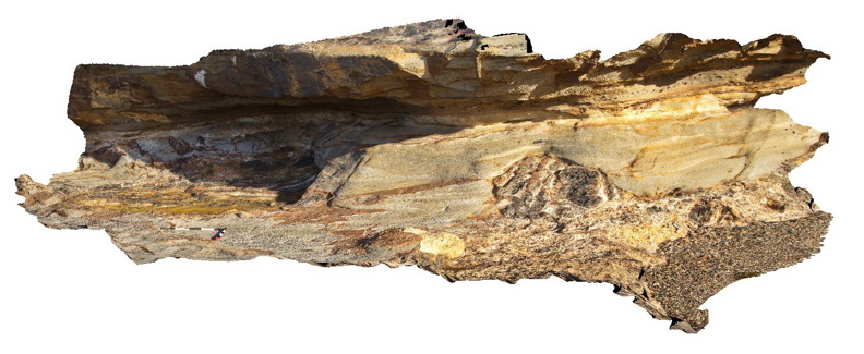
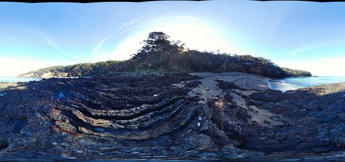
View of steeply dipping metasediments of the Cambro-Silurian Wagonga Group with flat-lying sandstone and breccia of the Permian Snapper Point Formation in the background. Unconformity is obscured by grass and talus. Dark Beach, N.S.W. |
50.00 |
-35.67807000000 |
150.30016000000 |
0.000 |
unconformity, structure, sedimentology |
breccia, sandstone |
DarkBchFSP3 Map
 |
5 |
08/27/2015 2:20 p.m. |
FSP |
View of steeply dipping metasediments of the Cambro-Silurian Wagonga Group with flat-lying sandstone and breccia of the Permian Snapper Point Formation in the background. Unconformity is obscured by grass and talus. Dark Beach, N.S.W. |
50.00 |
-35.67817000000 |
150.30003000000 |
1.000 |
unconformity, sedimentology, structure |
breccia, sandstone |
DarkBchFSP4 Map
 |
5 |
08/27/2015 2:20 p.m. |
FSP |
View of steeply dipping metasediments of the Cambro-Silurian Wagonga Group with flat-lying sandstone and breccia of the Permian Snapper Point Formation in the background. Dark Beach, N.S.W. |
50.00 |
-35.67945000000 |
150.29971000000 |
0.000 |
unconformity, structure, sedimentology |
sandstone, breccia |
DarkBchFSP5 Map
 |
5 |
08/27/2015 2:20 p.m. |
FSP |
View of steeply dipping metasediments of the Cambro-Silurian Wagonga Group with flat-lying sandstone and breccia of the Permian Snapper Point Formation in the background. Dark Beach, N.S.W. |
50.00 |
-35.67946000000 |
150.29959900000 |
1.000 |
unconformity, structure, sedimentology |
sandstone, breccia |
DarkBchFSP6 Map
 |
5 |
08/27/2015 2:20 p.m. |
FSP |
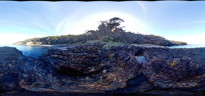
Exposed unconformity between steeply dipping metasediments of the Cambro-Silurian Wagonga Group with flat-lying sandstone and breccia of the Permian Snapper Point Formation. Dark Beach, N.S.W. |
50.00 |
-35.67953000000 |
150.30003000000 |
0.000 |
unconformity, structure, sedimentology |
sandstone, breccia |
DavisBeach 1 Map
 |
5 |
01/01/9999 midnight |
3D |
faulted Mallacoota Beds. Mallacoota, Vic. |
3.00 |
-37.58055600000 |
149.74636600000 |
-9999.000 |
fault, structure |
turbidite |
DavisBeach2 Map
 |
5 |
01/01/9999 midnight |
3D |
folded Mallacoota Beds. Mallacoota, Vic. |
3.50 |
-37.57783700000 |
149.75242500000 |
-9999.000 |
fold, turbidite |
turbidite |