Corny1 Map
 |
0 |
04/18/2016 8:32 a.m. |
3D |
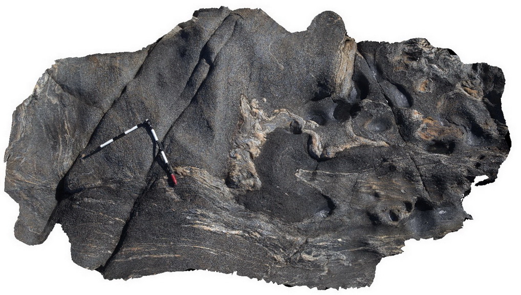
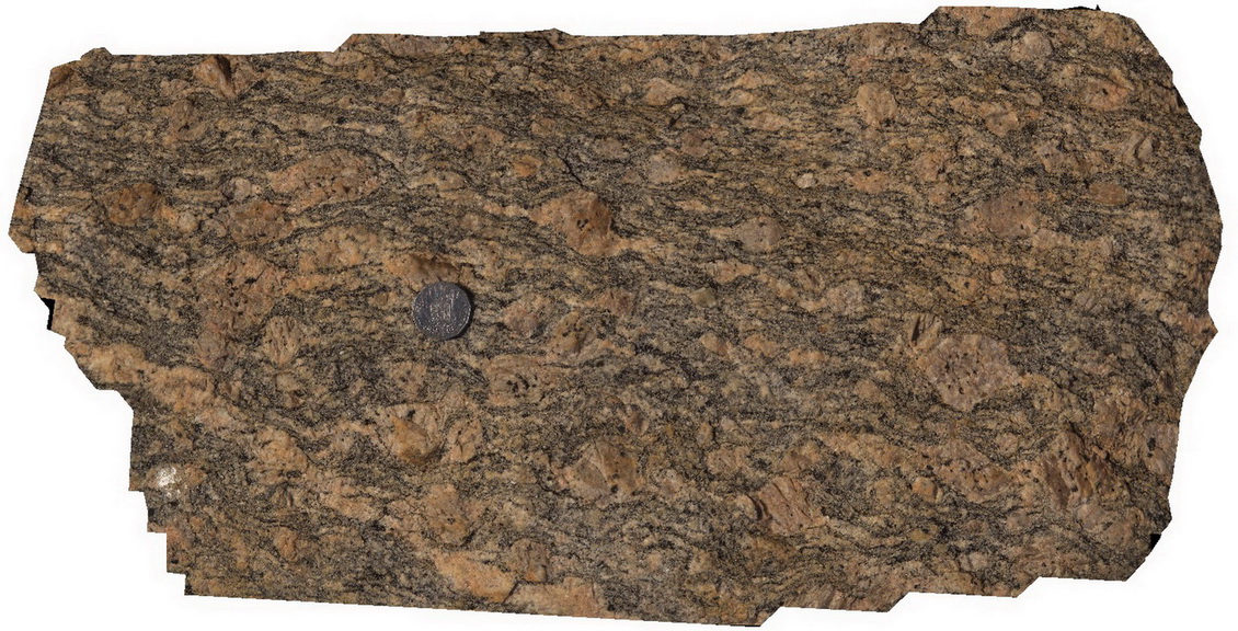
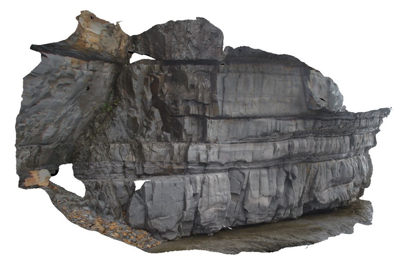
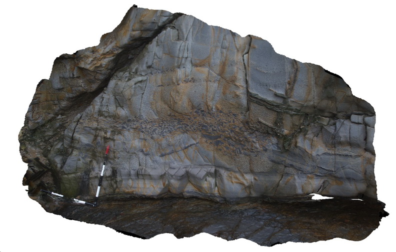
folded mafic zone - possibly amphibolite - in Bi gneiss, Corny Point. S.A. |
3.50 |
-34.89582000000 |
137.01161000000 |
-9999.000 |
Bi gneiss, folding, metamorphic |
gneiss |
Corny2 Map
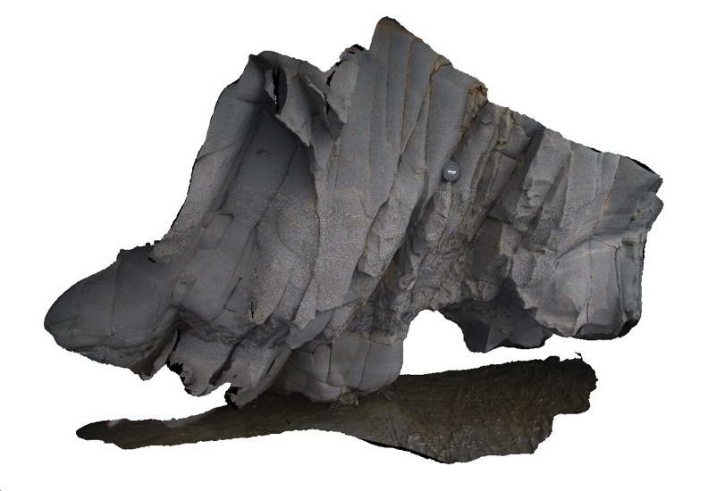
 |
0 |
11/17/2015 12:21 p.m. |
3D |
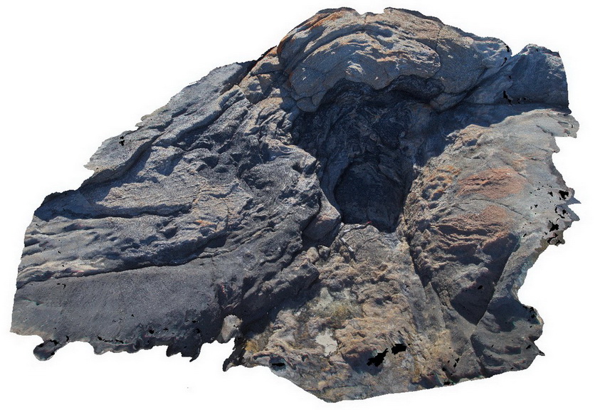
folded amphibolite gneiss, Point Corny. S.A. |
5.00 |
-34.89558000000 |
137.01118000000 |
-9999.000 |
gneiss, metamorphic, fold, structure |
gneiss |
Corny3 Map
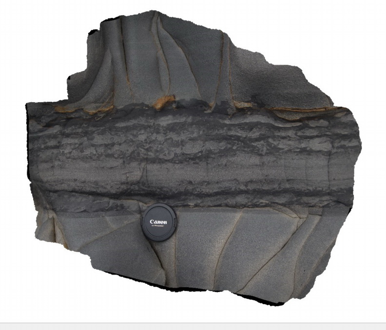
 |
0 |
11/17/2015 12:22 p.m. |
3D |
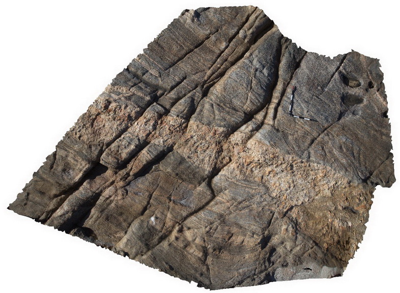
folding in layered gneissic rocks. Point Corny. S.A. |
2.00 |
-34.89569000000 |
137.01074000000 |
-9999.000 |
gneiss, metamorphic, folding |
gneiss |
Corny4 Map
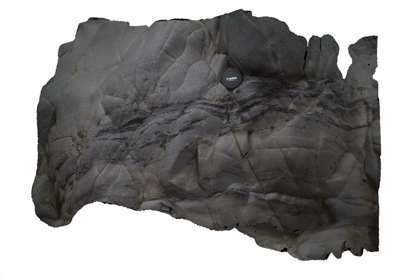
 |
0 |
11/17/2015 12:22 p.m. |
3D |
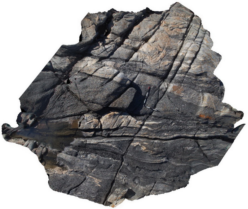
pegmatitic dyke cross cutting gneiss. Point Corny. S.A. |
4.00 |
-34.89557000000 |
137.00977000000 |
-9999.000 |
pegmatite dyke, gneiss, intrusive contact |
gneiss, pegmatite |
Corny5 Map
 |
0 |
11/17/2015 12:23 p.m. |
3D |
view of the fabric of folded Augen gneiss. Point Corny. S.A. |
0.50 |
-34.92128000000 |
137.01132000000 |
-9999.000 |
augen gneiss, metamorphic |
augen gneiss |
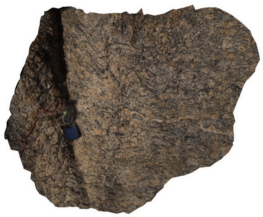
Corny6 Map
 |
0 |
02/12/2016 11:37 a.m. |
3D |
rotated augens in augen gneiss. Point Corny. S.A. |
0.40 |
-34.92134000000 |
137.01105000000 |
-9999.000 |
augen gneiss, augen |
augen gneiss |
Corny7 Map
 |
0 |
11/17/2015 12:24 p.m. |
3D |
detail of rotated augens in augen gneiss. Point Corny. S.A. |
0.15 |
-34.92134000000 |
137.01105000000 |
-9999.000 |
rotated augen, gneiss |
augen gneiss |
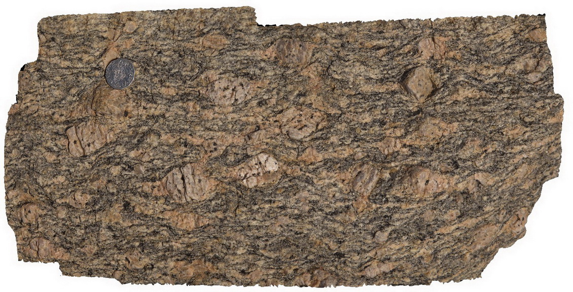
Corny8 Map
 |
0 |
11/17/2015 12:24 p.m. |
3D |
detail of augen in augen gneiss. Point Corny. S.A. |
0.30 |
-34.92155000000 |
137.01103000000 |
-9999.000 |
augen gneiss, metamorphic |
augen gneiss |
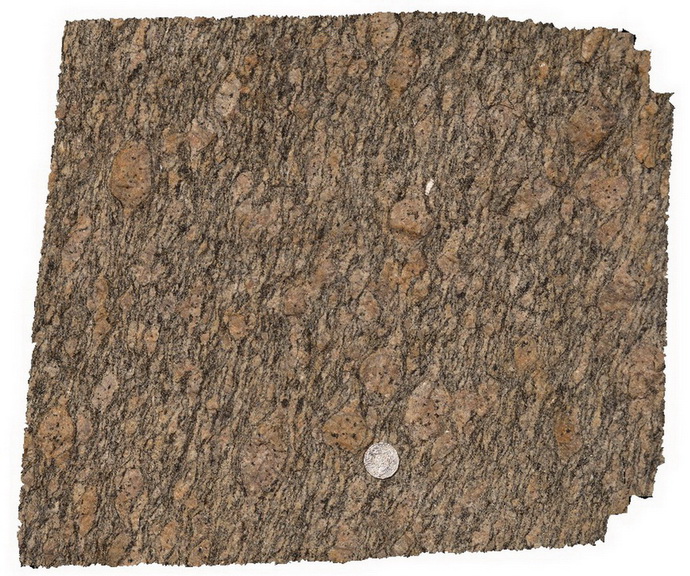
Corny9 Map
 |
0 |
11/17/2015 12:25 p.m. |
3D |
detail of feldspar augens in gneiss with wings. Point Corny. S.A. |
0.30 |
-34.92136000000 |
137.01102000000 |
-9999.000 |
augen, gneiss, structure |
augen gneiss |
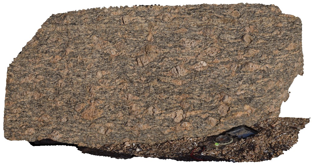
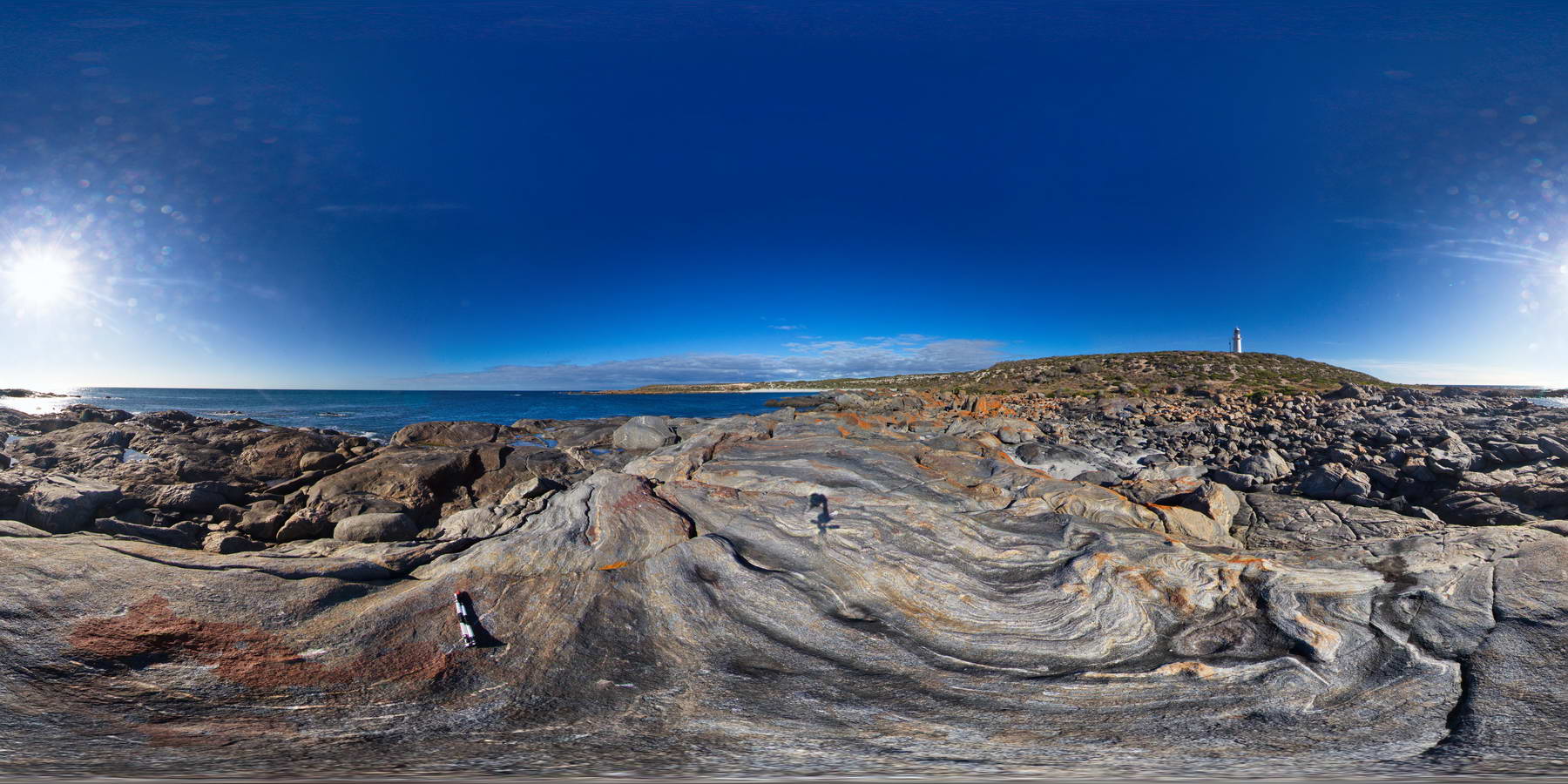
CornyFSP1 Map
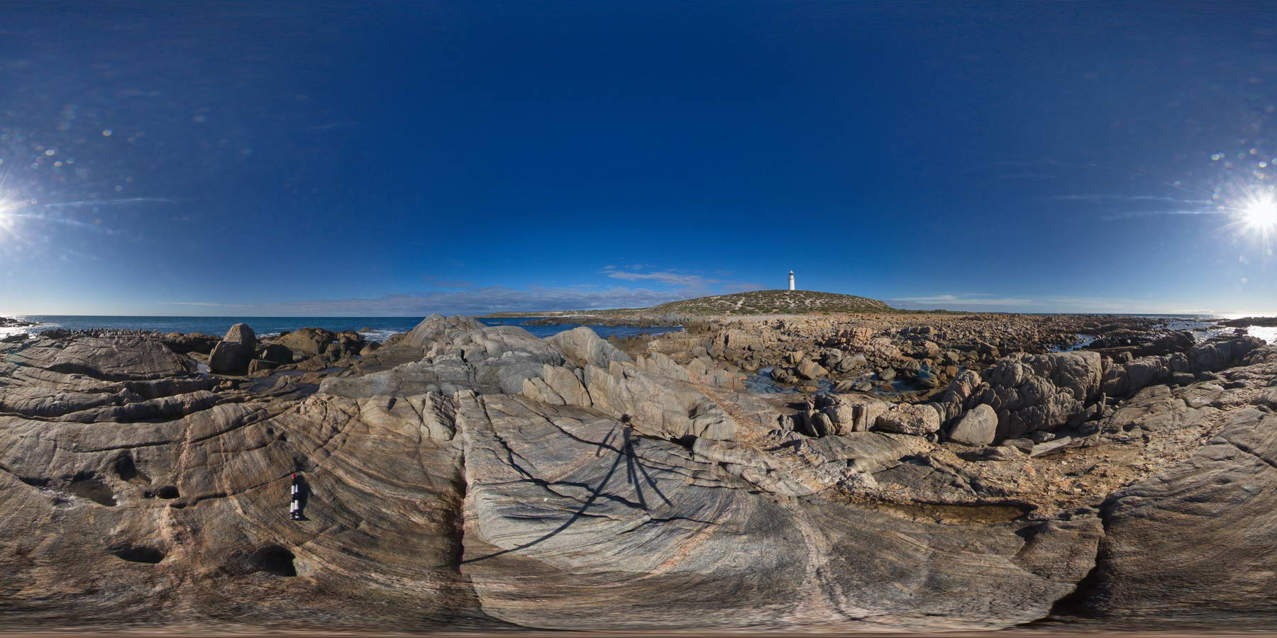 |
0 |
01/27/2016 11:33 a.m. |
FSP |
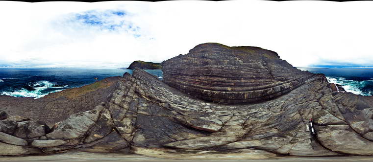
shoreline outcrop showing banded gneiss intruded by pegmatitic dyke. Point Corny. S.A. |
2000.00 |
-34.89556000000 |
137.00983000000 |
-9999.000 |
pegmatitic dyke, intrusive contact, gneiss, metamorphic |
gneiss, pegmatite |
CornyFSP2 Map
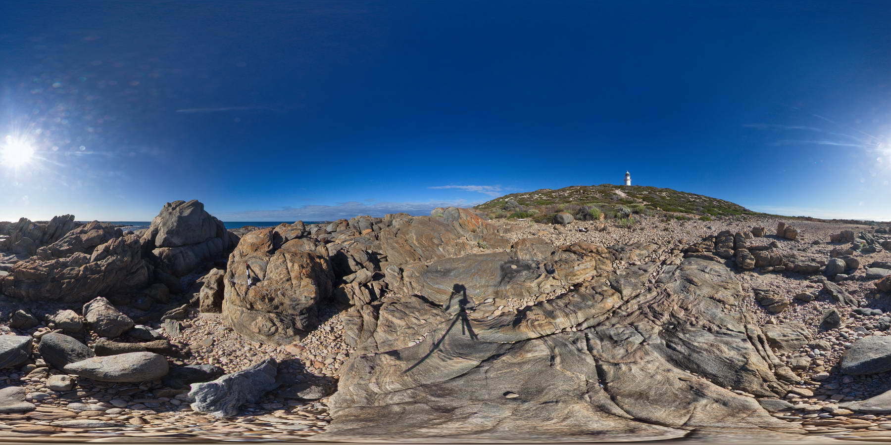 |
0 |
01/27/2016 11:40 a.m. |
FSP |
shoreline exposure of banded and folded gneiss. Point Corny. S.A. |
500.00 |
-34.89585000000 |
137.01038000000 |
-9999.000 |
folded, gneiss, metamorphic |
gneiss |
CornyFSP3 Map
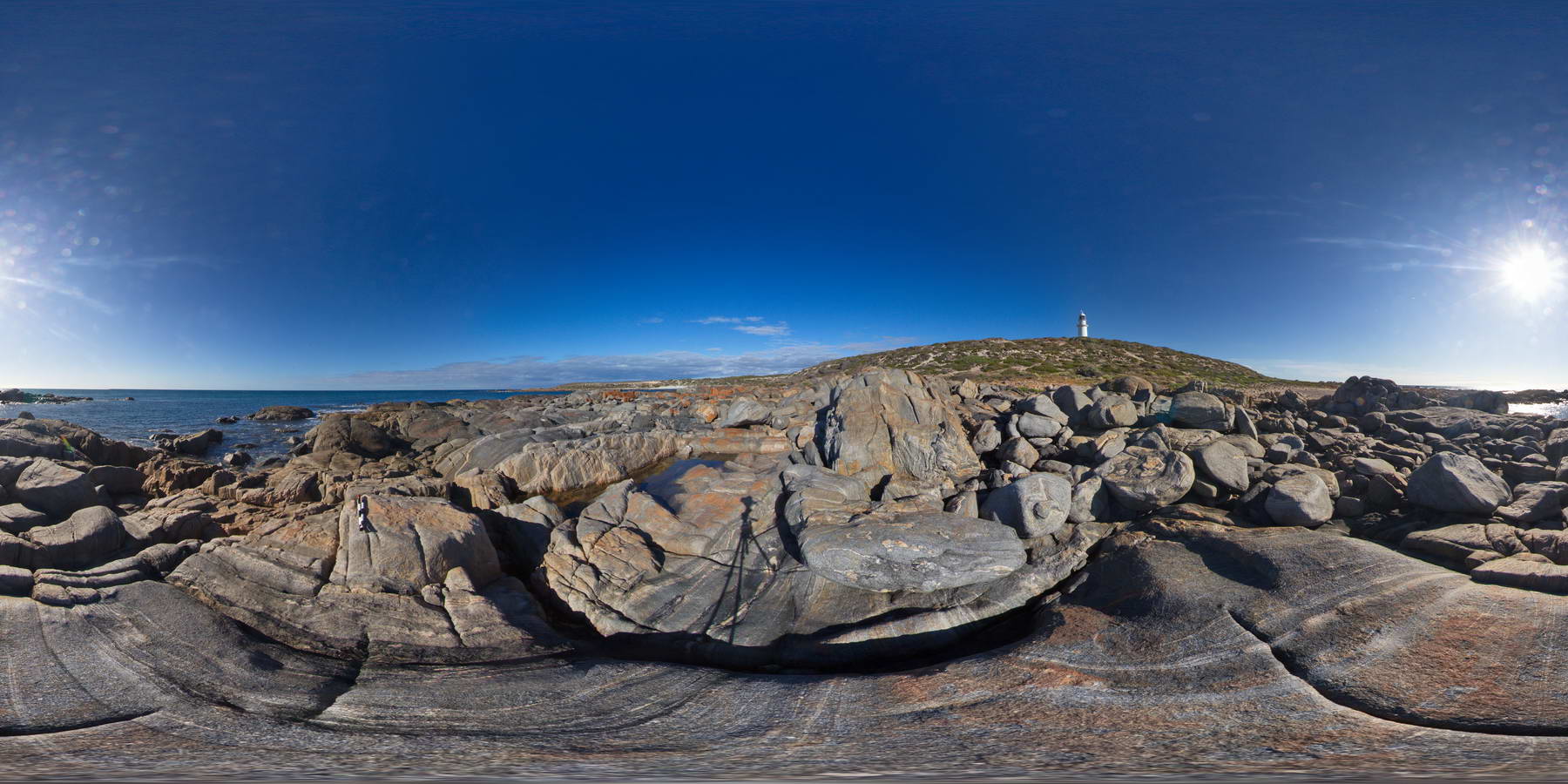 |
0 |
01/27/2016 11:41 a.m. |
FSP |
shoreline outcrop, showing boulders of banded and folded gneiss. Point Corny. S.A. |
2000.00 |
-34.89571000000 |
137.01054000000 |
-9999.000 |
banded gneiss, folded, metamorphic |
gneiss |
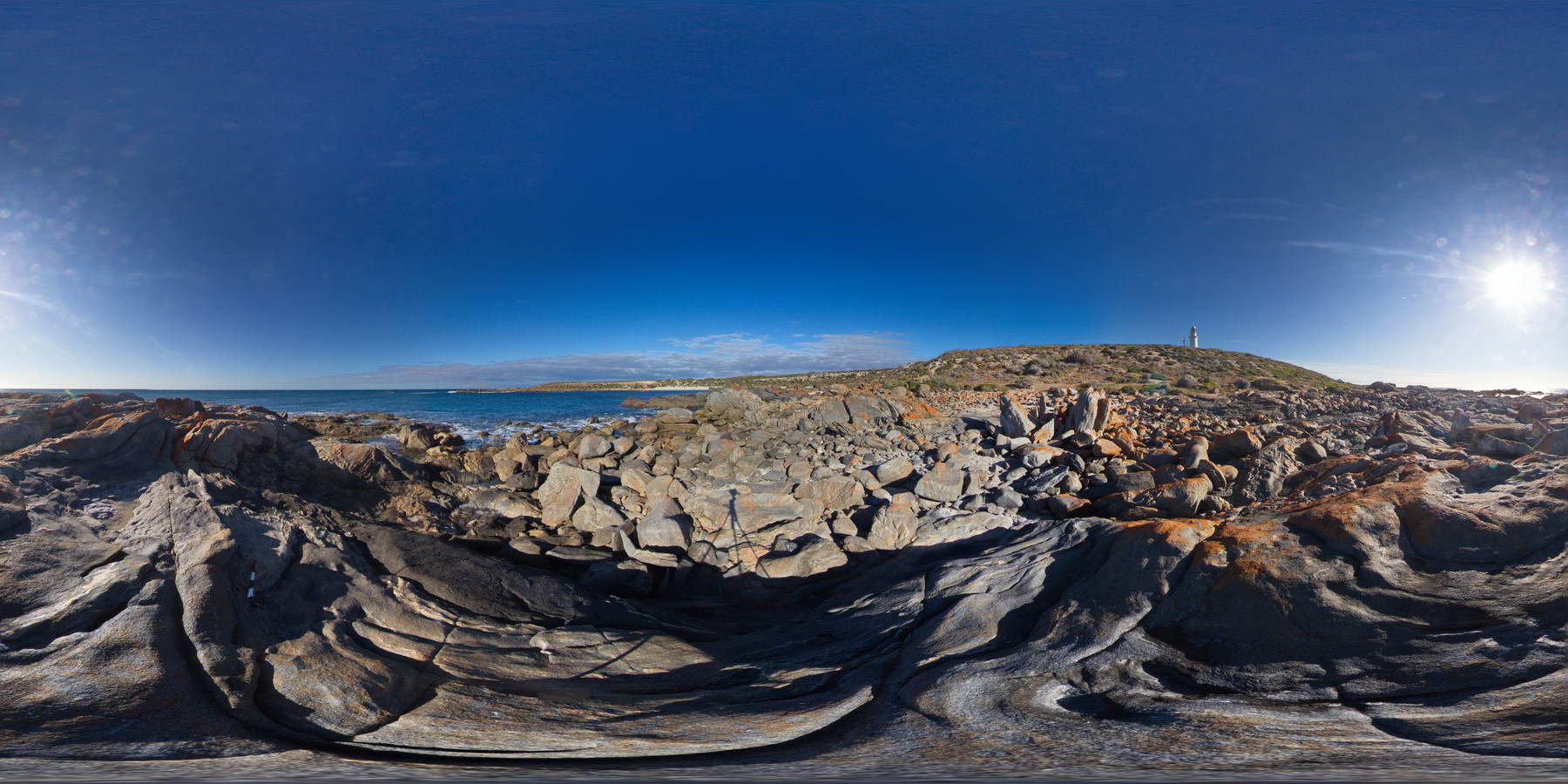
CornyFSP4 Map
 |
0 |
01/27/2016 11:41 a.m. |
FSP |
shoreline outcrop of banded and folded Bi-rich gneiss. Point Corny. S.A. |
2000.00 |
-34.89566000000 |
137.01076000000 |
-9999.000 |
banded gneiss, folded, gneiss, metamorphic |
gneiss |
CornyFSP5 Map
 |
0 |
01/27/2016 11:41 a.m. |
FSP |
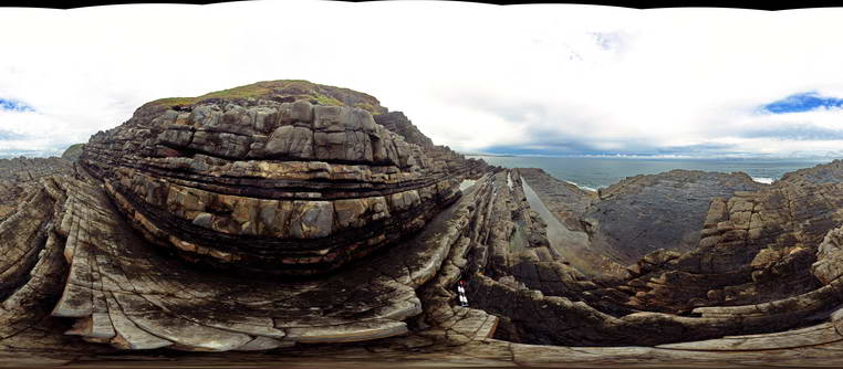
shoreline outcrop showing folded banded gneiss. Point Corny. S.A. |
2000.00 |
-34.89554000000 |
137.01094000000 |
-9999.000 |
banded gneiss, folded, metamorphic |
gneiss |
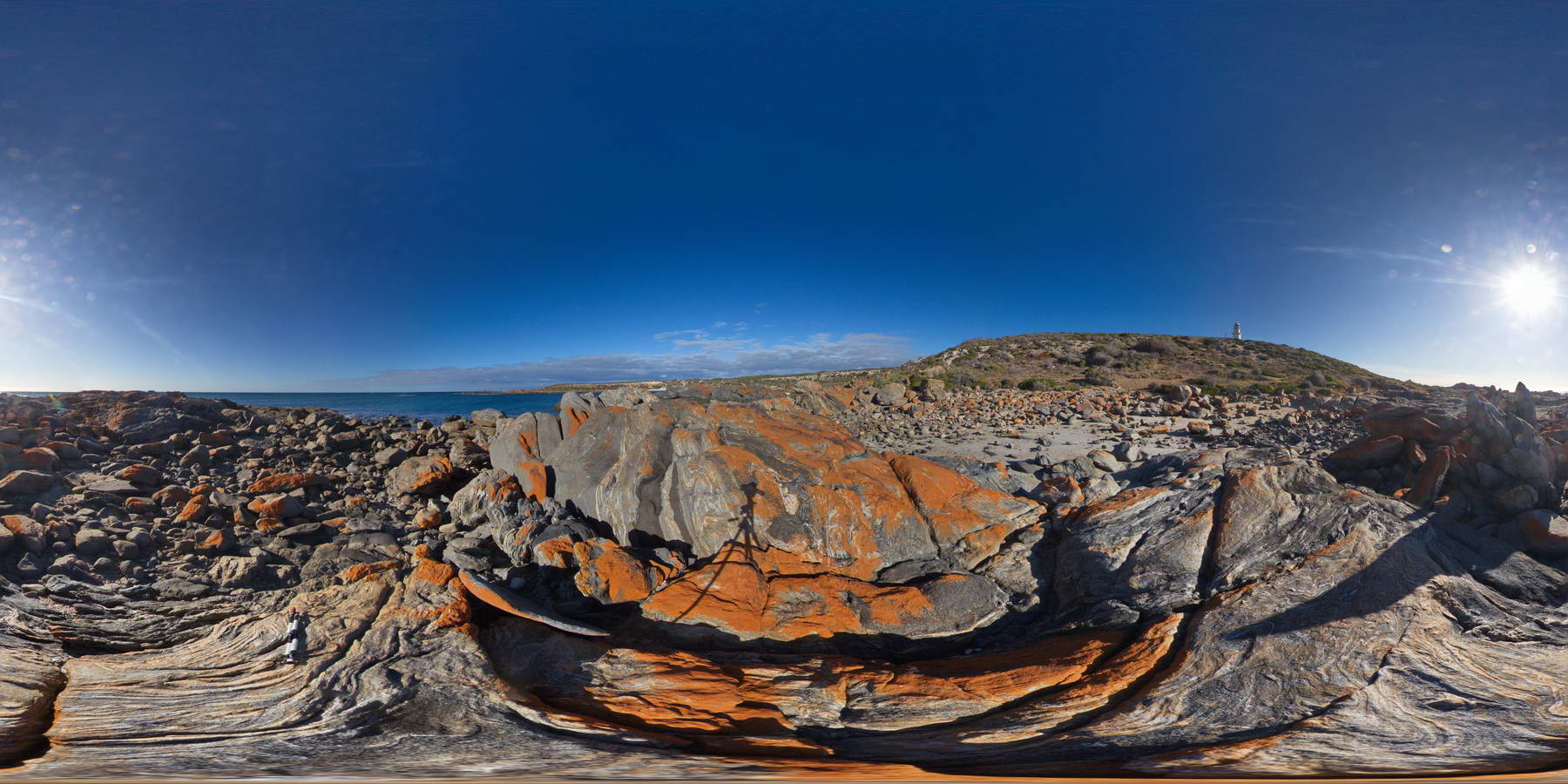
CornyFSP6 Map
 |
0 |
01/27/2016 11:41 a.m. |
FSP |
shoreline outcrop showing mafic zones within banded and folded Bi-gneiss. Point Corny. S.A. |
2000.00 |
-34.89562000000 |
137.01114000000 |
-9999.000 |
gneiss, metamorphic, folded |
gneiss |
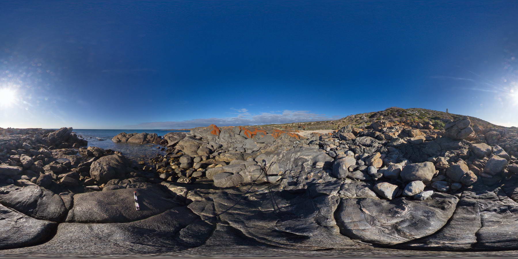
CornyFSP7 Map
 |
0 |
01/27/2016 11:41 a.m. |
FSP |
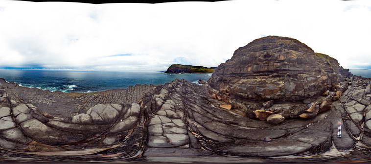
shoreline exposure, showing folded mafic / amphibolite bands in gneiss. Point Corny. S.A. |
2000.00 |
-34.89573000000 |
137.01125000000 |
-9999.000 |
gneiss, folded, metamorphic |
gneiss |
CornyFSP8 Map
 |
0 |
01/27/2016 12:25 p.m. |
FSP |
shoreline outcrop of folded and banded Bi rich gneiss. Point Corny. S.A. |
200.00 |
-34.89577000000 |
137.01157000000 |
-9999.000 |
gneiss, metamorphic, folded, structure |
gneiss |
Crescent1 Map
 |
5 |
07/08/2015 10:29 a.m. |
3D |
Layered sandstone with erosional basal contacts and silty beds with bioturbation - Permian Crescent head Formation. Crescent Head, N.S.W. |
10.00 |
-31.18672000000 |
152.98387000000 |
4.000 |
sandstone, sedimentology, siltstone, bioturbation |
sandstone, siltstone |
Crescent2 Map
 |
5 |
08/03/2015 12:56 p.m. |
3D |
Detail of deeply incised channel filled with coarse grained sandstone and mudstone rip-up clasts. Crescent Head, N.S.W. |
2.00 |
-31.18672000000 |
152.98387000000 |
8.000 |
sandstone, channel, rip-up clasts, sedimentology |
sandstone |
Crescent3 Map
 |
5 |
07/08/2015 10:30 a.m. |
3D |
Detail of fine sandstone/siltstone layer showing bioturbation. Crescent Head, N.S.W. |
0.70 |
-31.18672000000 |
152.98387000000 |
8.000 |
sandstone, bioturbation, sedimentology, palaeontology, fossil |
sandstone |
Crescent4 Map
 |
5 |
08/03/2015 1:40 p.m. |
3D |
Detail of mudstone rip up clasts in sand stone of the Permian Crescent Head Formation. Crescent Head, N.S.W. |
1.50 |
-31.18672000000 |
152.98387000000 |
8.000 |
sandstone, rip-up clasts, sedimentology |
sandstone |
Crescent5 Map
 |
5 |
10/15/2015 2:12 p.m. |
3D |
Coarse grained sandstone channel with mudstone rip up clasts eroded into fine grained sandstone. Crescent Head, N.S.W. |
4.00 |
-31.18688000000 |
152.98389000000 |
8.000 |
sandstone, rip-up clasts, sedimentology |
sandstone |
CrescentFSP1 Map
 |
5 |
08/27/2015 11:07 a.m. |
FSP |
View of dipping sandstone layers in the Permian Crescent Head Formation. Crescent Head, N.S.W. |
50.00 |
-31.18674000000 |
152.98433000000 |
-9999.000 |
bedding, sedimentology |
sandstone |
CrescentFSP2 Map
 |
5 |
08/27/2015 10:17 a.m. |
FSP |
View of dipping sandstone layers in the Permian Crescent Head Formation. Crescent Head, N.S.W. |
50.00 |
-31.18674000000 |
152.98431000000 |
5.000 |
bedding, sedimentology |
sandstone |
CrescentFSP3 Map
 |
5 |
08/27/2015 10:21 a.m. |
FSP |
View of dipping sandstone layers in the Permian Crescent Head Formation. Crescent Head, N.S.W. |
50.00 |
-31.18684000000 |
152.98419000000 |
6.000 |
bedding, sedimentology |
sandstone |