DixonRange3 Map
 |
0 |
06/14/2016 noon |
3D |
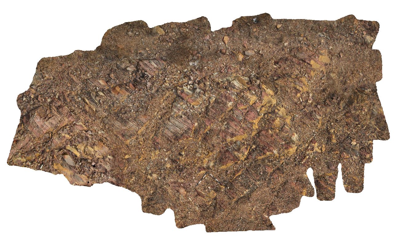
tightly folded, finely layered marble and calc-silicate rocks, near road to Dixon Range, north W.A. |
1.10 |
-17.22526000000 |
128.22598000000 |
-9999.000 |
marble, calc-silicate, tight fold, fold, structure, metamorphic |
calc-silicate |
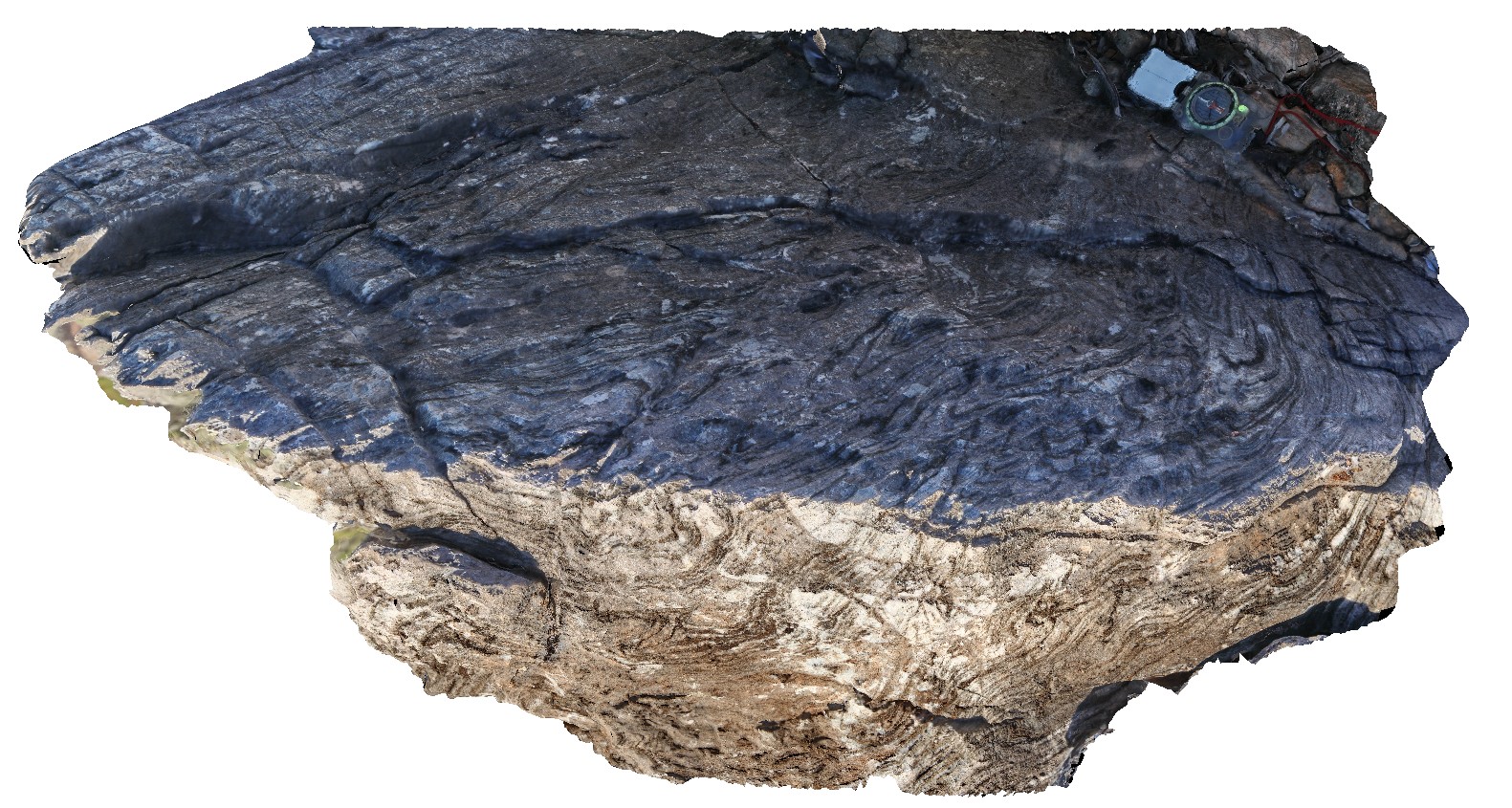
DixonRange4 Map
 |
0 |
06/14/2016 noon |
3D |
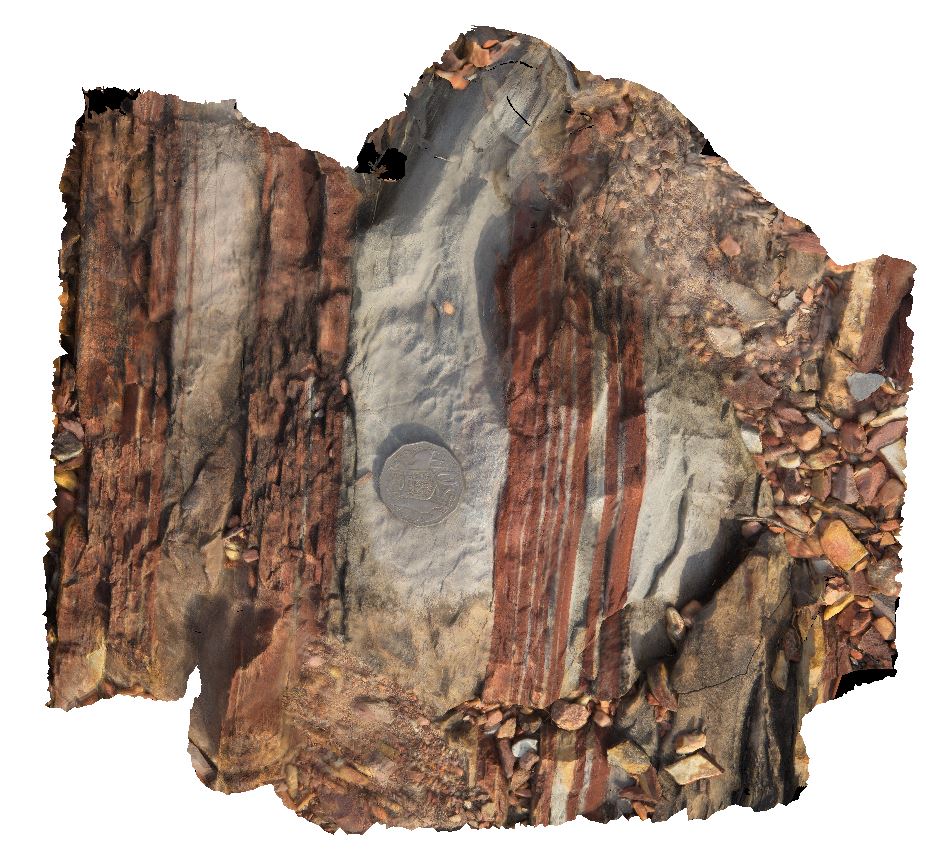
folded marble and calc-silicate showing 2 generations of tight to isoclinal folding. Hill above road to Dixon Range. North W.A. |
1.00 |
-17.22567000000 |
128.25273000000 |
-9999.000 |
calc-silicate, marble, fold, structure, metamorphic |
calc-silicate |
DixonRange5 Map
 |
0 |
06/14/2016 noon |
3D |
view of weathering surface of isoclinal folded thin calc-silicate layers in marble. Hill above road to Dixon Range. North W.A. |
0.30 |
-17.22566000000 |
128.25275000000 |
-9999.000 |
calc-silicate, marble, fold, isoclinal fold, metamorphic, structure |
calc-silicate |
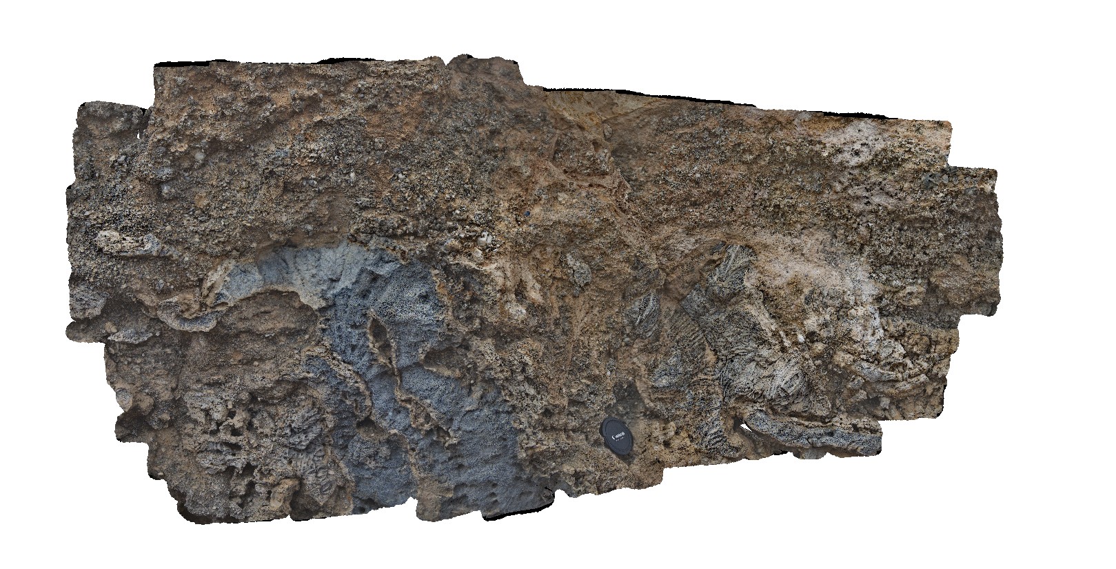
DixonRange6 Map
 |
0 |
06/14/2016 noon |
3D |
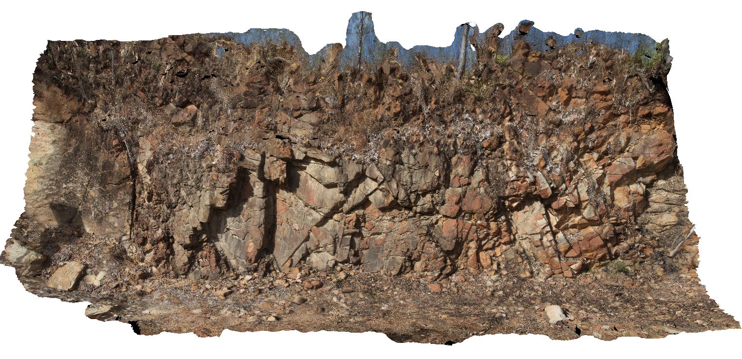
small thrust fault in competent calc-silicate layer of folded marble and calc-silicate interbeds. Hill above road to Dixon Range. North W.A. |
1.10 |
-17.22675000000 |
128.25240000000 |
-9999.000 |
thrust fault, fault, calc-silicate, marble, structure |
calc-silicate |
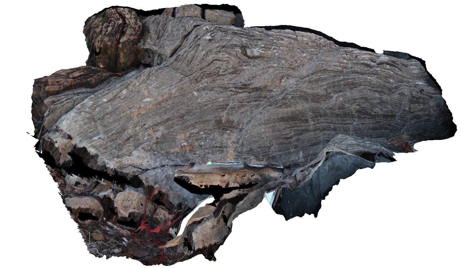
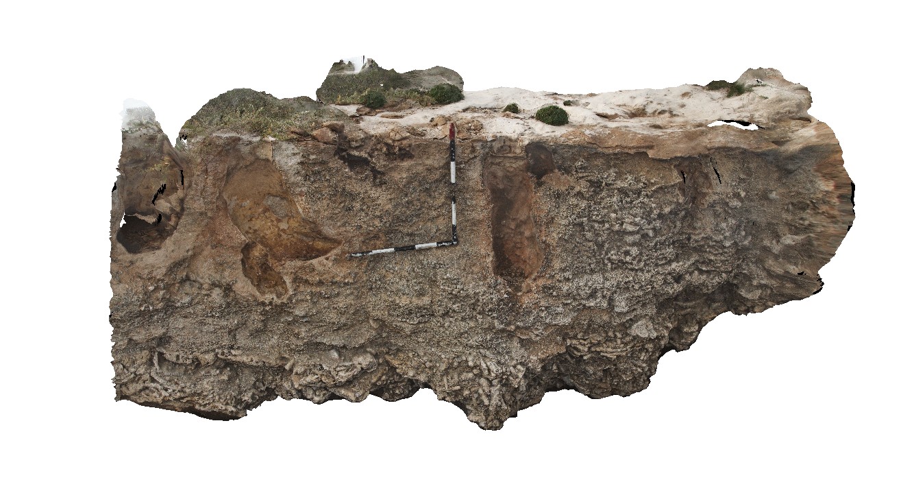
DixonRange7 Map
 |
0 |
06/14/2016 noon |
3D |
2 generations of folding in finely layered marble and calc-silicate. Hill above road to Dixon Range. North W.A. |
1.00 |
-17.22697000000 |
128.25227000000 |
-9999.000 |
marble, calc-silicate, fold, isoclinal fold, structure |
marble |
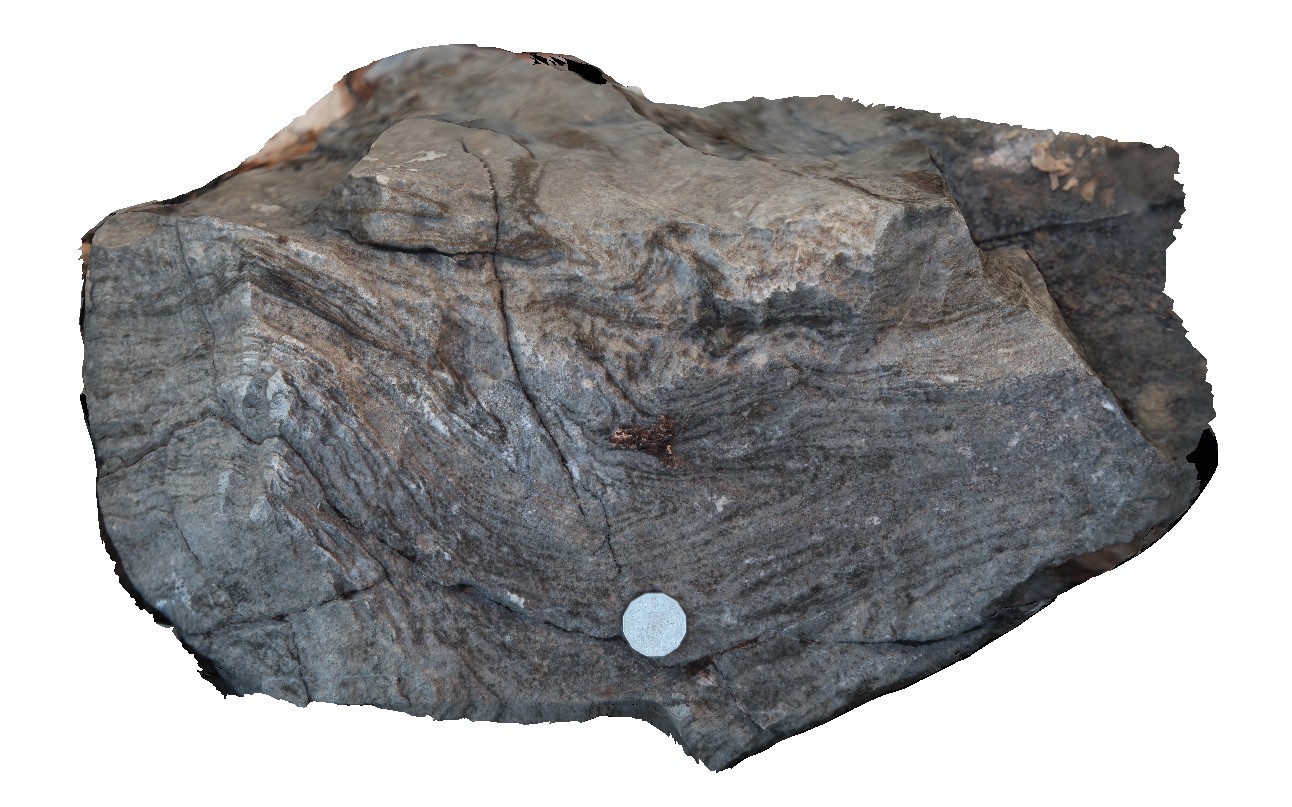
DixonRange8 Map
 |
0 |
06/14/2016 noon |
3D |
view of 2 generations of folds in interlayered marble and sandstone. Folds are open to tight. Hill above road to Dixon Range. North W.A. |
0.80 |
-17.22692000000 |
128.25224000000 |
-9999.000 |
folds, structure, refolded fold |
marble |
DixonRange9 Map
 |
0 |
06/14/2016 noon |
3D |
two fold hinges exposed in marble float. Hill above road to Dixon Range. North W.A. |
0.60 |
-17.22692000000 |
128.25224000000 |
-9999.000 |
fold hinge, fold, marble, metamorphic, structure |
marble |
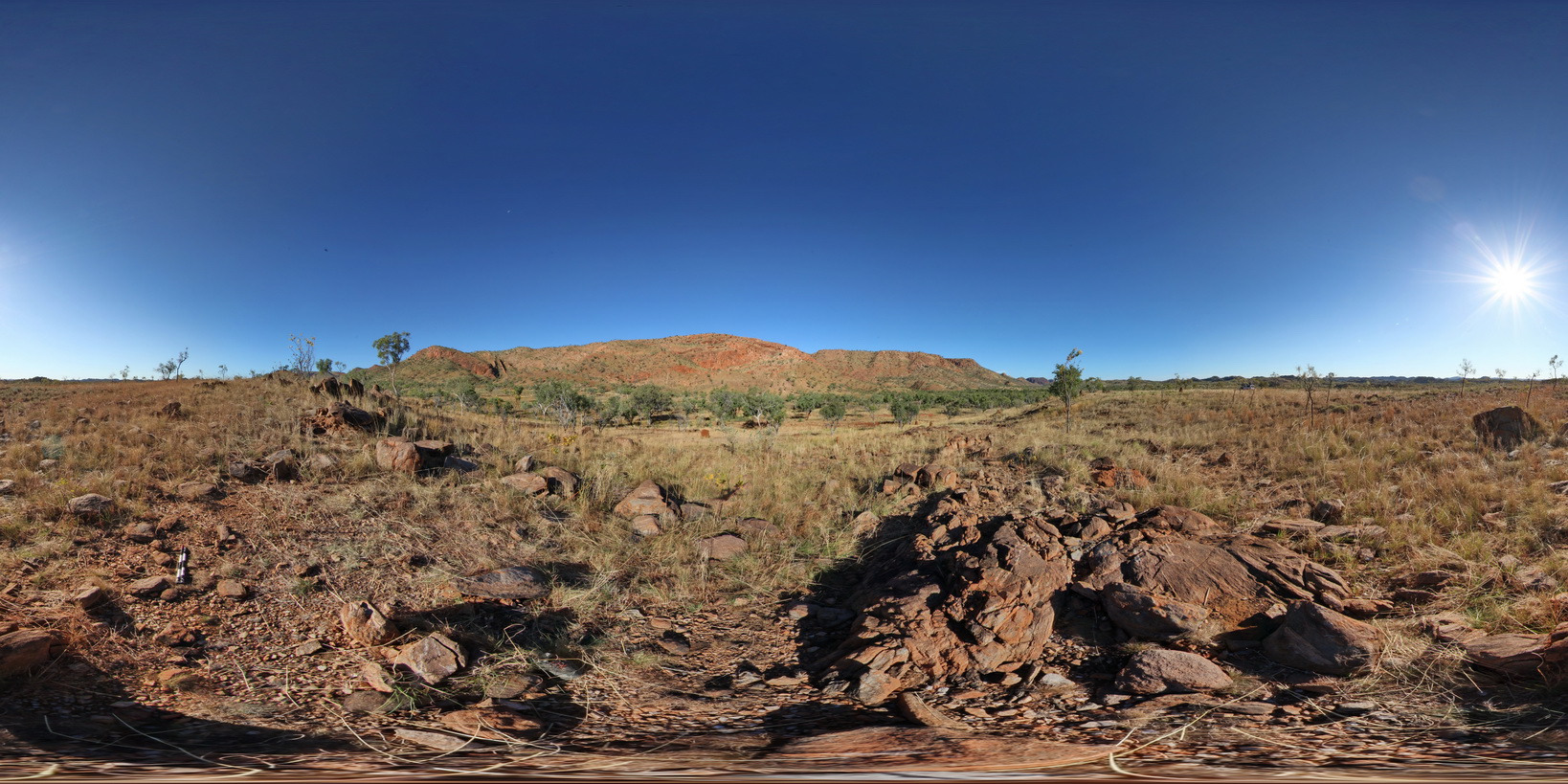
DixonRangeFSP1 Map
 |
0 |
06/14/2016 noon |
FSP |
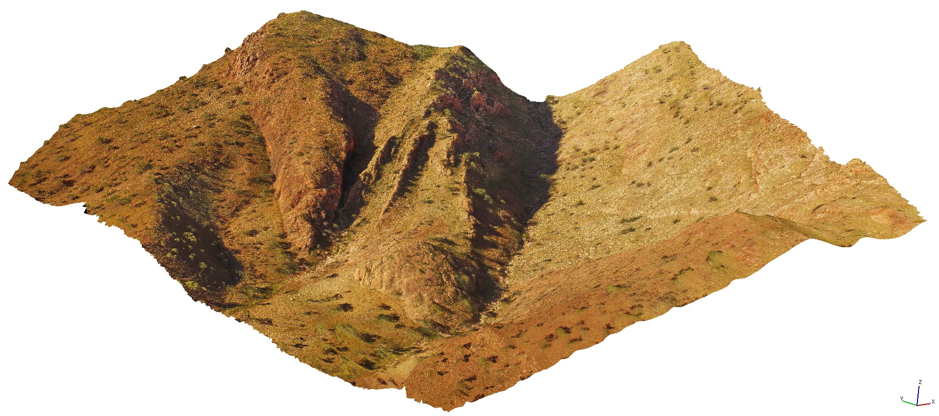
view of steep faults in metasediments / fault block terrane. Road Dixon Range, W.A. |
2000.00 |
-17.17853000000 |
128.24756000000 |
-9999.000 |
fault terrane, steep fault, metasediment, structure |
metasediment |
DixonRangeFSP2 Map
 |
0 |
06/14/2016 noon |
FSP |
view of fault-block terrane showing blocks of metasediment. Dixon Range road. Dixon Range, W.A. |
2000.00 |
-17.18634000000 |
128.24443000000 |
-9999.000 |
fault terrane, structure, fault, metasediment |
metasediment |
DixonRangeFSP3 Map
 |
0 |
06/14/2016 noon |
FSP |
view of fault-block terrane showing blocks of metasediment. Dixon Range road. Dixon Range, W.A. |
2000.00 |
-17.19481000000 |
128.24078000000 |
-9999.000 |
metasediments, fault block terrane, structure, fault |
metasediment |
DixonRangeFSP4 Map
 |
0 |
06/14/2016 noon |
FSP |
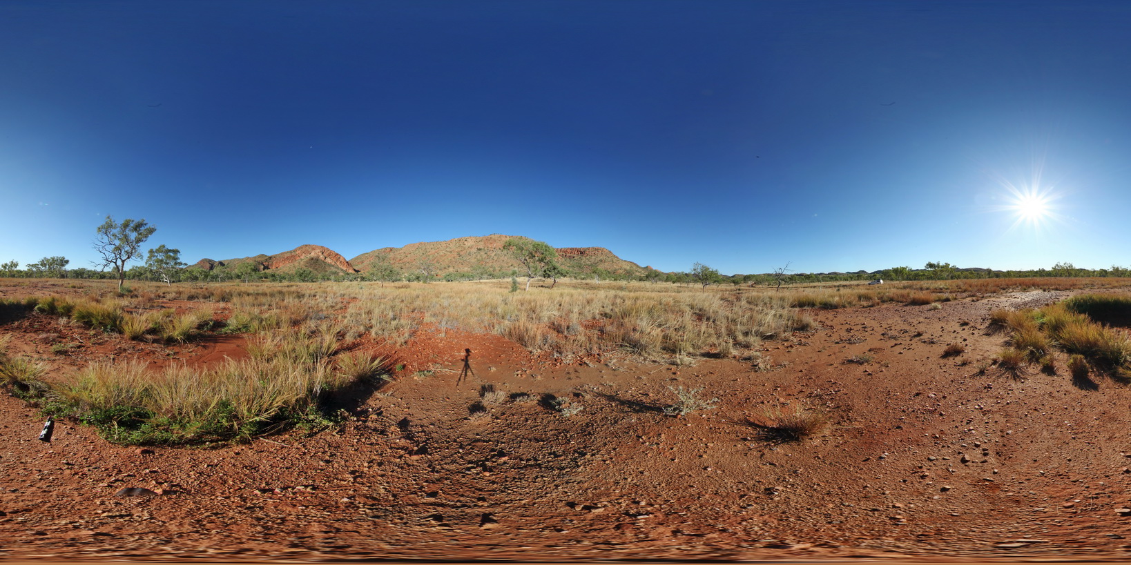
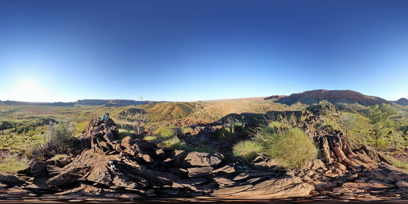
360 degree view of fault block terrane, showing hills and ridges of metasediments and flat, recessed plane of metamorphics below. Road to Dixon Range, north W.A. |
2000.00 |
-17.21462000000 |
128.23607000000 |
-9999.000 |
fault block terrane, fault, metasediments, structure, weathering landscape |
metasediments, metasediment |
DixonRangeFSP5 Map
 |
0 |
06/14/2016 noon |
FSP |
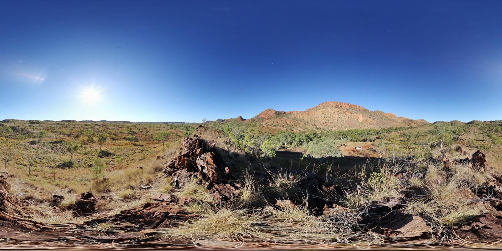
360 degree view of surrounding metasediment hills of the Red Rock Formation. Road to Dixon Range, north W.A. |
2000.00 |
-17.21930000000 |
128.24271000000 |
-9999.000 |
metasediment, fault terrane, metamorphic, fault, structure |
metasediment |
DixonRangeFSP6 Map
 |
0 |
06/14/2016 noon |
FSP |
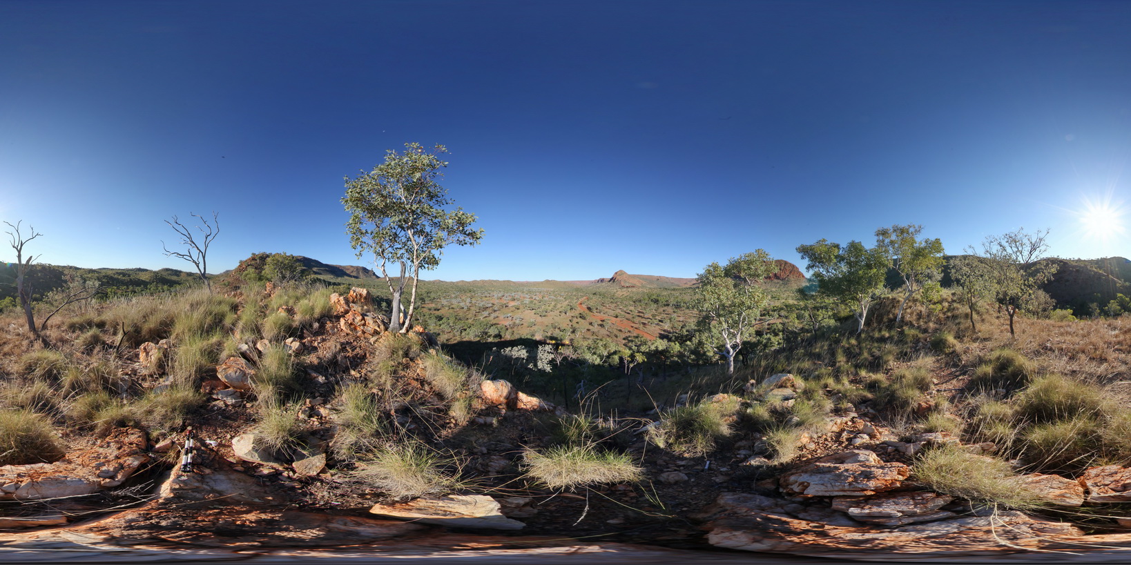
view from hill, showing calc-silicate and marble in foreground and looking to metasediment ridges of the Dixon Range. Hill above Dixon Range road, north W.A. |
2000.00 |
-17.22554000000 |
128.25269000000 |
-9999.000 |
calc-silicate, marble, metasediment, metamorphic, structure, fault |
metasediment |
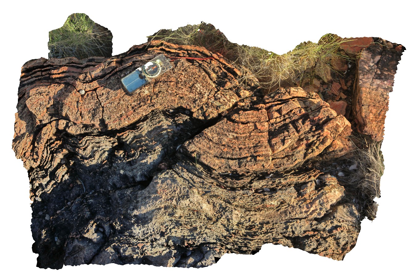
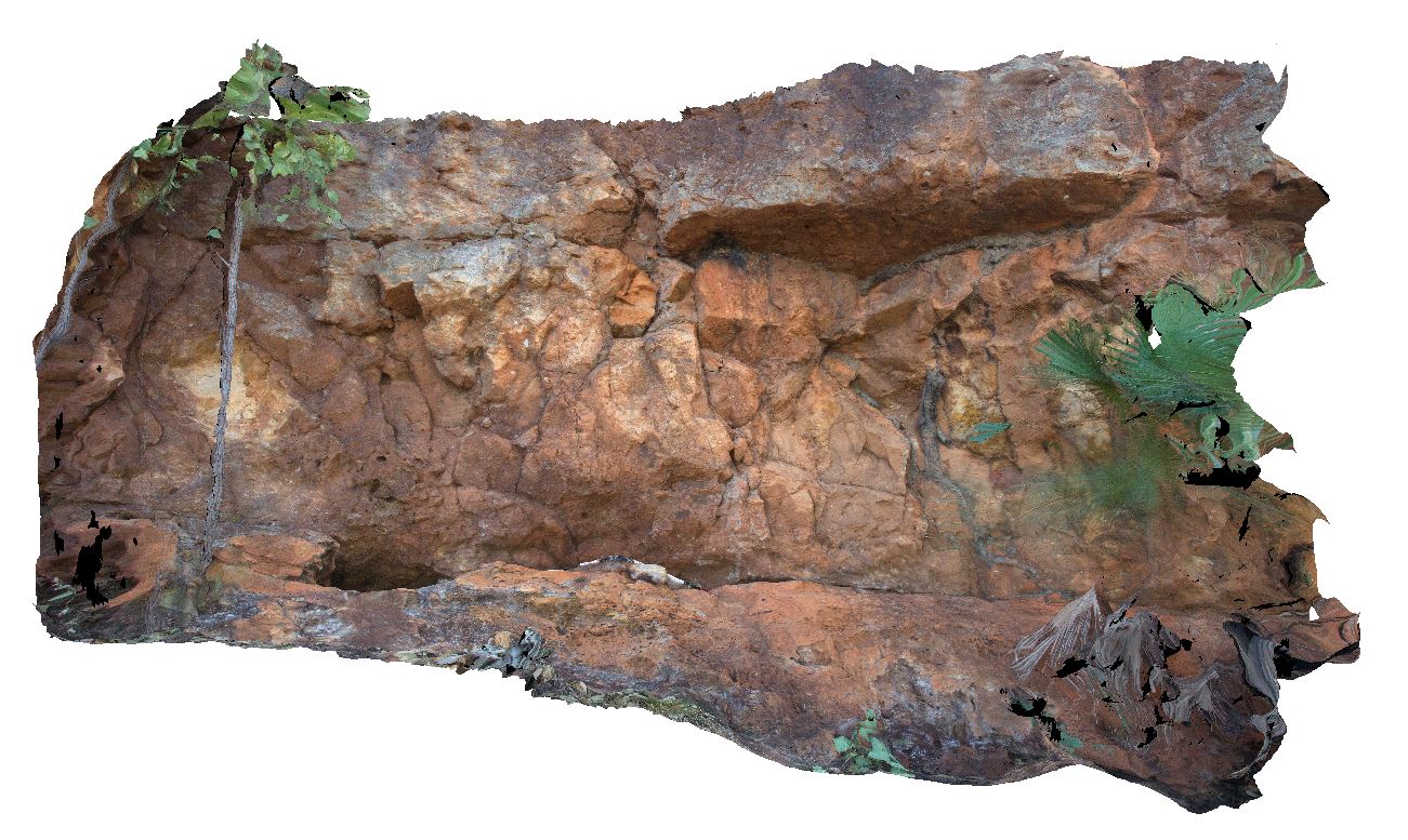
DixonRangeGIGa1 Map
 |
0 |
06/13/2016 noon |
GIGA |
steep fault in metasediments. Dixon Range, north W.A. |
0.00 |
-17.17853000000 |
128.24756000000 |
-9999.000 |
|
|
DixonRangeUAV1 Map
 |
0 |
06/14/2016 noon |
UAV |
aerial view of steep faults in metasediments. Road to Dixon Range, W.A. |
50.00 |
-17.17800000000 |
128.25186000000 |
-9999.000 |
steep fault, metasediments, structure |
metasediments |
Dongara1 Map
 |
0 |
05/18/2016 noon |
3D |
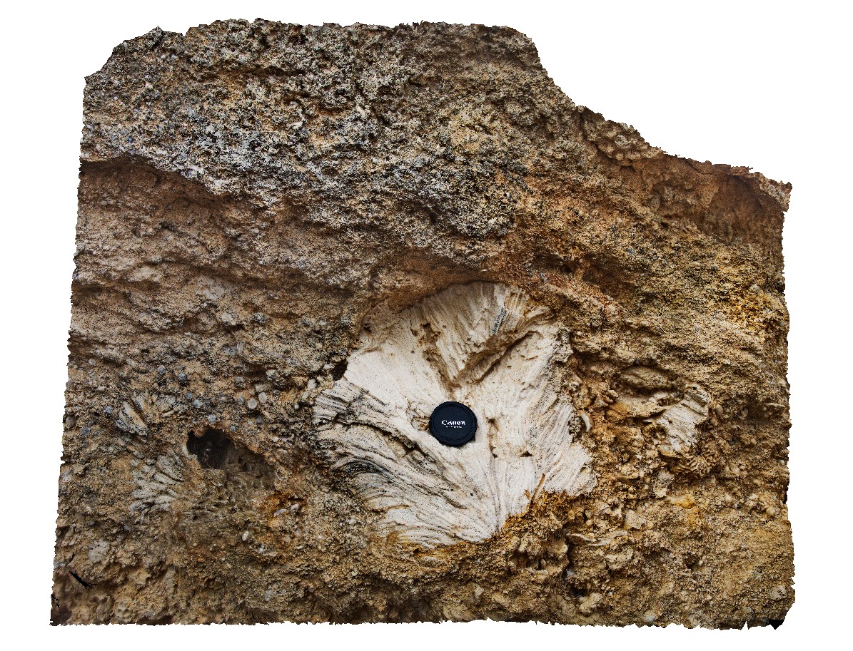
reef and shelly facies in Tamala Limestone, Dongra, W.A. |
0.90 |
-29.27921000000 |
114.91584000000 |
-9999.000 |
reef facies, limestone, fossil, palaeontology |
limestone |
Dongara2 Map
 |
0 |
05/18/2016 noon |
3D |
reef facies in Tamala Limestone, Dongra, W.A. |
0.00 |
-29.27918000000 |
114.91579000000 |
-9999.000 |
reef facies, limestone, stratigraphy, fossil, palaeontology |
limestone |
Dongara3 Map
 |
0 |
05/18/2016 noon |
3D |
reef facies and karstic features in Tamala Limestone, Dongra, W.A. |
0.00 |
-29.27914000000 |
114.91576000000 |
-9999.000 |
limestone, reef facies, palaeontology, fossil |
limestone |
Dongara4 Map
 |
0 |
05/18/2016 noon |
3D |
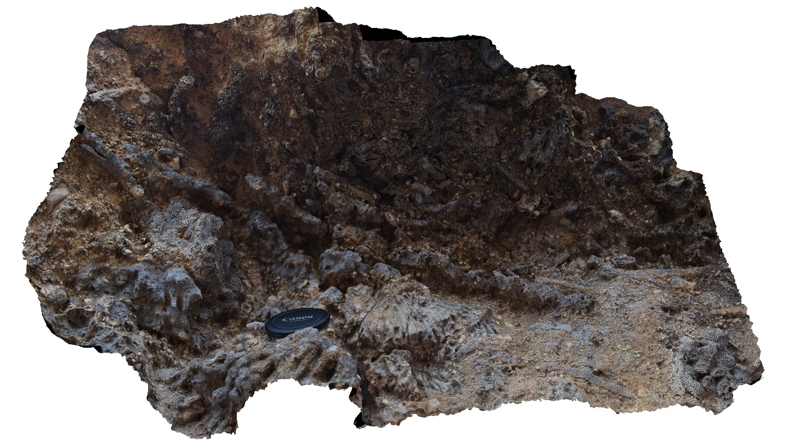
detail of reef and shelly facies features in Tamala Limestone, Dongra, W.A. |
0.00 |
-29.27913000000 |
114.91570000000 |
-9999.000 |
limestone, reef facies, sedimentology, fossil, palaeontology |
limestone |
Dorat1 Map
 |
0 |
06/23/2016 noon |
3D |
lenticular bedding in interbedded wackestone and fragmented siltstone. Cracks in siltstone have infilled with wackestone. Strong oxidation. Dorat Road, N.T. |
0.40 |
-13.53578000000 |
131.36366000000 |
-9999.000 |
wackestone, sedimentology, infilled mud cracks |
wackestone |
Dorat2 Map
 |
0 |
06/23/2016 noon |
3D |
shallowly dipping, very poorly sorted, thickly bedded granule to pebble bearing sandstone. Dorat Road, N.T. |
5.50 |
-13.54148000000 |
131.24234000000 |
-9999.000 |
poorly sorted sandstone, shallow dipping |
sandstone |
Dorat3 Map
 |
0 |
06/23/2016 noon |
3D |
steeply dipping beds of micaceous sandstone, crosscut by quartz veins that have been offset by reverse faults. Dorat Road, N.T. |
12.00 |
-13.46897000000 |
131.17831000000 |
-9999.000 |
steeply dipping, fault, structure, sandstone |
sandstone |
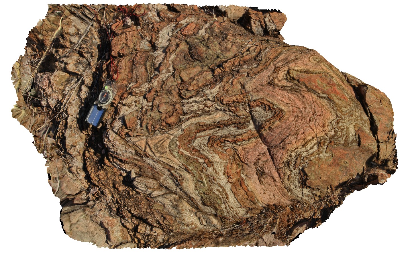
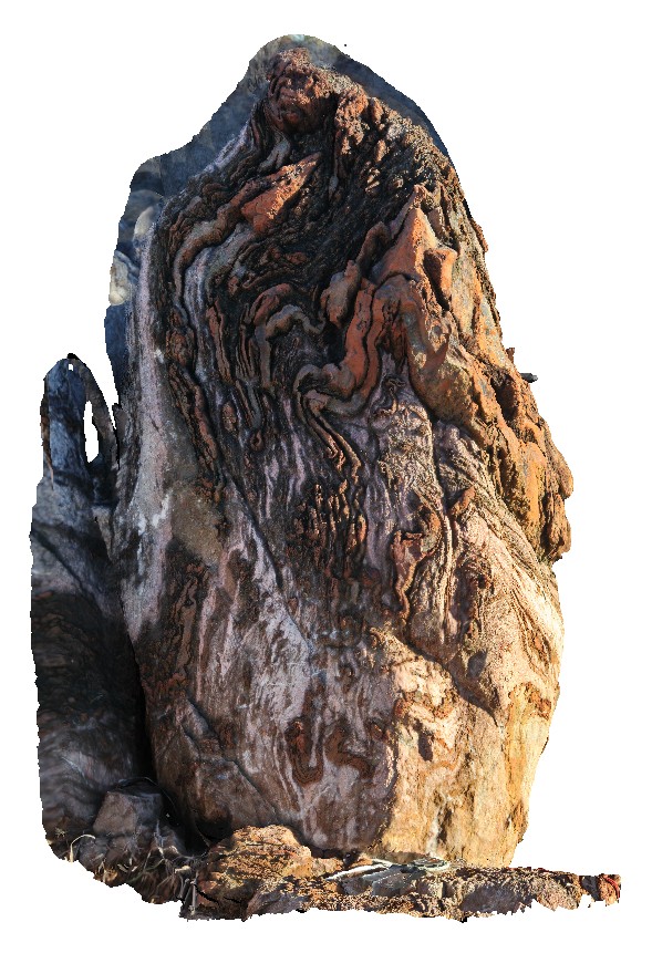
Dorat4 Map
 |
0 |
06/23/2016 noon |
3D |
red and white banded dolostone with stromatolite layers. Dorat Road, N.T. |
7.00 |
-13.25603000000 |
131.11040000000 |
-9999.000 |
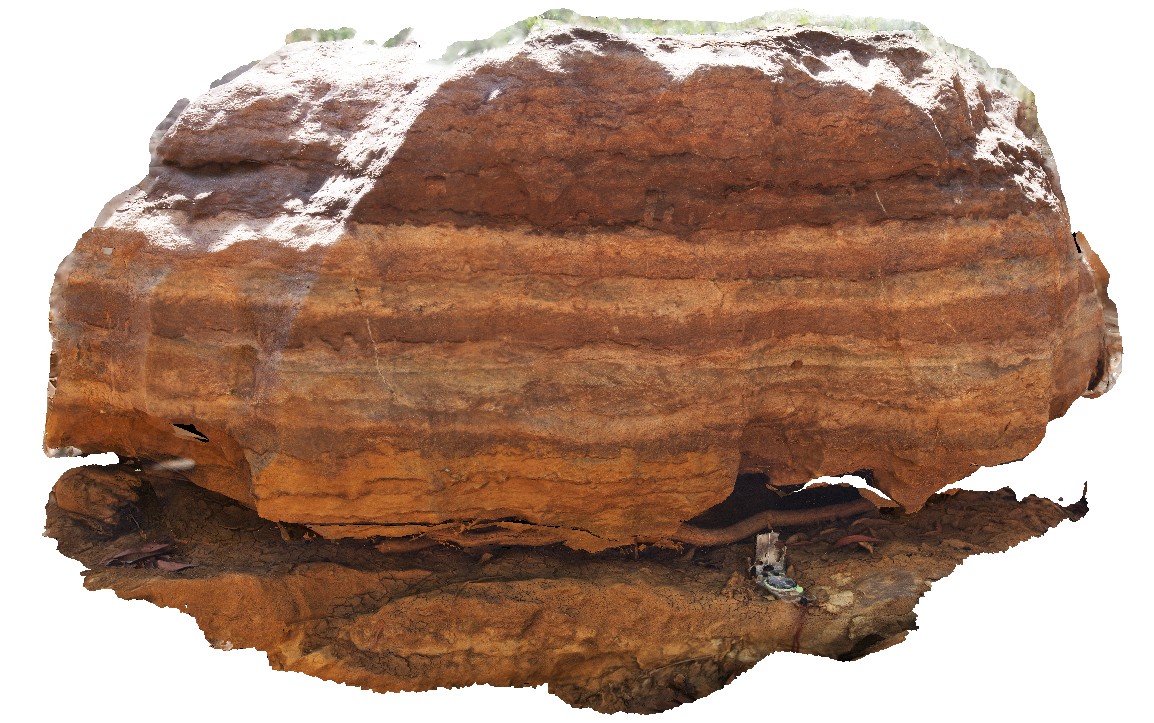
stromatolite, dolostone, fossil, palaeontology |
dolostone |
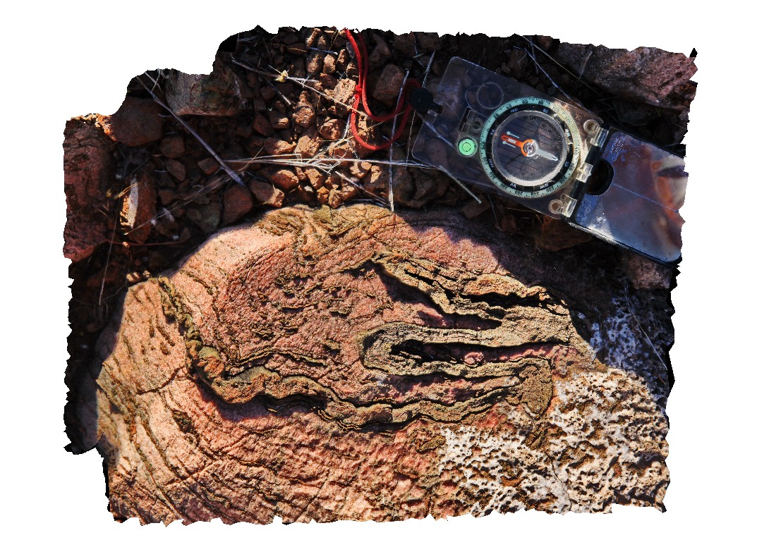
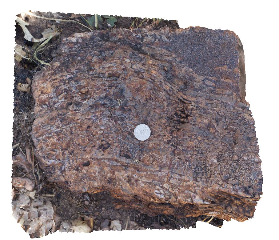
Dorat5 Map
 |
0 |
06/23/2016 noon |
3D |
macro of red and white banded dolostone. Dorat Road, N.T. |
0.25 |
-13.25619000000 |
131.11055000000 |
-9999.000 |
dolostone, sedimentology |
dolostone |
DouglasRiver1 Map
 |
0 |
06/23/2016 noon |
3D |
graded beds of fossiliferous limestone with styolitic bands, crosscut by calcite veins. Moderately recrystallised. Fossils are possibly shell fragments and crinoid ossicles. Limestone mixed with iron-rich muds. Oolloo Road, near Douglas-Daly Tourist Park. |
1.50 |
-13.80977000000 |
131.34131000000 |
-9999.000 |
fossiliferous, limestone, stylolite bands, sedimentology, fossil, palaeontology |
limestone |