CrescentFSP4 Map
 |
5 |
08/27/2015 10:32 a.m. |
FSP |
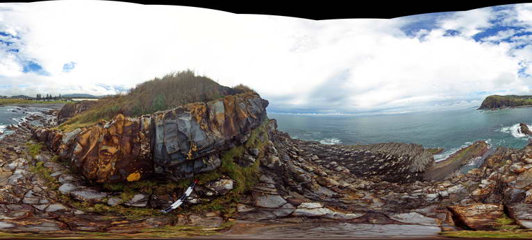
View of dipping sandstone layers in the Permian Crescent Head Formation. Crescent Head, N.S.W. |
50.00 |
-31.18687000000 |
152.98407000000 |
8.000 |
bedding, sedimentology |
sandstone |
CrescentFSP5 Map
 |
5 |
08/27/2015 10:40 a.m. |
FSP |
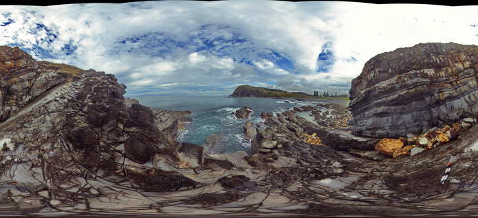
View of dipping sandstone layers in the Permian Crescent Head Formation. Crescent Head, N.S.W. |
50.00 |
-31.18689000000 |
152.98387000000 |
4.000 |
bedding, sedimentology, honeycomb weathering |
sandstone |
CrescentFSP6 Map
 |
5 |
08/27/2015 11:01 a.m. |
FSP |
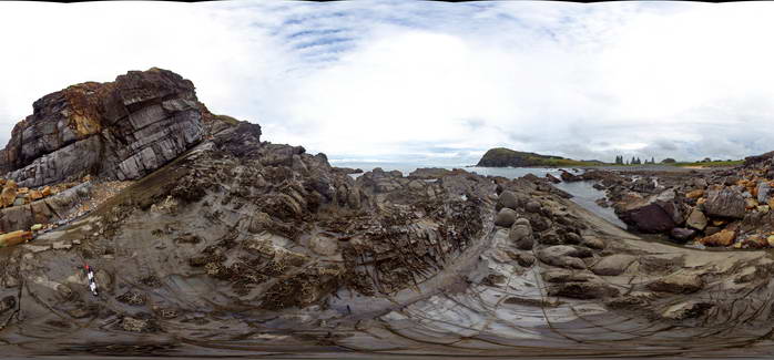
View of dipping sandstone layers in the Permian Crescent Head Formation. Crescent Head, N.S.W. |
50.00 |
-31.18692000000 |
152.98367000000 |
1.000 |
bedding, sedimentology |
sandstone |
CrescentUAV1 Map
 |
0 |
04/12/2016 10:20 a.m. |
UAV |
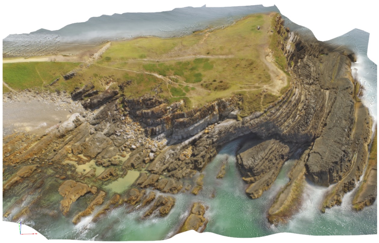
aerial view of moderately to gently dipping strata of the Crescent Head area. Crescent Head. N.S.W. |
100.00 |
-31.18692000000 |
152.98367000000 |
-9999.000 |
sediments |
sediments |
CrescentUAV2 Map
 |
0 |
04/12/2016 10:45 a.m. |
UAV |
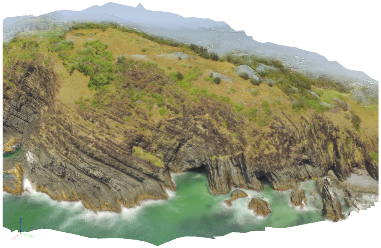
aerial view of moderately to gently dipping and openly folded strata of the Crescent Head area. Crescent Head. N.S.W. |
200.00 |
-31.18692000000 |
152.98367000000 |
-9999.000 |
fold, strata |
sediments |
Crowdy1 Map
 |
5 |
07/08/2015 10:33 a.m. |
3D |
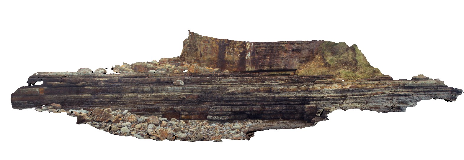
Thickly bedded sandstone and thin siltstone layers of the Devonian Cowangara Formation. Crowdy Head Cliffs, N.S.W. |
10.00 |
-31.84554000000 |
152.75208000000 |
1.000 |
sandstone, siltstone, sedimentology |
sandstone, siltstone |
Crowdy10 Map
 |
5 |
07/08/2015 10:41 a.m. |
3D |
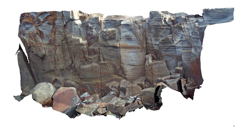
cross bedded and bioturbated sandstone of the Devonian Cowangara Formation. Crowdy Head Cliffs, N.S.W. |
5.00 |
-31.84562000000 |
152.75133000000 |
1.000 |
sandstone, cross bedded, sedimentology, bioturbation, palaeontology |
sandstone |
Crowdy11 Map
 |
5 |
07/08/2015 10:41 a.m. |
3D |
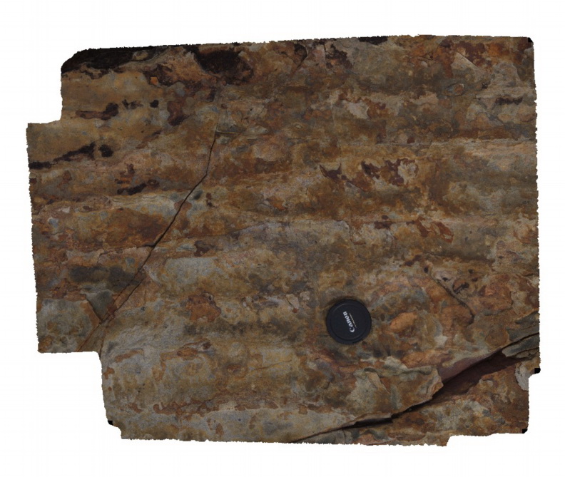
ripple marks on bedding surface in sandstone of the Devonian Cowangara Formation. Crowdy Head Cliffs, N.S.W. |
1.00 |
-31.84549000000 |
152.75151000000 |
2.000 |
sandstone, ripple marks, sedimentology |
sandstone |
Crowdy2 Map
 |
5 |
07/08/2015 10:34 a.m. |
3D |
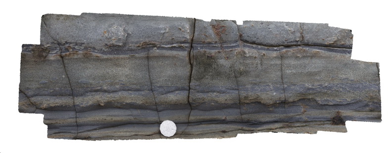
Detail of thickly bedded sandstone and thinly bedded siltstone with bioturbation - Devonian Cowangara Formation. Crowdy Head Cliffs, N.S.W. |
0.50 |
-31.84554000000 |
152.75208000000 |
1.000 |
sandstone, siltstone, bioturbation, sedimentology, palaeontology |
sandstone, siltstone |
Crowdy3 Map
 |
5 |
07/08/2015 10:35 a.m. |
3D |
Bioturbation in silty sandstone of the Cowangara Formation. Crowdy Head Cliffs, N.S.W. |
0.20 |
-31.84554000000 |
152.75208000000 |
2.000 |
sandstone, bioturbation, sedimentology, palaeontology |
sandstone |
Crowdy4 Map
 |
5 |
07/08/2015 10:36 a.m. |
3D |
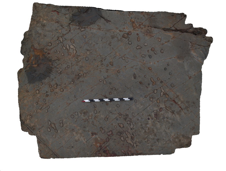
concretions exposed on a bedding surface in fine grained sandstone of the Devonian Cowangara Formation. Crowdy Head Cliffs, N.S.W. |
3.00 |
-31.84553000000 |
152.75177000000 |
2.000 |
sandstone, concretion, sedimentology |
sandstone |
Crowdy5 Map
 |
5 |
07/08/2015 10:37 a.m. |
3D |
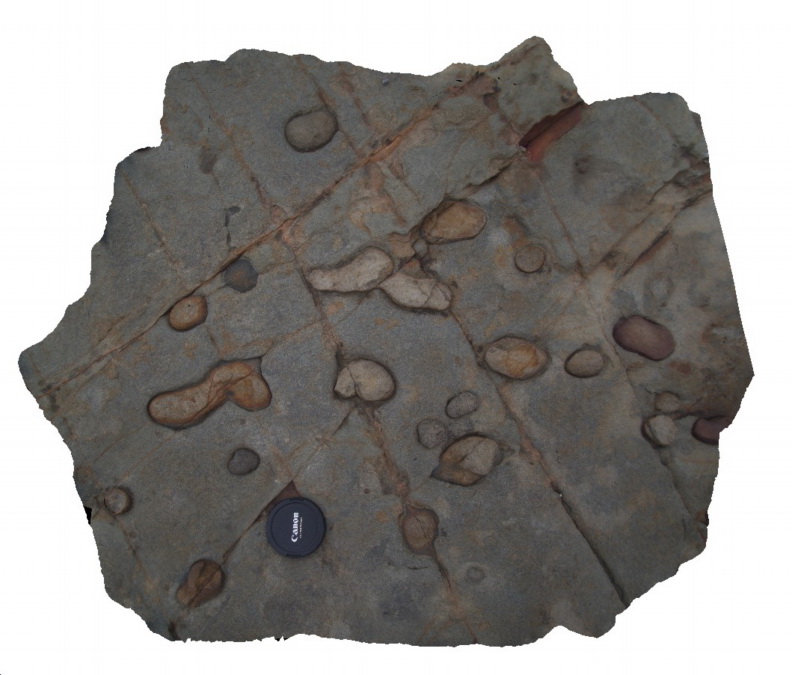
Detail of concretions in fine grained sandstone of the Devonian Cowangara Formation. Crowdy Head Cliffs, N.S.W. |
1.00 |
-31.84553000000 |
152.75177000000 |
2.000 |
sandstone, concretion, sedimentology |
sandstone |
Crowdy6 Map
 |
1 |
07/08/2015 10:37 a.m. |
3D |
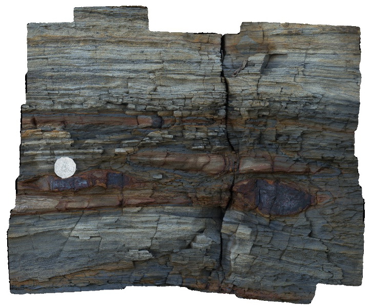
Detail of tessellated pavement in sandstone. Crowdy Head Cliffs, N.S.W. |
6.00 |
-31.84576000000 |
152.75128000000 |
-9999.000 |
tessellated pavement, jointing |
sandstone |
Crowdy7 Map
 |
5 |
07/08/2015 10:38 a.m. |
3D |
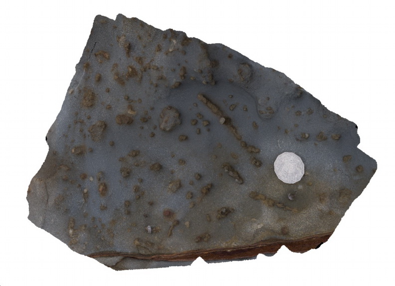
Bioturbation in fine-grained sandstone of the Devonian Cowangara Formation. Crowdy Head Cliffs, N.S.W. |
0.40 |
-31.84576000000 |
152.75136000000 |
2.000 |
sandstone, bioturbation, sedimentology, palaeontology |
sandstone |
Crowdy8 Map
 |
5 |
07/08/2015 10:39 a.m. |
3D |
Detail of micro honey comb weathering texture in sandstone of the Devonian Cowangara Formation. Crowdy Head Cliffs, N.S.W. |
0.30 |
-31.84597000000 |
152.75124000000 |
2.000 |
sandstone, honeycomb weathering, sedimentology |
sandstone |
Crowdy9 Map
 |
5 |
07/08/2015 10:40 a.m. |
3D |
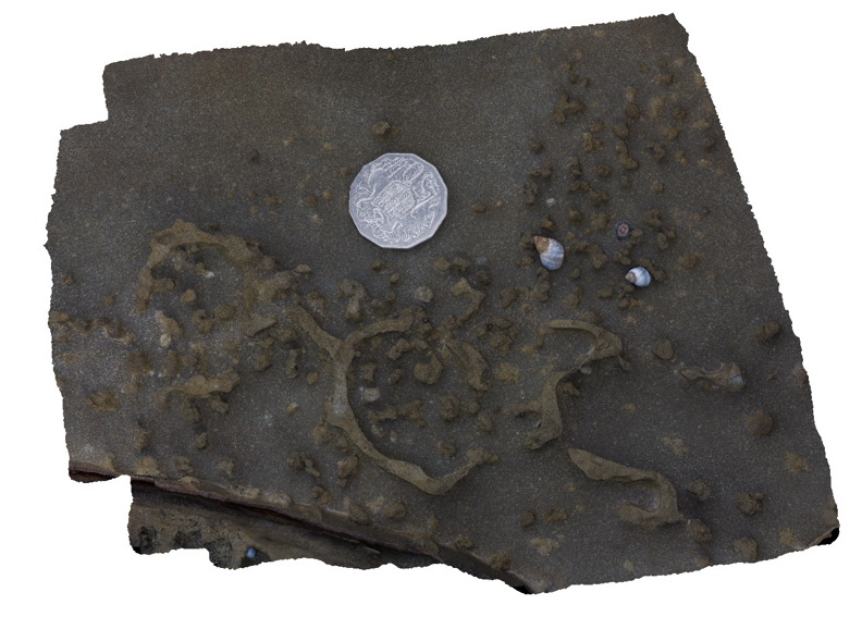
Detail of bioturbation. Crowdy Head Cliffs, N.S.W. |
0.25 |
-31.84579000000 |
152.75137000000 |
2.000 |
sandstone, bioturbation, sedimentology, palaeontology |
sandstone |
CrowdyFSP1 Map
 |
5 |
08/27/2015 11:54 a.m. |
FSP |
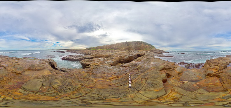
View of sandstone rock platforms of the Devonian Cowangara Formation. Crowdy Head Cliffs, N.S.W. |
50.00 |
-31.84595000000 |
152.75125000000 |
1.000 |
joints |
sandstone |
CrowdyFSP2 Map
 |
5 |
08/27/2015 12:15 p.m. |
FSP |
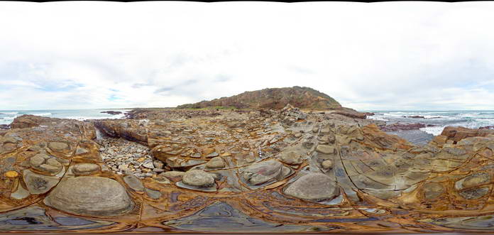
Tessellated pavement with sandstone core stones and honeycomb weathering in sandstone units of the Devonian Cowangara Formation. Crowdy Head Cliffs, N.S.W. |
50.00 |
-31.84582000000 |
152.75127000000 |
1.000 |
core stones, tessellated pavement, joints, structure, weathering |
sandstone |
CrowdyFSP3 Map
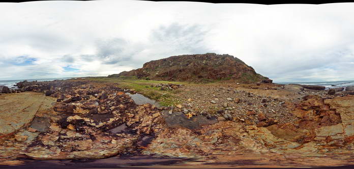 |
5 |
08/27/2015 12:15 p.m. |
FSP |
Gently dipping sandstone units of the Devonian Cowangara Formation. Crowdy Head Cliffs, N.S.W. |
50.00 |
-31.84544000000 |
152.75154000000 |
1.000 |
|
sandstone |
CrowdyFSP4 Map
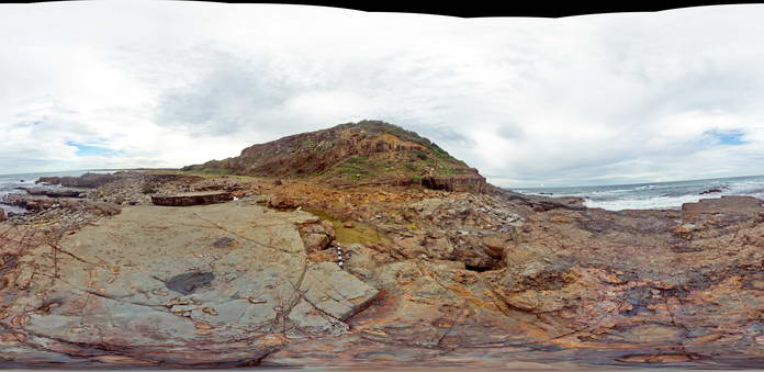 |
5 |
08/27/2015 12:04 p.m. |
FSP |
Gently dipping sandstone units of the Devonian Cowangara Formation. Crowdy Head Cliffs, N.S.W. |
50.00 |
-31.84557000000 |
152.75182000000 |
1.000 |
|
sandstone |
CrowdyFSP5 Map
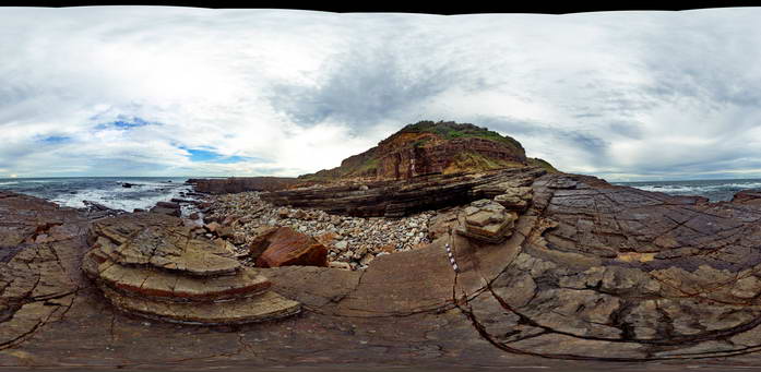 |
5 |
08/27/2015 12:15 p.m. |
FSP |
Gently dipping sandstone units of the Devonian Cowangara Formation. Crowdy Head Cliffs, N.S.W. |
50.00 |
-31.84557000000 |
152.75204000000 |
1.000 |
|
sandstone |
CrowdyPole1 Map
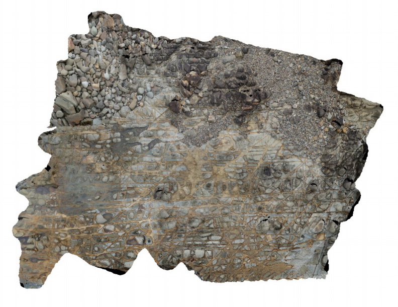 |
5 |
06/16/2015 5:34 p.m. |
3D |
View of tessellated pavement generated by intersecting joints in sandstone of the Devonian Cowangara Formation. Crowdy Head Cliffs, N.S.W. |
12.00 |
-31.84576000000 |
152.75128000000 |
2.000 |
tessellated pavement, joints, structure |
sandstone |
DairyCreek1 Map
 |
0 |
01/01/9999 midnight |
3D |
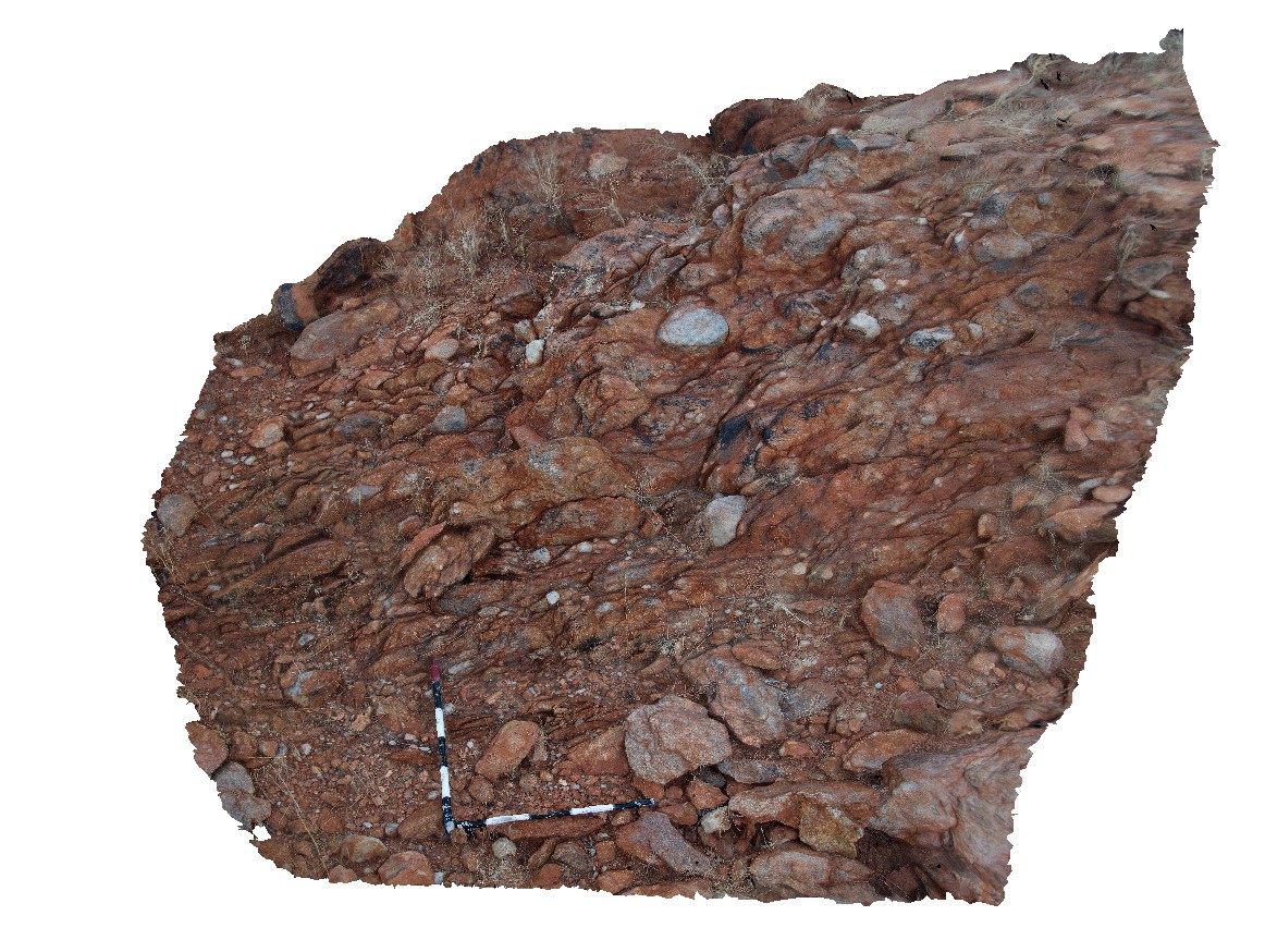
folded and sheared, matrix supported conglomerate. Cobra-Dairy Creek Road, Gascoyne, W.A. |
3.00 |
-25.15067000000 |
115.95077000000 |
-9999.000 |
conglomerate, sheared, structure, fold |
conglomerate |
DaisyBanksPit1 Map
 |
20 |
03/17/2015 1:18 p.m. |
3D |
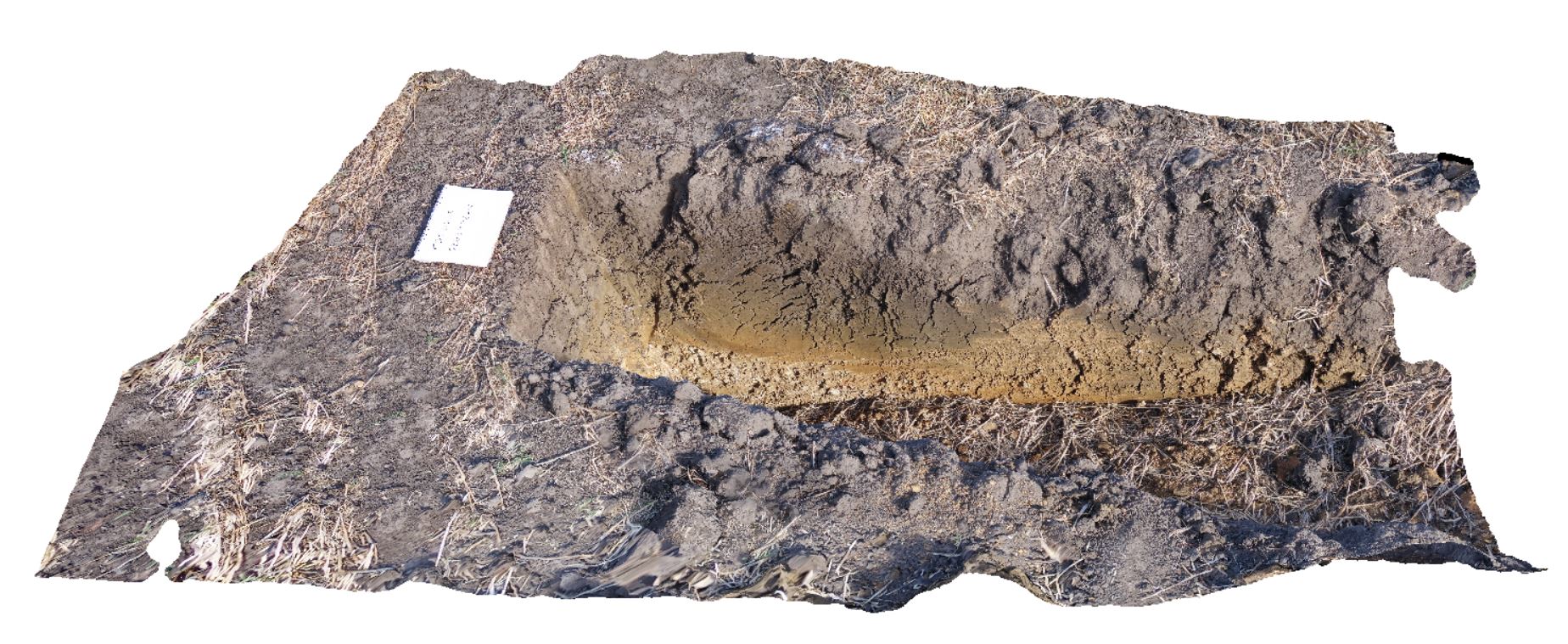
Undifferentiated alluvial soils and clays developed on Quaternary alluvial terrace gravel deposits predominantly derived from Parmeener and Palaeogene-Neogene units with clasts commonly of basalt and in places dolerite. Richmond, Tas. |
2.00 |
-42.73095300000 |
147.43018100000 |
-9999.000 |
clay, alluvium, regolith |
clay |
DaisyBanksPit10 Map
 |
20 |
03/23/2015 11:20 a.m. |
3D |
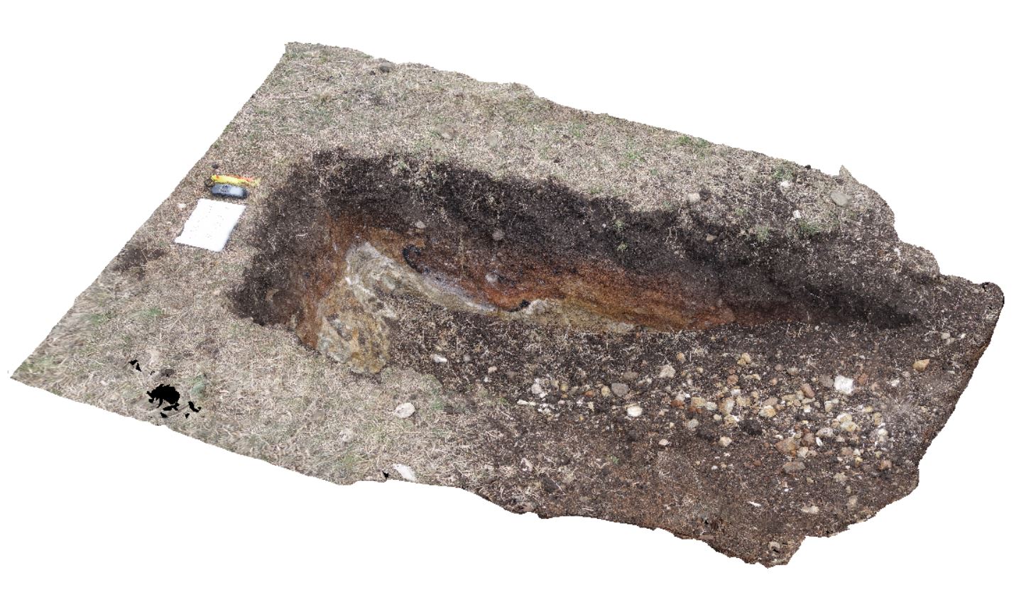
~80cm deep pit into Cenozoic soil and clays overlying (inferred) Jurassic Dolerite. Richmond, Tas. |
2.00 |
-42.73042400000 |
147.42464400000 |
-9999.000 |
Jurassic Dolerite, Clay, Alluvial, regolith |
Clay |


