Karijini19 Map
 |
0 |
05/29/2016 noon |
3D |
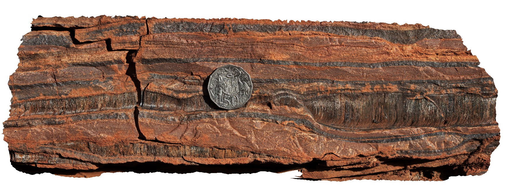
crocidolite seams in banded iron formation. Dales Gorge, Karijini National Park. W.A. |
0.30 |
-22.47812000000 |
118.55870000000 |
-9999.000 |
crocidolite, mineral, banded iron formation |
BIF |
Karijini2 Map
 |
0 |
05/29/2016 noon |
3D |
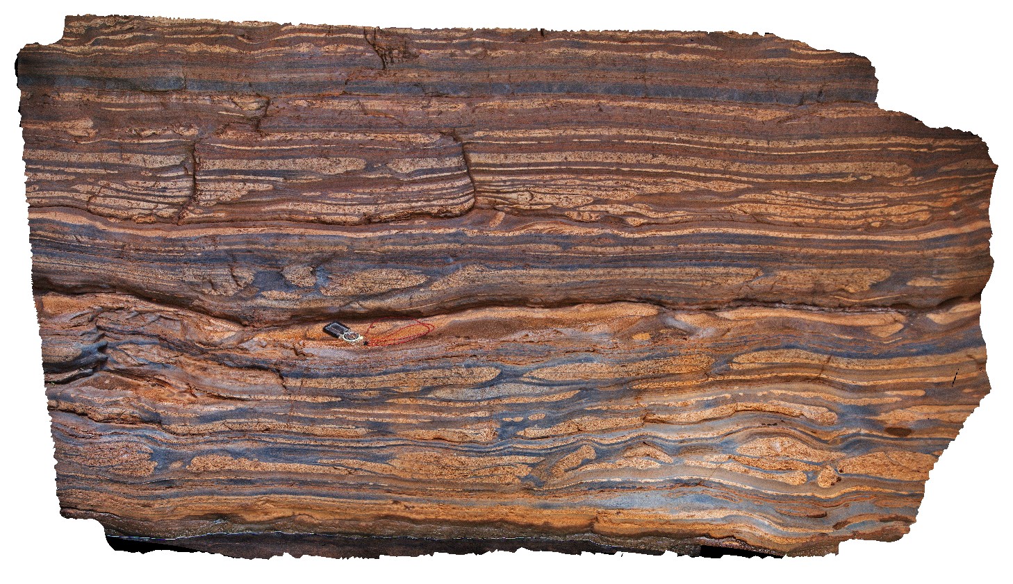
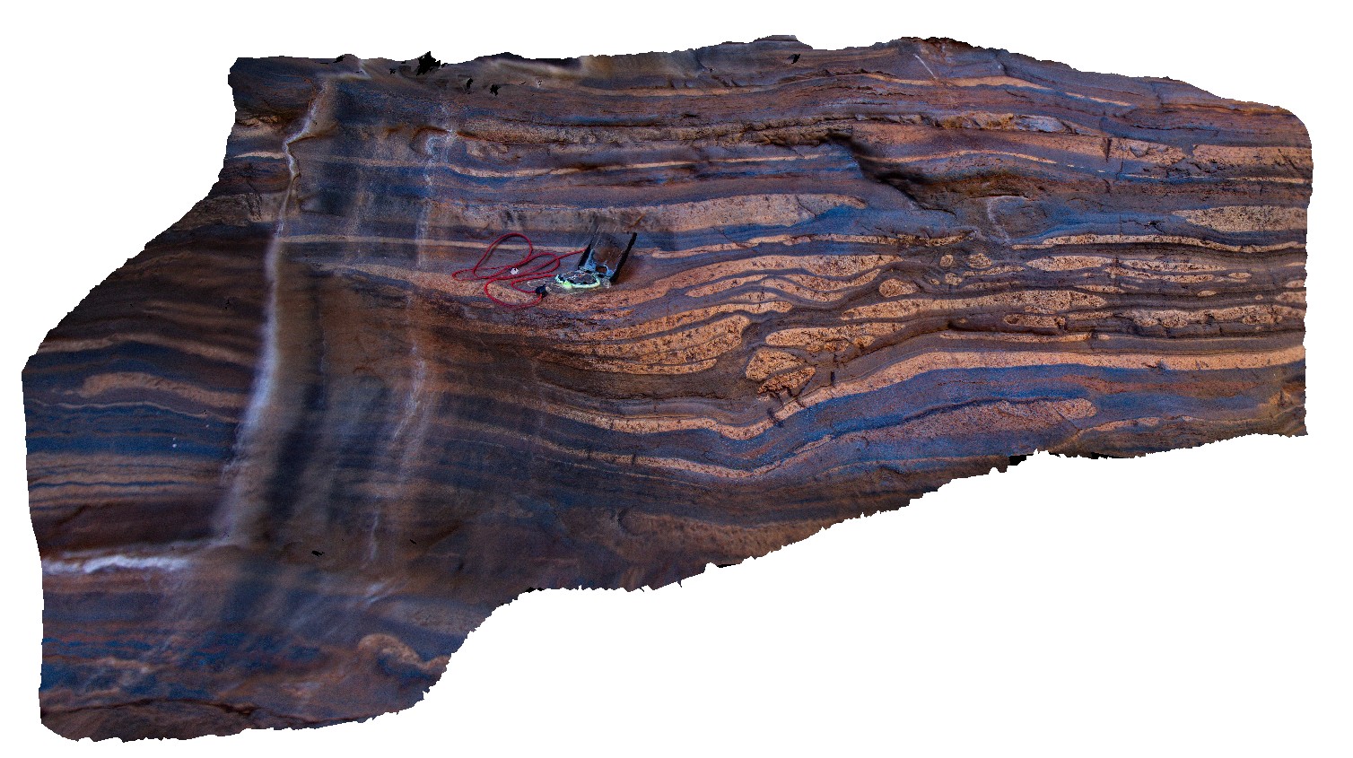
sandstone laminations in Brockman Iron Formation, Weano Gorge, Karijini National Park. W.A. |
2.60 |
-22.36123000000 |
118.28945000000 |
-9999.000 |
sandstone laminations, banded iron formation, Hamersley Basin, sedimentology |
BIF |
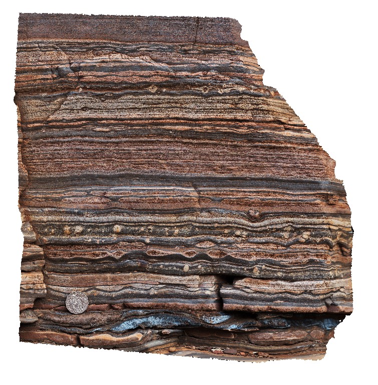
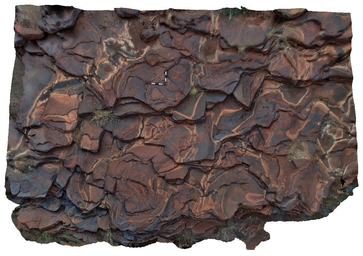
Karijini20 Map
 |
0 |
05/29/2016 noon |
3D |
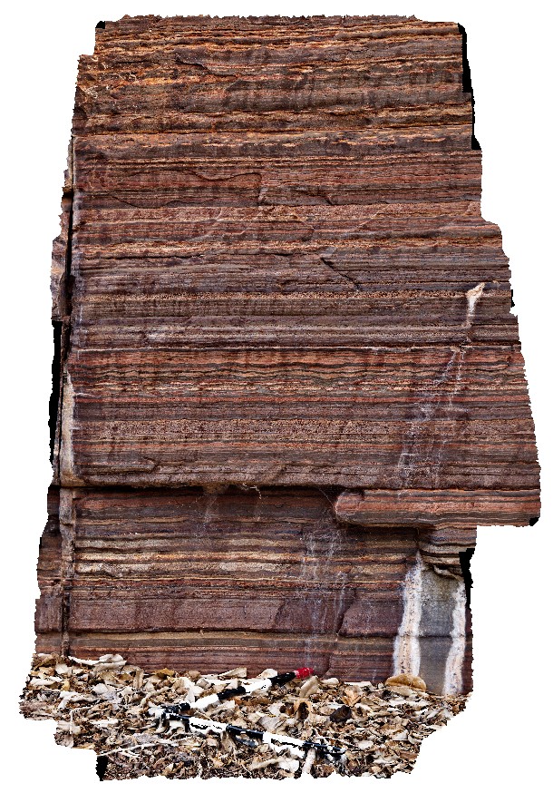
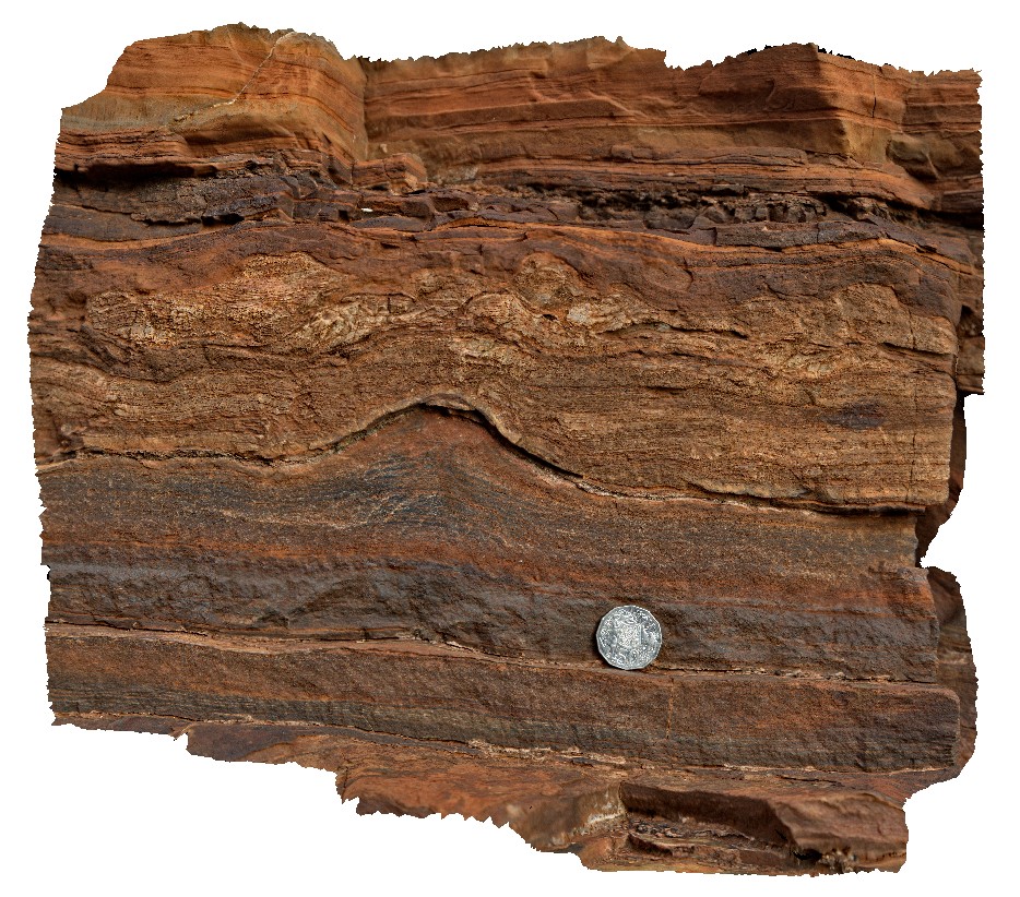
view of 2m profile of BIF, showing fine layering and chert nodules. Dales Gorge, Karijini National Park. W.A. |
2.20 |
-22.47716000000 |
118.55698000000 |
-9999.000 |
banded iron formation, chert nodules, sedimentary layering, stratigraphic |
BIF |
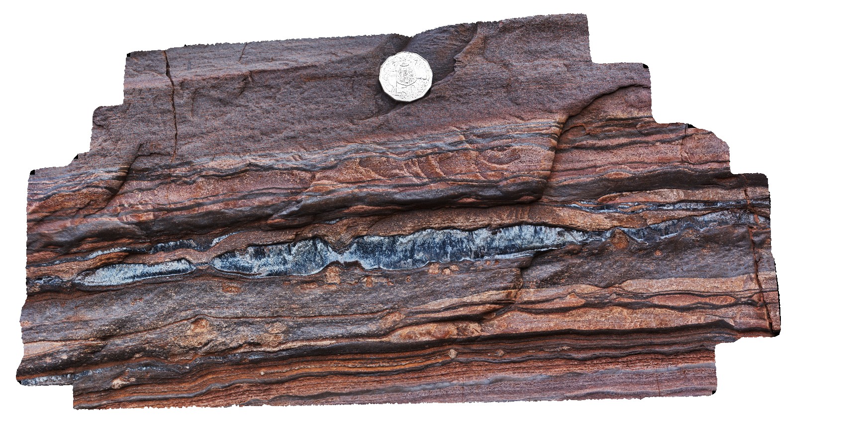
Karijini21 Map
 |
0 |
05/29/2016 noon |
3D |
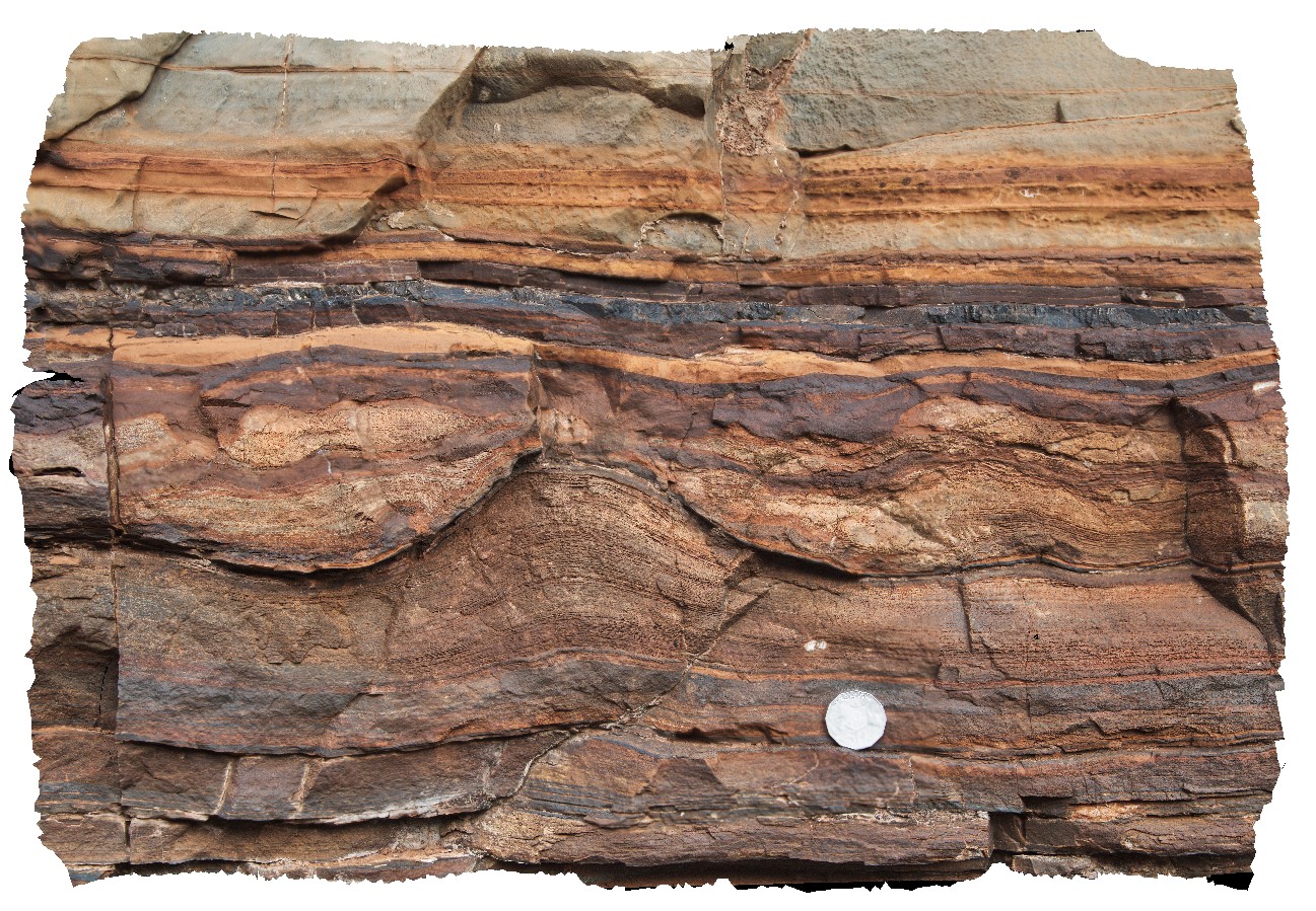
section through BIF, showing (from bottom to top); BIF, quartzite, silicified carbonate, pyritic shale, BIF. Dales Gorge, Karijini National Park. W.A. |
3.50 |
-22.47723000000 |
118.55693000000 |
-9999.000 |
stratigraphic layering, stratigraphy, banded iron formation |
BIF |
Karijini22 Map
 |
0 |
05/29/2016 noon |
3D |
macro view of fine layering and nodules in banded iron formation. Dales Gorge, Karijini National Park. W.A. |
0.45 |
-22.47762000000 |
118.55690000000 |
-9999.000 |
banded iron formation, sedimentological layering, nodules |
BIF |
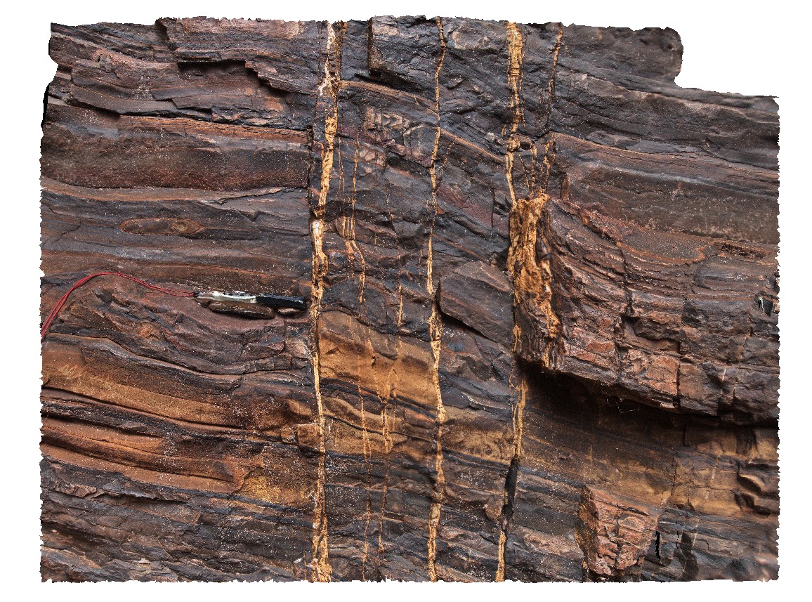
Karijini23 Map
 |
0 |
05/29/2016 noon |
3D |
view of crocidolite seam in Brockman Iron Formation. Dales Gorge, Karijini National Park. W.A. |
0.00 |
-22.47726000000 |
118.55666000000 |
-9999.000 |
crocidolite, banded iron formation |
BIF |
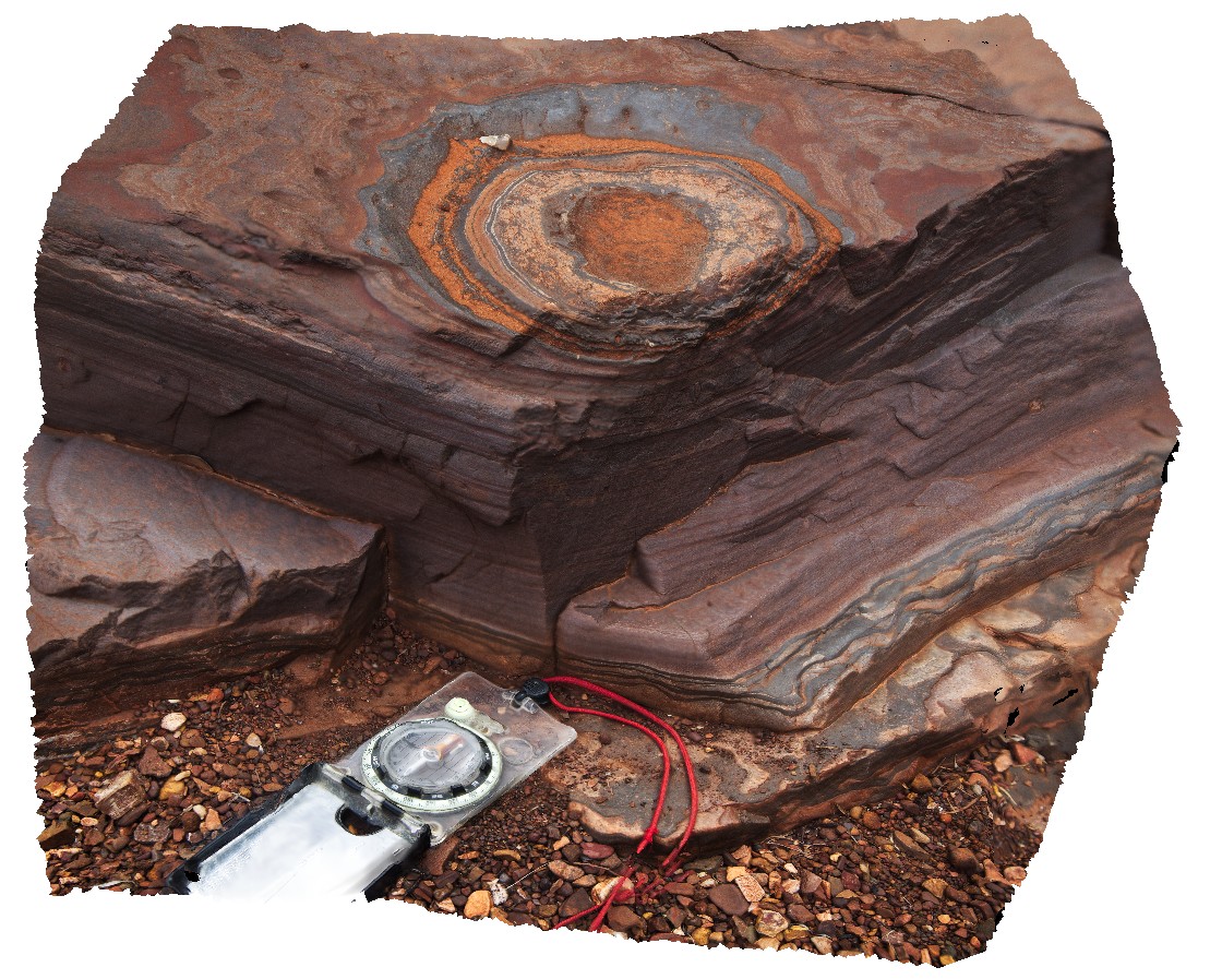
Karijini24 Map
 |
0 |
05/29/2016 noon |
3D |
3D view of disk-shaped concretions or weathering feature in banded iron formation. Dales Gorge, Karijini National Park. W.A. |
0.60 |
-22.47736000000 |
118.55669000000 |
-9999.000 |
banded iron formation, concretion, weathering feature |
BIF |
Karijini25 Map
 |
0 |
05/29/2016 noon |
3D |
3D view of disk-shaped concretions or weathering feature in banded iron formation. Dales Gorge, Karijini National Park. W.A. |
0.20 |
-22.47762000000 |
118.55690000000 |
-9999.000 |
concretion, weathering feature, banded iron formation, sedimentology |
BIF |
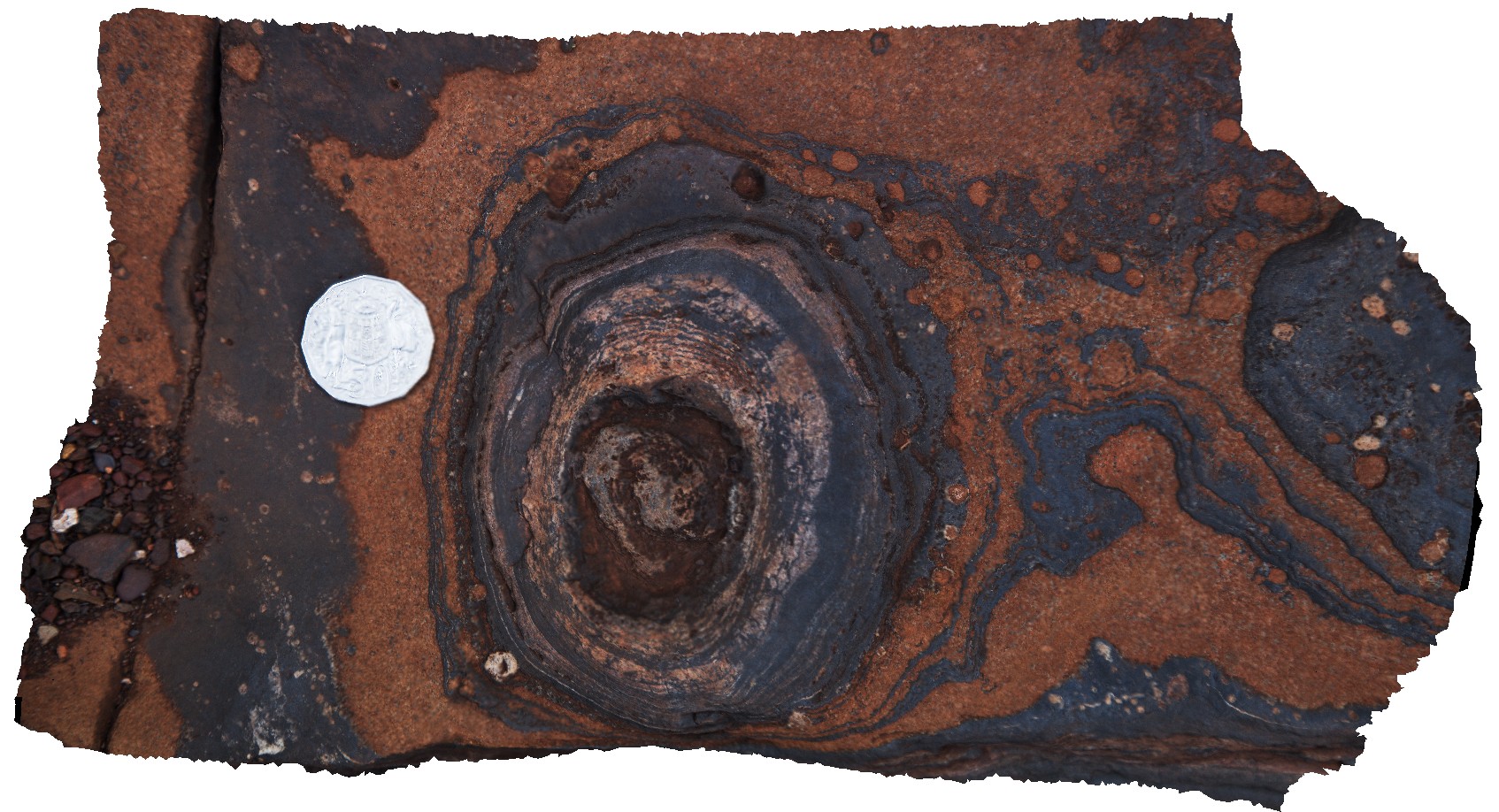
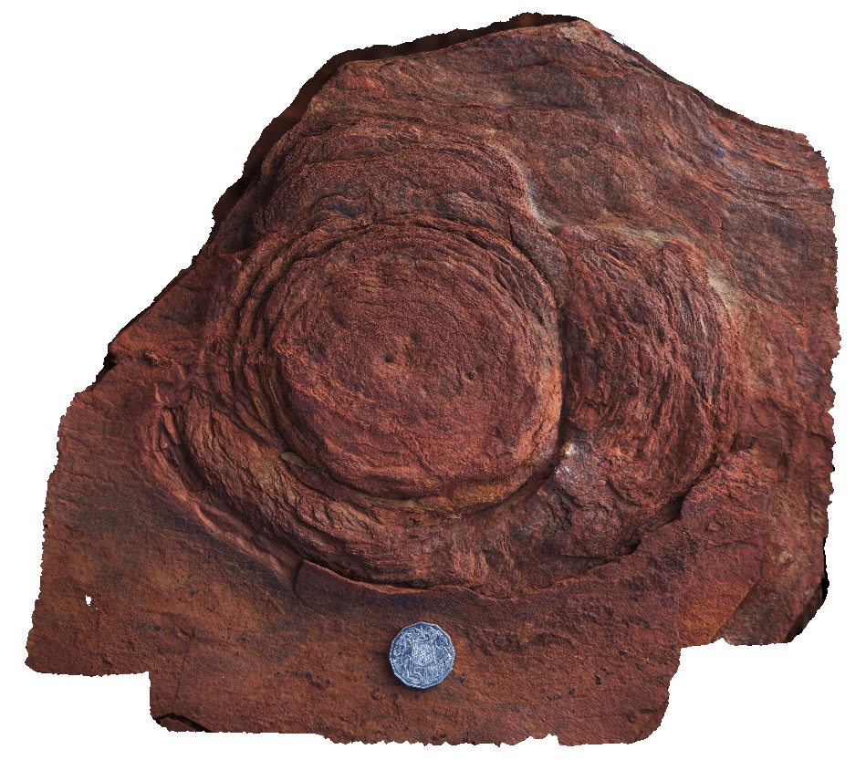
Karijini26 Map
 |
0 |
05/29/2016 noon |
3D |
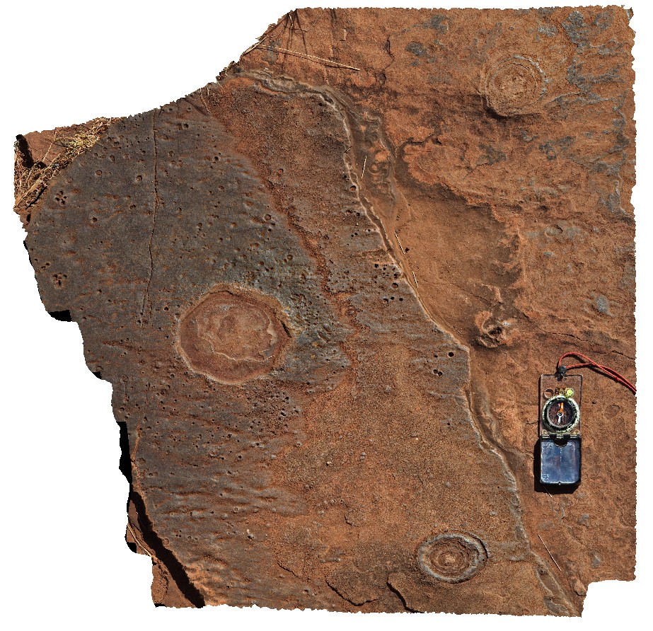
stromatolite-like structure in finely layered siliceous sediments. Dales Gorge, Karijini National Park. W.A. |
1.00 |
-22.47684000000 |
118.55659000000 |
-9999.000 |
stromatolite, sedimentology, banded iron formation |
BIF |
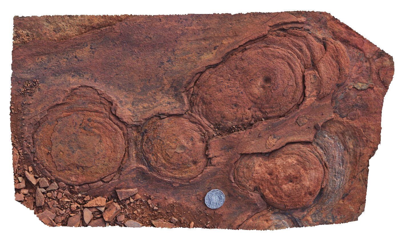
Karijini27 Map
 |
0 |
05/29/2016 noon |
3D |
stromatolites in finely layered banded iron sediments. Dales Gorge, Karijini National Park. W.A. |
0.50 |
-22.47800000000 |
118.55662000000 |
-9999.000 |
stromatolite, banded iron formation, sedimentology, fossil, palaeontology |
BIF |
Karijini3 Map
 |
0 |
05/29/2016 noon |
3D |
sandstone lenses in flat-lying beds of the Brockman Iron Formation, Weano Gorge, Karijini National Park. W.A. |
1.40 |
-22.36123000000 |
118.28945000000 |
-9999.000 |
Brockman Iron Formation, sandstone lenses, sedimentology, Hamersley Basin |
BIF |
Karijini4 Map
 |
0 |
05/29/2016 noon |
3D |
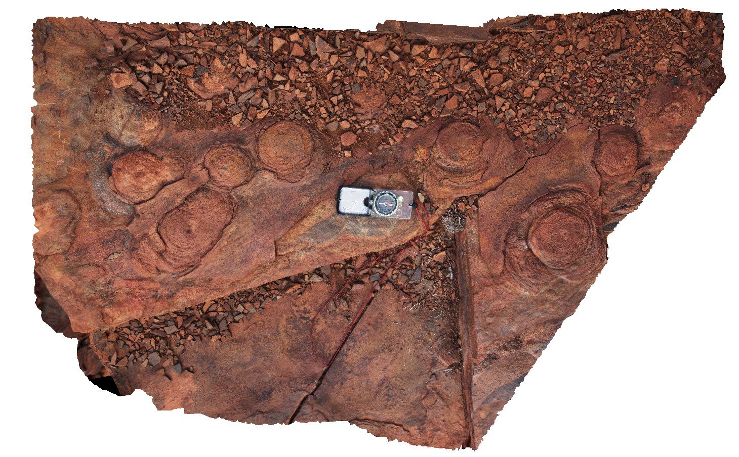
plan view of exposed stromatolites in flat-lying beds of the Brockman Iron Formation, Weano Gorge, Karijini National Park. W.A. |
2.80 |
-22.36123000000 |
118.28954000000 |
-9999.000 |
stromatolites, banded iron formation, sedimentology, fossil, palaeontology |
BIF |
Karijini5 Map
 |
0 |
05/29/2016 noon |
3D |
close-up view of exposed stromatolites in flat-lying beds of the Brockman Iron Formation, Weano Gorge, Karijini National Park. W.A. |
0.30 |
-22.36123000000 |
118.28954000000 |
-9999.000 |
stromatolite, Brockman Iron Formation, sedimentology, fossil, palaeontology |
BIF |
Karijini6 Map
 |
0 |
05/29/2016 noon |
3D |
close-up view of several exposed stromatolites in flat-lying beds of the Brockman Iron Formation, Weano Gorge, Karijini National Park. W.A. |
0.45 |
-22.36123000000 |
118.28954000000 |
-9999.000 |
stromatolite, sedimentology, Brockman Iron Formation, banded iron formation, palaeontology, fossil |
BIF |
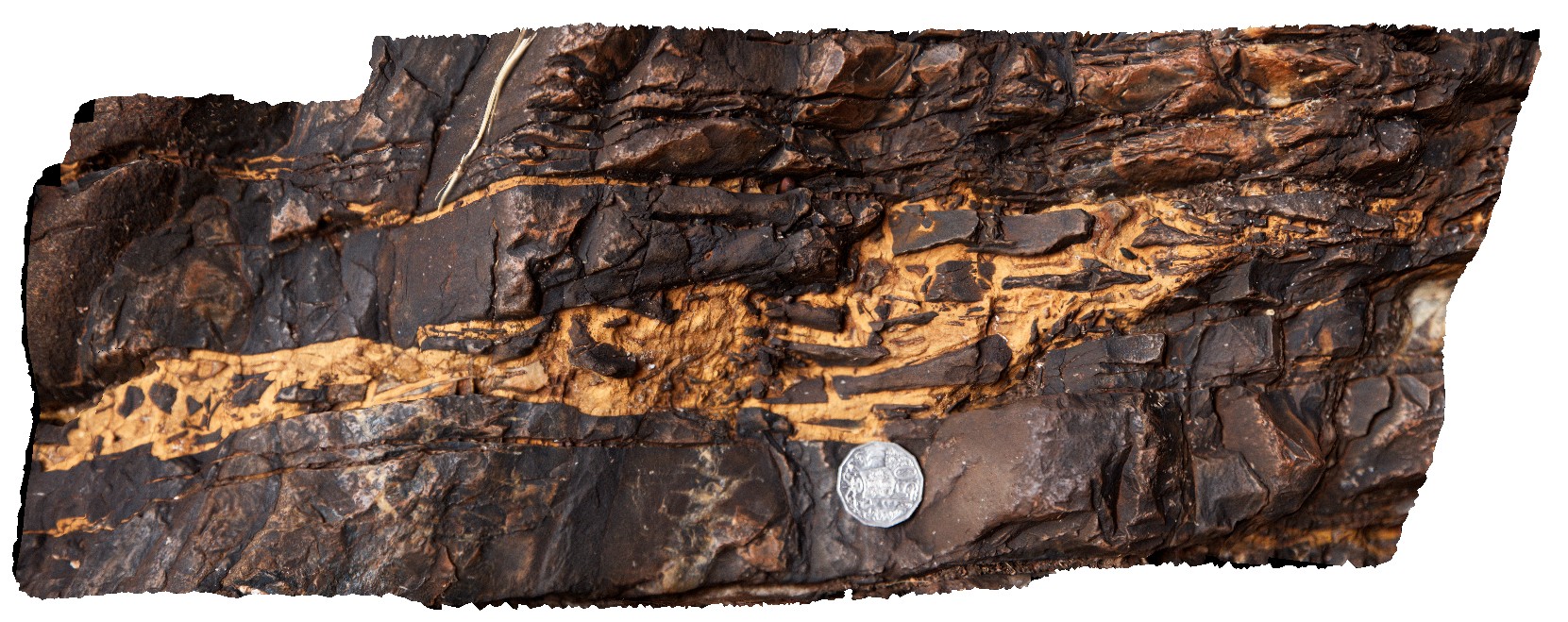
Karijini7 Map
 |
0 |
05/29/2016 noon |
3D |
small scale faulting with silica-carbonate veins cutting flat-lying beds of the Brockman Iron Formation, Weano Gorge, Karijini National Park. W.A. |
1.40 |
-22.35952000000 |
118.28896000000 |
-9999.000 |
brittle fault, fault, veins, banded iron formation, structure |
BIF |
Karijini8 Map
 |
0 |
05/29/2016 noon |
3D |
detail of dialational jog in small fault, showing fault breccia. Handrail Pool, Weano Gorge, Karijini National Park. W.A. |
0.50 |
-22.35952000000 |
118.28896000000 |
-9999.000 |
dialational jog, fault breccia, fault, structure, banded iron formation |
BIF |
Karijini9 Map
 |
0 |
05/29/2016 noon |
3D |
low amplitude open folds in banded iron formation. Handrail Pool, Weano Gorge, Karijini National Park. W.A. |
7.00 |
-22.35718000000 |
118.28704000000 |
-9999.000 |
open folds, fold, structure, banded iron formation |
BIF |
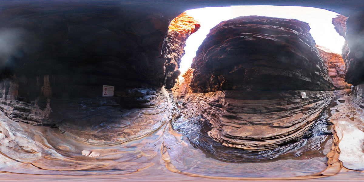
KarijiniFSP1 Map
 |
0 |
05/29/2016 noon |
FSP |
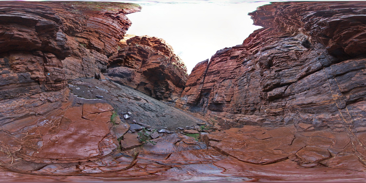
view along Weano gorge in Brockman Iron Formation, Karijini National Park. W.A. |
50.00 |
-22.36123000000 |
118.28945000000 |
-9999.000 |
Weano Gorge, Brockman Iron Formation, banded iron formation, sedimentology |
BIF |
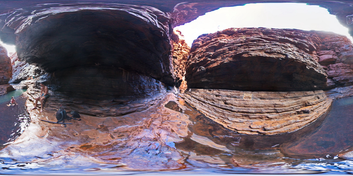
KarijiniFSP2 Map
 |
0 |
05/29/2016 noon |
FSP |
view along Weano gorge in Brockman Iron Formation, Karijini National Park. W.A. |
50.00 |
-22.36123000000 |
118.28945000000 |
-9999.000 |
banded iron formation, Weano Gorge, Brockman Iron Formation, sedimentology |
BIF |
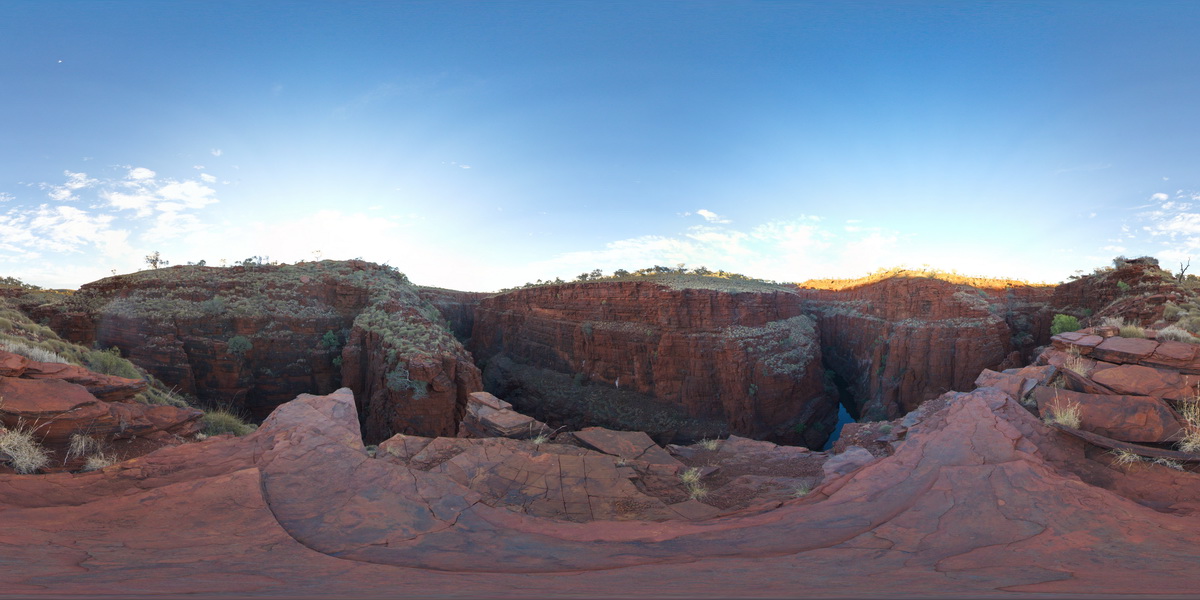
KarijiniFSP3 Map
 |
0 |
05/29/2016 noon |
FSP |
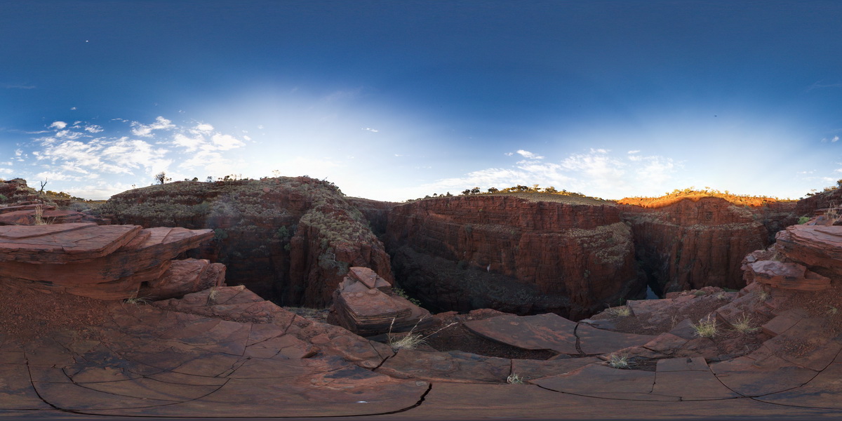
view from near Oxer Lookout above the confluence of Weano and Handcock gorges, showing stratigraphy of the Brockman Iron Formation, Karijini National Park. W.A. |
1000.00 |
-22.36123000000 |
118.28945000000 |
-9999.000 |
Brockman Iron Formation, banded iron formation, sedimentology |
BIF |
KarijiniFSP4 Map
 |
0 |
05/29/2016 noon |
FSP |
view from near Oxer Lookout above the confluence of Weano and Handcock gorges, showing stratigraphy of the Brockman Iron Formation, Karijini National Park. W.A. |
1000.00 |
-22.36123000000 |
118.28954000000 |
-9999.000 |
Brockman Iron Formation, banded iron formation, sedimentology |
BIF |
KarijiniFSP5 Map
 |
0 |
05/29/2016 noon |
FSP |
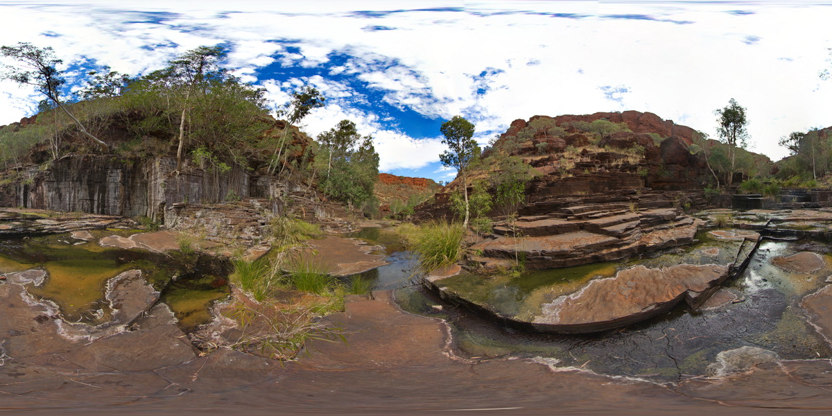
view of Handrail Pool, showing flat-lying stratigraphy of the Brockman Iron Formation. Weano Gorge, Karijini National Park. W.A. |
50.00 |
-22.35952000000 |
118.28896000000 |
-9999.000 |
Brockman Iron Formation, banded iron formation, stratigraphy |
BIF |
KarijiniFSP6 Map
 |
0 |
05/29/2016 noon |
FSP |
view of terraced floor and sides of Dales Gorge, showing ripple marks in bedding surfaces, Karijini National Park, W.A. |
100.00 |
-22.47661000000 |
118.56281000000 |
-9999.000 |
ripple marks, terrace, banded iron formation |
BIF |
KarijiniFSP7 Map
 |
0 |
05/29/2016 noon |
FSP |
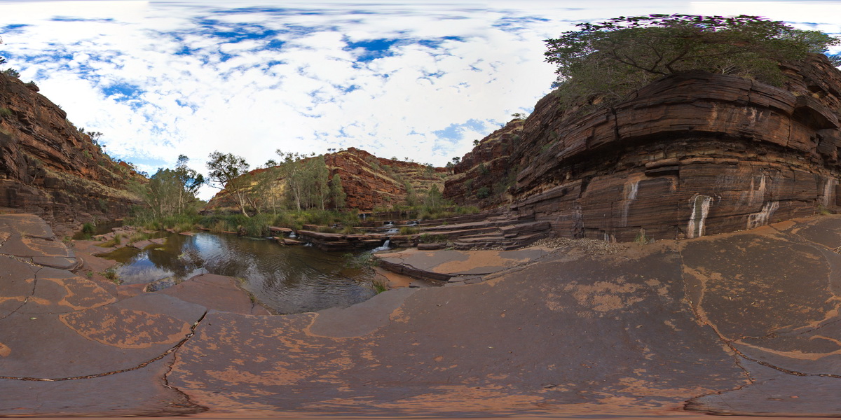
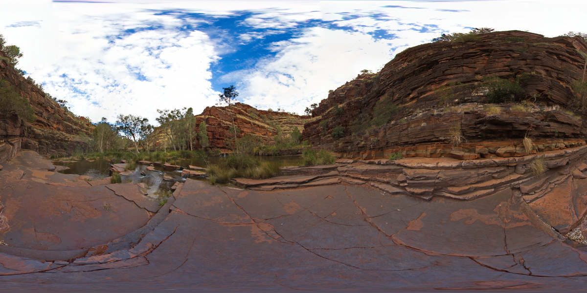
view of waterfalls, banded iron cliffs and terraced floor of Dales Gorge, Karijini National Park, W.A. |
100.00 |
-22.47715000000 |
118.55698000000 |
-9999.000 |
banded iron formation, Dales Gorge, terraced |
BIF |
KarijiniFSP8 Map
 |
0 |
05/29/2016 noon |
FSP |
view of waterfalls, finely bedded banded iron cliffs and terraced floor of Dales Gorge, Karijini National Park, W.A. |
100.00 |
-22.47713000000 |
118.55688000000 |
-9999.000 |
banded iron formation, cliffs, sedimentology |
BIF |