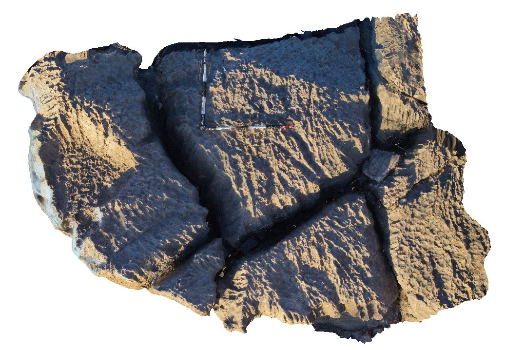
Judbarra21 Map
 |
0 |
06/18/2016 noon |
3D |
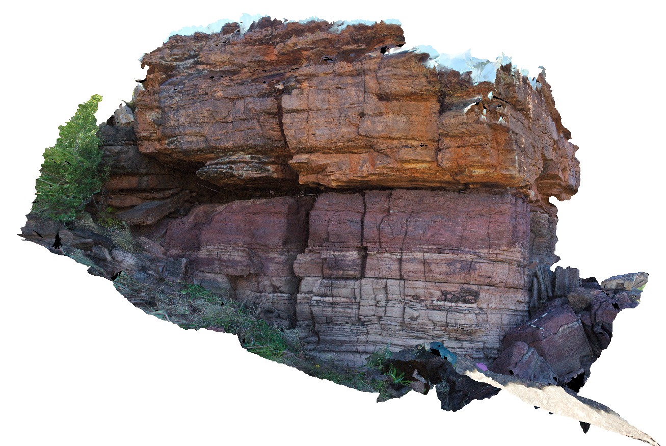
unconformable contact between overlying Jasper Gorge sandstone and underlying Timber Creek Formation dolostone. Wickham River access track. Judbarra / Gregory National Park. N.T. |
5.00 |
-16.78469000000 |
130.64877000000 |
-9999.000 |
unconformity, Jasper Gorge sandstone, Timber Creek Formation |
dolostone, sandstone |
Judbarra3 Map
 |
0 |
06/18/2016 noon |
3D |
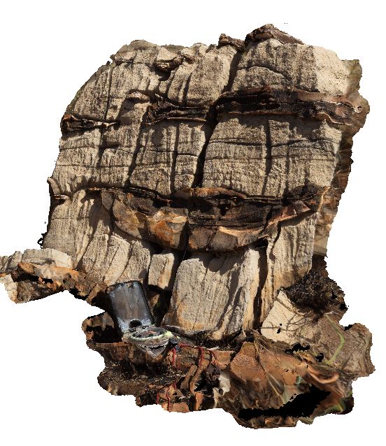
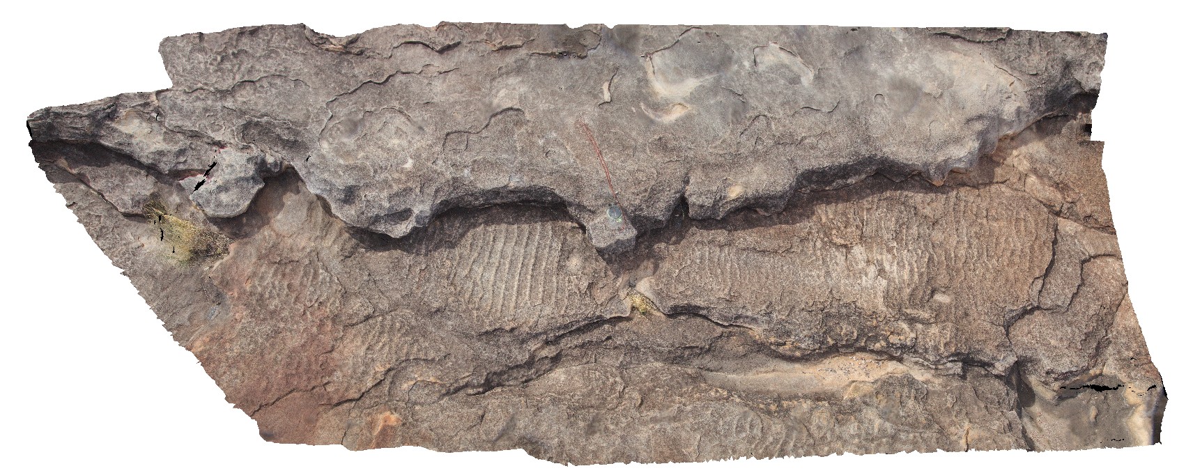
mudstone drapes within dolostone. Flaser bedding? Or channels. Judbarra / Gregory National Park access road. N.T. |
0.50 |
-15.85602000000 |
130.51295000000 |
-9999.000 |
draped bedding, dolostone, mudstone, flaser bedding, sedimentology |
dolostone |
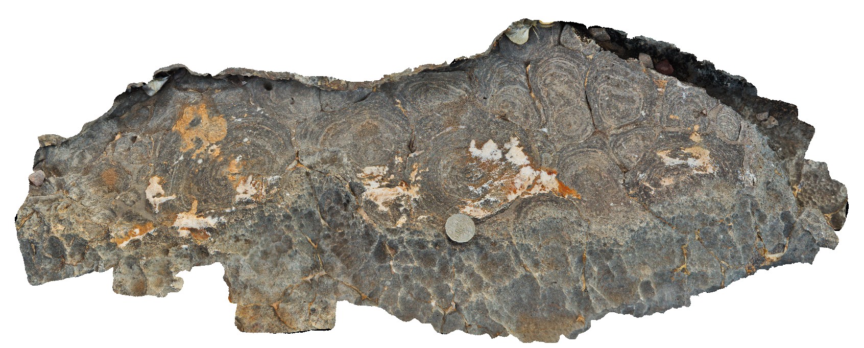
Judbarra4 Map
 |
0 |
06/18/2016 noon |
3D |
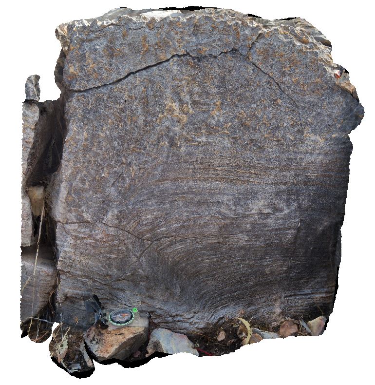
stromatolite overlain by stromatolitic conglomerate. Judbarra / Gregory National Park access road. N.T. |
0.60 |
-16.03527000000 |
130.45903000000 |
-9999.000 |
stromatolite, stromatolitic conglomerate, sedimentology, fossil, palaeontology |
limestone |
Judbarra5 Map
 |
0 |
06/18/2016 noon |
3D |
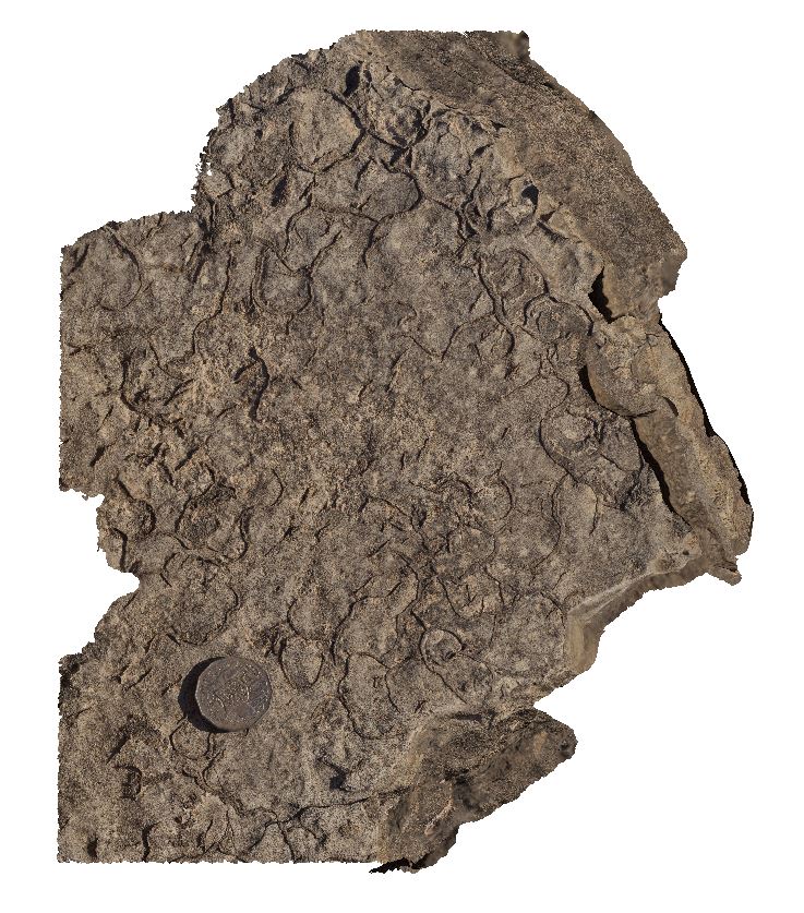
mud cracks in mud layer within dolostone. Limestone Gorge Campground, near East Baines River. N.T. |
0.40 |
-16.04986000000 |
130.38223000000 |
-9999.000 |
mud cracks, dolostone, Limestone Gorge, sedimentology |
dolostone |
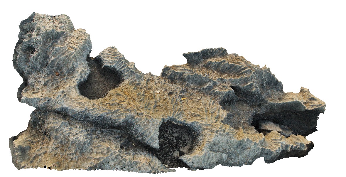
Judbarra6 Map
 |
0 |
06/18/2016 noon |
3D |
rillenkarren in stromatolitic limestone. Limestone Gorge Campground, near East Baines River. N.T. |
2.50 |
-16.04983000000 |
130.40259000000 |
-9999.000 |
Rillenkarren, stromatolite, fossil, sedimentology, palaeontology |
limestone |
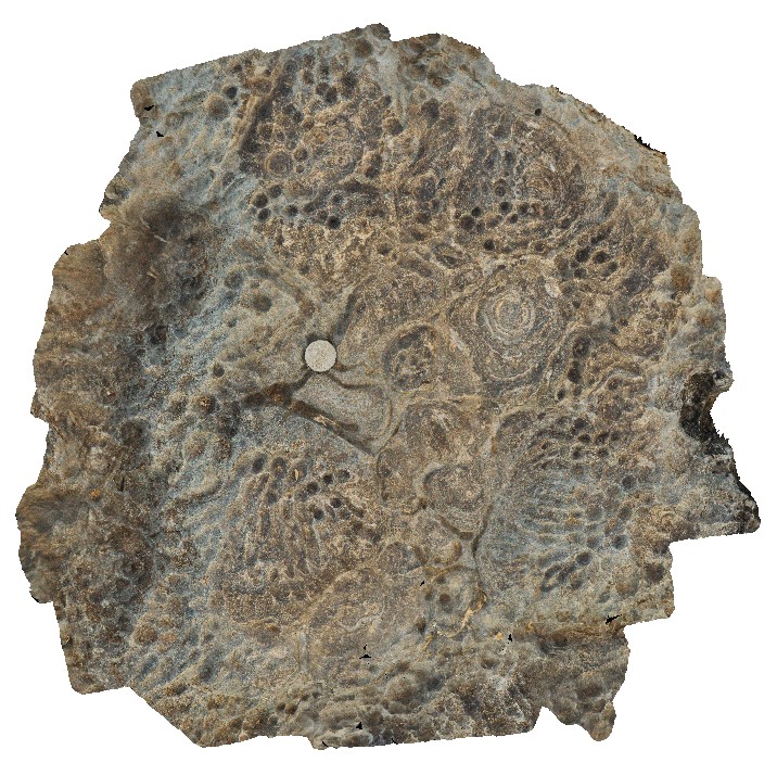
Judbarra7 Map
 |
0 |
06/18/2016 noon |
3D |
top view of stromatolites and rillenkarren. Limestone Gorge access track, Judbarra, N.T. |
0.80 |
-16.04983000000 |
130.40259000000 |
-9999.000 |
rillenkarren, limestone, weathering feature, stromatolite, sedimentology, fossil |
limestone |
Judbarra8 Map
 |
0 |
06/18/2016 noon |
3D |
top view of stromatolites and rillenkarren. Limestone Gorge access track, Judbarra, N.T. |
0.80 |
-16.04959000000 |
130.40291000000 |
-9999.000 |
rillenkarren, stromatolite, weathering feature, limestone, sedimentology, fossil |
limestone |
Judbarra9 Map
 |
0 |
06/18/2016 noon |
3D |
rillenkarren in stromatolitic limestone. Limestone Gorge access track, Judbarra, N.T. |
2.00 |
-16.04959000000 |
130.40291000000 |
-9999.000 |
limestone, rillenkarren, weathering, stromatolite, sedimentology, fossil |
limestone |
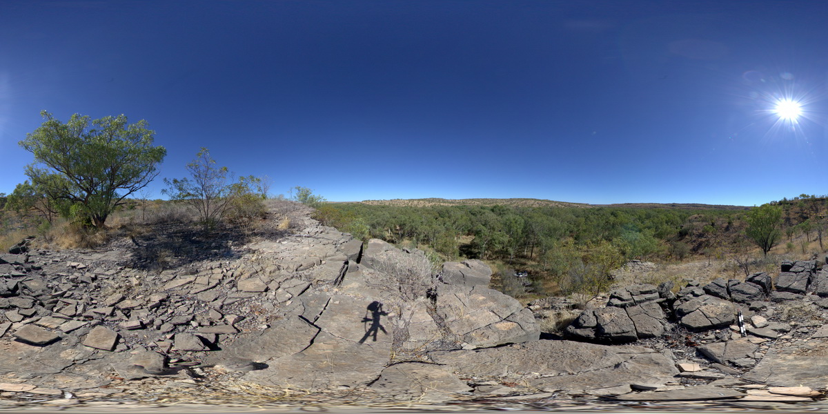
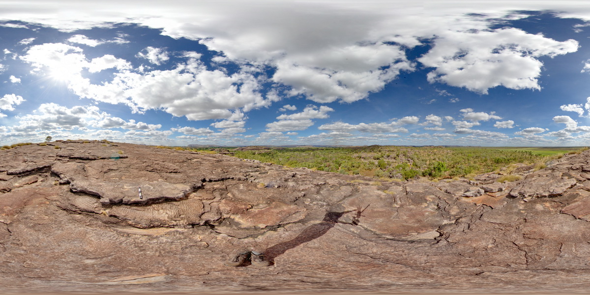
JudbarraFSP1 Map
 |
5 |
06/18/2016 noon |
FSP |
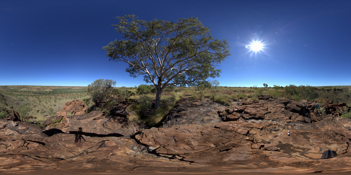
view from hill top of gorges cut through stromatolitic limestone, to West of Bullita / Timber Creek track. Limestone Gorge Campground, near East Baines River. N.T. |
2000.00 |
-16.04959000000 |
130.38254000000 |
-9999.000 |
stromatolite, limestone, gorge, Judbarra, fossil, sedimentology |
limestone |
JudbarraFSP2 Map
 |
0 |
06/18/2016 noon |
FSP |
view of valley from hill top of stromatolitic dolostone with rillenkarren weathering. . Humbert / Wickham River access track. Judbarra / Gregory National Park. N.T. |
2000.00 |
-16.46502000000 |
130.51921000000 |
-9999.000 |
stromatolite, dolostone, fossil, sedimentology, rillenkarren |
dolostone |
JudbarraFSP3 Map
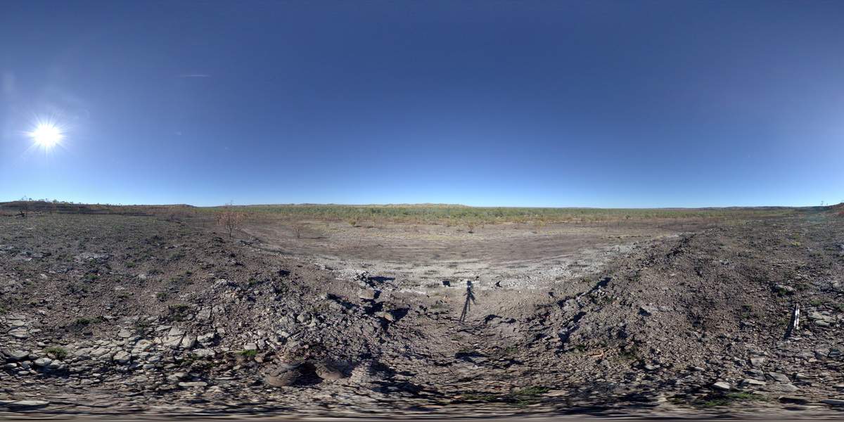 |
0 |
06/18/2016 noon |
FSP |
view of flat-lying beds of nodular dolostone in low hills. Wickham track. Judbarra / Gregory National Park. N.T. |
2000.00 |
-16.71327000000 |
130.58405000000 |
-9999.000 |
dolostone, nodular, sedimentology |
dolostone |
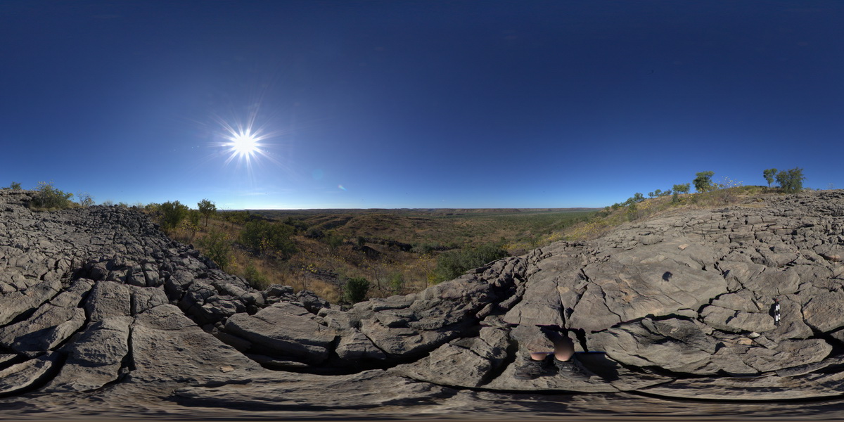
JudbarraFSP4 Map
 |
0 |
06/18/2016 noon |
FSP |
View from hill of shallow dipping dolostone around edges of surrounding valley. Wickham River access track. Judbarra / Gregory National Park. N.T. |
1000.00 |
-16.67808000000 |
130.66286000000 |
-9999.000 |
dolostone, sedimentology |
dolostone |
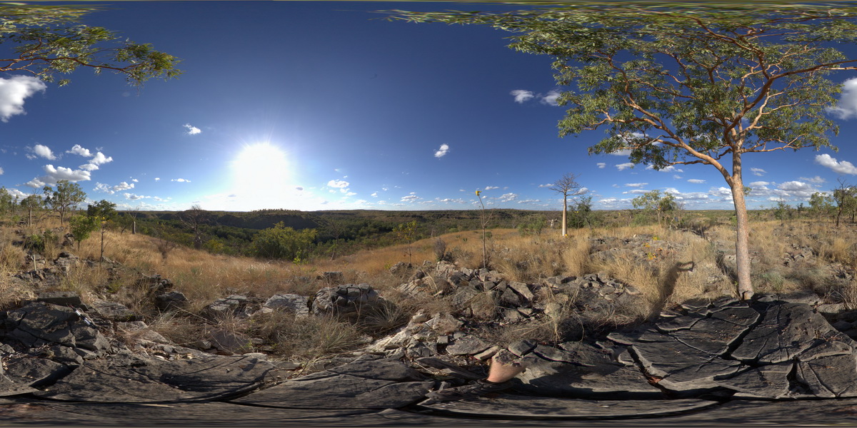
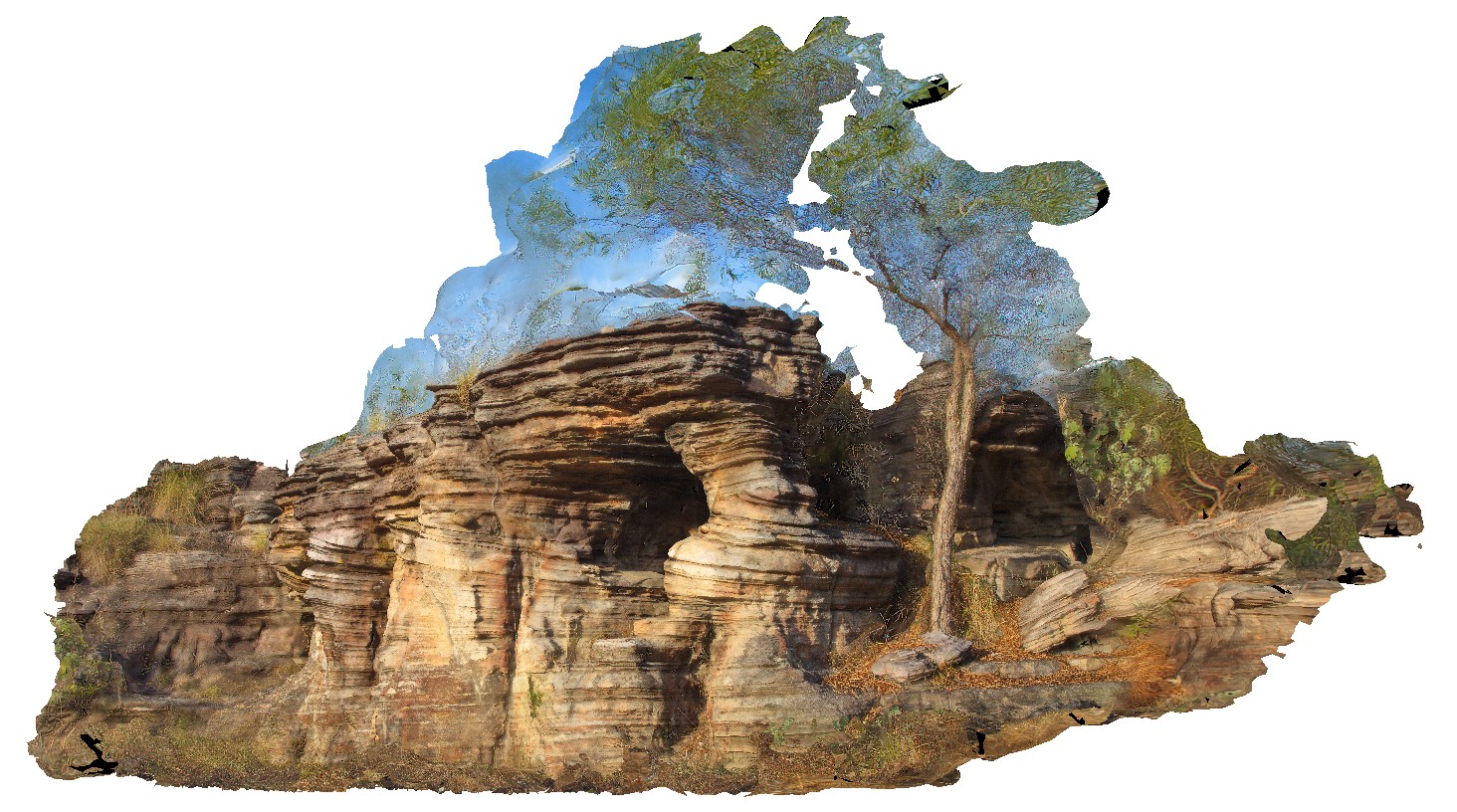
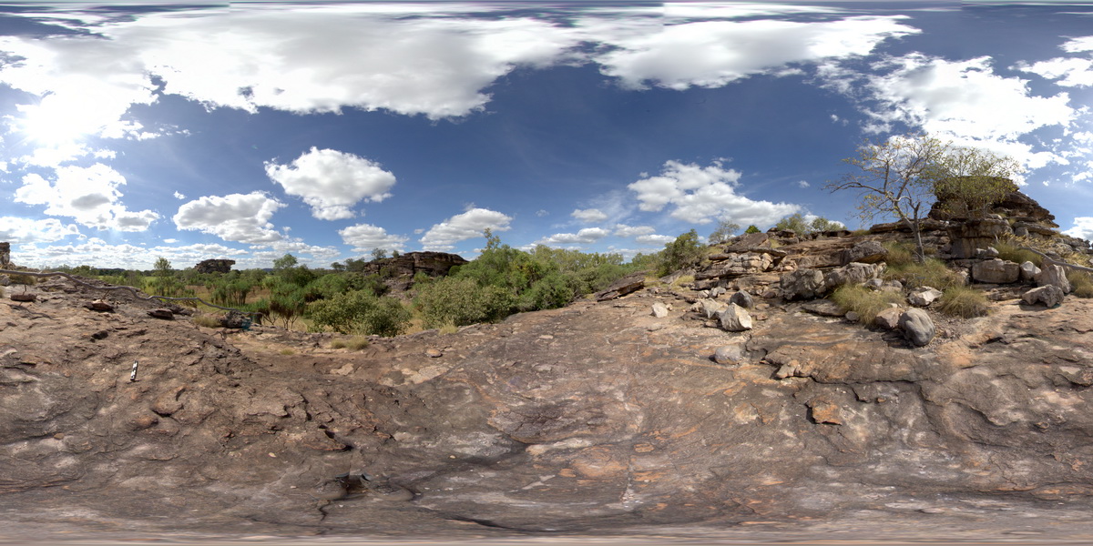
JudbarraFSP5 Map
 |
0 |
06/18/2016 noon |
FSP |
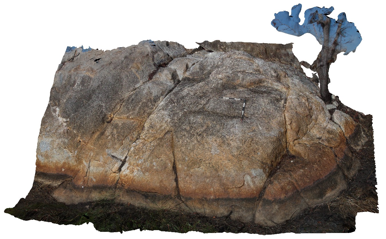
Ridgetop of Jaspar Gorge Sandstone unconformably overlying Supplejack Dolostone Member. Judbarra / Gregory National Park. N.T. |
1000.00 |
-16.78470000000 |
130.64859000000 |
-9999.000 |
unconformity, Supplejack Dolostone, Jaspar Gorge Sandstone, sedimentology |
sandstone, dolostone |
Kakadu1 Map
 |
0 |
06/25/2016 noon |
3D |
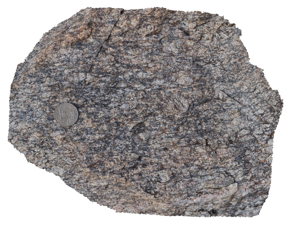
augen gneiss with K-feldspar-quartz pegmatite pod that is surrounded by biotite-feldspar halo. Gneiss crosscut by quartz veins. Gneissic basement, Arnhem Highway crossing of South Alligator River, N.T. |
5.30 |
-12.66160000000 |
132.51231000000 |
-9999.000 |
augen gneiss, pegmatite pod |
gneiss |
Kakadu2 Map
 |
0 |
06/25/2016 noon |
3D |
view of augen (up to 2.5cm wide) within augen gneiss basement. Arnhem Highway crossing of South Alligator River, N.T. |
0.30 |
-12.66160000000 |
132.51231000000 |
-9999.000 |
augen gneiss |
gneiss |
Kakadu3 Map
 |
0 |
06/25/2016 noon |
3D |
ripple marks in weathered medium-to-coarse sandstone. Ubirr Art Site. Kakadu National Park, N.T. |
2.60 |
-12.40900000000 |
132.95412000000 |
-9999.000 |
ripple marks, sandstone, sedimentology |
sandstone |
Kakadu4 Map
 |
0 |
06/25/2016 noon |
3D |
cross bedding in sandstone cliff. Bardedjilidji Walk. Kakadu National Park, N.T. |
11.00 |
-12.43685000000 |
132.97076000000 |
-9999.000 |
cross bedding, sandstone |
sandstone |
Kakadu5 Map
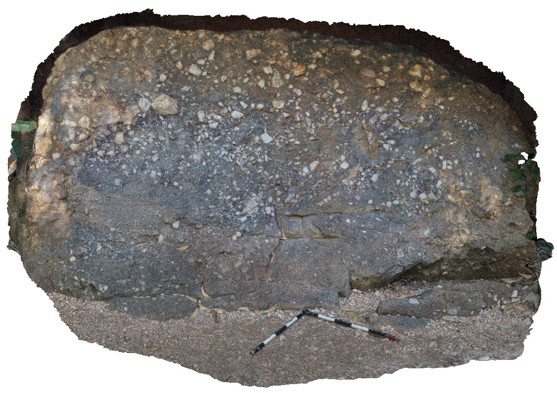 |
0 |
06/25/2016 noon |
3D |
polymict conglomerate with weak graded bedding. Clast types include; vein-quartz, sandstone and granite. Nourlangie Rock Art Site. Kakadu National Park, N.T. |
2.80 |
-12.86548000000 |
132.81525000000 |
-9999.000 |
polymict conglomerate, poor grading, sedimentology |
conglomerate |
Kakadu6 Map
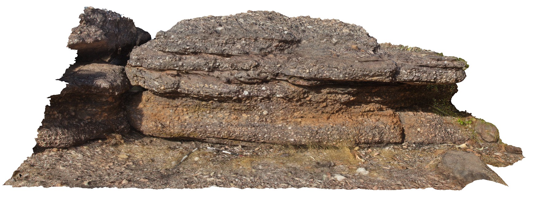 |
0 |
06/25/2016 noon |
3D |
interbedded, polymict conglomerate and sandstone with weak to moderate imbrication in some of the conglomerate beds. Nourlangie Rock Art Site. Kakadu National Park, N.T. |
5.00 |
-12.86475000000 |
132.81610000000 |
-9999.000 |
polymict conglomerate, imbricated conglomerate |
conglomerate |
Kakadu7 Map
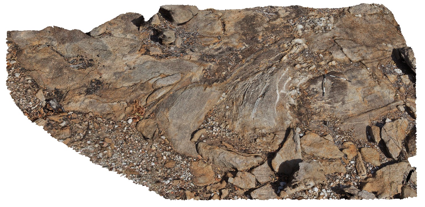 |
0 |
06/25/2016 noon |
3D |
folds and axial planar cleavage in muscovite schist. Nourlangie Rock Art Site. Kakadu National Park, N.T. |
7.50 |
-12.97397000000 |
132.69547000000 |
-9999.000 |
muscovite schist, folds, axial planar cleavage |
schist |
KakaduFPS2 Map
 |
0 |
06/25/2016 noon |
FSP |
foreground of pebbly sandstone with sandstone escarpment in the background. Ubirr Art Site. Kakadu National Park, N.T. |
2000.00 |
-12.40825000000 |
132.95457000000 |
-9999.000 |
sandstone, sedimentology, Kakadu National Park |
sandstone |
KakaduFPS4 Map
 |
0 |
06/25/2016 noon |
FSP |
towers of bedded sandstone with chert, cross bedding, caves and columns. Bardedjilidji Walk. Kakadu National Park, N.T. |
0.00 |
-12.43794000000 |
132.96854000000 |
-9999.000 |
cross bedding, sandstone, sedimentology, cave, Kakadu National Park |
sandstone |
KakaduFPS6 Map
 |
0 |
06/25/2016 noon |
FSP |
view of sandstone escarpment and cross bedding in sandstone at Bardedjilidji Walk. Kakadu National Park, N.T. |
500.00 |
-12.43680000000 |
132.97054000000 |
-9999.000 |
sandstone, cross bedding, Kakadu National Park |
sandstone |
KakaduFSP1 Map
 |
0 |
06/25/2016 noon |
FSP |
pebbly sandstone in the foreground, surrounded by stacks of shallow dipping sandstone (locally with rock art) in the background. Ubirr Art Site. Kakadu National Park, N.T. |
500.00 |
-12.40792000000 |
132.95520000000 |
-9999.000 |
sandstone, dip, sedimentology, Kakadu National Park |
sandstone |
KakaduFSP3 Map
 |
0 |
06/25/2016 noon |
FSP |
on top of Ubarr. Ripple marks in sandstone bedding top in foreground. Sandstone towers and escarpment in background. Ubirr Art Site. Kakadu National Park, N.T. |
2000.00 |
-12.40900000000 |
132.95412000000 |
-9999.000 |
ripple marks, bedding top, sedimentology, Kakadu National Park |
sandstone |