Kiewa5 Map
 |
5 |
06/17/2015 10:22 a.m. |
3D |
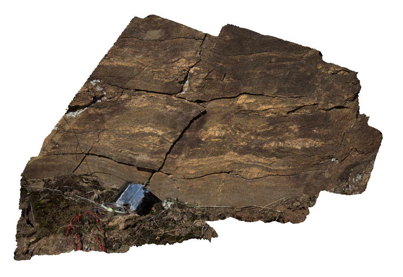
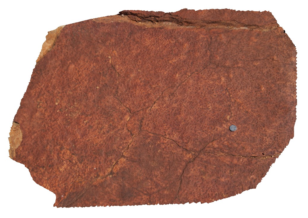
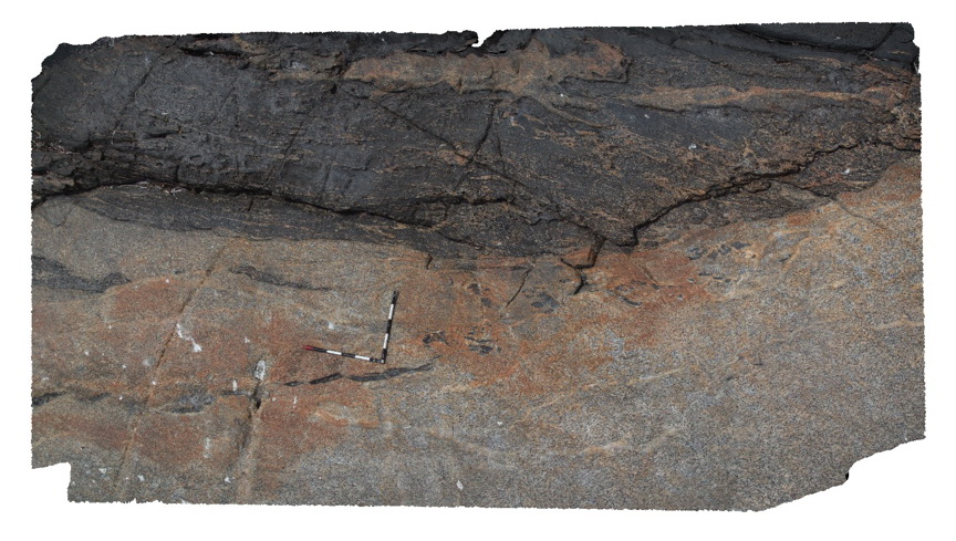
Migmatitic segregations in gneissic rocks of the Silurian Omeo Metamorphic Complex. Kiewa, Vic. |
1.00 |
-36.72432166000 |
147.12949028000 |
711.000 |
migmatite, structure, igneous |
migmatite |
Kiewa6 Map
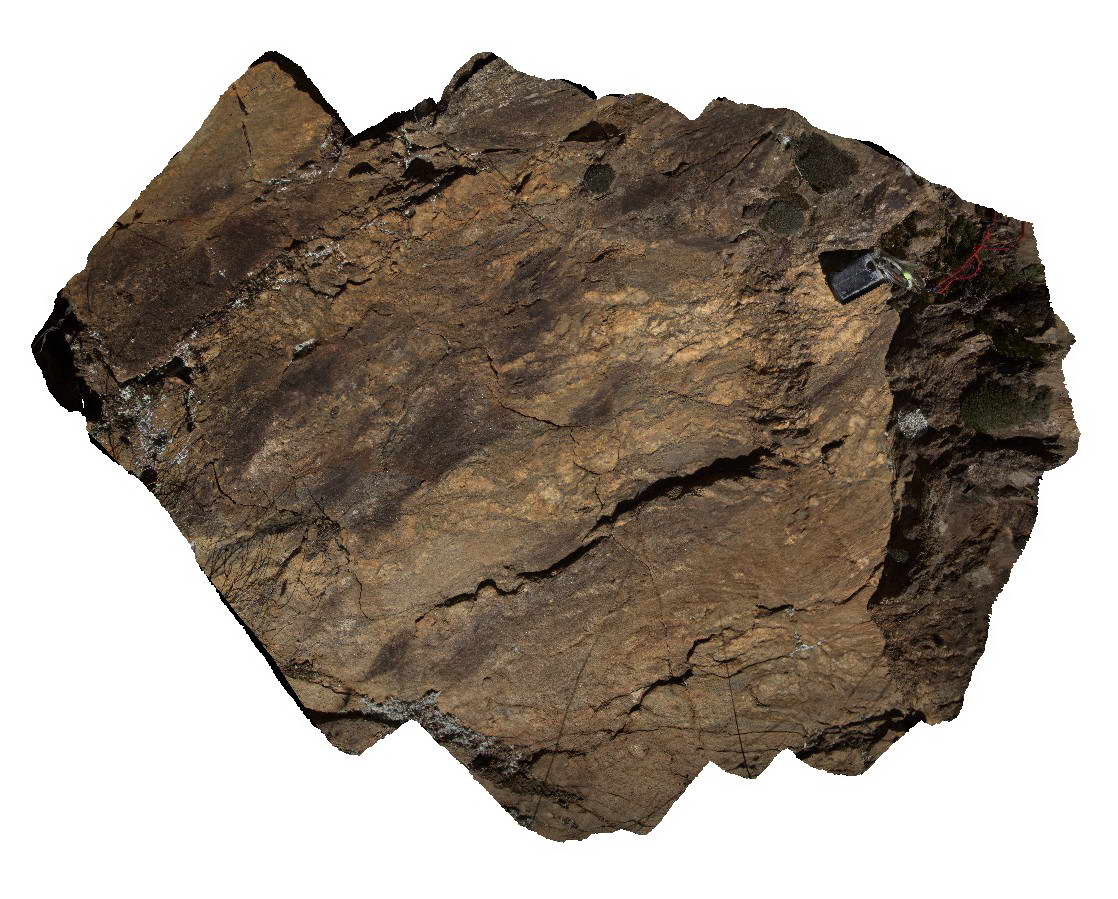 |
5 |
06/17/2015 10:22 a.m. |
3D |
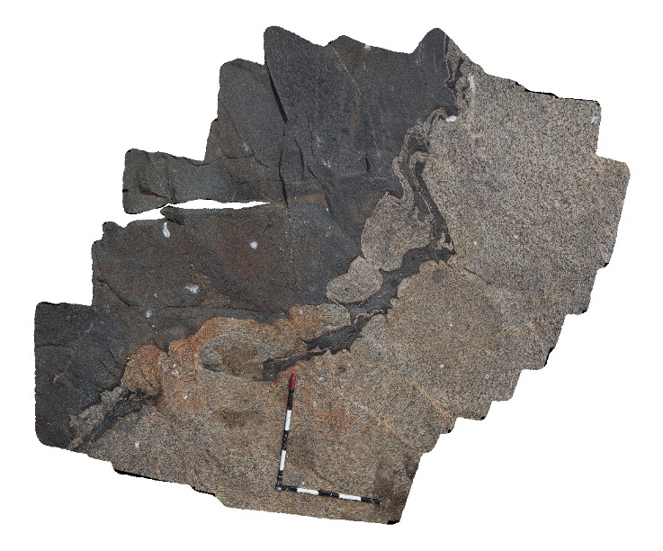
detailed view of migmatite in Silurian rocks of the Omeo Metamorphic Complex showing folded leucosomes. Kiewa, Vic. |
1.00 |
-36.72436000000 |
147.12953000000 |
726.000 |
migmatite, structure |
migmatite |
Kings1 Map
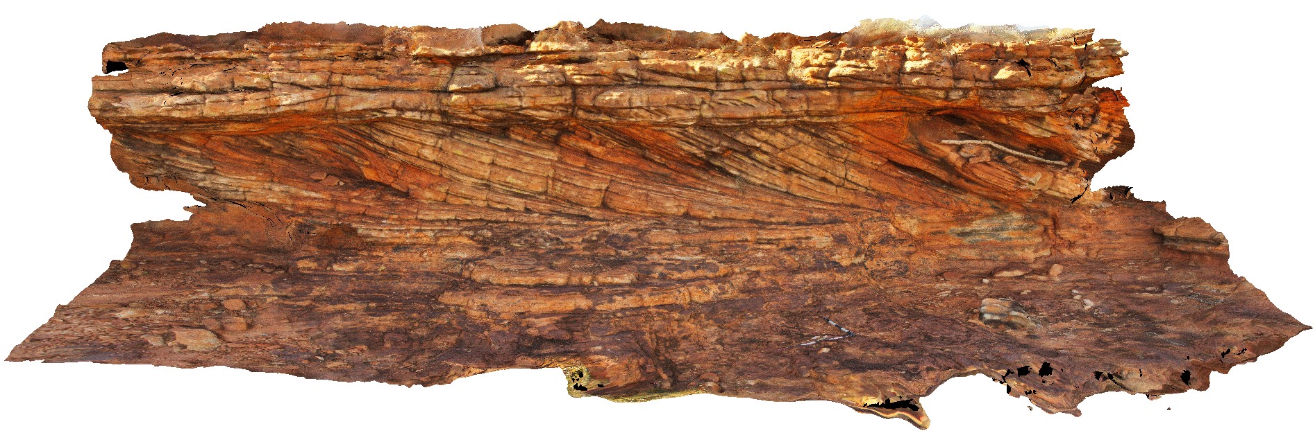 |
0 |
07/31/2016 10:16 a.m. |
3D |
trough - cross beds in Mareenie sandstone on cliff above Kings Canyon. Watarrka National Park, N.T. |
6.50 |
-24.24718600000 |
131.57438000000 |
741.265 |
Mereenie Sandstone, sedimentology, cross bedding, trough |
sandstone |
Kings2 Map
 |
0 |
07/31/2016 10:32 a.m. |
3D |
cross beds in Mareenie Sandstone on cliff above Kings Canyon. Watarrka National Park, N.T. |
4.50 |
-24.24683200000 |
131.57505300000 |
744.912 |
cross bedding, Mareenie Sandstone, Kings Canyon, sedimentology |
sandstone |
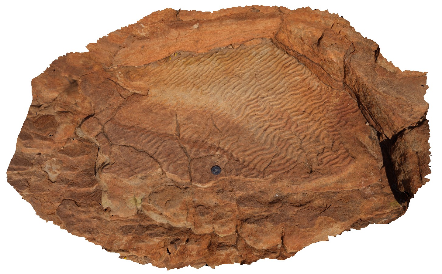
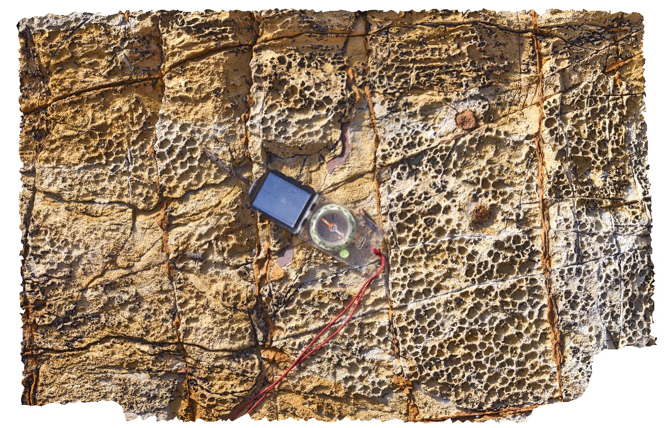
Kings3 Map
 |
5 |
07/31/2016 11:19 a.m. |
3D |
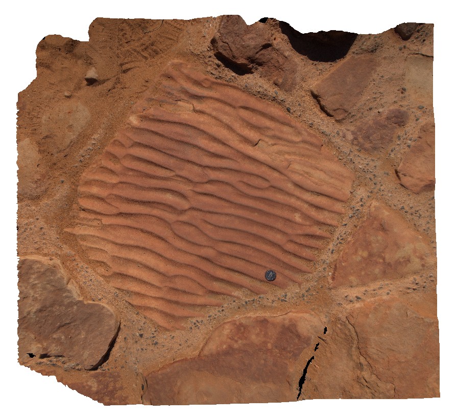
ripple marks on bedding surface of the Mereenie Sandstone. Kings Canyon, Watarrka National Park, N.T. |
1.00 |
-24.24878400000 |
131.57920900000 |
748.502 |
ripple marks, bedding surface, bedding, sedimentology, sandstone, Mereenie Sandstone |
sandstone |
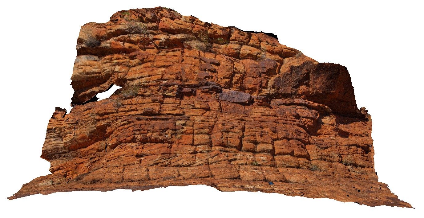
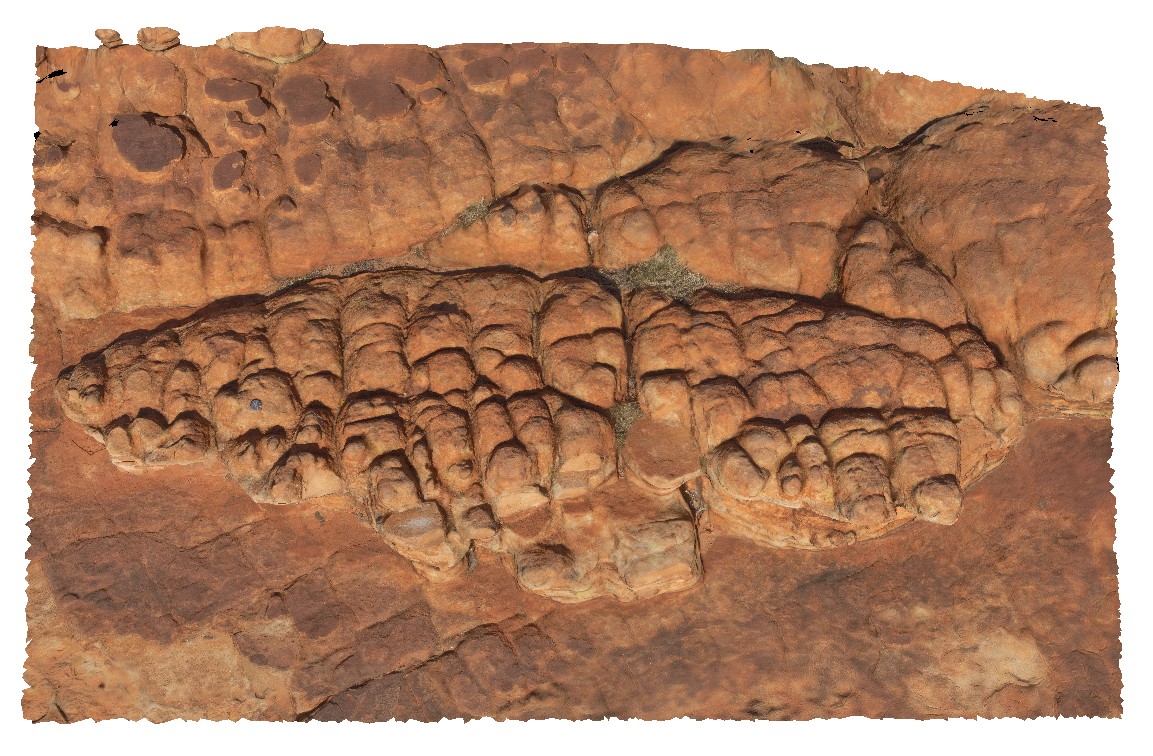
Kings4 Map
 |
0 |
07/31/2016 11:27 a.m. |
3D |
dome shaped joint weathering in Mereenie Sandstone, orientated E-W, N-S. Kings Canyon, Watarrka National Park, N.T. |
3.00 |
-24.24910300000 |
131.57939400000 |
744.410 |
joint, weathering, Mereenie Sandstone, Kings Canyon |
sandstone |
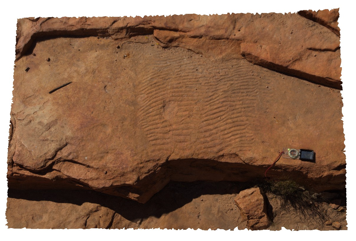
Kings5 Map
 |
0 |
07/31/2016 11:35 a.m. |
3D |
ripple marks exposed on bedding surface of Mereenie Sandstone. Kings Canyon, Watarrka National Park, N.T. |
2.50 |
-24.24900700000 |
131.57960600000 |
746.684 |
Mereenie Sandstone, ripple marks, bedding surface, sedimentology |
sandstone |
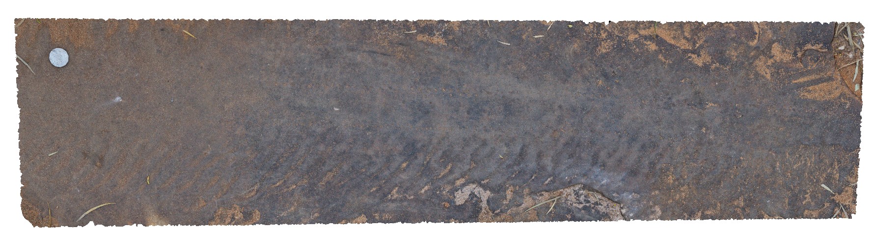
Kings6 Map
 |
5 |
07/31/2016 12:47 p.m. |
3D |
ripple marks and fossilised tracks in Mereenie Sandstone. Kings Canyon, Watarrka National Park, N.T. |
1.00 |
-24.25007200000 |
131.58426800000 |
739.529 |
fossil, fossil tracks, sandstone, ripple marks, Mereenie Sandstone, sedimentology, palaeontology |
sandstone |
Kings7 Map
 |
5 |
01/01/9999 midnight |
3D |
possible fossilised rain indentations/drops in Mereenie Sandstone. Kings Canyon, Watarrka National Park, N.T. |
1.00 |
-24.25160400000 |
131.58066300000 |
749.528 |
fossilised rain drops, Mereenie Sandstone, sedimentology, fossil, palaeontology |
sandstone |
Kings8 Map
 |
0 |
07/31/2016 1:49 p.m. |
3D |
large ripple marks preserved in Mereenie Sandstone slab, used in walking track. Kings Canyon, Watarrka National Park, N.T. |
1.00 |
-24.25637900000 |
131.57598700000 |
708.260 |
ripple marks, sedimentology, Mereenie Sandstone |
sandstone |
KingsFSP1 Map
 |
5 |
01/01/9999 midnight |
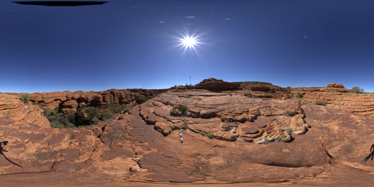
FSP |
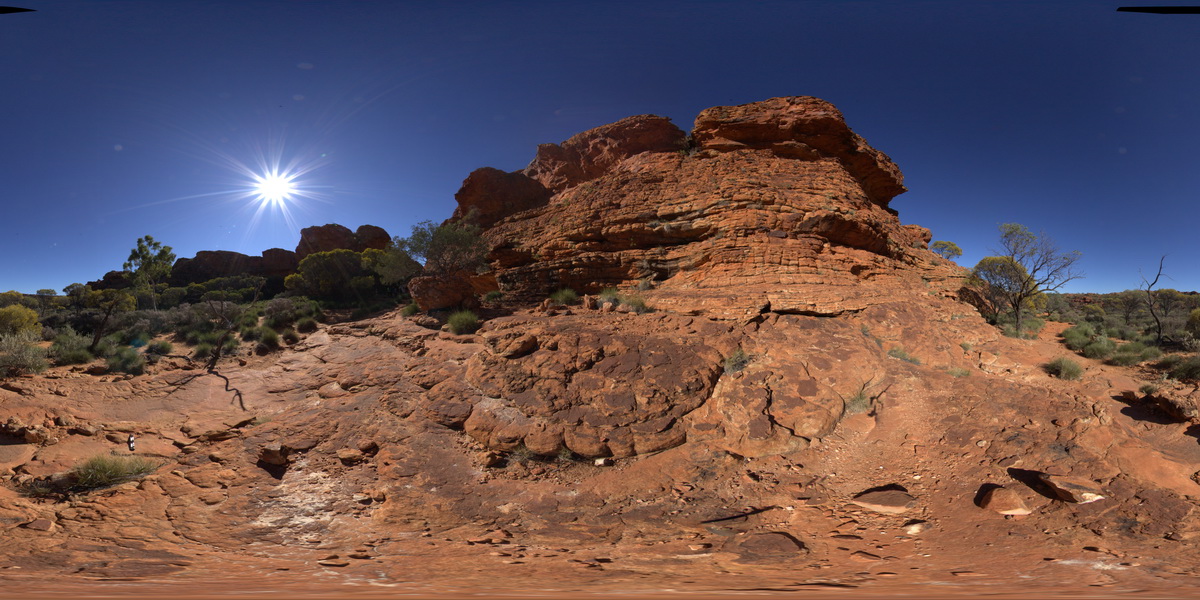
panorama image of Mereenie Sandstone cliff exposure, showing bedding and cross bedding. Kings Canyon, N.T. |
200.00 |
-24.24683200000 |
131.57505300000 |
744.912 |
cross bedding, bedding, cliff, sedimentology |
sandstone |
KingsFSP2 Map
 |
5 |
07/31/2016 11:04 a.m. |
FSP |
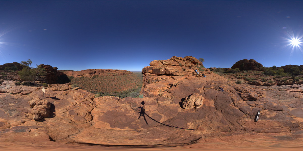
panorama view looking south across Kings Canyon, showing contact between
Mereenie Sandstone and the Carmichael Sandstone. Kings Canyon, Watarrka National Park, N.T. |
3000.00 |
-24.24864000000 |
131.57758600000 |
738.694 |
Kings Canyon, Carmichael Sandstone, Mereenie Sandstone, sedimentology, geological contact |
sandstone, sandstone |
KingsFSP3 Map
 |
5 |
07/31/2016 12:28 p.m. |
FSP |
panorama view, showing weathering and mud cracks? In the foreground and bedded strata of the Mereenie Sandstone in the background. Kings Canyon, Watarrka National Park, N.T. |
300.00 |
-24.24925300000 |
131.58338800000 |
747.126 |
mud cracks, weathering, joint, sedimentology, Mereenie Sandstone |
sandstone |
KingsFSP4 Map
 |
0 |
07/31/2016 1:10 p.m. |
FSP |
panorama view of Mereenie Sandstone cliffs from the edge of Kings Canyon. Watarrka National Park, N.T. |
500.00 |
-24.25160400000 |
131.58066300000 |
749.528 |
Kings Canyon, Mereenie Sandstone, sandstone, sedimentology |
sandstone |
Kingston1 Map
 |
0 |
07/15/2016 noon |
3D |
Permian sandstone outcrop with concretions and dropstones visible. Shore exposure south of Kingston Beach, Tas. |
0.80 |
-42.98557000000 |
147.32727000000 |
-9999.000 |
shore platform, Permian, dropstone, concretion, glacial |
sandstone |
Kingston2 Map
 |
0 |
07/15/2016 noon |
3D |
dropstones in marine, Permian sandstone. Shore exposure south of Kingston Beach, Tas. |
4.20 |
-42.98520000000 |
147.32668000000 |
-9999.000 |
glacial, marine facies, dropstone |
sandstone |
KingstonFSP1 Map
 |
20 |
07/15/2016 noon |
FSP |
view of shore platform exposure, showing pavement and cliffs of Permian sandstone with liesegang banding. Kingston Beach, Tasmania. |
1000.00 |
-42.98515000000 |
147.32671000000 |
-9999.000 |
Permian, sandstone, liesegang bands, sedimentology |
sandstone |
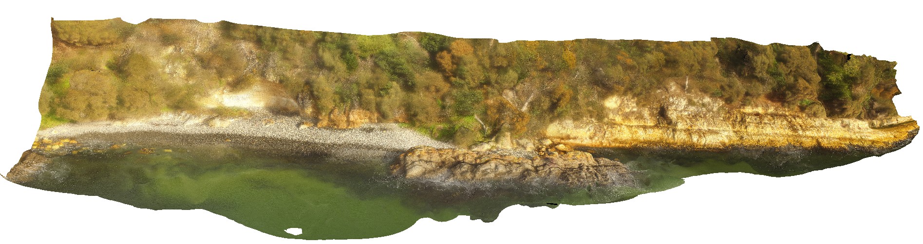
KingstonUAV1 Map
 |
20 |
07/15/2016 noon |
UAV |
aerial view of Permian sandstone contact with Jurassic dolerite. Shore exposure south of Kingston Beach, Tas. |
100.00 |
-42.98581000000 |
147.32770000000 |
-9999.000 |
Permian sandstone, Jurassic dolerite, intrusive contact |
sandstone, dolerite |
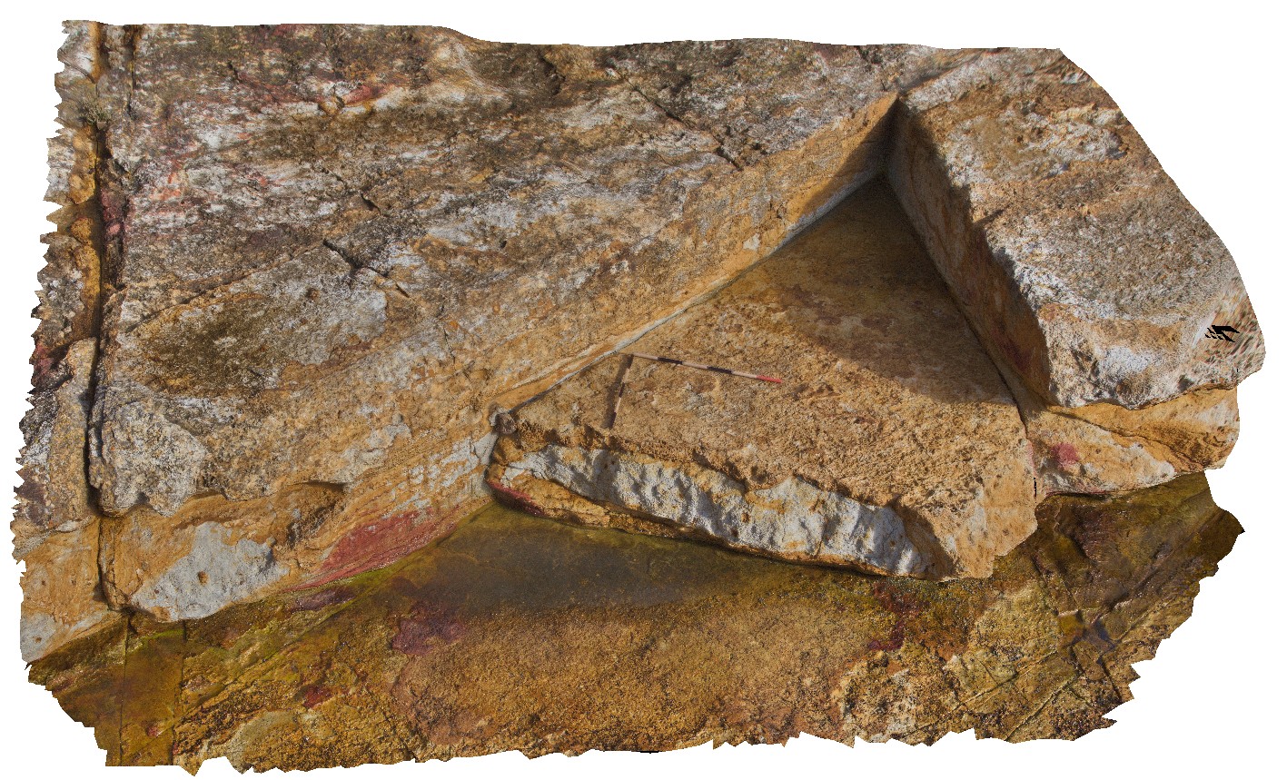
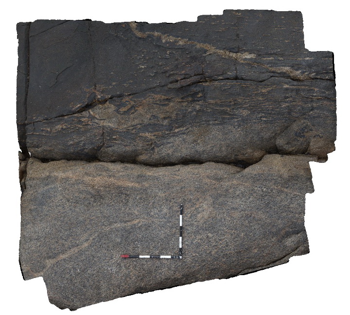
Kirton1 Map
 |
0 |
10/20/2015 2:57 p.m. |
3D |
dyke contact showing leucosomes and folding of foliation in granite, Kirton Point, Port Lincoln. S.A. |
2.50 |
-34.72417000000 |
135.88416000000 |
-9999.000 |
igneous contact, granite gneiss, mafic dyke |
granitic gneiss |
Kirton10 Map
 |
0 |
10/20/2015 2:58 p.m. |
3D |
folded / sheared fabric in granitic gneiss, Kirton Point, Point Lincoln. S.A. |
2.30 |
-34.72382000000 |
135.88371000000 |
-9999.000 |
fold, shear fabric, granitic gneiss |
granitic gneiss |
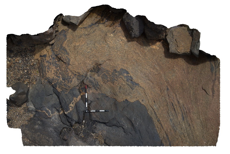
Kirton11 Map
 |
0 |
10/20/2015 2:59 p.m. |
3D |
geological contact between granitic gneiss and amphibolite with folded leucosomes. Point Kirton, Port Lincoln. S.A. |
4.50 |
-34.72371000000 |
135.88338000000 |
-9999.000 |
leucosome, granite gneiss, amphibolite, fold |
granitic gneiss, amphibolite |
Kirton12 Map
 |
0 |
10/20/2015 2:59 p.m. |
3D |
contact between amphibolite and folded and sheared granitic gneiss. Kirton Point, Port Lincoln. S.A. |
5.50 |
-34.72353000000 |
135.88251000000 |
-9999.000 |
amphibolite, granitic gneiss, intrusive contact |
granitic gneiss, amphibolite |
Kirton13 Map
 |
0 |
10/20/2015 3 p.m. |
3D |
Contact between gneiss and amphibolite with gneiss boudins. S.A. |
2.50 |
-34.72383000000 |
135.88351000000 |
-9999.000 |
boudin, amphibolite, granitic gneiss, structure |
granitic gneiss, amphibolite |
Kirton14 Map
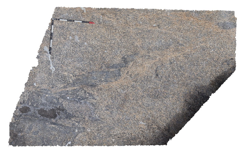
 |
0 |
10/20/2015 3 p.m. |
3D |
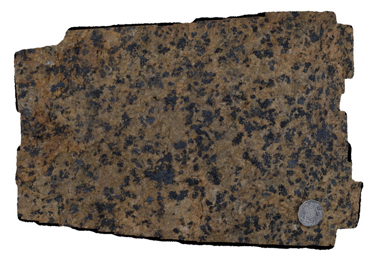
granite rocks with large mafic (pyroxene) crystals. Kirton Point, Port Lincoln. S.A. |
0.40 |
-34.72433000000 |
135.88425000000 |
-9999.000 |
granite |
granite |
Kirton2 Map
 |
0 |
10/20/2015 3:01 p.m. |
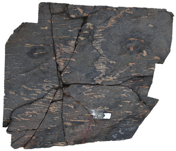
3D |
ptygmatic folding in leucosome in amphibolite, Kirton Point, Port Lincoln. S.A. |
0.60 |
-34.72424000000 |
135.88419000000 |
-9999.000 |
ptygmatic folding, leucosome, amphibolite |
amphibolite |