KakaduFSP5 Map
 |
0 |
06/25/2016 noon |
FSP |
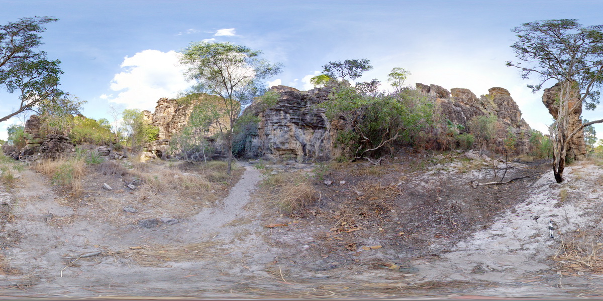
panorama, featuring towers of cross bedded sandstone Bardedjilidji Walk. Kakadu National Park, N.T. |
100.00 |
-12.43749000000 |
132.96887000000 |
-9999.000 |
cross bedding, sandstone, sedimentology, Kakadu National Park |
sandstone |
KakaduFSP7 Map
 |
0 |
06/25/2016 noon |
FSP |
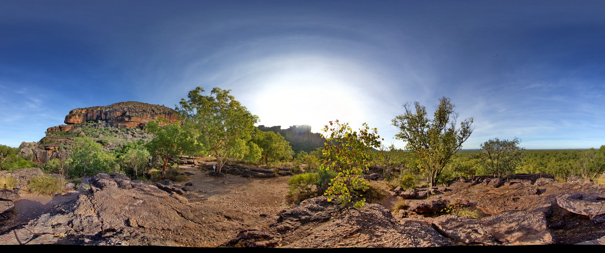
view of sandstone escarpment in background and conglomerate (as in site Kakadu5) in foreground. . Nourlangie Rock Art Site. Kakadu National Park, N.T. |
500.00 |
-12.86476000000 |
132.81610000000 |
-9999.000 |
conglomerate, sedimentology, sandstone |
sandstone |
KakaduFSP8 Map
 |
0 |
01/01/9999 midnight |
FSP |
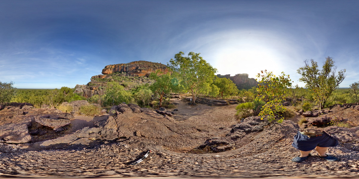
view of sandstone escarpment in background and conglomerate (as in site Kakadu5) in foreground. . Nourlangie Rock Art Site. Kakadu National Park, N.T. |
500.00 |
-12.86476000000 |
132.81590000000 |
-9999.000 |
sandstone, Kakadu National Park, escarpment, sedimentology |
sandstone |
KakaduUAV1 Map
 |
20 |
01/01/9999 midnight |
UAV |
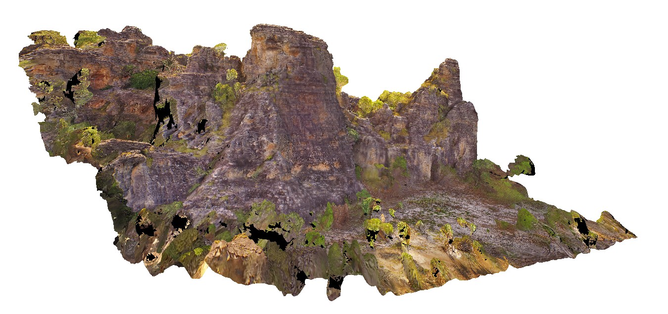
270 degree view of tall (~30m) sandstone tower with shallowly dipping cross beds and planar beds. Bardedjilidji Walk. Kakadu National Park. N.T. |
40.00 |
-12.43749000000 |
132.96887000000 |
-9999.000 |
tower, sandstone, cross bedding, weathering feature |
sandstone |
KakaduUAV2 Map
 |
20 |
01/01/9999 midnight |
UAV |
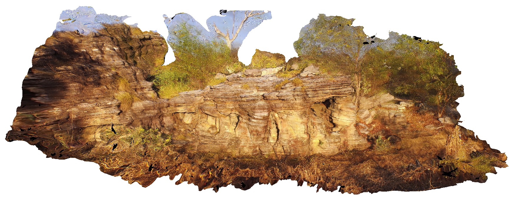
aerial view of small cliff exposure, showing gently dipping cross beds, truncated by planar bedded sandstone. Bardedjilidji Walk. Kakadu National Park. N.T. |
10.00 |
-12.43685000000 |
132.97076000000 |
-9999.000 |
cross bedding, sandstone, sedimentology |
sandstone |
Kalbarri1 Map
 |
0 |
05/20/2016 noon |
3D |
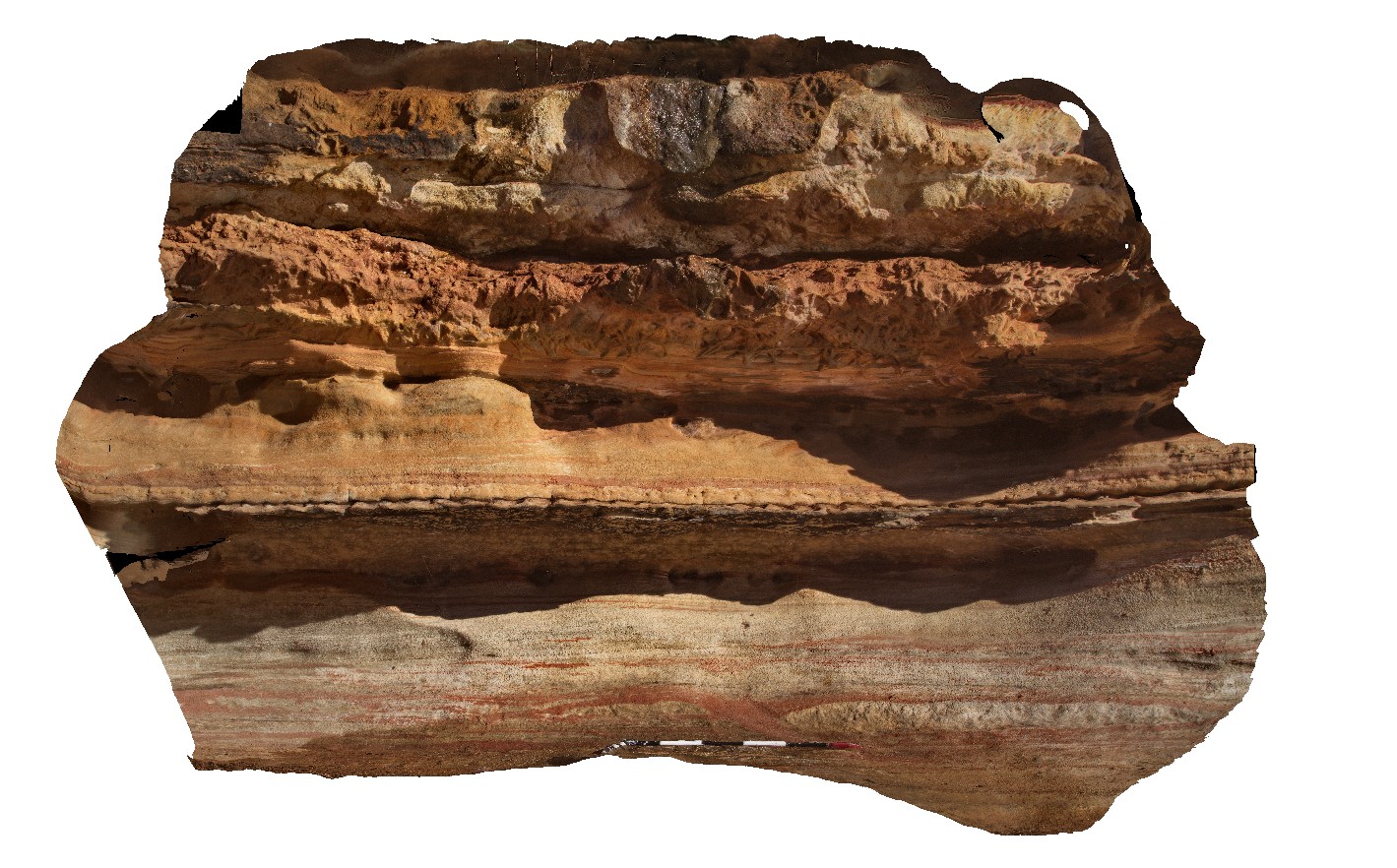
tidal facies, including ripple marked sandstone and intermittently bioturbated sandstone. Hawks Head Lookout, Kalbarri National Park. W.A. |
2.70 |
-27.79006000000 |
114.46938000000 |
-9999.000 |
bioturbation, ripple marks, sandstone, sedimentology, fossil, palaeontology |
sandstone |
Kalbarri10 Map
 |
0 |
05/20/2016 noon |
3D |
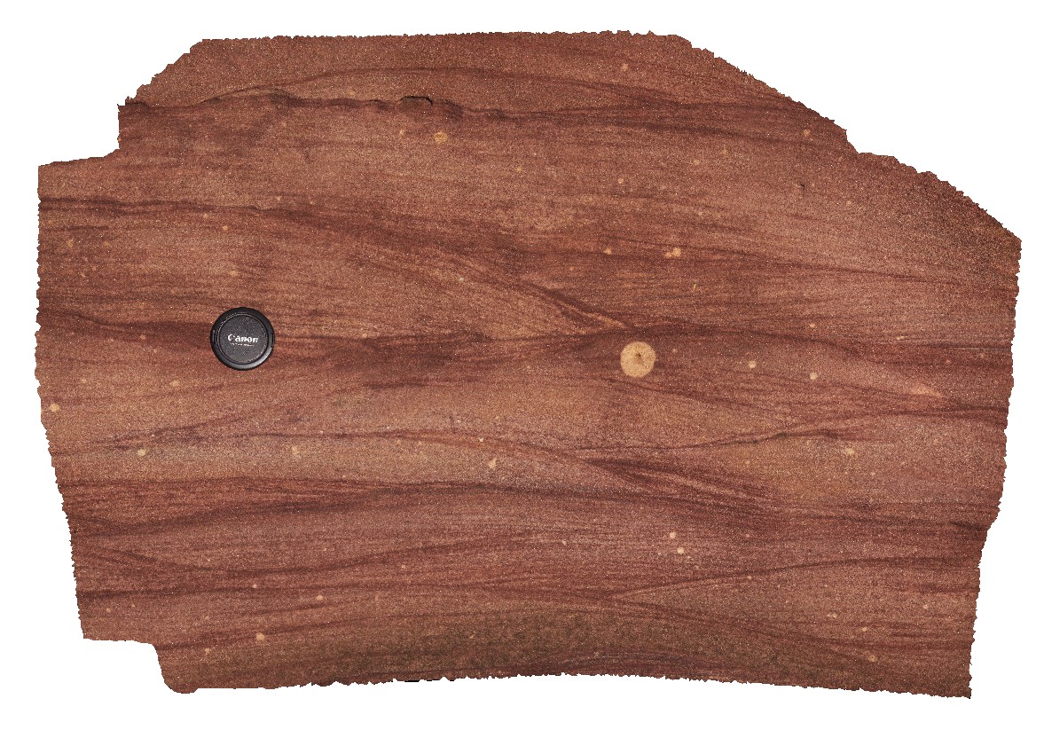
detailed view of site Kalbarri9, showing cross bedded red sandstone. 'Z bend', Kalbarri National Park. W.A. |
1.00 |
-27.65781000000 |
114.45559000000 |
-9999.000 |
cross bedding, Tumblagooda Sandstone, sedimentology |
sandstone |
Kalbarri11 Map
 |
0 |
05/20/2016 noon |
3D |
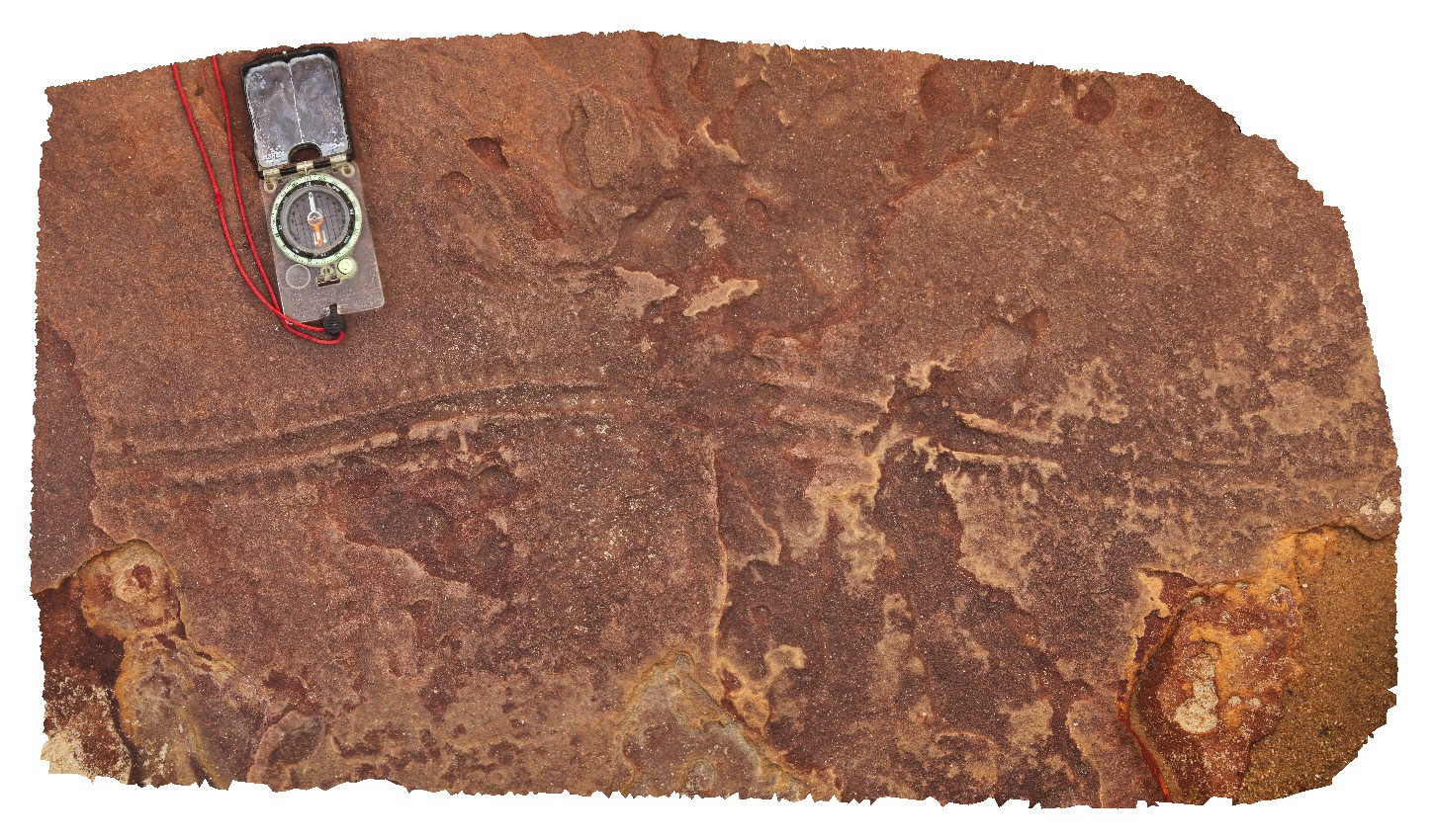
small Eurypterid tracks in sandstone bedding surface. 'Z bend', Kalbarri National Park. W.A. |
1.20 |
-27.65970000000 |
114.45638000000 |
-9999.000 |
Eurypterid tracks, animal tracks, Tumblagooda Sandstone, sedimentology, fossil, palaeontology |
sandstone |
Kalbarri12 Map
 |
0 |
05/20/2016 noon |
3D |
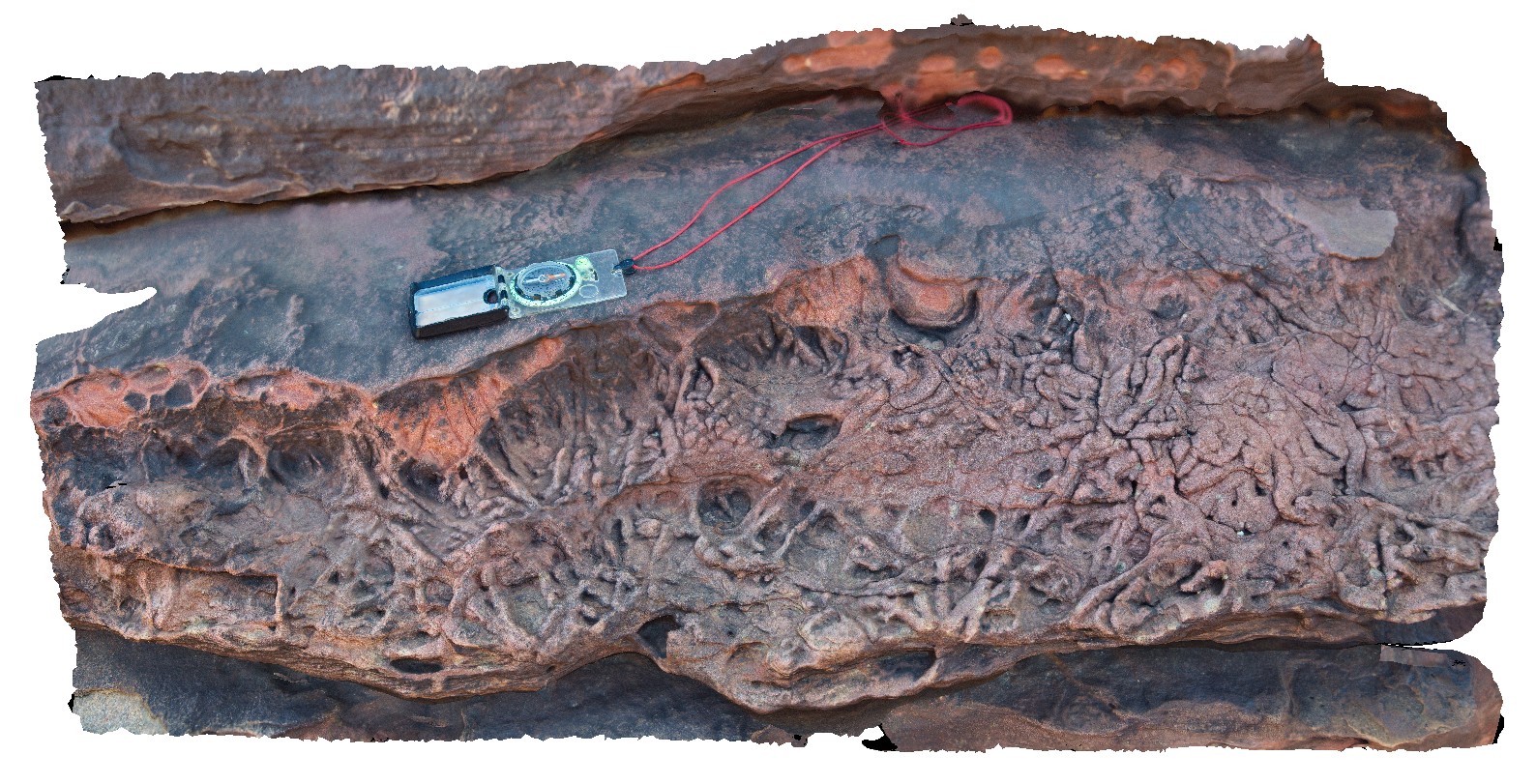
intense bioturbation in sandstone layer of Tumblagooda Sandstone. Upstream from 'Z bend', Kalbarri National Park. W.A. |
1.20 |
-27.65734000000 |
114.45575000000 |
-9999.000 |
bioturbation, Tumblagooda Sandstone, sedimentology, fossil, palaeontology |
sandstone |
Kalbarri13 Map
 |
0 |
05/20/2016 noon |
3D |
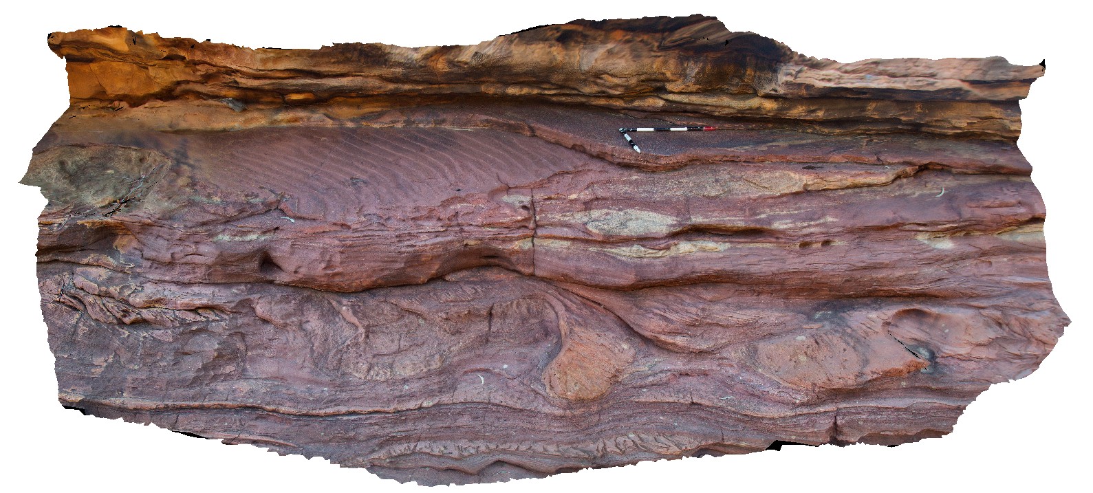
cross beds and ripple marks in red sandstone of the Tumblagooda Sandstone. Upstream from 'Z bend', Kalbarri National Park. W.A. |
5.00 |
-27.65623000000 |
114.45596000000 |
-9999.000 |
cross bedding, Tumblagooda Sandstone |
sandstone |
Kalbarri14 Map
 |
0 |
05/20/2016 noon |
3D |
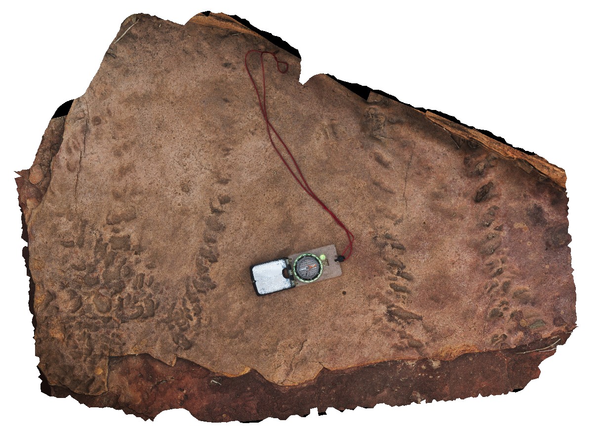
large Eurypterid tracks in sandstone layer. Upstream from 'Z bend', Kalbarri National Park. W.A. |
1.20 |
-27.65534000000 |
114.45622000000 |
-9999.000 |
Eurypterid tracks, track, palaeontology, fossil |
sandstone |
Kalbarri15 Map
 |
0 |
05/20/2016 noon |
3D |
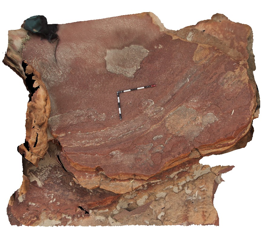
Eurypterid tracks on large slab of sandstone. Upstream from 'Z bend', Kalbarri National Park. W.A. |
3.50 |
-27.65507000000 |
114.45641000000 |
-9999.000 |
Eurypterid tracks, sandstone, tracks, fossil, palaeontology |
sandstone |
Kalbarri16 Map
 |
0 |
05/20/2016 noon |
3D |
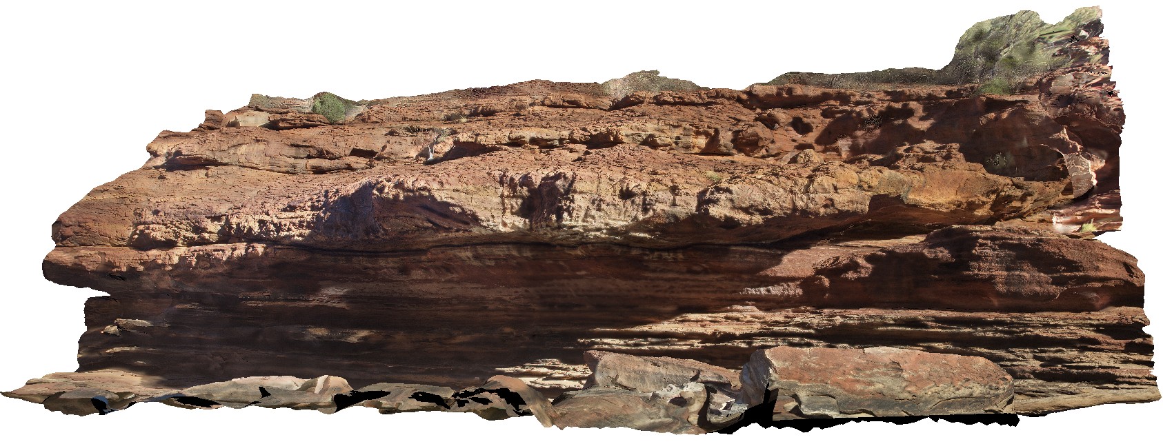
fluvial channel cutting into tidal facies at the 'Z bend', Kalbarri National Park. W.A. |
10.00 |
-27.65457000000 |
114.45911000000 |
-9999.000 |
fluvial facies, tidal facies, sedimentology |
sandstone |
Kalbarri17 Map
 |
0 |
05/20/2016 noon |
3D |
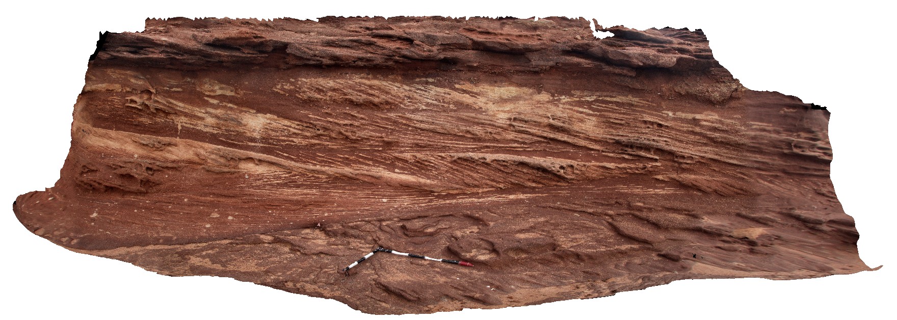
cross beds in pebbly sandstone delineated by differential oxidation. Red Bluff, Kalbarri, W.A. |
4.50 |
-27.74431000000 |
114.14072000000 |
-9999.000 |
cross bedding, pebbly sandstone |
sandstone |
Kalbarri18 Map
 |
0 |
05/20/2016 noon |
3D |
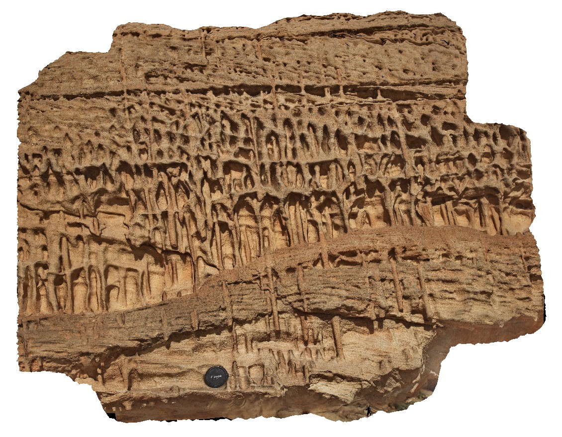
vertical burrows in overturned block of Tumblagooda Sandstone. Detail of site KalbarriUAV5. Red Bluff, Kalbarri, W.A. |
1.20 |
-27.74526000000 |
114.13950000000 |
-9999.000 |
bioturbation, burrows, sandstone, sedimentology, fossil, palaeontology |
sandstone |
Kalbarri19 Map
 |
0 |
05/20/2016 noon |
3D |
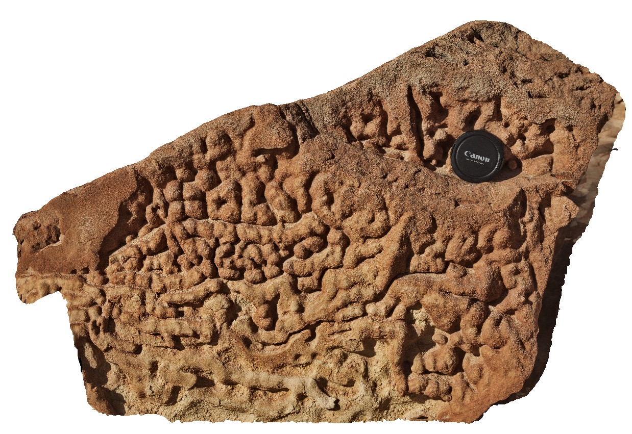
bioturbation in sandstone viewed perpendicular to bedding. Red Bluff, Kalbarri, W.A. |
0.70 |
-27.74548000000 |
114.13952000000 |
-9999.000 |
bioturbation, sandstone, Tumblagooda Sandstone, fossil, palaeontology |
sandstone |
Kalbarri2 Map
 |
0 |
05/20/2016 noon |
3D |
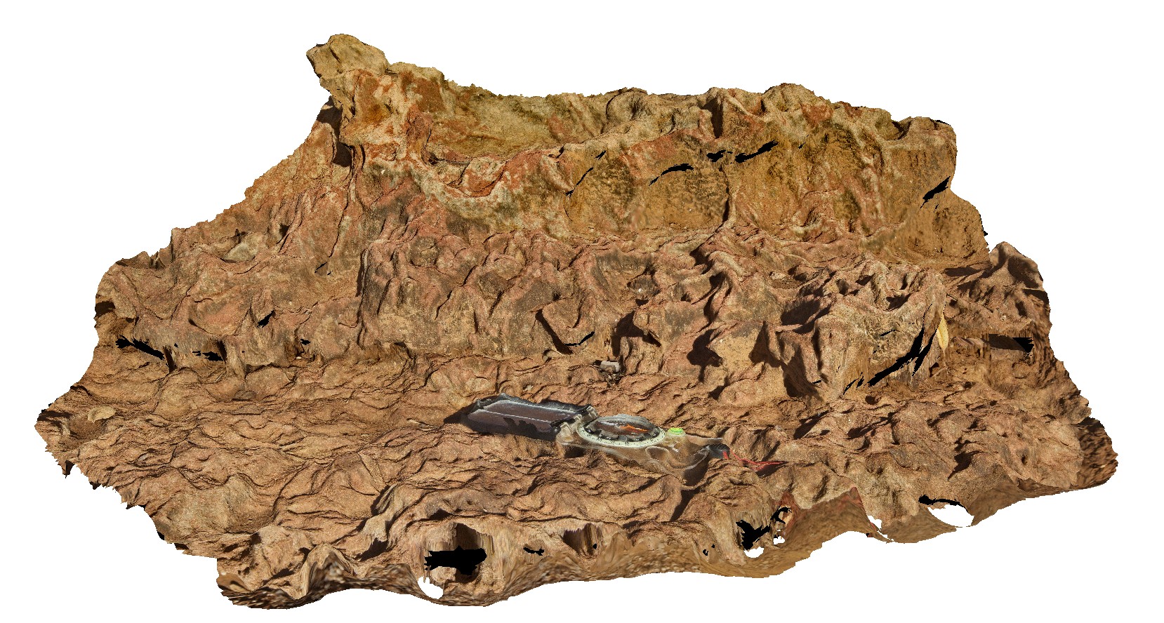
intense bioturbation with horizontal and vertical burrows in sandstone. Hawks Head Lookout, Kalbarri National Park. W.A. |
0.70 |
-27.78989000000 |
114.46958000000 |
-9999.000 |
bioturbation, sandstone, sedimentology, fossil, palaeontology |
sandstone |
Kalbarri20 Map
 |
0 |
05/20/2016 noon |
3D |
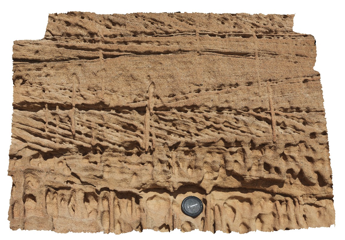
detail of bioturbation burrows cutting cross beds in the Tumblagooda Sandstone. Red Bluff, Kalbarri, W.A. |
1.00 |
-27.74553000000 |
114.13950000000 |
-9999.000 |
bioturbation, burrows, cross bedded, Tumblagooda Sandstone, fossil, palaeontology |
sandstone |
Kalbarri21 Map
 |
0 |
05/20/2016 noon |
3D |
steeply dipping sandstone cross beds, truncated by flat lying pebbly sandstone. Red Bluff, Kalbarri, W.A. |
9.00 |
-27.74457000000 |
114.14263000000 |
-9999.000 |
cross bedding, truncated bedding, pebbly sandstone, sedimentology |
sandstone |
Kalbarri3 Map
 |
0 |
05/20/2016 noon |
3D |
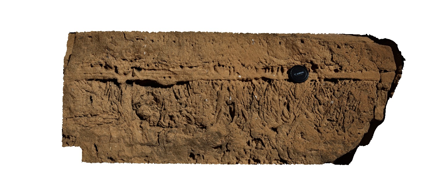
view of the detail of bioturbation perpendicular to bedding in the Tumblagooda Sandstone. Hawks Head Lookout, Kalbarri National Park. W.A. |
0.80 |
-27.78985000000 |
114.46956000000 |
-9999.000 |
bioturbation, sandstone, sedimentology, fossil, palaeontology |
sandstone |
Kalbarri4 Map
 |
0 |
05/20/2016 noon |
3D |
view of small bedded sandstone cliff, showing tidal facies. Hawks Head Lookout, Kalbarri National Park. W.A. |
6.00 |
-27.79003000000 |
114.46959000000 |
-9999.000 |
tidal strata, sandstone, sedimentology |
sandstone |
Kalbarri5 Map
 |
0 |
05/20/2016 noon |
3D |
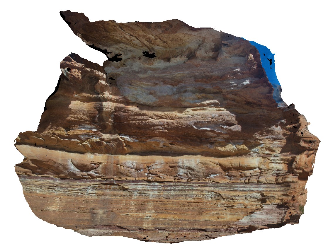
view of small cliff, showing the abrupt transition from tidal facies (finely laminated and have ripple marks and bioturbation) to fluvial facies (quartz rich sandstone with cross bedding). Hawks Head Lookout, Kalbarri National Park. W.A. |
12.00 |
-27.79029000000 |
114.47001000000 |
-9999.000 |
facies change, tidal facies, fluvial facies, ripple marks, cross bedding, sedimentology |
sandstone |
Kalbarri6 Map
 |
0 |
05/20/2016 noon |
3D |
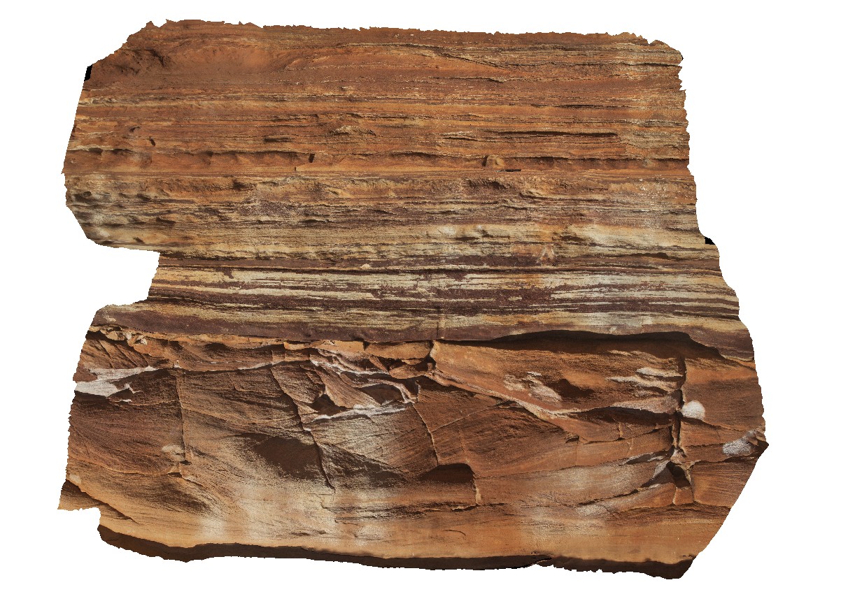
detail of transition from tidal to fluvial facies in sandstone beds. Image shows finely laminated (tidal beds) overlain by coarser, quartz rich sandstone with cross bedding. Hawks Head Lookout, Kalbarri National Park. W.A. |
2.00 |
-27.79029000000 |
114.47001000000 |
-9999.000 |
tidal facies, facies change, fluvial facies, sedimentology, sandstone |
sandstone |
Kalbarri7 Map
 |
0 |
05/20/2016 noon |
3D |
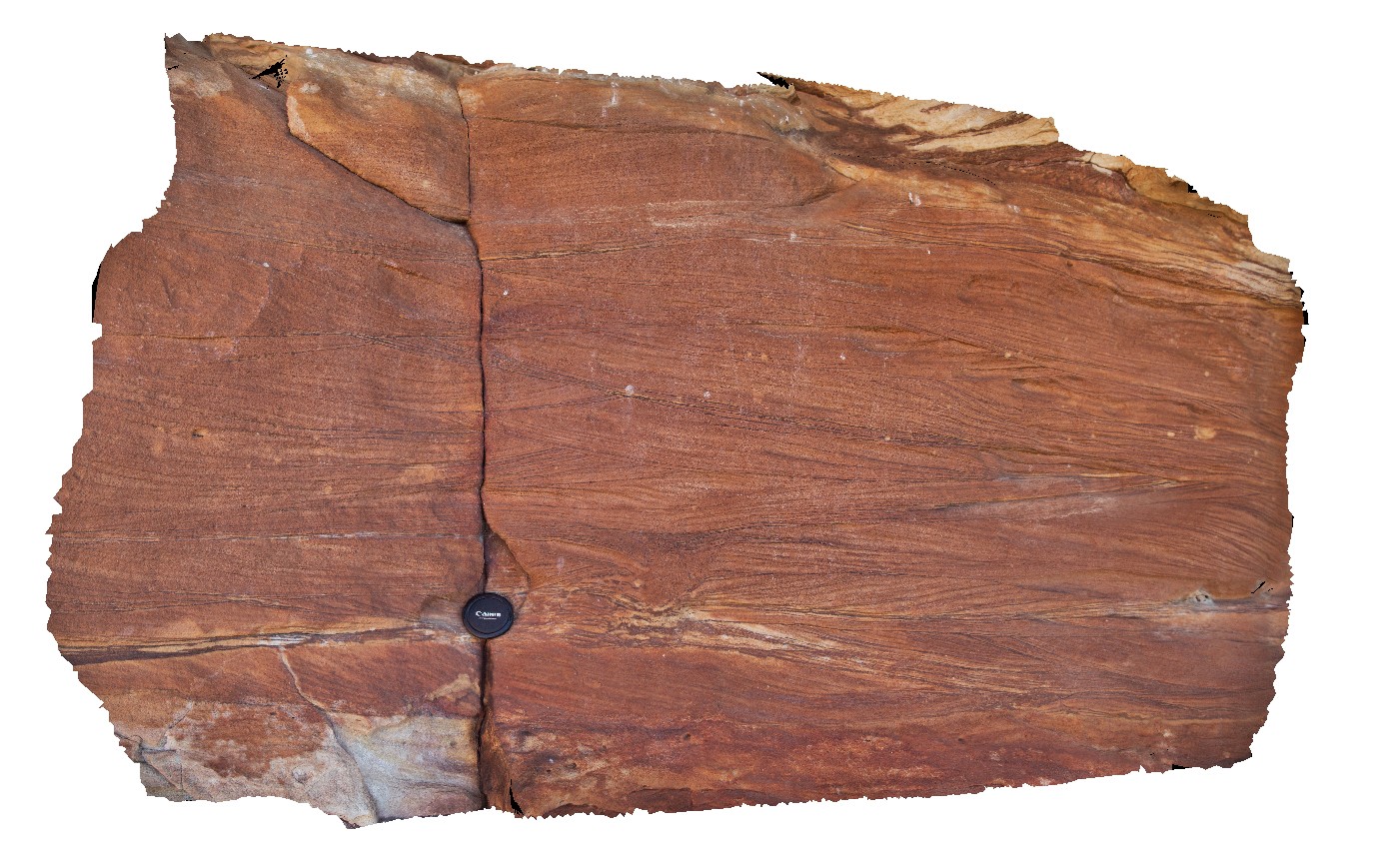
detail of cross bedding and small scour in fluvial facies sandstone. Hawks Head Lookout, Kalbarri National Park. W.A. |
2.00 |
-27.79041000000 |
114.46938000000 |
-9999.000 |
cross bedding, sandstone, fluvial facies, sedimentology |
sandstone |
Kalbarri8 Map
 |
0 |
05/20/2016 noon |
3D |
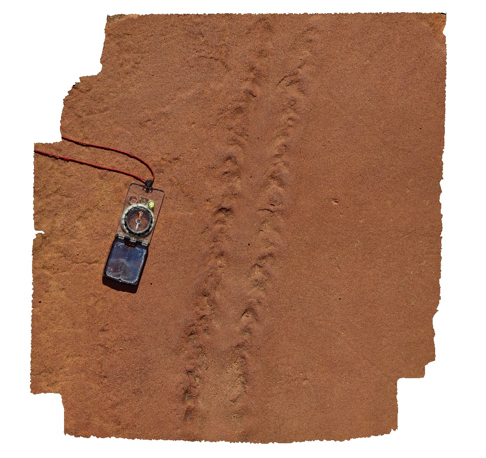
Eurypterid trackway in sandstone bedding surface at the 'Z bend', Kalbarri National Park. W.A. |
0.80 |
-27.65355000000 |
114.45638000000 |
-9999.000 |
Eurypterid, Eurypterid trackway, sandstone, sedimentology, tracks, fossil, palaeontology |
sandstone |


