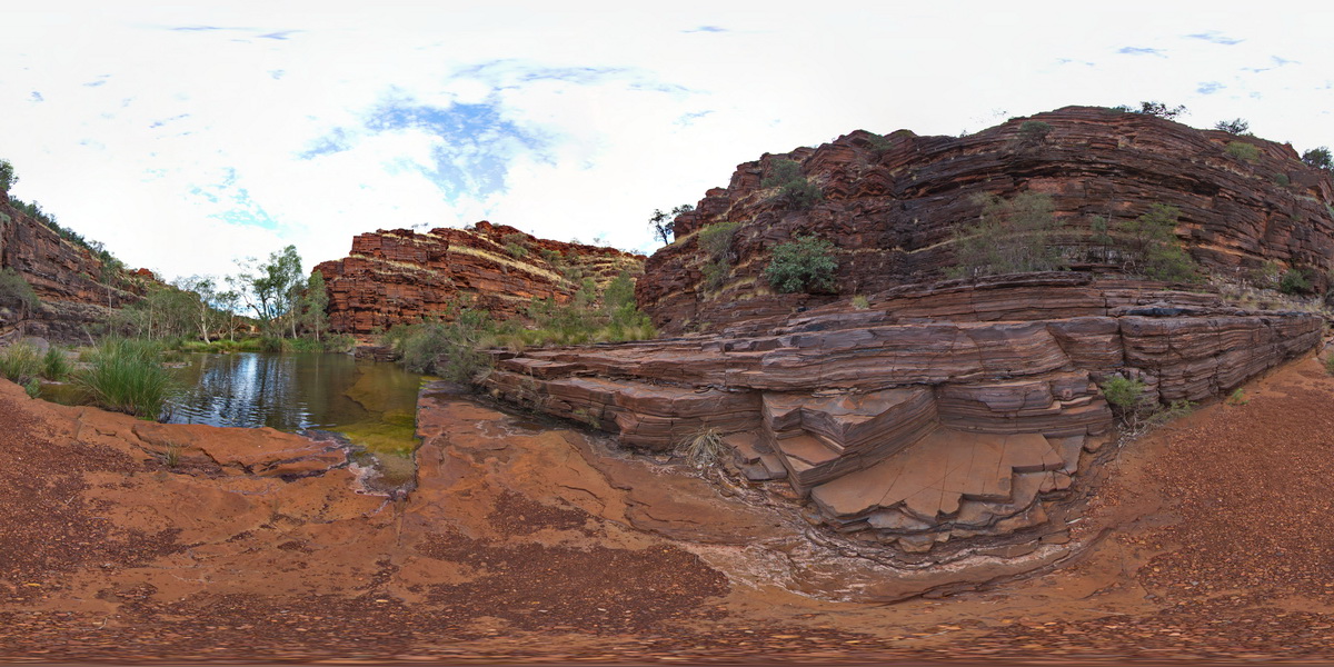
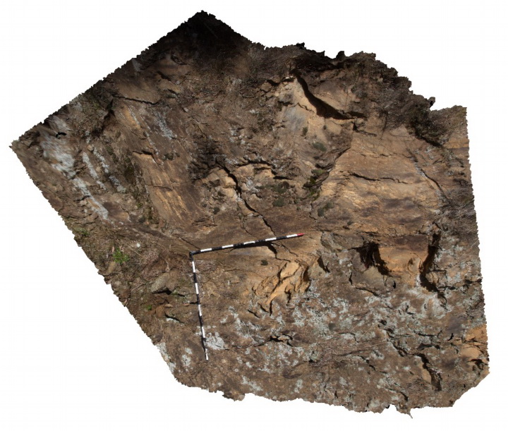
KarijiniFSP9 Map
 |
0 |
05/29/2016 noon |
FSP |
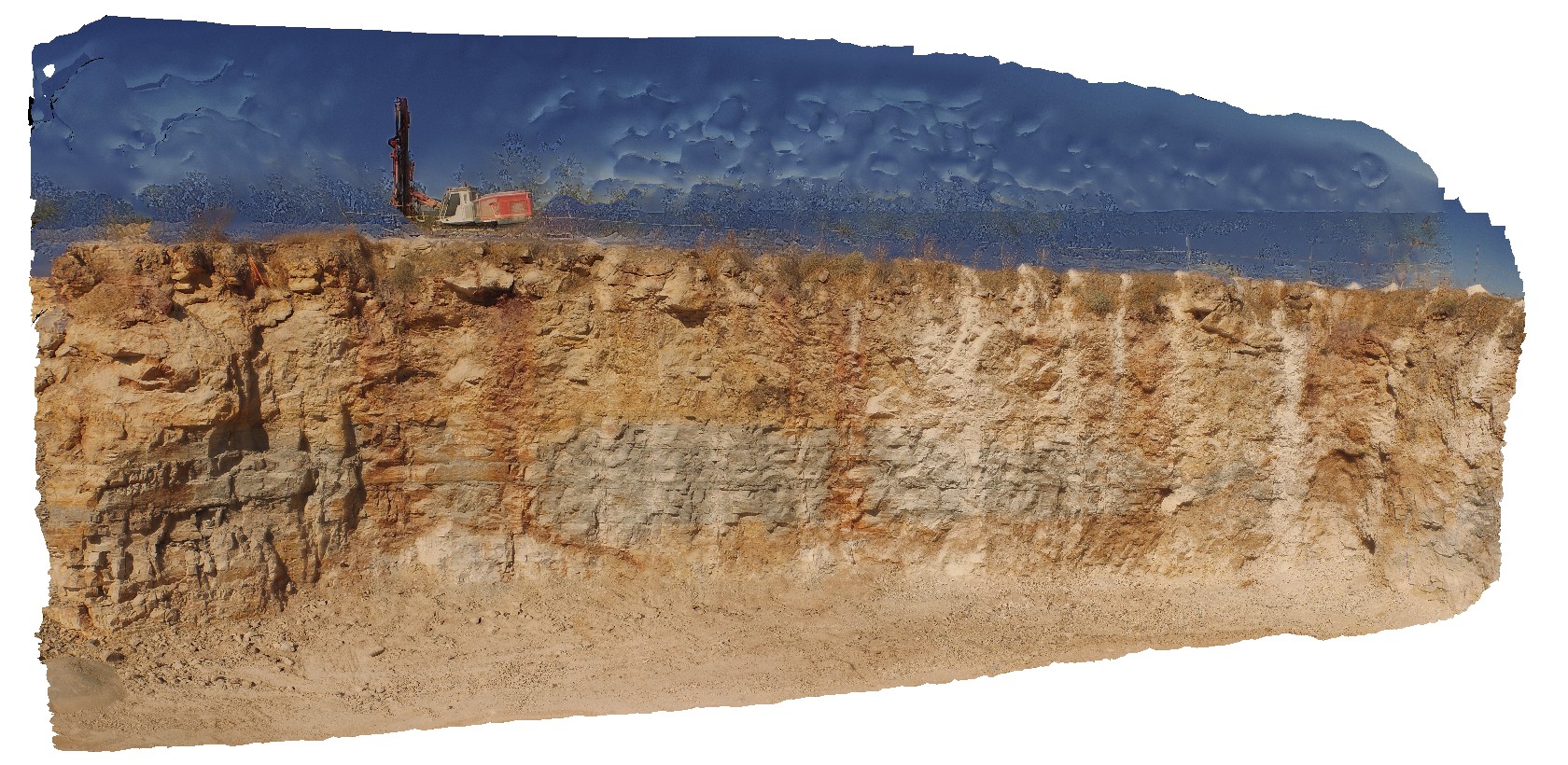
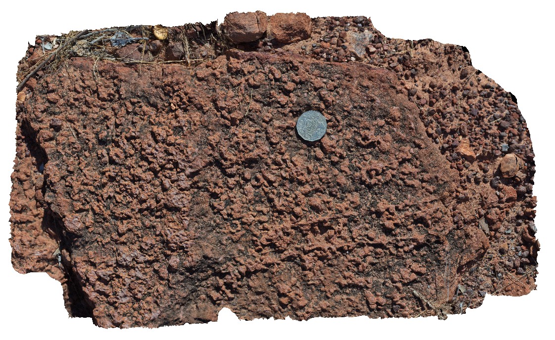
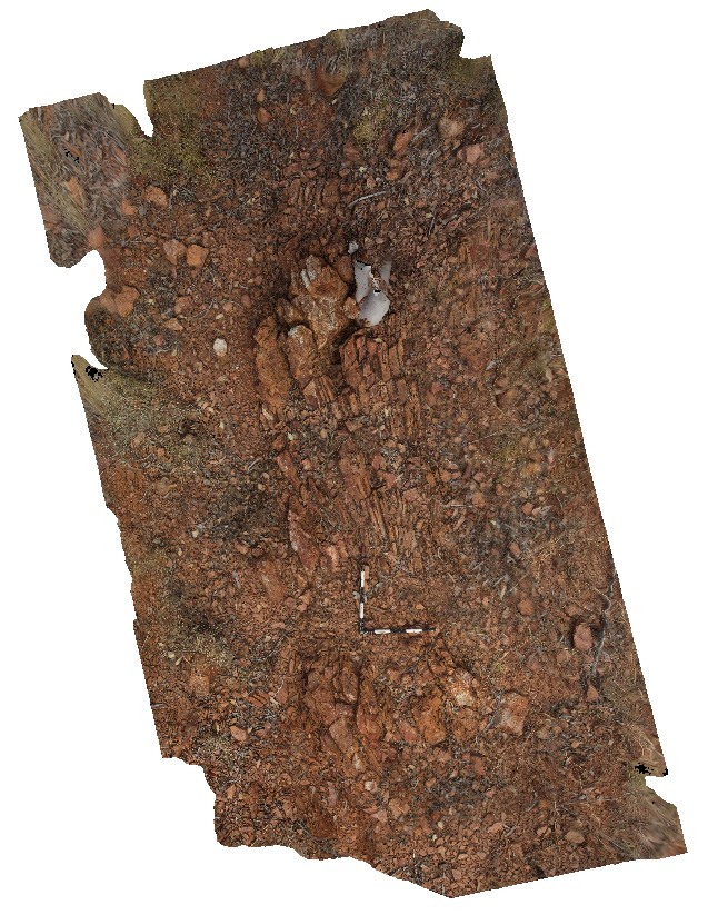
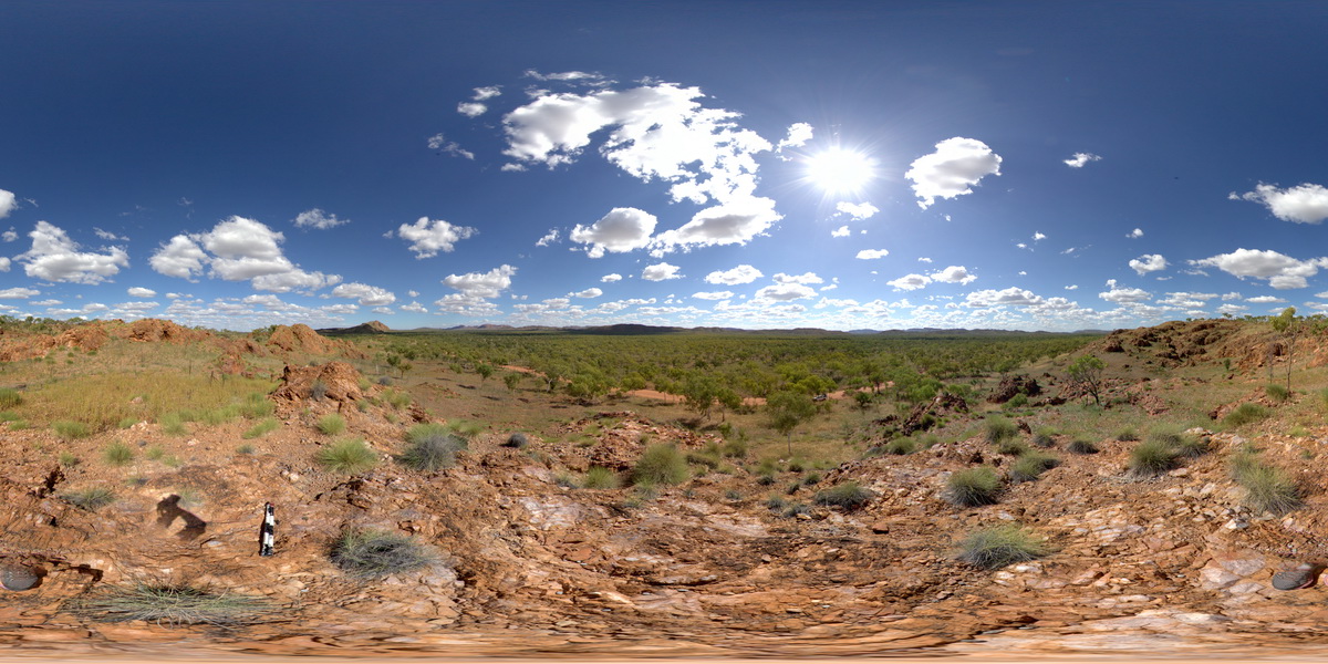
View of pool, finely bedded banded iron cliffs, crocidolite seam? and terraced floor of Dales Gorge, Karijini National Park, W.A. |
100.00 |
-22.47721000000 |
118.55666000000 |
-9999.000 |
banded iron formation, Karijini National Park |
BIF |
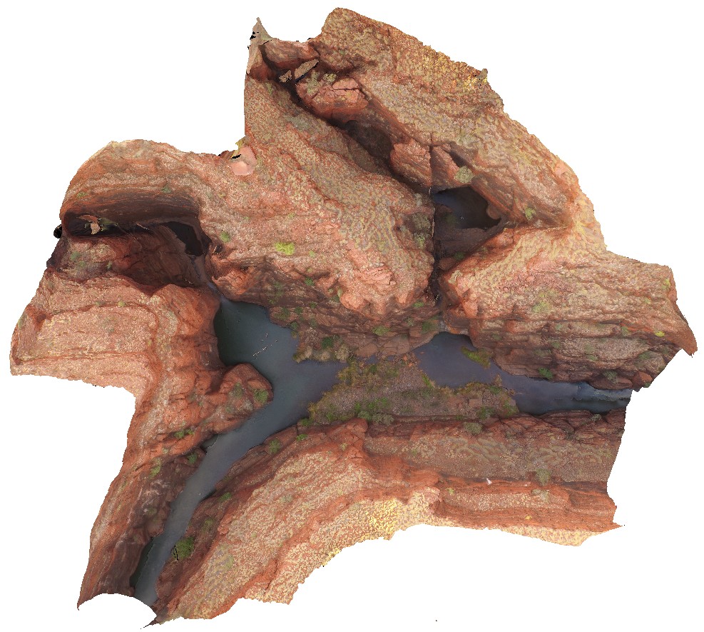
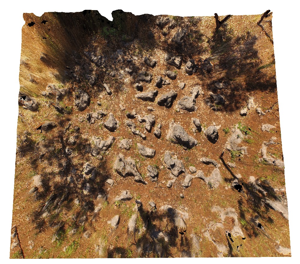
KarijiniUAV1 Map
 |
0 |
05/29/2016 noon |
UAV |
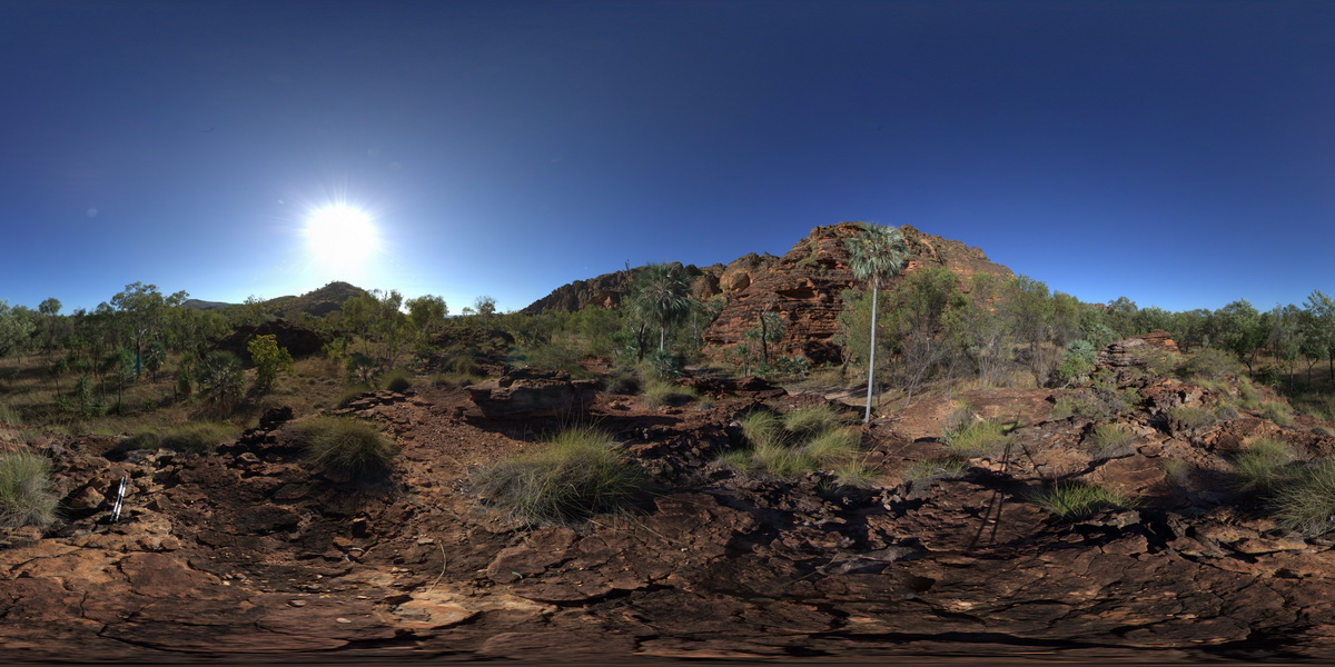
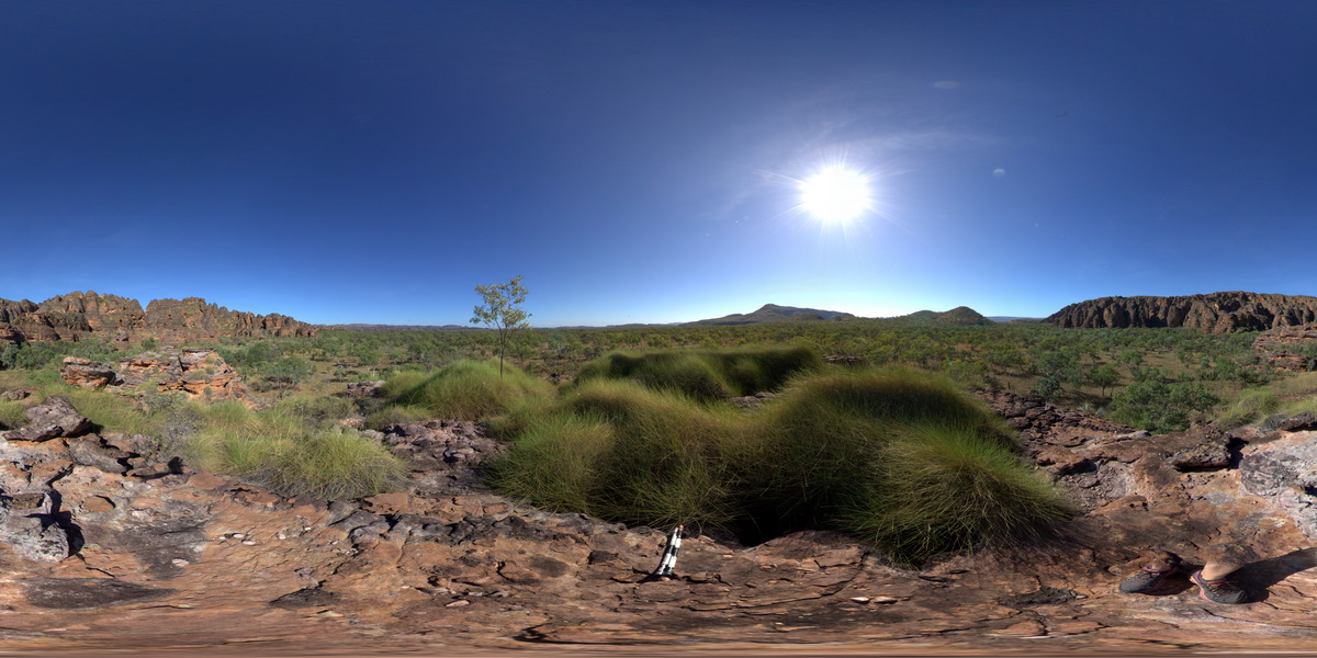
aerial view of confluence of Handcock and Weano gorges. Brockman Iron Formation. Karijini National Park. W.A. |
1000.00 |
-22.36102700000 |
118.28921700000 |
-9999.000 |
gorge, Brockman Iron Formation, banded iron formation, sedimentology |
BIF |
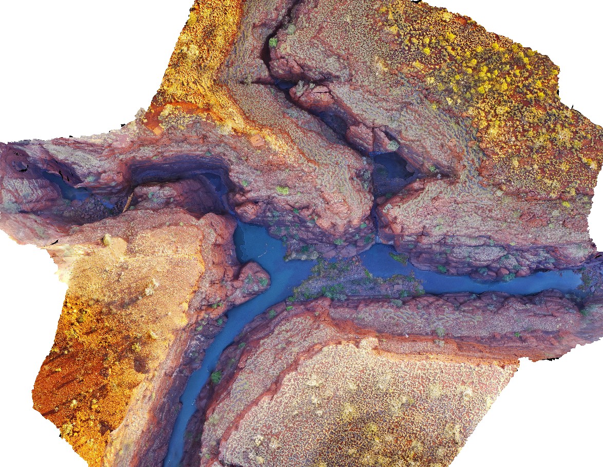
KarijiniUAV2 Map
 |
0 |
05/29/2016 noon |
UAV |
aerial view of confluence of Handcock and Weano gorges. Brockman Iron Formation. Karijini National Park. W.A. |
1000.00 |
-22.36123000000 |
118.28945000000 |
-9999.000 |
Banded Iron Formation, sedimentology, Brockman Iron Formation |
BIF |
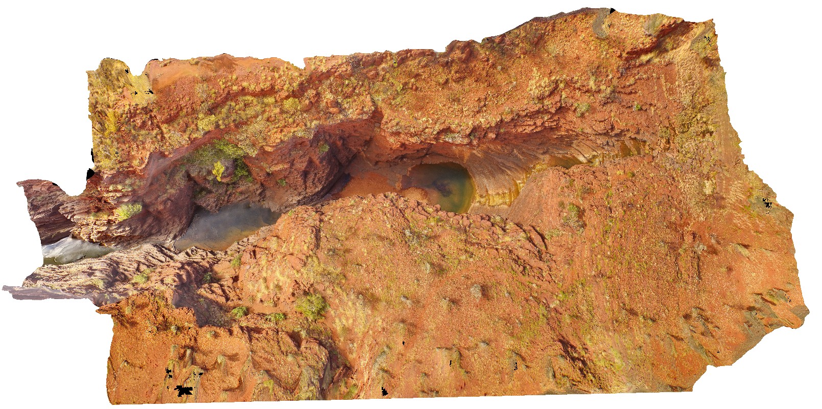
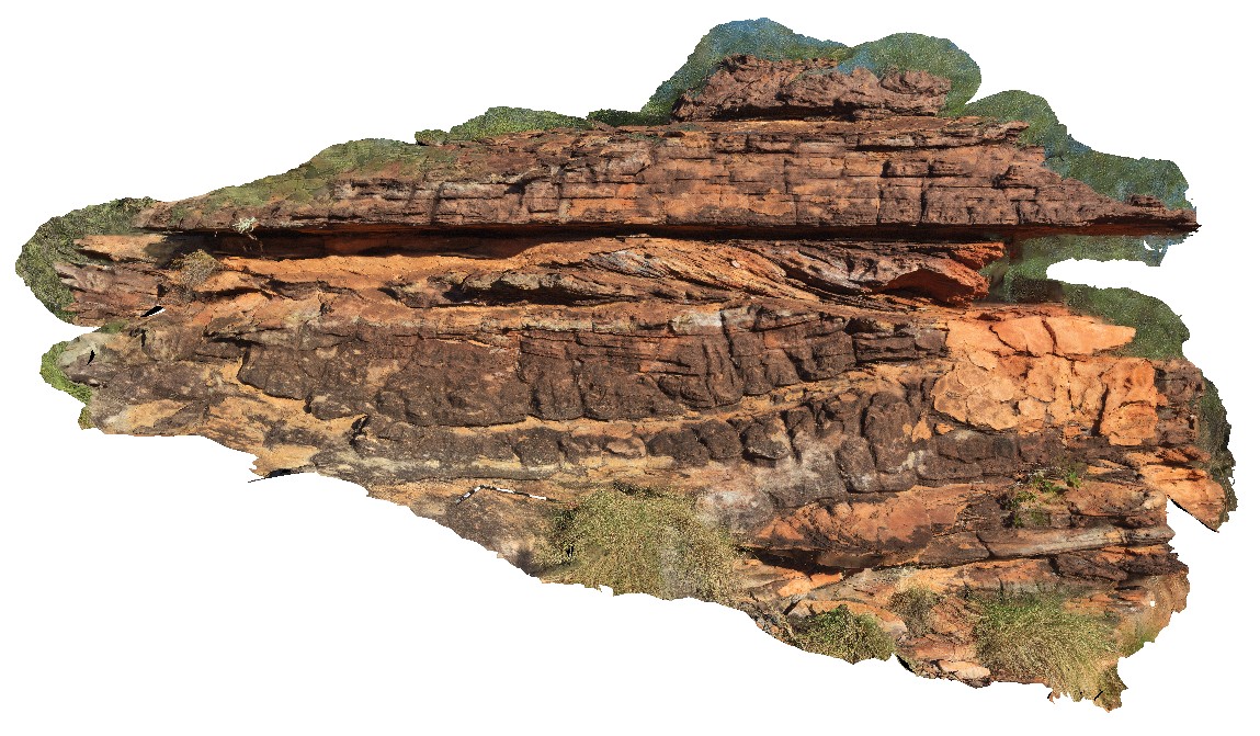
KarijiniUAV3 Map
 |
0 |
05/29/2016 noon |
UAV |
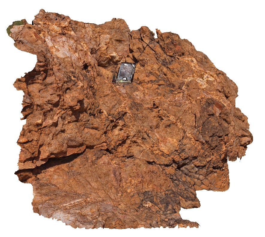
aerial view of Joffre Falls and Gorge, showing section through the Brockman Iron Formation. Karijini National Park. W.A. |
200.00 |
-22.36123000000 |
118.28945000000 |
-9999.000 |
Joffre Gorge, Brockman Iron Formation, banded iron formation |
BIF |
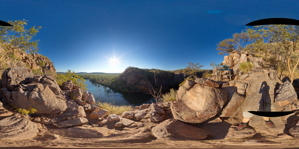
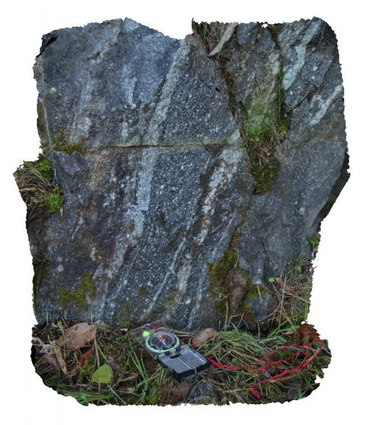
Kath1 Map
 |
0 |
07/20/2016 5:18 p.m. |
3D |
conglomerate of rounded boulders and cobbles in well-sorted sandstone matrix. Katherine Gorge, N.T. |
1.00 |
-14.31279300000 |
132.42419500000 |
170.669 |
conglomerate, sorting, sedimentology |
conglomerate |
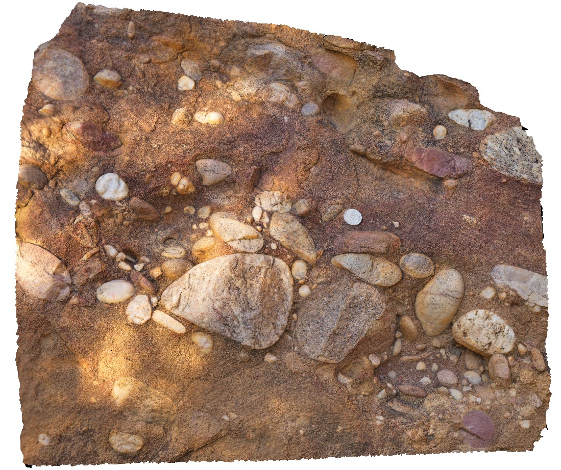
Kath2 Map
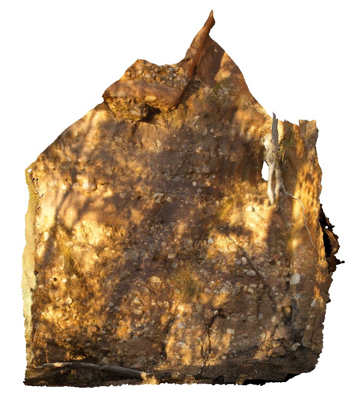 |
0 |
07/20/2016 5:56 p.m. |
3D |
outcrop of conglomerate / cobble bands in sandstone at the edge of the Katherine River. Katherine Gorge, N.T. |
5.00 |
-14.31142700000 |
132.42550800000 |
135.243 |
conglomerate, banding, sandstone, sedimentology |
sandstone |
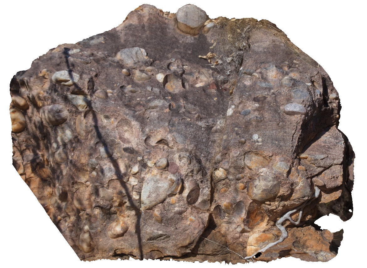
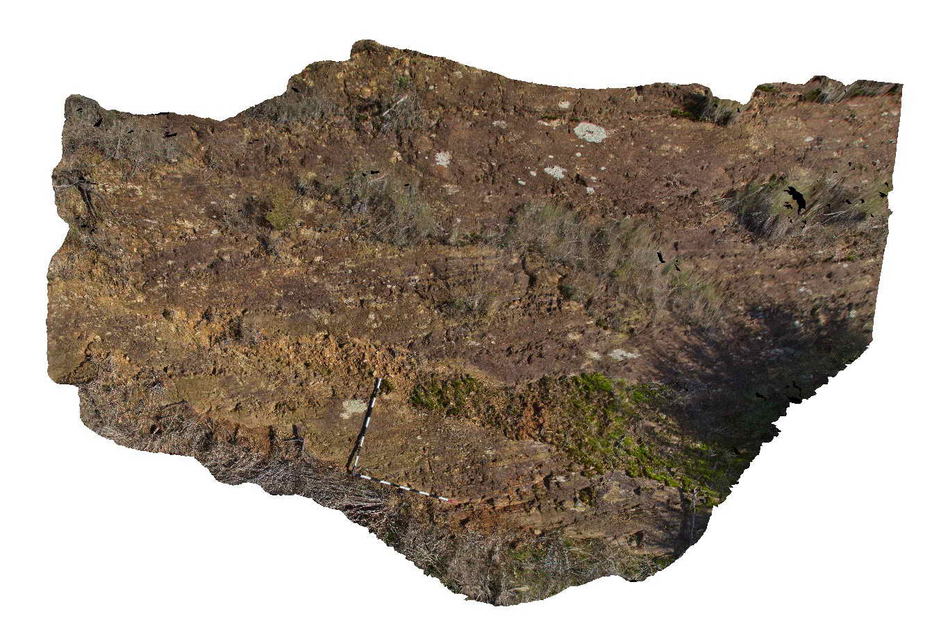
Kath3 Map
 |
5 |
01/01/9999 midnight |
3D |
macro view of quartz and granite cobbles in sandstone matrix. Katherine Gorge, N.T. |
0.60 |
-14.31142700000 |
132.42550800000 |
135.243 |
conglomerate, sedimentology, Katherine Gorge |
conglomerate |
Katherine1 Map
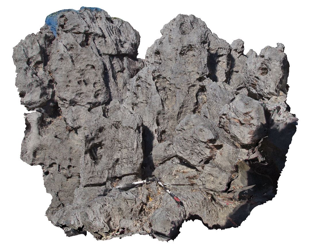 |
0 |
06/22/2016 noon |
3D |
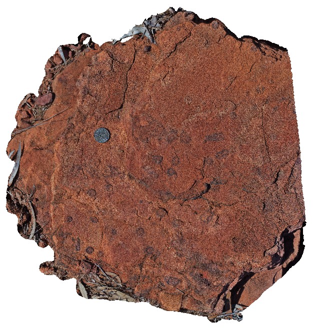
karst formations in limestone with extensive rillenkarren developed and small caves formed locally. Katherine township, N.T. |
3.20 |
-14.49961000000 |
132.33371000000 |
-9999.000 |
karst formations, rillenkarren, limestone |
limestone |
KatherineUAV1 Map
 |
0 |
06/22/2016 noon |
UAV |
view of finely laminated limestone in quarry wall. Katherine township, N.T. |
14.00 |
-14.50562000000 |
132.33664000000 |
-9999.000 |
limestone, laminated beds |
limestone |
KatherineUAV2 Map
 |
0 |
06/22/2016 noon |
UAV |
aerial view of karst towers in very thickly bedded limestone. N/W of Katherine township, N.T. |
14.00 |
-14.40787000000 |
132.19470000000 |
-9999.000 |
karst landscape, limestone, weathering feature |
limestone |
KathFSP1 Map
 |
0 |
07/20/2016 5:41 p.m. |
FSP |
view from the side of Katherine Gorge, showing banded sandstones. Katherine Gorge, N.T. |
200.00 |
-14.31134500000 |
132.42592800000 |
167.494 |
sandstone, bedded, sedimentology, Katherine Gorge |
sandstone |
KeepRiver1 Map
 |
5 |
06/17/2016 noon |
3D |
trough cross beds overlain by planar beds of interbedded pebbly and coarse-grained sandstone. Keep River National Park car park. N.T. |
6.00 |
-15.75793000000 |
129.08427000000 |
-9999.000 |
cross bedding, sandstone, sedimentology |
sandstone |
KeepRiver2 Map
 |
5 |
06/17/2016 noon |
3D |
macro view of a nodules / stromatolitic(?) layer within fine-grained sandstone, cross-cut by quartz veining. Keep River National Park car park. N.T. |
0.45 |
-15.75027000000 |
129.08376000000 |
-9999.000 |
sandstone, sedimentology |
sandstone |
KeepRiver3 Map
 |
0 |
06/17/2016 noon |
3D |
macro view of a nodules / stromatolitic(?) layer within fine-grained sandstone, cross-cut by quartz veining. Keep River National Park car park. N.T. |
0.60 |
-15.74996000000 |
129.08429000000 |
-9999.000 |
nodules, sandstone, sedimentology |
sandstone |
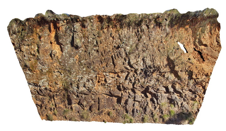
KeepRiver4 Map
 |
0 |
06/17/2016 noon |
3D |
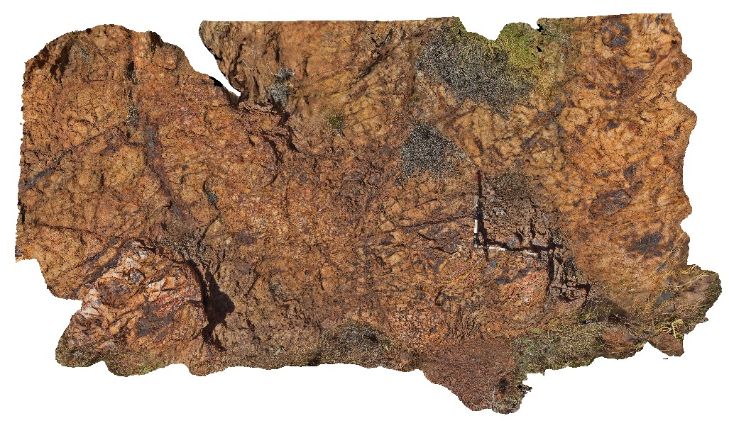
fault breccia of Halls Creek Group sediments. Keep River National Park car park. N.T. |
5.00 |
-15.74834000000 |
129.08809000000 |
-9999.000 |
fault, fault breccia, structure, Halls Creek Group |
sediment |
KeepRiver5 Map
 |
0 |
06/17/2016 noon |
3D |
close-up view of quartz-vein stock work in phyllite with local Cu staining. Keep River Access Track, N.T. |
0.60 |
-15.90718000000 |
129.07118000000 |
-9999.000 |
Cu, quartz stockwork, phyllite |
phyllite |
KeepRiver6 Map
 |
0 |
06/17/2016 noon |
3D |
phyllite with cleavage parallel to quartz veins. Zone of quartz stock work veining. Keep River Access Track, N.T. |
5.00 |
-15.90707000000 |
129.07123000000 |
-9999.000 |
phyllite, metamorphic, quartz stockwork veining, stockwork |
phyllite |
KeepRiver7 Map
 |
0 |
06/17/2016 noon |
3D |
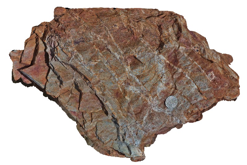
cockscomb quartz veins and cockscomb - drusy quartz cemented breccia in a highly fractured quartzite. Keep River Access Track, proximal to the Halls Creek Fault. N.T. |
0.80 |
-15.95273000000 |
129.02890000000 |
-9999.000 |
cockscomb vein texture, quartz vein, breccia |
quartzite |
KeepRiverFSP1 Map
 |
0 |
06/17/2016 noon |
FSP |
cross-bedded pebbly sandstone (foreground) and karst formations (bee hives) in the background. Keep River National Park car park. N.T. |
300.00 |
-15.75795000000 |
129.08453000000 |
-9999.000 |
cross bedding, sedimentology, karst formations |
sandstone |
KeepRiverFSP2 Map
 |
0 |
06/17/2016 noon |
FSP |
Pebbly sandstone in foreground with karst formations in the background. Keep River National Park car park. N.T. |
0.00 |
-15.75692000000 |
129.07898000000 |
-9999.000 |
sedimentology, karst, bee hive |
sandstone |
KeepRiverFSP3 Map
 |
0 |
01/01/9999 midnight |
FSP |
brecciated quartzite hills. Keep River Access Track, proximal to the Halls Creek Fault. N.T. |
2000.00 |
-15.95302000000 |
129.02904000000 |
-9999.000 |
breccia, quartzite, structure |
quartzite |
Kiewa1 Map
 |
5 |
06/17/2015 10:16 a.m. |
3D |
mylonitic fabric in the Siluro-Devonian Dederang Granite adjacent to the Kiewa Fault. Kiewa, Vic. |
1.00 |
-36.63150000000 |
147.11908000000 |
286.000 |
mylonite, structure, Kiewa Fault Zone |
granite |
Kiewa2 Map
 |
5 |
06/17/2015 10:17 a.m. |
3D |
mylonitic layering in gneissic metamorphic rocks of the Silurian Omeo Metamorphic Complex. Kiewa, Vic. |
6.00 |
-36.70951271000 |
147.14309159000 |
387.000 |
mylonite, structure |
mylonite |
Kiewa3 Map
 |
5 |
06/17/2015 10:18 a.m. |
3D |
Horizontal high temperature shear zone in gneissic rocks of the Silurian Omeo Metamorphic Complex. Kiewa, Vic. |
15.00 |
-36.72313706000 |
147.13280305000 |
611.000 |
shear zone, structure |
gneiss |
Kiewa4 Map
 |
5 |
06/17/2015 10:21 a.m. |
3D |
migmatite segregations in gneissic metamorphic rocks of the Silurian Omeo Metamorphic Complex. Kiewa, Vic. |
3.00 |
-36.72432166000 |
147.12949028000 |
711.000 |
migmatite, structure, igneous |
migmatite |