Kalbarri9 Map
 |
0 |
05/20/2016 noon |
3D |
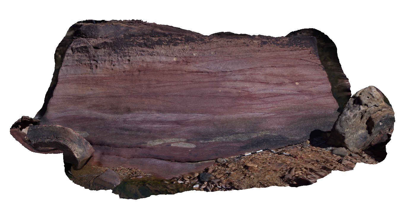
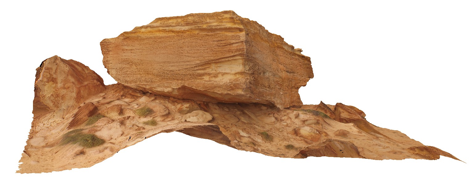
large boulder (upside down) of red sandstone with trough cross beds. 'Z bend', Kalbarri National Park. W.A. See also image Kalbarri10 for more detail. |
3.20 |
-27.65781000000 |
114.45559000000 |
-9999.000 |
cross bedding, sandstone, red sandstone |
sandstone |
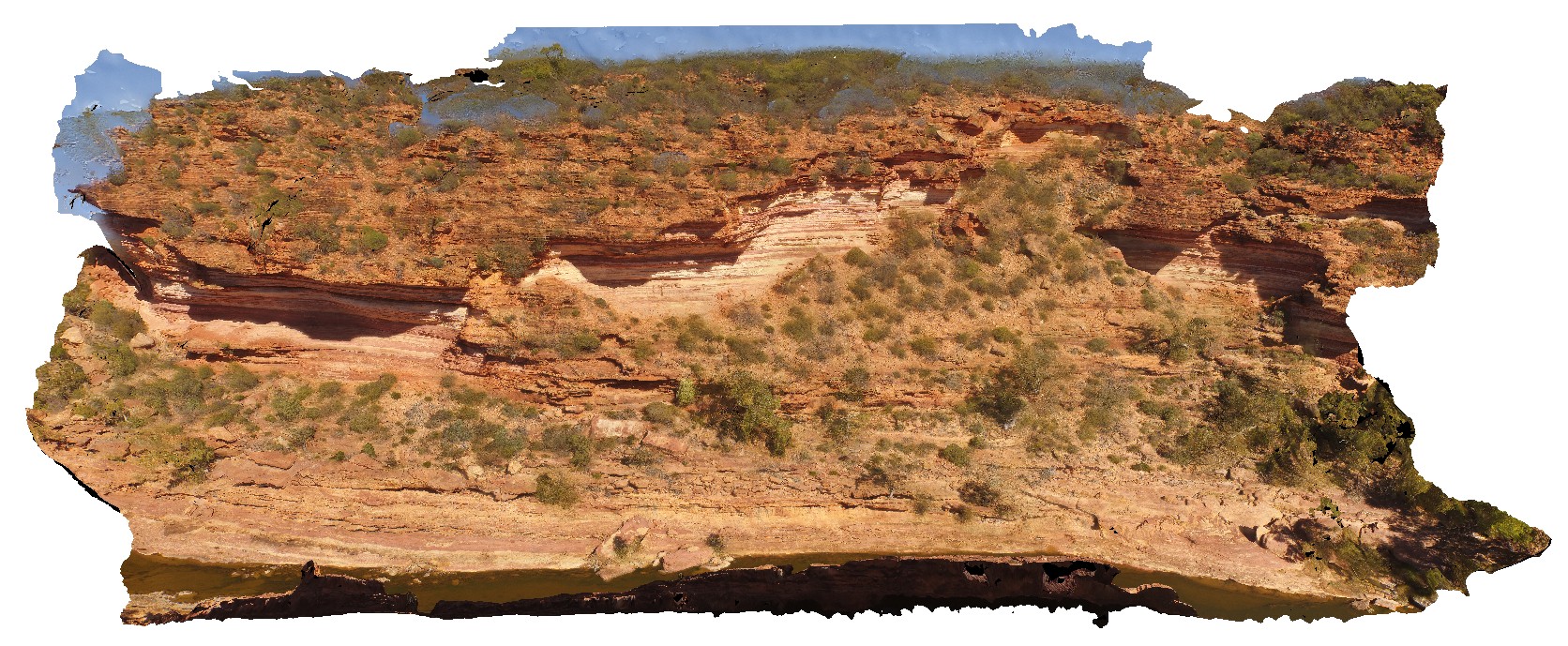
KalbarriFSP1 Map
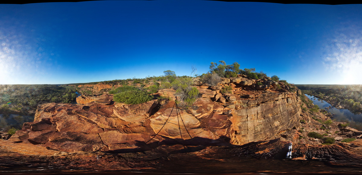 |
0 |
05/20/2016 noon |
FSP |
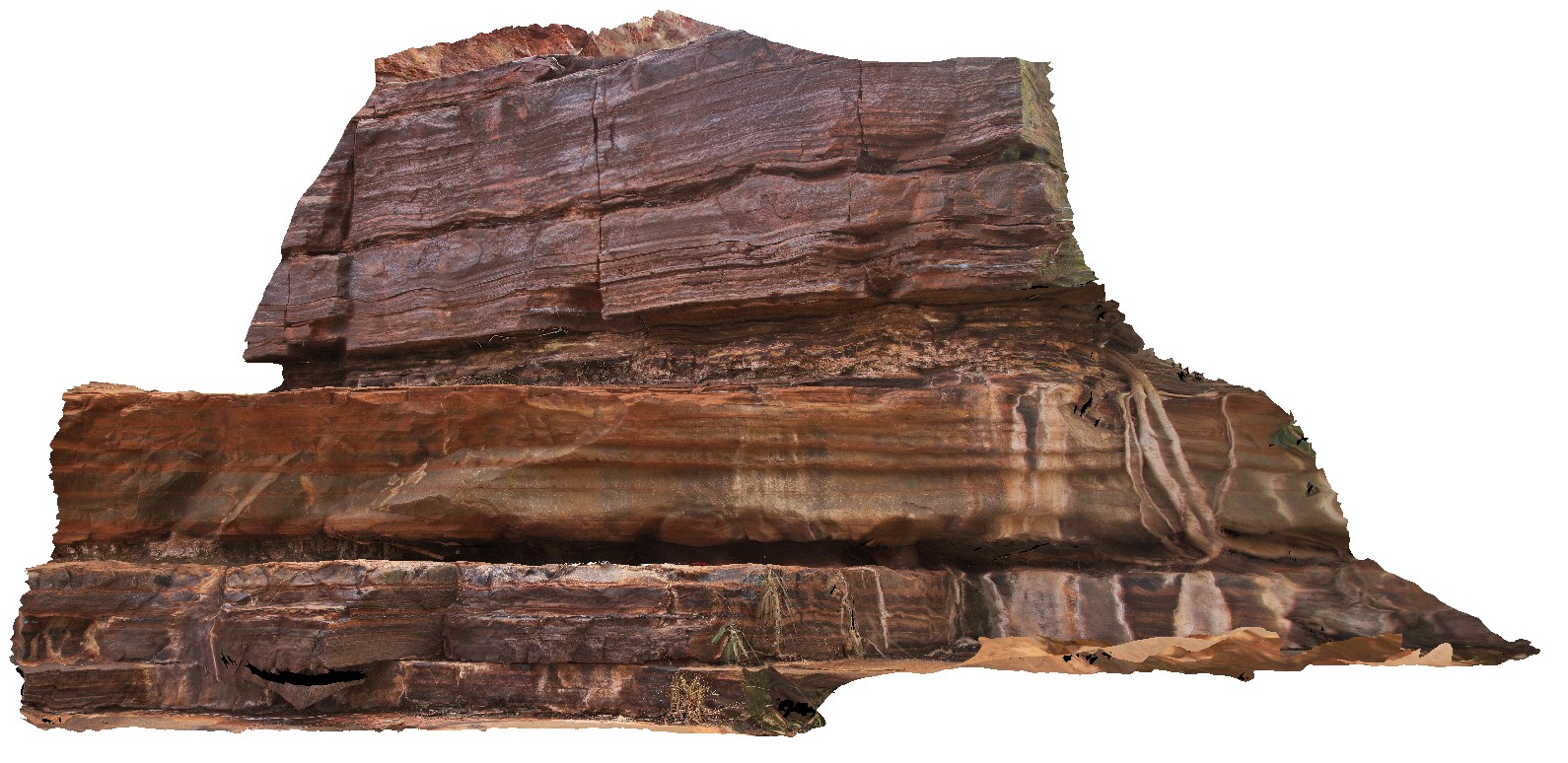
View of upper end of the Murchison Gorge at Hawks Head Lookout in the Tumblagooda Sandstone. Kalbarri National Part, W.A. |
1000.00 |
-27.78965000000 |
114.46932000000 |
-9999.000 |
sandstone, river gorge, sedimentology |
sandstone |
KalbarriFSP2 Map
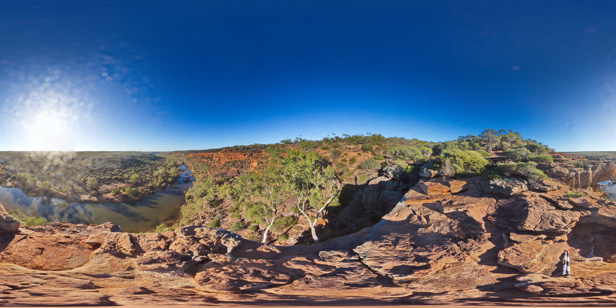 |
0 |
05/20/2016 noon |
FSP |
View of upper end of the Murchison Gorge at Hawks Head Lookout in the Tumblagooda Sandstone. Kalbarri National Part, W.A. |
1000.00 |
-27.78963000000 |
114.46930000000 |
-9999.000 |
sandstone, sedimentology, river gorge |
sandstone |
KalbarriFSP3 Map
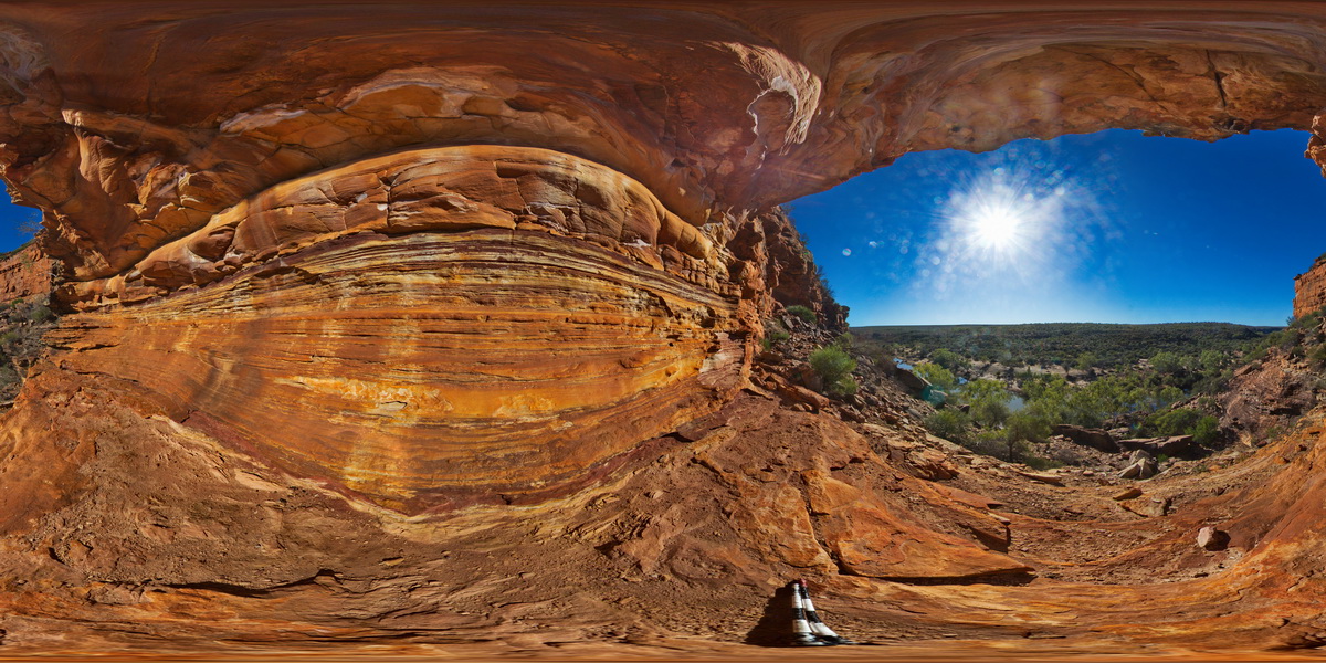 |
0 |
05/20/2016 noon |
FSP |
View of sandstone cliff exposure at upper end of the Murchison Gorge, Hawks Head Lookout. Kalbarri National Part, W.A. |
1000.00 |
-27.79029000000 |
114.47001000000 |
-9999.000 |
sandstone, sedimentology, river gorge |
sandstone |
KalbarriFSP4 Map
 |
0 |
05/20/2016 noon |
FSP |
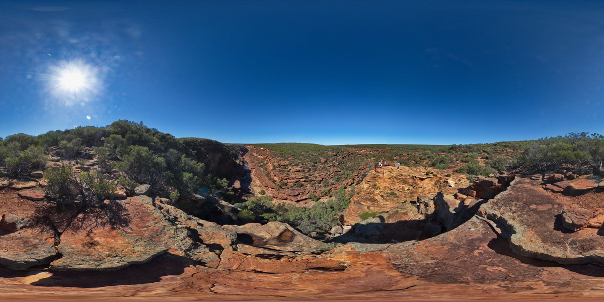
view of Murchison River gorge from near lookout at the 'Z bend', Kalbarri National Park. W.A. |
1000.00 |
-27.65339000000 |
114.45678000000 |
-9999.000 |
sandstone, river gorge |
sandstone |
KalbarriFSP5 Map
 |
0 |
05/20/2016 noon |
FSP |
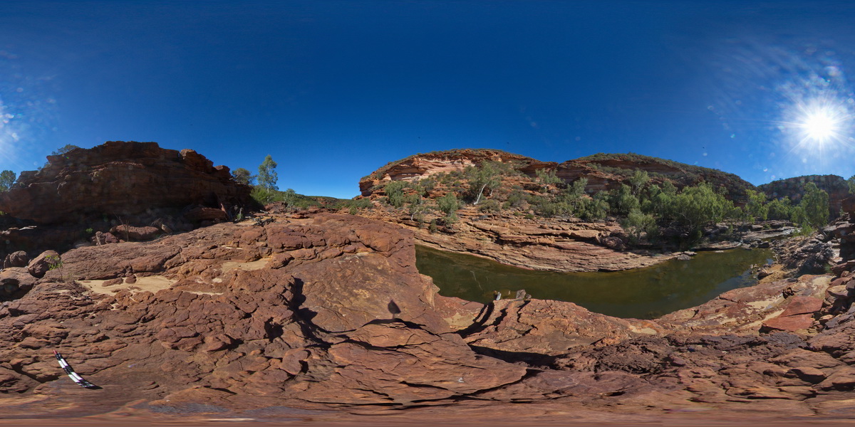
view along Murchison River Gorge, showing cliffs of Tumblagooda Sandstone. Near 'Z bend', Kalbarri National Park. W.A. |
1000.00 |
-27.65943000000 |
114.45569000000 |
-9999.000 |
sandstone, river gorge |
sandstone |
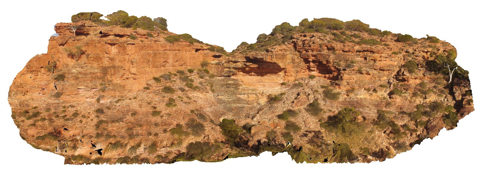
KalbarriFSP6 Map
 |
0 |
05/20/2016 noon |
FSP |
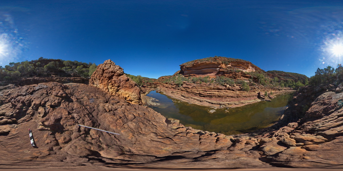
view along Murchison River Gorge, showing banded cliffs of Tumblagooda Sandstone. Near 'Z bend', Kalbarri National Park. W.A. |
1000.00 |
-27.65978000000 |
114.45676000000 |
-9999.000 |
river gorge, Tumblagooda Sandstone, sedimentology |
sandstone |
KalbarriFSP7 Map
 |
0 |
05/20/2016 noon |
FSP |
view along Murchison River Gorge, showing banded cliffs of Tumblagooda Sandstone. Near 'Z bend', Kalbarri National Park. W.A. |
1000.00 |
-27.65800000000 |
114.45562000000 |
-9999.000 |
river gorge, sandstone |
sandstone |
KalbarriUAV1 Map
 |
0 |
05/20/2016 noon |
UAV |
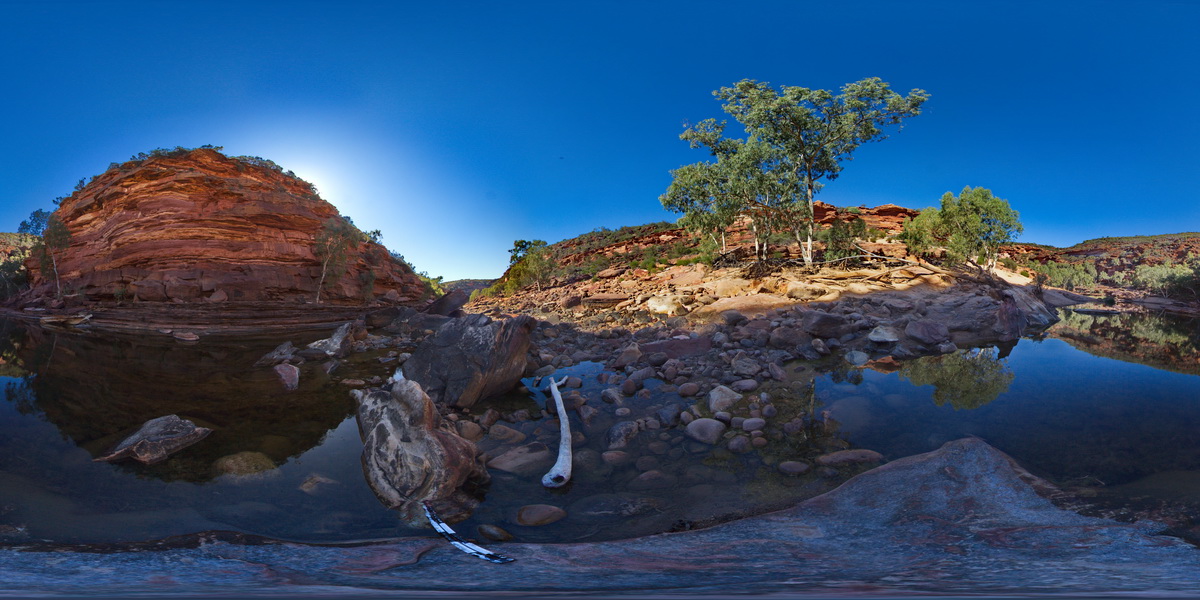
aerial view of small creek and waterfall in the Tumblagooda Sandstone. Hawks Head Lookout, Kalbarri National Park. W.A. |
200.00 |
-27.79011200000 |
114.46939300000 |
-9999.000 |
Tumblagooda Sandstone, waterfall |
sandstone |
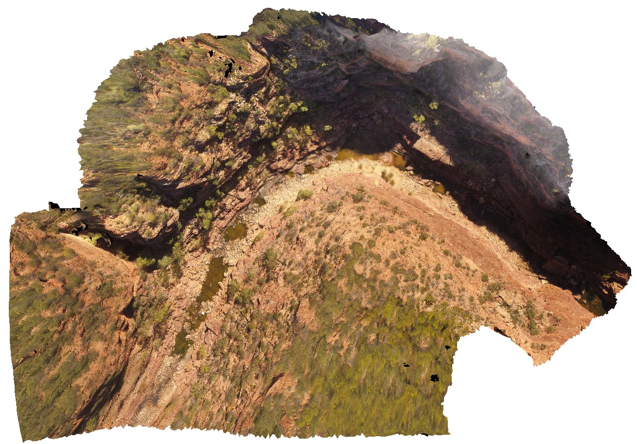
KalbarriUAV2 Map
 |
0 |
05/20/2016 noon |
UAV |
aerial view of Murchison River gorge and sandstone cliffs at the 'Z bend', Kalbarri National Park. W.A. |
200.00 |
-27.65389500000 |
114.45711900000 |
-9999.000 |
river gorge, cliff, Tumblagooda Sandstone |
sandstone |
KalbarriUAV3 Map
 |
0 |
05/20/2016 noon |
UAV |
aerial view of Murchison River gorge and large outcrop, approximately 800m upstream from the 'Z bend', Kalbarri National Park. W.A. |
200.00 |
-27.65967000000 |
114.45595500000 |
-9999.000 |
river gorge, sandstone |
sandstone |
KalbarriUAV4 Map
 |
0 |
05/20/2016 noon |
UAV |
Cross bedded red sandstone in horizontal exposure. location at Red Bluff carpark, Kalbarri, W.A. |
20.00 |
-27.74398000000 |
114.14342000000 |
-9999.000 |
cross bedding, Tumblagooda Sandstone |
sandstone |
KalbarriUAV5 Map
 |
0 |
05/20/2016 noon |
UAV |
large overturned block with cross bedding and vertical burrows. Red Bluff, Kalbarri, W.A. |
20.00 |
-27.74547600000 |
114.13947200000 |
-9999.000 |
sandstone, bioturbation |
sandstone |
KalbarriUAV6 Map
 |
0 |
01/01/9999 midnight |
UAV |
main cliff at Red Bluff, showing flat lying, thinly bedded or cross bedded sandstone of the Tumblagooda Sandstone. Kalbarri, W.A. |
28.00 |
-27.74557200000 |
114.13969200000 |
-9999.000 |
Tumblagooda Sandstone, cross beds, sedimentology |
sandstone |
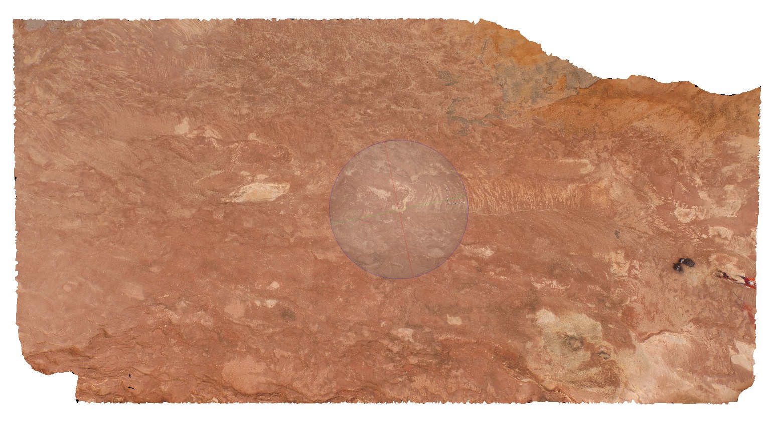
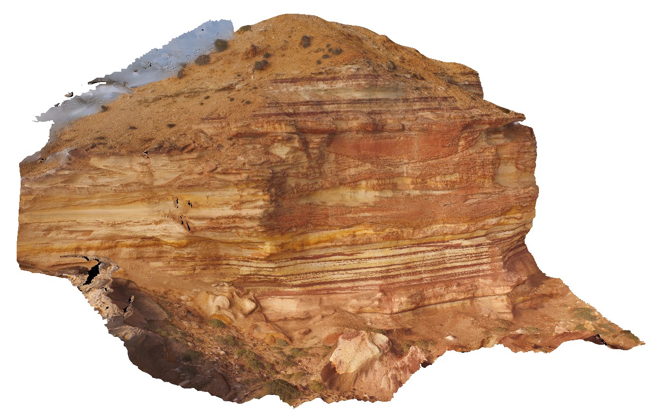
Kalkarindji1 Map
 |
5 |
06/20/2016 noon |
3D |
cross bedding in fine-grained sandstone, Kalkarindji. N.T. |
0.50 |
-17.39921000000 |
130.79724000000 |
-9999.000 |
cross bedding, sandstone |
sandstone |
Karijini1 Map
 |
0 |
05/29/2016 noon |
3D |
sandstone lenses in the Brockman Iron Formation, Handcock Gorge. Karijini National Park. W.A. |
0.70 |
-22.35906000000 |
118.28644000000 |
-9999.000 |
Brockman Iron Formation, banded iron formation, sandstone lenses, sedimentology |
BIF |
Karijini10 Map
 |
0 |
05/29/2016 noon |
3D |
pods of crocidolite in banded iron formation. Circular Pool, Karijini National Park. W.A. |
0.30 |
-22.36123000000 |
118.28945000000 |
-9999.000 |
crocidolite, banded iron formation, mineral |
BIF |
Karijini11 Map
 |
0 |
05/29/2016 noon |
3D |
thin layers in the Brockman Iron Formation. Circular Pool, Karijini National Park. W.A. |
1.40 |
-22.36123000000 |
118.28945000000 |
-9999.000 |
banded iron formation, bedding, sedimentology |
BIF |
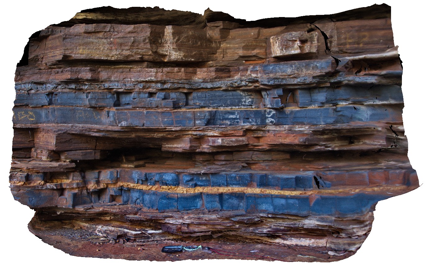
Karijini12 Map
 |
0 |
05/29/2016 noon |
3D |
domed stromatolites? Or concentric concretions on bedding surface in the Brockman Iron Formation. Dales Gorge, Karijini National Park. W.A. |
0.80 |
-22.47582000000 |
118.56270000000 |
-9999.000 |
stromatolite, banded iron formation, fossil, palaeontology |
BIF |
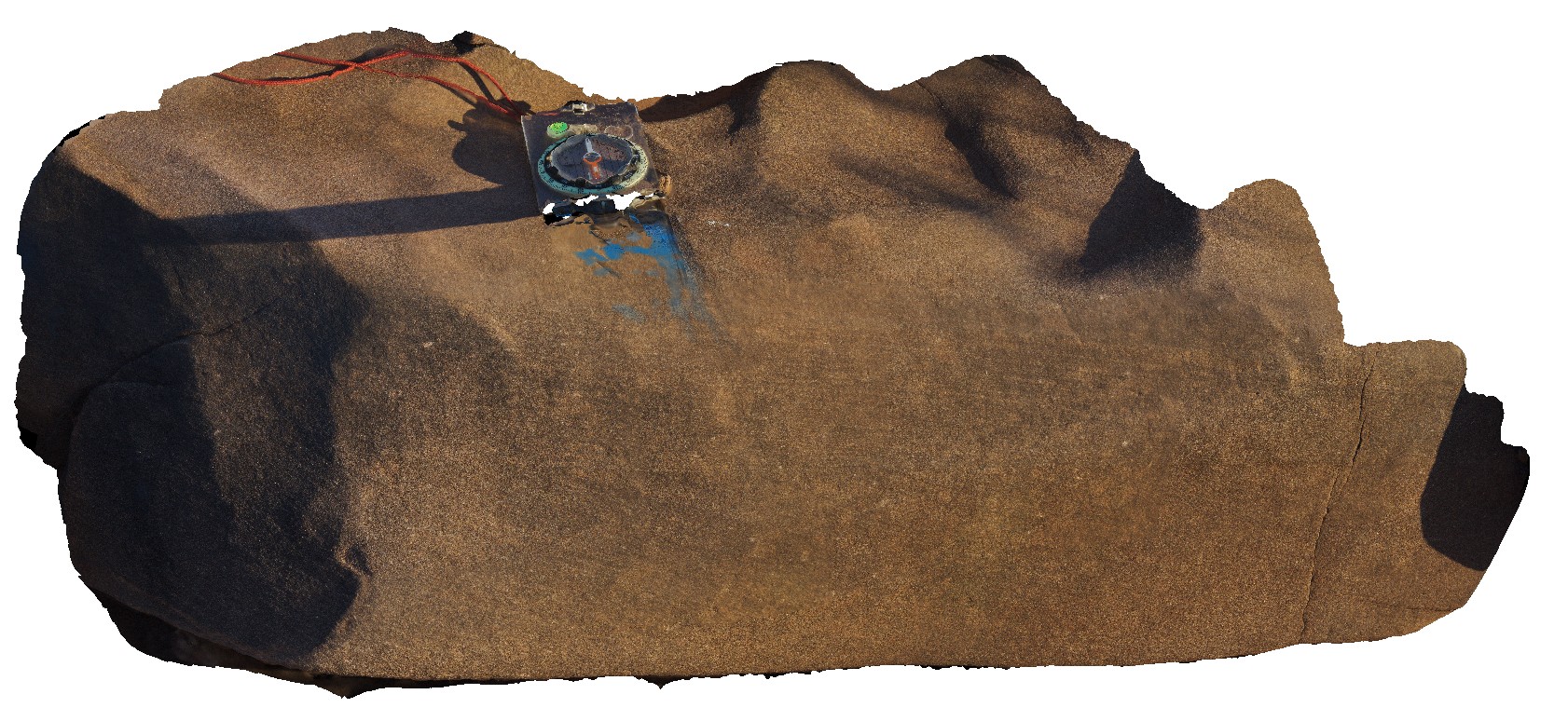
Karijini13 Map
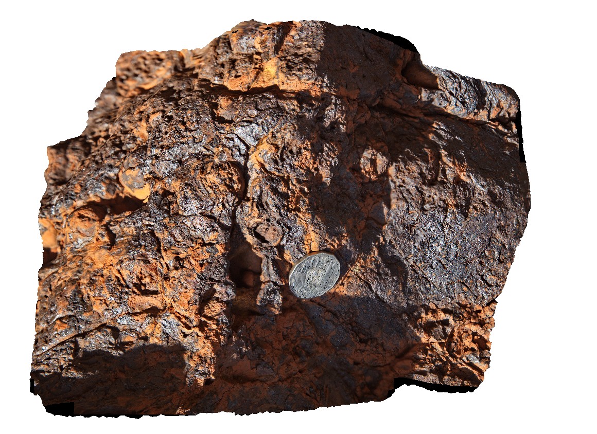 |
0 |
05/29/2016 noon |
3D |
massive haematite in large boulder. Dales Gorge, Karijini National Park. W.A. |
0.30 |
-22.47628000000 |
118.56247000000 |
-9999.000 |
hematite, banded iron formation, mineral |
BIF |
Karijini14 Map
 |
0 |
05/29/2016 noon |
3D |
conglomerate or breccia on flanks of Dales Gorge. Karijini National Park. W.A. |
2.30 |
-22.47628000000 |
118.56258000000 |
-9999.000 |
breccia, banded iron formation |
breccia |
Karijini15 Map
 |
0 |
05/29/2016 noon |
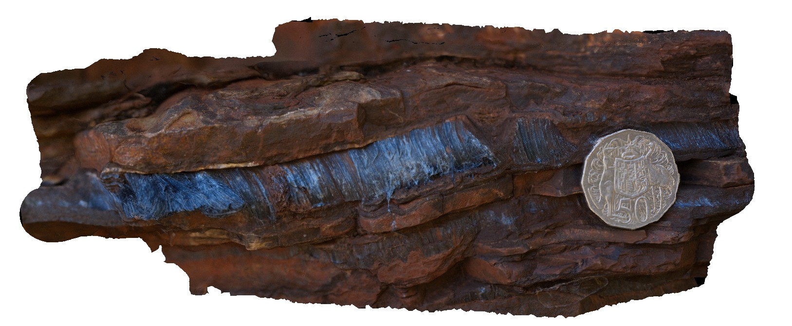
3D |
macro view of 1cm wide seam of radiating crocidolite in Brockman Iron Formation. Dales Gorge, Karijini National Park. W.A. |
0.10 |
-22.47611000000 |
118.56268000000 |
-9999.000 |
crocidolite, banded iron formation, mineral |
BIF |
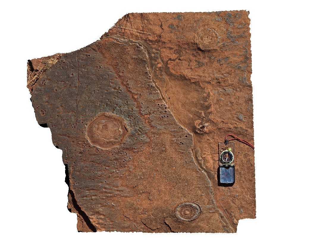
Karijini16 Map
 |
0 |
05/29/2016 noon |
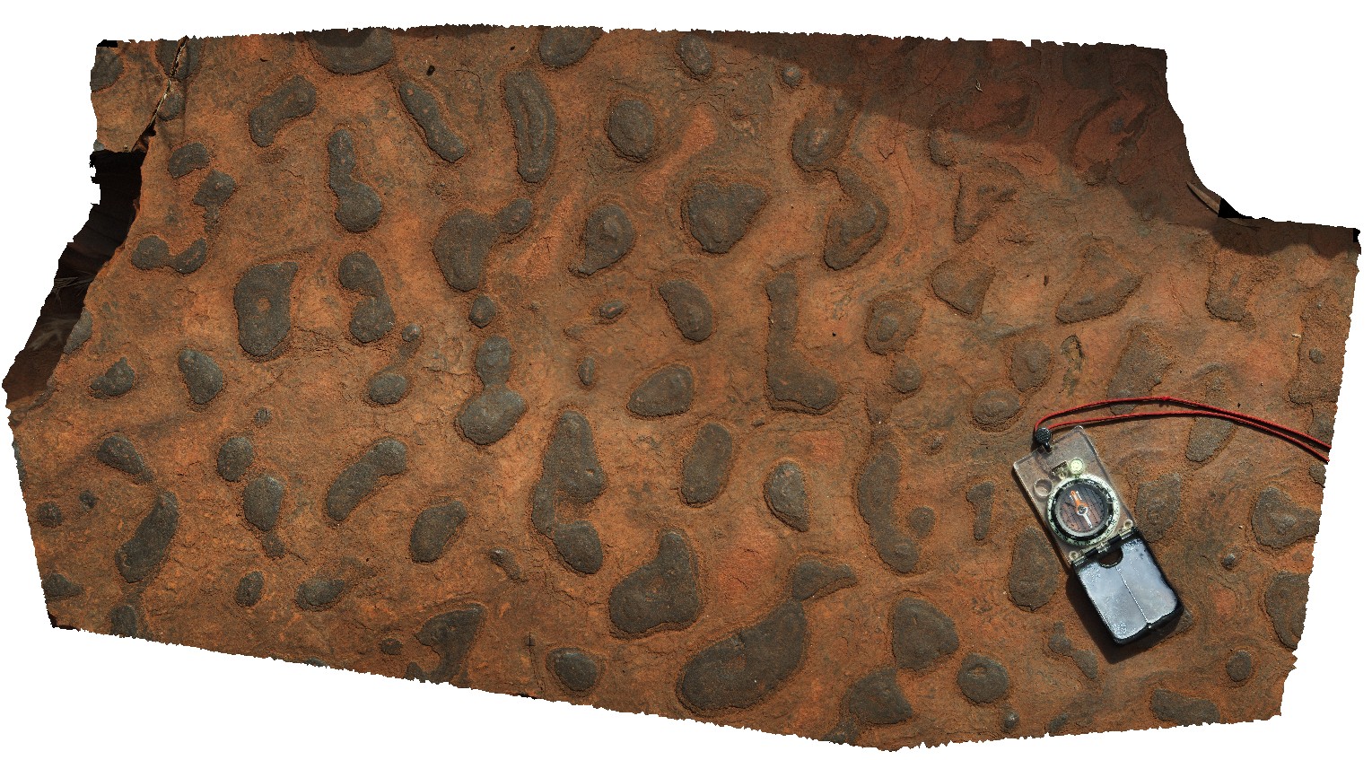
3D |
pavement of rounded features. Possible concretions / chert nodules or stromatolites. Dales Gorge, Karijini National Park. W.A. |
0.75 |
-22.47663000000 |
118.56258000000 |
-9999.000 |
banded iron formation, sedimentology |
BIF |
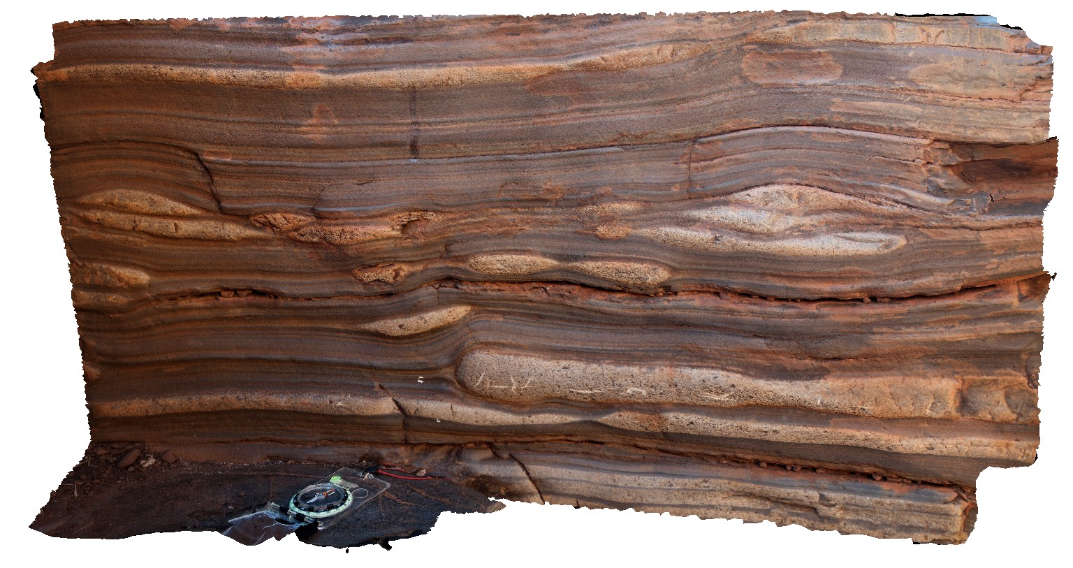
Karijini17 Map
 |
0 |
05/29/2016 noon |
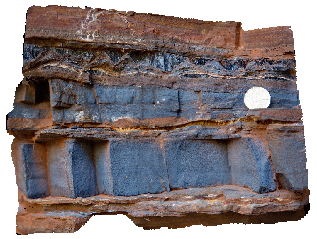
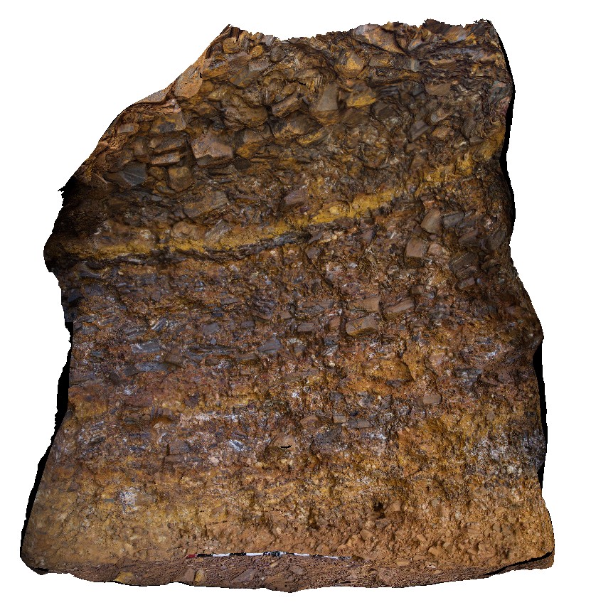
3D |
section through part of the Brockman Iron Formation, showing (from the bottom up); BIF, silicified carbonate; pyritic shale and BIF. Dales Gorge, Karijini National Park. W.A. |
4.30 |
-22.47609000000 |
118.56262000000 |
-9999.000 |
cross-section, Banded iron formation, silicified carbonate, pyritic shale, sedimentology |
BIF |
Karijini18 Map
 |
0 |
05/29/2016 noon |
3D |
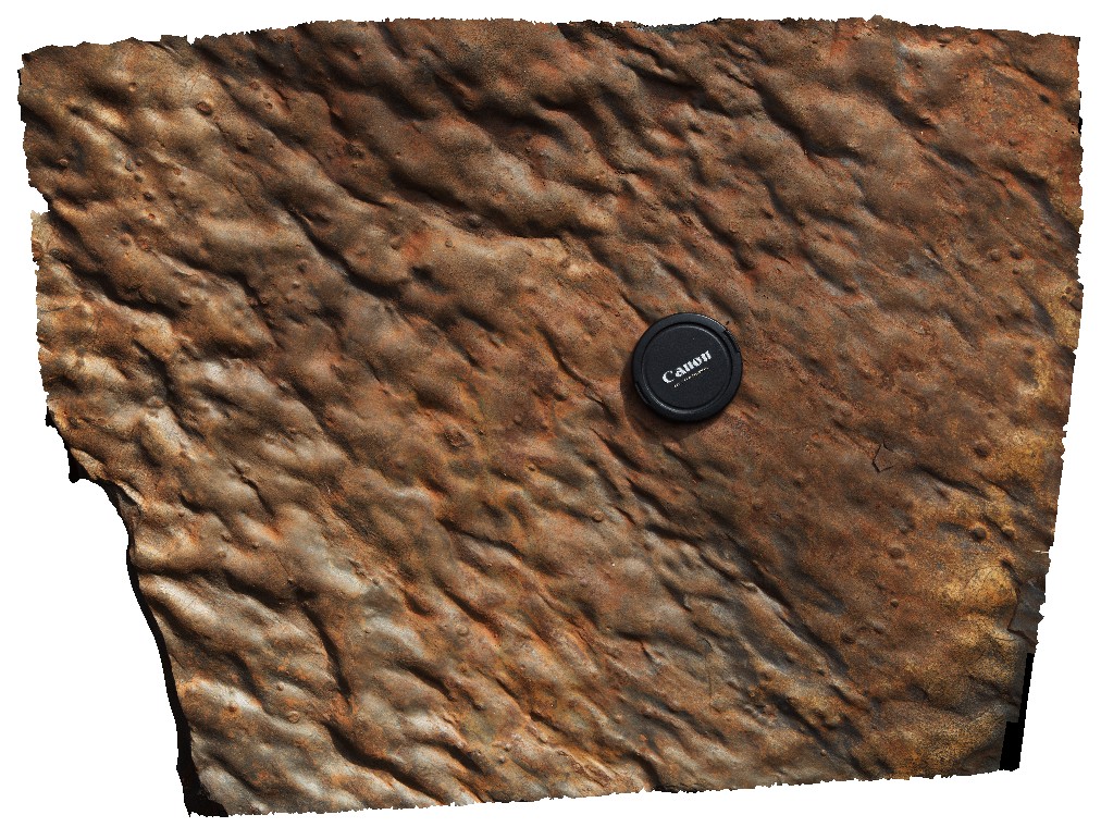
undulating 'rippled?' surface of bedding plane. Dales Gorge, Karijini National Park. W.A. |
0.50 |
-22.47732000000 |
118.56297000000 |
-9999.000 |
ripple marks, bedding plane, banded iron formation |
BIF |