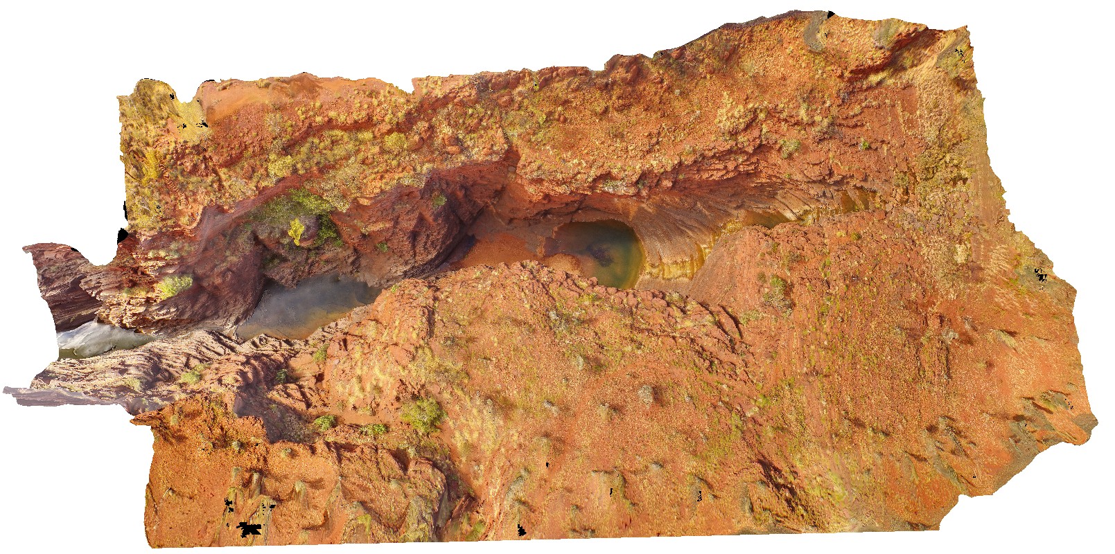
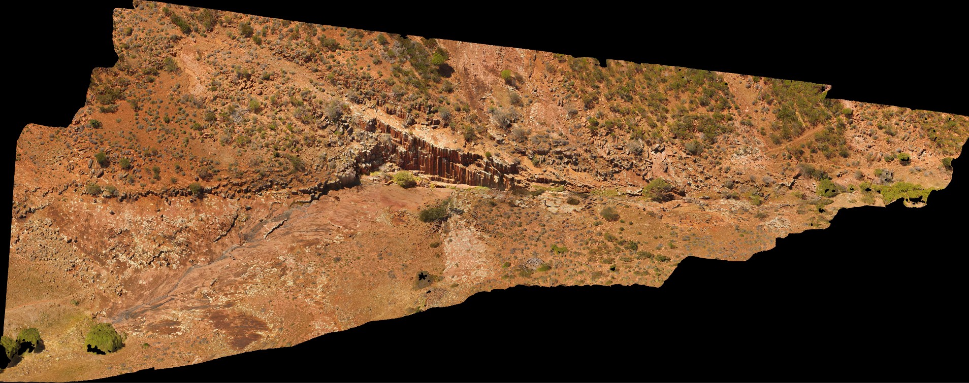
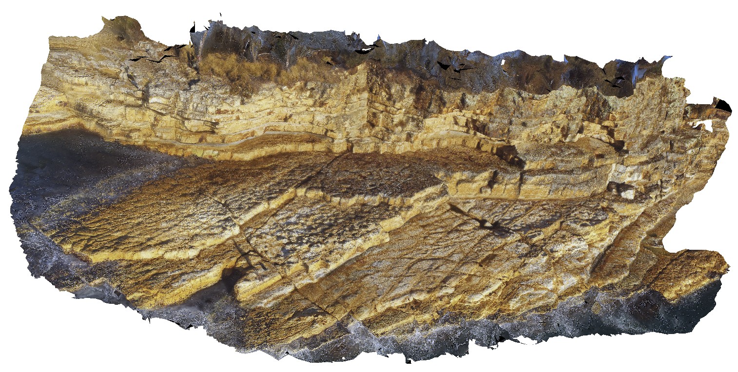
GawlerUAV1 Map
 |
0 |
10/20/2015 4:07 p.m. |
UAV |
aerial view of gully, waterfall and organ pipes exposed on side of gully. Organ pipes Gorge. Gawler Ranges. |
200.00 |
-32.53903400000 |
135.29649400000 |
-9999.000 |
columnar, igneous, joint |
dacite |
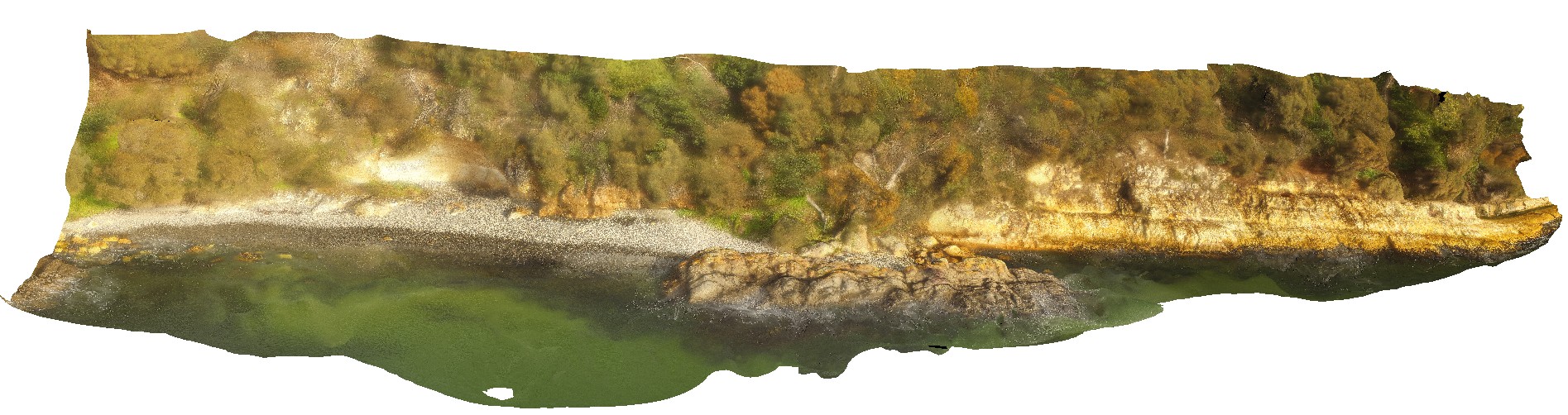
WTasUAV2 Map
 |
20 |
01/01/9999 midnight |
UAV |
aerial view of Heemskirk Granite in contact with ultramafic suite at north end of Trial Harbour. Trial Harbour, West Tas. |
50.00 |
-41.92522000000 |
145.16256400000 |
-9999.000 |
igneous contact, contact, Heemskirk Granite |
granite, ultramafic |
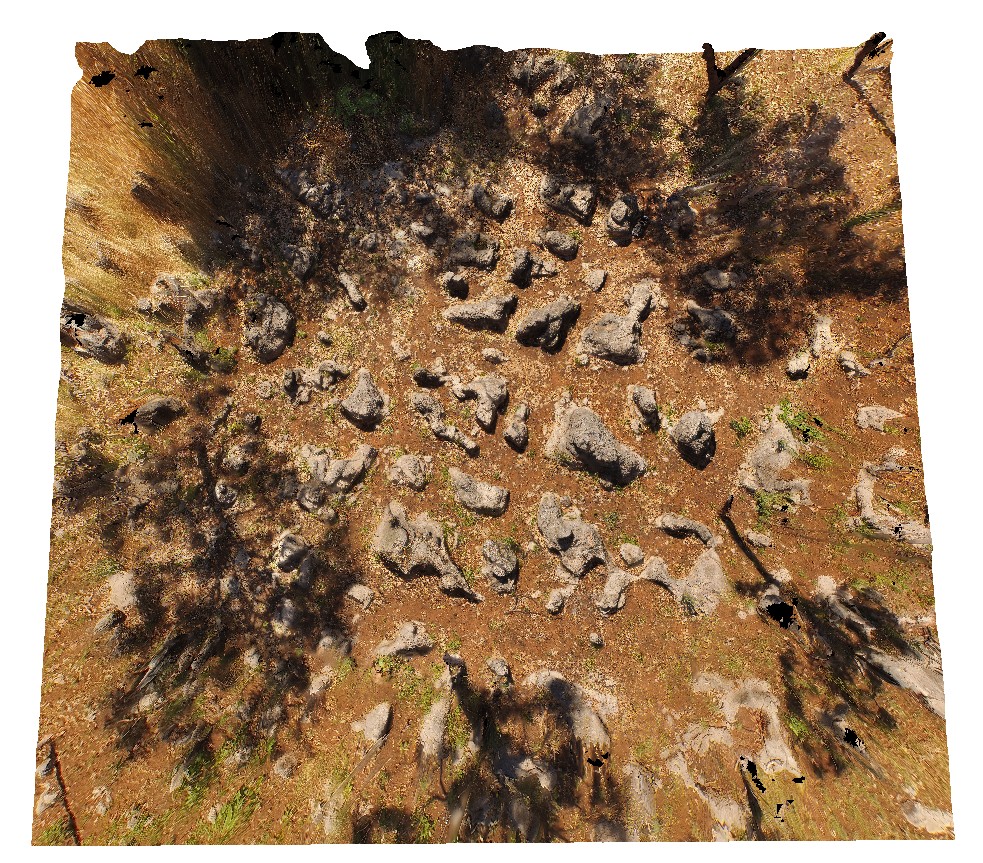
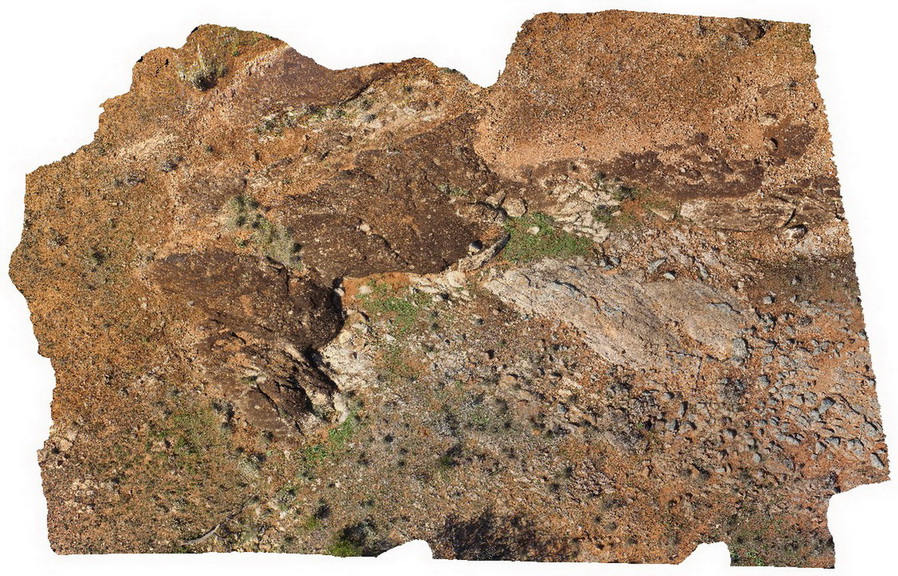
HENBUAV1 Map
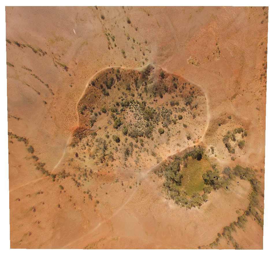 |
0 |
07/29/2016 11:43 a.m. |
UAV |
aerial view of Henbury impact craters. Henbury Meteorites Conservation Reserve. N.T. |
200.00 |
-24.57164500000 |
133.14883500000 |
460.694 |
meteorite impact craters, Henbury, Meteorites |
sediments |
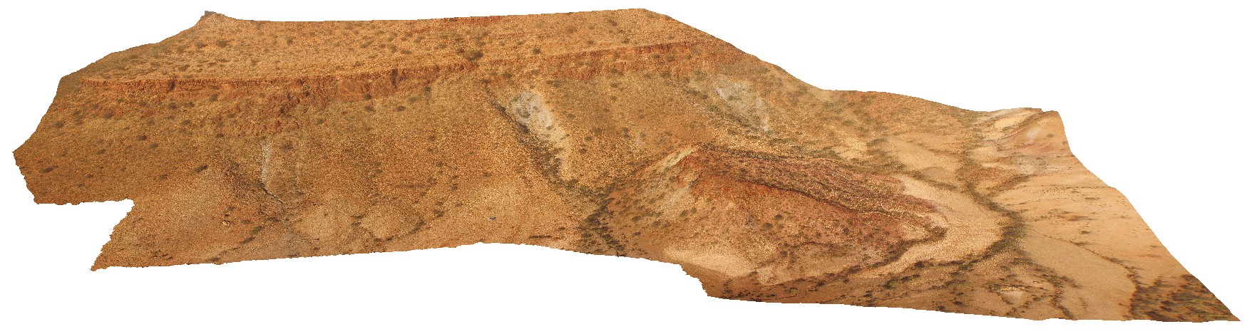
KarijiniUAV3 Map
 |
0 |
05/29/2016 noon |
UAV |
aerial view of Joffre Falls and Gorge, showing section through the Brockman Iron Formation. Karijini National Park. W.A. |
200.00 |
-22.36123000000 |
118.28945000000 |
-9999.000 |
Joffre Gorge, Brockman Iron Formation, banded iron formation |
BIF |
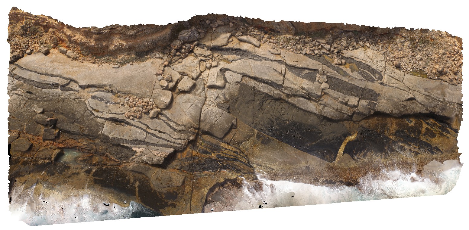
WTasUAV3 Map
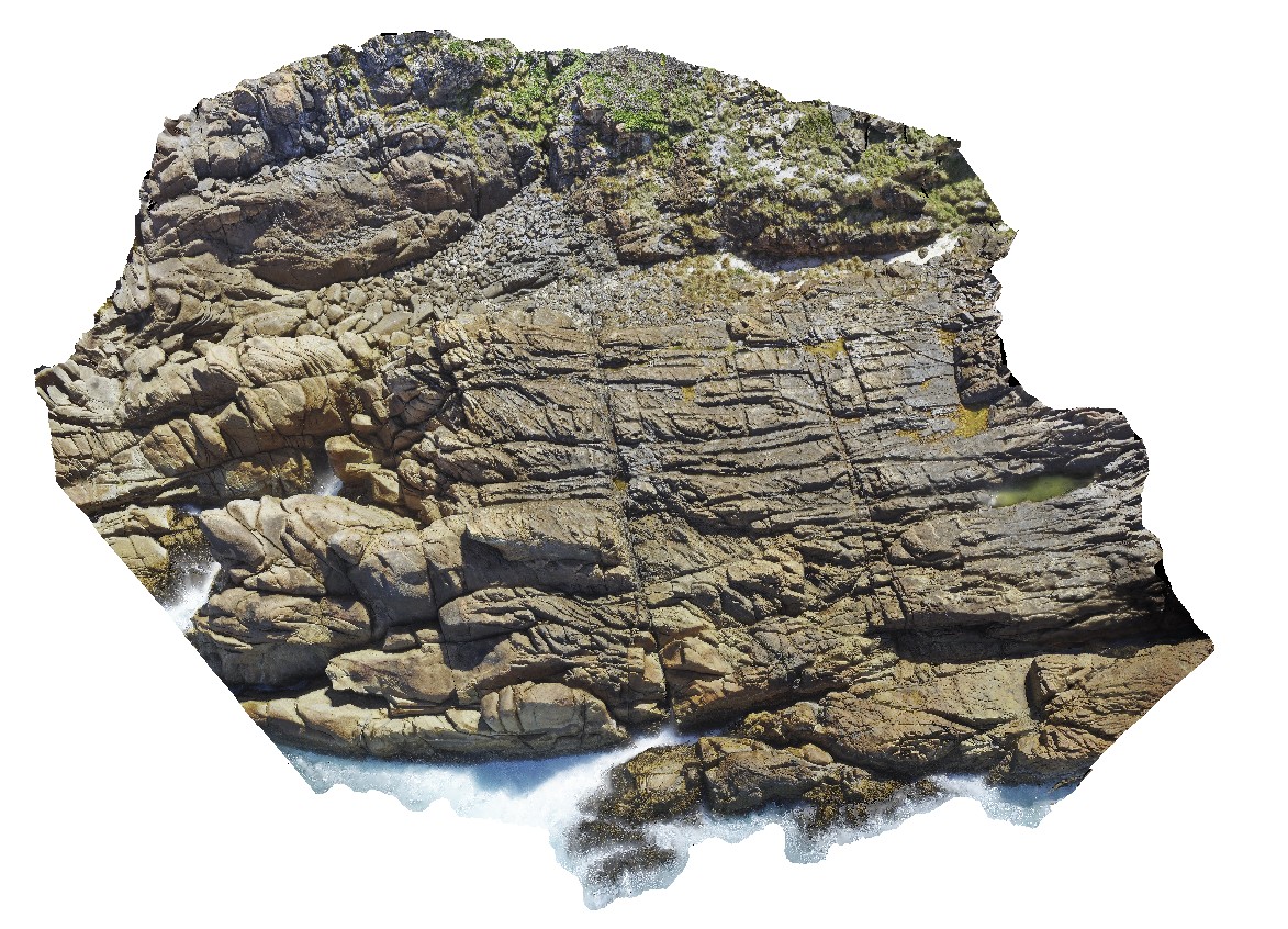 |
20 |
01/01/9999 midnight |
UAV |
aerial view of jointed granite, with magmatic - hydrothermal alteration and veining. Trial Harbour, West Tasmania. |
100.00 |
-41.92280300000 |
145.15734300000 |
-9999.000 |
granite, tourmaline orbicules, intrusive contact |
granite |
KatherineUAV2 Map
 |
0 |
06/22/2016 noon |
UAV |
aerial view of karst towers in very thickly bedded limestone. N/W of Katherine township, N.T. |
14.00 |
-14.40787000000 |
132.19470000000 |
-9999.000 |
karst landscape, limestone, weathering feature |
limestone |
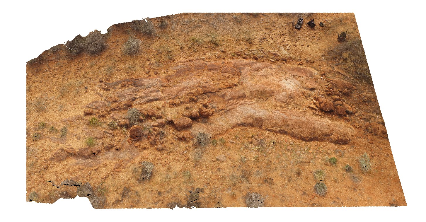
PurnululuUAV5 Map
 |
0 |
06/12/2016 noon |
UAV |
aerial view of knife-edge ridge in with carbonate cemented breccias. Purnululu National Park, W.A. |
50.00 |
-17.41007000000 |
128.20453000000 |
-9999.000 |
weathering feature, knife-edge ridge, carbonate, Bungle Bungles, Purnululu National Park |
dolostone |
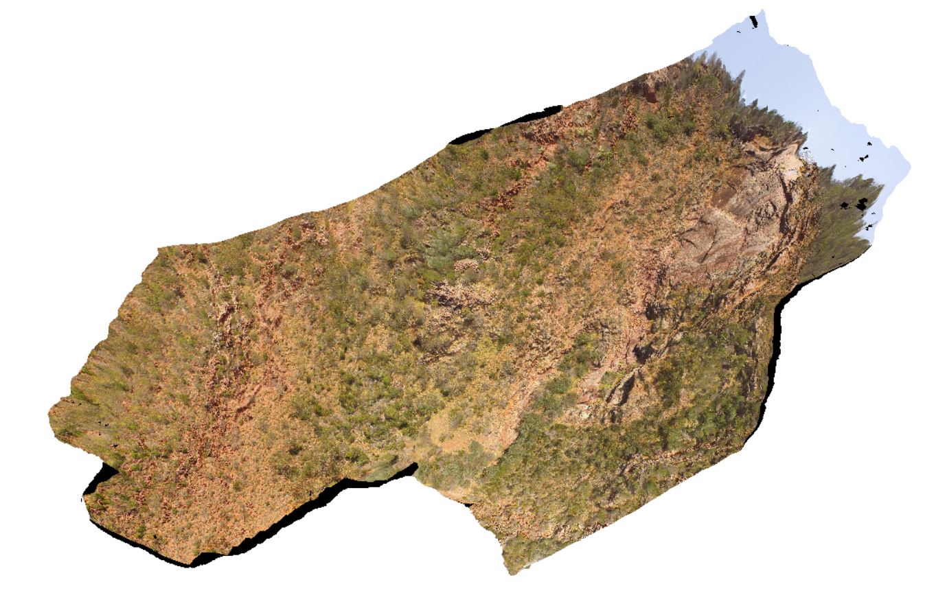
GawlerUAV2 Map
 |
0 |
10/20/2015 4:08 p.m. |
UAV |
aerial view of Kolar Falls, showing columnar dacite. Mount Fairview, Gawler Ranges. |
500.00 |
-32.56346300000 |
135.57600000000 |
-9999.000 |
columnar, joint, dacite |
dacite |
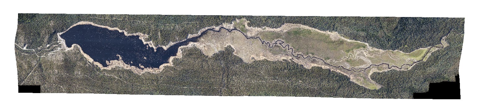
LakeRowallan Map
 |
20 |
01/01/9999 midnight |
3D |
aerial view of lake Rowallan during low water level. Tasmania. |
0.00 |
-41.73505940000 |
146.21744630000 |
-9999.000 |
|
|
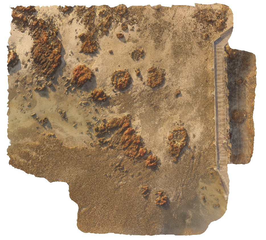
HamelinUAV4 Map
 |
0 |
05/23/2016 noon |
UAV |
aerial view of large stromatolite mounds - supra-tidal. Hamelin Pool. Shark Bay, W.A. |
50.00 |
-26.40053100000 |
114.15087300000 |
-9999.000 |
tidal flat deposits, stromatolites |
tidal flat deposits |
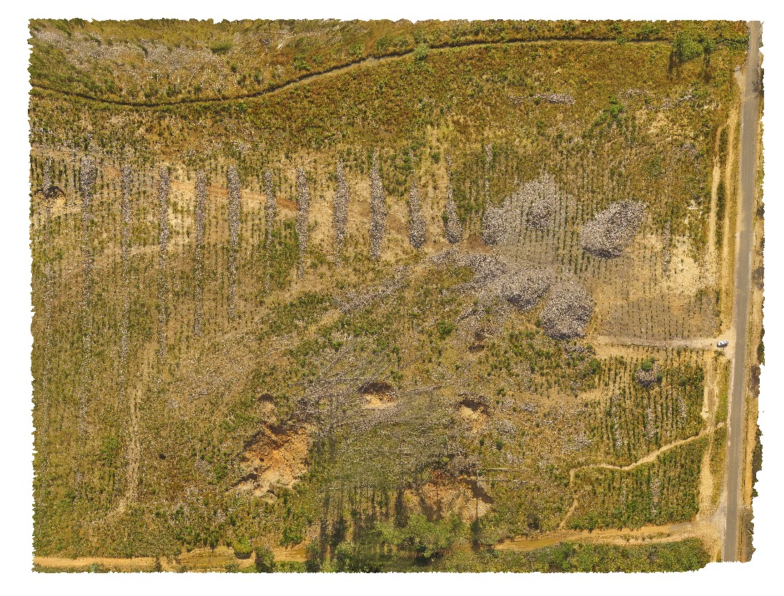
RailtonUAV1 Map
 |
20 |
01/01/9999 midnight |
UAV |
aerial view of logging coupe, showing sink holes in the 'Goliath Limestone' near the cement works, Dulverton Road, Railton. Northern Tasmania. |
480.00 |
-41.31009900000 |
146.40432500000 |
37.500 |
sink hole, logging coupe, Goliath Limestone |
limestone |
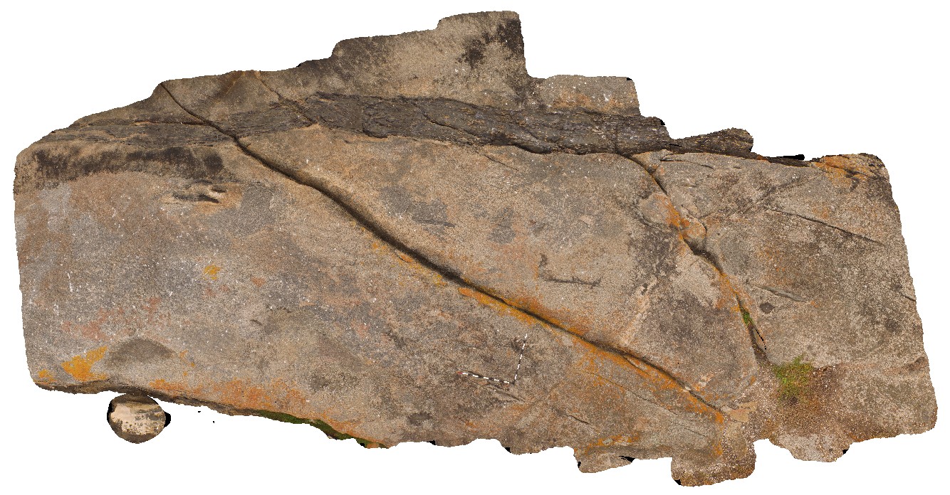
KirtonUAV2 Map
 |
20 |
10/20/2015 3:08 p.m. |
UAV |
aerial view of mafic dyke in granitic gneiss. Kirton Point. Port Lincoln. S.A. |
7.00 |
-34.72473000000 |
135.88480000000 |
-9999.000 |
mafic dyke, granitic gneiss, intrusive contact |
granitic gneiss, amphibolite |
CrescentUAV2 Map
 |
0 |
04/12/2016 10:45 a.m. |
UAV |
aerial view of moderately to gently dipping and openly folded strata of the Crescent Head area. Crescent Head. N.S.W. |
200.00 |
-31.18692000000 |
152.98367000000 |
-9999.000 |
fold, strata |
sediments |
CrescentUAV1 Map
 |
0 |
04/12/2016 10:20 a.m. |
UAV |
aerial view of moderately to gently dipping strata of the Crescent Head area. Crescent Head. N.S.W. |
100.00 |
-31.18692000000 |
152.98367000000 |
-9999.000 |
sediments |
sediments |
KalbarriUAV3 Map
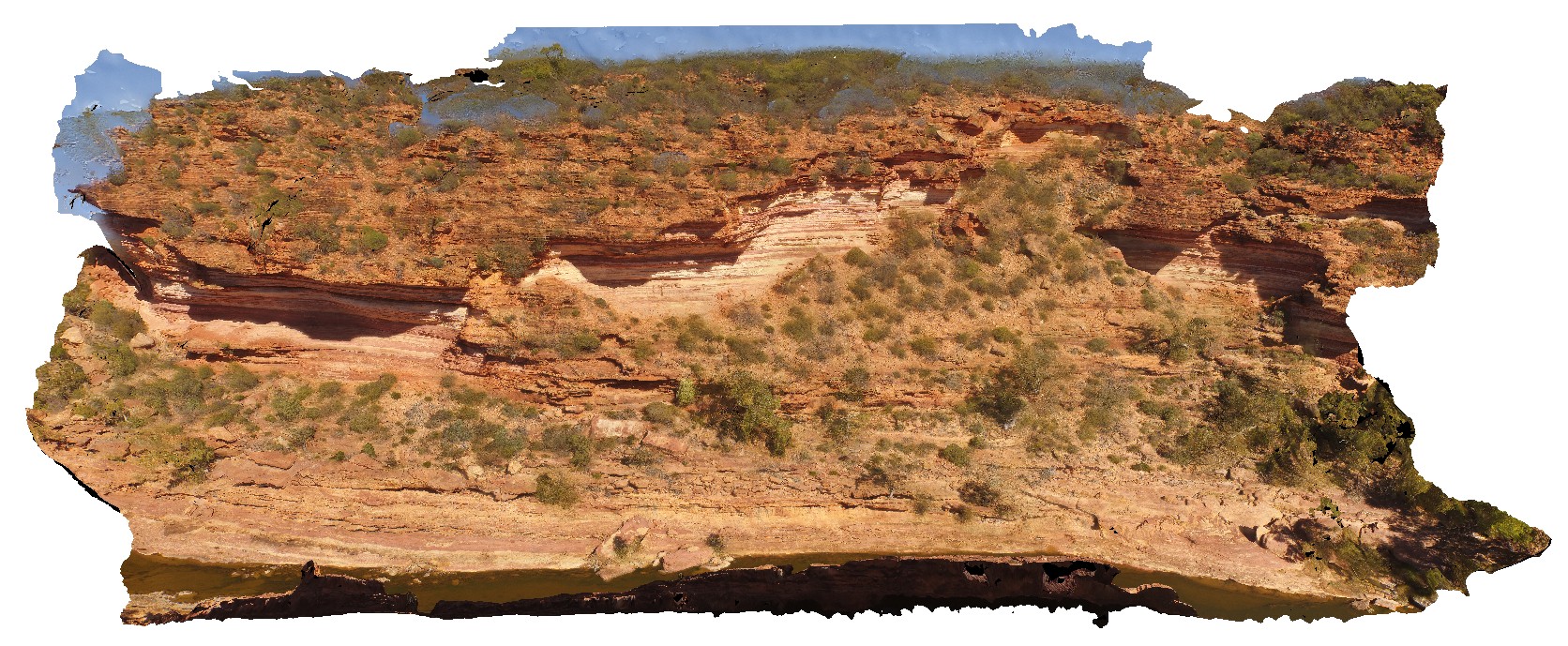 |
0 |
05/20/2016 noon |
UAV |
aerial view of Murchison River gorge and large outcrop, approximately 800m upstream from the 'Z bend', Kalbarri National Park. W.A. |
200.00 |
-27.65967000000 |
114.45595500000 |
-9999.000 |
river gorge, sandstone |
sandstone |
KalbarriUAV2 Map
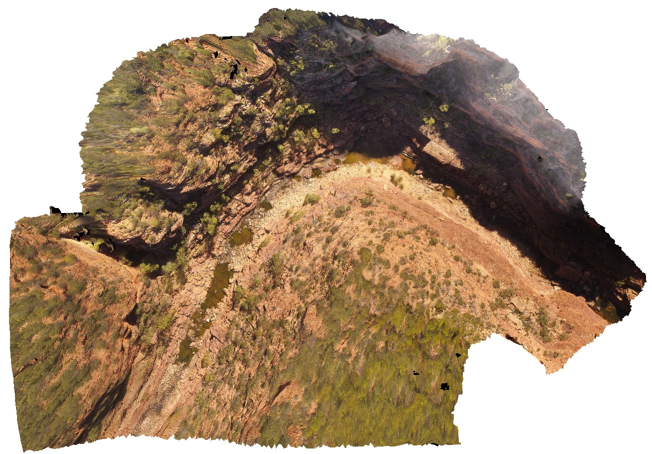 |
0 |
05/20/2016 noon |
UAV |
aerial view of Murchison River gorge and sandstone cliffs at the 'Z bend', Kalbarri National Park. W.A. |
200.00 |
-27.65389500000 |
114.45711900000 |
-9999.000 |
river gorge, cliff, Tumblagooda Sandstone |
sandstone |
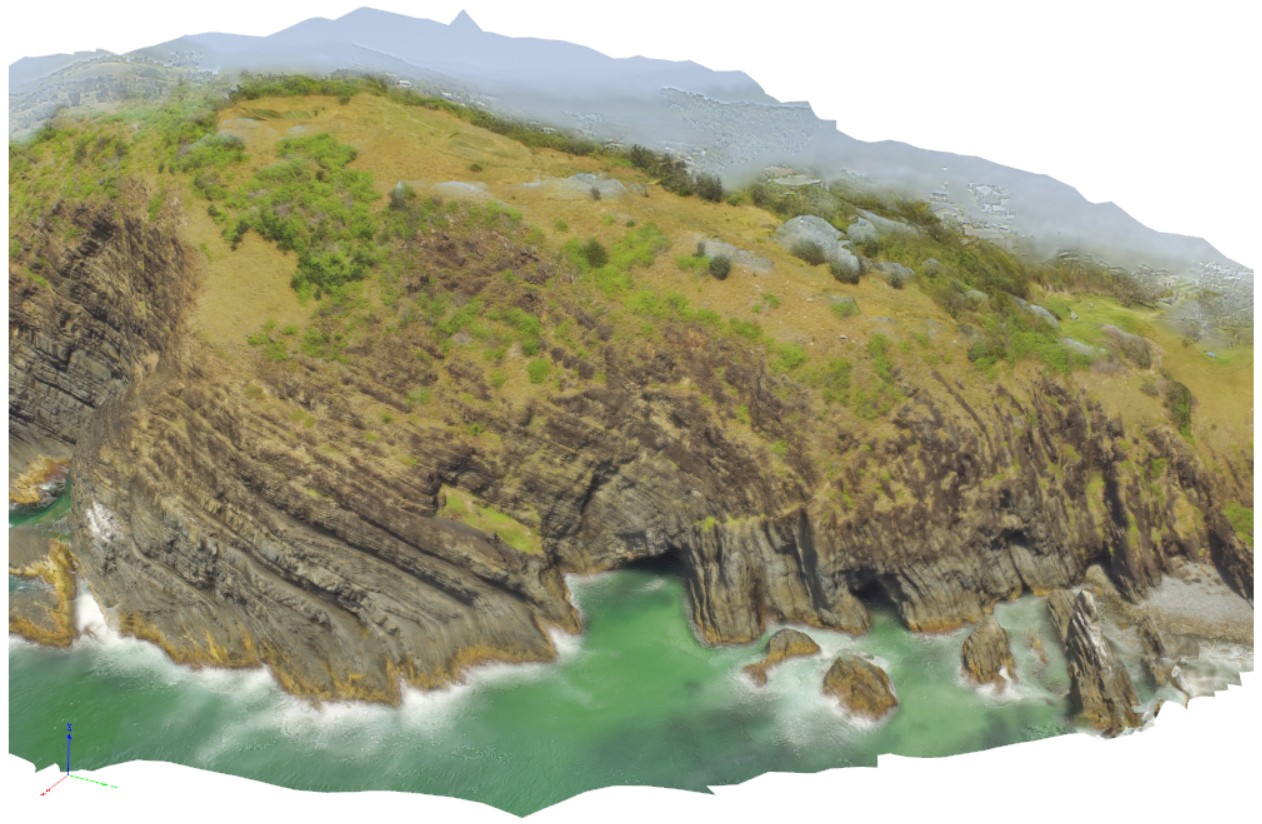
OlaryUAV2 Map
 |
0 |
09/27/2015 6:50 p.m. |
UAV |
aerial view of Old Boolcoomata Conglomerate Member, showing interbedded conglomerate with pebbly sandstone and siltstone. Old Boolcoomata Station. Olary. S.A. |
0.00 |
-32.09433000000 |
140.27747000000 |
-9999.000 |
conglomerate, sedimentology |
conglomerate |
OlaryUAV1 Map
 |
0 |
09/27/2015 6:49 p.m. |
UAV |
aerial view of Old Boolcoomata Conglomerate Member, showing interbedded conglomerate with pebbly sandstone and siltstone. Old Boolcoomata Station. Olary. S.A. |
100.00 |
-32.09570000000 |
140.27974000000 |
-9999.000 |
conglomerate, sedimentology |
conglomerate |
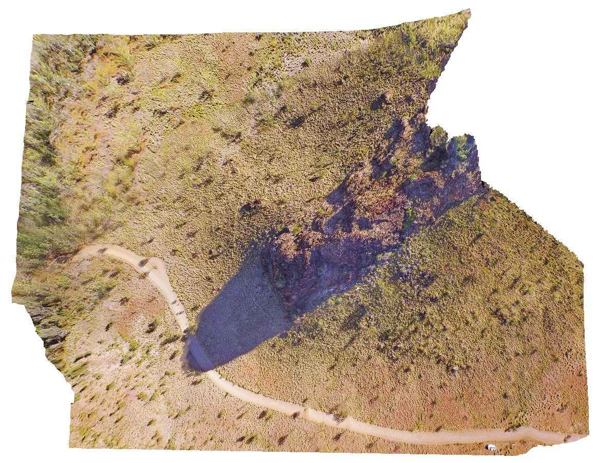
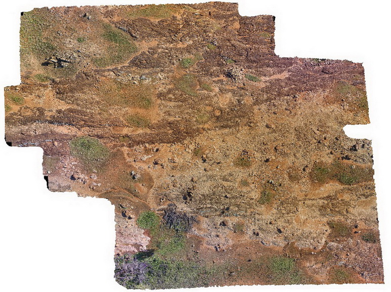
PingandyUAV1 Map
 |
0 |
05/28/2016 noon |
UAV |
aerial view of outcrop unconformity between the Edmund Basin and the Ashburton Formation. 'Tchintaby Ridge'. Ashburton Downs - Meekatharra Road, W.A. |
100.00 |
-23.98458850000 |
117.92190660000 |
-9999.000 |
unconformity |
sandstone, sandstone |
REYNUAV2 Map
 |
0 |
07/24/2016 2:07 p.m. |
UAV |
aerial view of parasitic folds in mixed mafic-felsic orthogneiss. North West side of Mount Boothby, Reynolds Range. Next to Stuart Highway. N.T. |
50.00 |
-22.57375700000 |
133.30383400000 |
688.246 |
orthogneiss, metamorphic |
orthogneiss |
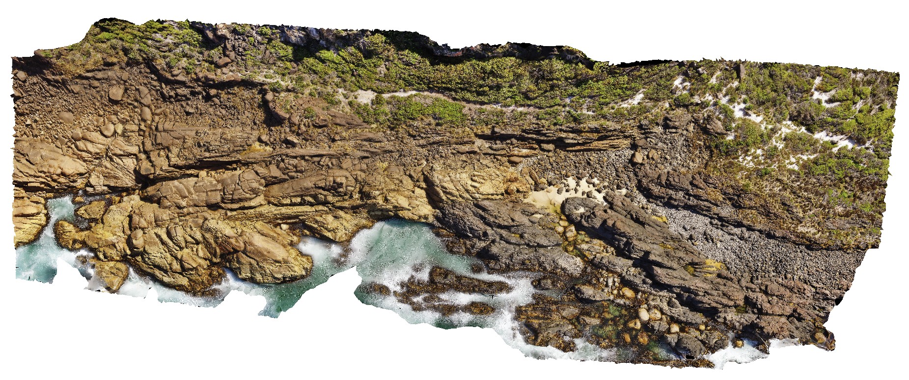
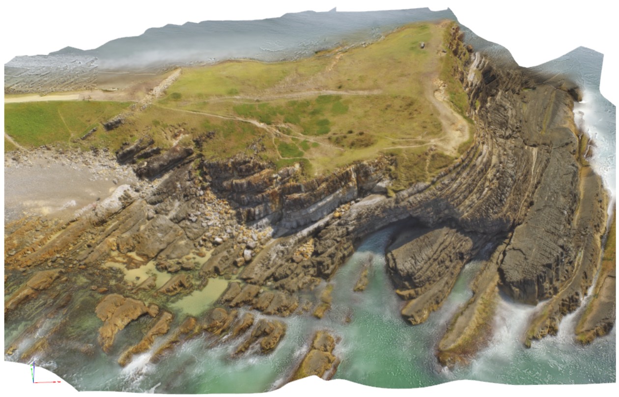
BlackmansBayUAV1 Map
 |
0 |
04/12/2016 3:27 p.m. |
UAV |
aerial view of Permian cliff at northern end of Blackmans Bay beach, showing bedding and exposed shore platform. Tasmania. |
100.00 |
-42.99987000000 |
147.32823000000 |
-9999.000 |
shore platform, strata, Permian |
siltstone |
KingstonUAV1 Map
 |
20 |
07/15/2016 noon |
UAV |
aerial view of Permian sandstone contact with Jurassic dolerite. Shore exposure south of Kingston Beach, Tas. |
100.00 |
-42.98581000000 |
147.32770000000 |
-9999.000 |
Permian sandstone, Jurassic dolerite, intrusive contact |
sandstone, dolerite |
EaglehawkUAV1 Map
 |
20 |
01/01/9999 midnight |
UAV |
aerial view of Permian sea cliffs at Eaglehawk Neck, Tasmania. |
500.00 |
-43.03373200000 |
147.94973000000 |
94.070 |
sea cliff, Permian sediments |
sediments |
CervantesUAV2 Map
 |
0 |
05/18/2016 noon |
UAV |
aerial view of pinnacles, 'Pinnacles Desert', Nambung National Park, Cervantes, W.A. |
50.00 |
-30.60426800000 |
115.16101400000 |
-9999.000 |
weathering features, limestone weathering feature |
limestone |
WannaUAV1 Map
 |
0 |
10/20/2015 4:57 p.m. |
UAV |
aerial view of shore exposure, showing intruding meta dolerite dykes into granite gneiss, Wanna, Port Lincoln. |
100.00 |
-34.89307000000 |
135.85373000000 |
-9999.000 |
meta dolerite, granite gneiss, intrusive contact |
granite gneiss, meta dolerite |