PCFSP4 Map
 |
0 |
07/20/2016 12:48 p.m. |
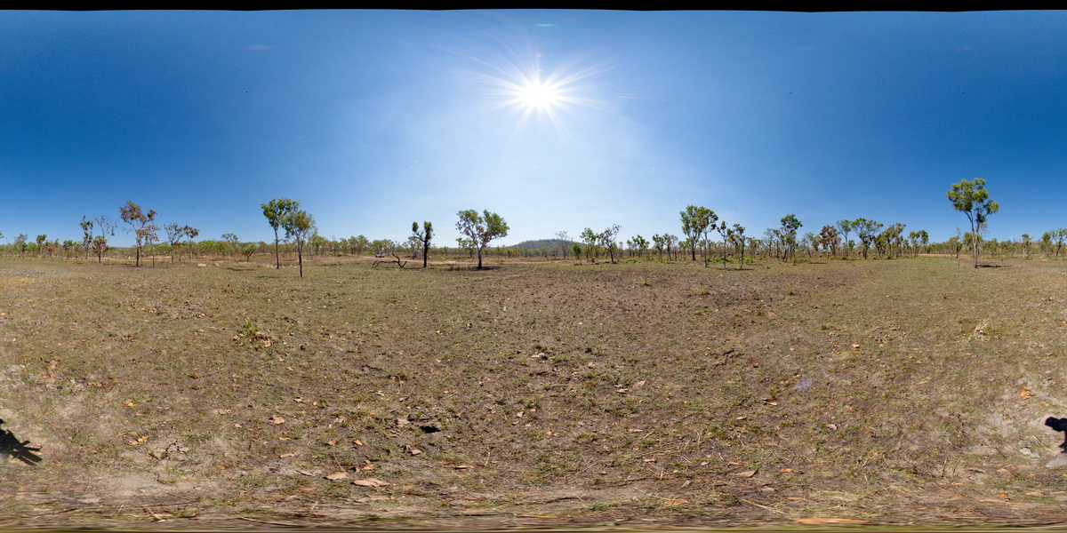
Full Spherical Panorama |
Pine Creek Orogen. Low-lying granite boulder field. Basalt hills to the north and flat-lying sandstone hills to the south. Creek off Grove Hill Road, Stuart Highway, N.T. |
0.00 |
-13.59143200000 |
131.53143600000 |
168.098 |
Pine Creek Orogen, granite, basalt, sandstone |
granite |
PeakHillUAV1 Map
 |
0 |
04/13/2016 12:52 p.m. |
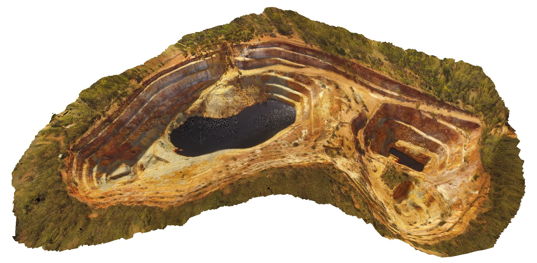
3D UAV photogrammetric model |
aerial view of the Peak Hill open pit, Peak Hill. N.S.W. |
486.00 |
-32.71978600000 |
148.19610200000 |
-9999.000 |
open pit, Peak Hill Gold Mine, mining, mine |
andesite |
Pedder1 Map
 |
5 |
04/29/2016 11:45 a.m. |
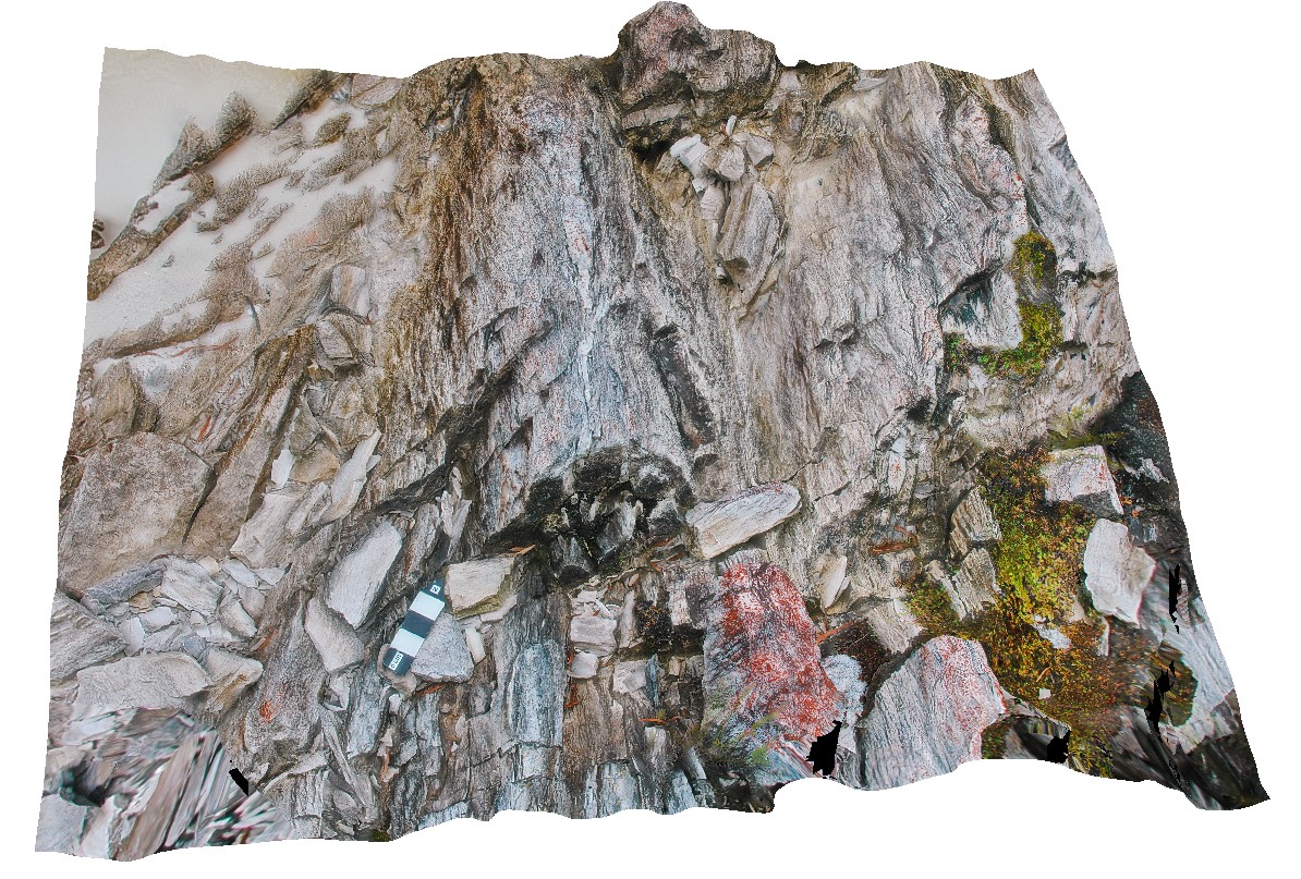
3D terrestrial photogrammetric model |
gently plunging fold hinge in Precambrian quartzite, with quartz veins. Lake Pedder, south west Tasmania. |
0.45 |
-42.84893657000 |
146.11540272000 |
-9999.000 |
fold plunge, fold, open fold, structure, quartzite |
quartzite |
Pedder10 Map
 |
5 |
05/04/2016 11:11 a.m. |
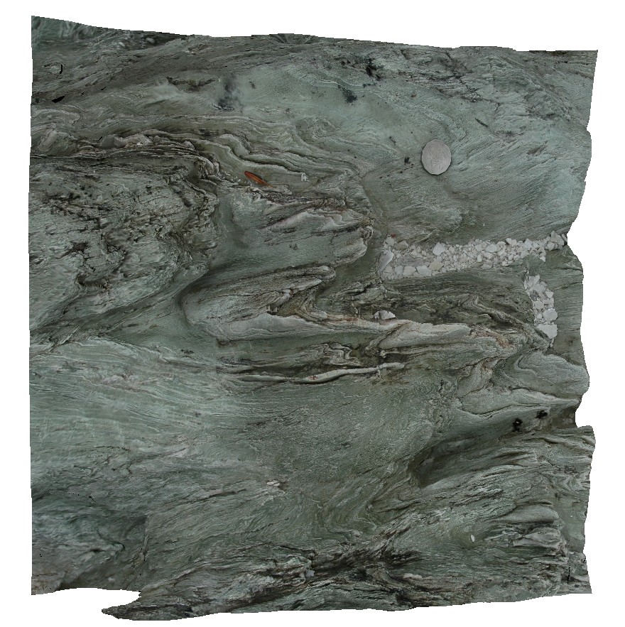
3D terrestrial photogrammetric model |
moderately plunging, asymmetric parasitic folds. Lake Pedder, south west Tasmania. |
0.45 |
-42.84908871000 |
146.10443679000 |
-9999.000 |
asymmetric fold, fold, fold hinge, plunging fold, structure |
phyllite |
Pedder11 Map
 |
5 |
05/04/2016 12:04 p.m. |
3D terrestrial photogrammetric model |
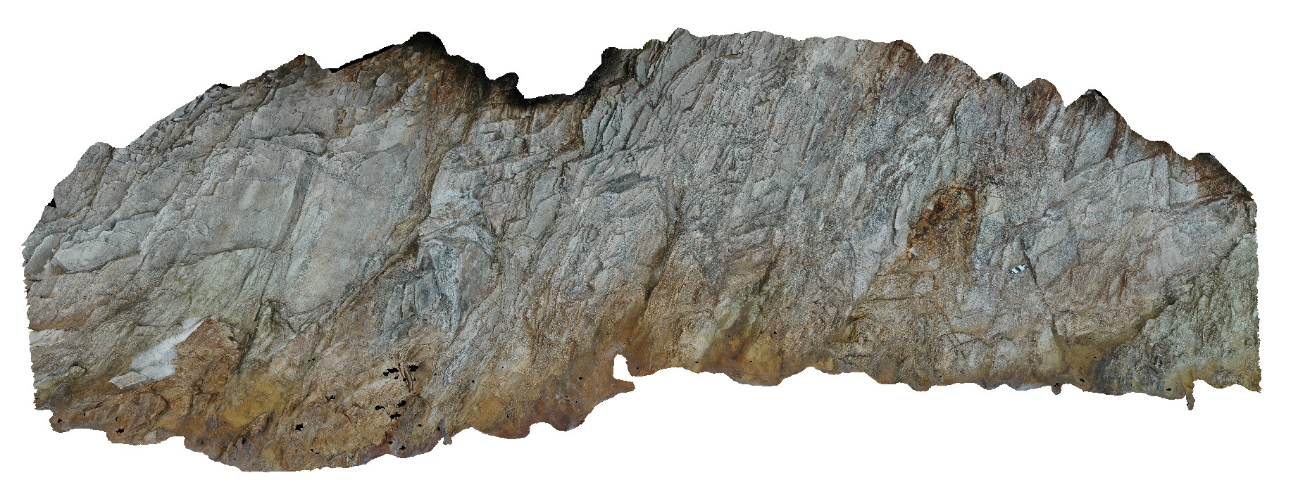
moderately plunging, inclined, asymmetric parasitic folds in quartzite. Lake Pedder, south west Tasmania. |
2.50 |
-42.84902711000 |
146.10461774000 |
-9999.000 |
asymmetric folds, parasitic fold, fold plunge, overturned fold, structure |
quartzite |
Pedder12 Map
 |
5 |
05/04/2016 12:38 p.m. |
3D terrestrial photogrammetric model |
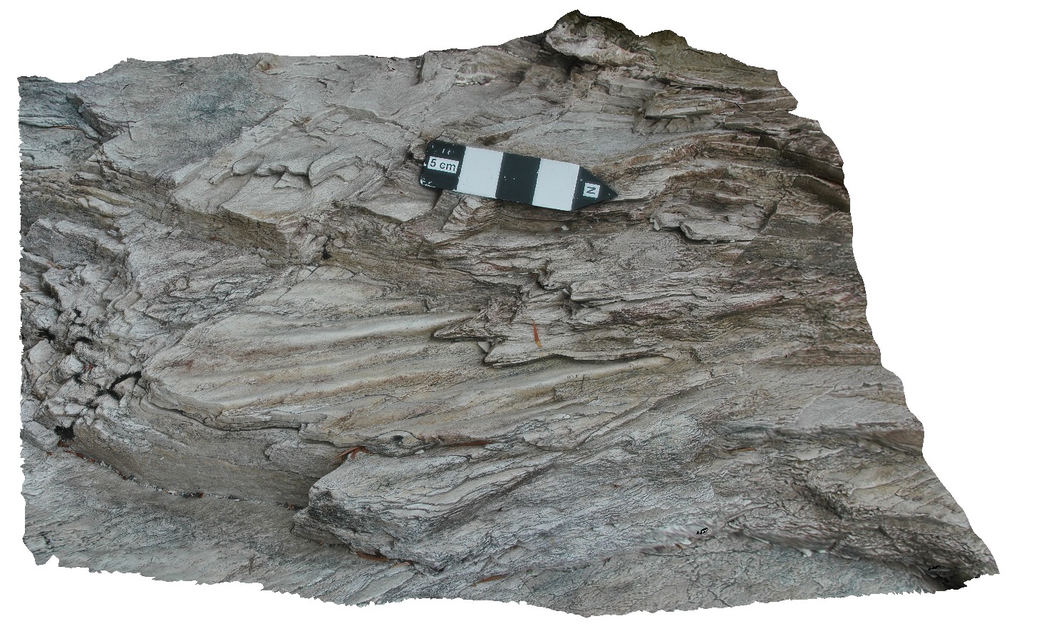
preserved ripple marks in bedded, folded quartzite. Lake Pedder, south west Tasmania. |
7.75 |
-42.84887512000 |
146.10483247000 |
-9999.000 |
ripple mark, fold, structure, quartzite |
quartzite |
Pedder13 Map
 |
5 |
03/16/2015 2:26 p.m. |
3D terrestrial photogrammetric model |
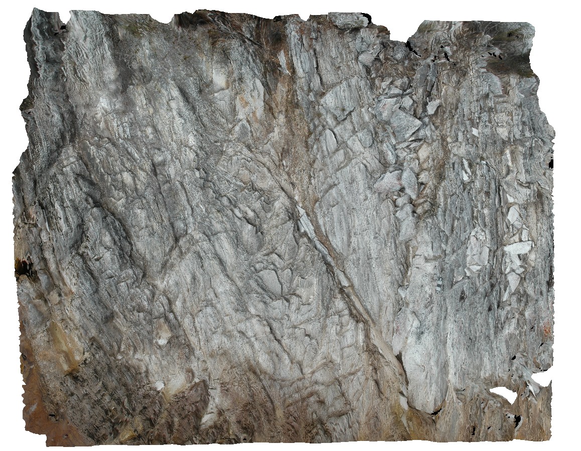
fault cutting folded quartzite. Lake Pedder, south west Tasmania. |
0.00 |
-42.84890616000 |
146.10493121000 |
-9999.000 |
fault, fold, structure, quartzite |
quartzite |
Pedder14 Map
 |
5 |
03/16/2015 2:27 p.m. |
3D terrestrial photogrammetric model |
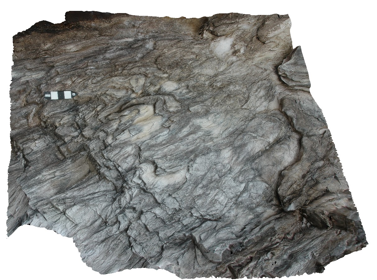
gently plunging, parasitic folds in phyllite. Lake Pedder, south west Tasmania. |
0.25 |
-42.84891061000 |
146.10477646000 |
-9999.000 |
parasitic fold, gently plunging, fold plunge, fold, structure, phyllite |
phyllite |
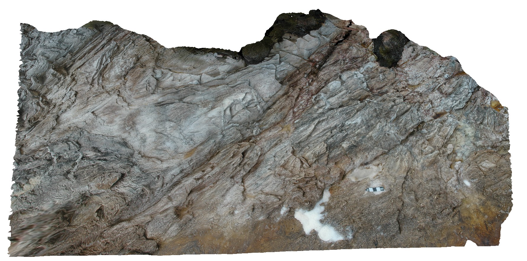
Pedder15 Map
 |
5 |
05/05/2016 1:01 p.m. |
3D terrestrial photogrammetric model |
open parasitic folds in quartzite. Lake Pedder, south west Tasmania. |
1.20 |
-42.84895071000 |
146.10478655000 |
-9999.000 |
open fold, fold, structure, quartzite |
quartzite |
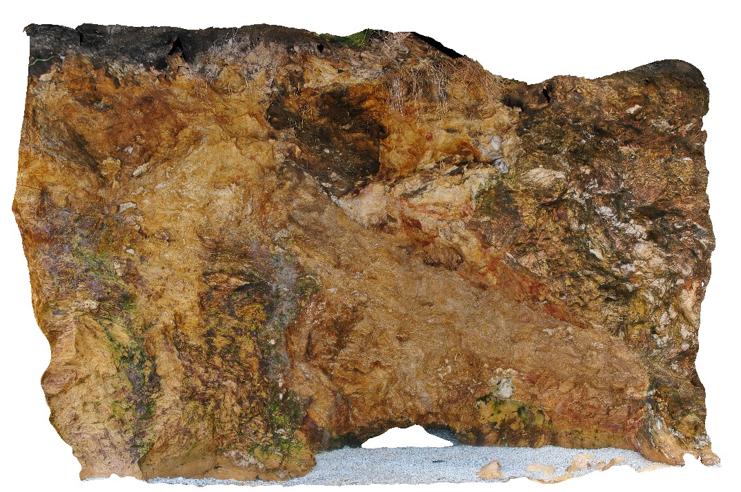
Pedder16 Map
 |
5 |
05/05/2016 1:10 p.m. |
3D terrestrial photogrammetric model |
strongly deformed, thinly banded quartzite with iron oxide staining. Complex folding and faulting? Cataclasite. Lake Pedder, south west Tasmania. |
1.00 |
-42.89104841000 |
146.04772315000 |
-9999.000 |
Cataclasite, fold, fault, structure, quartzite |
quartzite |
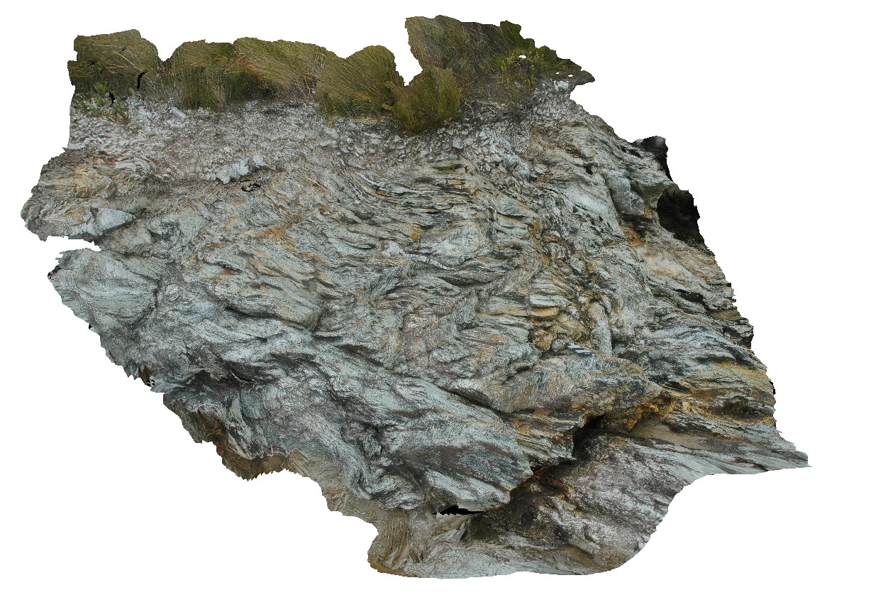
Pedder17 Map
 |
5 |
05/05/2016 1:35 p.m. |
3D terrestrial photogrammetric model |
plunging, asymmetric parasitic folds in phyllite, with kink folds. Lake Pedder, south west Tasmania. |
0.60 |
-42.89055298000 |
146.04779245000 |
-9999.000 |
fold plunge, asymmetric folds, fold, parasitic fold, phyllite, structure, kink fold |
phyllite |
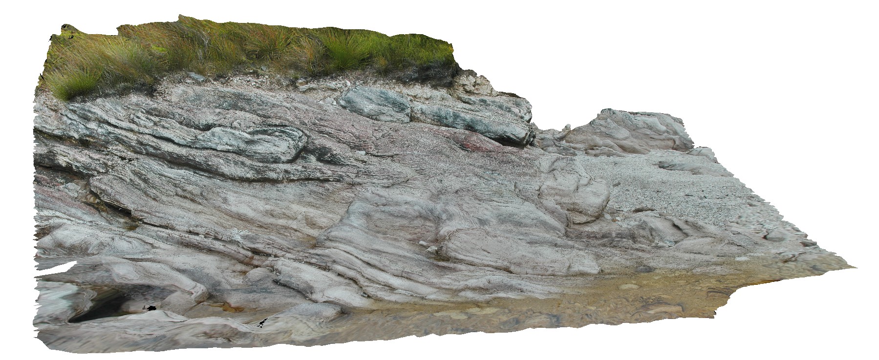
Pedder18 Map
 |
5 |
05/04/2016 9:54 a.m. |
3D terrestrial photogrammetric model |
folded quartzite. Lake Pedder, south west Tasmania. |
1.00 |
-42.89020078000 |
146.04809078000 |
-9999.000 |
fold, quartzite |
quartzite |
Pedder19 Map
 |
5 |
05/05/2016 2:03 p.m. |
3D terrestrial photogrammetric model |
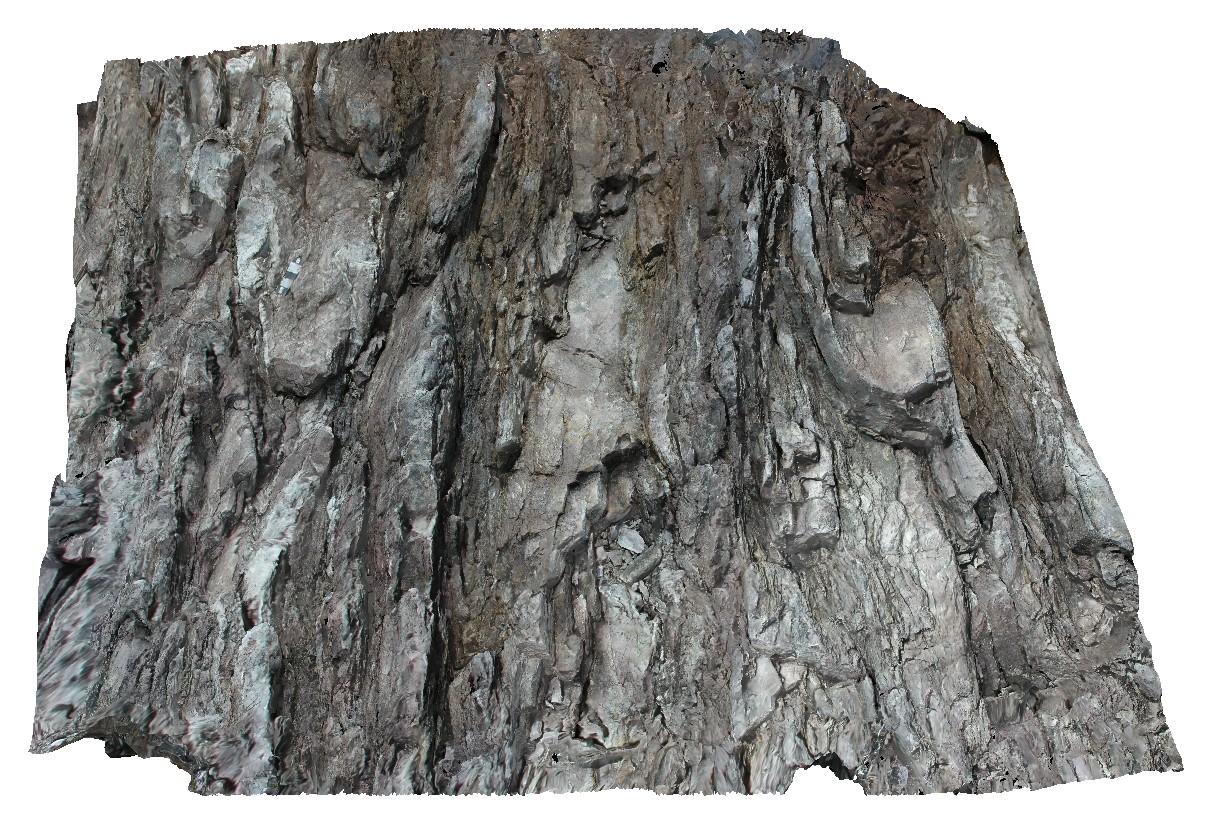
series of gently plunging synforms and antiforms in thinly bedded quartzite. Lake Pedder, south west Tasmania. |
2.00 |
-42.88984702000 |
146.04808130000 |
-9999.000 |
plunge, fold, structure, synforms, antiform |
quartzite |
Pedder2 Map
 |
5 |
04/29/2016 11:49 a.m. |
3D terrestrial photogrammetric model |
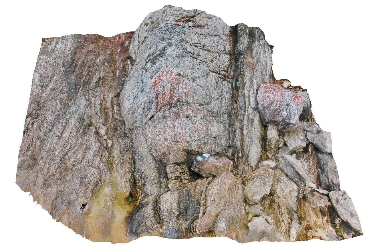
gently plunging open fold in Precambrian quartzite. Lake Pedder, south west Tasmania. |
0.55 |
-42.84874629000 |
146.11562709000 |
-9999.000 |
Precambrian, fold, open fold, structure |
quartzite |
Pedder20 Map
 |
5 |
03/16/2015 2:28 p.m. |
3D terrestrial photogrammetric model |
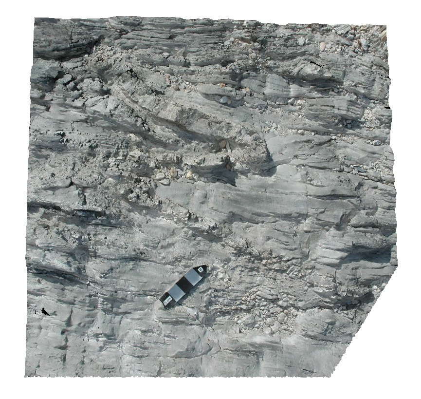
tight folding in quartzites. Lake Pedder, south west Tasmania. |
0.20 |
-42.95960454000 |
146.13608791000 |
-9999.000 |
tight fold, fold, structure |
quartzite |
Pedder21 Map
 |
5 |
03/16/2015 2:28 p.m. |
3D terrestrial photogrammetric model |
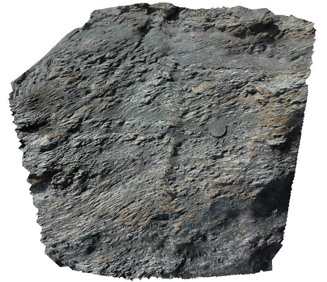
finely layered metasediments with fold kink-bands. Lake Pedder, south west Tasmania. |
0.50 |
-42.95944082000 |
146.13525103000 |
-9999.000 |
kink band, fold, structure |
quartzite |
Pedder22 Map
 |
5 |
03/16/2015 2:28 p.m. |
3D terrestrial photogrammetric model |
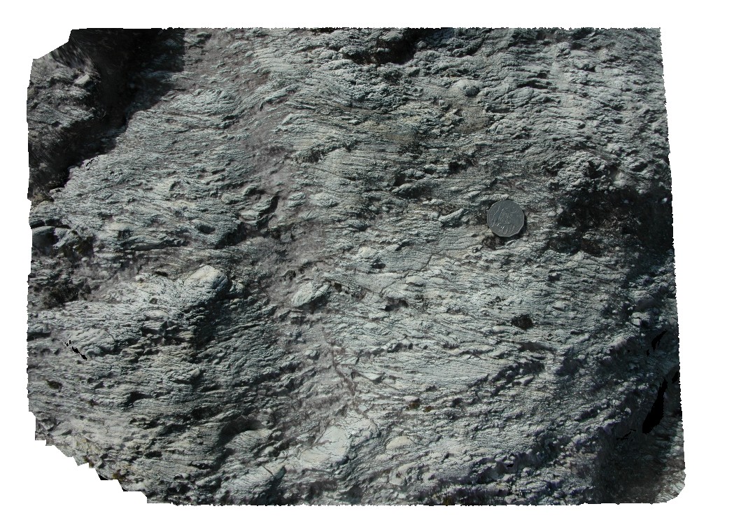
quartzite clasts in conglomerate with strong foliation and folding. Lake Pedder, south west Tasmania. |
0.50 |
-42.95896681000 |
146.13472805000 |
-9999.000 |
conglomerate, foliation, folding, structure |
conglomerate |
Pedder23 Map
 |
5 |
03/16/2015 2:28 p.m. |
3D terrestrial photogrammetric model |
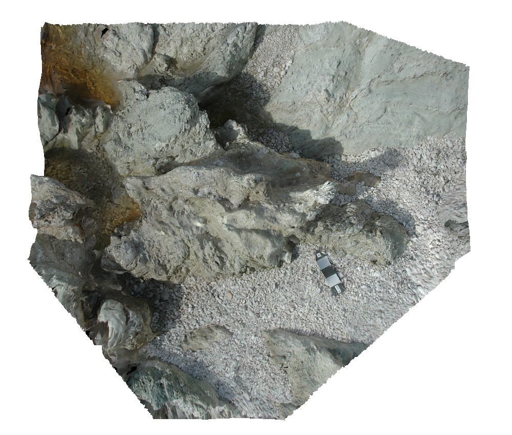
fault zone with cataclasite/ quartzite pebble conglomerate. Lake Pedder, south west Tasmania. |
0.50 |
-42.95895720000 |
146.13461196000 |
-9999.000 |
cataclasite, fault |
conglomerate |
Pedder24 Map
 |
5 |
03/16/2015 2:28 p.m. |
3D terrestrial photogrammetric model |
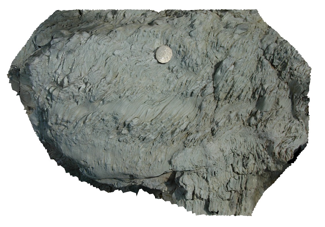
small kink bands in clay-rich finely laminated metasediments. Lake Pedder, south west Tasmania. |
0.40 |
-42.95895228000 |
146.13448718000 |
-9999.000 |
mudstone, kink band, fold, structure |
mudstone |
Pedder25 Map
 |
5 |
03/16/2015 2:28 p.m. |
3D terrestrial photogrammetric model |
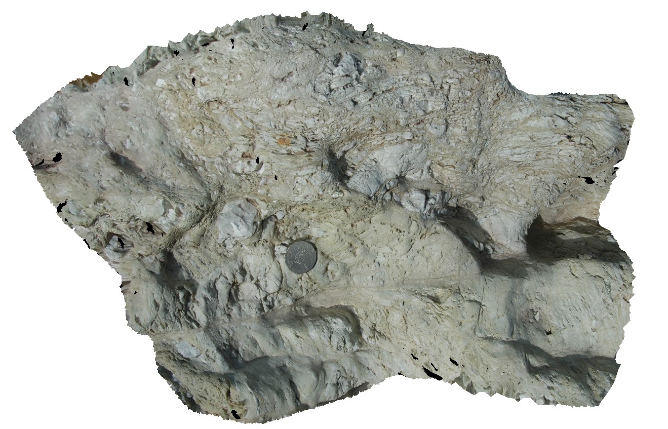
fault contact with surrounding sediments, showing cataclasite and shear structures. Lake Pedder, south west Tasmania. |
0.00 |
-42.95896997000 |
146.13457732000 |
-9999.000 |
shear, fault, cataclasite |
mudstone |
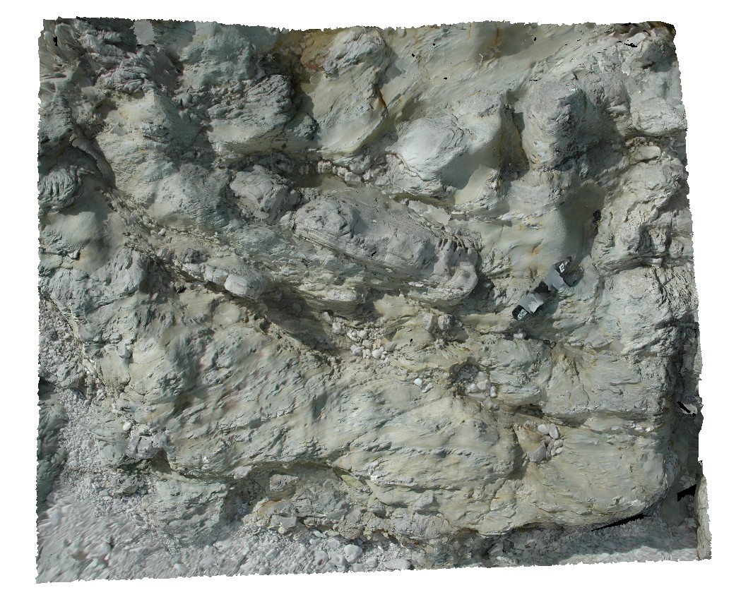
Pedder26 Map
 |
5 |
03/16/2015 2:28 p.m. |
3D terrestrial photogrammetric model |
quartzite beds in metamudstone. Lake Pedder, south west Tasmania. |
0.40 |
-42.95900682000 |
146.13441873000 |
-9999.000 |
sedimentology |
mudstone |
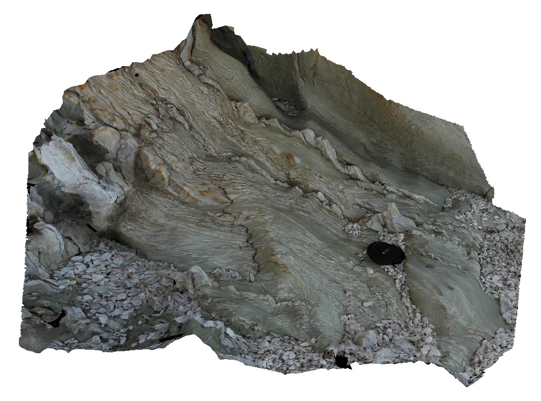
Pedder27 Map
 |
5 |
03/16/2015 2:29 p.m. |
3D terrestrial photogrammetric model |
quartzite beds in metamudstone, with stretched, folded and boudinaged layers. Lake Pedder, south west Tasmania. |
0.50 |
-42.95898711000 |
146.13431346000 |
-9999.000 |
boudinage, fold, structure, sedimentology |
mudstone |
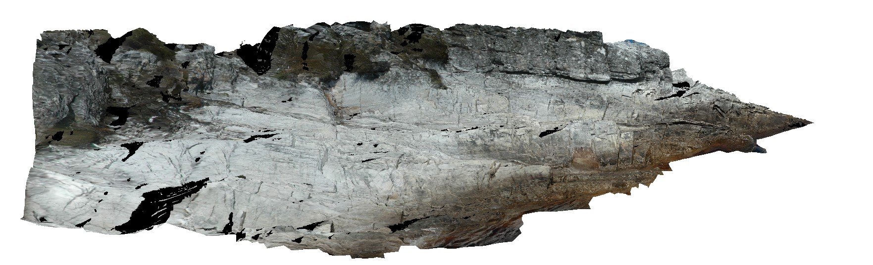
Pedder28 Map
 |
5 |
03/16/2015 2:29 p.m. |
3D terrestrial photogrammetric model |
upright to slightly inclined, open to tight folds in layered quartzite. Lake Pedder, south west Tasmania. |
5.00 |
-42.84637281000 |
146.08904307000 |
-9999.000 |
fold geometry, upright fold, inclined fold, open fold, tight fold, structure |
quartzite |
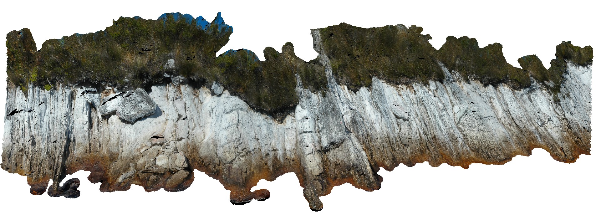
Pedder29 Map
 |
5 |
05/04/2016 10:14 a.m. |
3D terrestrial photogrammetric model |
view of shore exposure of quartzite sediments along Lake Pedder, showing plunging, upright folds. Lake Pedder, south west Tasmania. |
22.00 |
-42.84673300000 |
146.09027980000 |
-9999.000 |
folding, upright fold, structure, quartzite |
quartzite |
Pedder3 Map
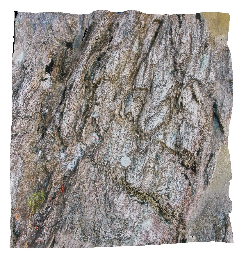 |
0 |
04/29/2016 11:50 a.m. |
3D terrestrial photogrammetric model |
gently plunging, multiple parasitic fold hinges. Lake Pedder, south west Tasmania. |
0.70 |
-42.84856842000 |
146.11586429000 |
-9999.000 |
parasitic fold hinge, fold plunge, fold, structure |
quartzite |
 AusGeol.org