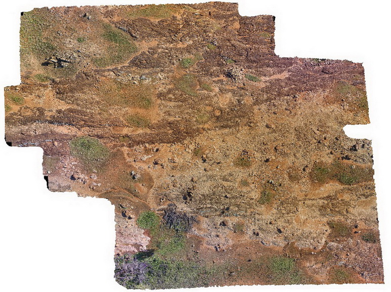
OlaryUAV1 Map
 |
0 |
09/27/2015 6:49 p.m. |
UAV |
aerial view of Old Boolcoomata Conglomerate Member, showing interbedded conglomerate with pebbly sandstone and siltstone. Old Boolcoomata Station. Olary. S.A. |
100.00 |
-32.09570000000 |
140.27974000000 |
-9999.000 |
conglomerate, sedimentology |
conglomerate |
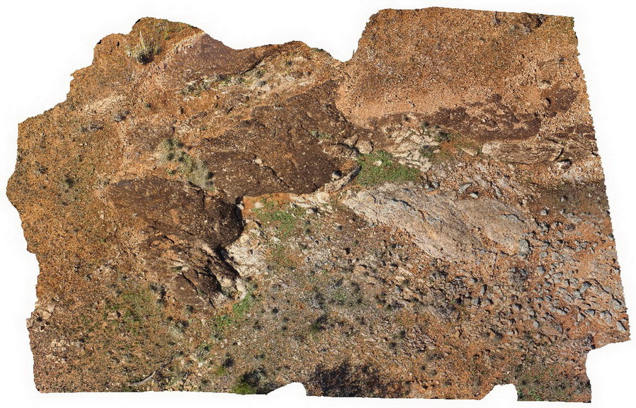
OlaryUAV2 Map
 |
0 |
09/27/2015 6:50 p.m. |
UAV |
aerial view of Old Boolcoomata Conglomerate Member, showing interbedded conglomerate with pebbly sandstone and siltstone. Old Boolcoomata Station. Olary. S.A. |
0.00 |
-32.09433000000 |
140.27747000000 |
-9999.000 |
conglomerate, sedimentology |
conglomerate |
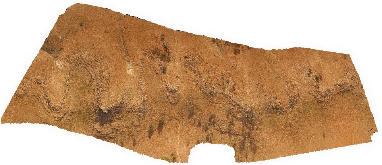
OlaryUAV3 Map
 |
0 |
09/27/2015 6:50 p.m. |
UAV |
aerial view of 'Wiggly quartzite'. A folded quartzite unit at Weekaroo, Olary. S.A. |
100.00 |
-32.18229700000 |
139.95783400000 |
-9999.000 |
quartzite, fold, structure |
quartzite |
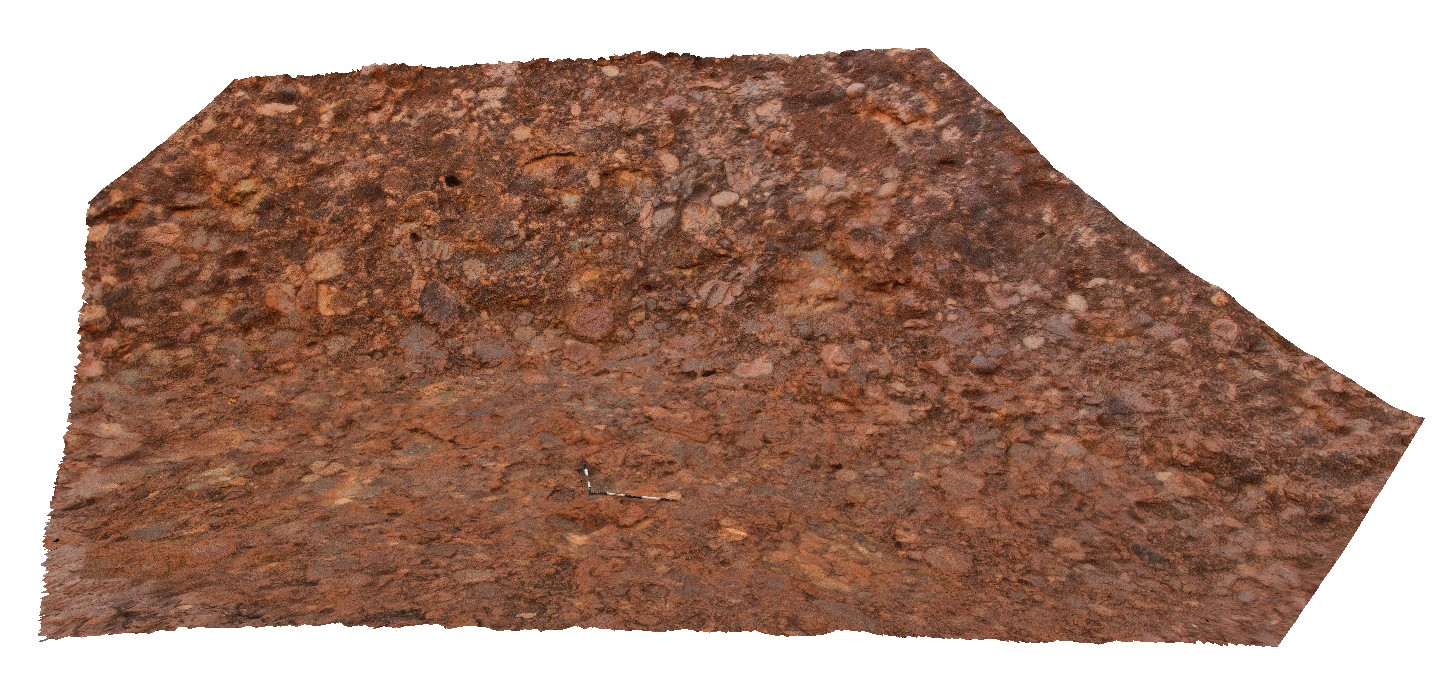
OLGA1 Map
 |
0 |
07/30/2016 10:18 a.m. |
3D |
view of conglomerate at Kata Tjuta (The Olgas), showing poor sorting and rounding of cobbles. Kata Tjuta National Park. N.T. |
8.00 |
-25.30090900000 |
130.73502000000 |
645.453 |
conglomerate, Kata Tjuta, sedimentology |
conglomerate |
OLGA2 Map
 |
0 |
07/30/2016 10:38 a.m. |
3D |
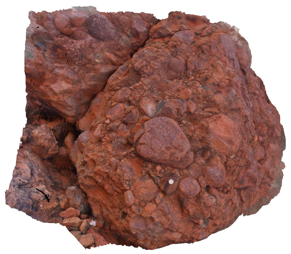
detailed view of polymict clasts in Mt Currie conglomerate at Kata Tjuta (The Olgas). Clasts are sub rounded, poorly sorted and matrix supported. Kata Tjuta National Park. N.T. |
1.00 |
-25.30027200000 |
130.72979700000 |
620.020 |
conglomerate, Kata Tjuta, Mt Currie conglomerate, sedimentology |
conglomerate |
OLGAFSP1 Map
 |
5 |
07/30/2016 10:04 a.m. |
FSP |
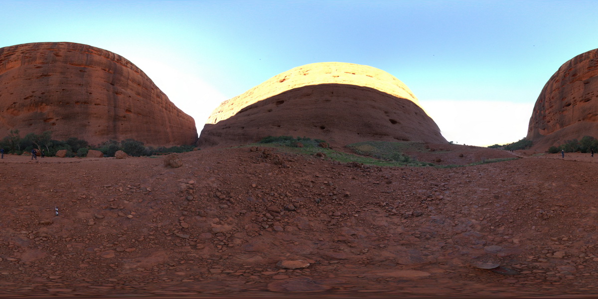
view of Kata Tjuta (The Olgas), showing conglomerate layers. Kata Tjuta National Park. N.T. |
100.00 |
-25.29999200000 |
130.73189500000 |
632.614 |
Kata Tjuta, conglomerate, sedimentology |
conglomerate |
OrganPipes1 Map
 |
5 |
01/01/9999 midnight |
3D |
lava flows with well developed columnar jointing. Organ Pipes National Park, Keilor North. Vic. |
200.00 |
-37.66467900000 |
144.77204400000 |
-9999.000 |
Tullamarine Basalt, Newer Volcanics, basalt, columnar joints, lava |
basalt |
OrganPipes2 Map
 |
5 |
01/01/9999 midnight |
3D |
lava flows with well developed columnar jointing. Organ Pipes National Park, Keilor North. Vic. |
200.00 |
-37.66467900000 |
144.77204400000 |
-9999.000 |
Tullamarine Basalt, Newer Volcanics, columnar joints, basalt, lava |
basalt |
OrganPipes3 Map
 |
5 |
01/01/9999 midnight |
3D |
lava flows with well developed columnar jointing. Organ Pipes National Park, Keilor North. Vic. |
200.00 |
-37.66467900000 |
144.77204400000 |
1.000 |
Tullamarine Basalt, Newer Volcanics, basalt, columnar joints, lava |
baslat |
OrganPipes4 Map
 |
5 |
01/01/9999 midnight |
3D |
lava flows with well developed columnar jointing. Organ Pipes National Park, Keilor North. Vic. |
20.00 |
-37.66434400000 |
144.76721400000 |
-9999.000 |
Tullamarine Basalt, Newer Volcanics, basalt, columnar joints, lava |
basalt |
OrganPipes5 Map
 |
5 |
01/01/9999 midnight |
3D |
lava flows with well developed columnar jointing. Organ Pipes National Park, Keilor North. Vic. |
30.00 |
-37.66560200000 |
144.76513500000 |
-9999.000 |
Tullamarine Basalt, Newer Volcanics, basalt, columnar joints, lava |
basalt |
ORMG1 Map
 |
5 |
08/01/2016 2:28 p.m. |
3D |
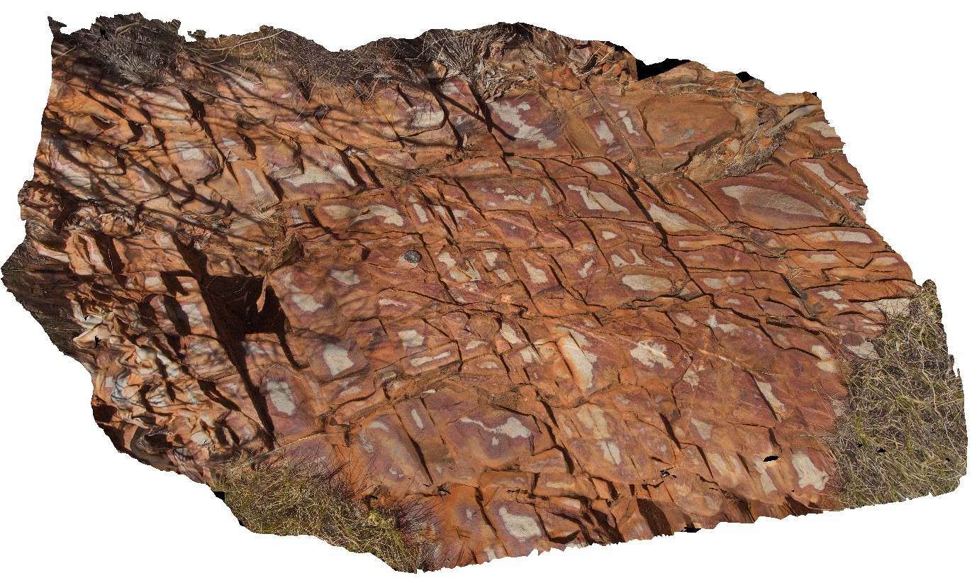
weathering pattern on joints in quartzite with late quartz veins. Pound walk, Ormiston Gorge, N.T. |
1.00 |
-23.63449900000 |
132.73310600000 |
646.864 |
joint, weathering, quartzite |
quartzite |
ORMG2 Map
 |
5 |
08/01/2016 4:04 p.m. |
3D |
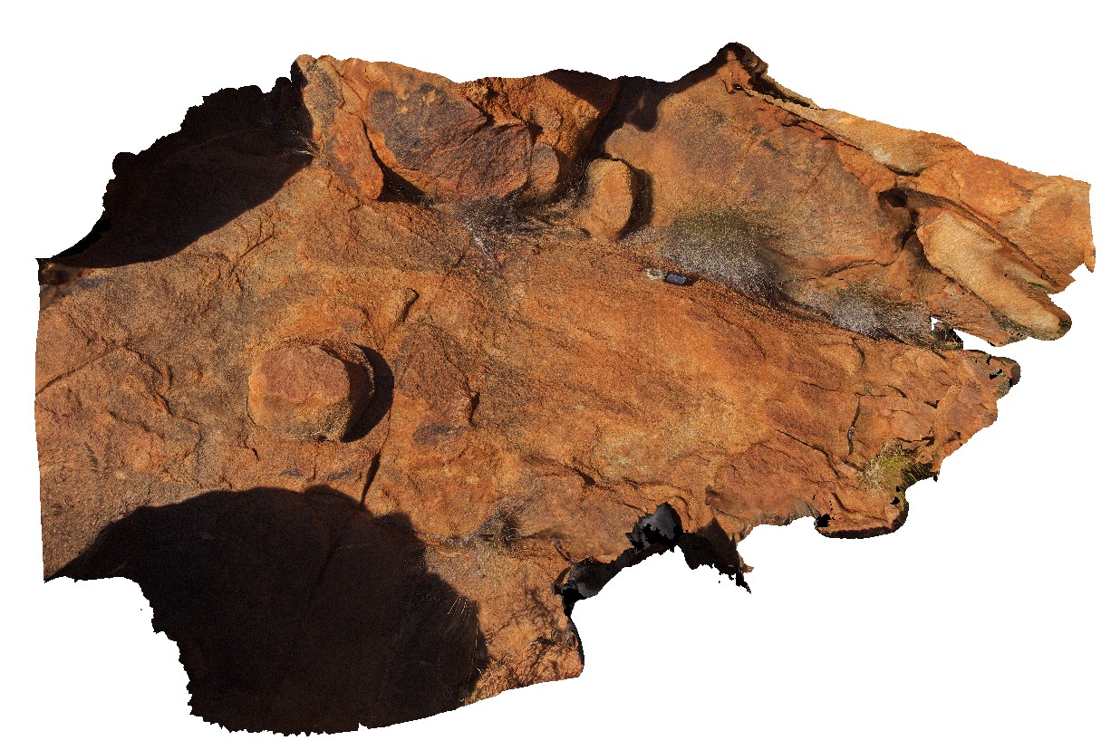
Ormiston Pound Granite cut by pegmatite vein. Pound walk, Ormiston Gorge, N.T. |
3.00 |
-23.63306800000 |
132.75418100000 |
693.385 |
granite, Ormiston Pound Granite |
granite |
ORMG3 Map
 |
0 |
08/01/2016 4:20 p.m. |
3D |
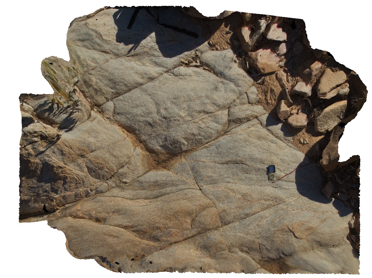
foliated granite in Ormiston Creek, but by magnetite-bearing pegmatite vein. Pound walk, Ormiston Gorge, N.T. |
3.00 |
-23.63082800000 |
132.75272100000 |
675.807 |
metamorphic, pegmatite dyke, structure, foliation |
granite |
ORMG4 Map
 |
0 |
08/01/2016 4:55 p.m. |
3D |
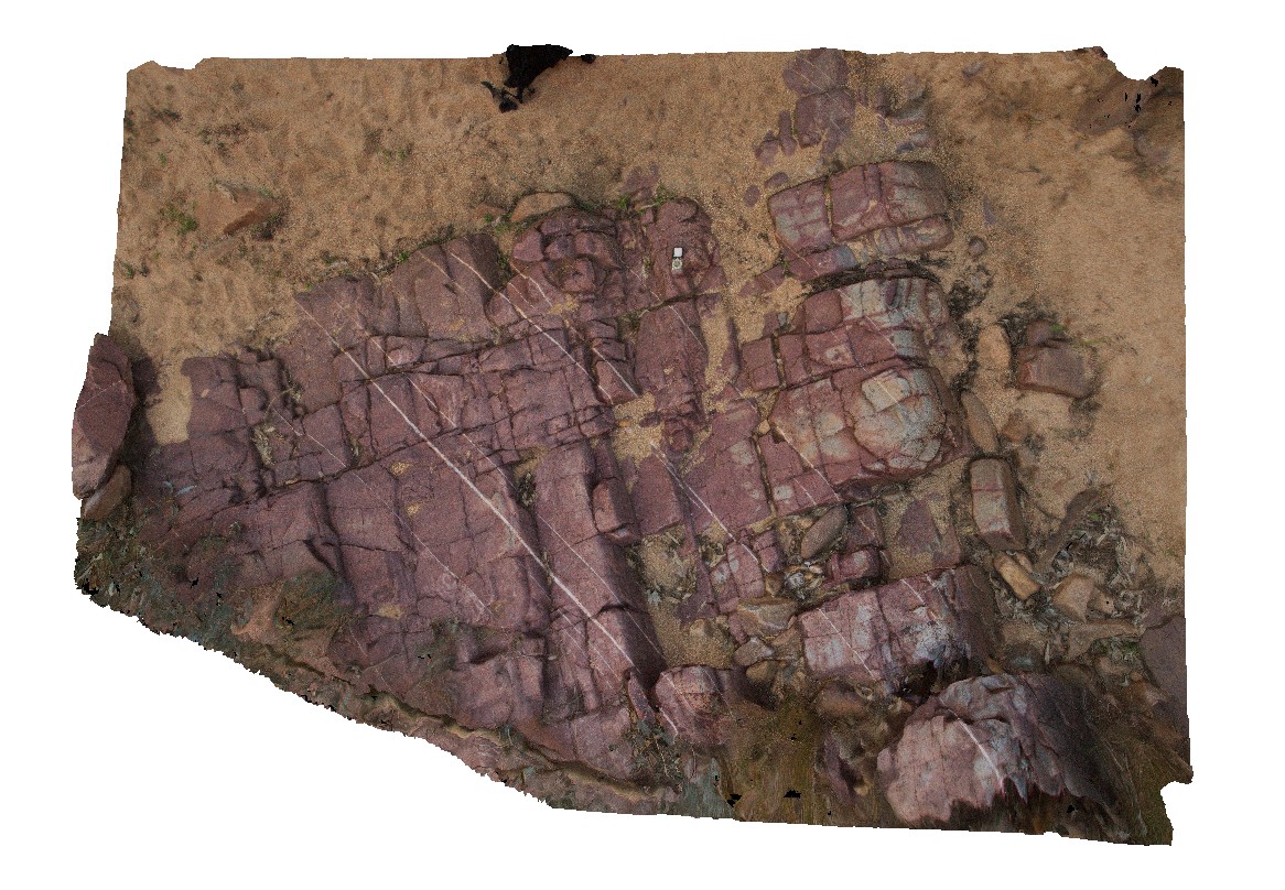
sheeted quartz vein set in quartzite. Pound walk, Ormiston Gorge, N.T. |
6.00 |
-23.62534500000 |
132.73788800000 |
662.889 |
quartzite, quartz vein, vein array, structure |
quartzite |
ORMG5 Map
 |
5 |
01/01/9999 midnight |
3D |
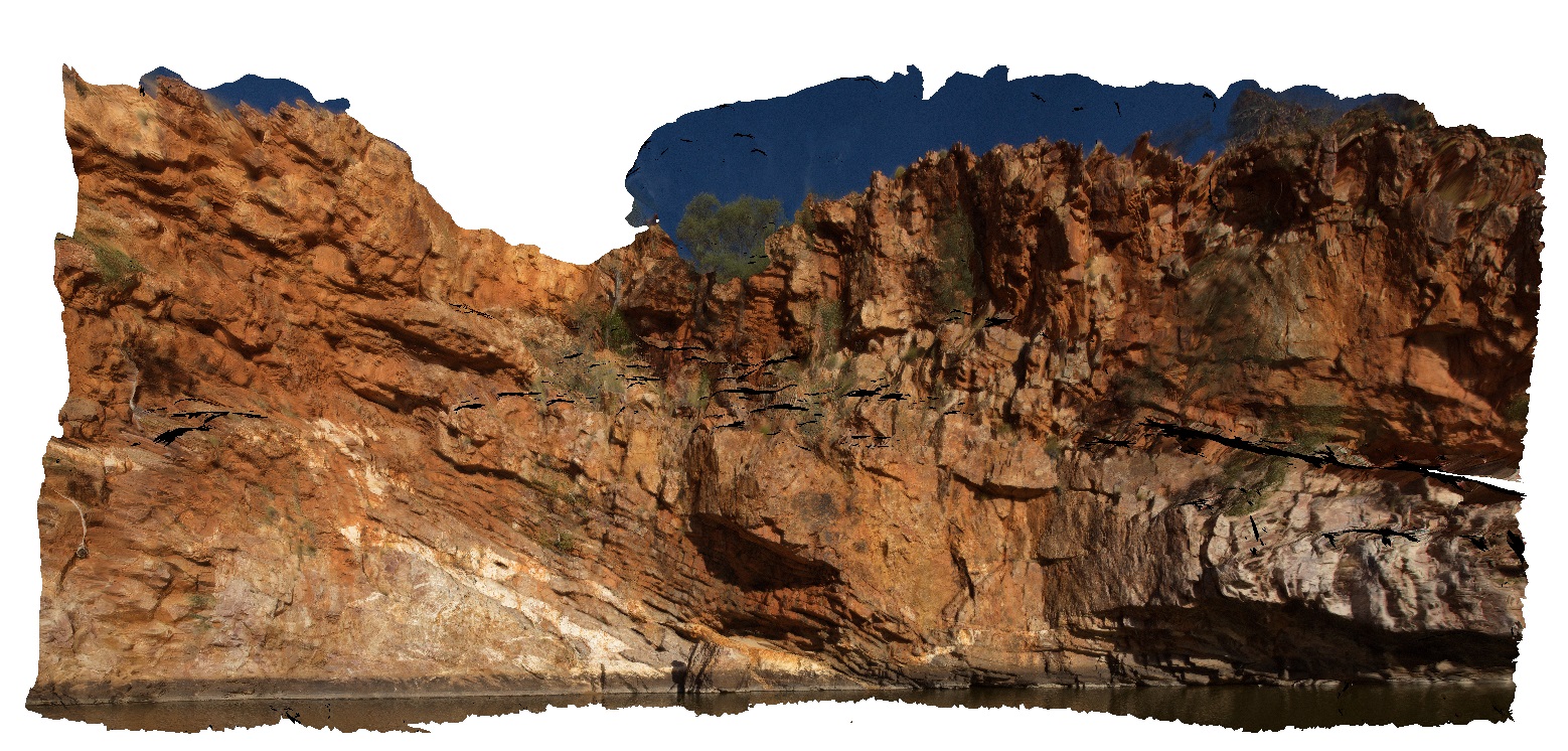
quartz veins and stacked thrusts in quartzite layers at Ormiston Gorge water hole. Ormiston Gorge, N.T. |
50.00 |
-23.62811000000 |
132.72731000000 |
651.970 |
thrust stack, fault, vein, quartz vein, quartzite, structure |
quartzite |
ORMG6 Map
 |
5 |
08/02/2016 10:13 a.m. |
3D |
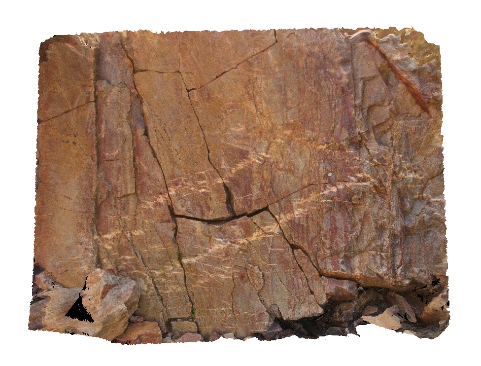
en-echelon quartz veins (dilatational?) in quartzite layers. Ormiston Gorge, N.T. |
2.00 |
-23.62691900000 |
132.72820800000 |
658.543 |
en-echelon vein, quartzite, Ormiston Gorge |
quartzite |
ORMG7 Map
 |
0 |
08/02/2016 11:03 a.m. |
3D |
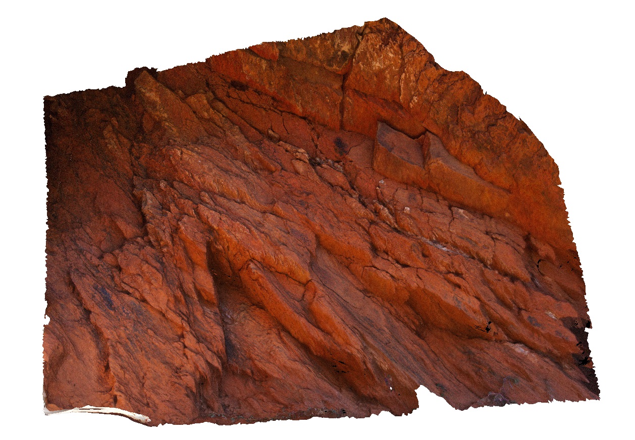
parasitic fold of larger recumbent anticline, also showing cleavage parallel to fold axis. Ormiston Gorge, N.T. No scale. |
0.00 |
-23.62788400000 |
132.72621500000 |
709.636 |
anticline, recumbent fold, parasitic fold, cleavage, structure, fold axis |
quartzite |
ORMG8 Map
 |
5 |
08/02/2016 11:14 a.m. |
3D |
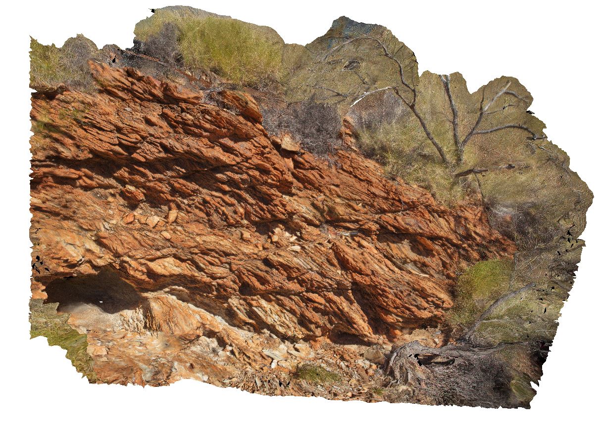
small-scale thrusts in phyllite. Ormiston Gorge, N.T. |
4.00 |
-23.62883900000 |
132.72607200000 |
724.081 |
thrust fault, phyllite, cleavage, fault, structure |
phyllite |
ORMG9 Map
 |
0 |
08/02/2016 11:37 a.m. |
3D |
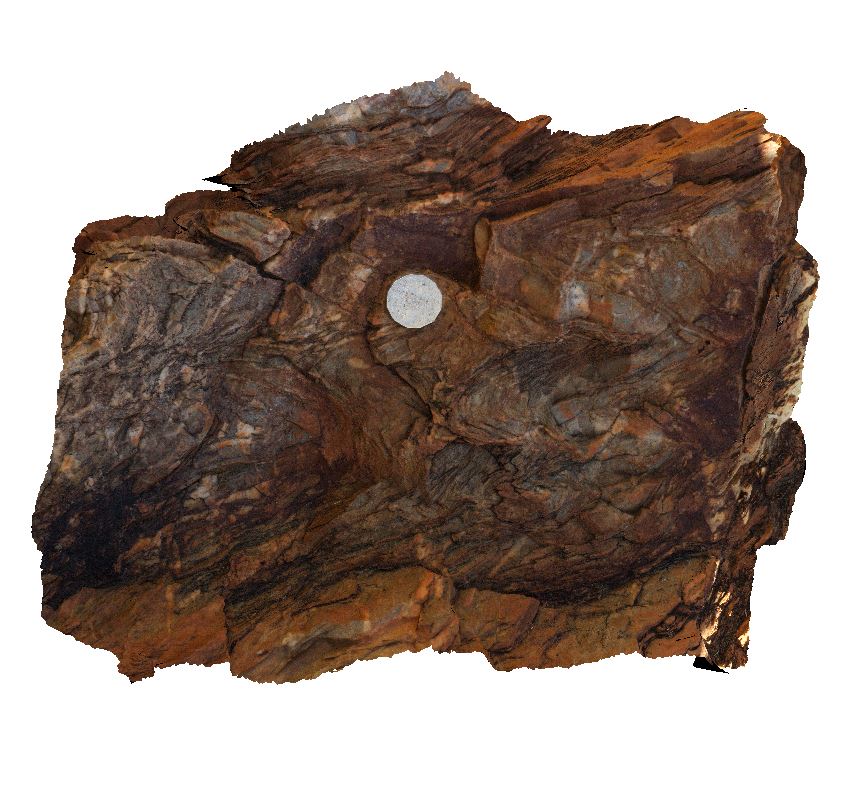
small-scale parasitic folds in intermixed psammite - phyllite layers. Ormiston Gorge, N.T. |
0.40 |
-23.62943900000 |
132.72633500000 |
720.730 |
metasediment, structure, parasitic fold, fold, metamorphic, cleavage |
psammite |
ORMGFSP1 Map
 |
5 |
08/01/2016 2:52 p.m. |
FSP |
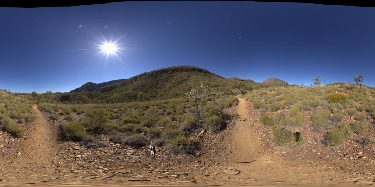
panorama of north-dipping limbs of anticline on the south side of Ormiston Gorge. Pound walk, Ormiston Gorge, N.T. |
1000.00 |
-23.63424300000 |
132.73689000000 |
710.433 |
anticline, fold, structure, fold limb |
quartzite |
ORMGFSP2 Map
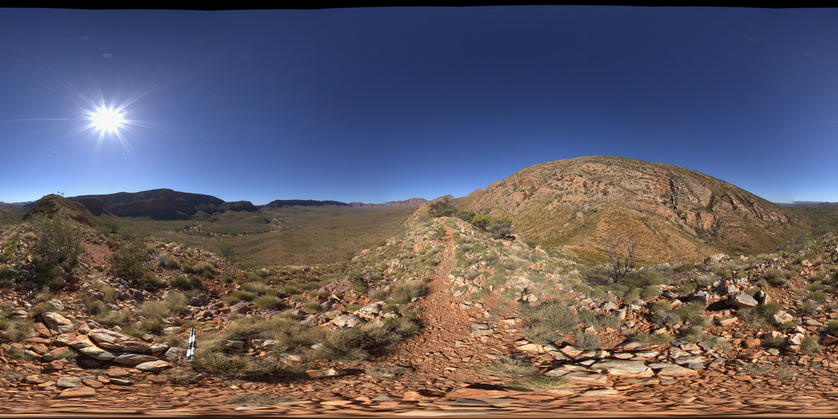 |
0 |
08/01/2016 3:29 p.m. |
FSP |
panorama view of Ormiston Gorge (NW) and southerly inclined fold axis to the SW. Pound walk, Ormiston Gorge, N.T. |
1000.00 |
-23.63673100000 |
132.74850400000 |
798.151 |
fold, fold axis, inclined fold axis, structure, quartzite |
quartzite |
ORMGFSP3 Map
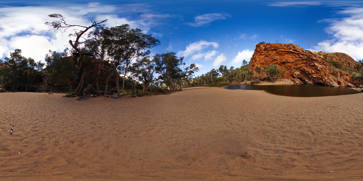 |
5 |
08/02/2016 9:37 a.m. |
FSP |
S-recumbent anticline in quartzite, in wall of Ormiston Gorge, N.T. |
500.00 |
-23.62885500000 |
132.72759000000 |
649.876 |
anticline, fold, S fold, recumbent, structure, Ormiston Gorge |
quartzite |
ORMGFSP4 Map
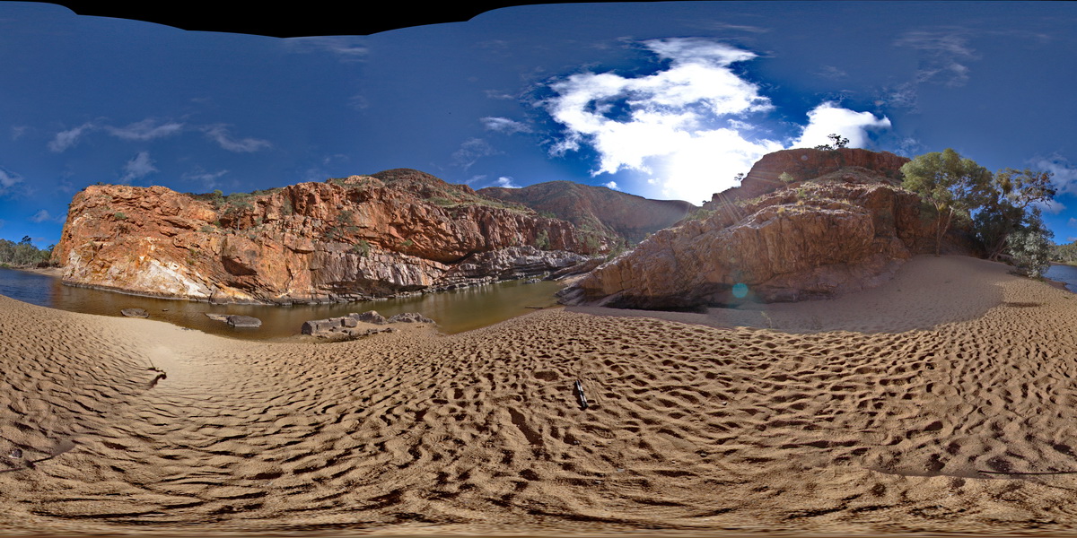 |
5 |
08/02/2016 9:47 a.m. |
FSP |
Stacked thrusts in quartzite on SW face of gorge. Faulting has offset quartz veins. Ormiston Gorge, N.T. |
500.00 |
-23.62811000000 |
132.72731000000 |
651.970 |
thrust, fault, structure, quartzite |
quartzite |
ORMGFSP5 Map
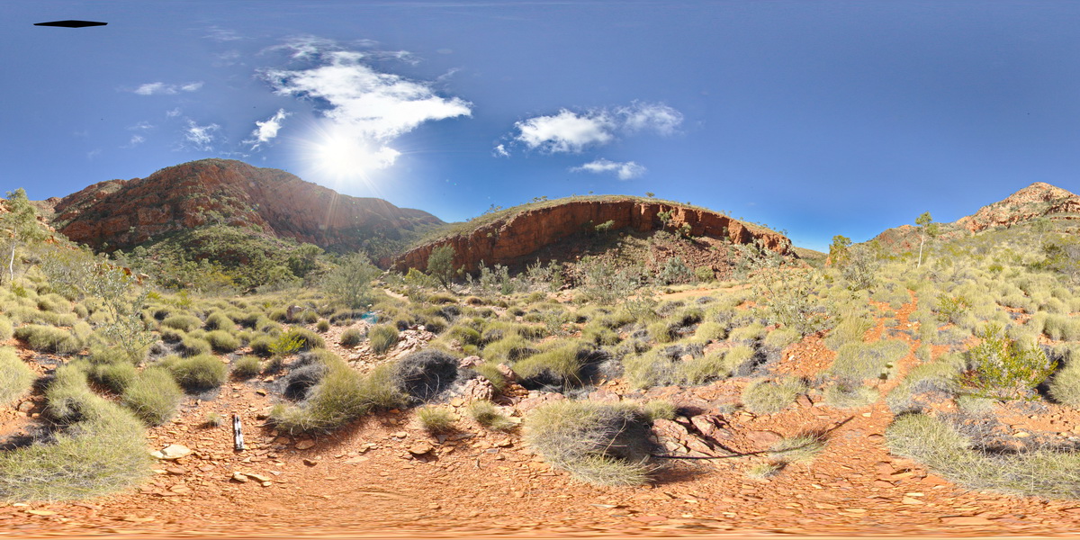 |
5 |
08/02/2016 10:41 a.m. |
FSP |
panorama view of stacked thrust faults in quartzite beds. Ormiston Gorge, N.T. |
500.00 |
-23.62586200000 |
132.72835300000 |
687.528 |
thrust fault, stacked thrusts, fault, quartzite, structure |
quartzite |


