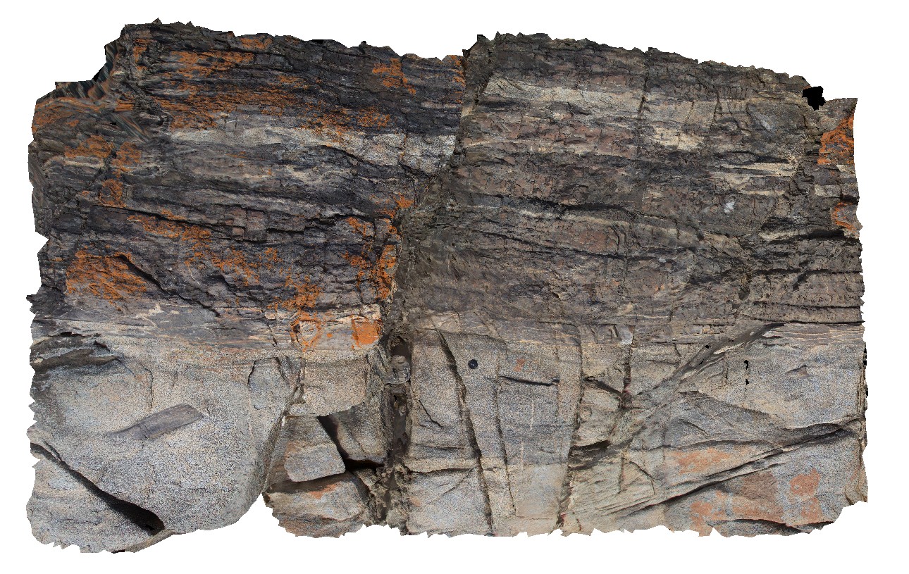
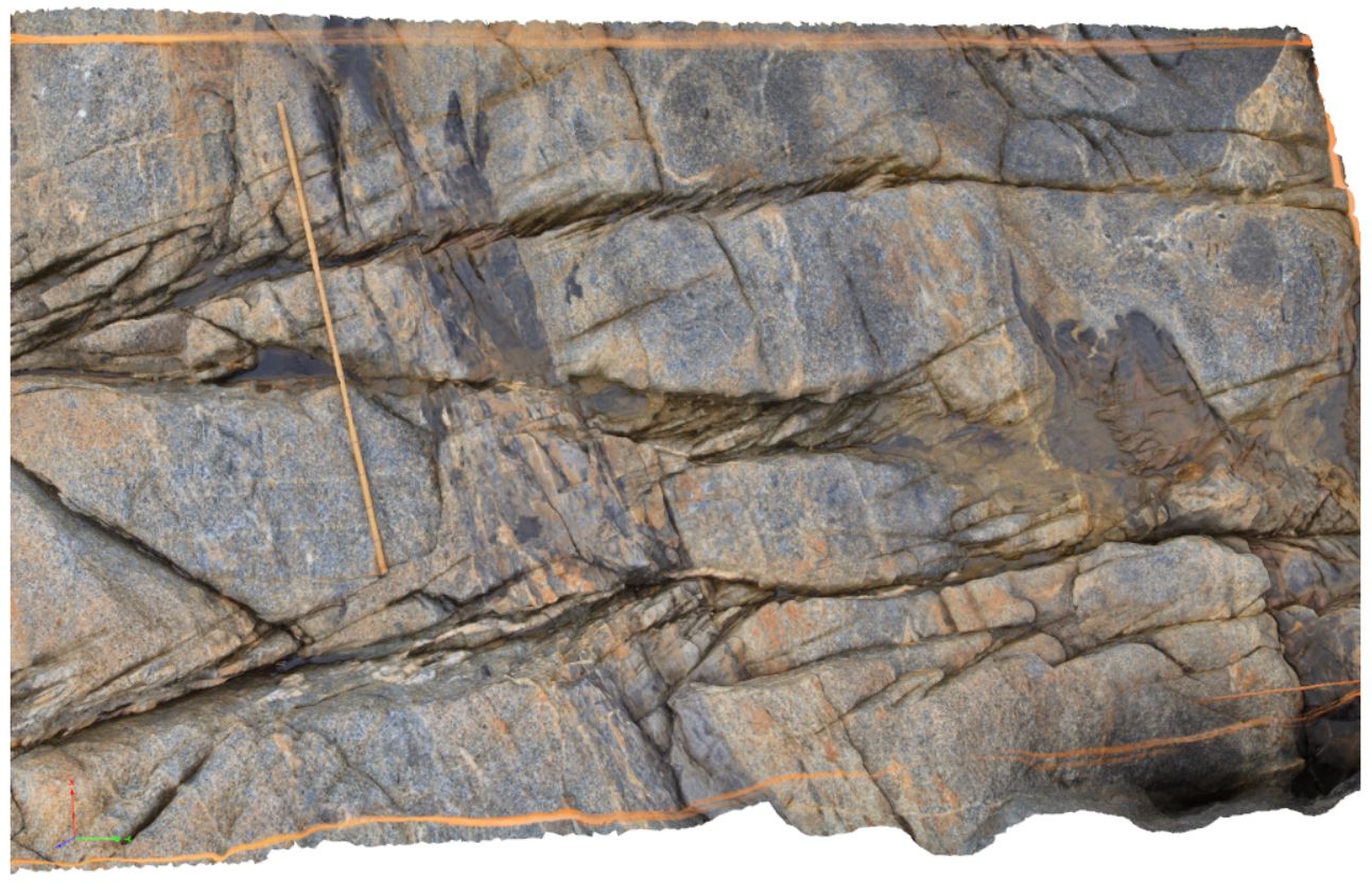
Piccaninny24 Map
 |
20 |
03/13/2015 9:06 a.m. |
3D |
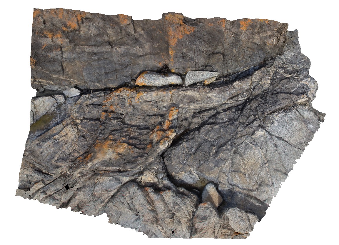
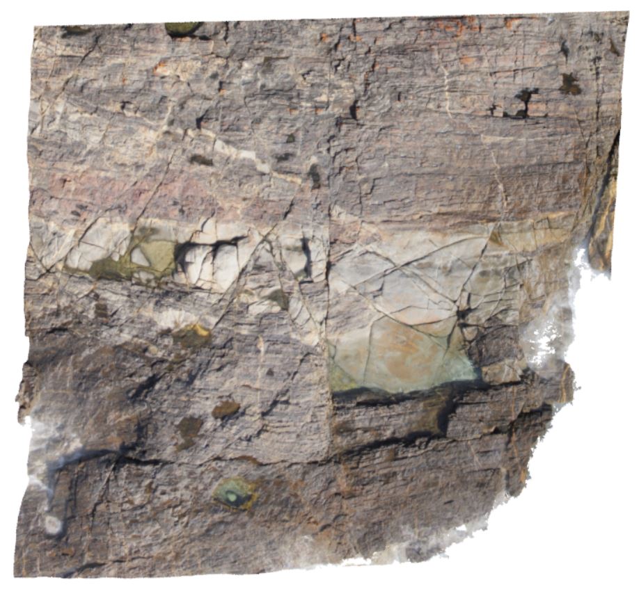
Long Point Granodiorite intruding into and assimilating well bedded Mathinna Supergroup. Multiple fault generations well displayed; 20cm aplite dyke offset by qz-filled fault, 1m wide fault zone with drag folding, all offset by secondary conjugate faults. |
5.00 |
-41.69546700000 |
148.29358800000 |
3.000 |
igneous, structure, assimilation, conjugate fault, fault zone, dyke |
Turbidite, Granodiorite |
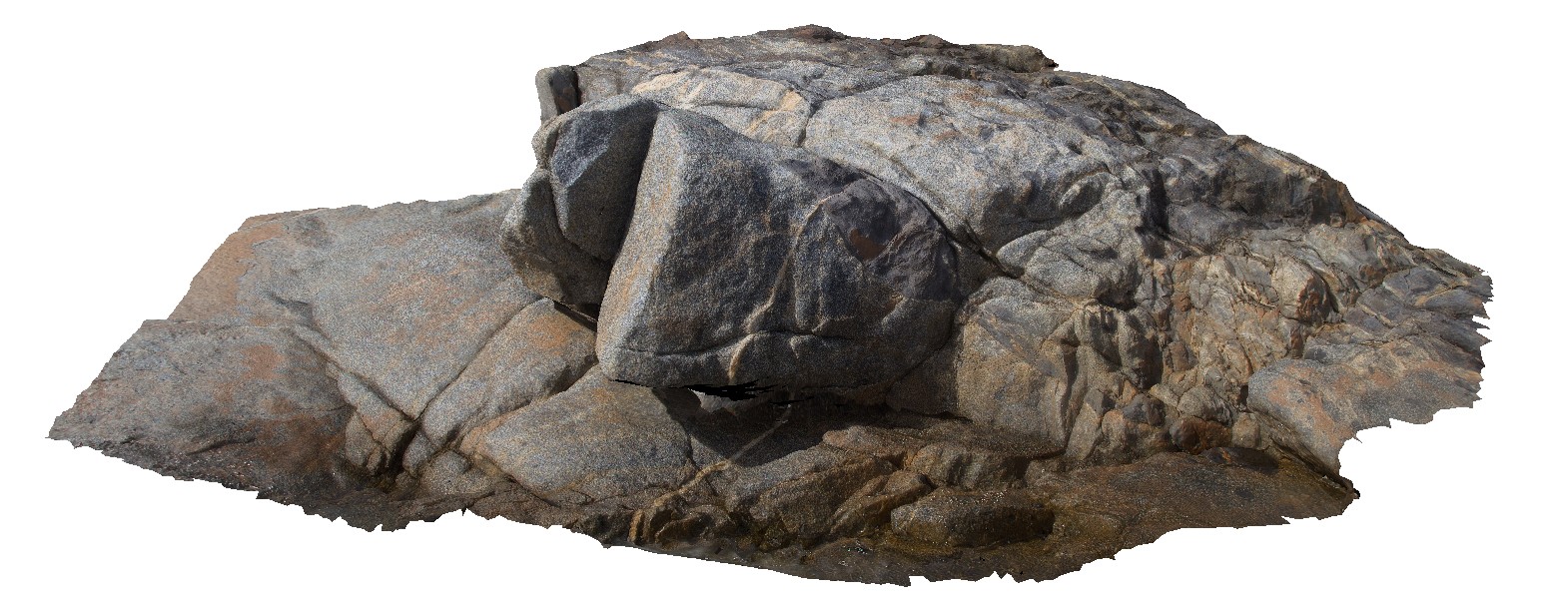
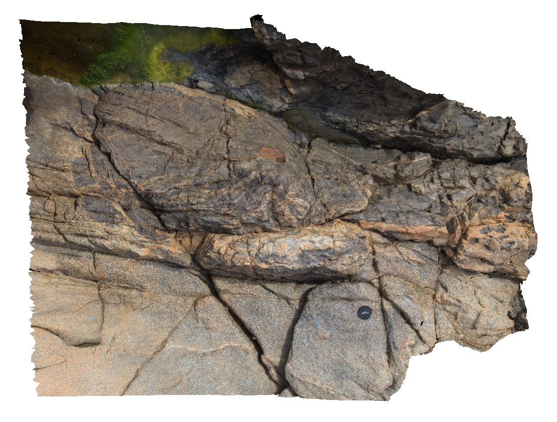
Piccaninny25 Map
 |
20 |
03/13/2015 9:06 a.m. |
3D |
Very large (approx. 5m x 15m) Mathinna Supergroup xenolith within Long Point Granodiorite, with associated smaller xenoliths. Prolific veining (aplite, qz?) proximal to contact. Piccaninny Point, eastern Tasmania. |
5.00 |
-41.69528200000 |
148.29354700000 |
4.000 |
igneous, aplite, xenolith |
Granodiorite, Turbidite |
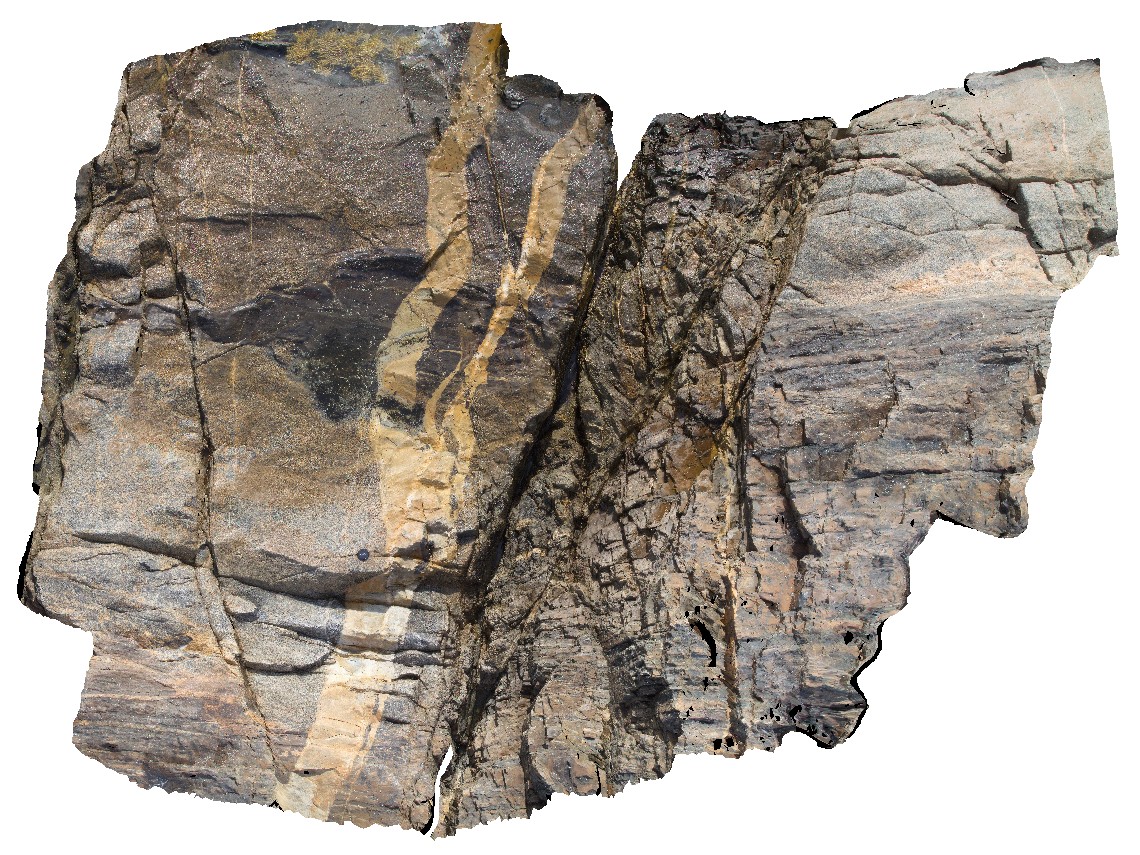
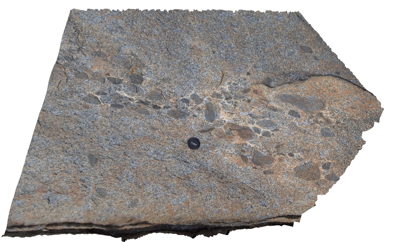
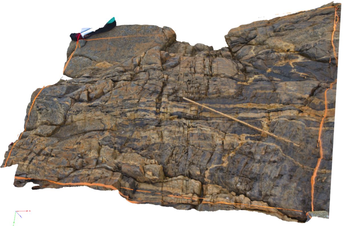
Piccaninny26 Map
 |
20 |
03/13/2015 9:06 a.m. |
3D |
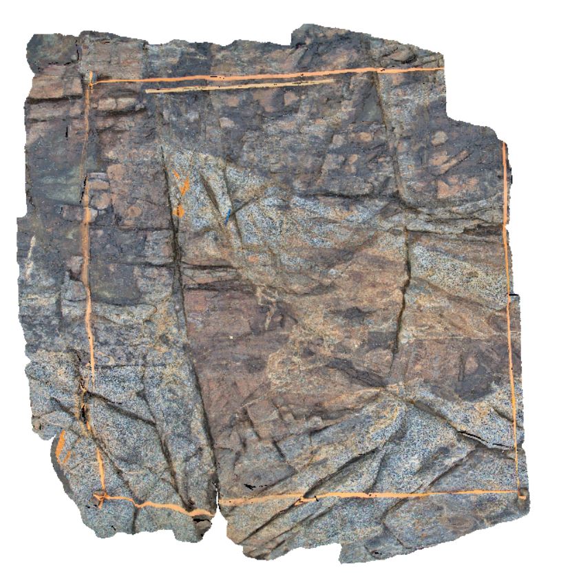
Long Point Granodiorite - Mathinna Supergroup hornfels sharp contact. A marked discordance containing granodiorite within the Mathinna - possibly a big fold structure.. Large fracture with small offset cross cutting the Granodiorite and Mathinna. Tas. |
8.00 |
-41.69476400000 |
148.29384500000 |
5.000 |
structure, igneous, Fault, xenolith, contact, hornfels |
Turbidite, Granodiorite |
Piccaninny27 Map
 |
30 |
03/13/2015 9:06 a.m. |
3D |
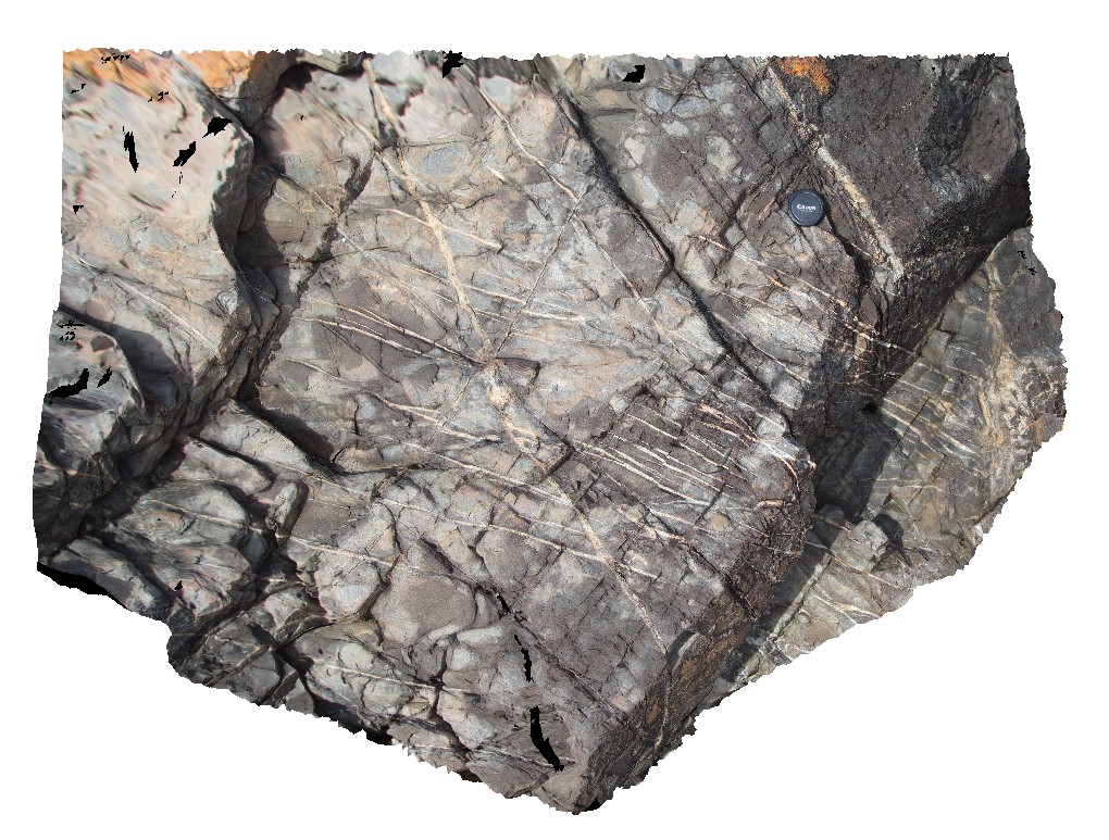
Comprehensively micro-faulted aplite intruding Mathinna Supergroup. Probably fractured due to conjugate faulting in Mathinna and granodiorite. Piccaninny Point, eastern Tasmania. |
6.00 |
-41.69436000000 |
148.29421800000 |
2.000 |
igneous, aplite, fault, structure |
Turbidite, Aplite |
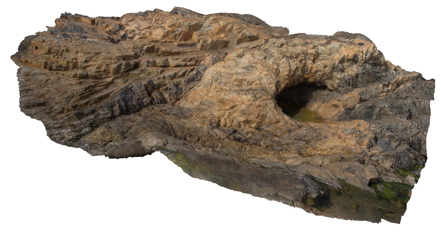
Piccaninny28 Map
 |
30 |
03/13/2015 9:07 a.m. |
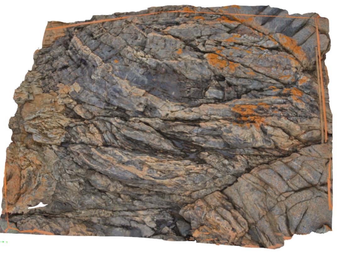
3D |
Large Mathinna Group block with chevron folds, within Long Point Granodiorite. Possibly a stope block due to lack of isoclinal folding indicative of wall rock Mathinna Group proximal to intrusion. Note: individual photos display this better. Tas. |
10.00 |
-41.69428700000 |
148.29417100000 |
5.000 |
structure, igneous, chevron folds |
Turbidite, Granodiorite |
Piccaninny29 Map
 |
20 |
03/13/2015 9:07 a.m. |
3D |
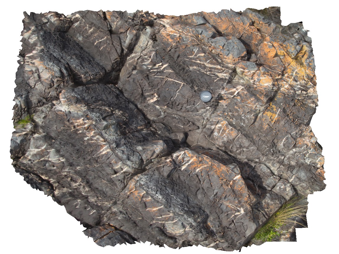
Intersecting vein sets (probably qz or aplite), possibly conjugates, within hornfelsed Mathinna Supergroup, close to contact with Long Point Granodiorite. Piccaninny Point, eastern Tasmania. |
2.00 |
-41.69429200000 |
148.29403000000 |
6.000 |
structure, igneous, conjugate vein, hornfels |
Turbidite, Granodiorite |
Piccaninny3 Map
 |
50 |
01/01/9999 midnight |
3D |
irregular intrusive contact between the grey granodiorite dyke and hosting Mathinna Supergroup sediments. Piccaninny Point, eastern Tasmania. |
5.00 |
-41.69446100000 |
148.29395280000 |
5.000 |
intrusive contact, turbidite |
turbidite, granodiorite |
Piccaninny30 Map
 |
20 |
03/13/2015 9:07 a.m. |
3D |
well bedded hornfelsed Mathinna Supergroup, displaying competency control on development of qz veins. Piccaninny Point, eastern Tasmania. |
1.00 |
-41.69424200000 |
148.29408500000 |
6.000 |
structure, hornfels, competency controlled veins, bedding |
Turbidite, Granodiorite |
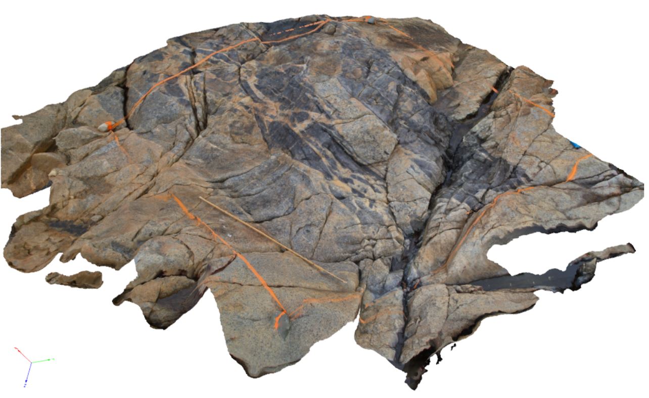
Piccaninny31 Map
 |
20 |
03/13/2015 9:07 a.m. |
3D |
xenoliths of dark, fine grained, mafic rock in Long Point Granodiorite. Late stage more aplitic or k feldspar material around xenoliths - late melt. Pervasive bt-defined foliation within granodiorite - evidence it is a syn-orogenic granite. Tas. |
2.00 |
-41.69430300000 |
148.29438700000 |
4.000 |
xenoliths, Long Point Granodiorite, syn-orogenic |
Turbidite, Granodiorite |
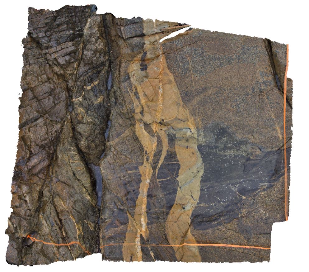
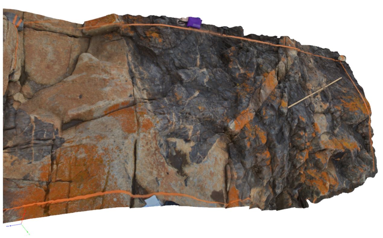
Piccaninny32 Map
 |
80 |
03/13/2015 9:07 a.m. |
3D |
Contact between Mathinna Supergroup and Long Point Granodiorite, very good example of ductile deformation within Mathinna at contact, and late melt veining. Piccaninny Point, eastern Tasmania. |
2.00 |
-41.69427300000 |
148.29452500000 |
4.000 |
Mathinna Supergroup, Long Point Granodiorite, ductile deformation |
Turbidite, Granodiorite |
Piccaninny4 Map
 |
50 |
01/01/9999 midnight |
3D |
irregular intrusive contact between Mathinna Supergroup turbidites and granodiorite. Both rock types are cut by a later fine-grained aplite? Dyke and later faulting and quartz veins. Piccaninny Point, eastern Tasmania. |
5.00 |
-41.69446100000 |
148.29395280000 |
2.000 |
contact metamorphism, intrusive contact, dyke, fault, structure |
turbidite, granodiorite |
Piccaninny5 Map
 |
5 |
01/01/9999 midnight |
3D |
coarse-grained granodiorite with mafic enclaves / dykes, offset by faulting. Piccaninny Point, eastern Tasmania. |
2.50 |
-41.69446100000 |
148.29395280000 |
2.000 |
fault offset, dyke, structure |
granodiorite |
Piccaninny6 Map
 |
5 |
01/01/9999 midnight |
3D |
irregular intrusive and faulted? Contact of granodiorite dyke with turbidite beds. Piccaninny Point, eastern Tasmania. |
2.00 |
-41.69446100000 |
148.29395280000 |
2.000 |
dyke, intrusive contact, fault contact, fault, metamorphic aureole |
turbidite, granodiorite |
Piccaninny7 Map
 |
50 |
01/01/9999 midnight |
3D |
granodiorite dyke intruding folded turbidite package rocks with later offset by faulting. Some parts of the dyke appear to be bedding parallel. Piccaninny Point, eastern Tasmania. |
2.00 |
-41.69446100000 |
148.29395280000 |
2.000 |
dyke, fault, structure |
turbidite, granodiorite |
Piccaninny8 Map
 |
50 |
01/01/9999 midnight |
3D |
granodiorite dyke with irregular intrusive contact intruding Mathinna Supergroups turbidite package. Dyke contains xenoliths of country rock. Piccaninny Point, eastern Tasmania. |
4.00 |
-41.69446100000 |
148.29395280000 |
2.000 |
xenolith, dyke, intrusive contact, hornfels |
turbidite, granodiorite |
Piccaninny9 Map
 |
50 |
01/01/9999 midnight |
3D |
granodiorite with xenoliths of Mathinna Supergroup turbidites. Piccaninny Point, eastern Tasmania. |
2.00 |
-41.69446100000 |
148.29395280000 |
2.000 |
xenolith, granodiorite |
granodiorite |
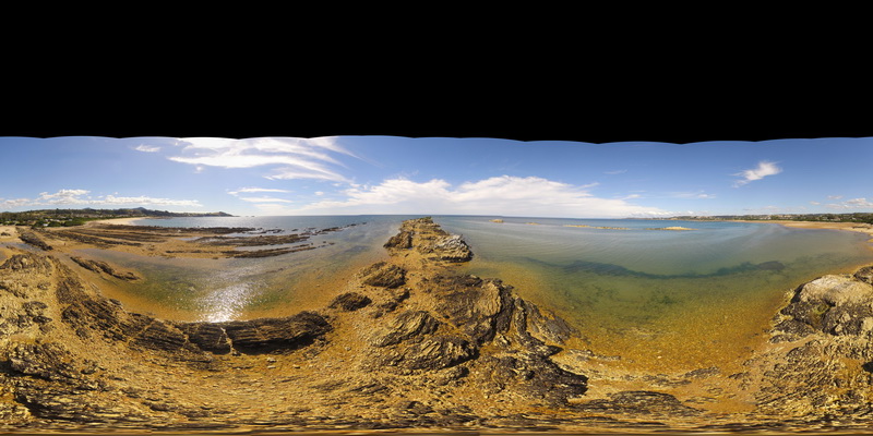
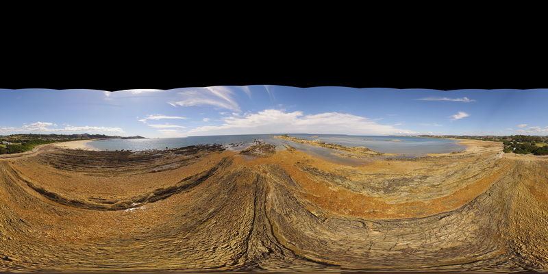
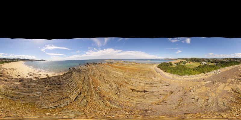
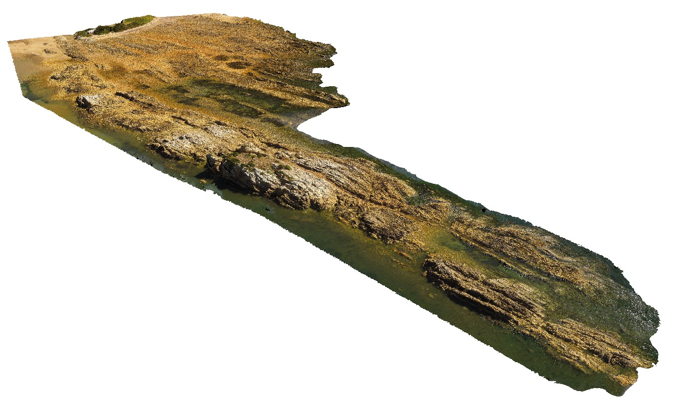
PiccaninnyUAV Map
 |
20 |
03/16/2015 2:36 p.m. |
UAV |
aerial view of granodiorite intruding thick package of turbidite beds. Piccaninny Point, eastern Tasmania. |
50.00 |
-41.69264700000 |
148.29592000000 |
50.000 |
intrusive contact, turbidite, granodiorite |
turbidite, granodiorite |
PicnicPtFSP1 Map
 |
5 |
01/01/9999 midnight |
FSP |
360 degree view of folded pelite and psammite beds exposed at Picnic Point, Northern Tas. |
250.00 |
-41.14010200000 |
146.16233400000 |
1.000 |
metasediments, fold, structure |
metasediments |
PicnicPtFSP2 Map
 |
5 |
01/01/9999 midnight |
FSP |
360 degree view of fault in pelite and psammite beds exposed at Picnic Point, Northern Tas. |
250.00 |
-41.14010200000 |
146.16233400000 |
1.000 |
fault, structure, metasediments |
metasediments |
PicnicPtFSP3 Map
 |
5 |
01/01/9999 midnight |
FSP |
360 degree view of folding and faulting in pelite and psammite beds exposed at Picnic Point, Northern Tas. |
250.00 |
-41.14010200000 |
146.16233400000 |
1.000 |
kink band, fault, fold, structure, metasediment |
metasediment |
PicnicPtUAV1 Map
 |
20 |
01/01/9999 midnight |
UAV |
aerial view of Ulverstone metamorphics, showing folded bedding traces. Ulverstone Tasmania. |
641.00 |
-41.14010200000 |
146.16233400000 |
2.500 |
metasediments |
metasediments |
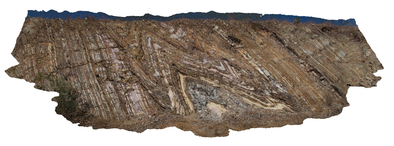
PineCreek1 Map
 |
0 |
06/25/2016 noon |
3D |
road cutting, showing tight to open folds in thinly layered, white, brown and grey mudstone of the Mount Bonnie Formation. Kakadu Highway, N.T. |
10.00 |
-13.65349000000 |
132.15392000000 |
-9999.000 |
tight fold, fold hinge, fold, structure, sheared limb |
mudstone |
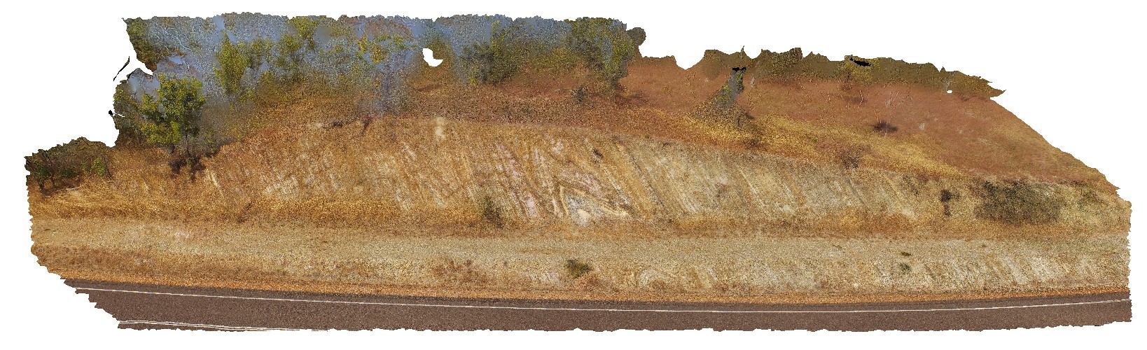
PineCreekUAV1 Map
 |
0 |
06/25/2016 noon |
UAV |
overview of road cutting, showing tight to open folds with sheared limbs in thinly banded mudstone. Kakadu Highway, N.T. |
25.00 |
-13.65349000000 |
132.15392000000 |
-9999.000 |
sheared fold limb, fold, structure, mudstone |
mudstone |
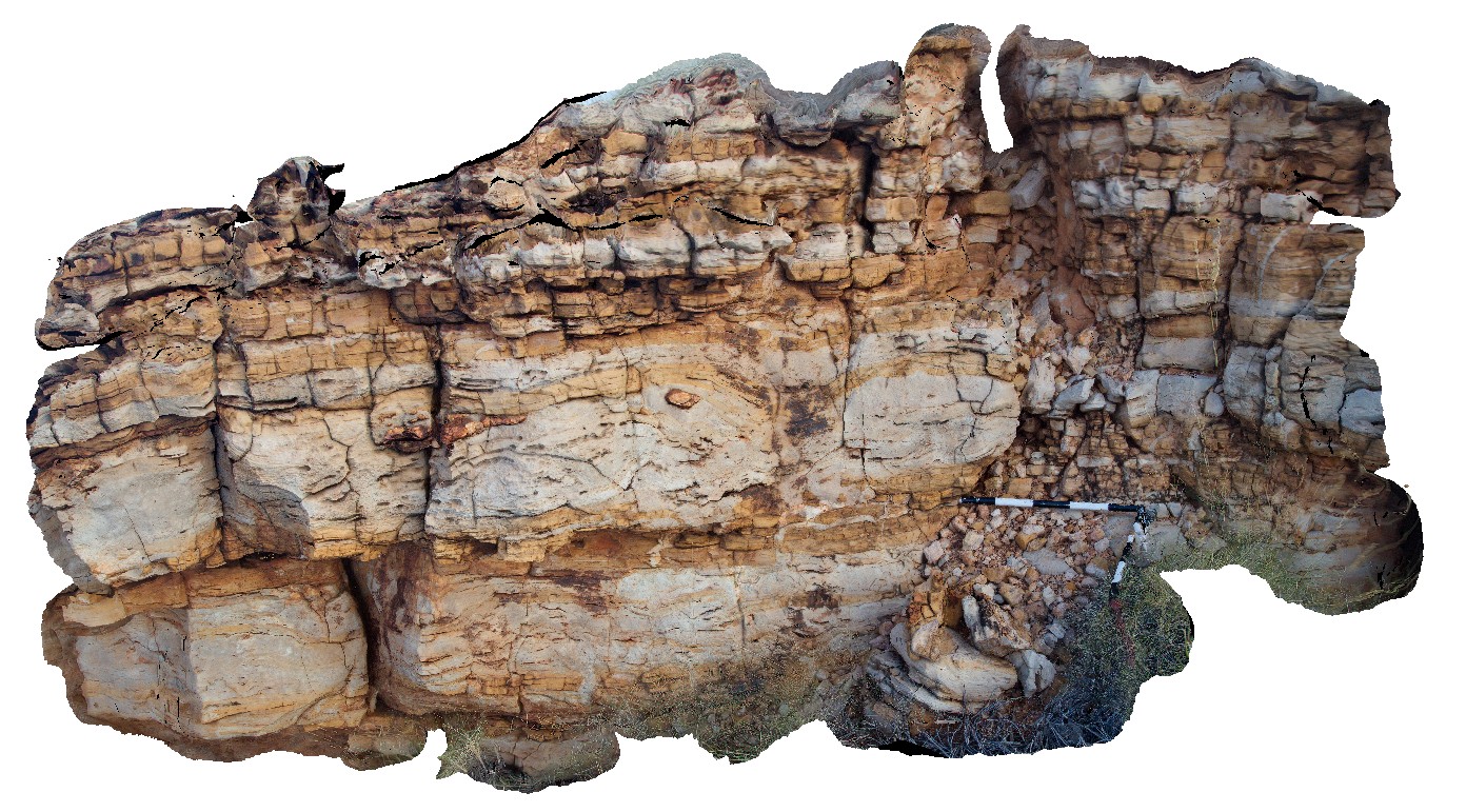
Pingandy1 Map
 |
0 |
05/27/2016 noon |
3D |
thickly bedded carbonate unit near the base of the Bangemall Basin, showing irregular and disrupted bedding, chert nodules and clastic dykes. Ashburton Downs - Meekatharra Road, W.A. |
0.00 |
-24.00582000000 |
117.91148000000 |
-9999.000 |
carbonate, limestone, sedimentology, disrupted bedding, chert nodules |
limestone |
Pingandy10 Map
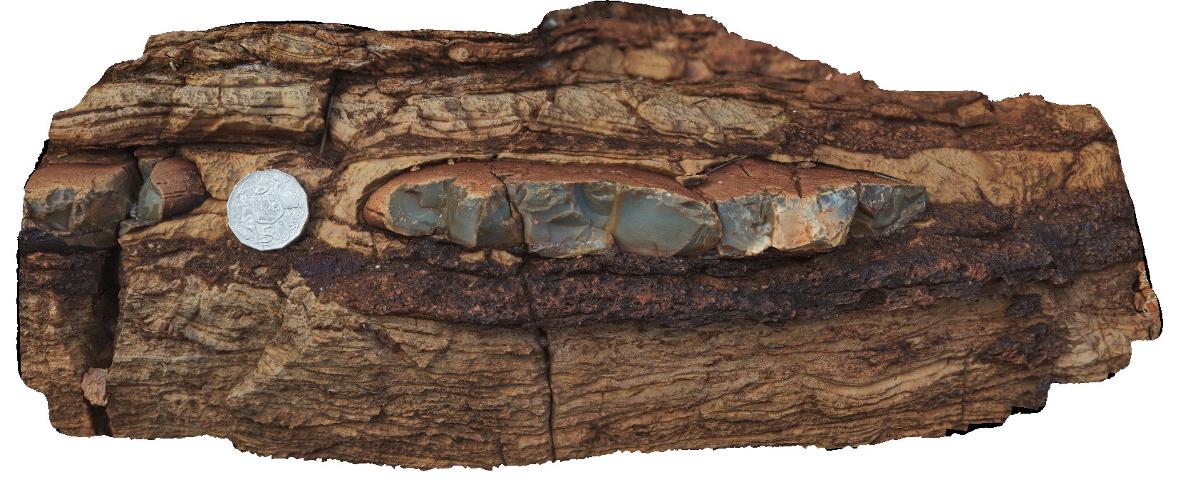 |
0 |
05/28/2016 noon |
3D |
detail of chert nodule and enclosing bed of finely laminated carbonate. Pingandy, Ashburton Downs - Meekatharra Road, W.A. |
0.40 |
-23.98612000000 |
117.92156000000 |
-9999.000 |
chert nodule, carbonate, sedimentology |
carbonate |