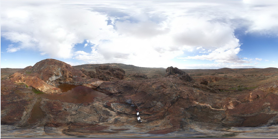
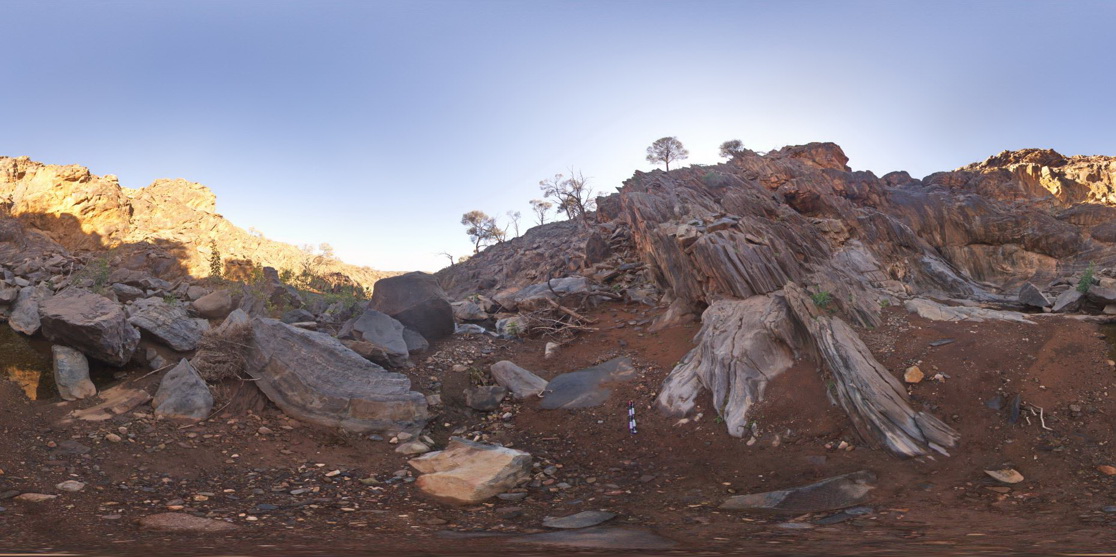
OlaryFSP1 Map
 |
0 |
07/14/2015 11:38 a.m. |
FSP |
3D view from Cathedral Rock, showing green (Amphibole?) veins and pegmatite dyke cross cutting metasediments. Olary. S.A. |
2000.00 |
-32.09031000000 |
140.31964000000 |
-9999.000 |
mineral vein, pegmatite dyke, metasediments, structure |
metasediments, pegmatite |
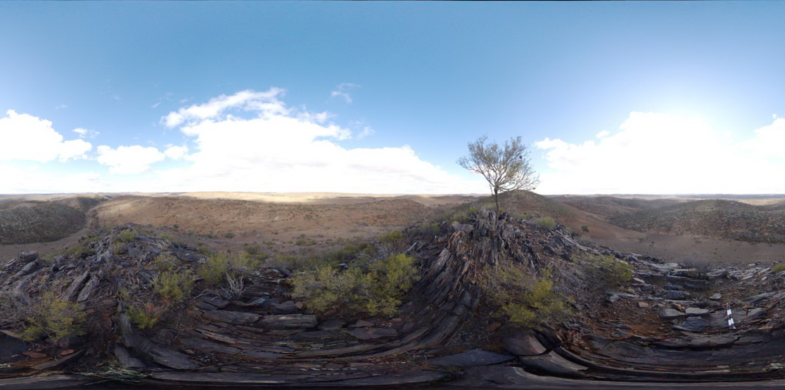
OlaryFSP10 Map
 |
0 |
07/14/2015 11:38 a.m. |
FSP |
3D view from hill top over surrounding countryside, showing steeply dipping metasediment beds in the foreground . Olary, S.A. |
2000.00 |
-32.17412000000 |
140.00279000000 |
-9999.000 |
bedding, structure, dip, metasediments |
metasediments |
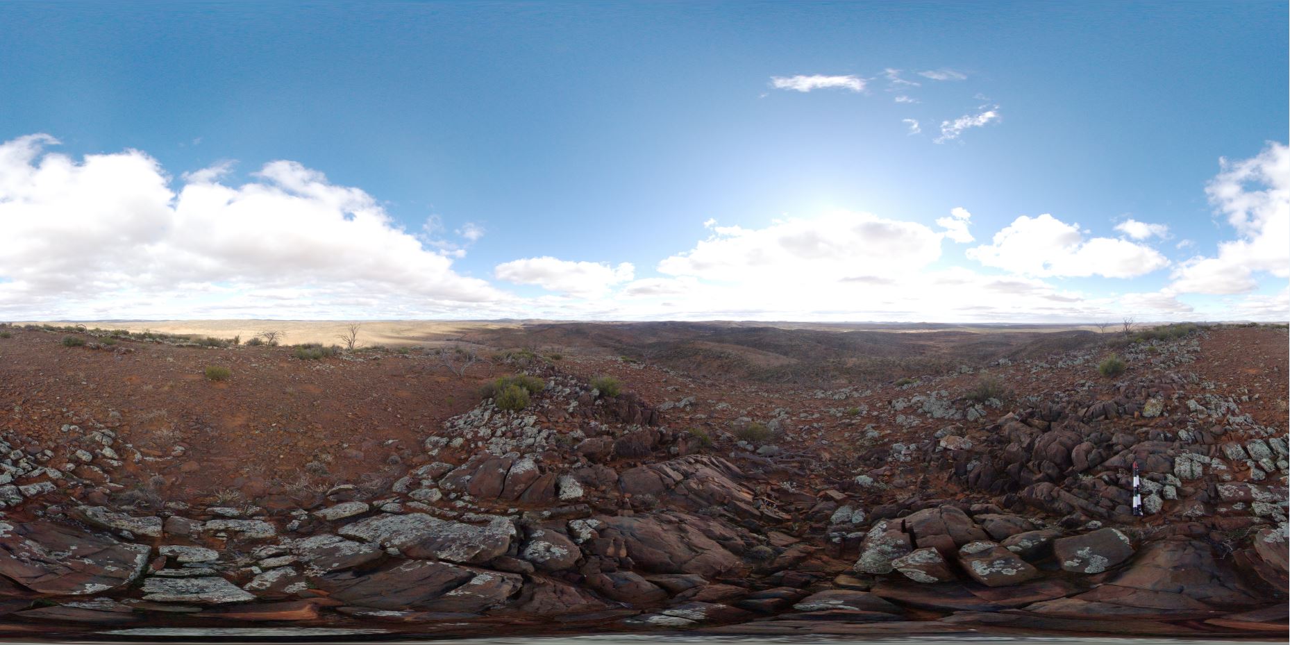
OlaryFSP11 Map
 |
0 |
07/14/2015 11:38 a.m. |
FSP |
3D view from hill top over surrounding landscape. Olary, S.A. |
2000.00 |
-32.17503000000 |
139.99957000000 |
-9999.000 |
metasediments |
metasediments |
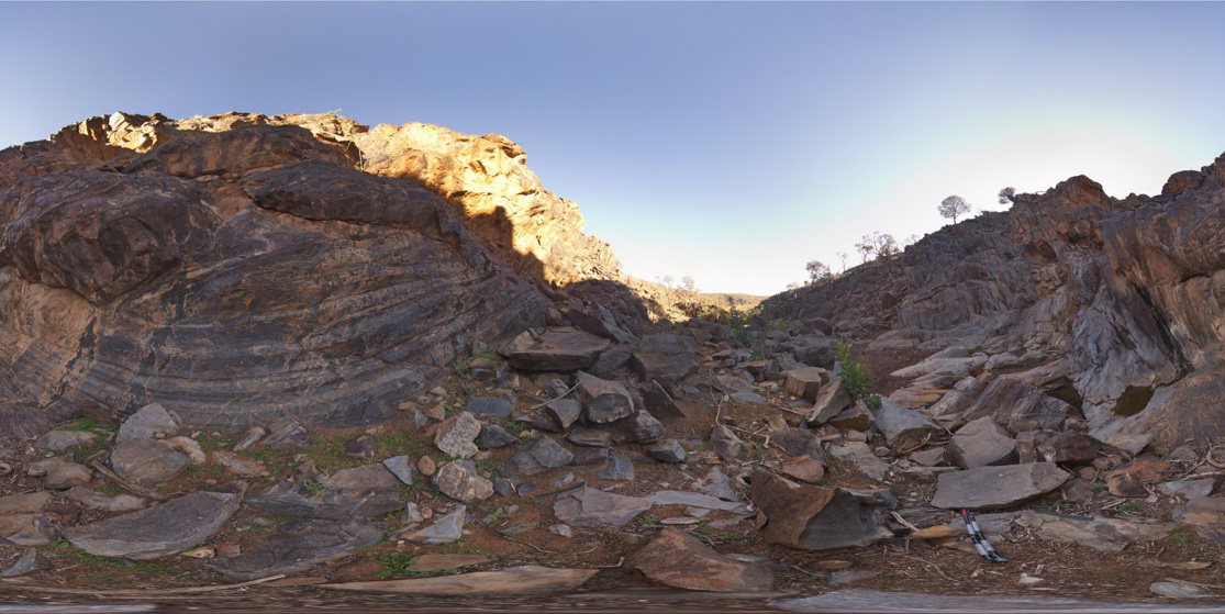
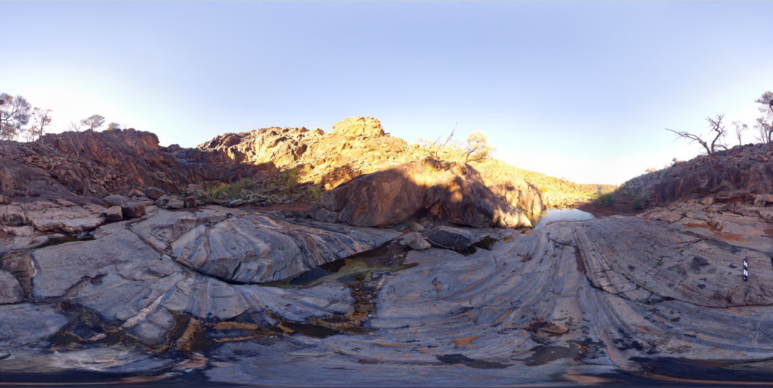
OlaryFSP9 Map
 |
0 |
07/14/2015 11:39 a.m. |
FSP |
3D view inside creek bed of finely bedded, steeply dipping and folded metasediments. Weearoo. Olary, S.A. |
100.00 |
-32.17100000000 |
139.98495000000 |
-9999.000 |
fold, structure, metasediment |
metasediment |
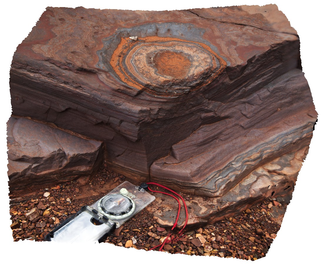
Karijini24 Map
 |
0 |
05/29/2016 noon |
3D |
3D view of disk-shaped concretions or weathering feature in banded iron formation. Dales Gorge, Karijini National Park. W.A. |
0.60 |
-22.47736000000 |
118.55669000000 |
-9999.000 |
banded iron formation, concretion, weathering feature |
BIF |
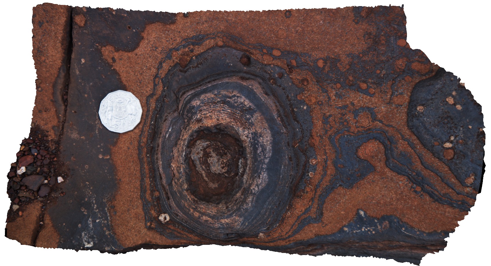
Karijini25 Map
 |
0 |
05/29/2016 noon |
3D |
3D view of disk-shaped concretions or weathering feature in banded iron formation. Dales Gorge, Karijini National Park. W.A. |
0.20 |
-22.47762000000 |
118.55690000000 |
-9999.000 |
concretion, weathering feature, banded iron formation, sedimentology |
BIF |
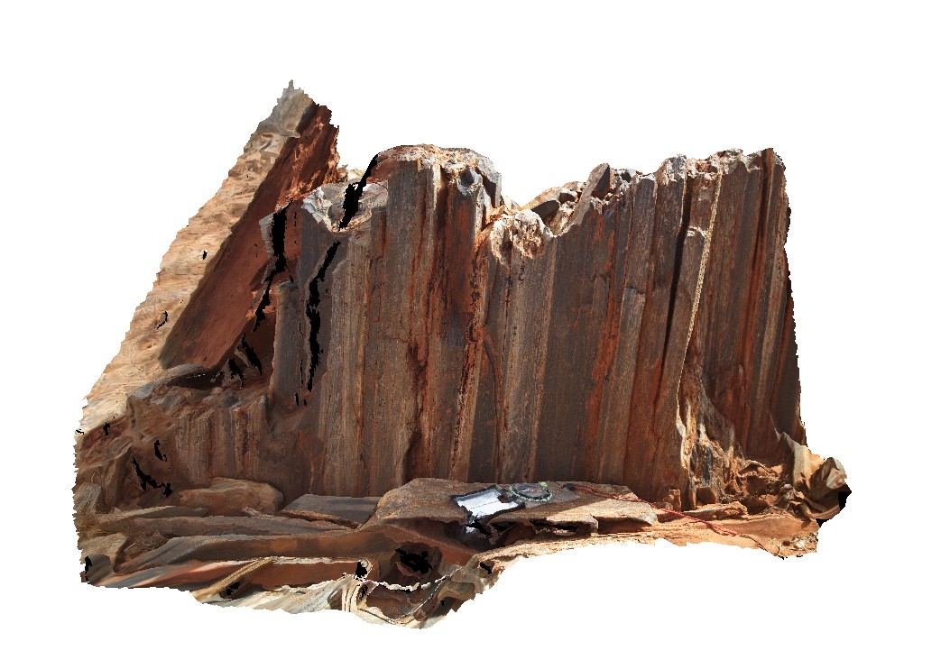
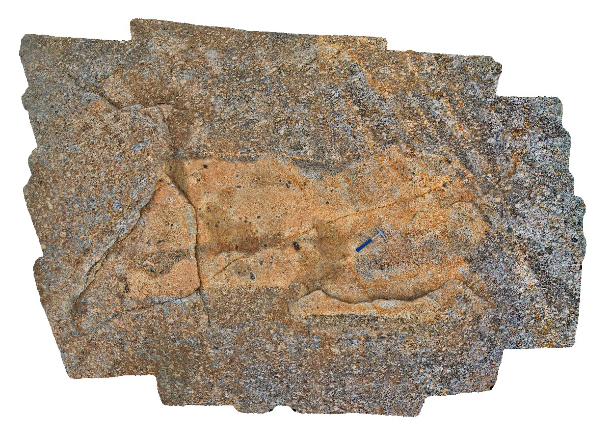
Cobra3 Map
 |
0 |
05/27/2016 noon |
3D |
3D view of outcrop of sub-vertical bedding with micro folds, cleavage and lineations on cleavage surface. Cobra-Dairy Creek, Wanna Road Junction, W.A. |
1.00 |
-24.20044000000 |
116.44952000000 |
-9999.000 |
cleavage, lineation, structure, fold |
siltstone |
OlaryFSP8 Map
 |
0 |
07/14/2015 11:39 a.m. |
FSP |
3D view of steeply dipping and folded metasediments, including reclined folding at the base of a waterfall. Weekaroo. Olary, S.A. |
100.00 |
-32.17093000000 |
139.98509000000 |
-9999.000 |
reclined fold, structure, metamorphic |
pelite |
OlaryFSP7 Map
 |
0 |
07/14/2015 11:39 a.m. |
FSP |
3D view of steeply dipping and folded metasediments within creek bed and creek sides. Weekaroo, Orlay. S.A. |
200.00 |
-32.17091000000 |
139.98482000000 |
-9999.000 |
dip, structure, fold, metasediment |
pelite |
Bicheno18 Map
 |
20 |
03/13/2015 9:03 a.m. |
3D |
3m xenolith containing bt-tourmaline clots and within coarse grained porphyritic Bicheno Granite of the Boobyalla Suite. Assimilation of the xenolith into the melt is evident around the edges. Tas. |
4.00 |
-41.88074253000 |
148.30846867000 |
1.000 |
granite, igneous, xenolith, assimilation |
Granite |
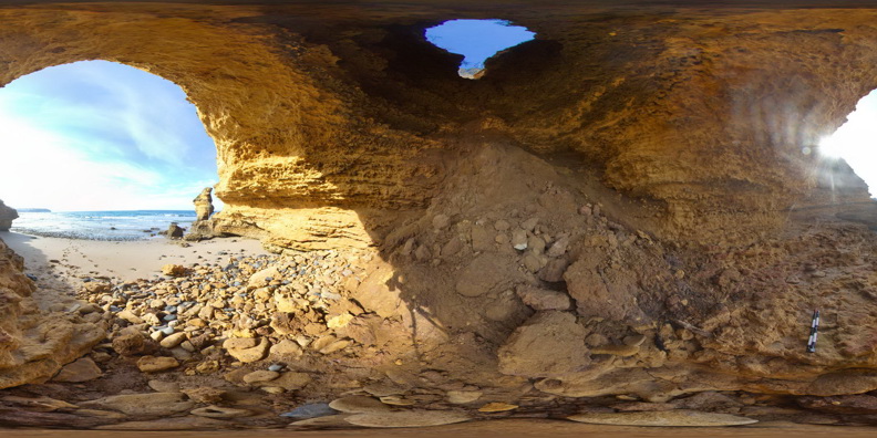
SplitpointFSP13 Map
 |
5 |
06/17/2015 11:05 a.m. |
FSP |
4m doline within flat lying, thinly bedded, sandy limestone of the Oligocene-Miocene Torquay Group. Split Point, Vic. |
50.00 |
-38.46674000000 |
144.10675000000 |
1.000 |
limestone, doline, sedimentology |
limestone |
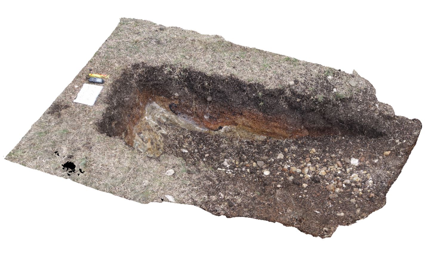
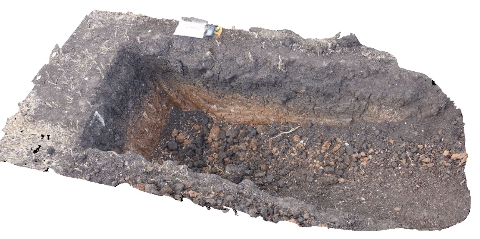
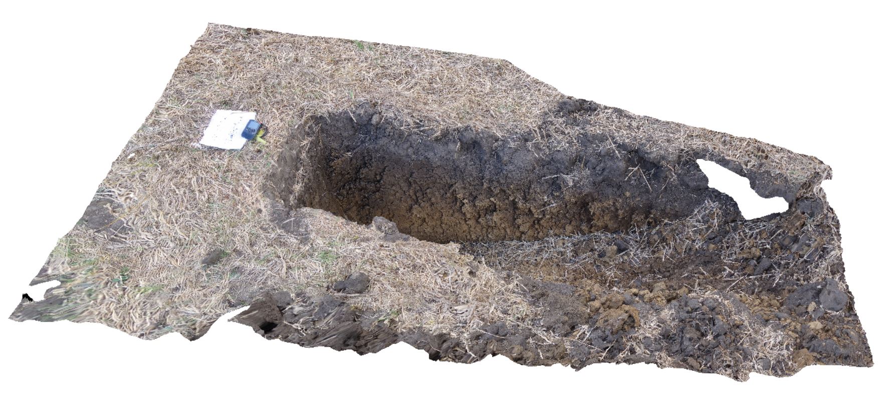
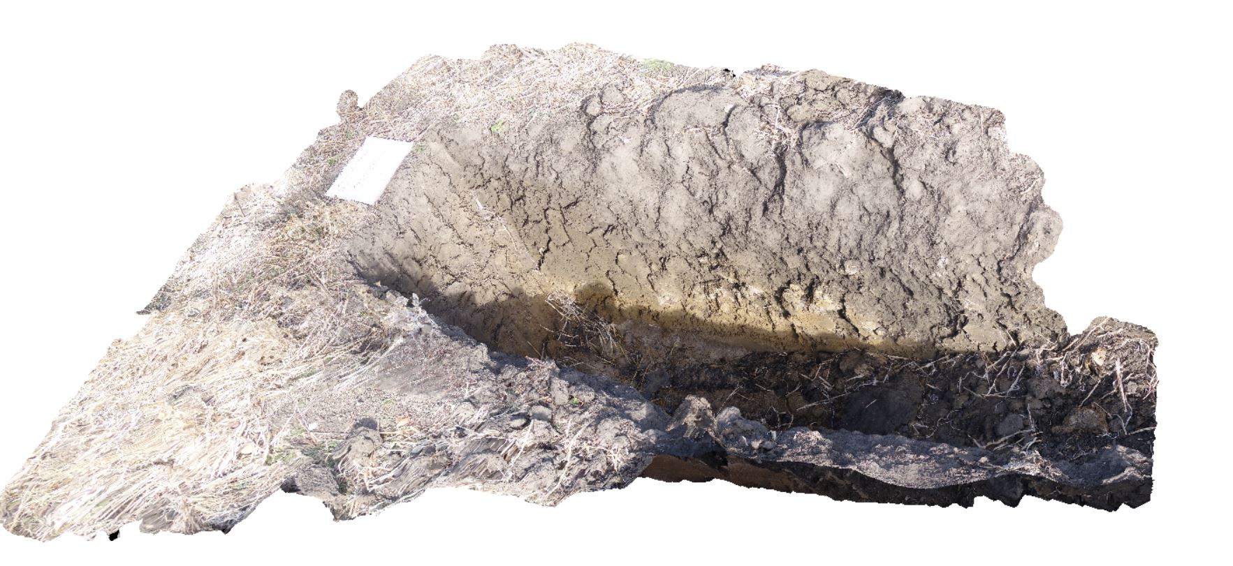
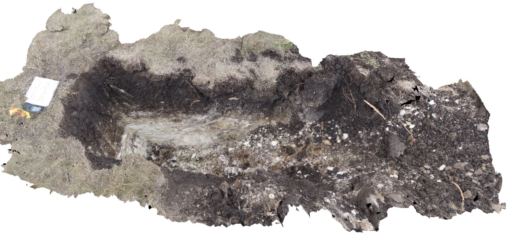
DaisyBanksPit10 Map
 |
20 |
03/23/2015 11:20 a.m. |
3D |
~80cm deep pit into Cenozoic soil and clays overlying (inferred) Jurassic Dolerite. Richmond, Tas. |
2.00 |
-42.73042400000 |
147.42464400000 |
-9999.000 |
Jurassic Dolerite, Clay, Alluvial, regolith |
Clay |
DaisyBanksPit9 Map
 |
20 |
03/17/2015 12:49 p.m. |
3D |
~80cm deep pit into soil and clays overlying late Cenozoic alluvial terrace deposits. Richmond, Tas. |
2.00 |
-42.72983600000 |
147.42554400000 |
-9999.000 |
clay, alluvial, regolith |
Clay |
DaisyBanksPit8 Map
 |
20 |
03/17/2015 2:03 p.m. |
3D |
~80cm deep pit into soil and clays overlying Paleogene-Neogene silicified rock. Richmond, Tas. |
2.00 |
-42.73246200000 |
147.42641700000 |
-9999.000 |
clay, alluvial, regolith |
clay |
DaisyBanksPit6 Map
 |
20 |
03/17/2015 1:54 p.m. |
3D |
~80cm deep pit into soil and clays overlying Quaternary alluvial and marsh deposits of modern flood plains; of gravel, sand, silt and clay. Richmond, Tas. |
2.00 |
-42.73310300000 |
147.43077000000 |
-9999.000 |
clay, alluvial, regolith |
clay |
DaisyBanksPit4 Map
 |
20 |
03/17/2015 1:45 p.m. |
3D |
~80cm deep pit into soil and clays overlying Quaternary alluvial and marsh deposits of modern flood plains; of gravel, sand, silt and clay. Richmond, Tas. |
2.00 |
-42.73176200000 |
147.42817100000 |
-9999.000 |
Clay, alluvium, regolith |
Clay |
DaisyBanksPit3 Map
 |
20 |
03/17/2015 1:37 p.m. |
3D |
~80cm deep pit into soil and clays overlying Quaternary alluvial and marsh deposits of modern flood plains; of gravel, sand, silt and clay. Richmond, Tas. |
2.00 |
-42.73071600000 |
147.42842100000 |
-9999.000 |
clay, alluvium, regolith |
Clay |
DaisyBanksPit2 Map
 |
20 |
03/17/2015 1:33 p.m. |
3D |
~80cm deep pit into soil and clays overlying quaternary alluvial deposits. Richmond, Tas. |
2.00 |
-42.73141700000 |
147.43138200000 |
-9999.000 |
clay, alluvium, regolith |
clay |
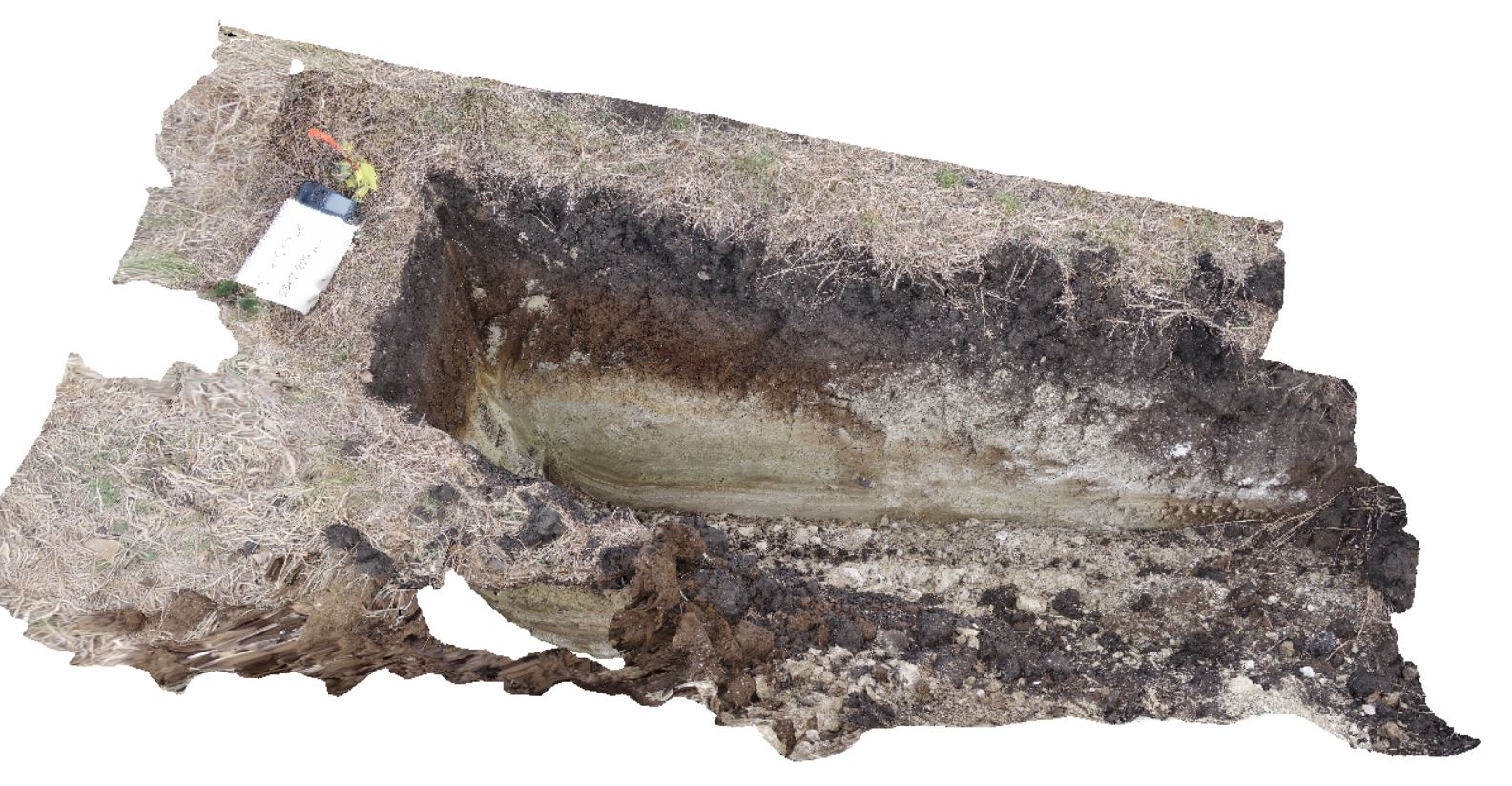
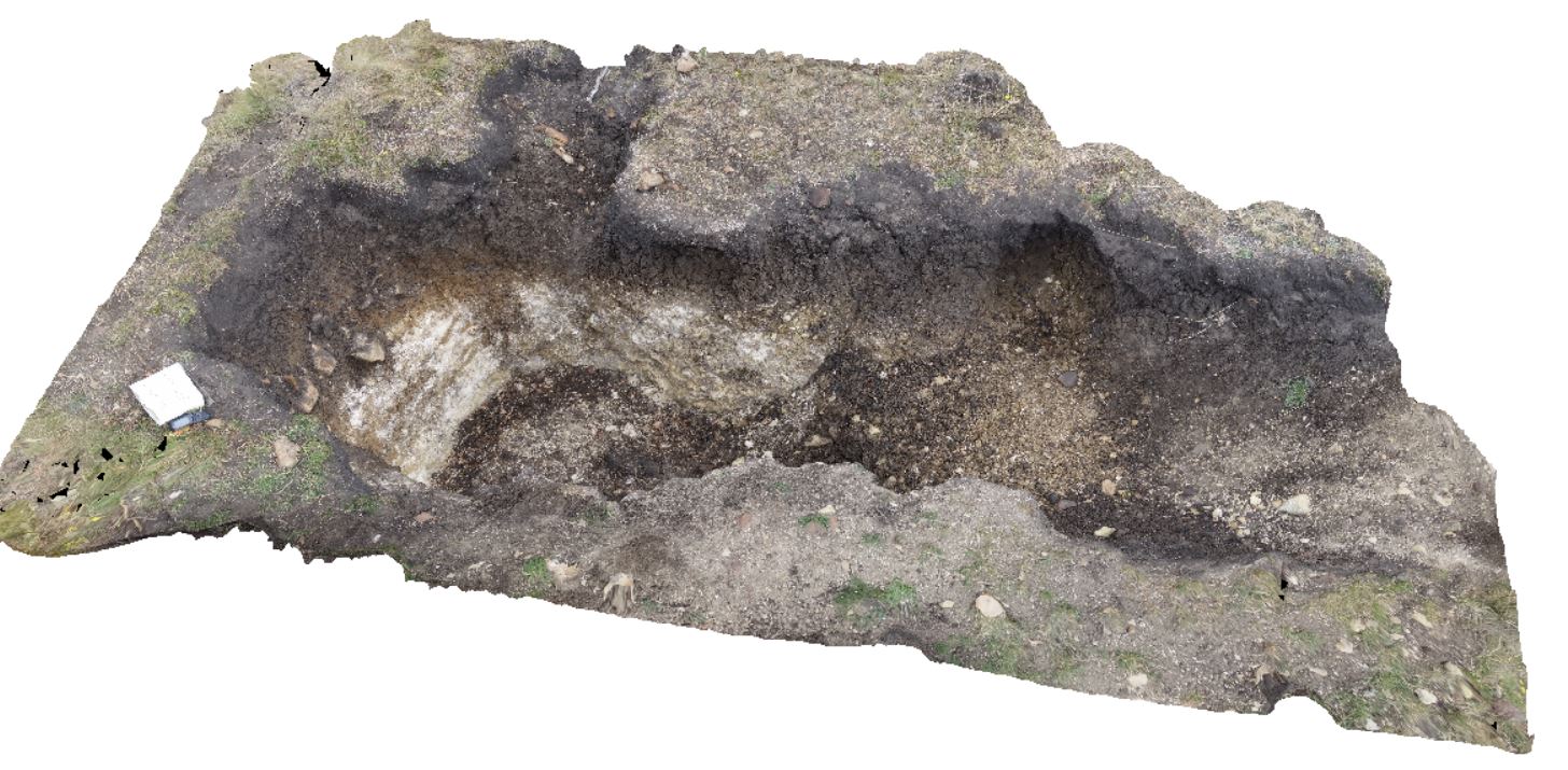
DaisyBanksPit15 Map
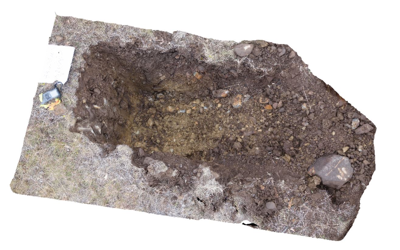 |
20 |
03/24/2015 9:47 a.m. |
3D |
~80cm pit into dark grey sandy soils and white-brown sandy clay overlying Jurassic Dolerite. Richmond, Tas. |
2.00 |
-42.73051200000 |
147.42269000000 |
-9999.000 |
Clay, Jurassic Dolerite, regolith |
clay |
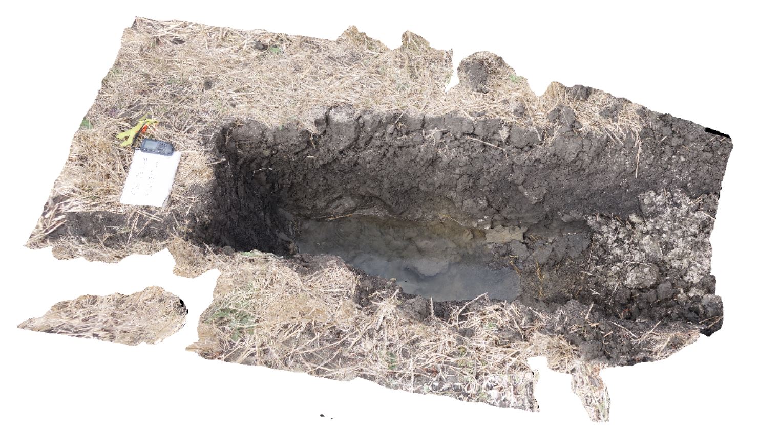
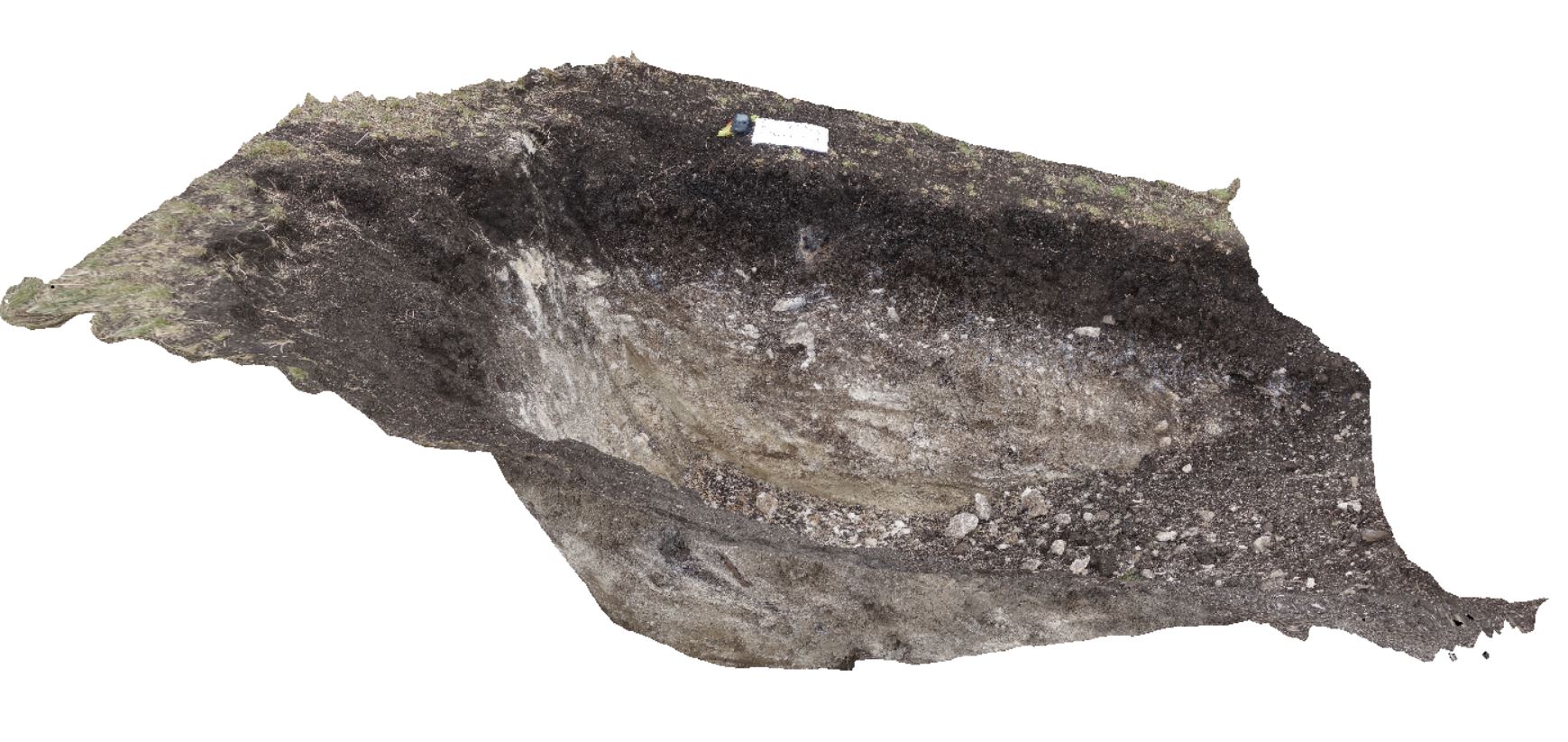
DaisyBanksPit14 Map
 |
20 |
03/24/2015 10:06 a.m. |
3D |
~80cm pit into dark grey sandy soils and white-brown sandy clay overlying Jurassic Dolerite. Richmond, Tas. |
2.00 |
-42.73006300000 |
147.42246700000 |
-9999.000 |
Clay, Jurassic Dolerite, regolith |
Clay |
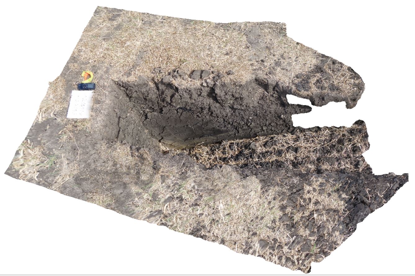
DaisyBanksPit13 Map
 |
20 |
03/23/2015 12:07 p.m. |
3D |
~80cm pit into dark grey sandy soils and white-brown sandy clay overlying Jurassic Dolerite. Richmond, Tas. |
2.00 |
-42.72961200000 |
147.42258600000 |
-9999.000 |
clay, Jurassic Dolerite, regolith |
clay |
DaisyBanksPit12 Map
 |
20 |
03/23/2015 12:11 p.m. |
3D |
~80cm pit into dark grey sandy soils and white-brown sandy clay overlying Jurassic Dolerite. Richmond, Tas. |
2.00 |
-42.72939600000 |
147.42269500000 |
-9999.000 |
clay, Jurassic Dolerite, regolith |
clay |
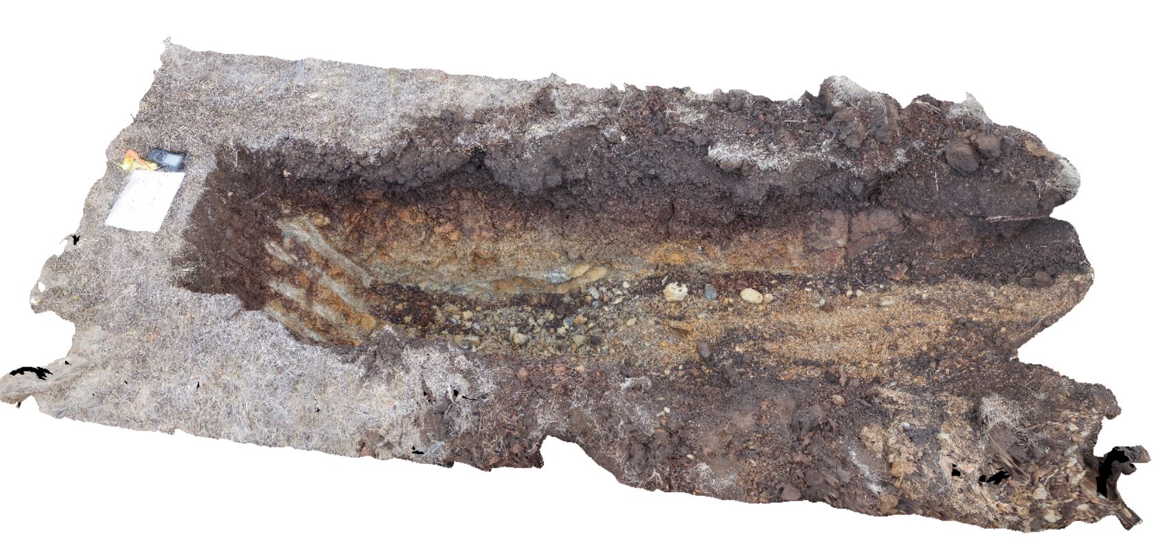
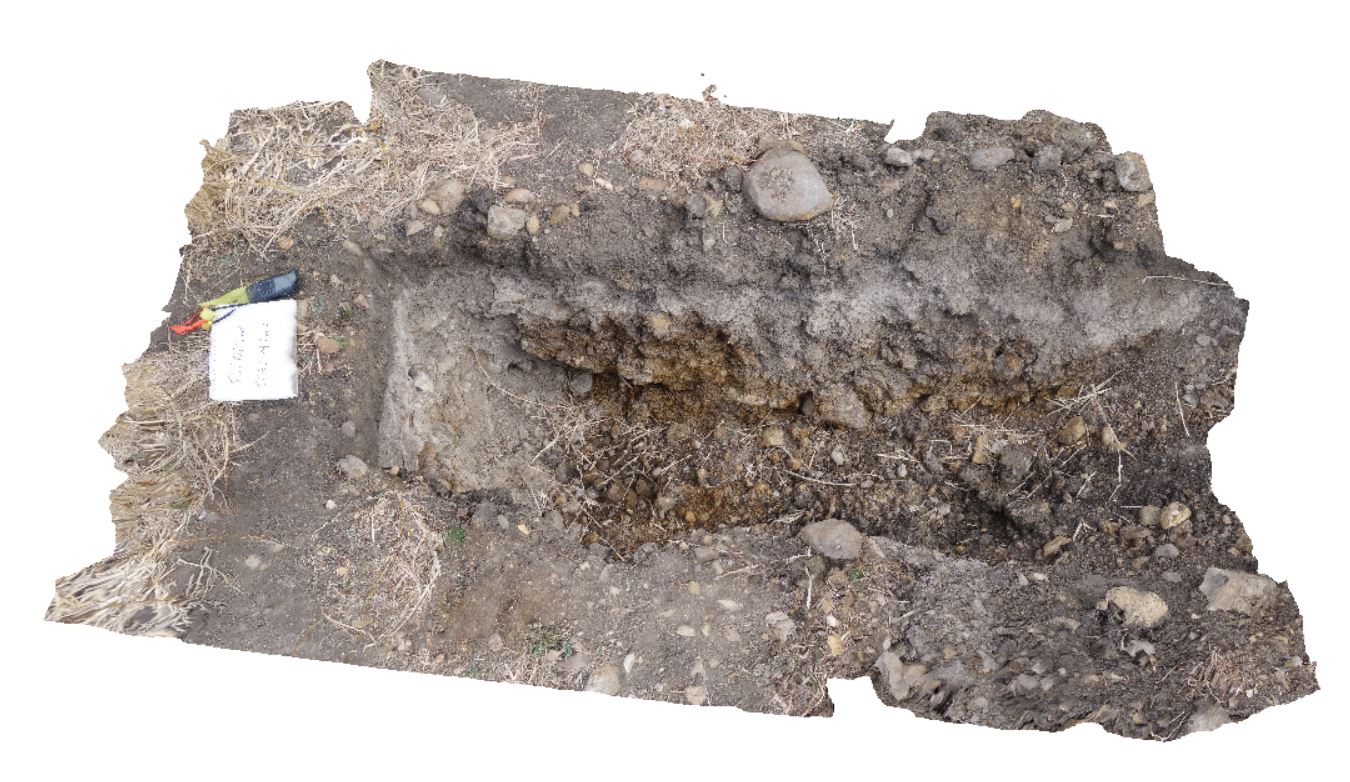
DaisyBanksPit11 Map
 |
20 |
03/23/2015 11:25 a.m. |
3D |
~80cm pit into dark grey sandy soils and white-brown sandy clay overlying Triassic interbedded micaceous brown, red-purple, green and grey carbonaceous siltstone, shale, mudstone and sandstone. Richmond, Tas. |
2.00 |
-42.72936200000 |
147.42457600000 |
-9999.000 |
clay, regolith |
clay |
DaisyBanksPit5 Map
 |
20 |
03/17/2015 1:50 p.m. |
3D |
~80cm wide pit into recent sediments overlying Quaternary alluvial and marsh deposits of modern flood plains; of gravel, sand, silt and clay. Richmond, Tas. |
2.00 |
-42.73253700000 |
147.42790800000 |
-9999.000 |
palaeochannel, alluvial, regolith |
Gravel |
BellinghamUAV2 Map
 |
20 |
01/01/9999 midnight |
UAV |
a 20m above the ground aerial overview of parasitic folds in the folded turbidites of the Retreat Formation. Bellingham, NE Tasmania. |
200.00 |
-41.00787100000 |
147.16577100000 |
20.000 |
turbidite, fold, parasitic fold, structure |
turbidite |