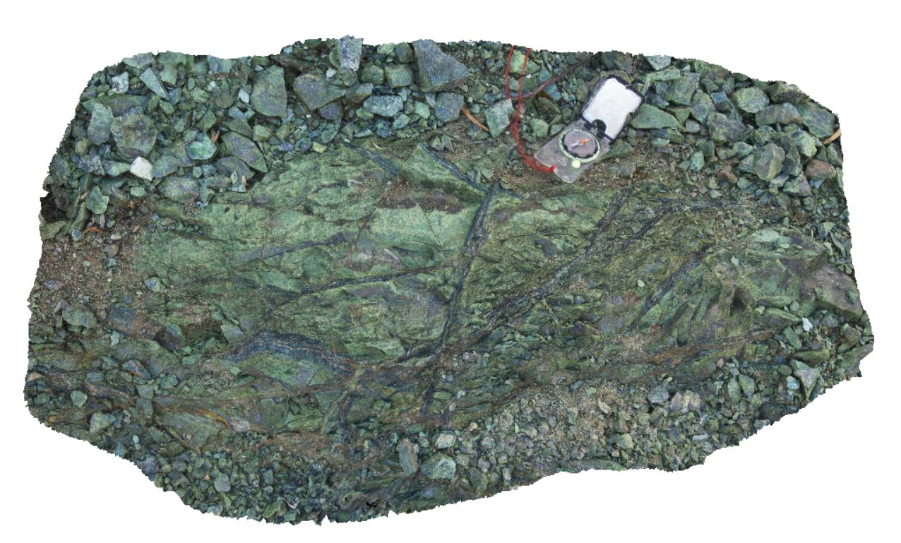
WTas30 Map
 |
5 |
01/01/9999 midnight |
3D |
serpentinised ultramafic rock, cut by magnetite veins. Quarry on Murchison Highway to Zeehan, near Mount Razorback. West Tasmania. |
0.00 |
-41.83036000000 |
145.41248000000 |
-9999.000 |
serpentinite, ultramafic, magnetite |
ultramafic |
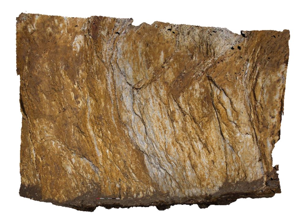
WTas4 Map
 |
5 |
01/01/9999 midnight |
3D |
outcrop of qtz-sericite-pyrite alteration in Lyell Schist, Mt Lyell, Queenstown, Tasmania. |
5.50 |
-42.07719000000 |
145.58276000000 |
-9999.000 |
Lyell schist, alteration |
schist |
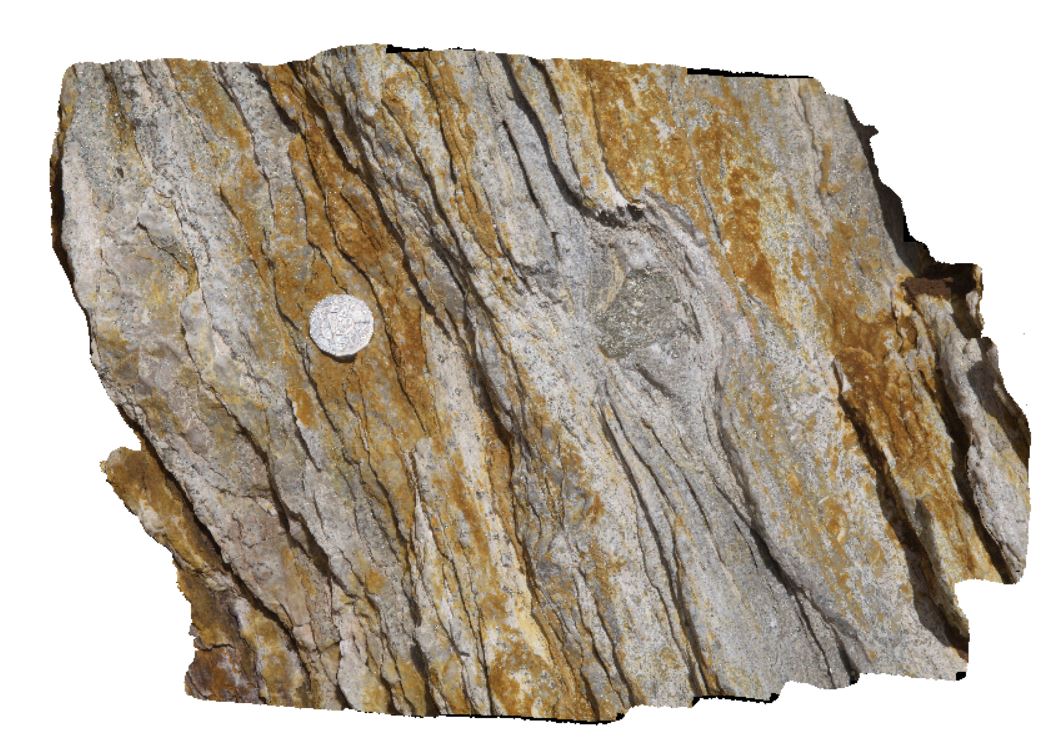
WTas5 Map
 |
5 |
01/01/9999 midnight |
3D |
detailed view of qtz-sericite-pyrite alteration in Lyell Schist, Mt Lyell, Queenstown, Tasmania. |
0.60 |
-42.07719000000 |
145.58276000000 |
-9999.000 |
schist, Lyell Schist, alteration |
schist |
WTas6 Map
 |
5 |
01/01/9999 midnight |
3D |
contact between the Pioneer Beds and the Central Volcanic Complex (CVC) / Mt Read volcanics. |
5.00 |
-42.07610000000 |
145.56078000000 |
-9999.000 |
geological contact |
sandstone, volcanics |
WTas7 Map
 |
5 |
01/01/9999 midnight |
3D |
fault with drag in silicified mudstone of the Eldon Group. Trial Harbour, West Tasmania. |
5.00 |
-41.93887000000 |
145.18092000000 |
-9999.000 |
fault, silicification, Eldon Group |
mudstone |
WTas8 Map
 |
5 |
01/01/9999 midnight |
3D |
fold in silicified mudstone of the Eldon Group. Trial Harbour, West Tasmania. |
2.00 |
-41.93808000000 |
145.18112000000 |
-9999.000 |
fold, structure, silicified |
mudstone |
WTas9 Map
 |
5 |
01/01/9999 midnight |
3D |
faulted contact between Oonah Formation siltstone and quartzite and Permian diamictite. Heemskirk Road, West Tasmania. |
9.00 |
-41.85563000000 |
145.31541000000 |
-9999.000 |
structure, drag fault, fault |
mudstone, diamictite |
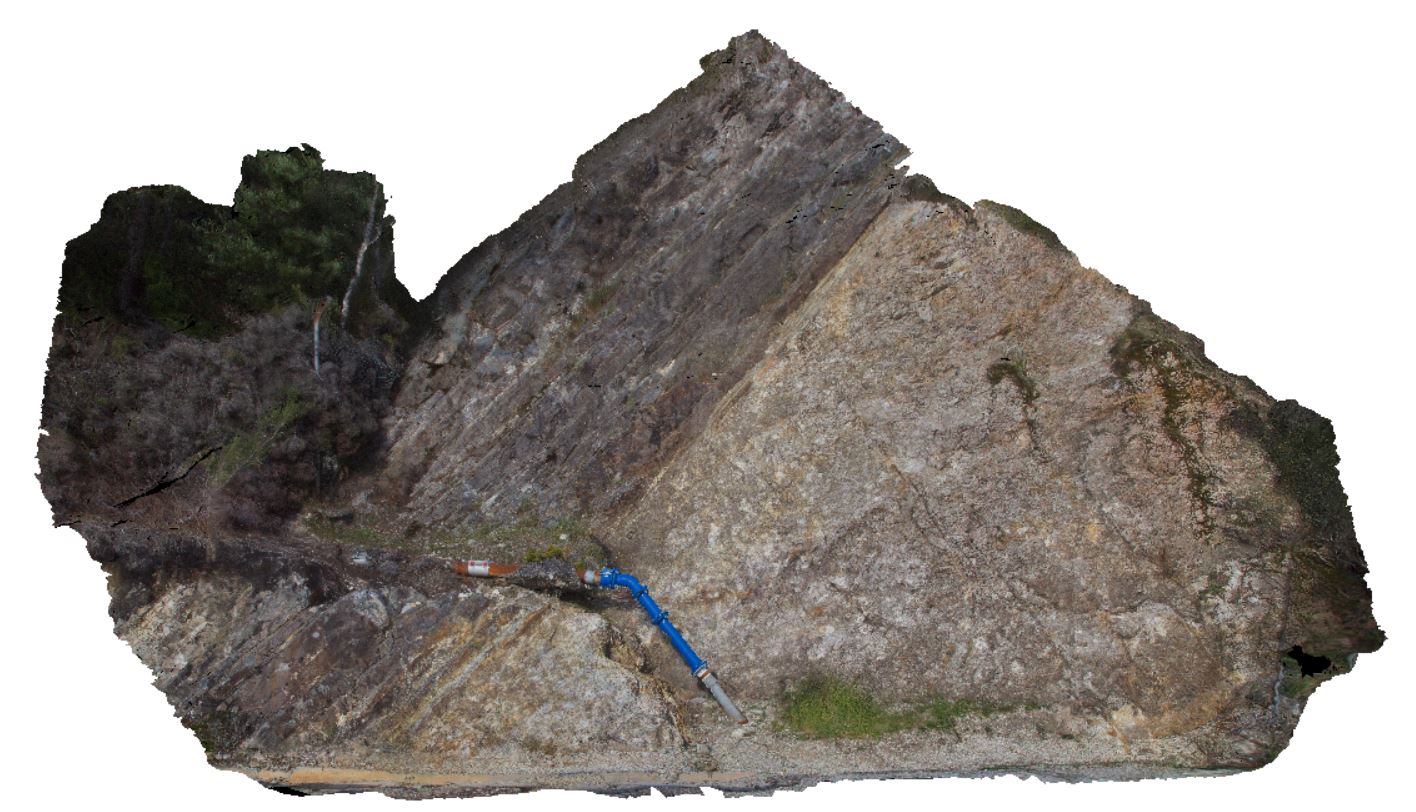
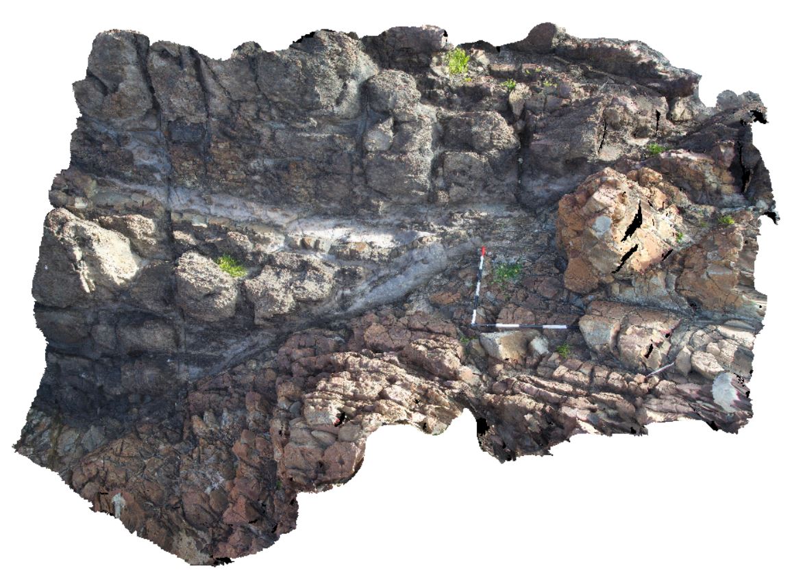
WTasFSP1 Map
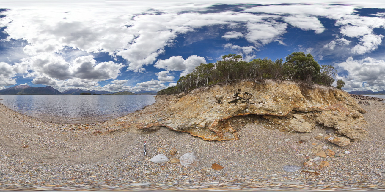 |
5 |
01/01/9999 midnight |
FSP |
view of shore of Lake Burbury, showing the vista and (Pleistocene) tillite. Lake Burbury, West Tasmania. |
200.00 |
-42.09616000000 |
145.67336000000 |
-9999.000 |
tillite, Pleistocene sediments |
tillite |
WTasFSP10 Map
 |
5 |
01/01/9999 midnight |
FSP |
360 degree view of coastal platform and exposure, showing the Heemskirk White Granite with very large tourmaline orbicules. Trial Harbour, West Tasmania. |
100.00 |
-41.92313000000 |
145.15698000000 |
-9999.000 |
igneous contact, tourmaline orbicules |
granite |
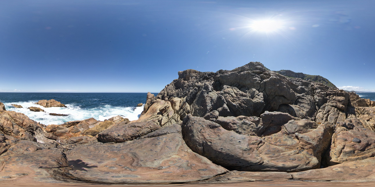
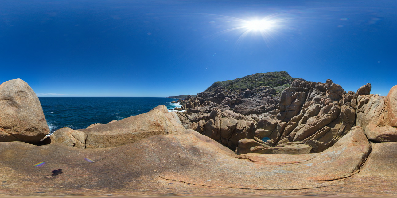
WTasFSP11 Map
 |
5 |
01/01/9999 midnight |
FSP |
360 degree view of coastal platform and exposure, showing the Heemskirk White Granite with very large tourmaline orbicules. Trial Harbour, West Tasmania. |
100.00 |
-41.92325000000 |
145.15707000000 |
-9999.000 |
granite, tourmaline orbicule, igneous contact |
granite |
WTasFSP12 Map
 |
5 |
01/01/9999 midnight |
FSP |
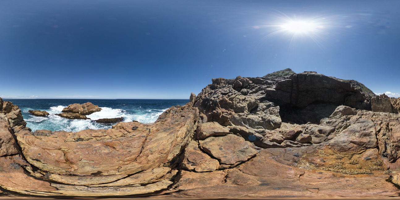
360 degree view of coastal platform and exposure, showing zoned Heemskirk White Granite with very large tourmaline orbicules in contact with the Heemskirk Red Granite. Trial Harbour, West Tasmania. |
500.00 |
-41.92292000000 |
145.15681000000 |
-9999.000 |
igneous contact, tourmaline orbicule, zoned granite |
granite, granite |
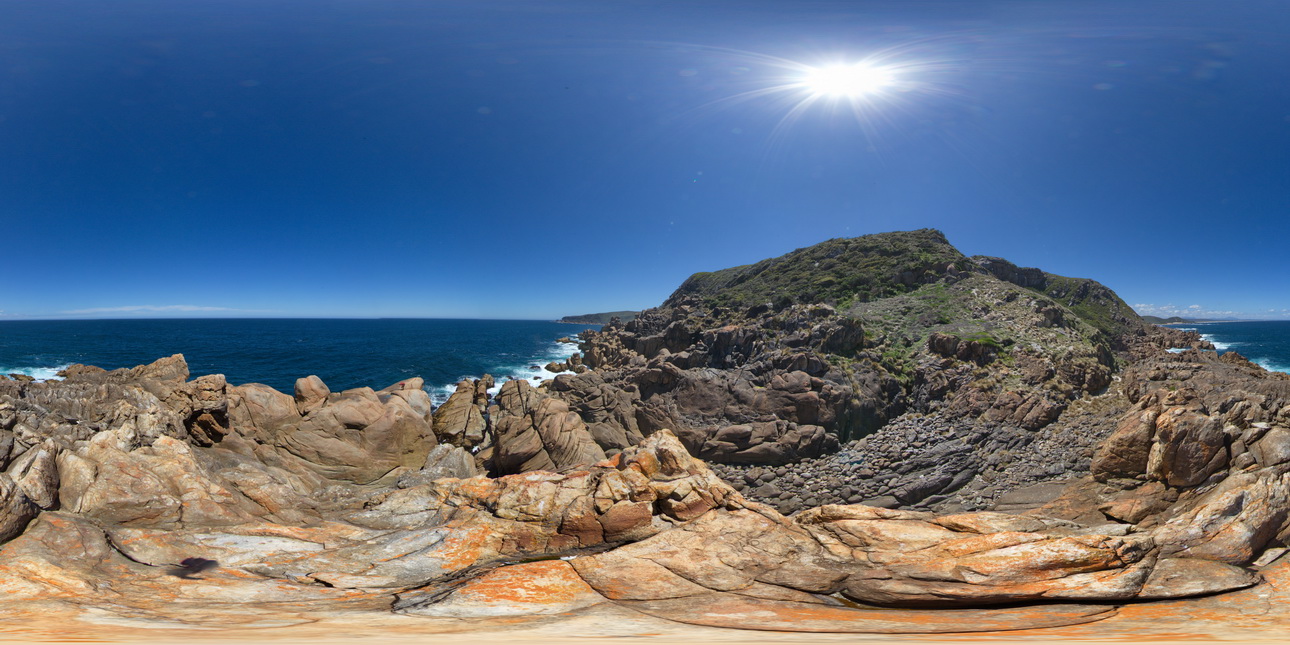
WTasFSP13 Map
 |
5 |
01/01/9999 midnight |
FSP |
360 degree view of coastal platform and exposure, showing the Heemskirk White Granite with tourmaline orbicules. Trial Harbour, West Tasmania. |
500.00 |
-41.92290000000 |
145.15672000000 |
-9999.000 |
igneous contact, tourmaline orbicule |
granite |
WTasFSP14 Map
 |
5 |
01/01/9999 midnight |
FSP |
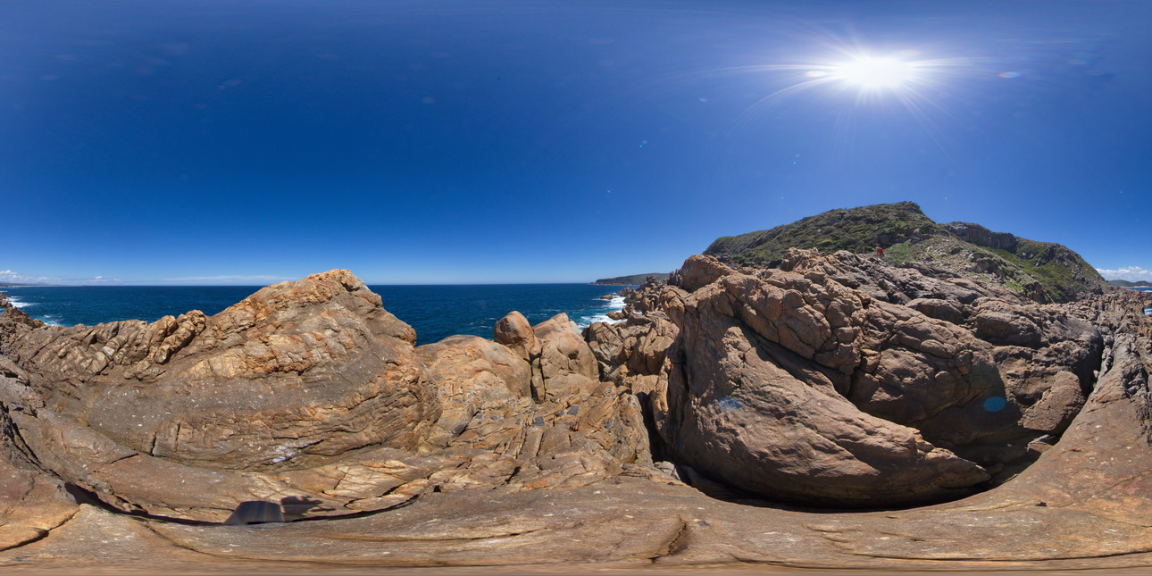
exposure, showing the Heemskirk White Granite with small tourmaline patches in the foreground and the contact with the Heemskirk Red Granite in the middle ground. Trial Harbour, West |
500.00 |
-41.92283000000 |
145.15660000000 |
-9999.000 |
igneous contact, granite, contact alteration |
granite, granite |
WTasFSP15 Map
 |
5 |
01/01/9999 midnight |
FSP |
exposure, showing the Heemskirk White Granite with small tourmaline patches in the foreground and the contact with the Heemskirk Red Granite in the middle ground. Trial Harbour, West |
500.00 |
-41.92282000000 |
145.15688000000 |
-9999.000 |
igneous contact, tourmaline orbicules, contact alteration |
granite, granite |
WTasFSP17 Map
 |
5 |
01/01/9999 midnight |
FSP |
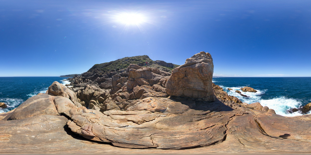
intrusive contact where the Heemkirk Red Granite intrudes the Trial Harbour Ultramafic Complex. Granite has large mafic / ultramafic xenoliths. Trial Harbour, West Tasmania. |
500.00 |
-41.92490000000 |
145.16226000000 |
-9999.000 |
igneous contact |
granite, ultramafic |
WTasFSP18 Map
 |
5 |
01/01/9999 midnight |
FSP |
intrusive contact where the Heemkirk Red Granite intrudes the Trial Harbour Ultramafic Complex. Trial Harbour, West Tasmania. |
500.00 |
-41.92499000000 |
145.16190000000 |
-9999.000 |
igneous contact, granite |
granite, ultramafic |
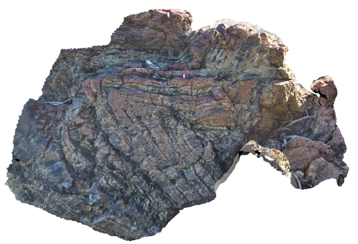
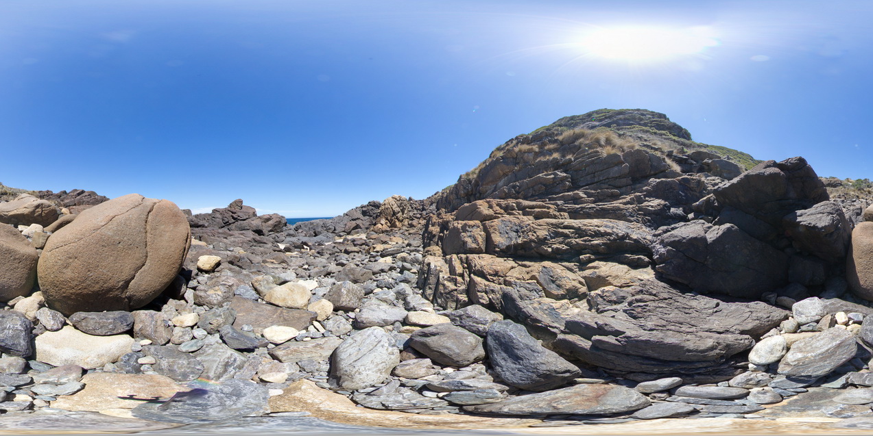
WTasFSP19 Map
 |
5 |
01/01/9999 midnight |
FSP |
outcropping folded sediments of the Oonah Formation. Granville Harbour, West Tasmania. |
100.00 |
-41.78020000000 |
145.00650000000 |
-9999.000 |
fold, structure, Oonah Formation |
quartzite |
WTasFSP2 Map
 |
5 |
01/01/9999 midnight |
FSP |
view of the Iron Blow at My Lyell with view of the Lyell Schist and Owen Group. Gormanston, West Tasmania. |
1000.00 |
-42.06907000000 |
145.58952000000 |
-9999.000 |
Iron Blow, Mount Lyell Copper Mine, Lyell Schist, Mine, open pit |
schist, conglomerate |
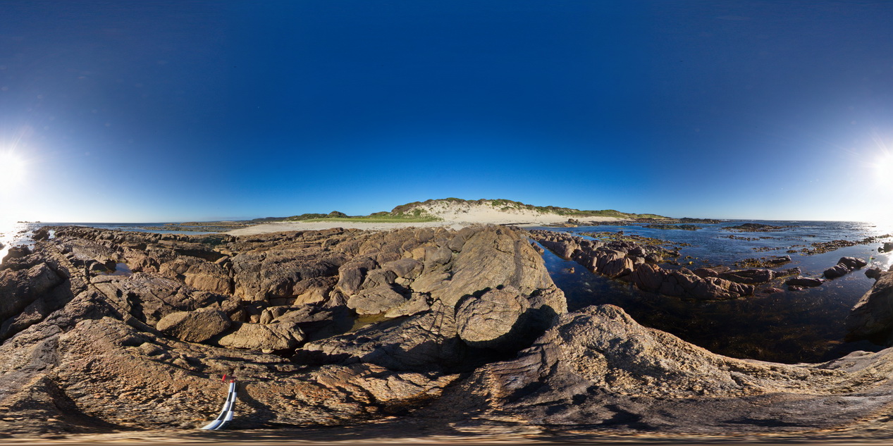
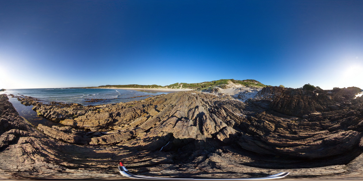
WTasFSP20 Map
 |
5 |
01/01/9999 midnight |
FSP |
outcropping folded sediments of the Oonah Formation with cross cutting felsic dyke. Granville Harbour, West Tasmania. |
1000.00 |
-41.77933000000 |
145.00633000000 |
-9999.000 |
fold, structure, dyke |
metasediments |
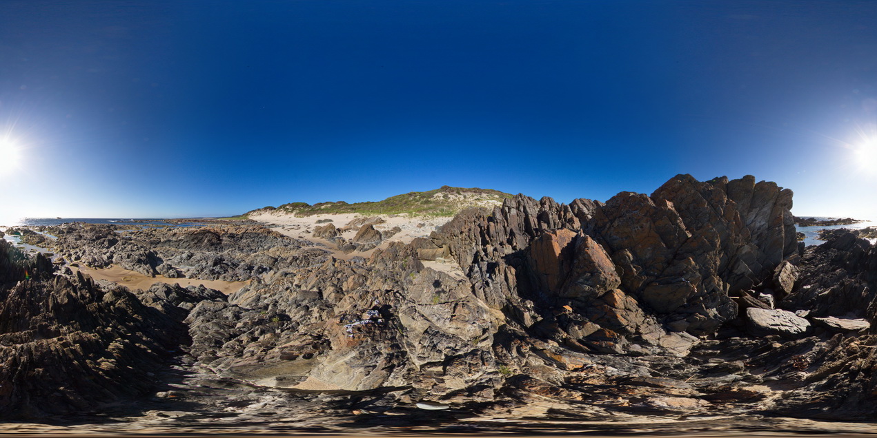
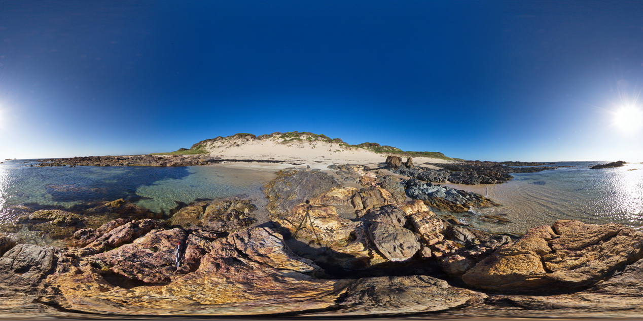
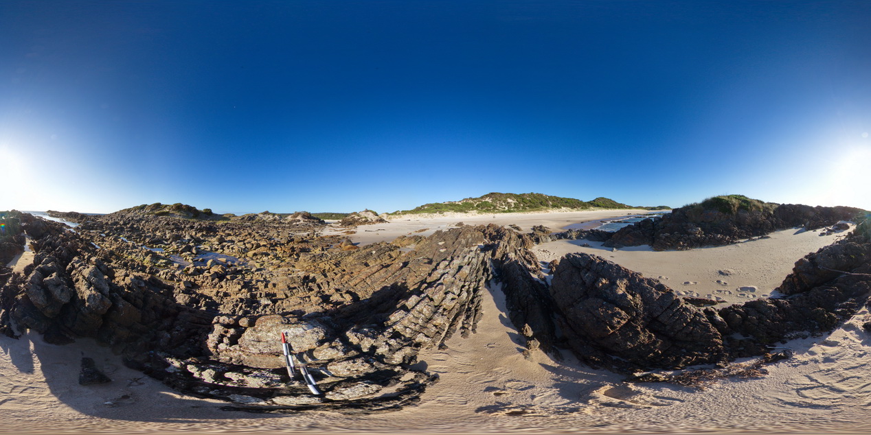
WTasFSP21 Map
 |
5 |
01/01/9999 midnight |
FSP |
basal Ordovician conglomerate of the 'Duck Creek' conglomerate, with Oona Formation rocks to the south. Granville Harbour, West Tasmania. |
1000.00 |
-41.77914000000 |
145.00606000000 |
-9999.000 |
conglomerate, fold, structure |
conglomerate |
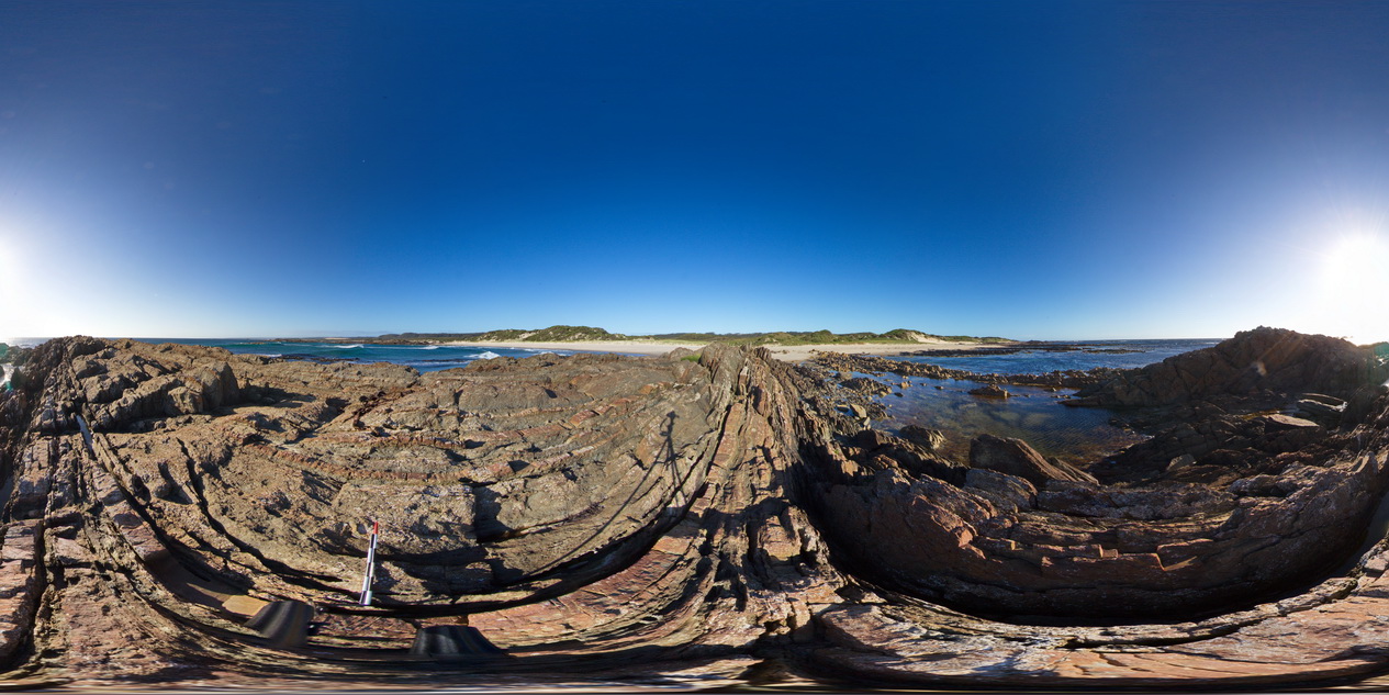
WTasFSP22 Map
 |
5 |
01/01/9999 midnight |
FSP |
steeply dipping conglomerate beds at the base of the Ordovician, with carbonate units to the north. Granville Harbour, West Tasmania. |
1000.00 |
-41.77903000000 |
145.00580000000 |
-9999.000 |
fold, structure, conglomerate |
conglomerate |
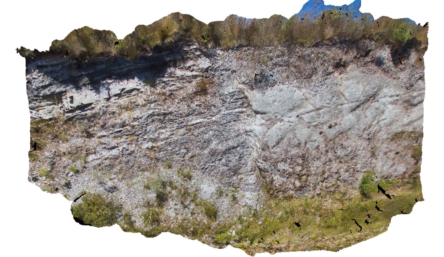
WTasFSP23 Map
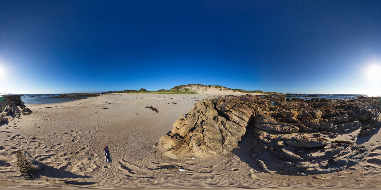 |
5 |
01/01/9999 midnight |
FSP |
moderately dipping calcareous quartzite beds exposed at beach at Granville Harbour, West Tasmania. |
1000.00 |
-41.77887000000 |
145.00580000000 |
-9999.000 |
dip, bedding |
carbonate |
WTasFSP24 Map
 |
5 |
01/01/9999 midnight |
FSP |
steeply dipping sandstone and siltstone beds exposed along the beach at Granville Harbour, West Tasmania. |
1000.00 |
-41.77747000000 |
145.00507000000 |
-9999.000 |
dip, structure |
sandstone |
WTasFSP25 Map
 |
5 |
01/01/9999 midnight |
FSP |
steeply dipping sandstone and siltstone beds exposed along the beach at Granville Harbour, West Tasmania. |
1000.00 |
-41.77426000000 |
145.00587000000 |
-9999.000 |
dip, bedding, sedimentology, sandstone |
sandstone |
WTasFSP26 Map
 |
5 |
01/01/9999 midnight |
FSP |
steeply dipping sandstone and siltstone beds exposed along the beach at Granville Harbour, West Tasmania. |
1000.00 |
-41.77359000000 |
145.00658000000 |
-9999.000 |
dip, bedding, sedimentology, structure |
sandstone |