WTasFSP27 Map
 |
5 |
01/01/9999 midnight |
FSP |
shallowly to moderately dipping, pale grey, fine-grained quartz sandstone with subordinate interbedded greenish-grey siltstone. Abundantly fossiliferous in parts. Duck Creek, West Tasmania. |
1000.00 |
-41.76950000000 |
145.00429000000 |
-9999.000 |
dip, bedding, sandstone, structure |
sandstone |
WTasFSP28 Map
 |
5 |
01/01/9999 midnight |
FSP |
shallowly to moderately dipping, pale grey, fine-grained quartz sandstone with subordinate interbedded greenish-grey siltstone. Abundantly fossiliferous in parts. Duck Creek, West Tasmania. |
1000.00 |
-41.76839000000 |
145.00325000000 |
-9999.000 |
sandstone, dip, bedding |
sandstone |
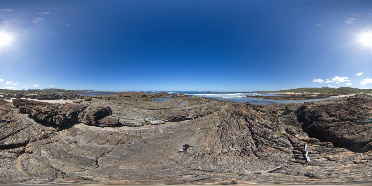
WTasFSP29 Map
 |
5 |
01/01/9999 midnight |
FSP |
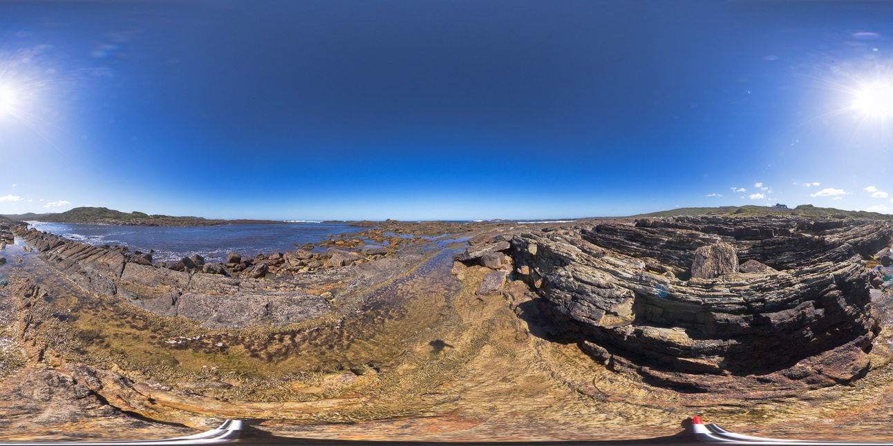
shallowly to moderately dipping, fine-grained, cross bedded quartz sandstone with subordinate interbedded greenish-grey siltstone. Abundantly fossiliferous in parts. Duck Creek, West Tasmania. |
1000.00 |
-41.76839000000 |
145.00346000000 |
-9999.000 |
dip, bedding, cross bedding, structure, sedimentology |
sandstone |
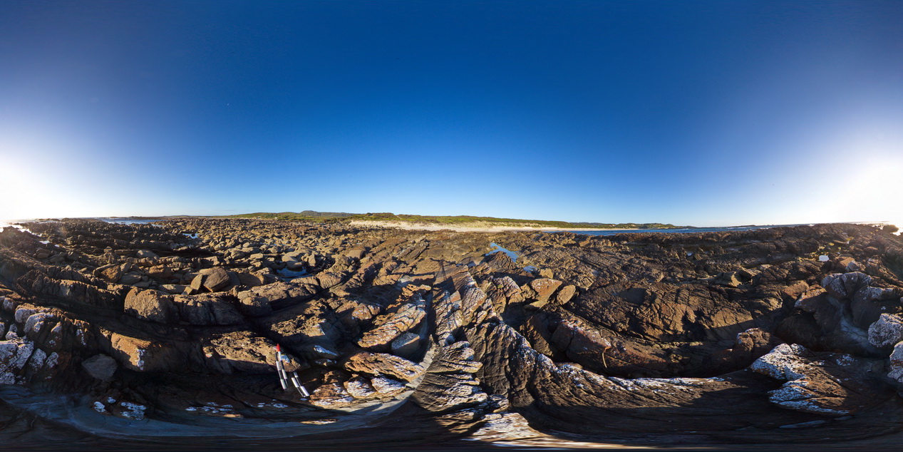
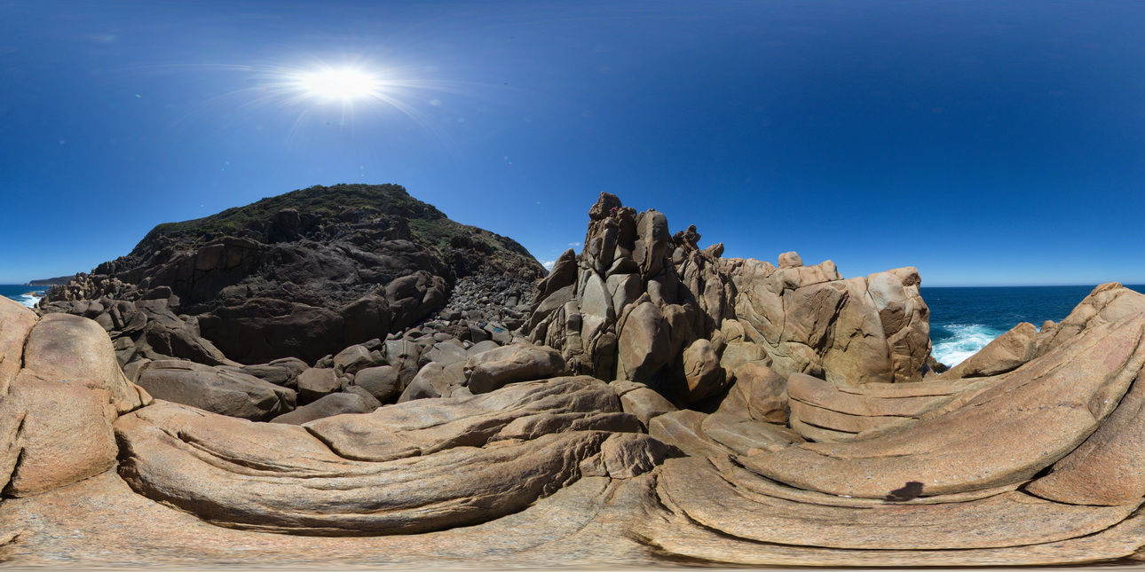
WTasFSP3 Map
 |
5 |
01/01/9999 midnight |
FSP |
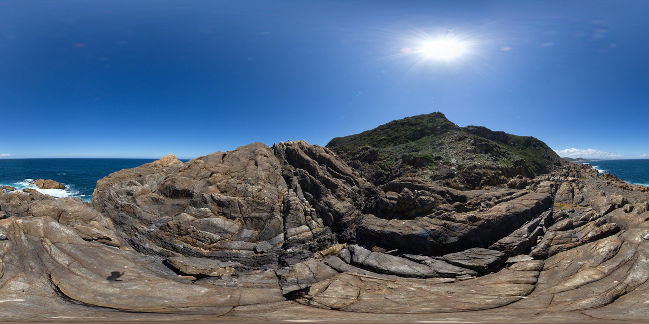
360 degree view of coastal exposure, showing White Heemskirk Granite with tourmaline orbicules. Trial Harbour, West Tasmania. |
100.00 |
-41.92277000000 |
145.15710000000 |
-9999.000 |
tourmaline orbicules |
granite |
WTasFSP30 Map
 |
5 |
01/01/9999 midnight |
FSP |
shallowly to moderately dipping, fine-grained, cross bedded quartz sandstone with subordinate interbedded greenish-grey siltstone. Abundantly fossiliferous in parts. Duck Creek, West Tasmania. |
1000.00 |
-41.76828000000 |
145.00345000000 |
-9999.000 |
bedded, sandstone, dip |
sandstone |
WTasFSP31 Map
 |
5 |
01/01/9999 midnight |
FSP |
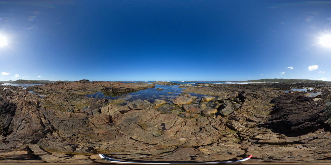
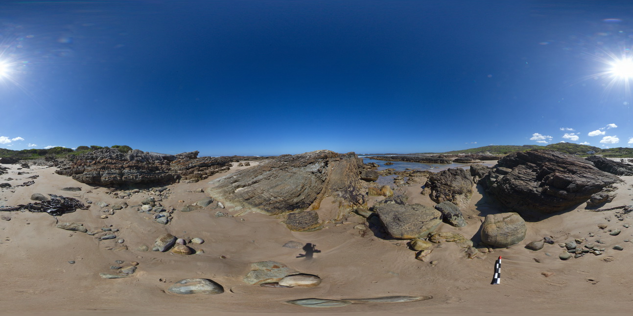
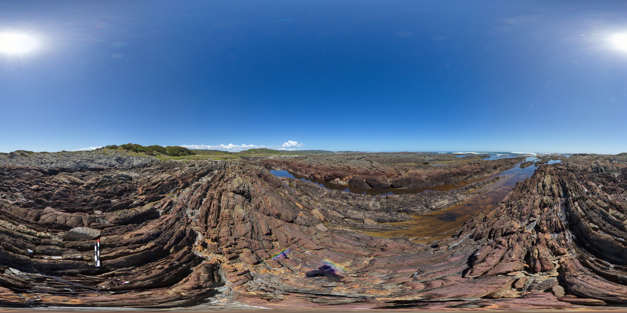
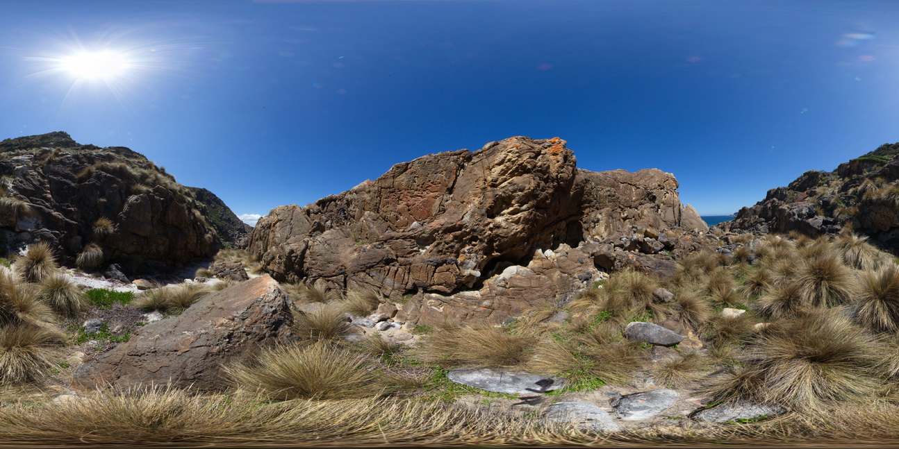
view of shallow basin in shallowly dipping, fine-grained, quartz sandstone and siltstone. Duck Creek, West Tasmania. |
1000.00 |
-41.76824000000 |
145.00360000000 |
-9999.000 |
folding, basin, structure |
sandstone |
WTasFSP31a Map
 |
5 |
01/01/9999 midnight |
FSP |
view of shallow basin in shallowly dipping, fine-grained, quartz sandstone and siltstone. Duck Creek, West Tasmania. |
1000.00 |
-41.76810000000 |
145.00371000000 |
-9999.000 |
basin, dip, sedimentology, structure |
sandstone |
WTasFSP32 Map
 |
5 |
01/01/9999 midnight |
FSP |
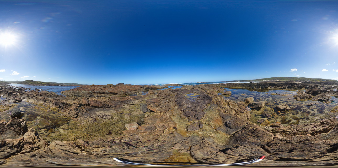
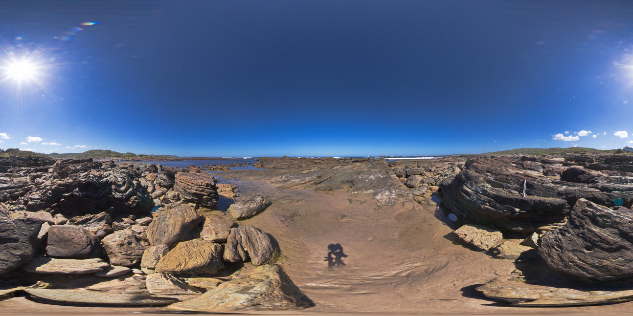
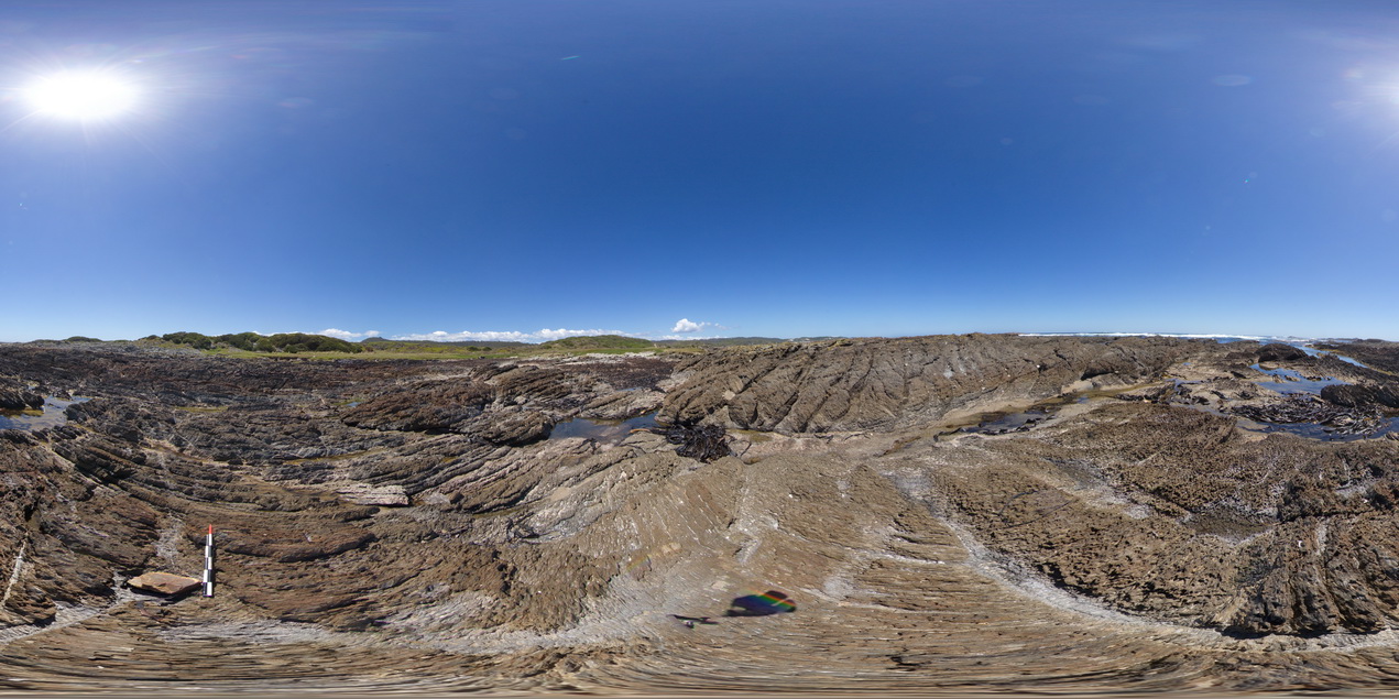
view of shallow to moderately dipping, thinly bedded sandstones and siltstones. Duck Creek, west coast, Tasmania. |
1000.00 |
-41.76805000000 |
145.00377000000 |
-9999.000 |
dip, bedding, structure |
sandstone |
WTasFSP33 Map
 |
5 |
01/01/9999 midnight |
FSP |
view of shallow to moderately dipping, thinly bedded sandstones and siltstones. Duck Creek, west coast, Tasmania. |
1000.00 |
-41.76815000000 |
145.00415000000 |
-9999.000 |
bedding, dip, structure |
sandstone |
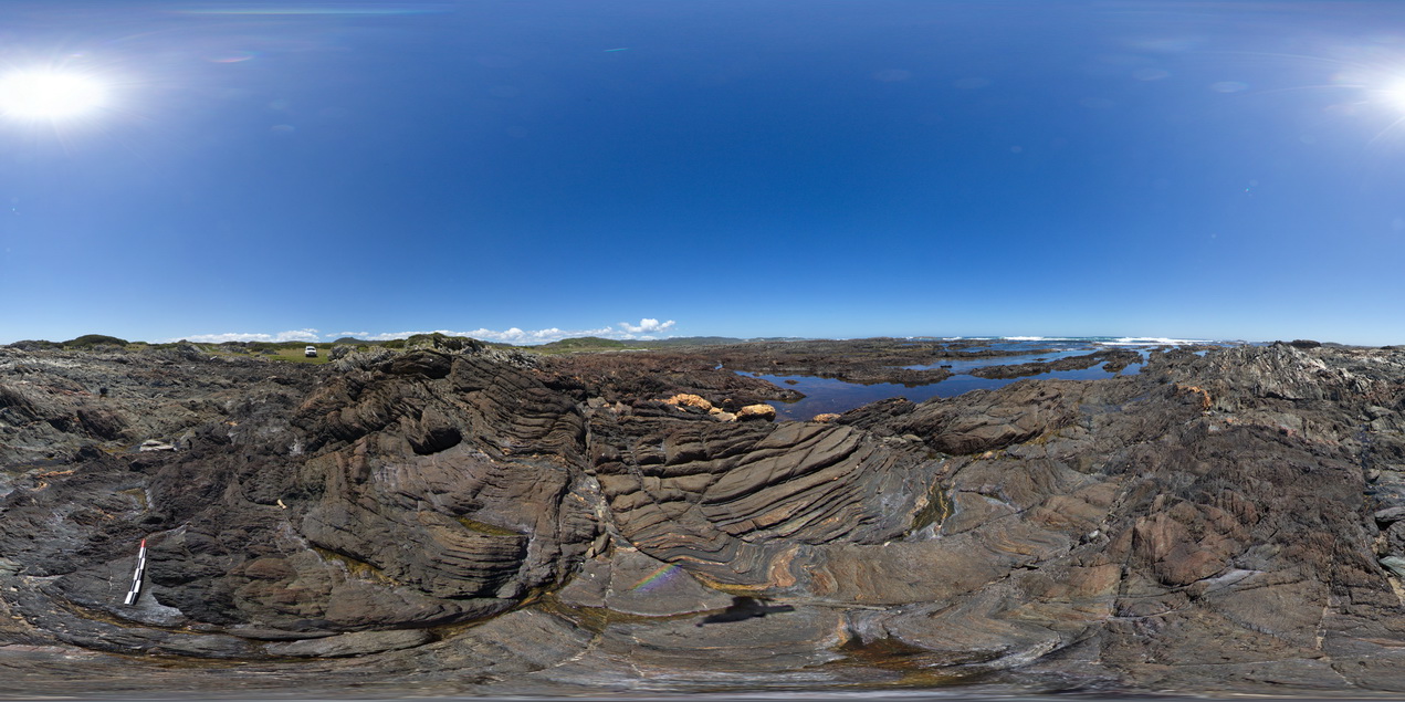
WTasFSP34 Map
 |
5 |
01/01/9999 midnight |
FSP |
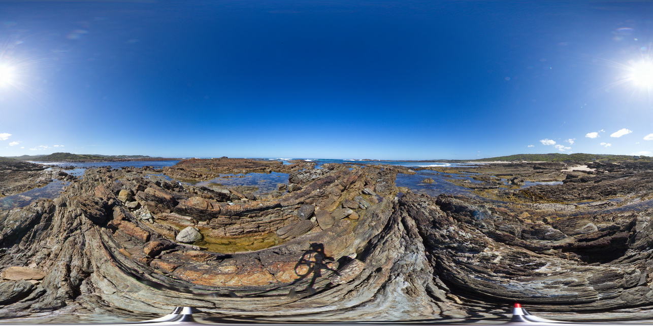
view of shallow to moderately dipping, bedded sandstones and siltstones. Duck Creek, west coast, Tasmania. |
1000.00 |
-41.76799000000 |
145.00394000000 |
-9999.000 |
bedding, dip, structure, sedimentology |
sandstone |
WTasFSP35 Map
 |
5 |
01/01/9999 midnight |
FSP |
view of shallow to moderately dipping, bedded sandstones and siltstones. Duck Creek, west coast, Tasmania. |
1000.00 |
-41.76805000000 |
145.00401000000 |
-9999.000 |
bedding, dip, sedimentology, structure |
sandstone |
WTasFSP36 Map
 |
5 |
01/01/9999 midnight |
FSP |
'M' folding in thinly bedded sediments. Duck Creek, west coast, Tasmania. |
1000.00 |
-41.76784000000 |
145.00398000000 |
-9999.000 |
M folding, fold, structure |
sandstone |
WTasFSP37 Map
 |
5 |
01/01/9999 midnight |
FSP |
'M' folding in thinly bedded sediments. Duck Creek, west coast, Tasmania. |
1000.00 |
-41.76770000000 |
145.00414000000 |
-9999.000 |
fold, structure, M fold |
sandstone |
WTasFSP38 Map
 |
5 |
01/01/9999 midnight |
FSP |
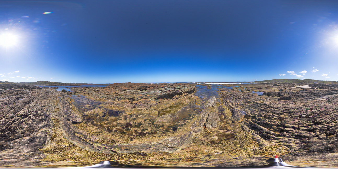
shallowly dipping, thinly bedded sandstones and siltstones. Duck Creek, west coast, Tasmania. |
1000.00 |
-41.76782000000 |
145.00378000000 |
-9999.000 |
dip, structure, sedimentology |
sandstone |
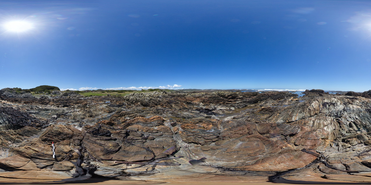
WTasFSP39 Map
 |
5 |
01/01/9999 midnight |
FSP |
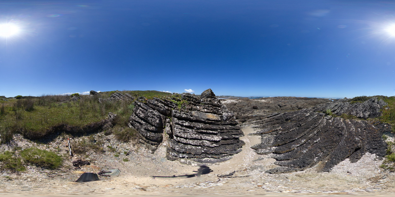
folded, finely layered, sandstones and siltstones? of the Oonah Formation. North of Duck Creek, west coast, Tasmania. |
500.00 |
-41.76513000000 |
145.00041000000 |
-9999.000 |
fold, structure, open fold, sedimentology |
sandstone |
WTasFSP4 Map
 |
5 |
01/01/9999 midnight |
FSP |
360 degree view of coastal exposure, showing White Heemskirk Granite with tourmaline orbicules. Trial Harbour, West Tasmania. |
100.00 |
-41.92263000000 |
145.15669000000 |
-9999.000 |
tourmaline, orbicules, granite, alteration |
granite |
WTasFSP40 Map
 |
5 |
01/01/9999 midnight |
FSP |
folded and faulted sedimentary rocks of the Oonah Formation. North of Duck Creek, west coast, Tasmania. |
500.00 |
-41.76544000000 |
145.00070000000 |
-9999.000 |
fault, fold, cleavage, structure |
sandstone |
WTasFSP41 Map
 |
5 |
01/01/9999 midnight |
FSP |
folded, thinly bedded sandstone beds of the Oonah Formation with faulted contact against the Eldon Group in the background. North of Duck Creek, west coast, Tasmania. |
500.00 |
-41.76550000000 |
145.00102000000 |
-9999.000 |
fold, dip, faulted contact, structure |
sandstone, sandstone |
WTasFSP42 Map
 |
5 |
01/01/9999 midnight |
FSP |
moderately to steeply dipping, sandy to calcareous shale, with spaced cleavage, cross-cut by kink bands / crenulated cleavage. North of Duck Creek, west coast, Tasmania. |
1000.00 |
-41.76572000000 |
145.00134000000 |
-9999.000 |
dip, cleavage, spaced cleavage, kink band, crenulated cleavage, structure |
shale |
WTasFSP43 Map
 |
5 |
01/01/9999 midnight |
FSP |
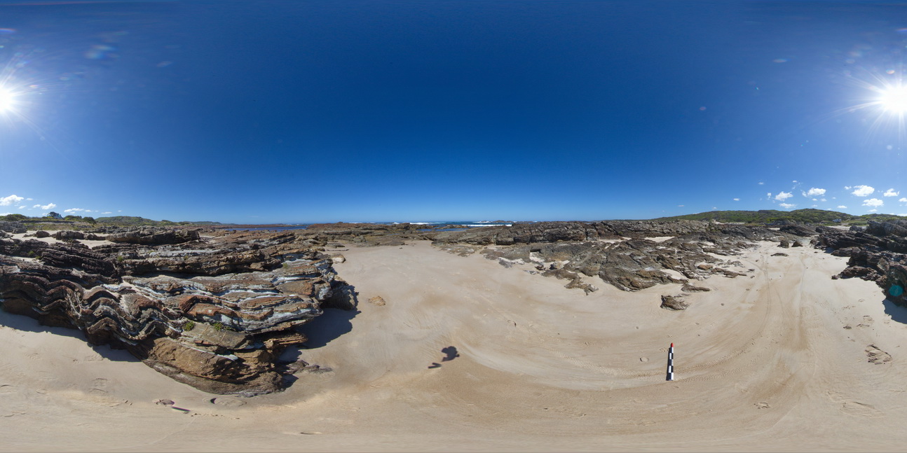
shallow to moderately dipping bedded sandstones of the Eldon Group. North of Duck Creek, west coast, Tasmania. |
250.00 |
-41.76608000000 |
145.00227000000 |
-9999.000 |
dip, bedding, structure |
sandstone |
WTasFSP44 Map
 |
5 |
01/01/9999 midnight |
FSP |
moderately dipping bedded sandstones of the Eldon Group. North of Duck Creek, west coast, Tasmania. |
1000.00 |
-41.76666000000 |
145.00233000000 |
-9999.000 |
dip, structure |
sandstone |
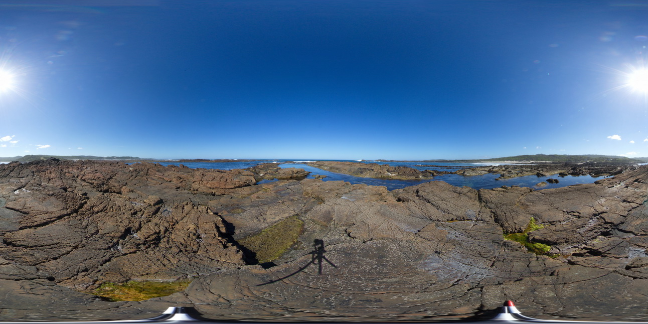
WTasFSP5 Map
 |
5 |
01/01/9999 midnight |
FSP |
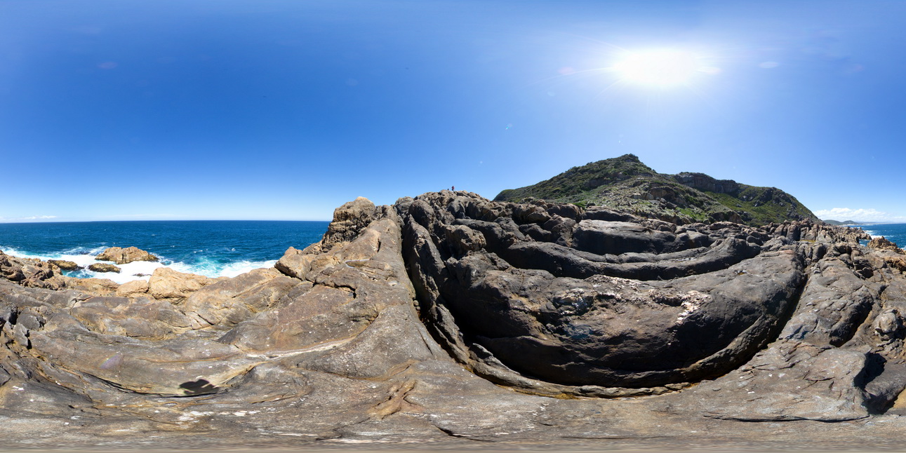
360 degree view of coastal exposure, showing the contact between the White Heemskirk Granite with tourmaline orbicules and the Red Heemskirk Granite. Trial Harbour, West Tasmania. |
100.00 |
-41.92286000000 |
145.15720000000 |
-9999.000 |
igneous contact, tourmaline orbicules |
granite, granite |
WTasFSP6 Map
 |
5 |
01/01/9999 midnight |
FSP |
360 degree view of coastal exposure, showing the contact between the White Heemskirk Granite with tourmaline orbicules and the Red Heemskirk Granite. Trial Harbour, West Tasmania. |
100.00 |
-41.92289000000 |
145.15701000000 |
-9999.000 |
igneous contact |
granite, granite |
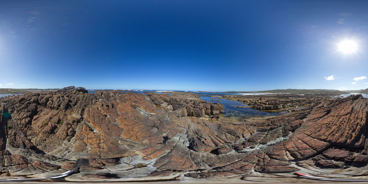
WTasFSP7 Map
 |
5 |
01/01/9999 midnight |
FSP |
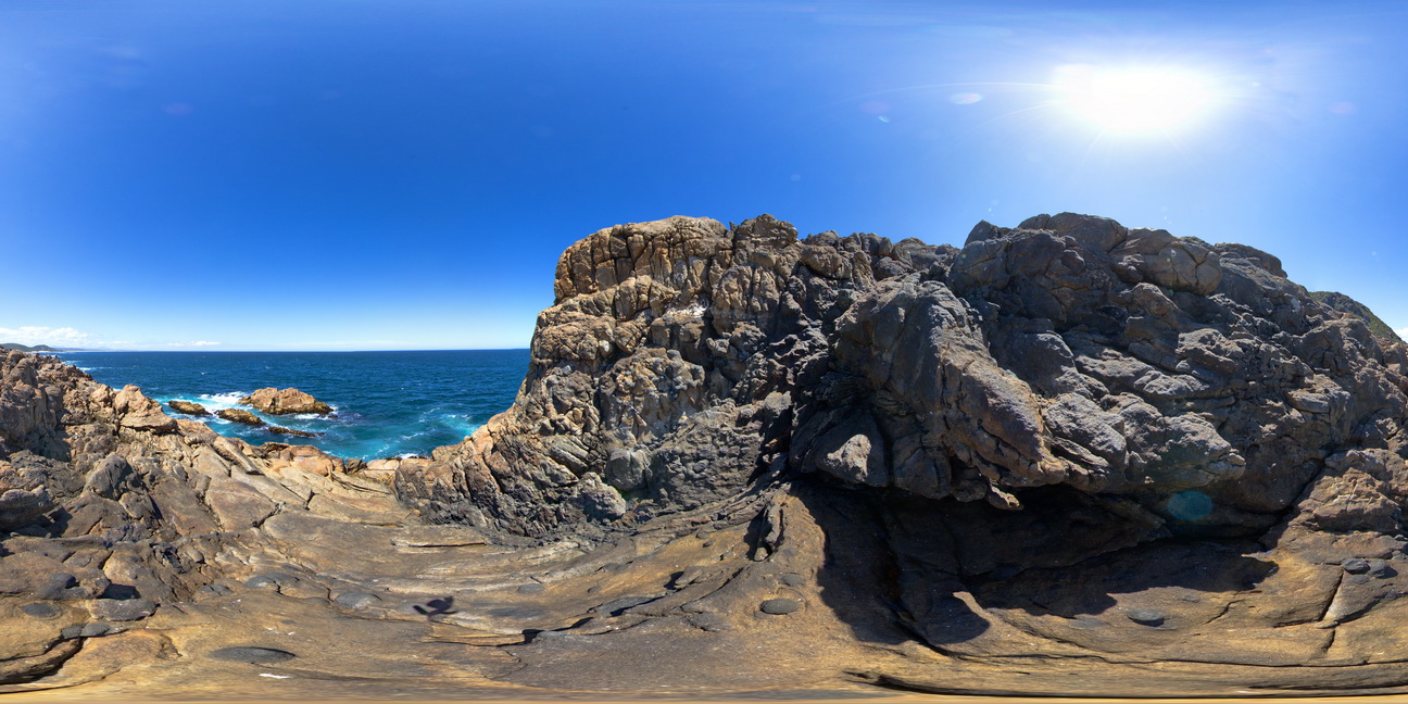
360 degree view of coastal exposure, showing the contact between the White Heemskirk Granite with tourmaline orbicules and the Red Heemskirk Granite with quartz veins. Trial Harbour, West Tasmania. |
100.00 |
-41.92303000000 |
145.15710000000 |
-9999.000 |
igneous contact |
granite, granite |
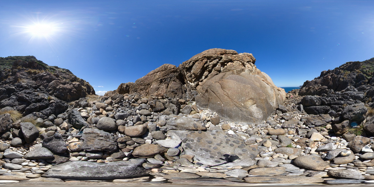
WTasFSP8 Map
 |
5 |
01/01/9999 midnight |
FSP |
360 degree view of coastal exposure, showing the contact between the Heemskirk White Granite with very large tourmaline orbicules and the Heemskirk Red Granite. Trial Harbour, West Tasmania. |
50.00 |
-41.92303000000 |
145.15695000000 |
-9999.000 |
igneous contact, tourmaline orbicule, contact alteration |
granite, granite |