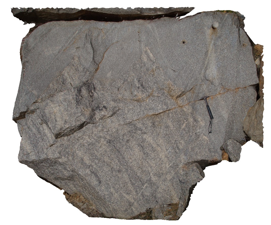
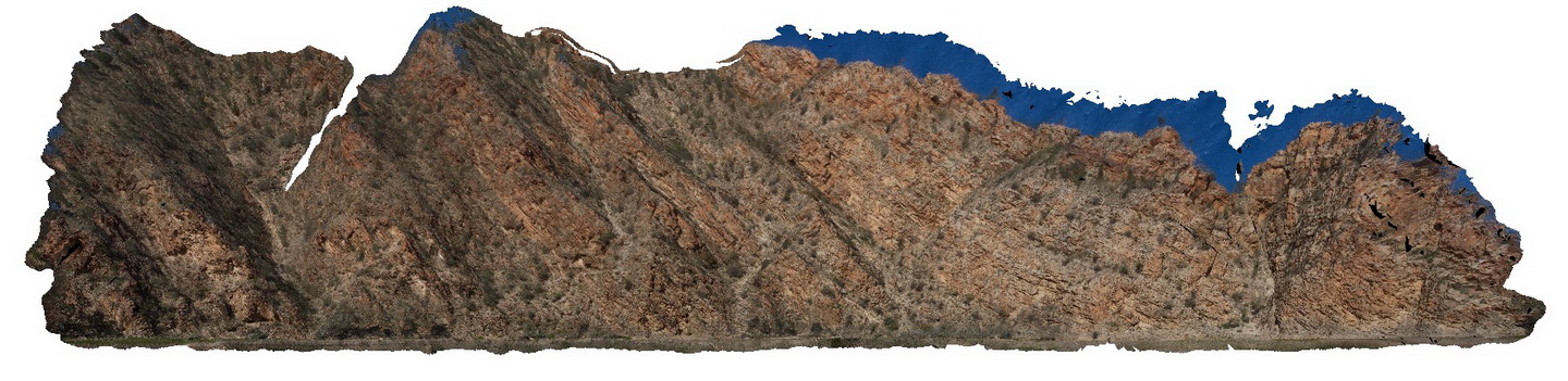
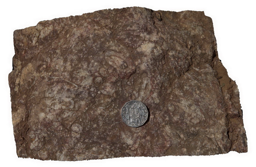
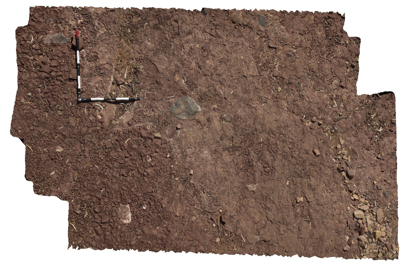
Boya1 Map
 |
5 |
03/13/2015 9:26 a.m. |
3D |
view of contact between granite and granitic? Gneiss. Boya quarry, Boya, Western Australia. |
5.00 |
-31.91516117000 |
116.06258702000 |
-9999.000 |
contact, granite, gneiss, metamorphic |
granite, gneiss |
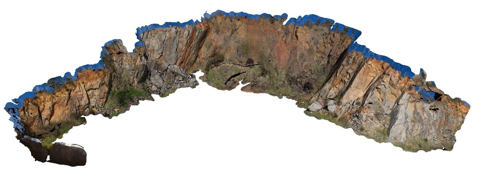
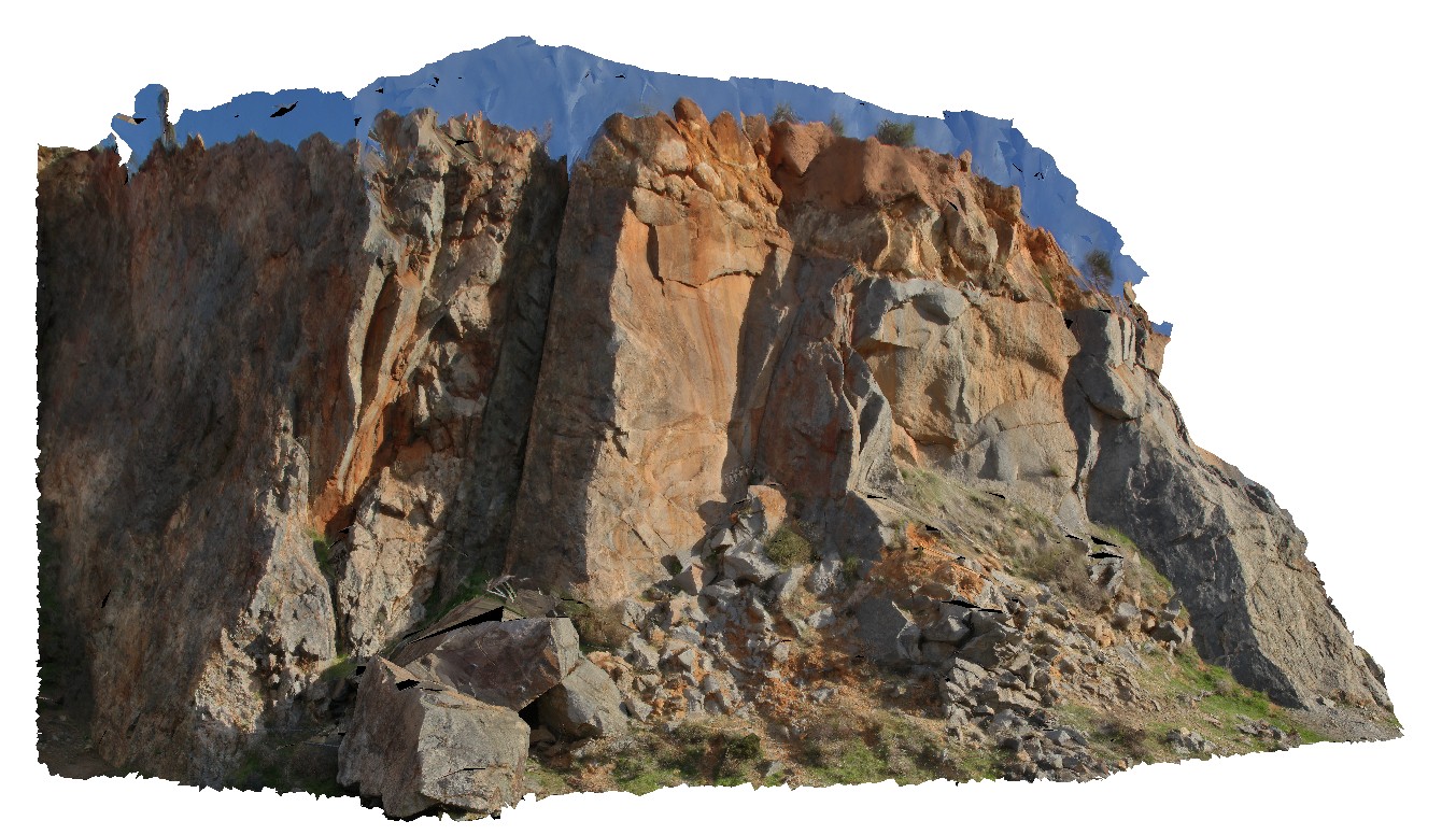
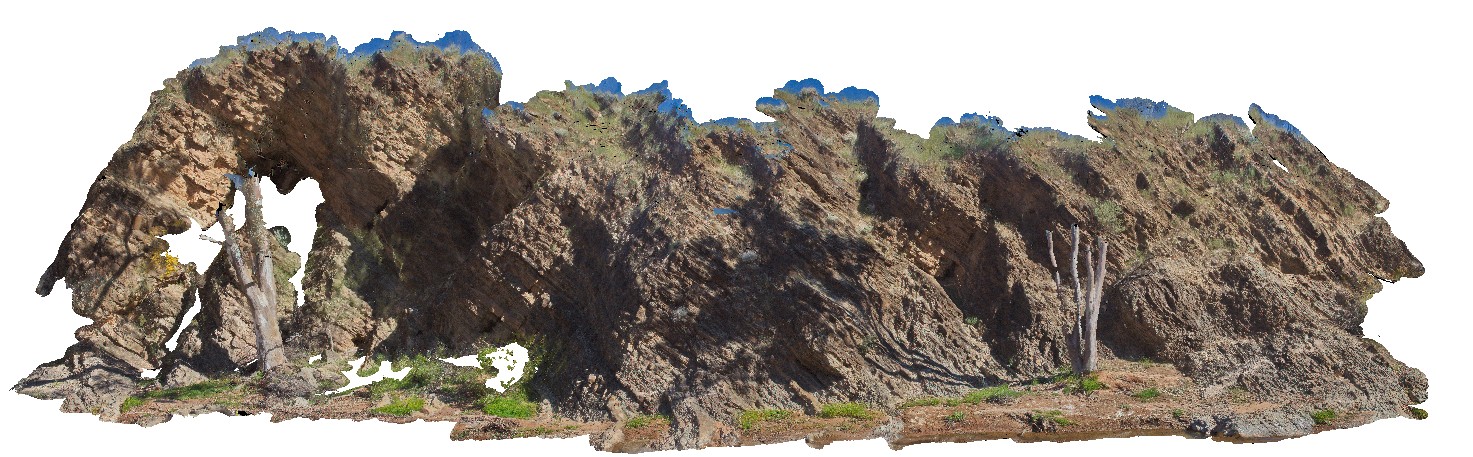
Boya2 Map
 |
10 |
03/13/2015 9:27 a.m. |
3D |
view of quarry walls, showing weathering and jointing patterns in granite and gneiss. Boya quarry, Boya, Western Australia. |
50.00 |
-31.91484580000 |
116.06239402000 |
-9999.000 |
quarry, granite, gneiss, Boya |
granite, gneiss |
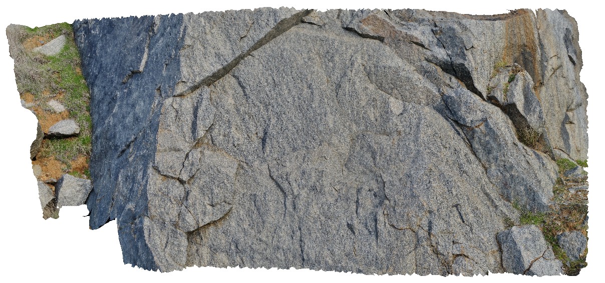
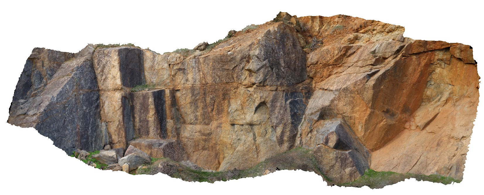
Boya3 Map
 |
20 |
01/01/9999 midnight |
3D |
view of granite quarry walls, showing joint surfaces and blocky granite. Boya quarry, Boya, Western Australia. |
10.00 |
-31.91484580000 |
116.06239402000 |
-9999.000 |
quarry, Boya, granite |
granite |
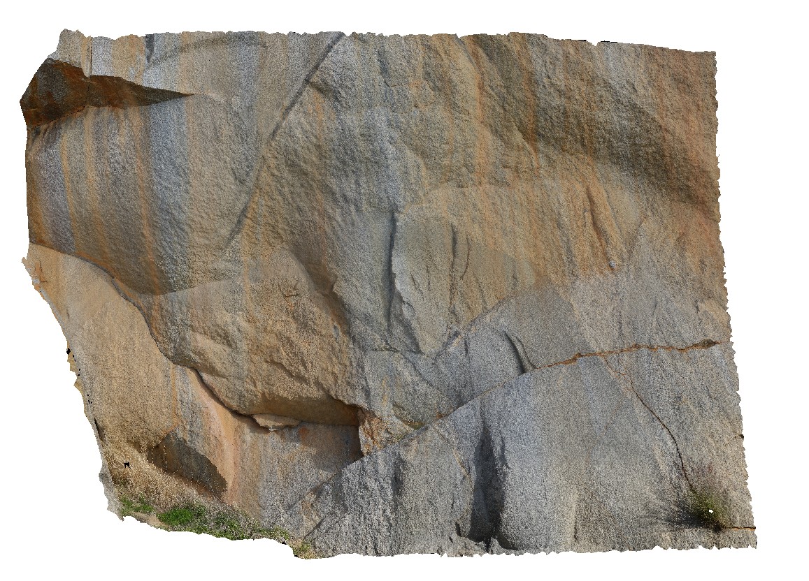
Boya4 Map
 |
20 |
01/01/9999 midnight |
3D |
view of dark mineral (manganese oxide?) coating joint surface on granite. Boya quarry, Boya, Western Australia. |
2.00 |
-31.91484580000 |
116.06239402000 |
-9999.000 |
joint surface, granite, manganese oxide |
granite |
Boya5 Map
 |
0 |
03/13/2015 9:26 a.m. |
PANO |
Boya quarry, Boya, Western Australia. |
0.00 |
-31.91484580000 |
116.06239402000 |
-9999.000 |
|
|
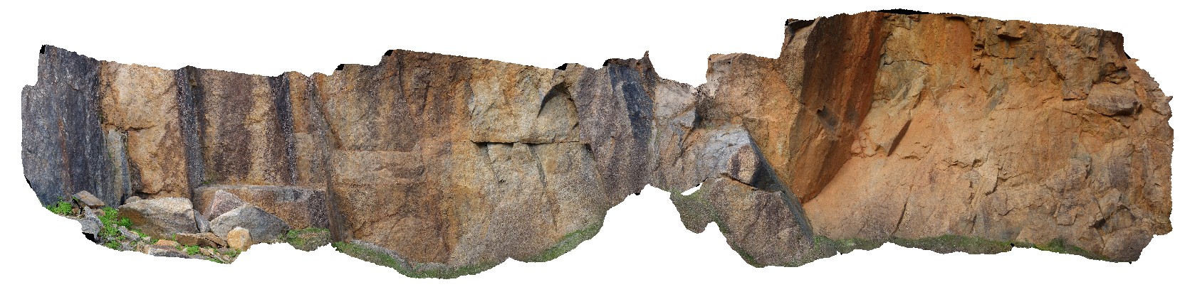
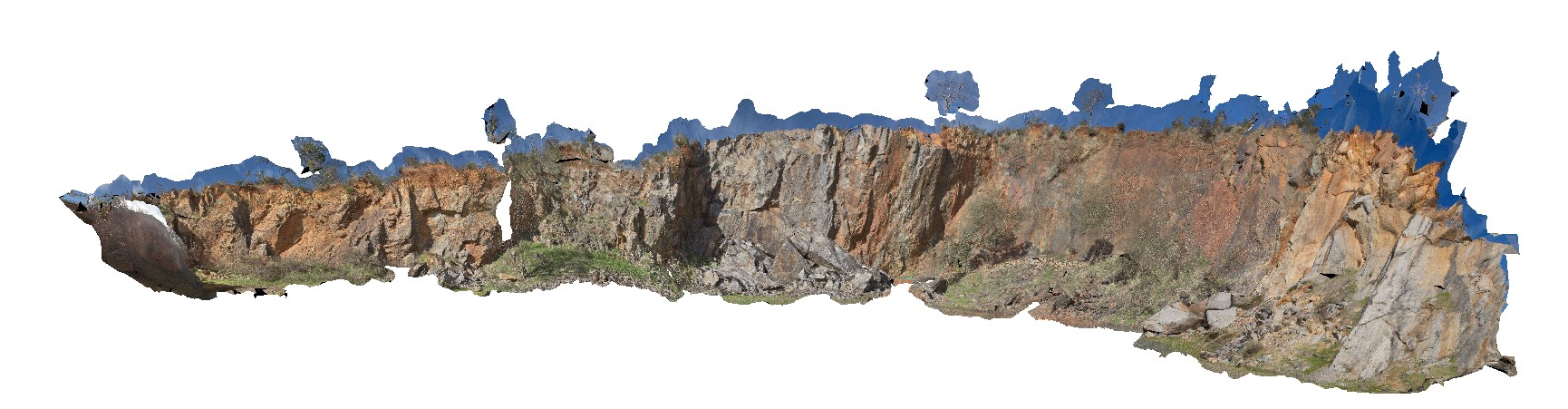
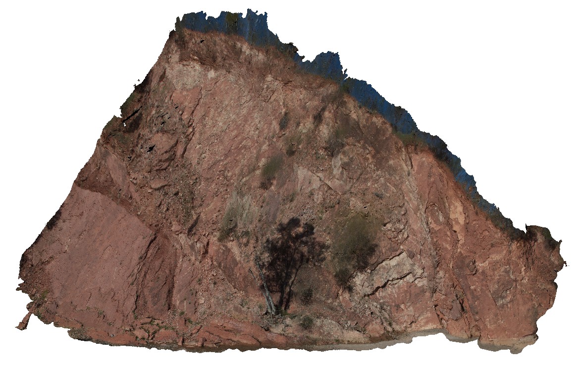
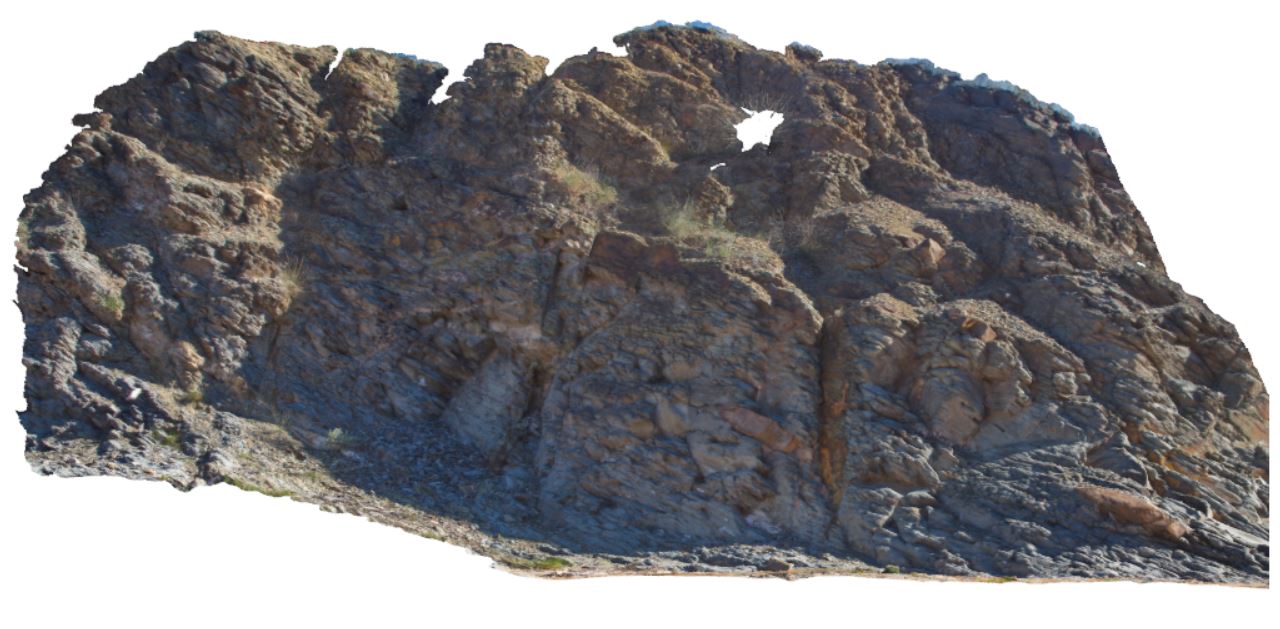
Boya7 Map
 |
20 |
04/21/2015 3:22 p.m. |
3D |
view of granite quarry walls, with joint surfaces and fault plane along one side. Boya quarry, Boya, Western Australia. |
20.00 |
-31.91484580000 |
116.06239402000 |
-9999.000 |
fault, structure, granite, Boya Quarry, joint surface |
granite, gneiss |
BoyaPole1 Map
 |
0 |
03/13/2015 9:27 a.m. |
3D |
Boya quarry, Boya, Western Australia. |
0.00 |
-31.91484580000 |
116.06239402000 |
-9999.000 |
|
|
BoyaPole2 Map
 |
0 |
03/13/2015 9:27 a.m. |
3D |
Boya quarry, Boya, Western Australia. |
0.00 |
-31.91484580000 |
116.06239402000 |
-9999.000 |
|
|
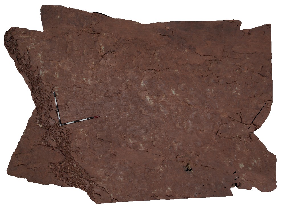
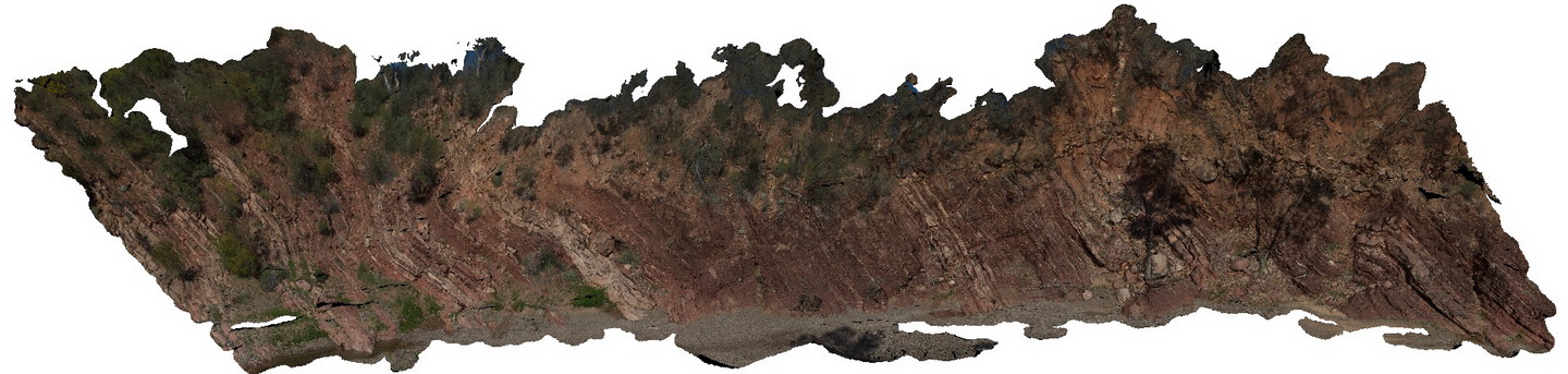
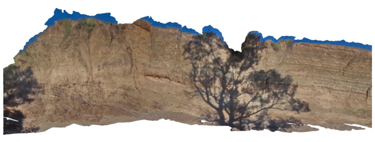
Brachina1 Map
 |
5 |
11/13/2015 2:35 p.m. |
3D |
view of large cliff section of Brachina Gorge, showing moderately dipping, bedded sediments on the Brachina Gorge Road. S.A. |
250.00 |
-31.33686000000 |
138.54781000000 |
-9999.000 |
Bedding |
Siltstone |
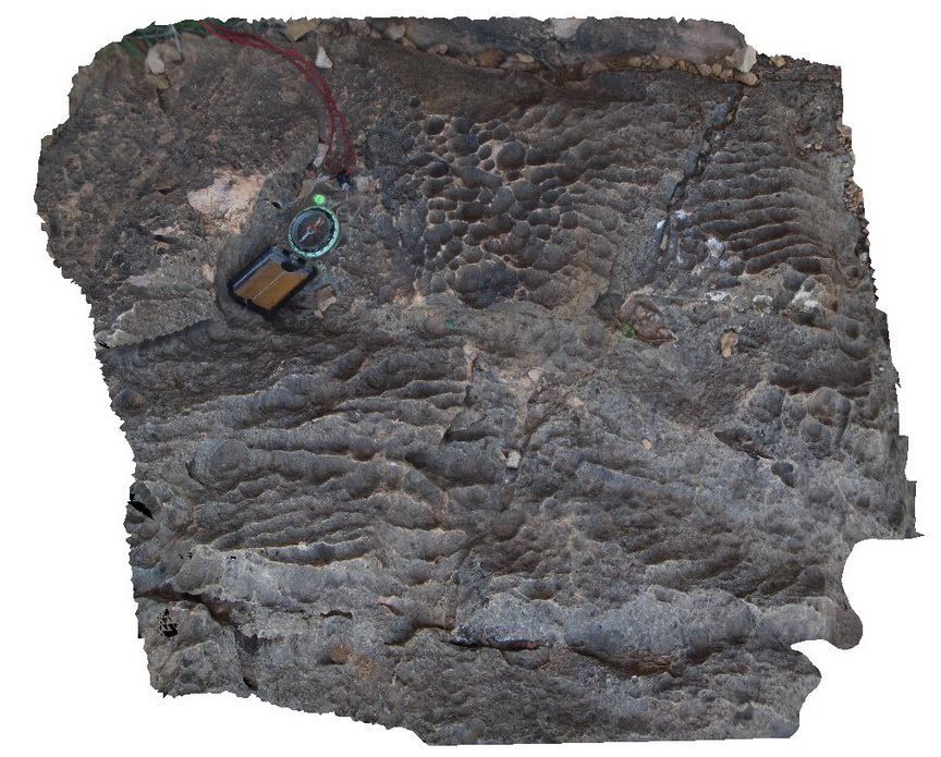
Brachina10 Map
 |
5 |
11/17/2015 8:08 a.m. |
3D |
surface solution features in Wilkawillina Limestone, Brachina Gorge. S.A. |
0.40 |
-31.33686000000 |
138.54781000000 |
-9999.000 |
karst features |
limestone |
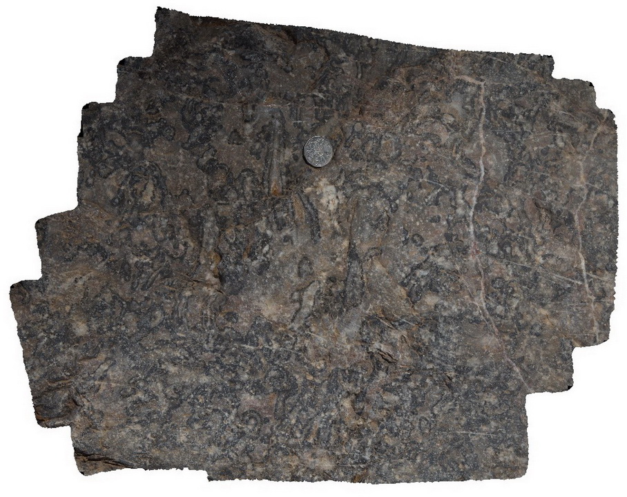
Brachina11 Map
 |
5 |
11/17/2015 8:23 a.m. |
3D |
detail of Archaeocyatha bearing carbonates of the Wilkawillina Limestone, Brachina Gorge. S.A. |
0.30 |
-31.33817000000 |
138.54636000000 |
-9999.000 |
Archaeocyatha, palaeontology, fossil |
limestone |
Brachina12 Map
 |
5 |
11/17/2015 8:24 a.m. |
3D |
detail of Archaeocyatha bearing carbonates of the Wilkawillina Limestone, Brachina Gorge. S.A. |
0.50 |
-31.33817000000 |
138.54636000000 |
-9999.000 |
Archaeocyatha, palaeontology, fossil |
limestone |
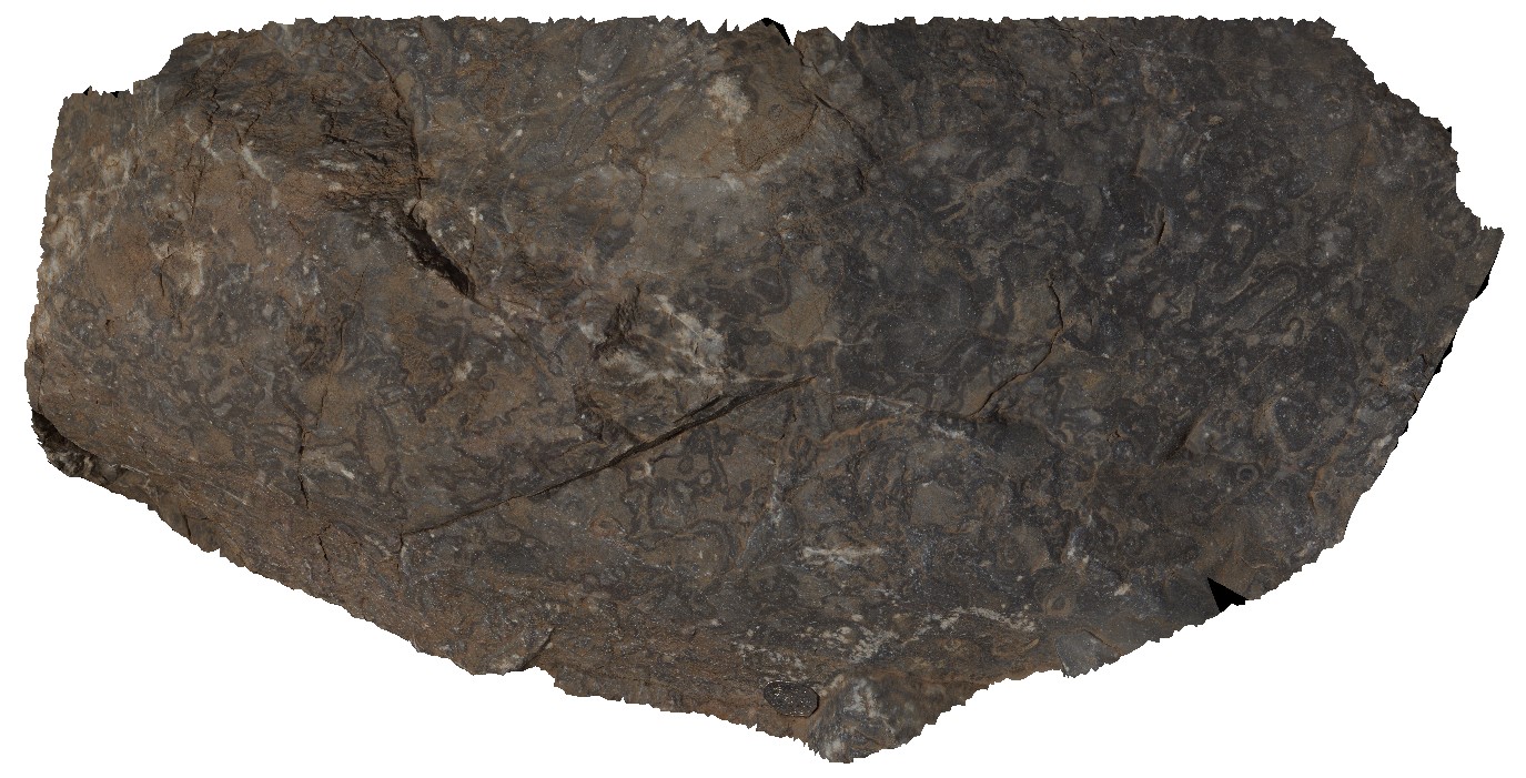
Brachina13 Map
 |
5 |
11/17/2015 8:25 a.m. |
3D |
detail of Archaeocyatha in carbonate in Wilkawillina Limestone. Brachina Gorge. S.A. |
0.20 |
-31.33800000000 |
138.54625000000 |
-9999.000 |
Archaeocyatha, limestone, palaeontology, fossil |
limestone |
Brachina15 Map
 |
5 |
11/17/2015 8:25 a.m. |
3D |
cliff exposure, showing large bedding / dip slope in red Bonney Formation. Brachina, S.A. |
15.00 |
-31.33542000000 |
138.56320000000 |
-9999.000 |
bedding |
sandstone |
Brachina16 Map
 |
5 |
11/17/2015 8:26 a.m. |
3D |
lumpy bedforms on bedding on surface of Bonney Sandstone, Brachina Gorge. S.A. |
0.00 |
-31.33549000000 |
138.56331000000 |
-9999.000 |
bedforms, sedimentology |
sandstone |
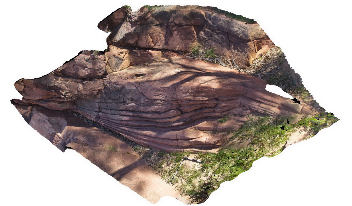
Brachina17 Map
 |
5 |
11/17/2015 8:26 a.m. |
3D |
large-scale crossbedding in Bonney Sandstone. Brachina Gorge. S.A. |
5.00 |
-31.33482000000 |
138.56602000000 |
-9999.000 |
cross-bedding, sedimentology |
sandstone |
Brachina18 Map
 |
5 |
11/17/2015 8:27 a.m. |
3D |
large exposure of the Wonoka Formations showing moderately dipping siltstone, sandstone and thin limestone beds. Brachina Gorge. S.A. |
20.00 |
-31.33287000000 |
138.57057000000 |
-9999.000 |
bedding |
siltstone |
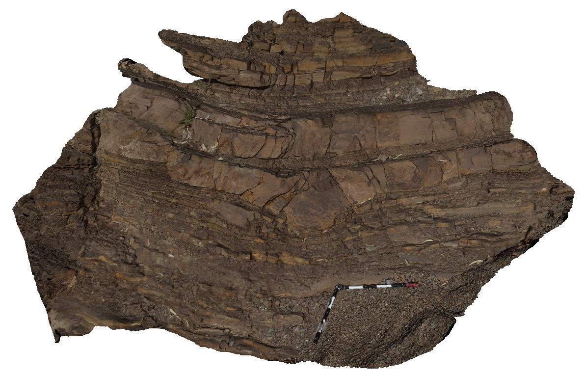
Brachina19 Map
 |
5 |
11/17/2015 8:27 a.m. |
3D |
moderately dipping, fissile mudstone beds, with blocky (siltstone/sandstone?) boudins, cut by high angle fault. Location near Brachina Gorge road junction with Aroona Valley Road. S.A. |
6.00 |
-31.32972000000 |
138.58800000000 |
-9999.000 |
bedding, fault, structure |
mudstone |
Brachina2 Map
 |
5 |
11/13/2015 2:36 p.m. |
3D |
large outcrop of moderately to steeply dipping and folded Bonney Sandstone. Brachina Gorge road. S.A. |
12.00 |
-31.33788000000 |
138.56290000000 |
-9999.000 |
folds, bedding |
sandstone |
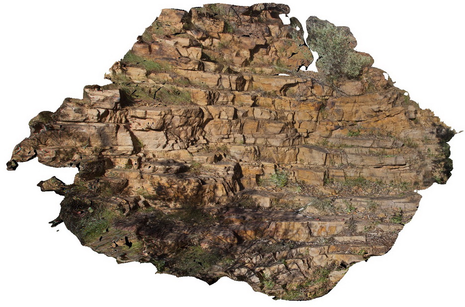
Brachina20 Map
 |
5 |
11/17/2015 8:28 a.m. |
3D |
view of ABC Range Quartzite, showing very gently dipping bedding and cross-beds. Brachina Gorge. S.A. |
4.00 |
-31.33305000000 |
138.59460000000 |
-9999.000 |
bedding, quartzite, cross beds |
quartzite |
Brachina21 Map
 |
5 |
11/17/2015 9:23 a.m. |
3D |
large cliff exposure, showing angular unconformity between gently dipping and openly folded Brachina Formation siltstone and overlying Quaternary lacustrine sediments. Brachina Gorge road. S.A. |
20.00 |
-31.33818000000 |
138.60651000000 |
-9999.000 |
unconformity, sedimentology |
siltstone, silts |
Brachina22 Map
 |
5 |
11/17/2015 9:44 a.m. |
3D |
detail of small sand channels in Brachina Formation, including cross-bedding in sandstone, Brachina Gorge Road. S.A. |
3.00 |
-31.33824000000 |
138.60661000000 |
-9999.000 |
cross-bedding, sedimentology |
sandstone |
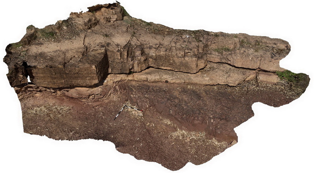
Brachina23 Map
 |
5 |
11/17/2015 9:44 a.m. |
3D |
Locality of the Golden Spike of the Ediacaran Period, showing the contact between diamictite of the Elatina Formation and the dolomite of the Nuccaleena Formation. Pictures also shows sampling holes. Trezona Loop walk, Brachina. S.A. |
5.50 |
-31.33156000000 |
138.63342000000 |
-9999.000 |
Golden Spike, Ediacaran Period, Sedimentology |
diamictite, dolomite |
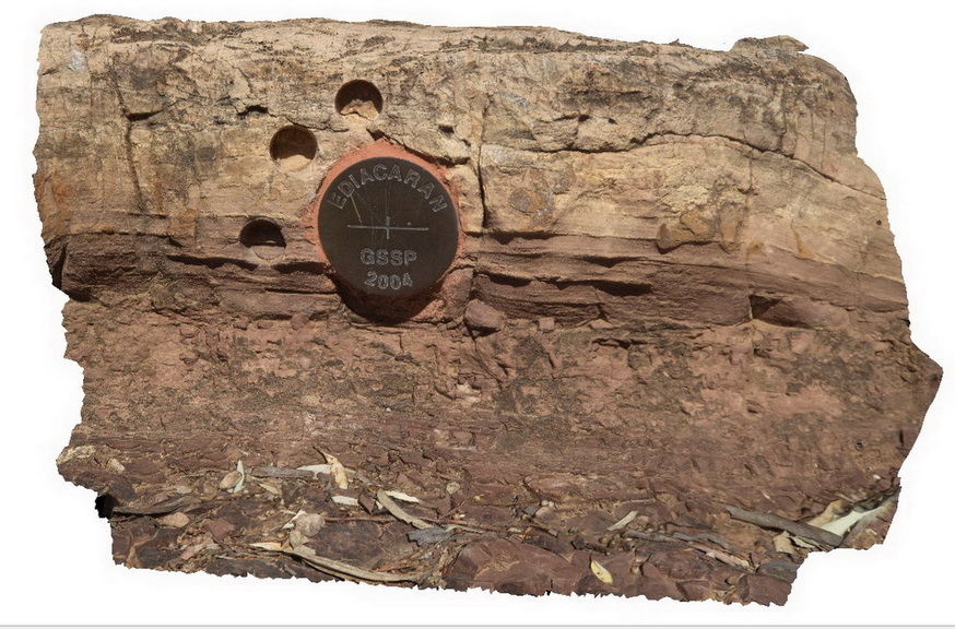
Brachina24 Map
 |
5 |
11/17/2015 9:45 a.m. |
3D |
Locality of the Golden Spike of the Ediacaran Period, showing the contact between diamictite of the Elatina Formation and the dolomite of the Nuccaleena Formation. Pictures also shows sampling holes. Trezona Loop walk, Brachina. S.A. |
0.15 |
-31.33156000000 |
138.63342000000 |
-9999.000 |
Golden Spike, Ediacaran Period, stratigraphy |
diamictite, dolomite |
Brachina25 Map
 |
5 |
11/17/2015 9:45 a.m. |
3D |
detail of the diamictite of the Elatina Formation near Golden Spike locality, Brachina. S.A. |
3.50 |
-31.33155000000 |
138.63344000000 |
-9999.000 |
diamictite, Golden Spike, Ediacaran Period |
diamictite |