BomboFSP3 Map
 |
5 |
08/25/2015 12:20 p.m. |
FSP |
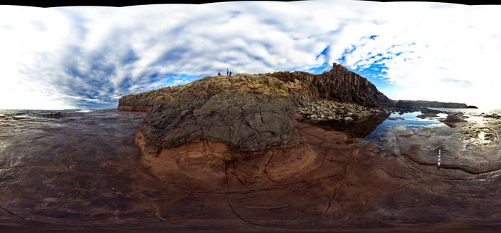
View of the contact between the Bombo Latite and the underlying tuffaceous sandstones. Bombo, N.S.W. |
50.00 |
-34.65239000000 |
150.86319000000 |
1.000 |
volcanology, sedimentology |
latite, sandstone |
BomboFSP4 Map
 |
5 |
08/25/2015 12:20 p.m. |
FSP |
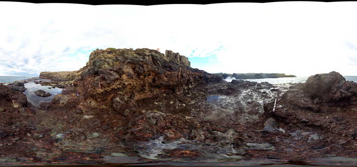
View of the contact between the Permian Bumbo Latite and an underlying volcanic breccia. Bombo, N.S.W. |
50.00 |
-34.65204000000 |
150.86305000000 |
1.000 |
breccia, volcanology |
latite, breccia |
BomboFSP5 Map
 |
5 |
08/25/2015 12:20 p.m. |
FSP |
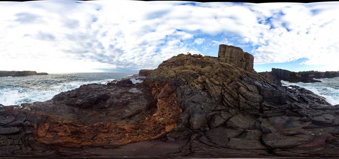
View of the contact between the Permian Bumbo Latite and an underlying volcanic breccia. Bombo, N.S.W. |
50.00 |
-34.65197000000 |
150.86296000000 |
2.000 |
volcanology |
latite |
Booti1 Map
 |
5 |
07/08/2015 9:43 a.m. |
3D |
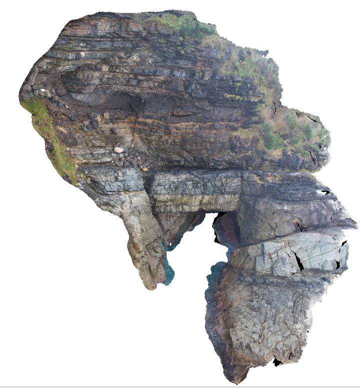
Dipping thickly bedded sandstone and minor siltstone of the Booti Booti Sandstone with a sea cave. Booti Booti, N.S.W. |
12.00 |
-32.31560000000 |
152.52878000000 |
5.000 |
sandstone, sea cave, fault, sedimentology, geomorphology |
sandstone |
Booti2 Map
 |
5 |
07/08/2015 9:44 a.m. |
3D |
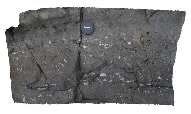
Brachiopod valve casts infilled by calcite in Carboniferous sandstone of the Booti Booti Sandstone. Booti Booti, N.S.W. |
0.70 |
-32.31560000000 |
152.52880000000 |
5.000 |
sandstone, brachiopods, fossils, sedimentology, palaeontology |
sandstone |
Booti3 Map
 |
5 |
07/08/2015 9:45 a.m. |
3D |
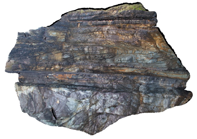
Cross bedding in thickly bedded sandstone layers of the Carboniferous Booti Booti Sandstone. Booti Booti, N.S.W. |
10.00 |
-32.31627000000 |
152.52956000000 |
8.000 |
sandstone, cross bedding, sedimentology |
sandstone |
Booti4 Map
 |
5 |
07/08/2015 9:46 a.m. |
3D |
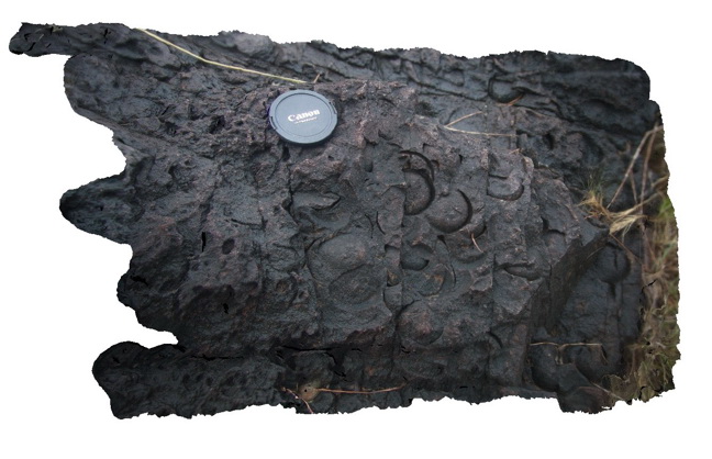
Casts of brachiopod valves in medium to coarse grained sandstone of the Carboniferous Booti Booti Sandstone. Booti Booti, N.S.W. |
0.60 |
-32.31584000000 |
152.52887000000 |
8.000 |
sandstone, fossils, brachiopods, sedimentology, palaeontology |
sandstone |
Bouddi1 Map
 |
5 |
07/08/2015 9:54 a.m. |
3D |
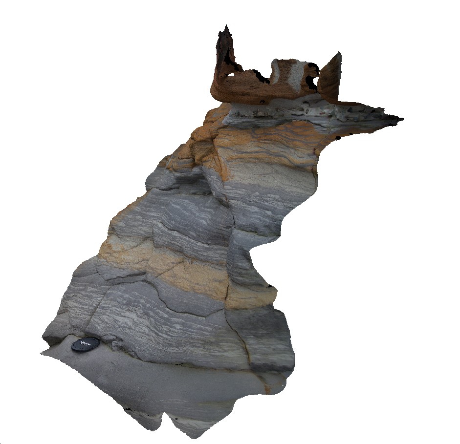
Ripple cross laminations and bioturbation in sand/silt layers of the fluvial Triassic Narrabeen Group. Gerrin Point, N.S.W. |
1.00 |
-33.53091000000 |
151.37502000000 |
5.000 |
ripples, bioturbation, sandstone, siltstone, sedimentology, palaeontology |
sandstone, siltstone |
Bouddi2 Map
 |
5 |
07/08/2015 9:55 a.m. |
3D |
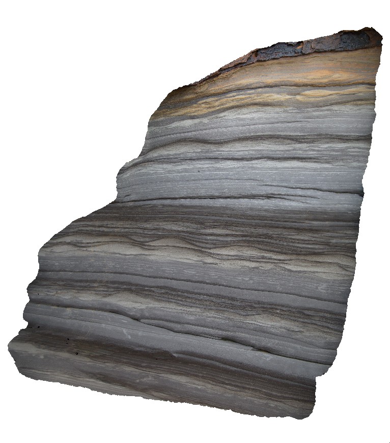
Ripples in thin sandstone layers interbedded with grey, bioturbated siltstone of the Triassic Narrabeen Group. No scale - ripples are ~0.15m half wavelength. Gerrin Point, N.S.W. |
1.00 |
-33.53093000000 |
151.37502000000 |
7.000 |
sandstone, siltstone, ripples, bioturbation, sedimentology |
sandstone, siltstone |
Bouddi3 Map
 |
5 |
07/08/2015 9:57 a.m. |
3D |
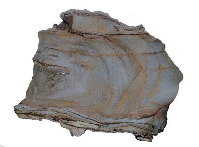
Cross bedded medium to coarse grained quartz sandstone of the Triassic Narrabeen Group. Gerrin Point, N.S.W. |
5.00 |
-33.53099000000 |
151.37500000000 |
7.000 |
sandstone, cross bedded, sedimentology |
sandstone |
Bouddi4 Map
 |
5 |
07/08/2015 9:58 a.m. |
3D |
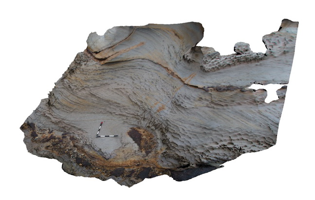
cross-bedded sandstone with honeycomb weathering and a pebble lag deposit - Triassic Narabeen Group. Gerrin Point, N.S.W. |
5.00 |
-33.53096000000 |
151.37479000000 |
4.000 |
sandstone, cross bedded, honeycomb weathering, pebble lag, sedimentology |
sandstone |
Bouddi5 Map
 |
5 |
07/08/2015 9:59 a.m. |
3D |
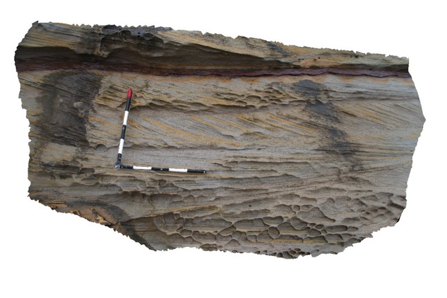
cross bedded sandstone with honeycomb weathering - Triassic Narrabeen Group. Gerrin Point, N.S.W. |
2.00 |
-33.53091000000 |
151.37473000000 |
5.000 |
sandstone, cross bedded, sedimentology, honeycomb weathering |
sandstone |
Bouddi6 Map
 |
5 |
07/08/2015 9:59 a.m. |
3D |
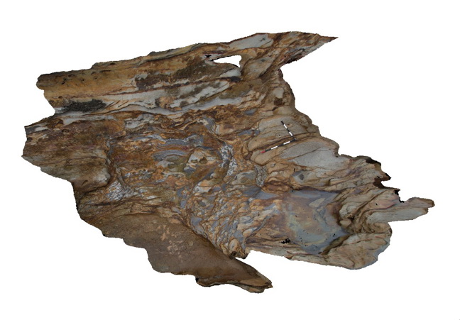
Intraformational breccia with mudstone rip-up clasts in sandstone of the Triassic Narrabeen Group. Gerrin Point, N.S.W. |
5.00 |
-33.53039000000 |
151.37462000000 |
1.000 |
sandstone, intraformational breccia, mudstone, rip-up clasts, sedimentology |
breccia |
Bouddi7 Map
 |
5 |
07/08/2015 10 a.m. |
3D |
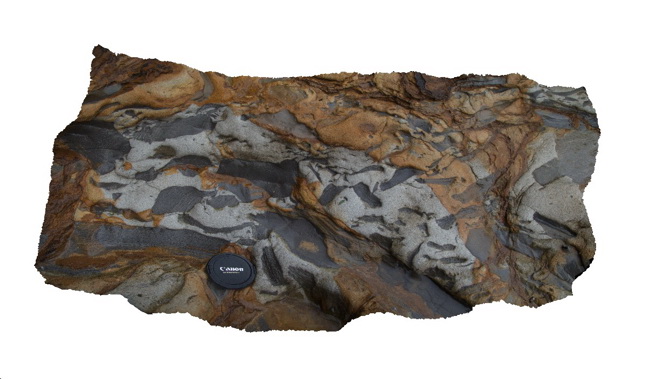
Detail of intraformational breccia with mudstone rip-up clasts in a matrix of medium grained sandstone - Triassic Narrabeen Group. Gerrin Point, N.S.W. |
0.80 |
-33.53039000000 |
151.37462000000 |
1.000 |
sandstone, mudstone, rip-up clasts, intraformational breccia, sedimentology |
breccia |
BouddiFSP1 Map
 |
5 |
08/25/2015 12:31 p.m. |
FSP |
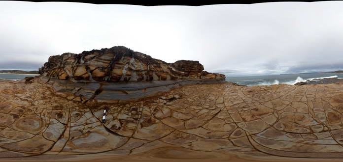
Medium to coarse grained, jointed quartz sandstone with thin silty interbeds. Triassic Narrabeen Group. Gerrin Point, N.S.W. |
50.00 |
-33.53085000000 |
151.37488000000 |
4.000 |
sedimentology, fluvial, joints, structure |
sandstone |
BouddiFSP2 Map
 |
5 |
08/25/2015 12:34 p.m. |
FSP |
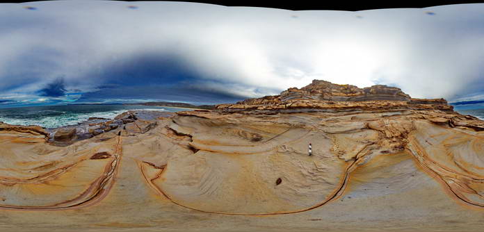
Medium to coarse grained, jointed, cross bedded quartz sandstone with thin silty interbeds. Triassic Narrabeen Group. Gerrin Point, N.S.W. |
50.00 |
-33.53100000000 |
151.37498000000 |
4.000 |
fluvial, sedimentology, joints, cross bedding structure |
sandstone |
BouddiFSP3 Map
 |
5 |
08/28/2015 12:01 p.m. |
FSP |
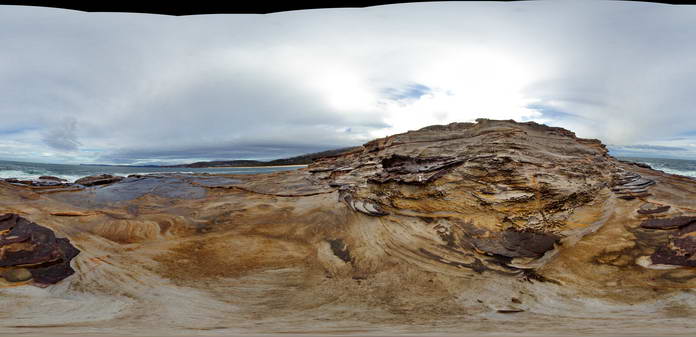
Medium to coarse grained, jointed, cross bedded quartz sandstone with honeycomb weathering. Triassic Narrabeen Group. Gerrin Point, N.S.W. |
50.00 |
-33.53098000000 |
151.37471000000 |
3.000 |
sedimentology, fluvial, honeycomb weathering |
sandstone |
BouddiFSP4 Map
 |
5 |
08/27/2015 9:48 a.m. |
FSP |
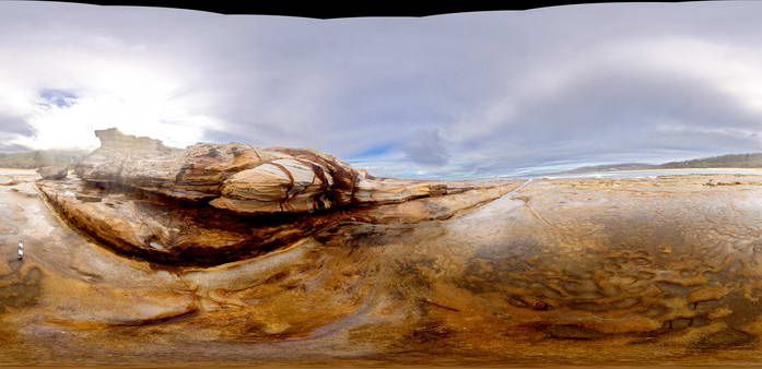
Medium to coarse grained, jointed, cross bedded quartz sandstone with honeycomb weathering. Triassic Narrabeen Group. Extreme contrast variation. Gerrin Point, N.S.W. |
50.00 |
-33.53080000000 |
151.37433000000 |
1.000 |
sedimentology, cross bedding, fluvial |
sandstone |
BouddiFSP5 Map
 |
5 |
09/02/2015 9:46 a.m. |
FSP |
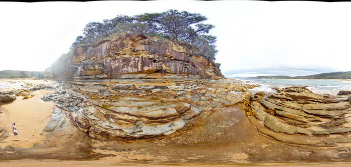
Medium to coarse grained, jointed, cross bedded quartz sandstone with honeycomb weathering, thin siltstone interbeds and intraformational breccia. Triassic Narrabeen Group. Gerrin Point, N.S.W. |
50.00 |
-33.53037000000 |
151.37471000000 |
0.000 |
sedimentology, fluvial, intraformational breccia |
sandstone |
BowRiver1 Map
 |
5 |
06/11/2016 noon |
3D |
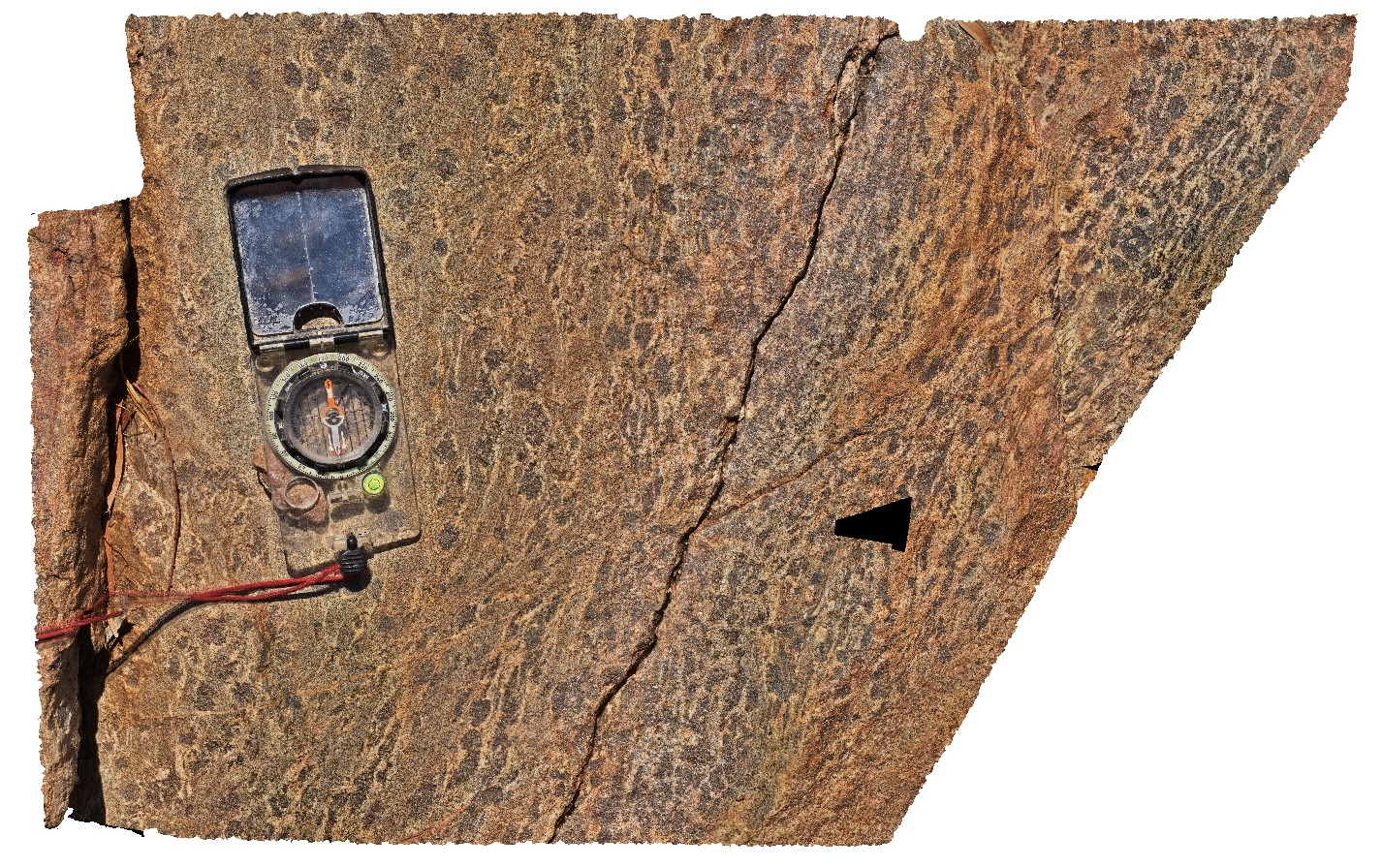
close-up view of cordierite and muscovite / biotite migmatite with leucosomes wrapping cordierite porphyroblasts. Near junction of Bow and Wilson rivers. Great Northern Highway, W.A. |
0.60 |
-16.79276000000 |
128.28146000000 |
-9999.000 |
migmatite, cordierite |
migmatite |
BowRiver2 Map
 |
5 |
06/11/2016 noon |
3D |
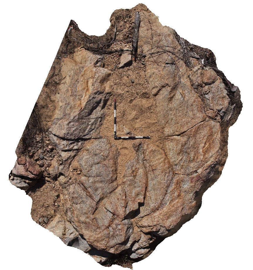
outcrop of cordierite and muscovite / biotite migmatite. Near junction of Bow and Wilson rivers. Great Northern Highway, W.A. |
3.70 |
-16.79276000000 |
128.28146000000 |
-9999.000 |
cordierite, migmatite, structure |
migmatite |
BowRiver3 Map
 |
5 |
06/11/2016 noon |
3D |
outcrop of granite / migmatite contact, with quartz-tourmaline banded veins perpendicular to and truncated at contact. Near junction of Bow and Wilson rivers. Great Northern Highway, W.A. |
5.50 |
-16.79272000000 |
128.28047000000 |
-9999.000 |
migmatite contact, granite, migmatite, vein, tourmaline |
migmatite, granite |
BowRiver4 Map
 |
5 |
06/11/2016 noon |
3D |
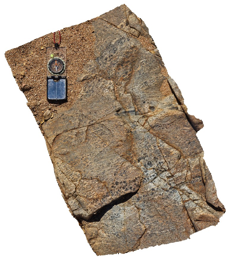
outcrop of cordierite-muscovite / biotite migmatite. Near junction of Bow and Wilson rivers. Great Northern Highway, W.A. |
0.80 |
-16.79303000000 |
128.28053000000 |
-9999.000 |
migmatite, cordierite |
migmatite |
BowRiver5 Map
 |
5 |
06/11/2016 noon |
3D |
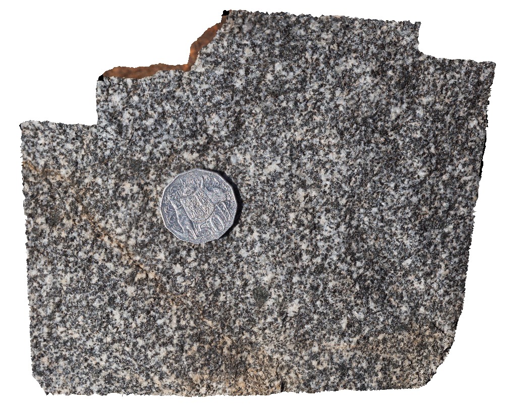
outcrop of tonalite near junction of Bow and Wilson rivers. Great Northern Highway, W.A. |
0.20 |
-16.83981000000 |
128.27097000000 |
-9999.000 |
tonalite, granite |
tonalite |
BowRiver6 Map
 |
5 |
06/11/2016 noon |
3D |
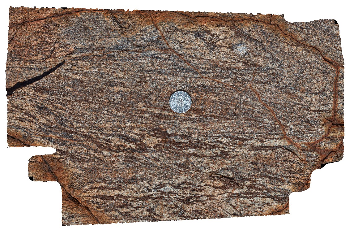
view of augen gneiss, near junction of Bow and Wilson rivers. Great Northern Highway, W.A. |
0.50 |
-16.91609000000 |
128.25923000000 |
-9999.000 |
augen gneiss |
gneiss |


