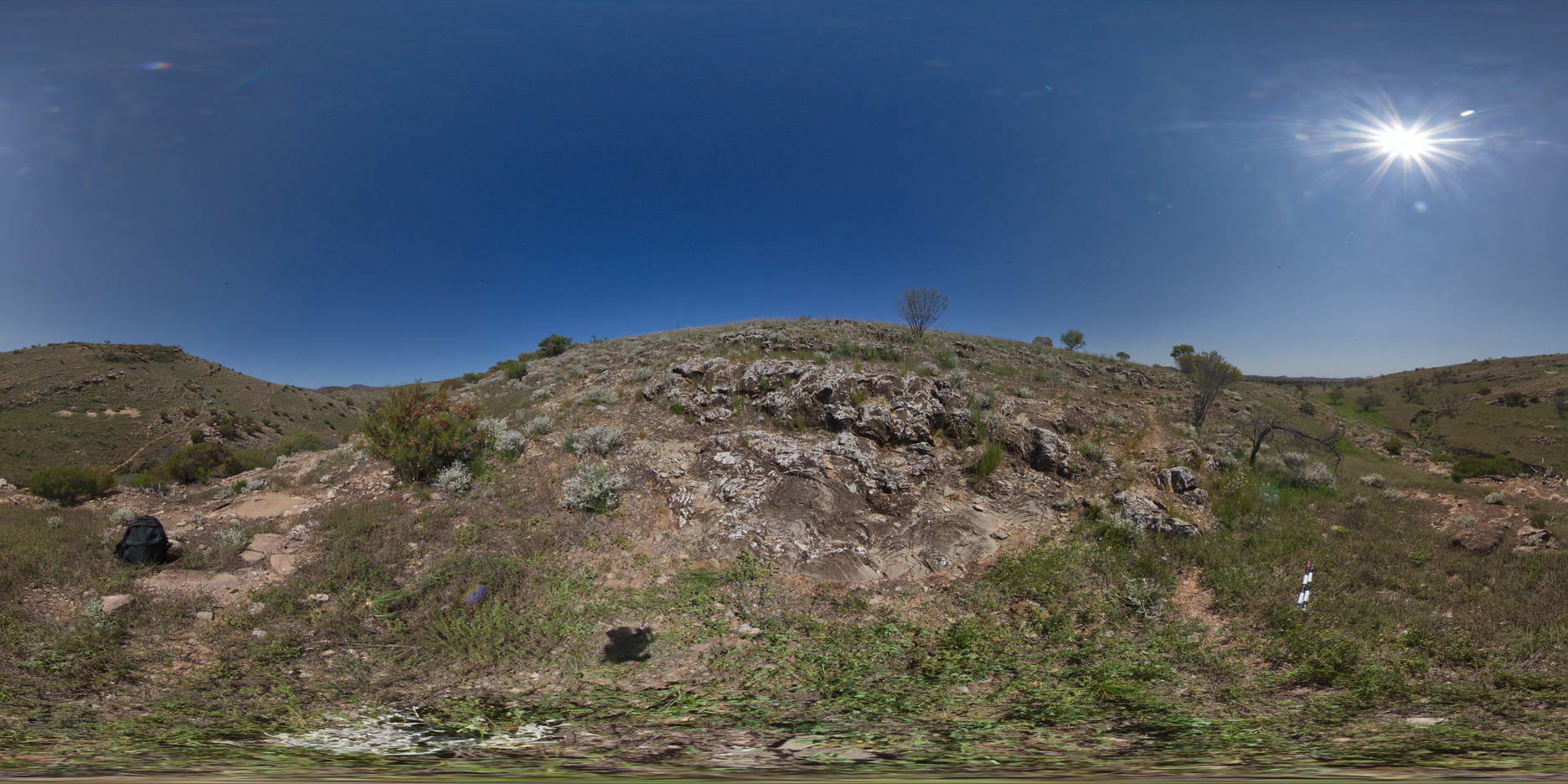
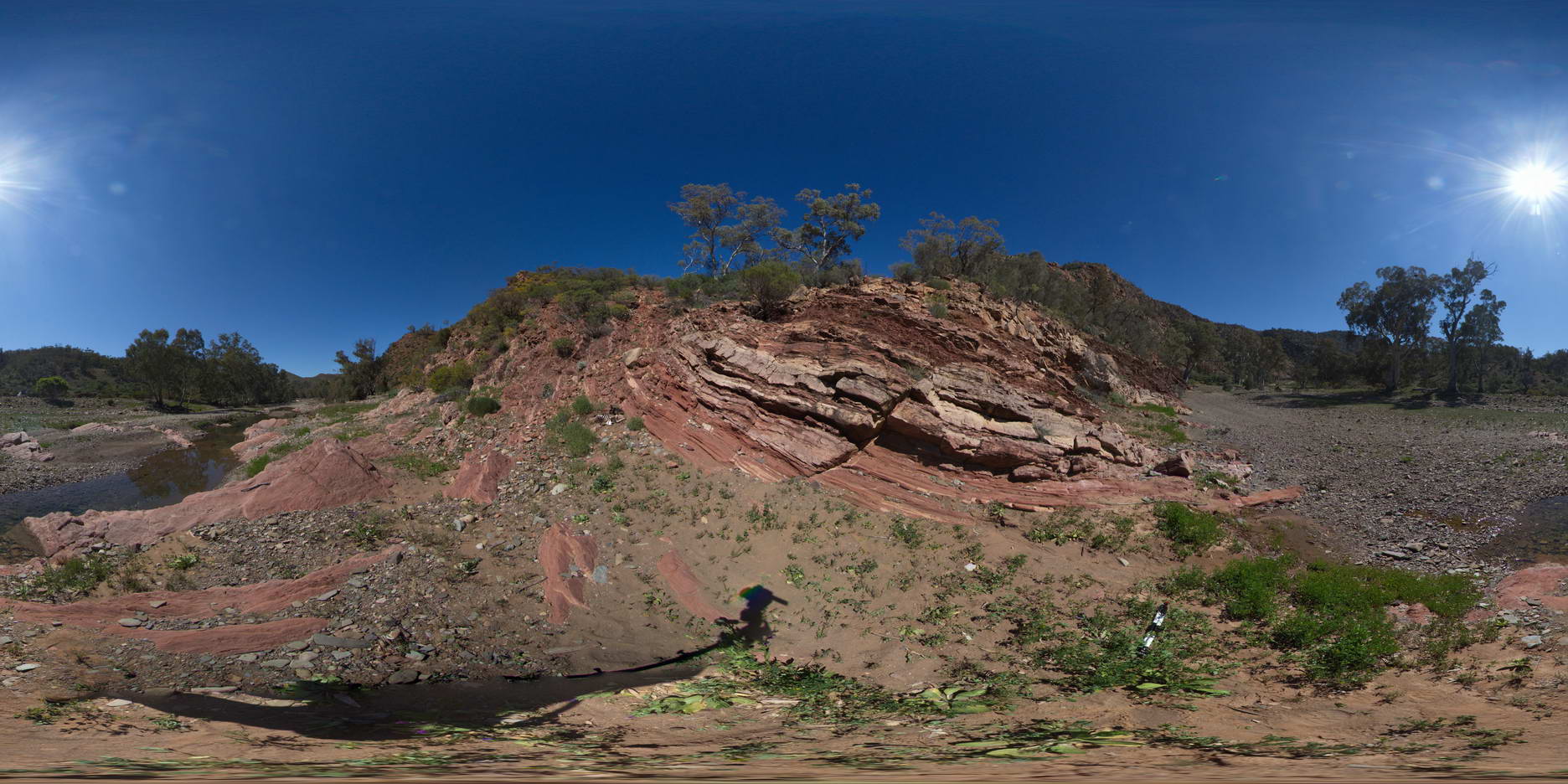
BrachinaFSP14 Map
 |
5 |
11/27/2015 11:52 a.m. |
FSP |
stromatolites exposed on hillside outcrop, Trezone Formation, Brachina. S.A. |
1000.00 |
-31.32737000000 |
138.64305000000 |
-9999.000 |
stromatolite, stratigraphy, palaeontology, fossil |
limestone |
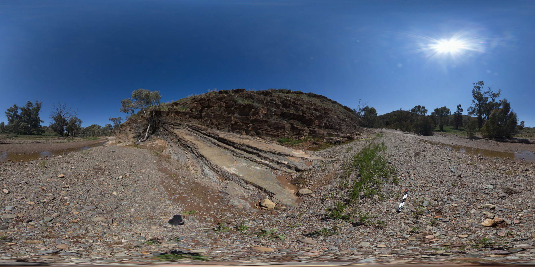
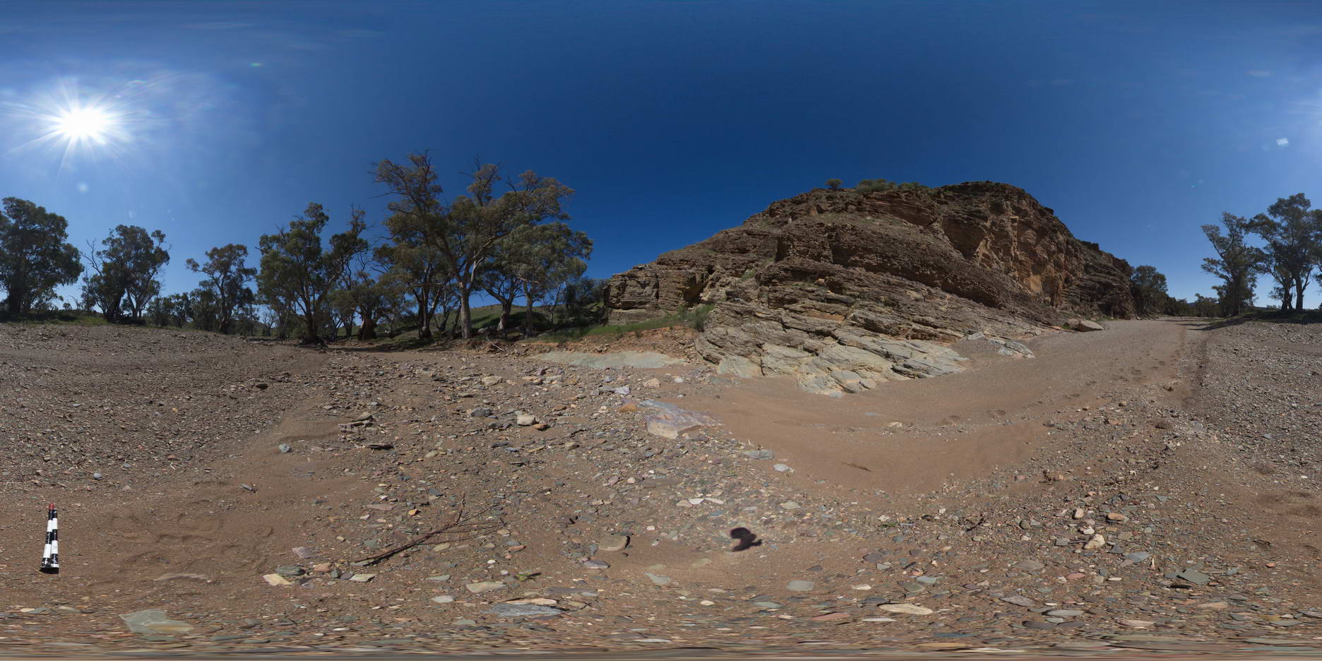
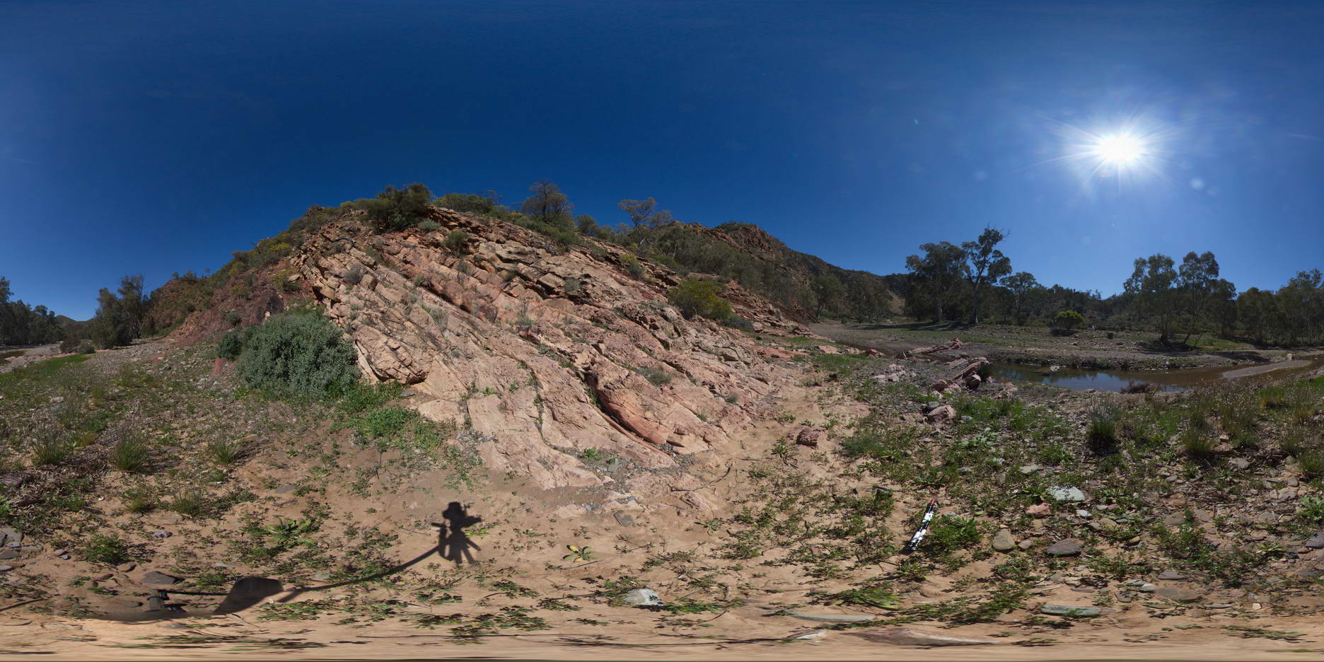
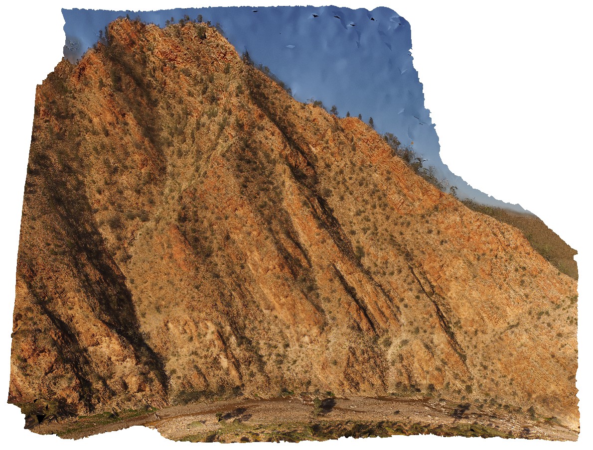
BrachinaFSP15 Map
 |
5 |
11/27/2015 12:29 p.m. |
FSP |
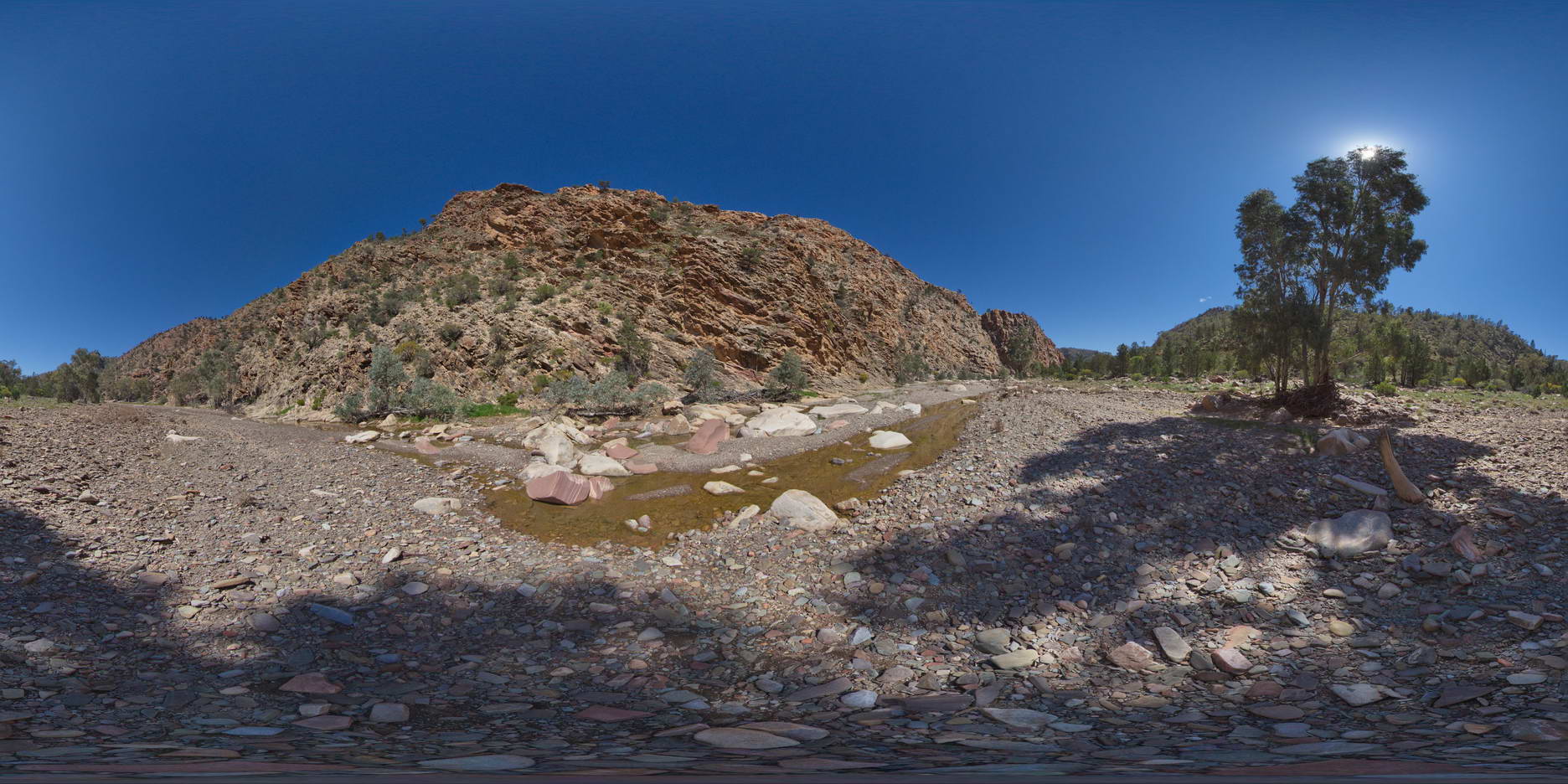
moderate to gently dipping bedding of the Trezona Formation, Trezone Loop Walk, Brachina. S.A. |
1000.00 |
-31.32920000000 |
138.64587000000 |
-9999.000 |
sedimentology |
limestone |
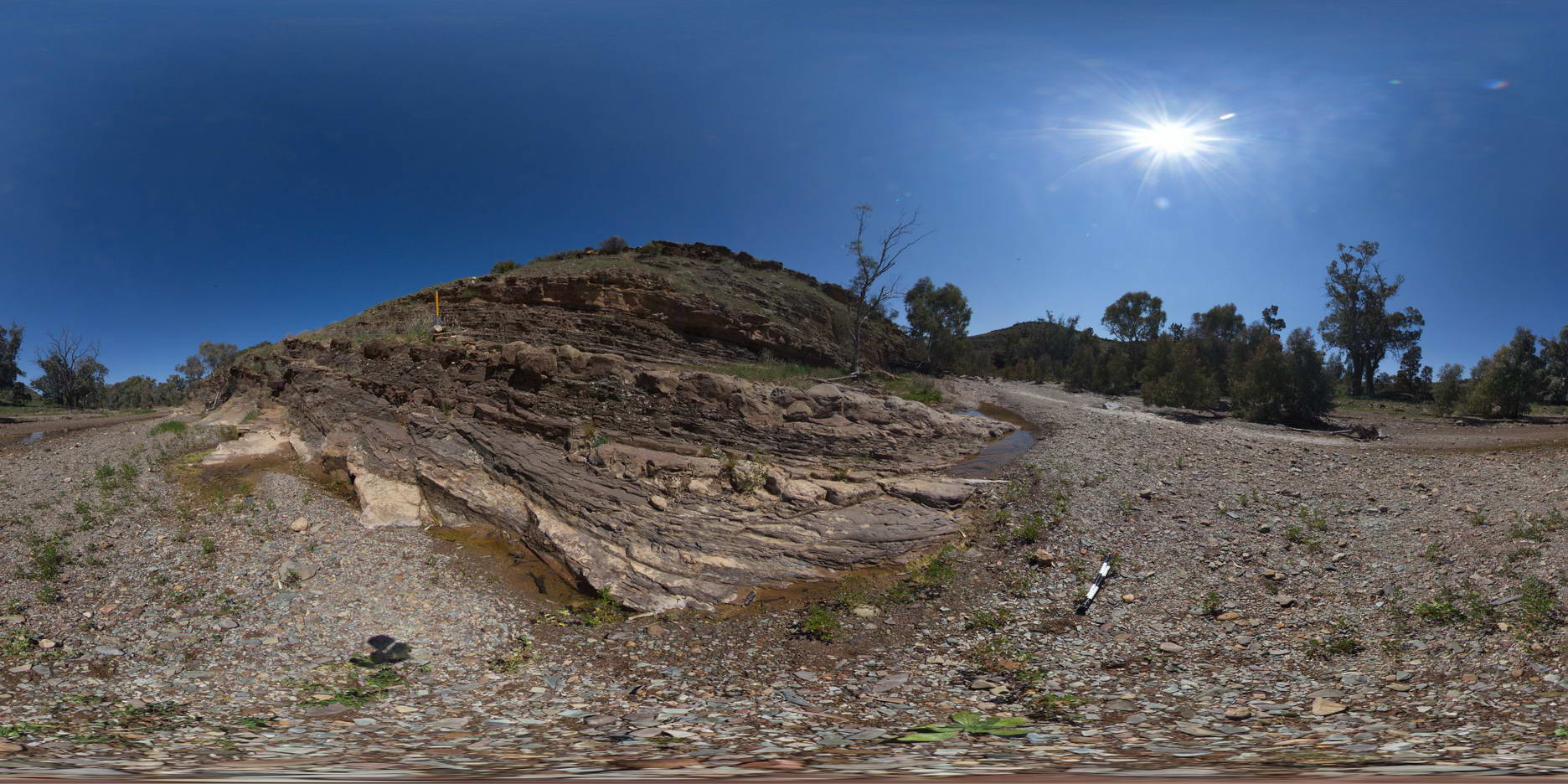
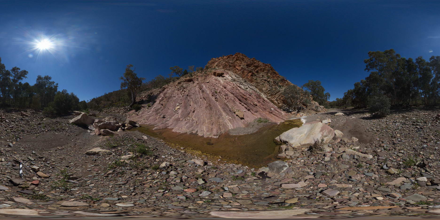
BrachinaFSP16 Map
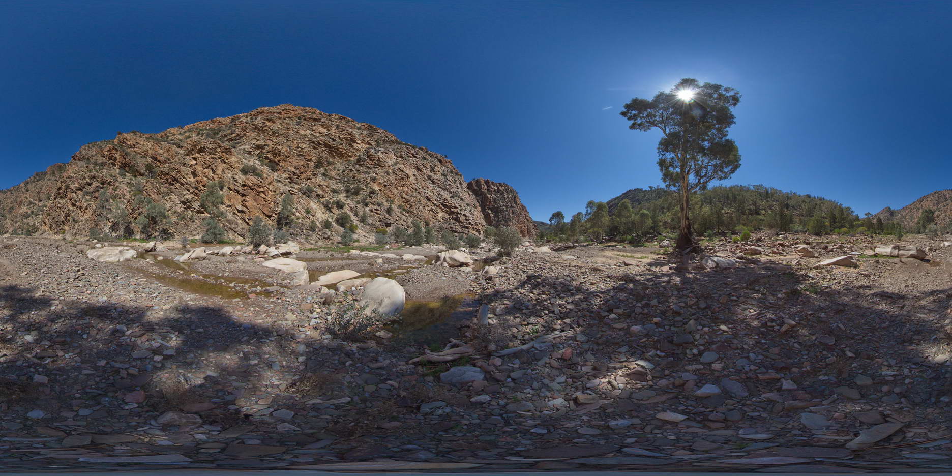
 |
5 |
11/27/2015 12:29 p.m. |
FSP |
moderately dipping beds of the Trezona Formation, with stromatolites, Trezona Loop Walk, Brachina. S.A. |
1000.00 |
-31.32911000000 |
138.64587000000 |
-9999.000 |
stromatolite, sedimentology, palaeontology, fossil |
carbonate |
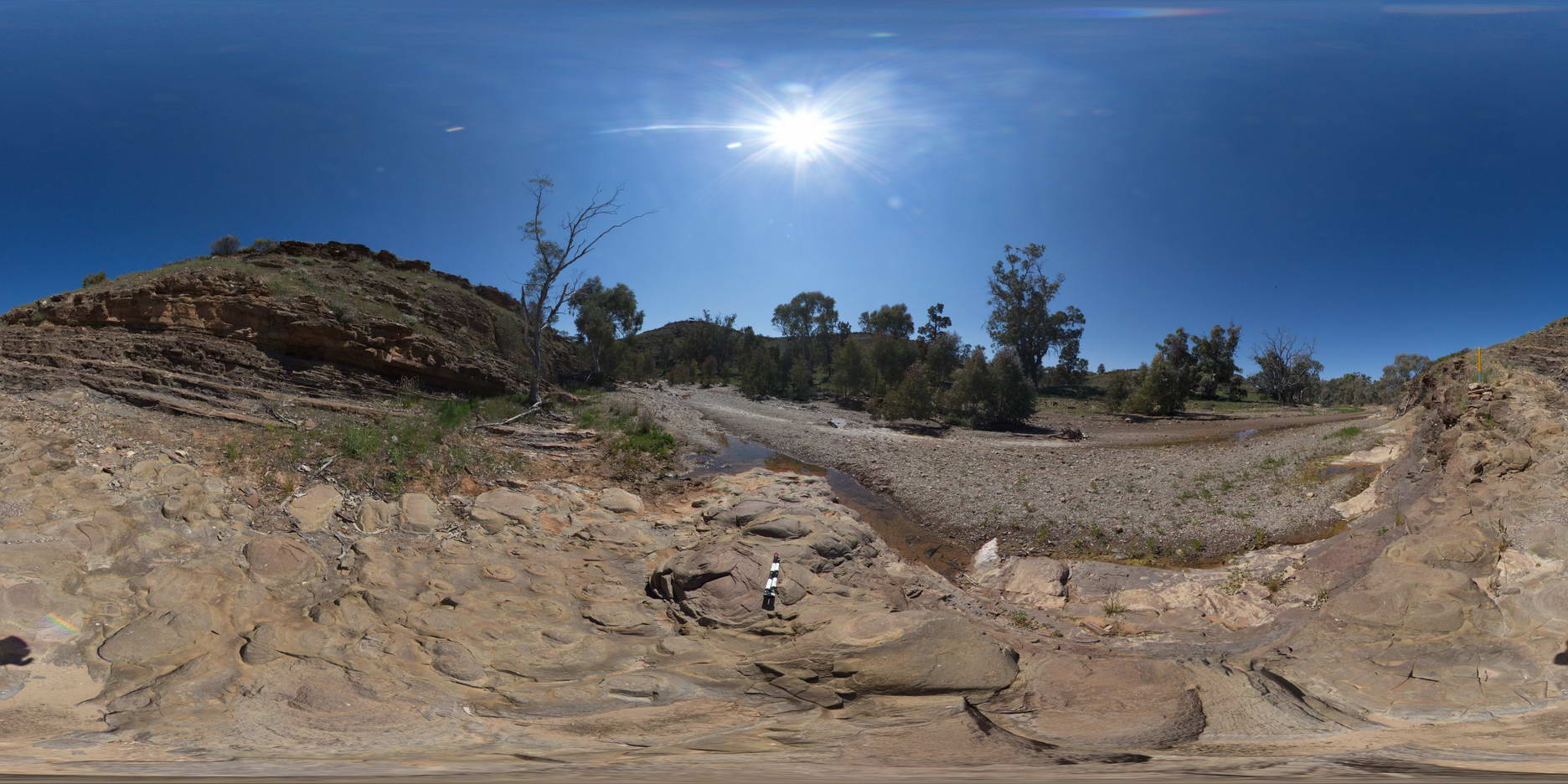
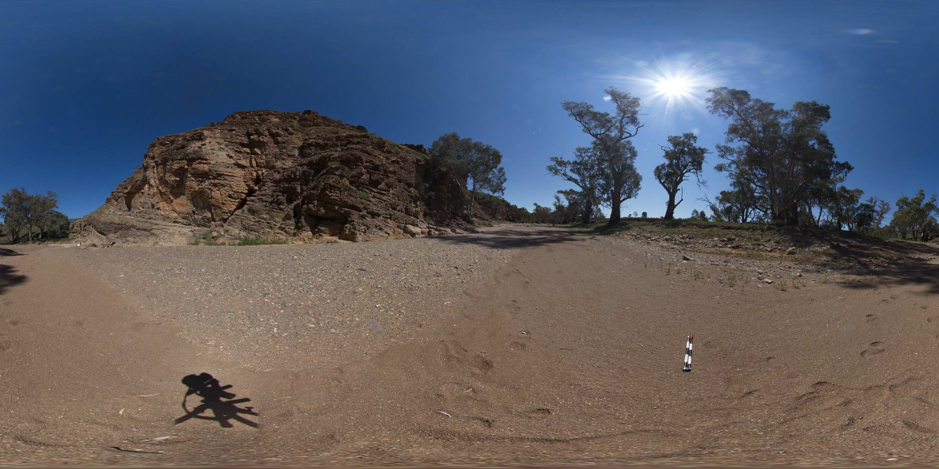
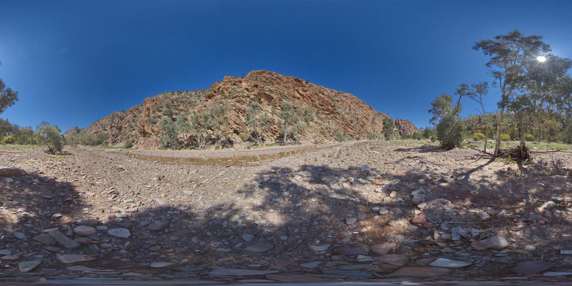
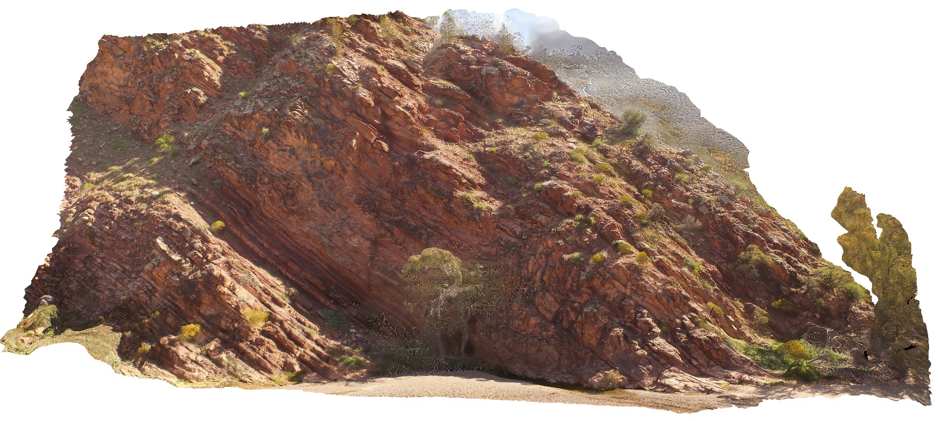
BrachinaFSP17 Map
 |
5 |
11/27/2015 12:29 p.m. |
FSP |
Out crop, showing 3D 'hummocks' of stromatolites on the Trezona Formation, Trezona Loop Walk, Brachina. S.A. |
1000.00 |
-31.32907000000 |
138.64583000000 |
-9999.000 |
stromatolites, sedimentology, palaeontology, fossil |
limestone |
BrachinaFSP18 Map
 |
5 |
11/27/2015 12:29 p.m. |
FSP |
moderately to gently dipping beds of the Trezona Formation. Trezone Loop Walk, Brachina. S.A. |
1000.00 |
-31.33298000000 |
138.64226000000 |
-9999.000 |
bedding, sedimentology |
sandstone |
BrachinaFSP19 Map
 |
5 |
11/27/2015 12:29 p.m. |
FSP |
cliff exposure of gently dipping beds of the Trezona Formation, from creek. Brachina. S.A. |
1000.00 |
-31.33274000000 |
138.64189000000 |
-9999.000 |
sedimentology |
mudstone |
BrachinaFSP2 Map
 |
5 |
11/27/2015 10:24 a.m. |
FSP |
outcrop of moderately dipping red Bonney Sandstone, Brachina Gorge. S.A. |
100.00 |
-31.33783000000 |
138.56297000000 |
-9999.000 |
bedding |
sandstone |
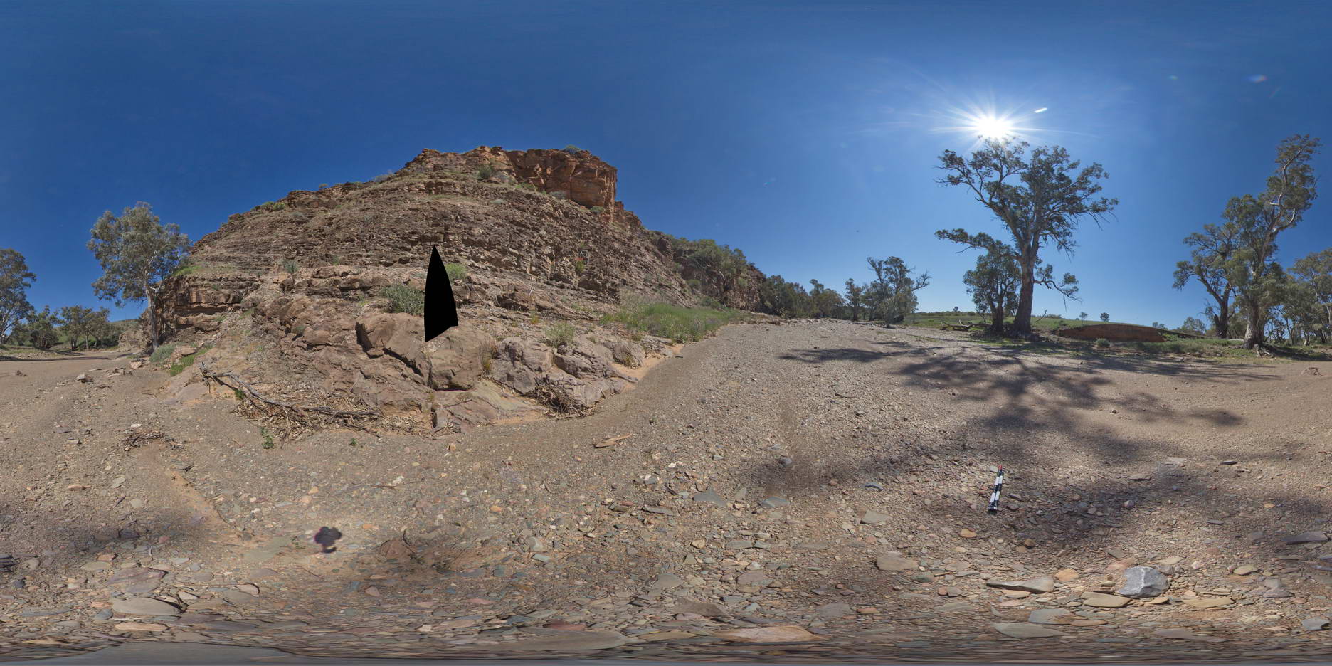
BrachinaFSP20 Map
 |
5 |
11/27/2015 12:29 p.m. |
FSP |
cliff exposure of Trezona Formation, showing stromatolite layer, Brachina. S.A. |
1000.00 |
-31.33269000000 |
138.64146000000 |
-9999.000 |
stromatolite, sedimentology, palaeontology, fossil |
limestone |
BrachinaFSP3 Map
 |
5 |
11/27/2015 11:13 a.m. |
FSP |
view of moderately dipping, folded and faulted strata of the Bonney Sandstone, Brachina Gorge. S.A. |
100.00 |
-31.33797000000 |
138.56308000000 |
-9999.000 |
fault, structure |
sandstone |
BrachinaFSP4 Map
 |
5 |
11/27/2015 11:13 a.m. |
FSP |
outcrop of side of creek, showing moderately dipping sandstone beds with cross bedding sedimentary structures. Brachina, S.A. |
100.00 |
-31.33808000000 |
138.56325000000 |
-9999.000 |
cross bedding, sediments |
sandstone |
BrachinaFSP5 Map
 |
5 |
11/27/2015 11:13 a.m. |
FSP |
outcrop exposure on the side of a creek, showing the geological contact between Bonney Sandstone and the Rawnsley Quartzite. Brachina Gorge. S.A. |
100.00 |
-31.34381000000 |
138.56290000000 |
-9999.000 |
geological contact |
sandstone, quartzite |
BrachinaFSP6 Map
 |
5 |
11/27/2015 11:13 a.m. |
FSP |
large cliff exposure of moderately dipping Rawnsley quartzite, Brachina Gorge. S.A. |
100.00 |
-31.34433000000 |
138.55624000000 |
-9999.000 |
bedding, quartzite |
quartzite |
BrachinaFSP7 Map
 |
5 |
11/27/2015 11:13 a.m. |
FSP |
outcrop showing moderately dipping Rawnley Quartzite, Brachina Gorge, near Brachina Pool. S.A. |
100.00 |
-31.34419000000 |
138.55562000000 |
-9999.000 |
bedding |
quartzite |
BrachinaFSP8 Map
 |
5 |
11/27/2015 11:14 a.m. |
FSP |
cliff exposure of moderately dipping Rawnsley Quartzite in the Brachina Gorge. S.A. |
100.00 |
-31.34379000000 |
138.55498000000 |
-9999.000 |
bedding, quartzite |
quartzite |
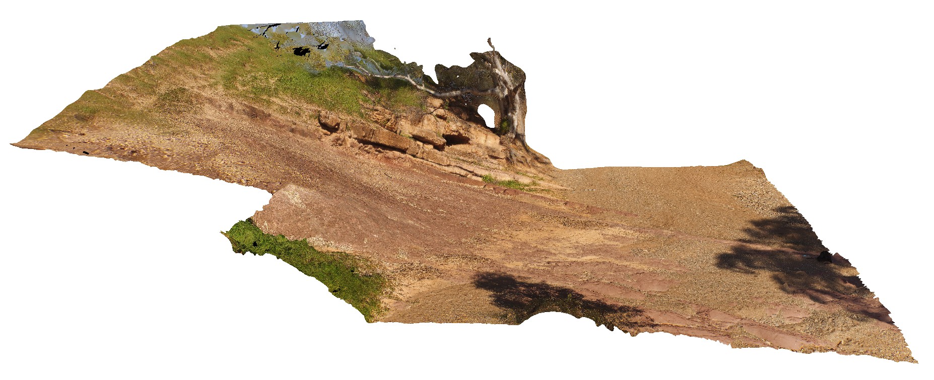
BrachinaFSP9 Map
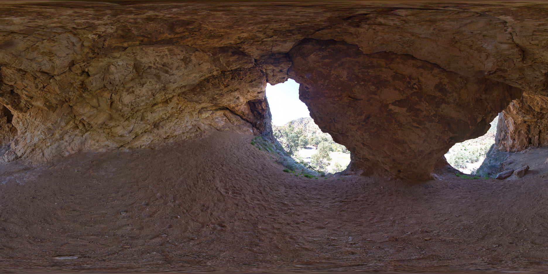 |
5 |
11/27/2015 11:52 a.m. |
FSP |
inside detail of cave above gorge, showing moderately dipping bedding. Brachina. S.A. |
20.00 |
-31.33800000000 |
138.54625000000 |
-9999.000 |
limestone |
limestone |
BrachinaUAV1 Map
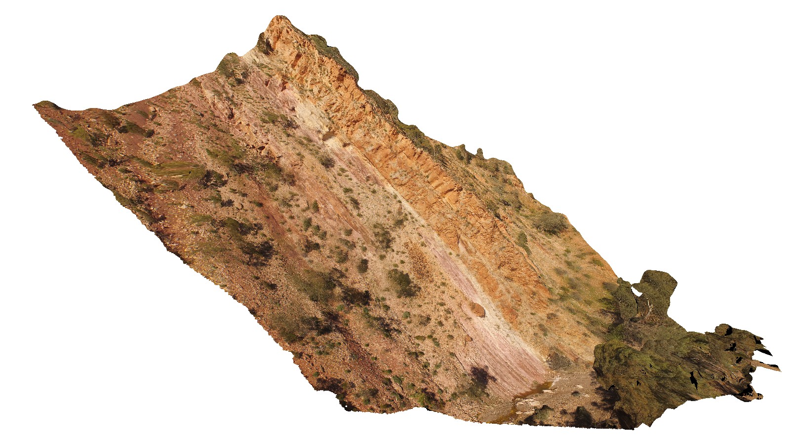 |
20 |
04/21/2016 5:09 p.m. |
FSP |
large cliff section showing contact between the Bonny Sandstone and the Rawnsley Quartzite, Brachina Gorge. S.A. |
250.00 |
-31.34345800000 |
138.56331600000 |
-9999.000 |
geological contact |
quartzite, sandstone |
BrachinaUAV2 Map
 |
20 |
04/20/2016 4:10 p.m. |
FSP |
view of cliff exposure of the Bonney Sandstone, showing gently folded, moderately dipping stratigraphy. Brachina Gorge. S.A. |
100.00 |
-31.33480600000 |
138.56632900000 |
-9999.000 |
bedding, sedimentology |
sandstone |
BrachinaUAV3 Map
 |
20 |
04/22/2016 11:02 a.m. |
FSP |
View of surrounding Rawnsley Quartzite from hill above Brachina Gorge Road. S.A. |
1000.00 |
-31.34426900000 |
138.55557900000 |
-9999.000 |
sedimentology |
quartzite |
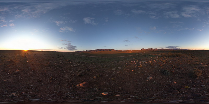
BrachinaUAV4 Map
 |
20 |
04/22/2016 11:15 a.m. |
FSP |
Golden Spike. Contact between the diamictite of the Elatina Formation and the dolomite of the Nuccaleena Formation. S.A. |
20.00 |
-31.33155000000 |
138.63344000000 |
-9999.000 |
golden spike, geological contact |
diamictite, dolomite |
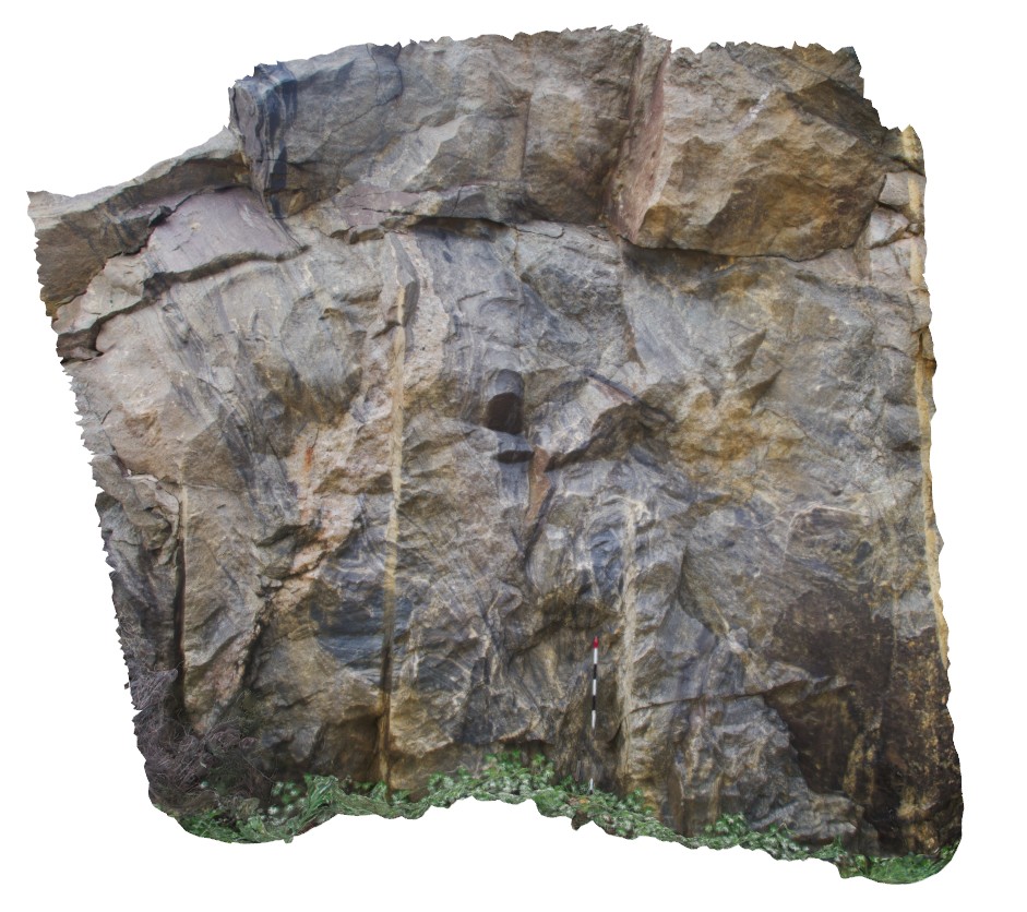
Bremer1 Map
 |
0 |
06/05/2016 10:40 a.m. |
3D |
layered gneiss exposed in quarry at Fisheries Road, Bremer Bay, W.A. |
3.50 |
-34.42645000000 |
119.40096000000 |
-9999.000 |
gneiss |
gneiss |
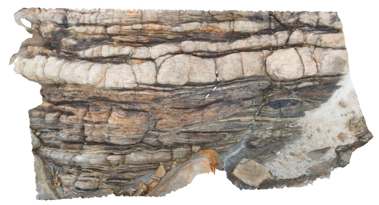
Bremer2 Map
 |
0 |
06/05/2016 10:41 a.m. |
3D |
gneissic rocks in quarry wall with cross-cutting pegmatite dyke. Bremer Bay, W.A. |
2.20 |
-34.42630000000 |
119.40098000000 |
-9999.000 |
gneiss, pegmatite dyke |
gneiss |
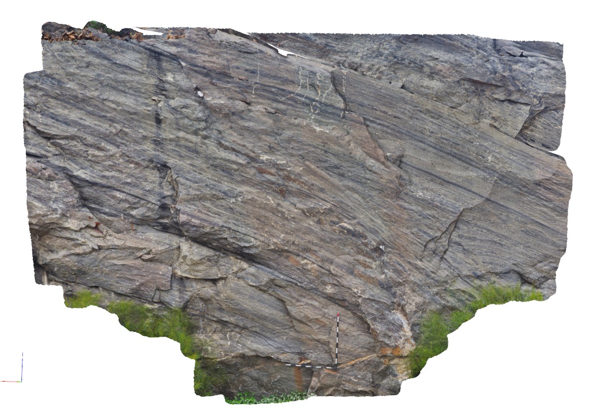
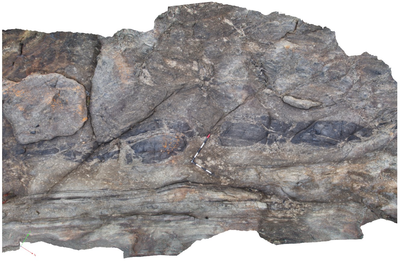
Bremer3 Map
 |
0 |
06/05/2016 10:41 a.m. |
3D |
banded mafic gneiss with thick felsic layers. Mafic bodies boudinaged in felsic bands. Bremer Bay, W.A. |
4.00 |
-34.44188000000 |
119.39850000000 |
-9999.000 |
boudinage, gneiss, structure |
gneiss |
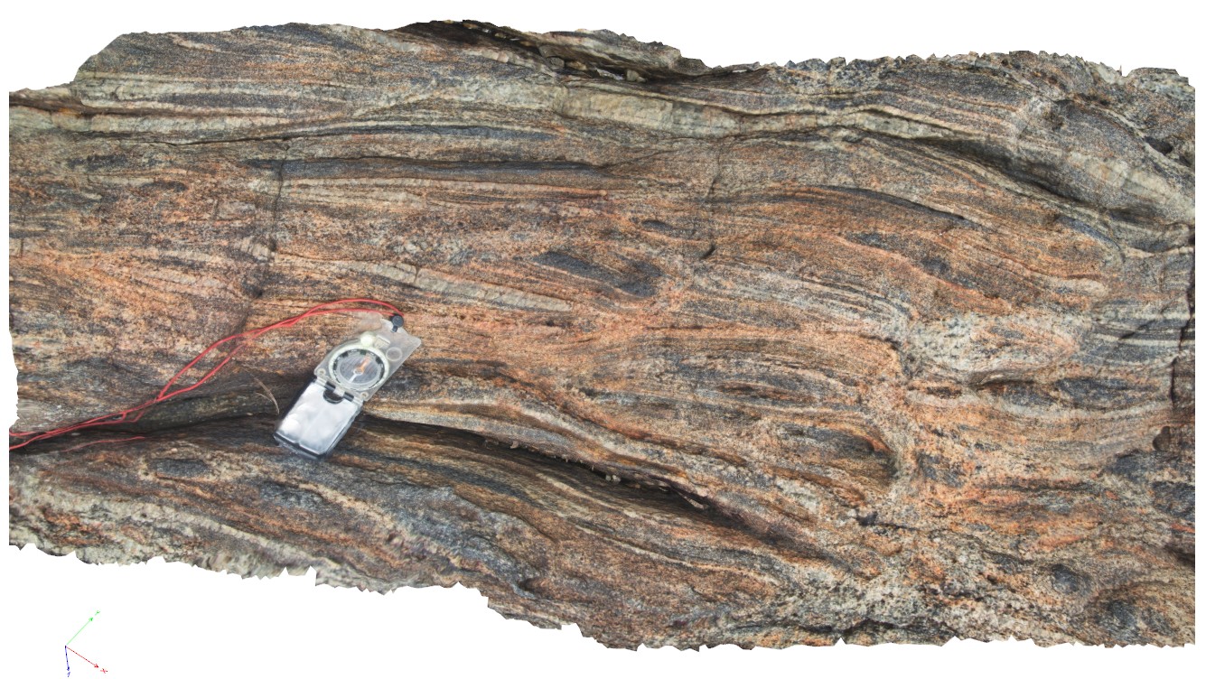
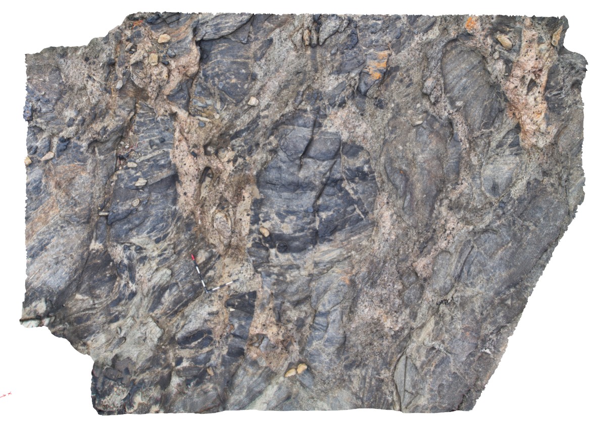
Bremer4 Map
 |
0 |
06/05/2016 10:42 a.m. |
3D |
detail of layering, boudinaging and structure in gneiss from site Bremer3. Bremer Bay, W.A. |
1.00 |
-34.44188000000 |
119.39850000000 |
-9999.000 |
boudinage, gneissic layering, structure |
gneiss |
Bremer5 Map
 |
0 |
06/05/2016 10:42 a.m. |
3D |
boudinaged mafic dyke in gneiss with pegmatite in boudin necks. Bremer Bay, W.A. |
6.00 |
-34.45616000000 |
119.36192000000 |
-9999.000 |
banded gneiss |
gneiss |
Bremer6 Map
 |
0 |
06/05/2016 10:42 a.m. |
3D |
chaotic blocks of mafic and felsic gneiss in pegmatite |
4.50 |
-34.45622000000 |
119.36204000000 |
-9999.000 |
mafic gneiss blocks, pegmatite |
gneiss, pegmatite |