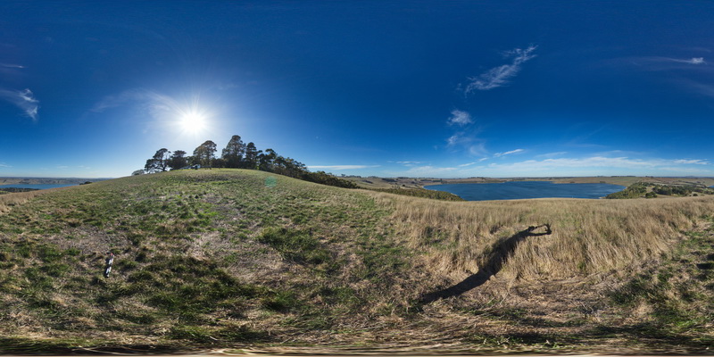
BunkerBay2 Map
 |
5 |
05/15/2016 noon |
3D |
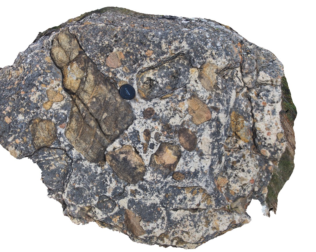
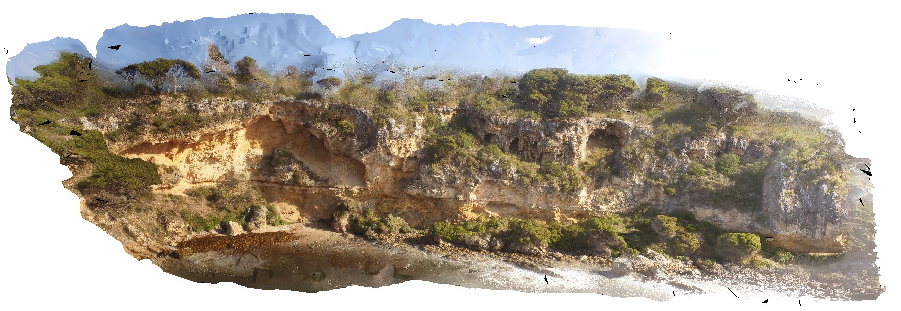
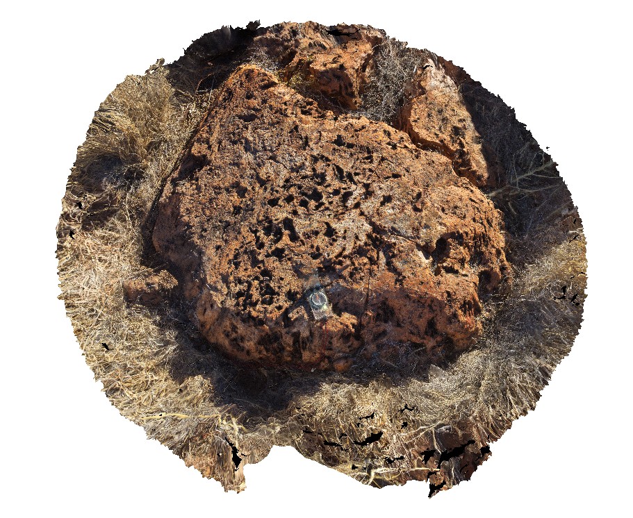
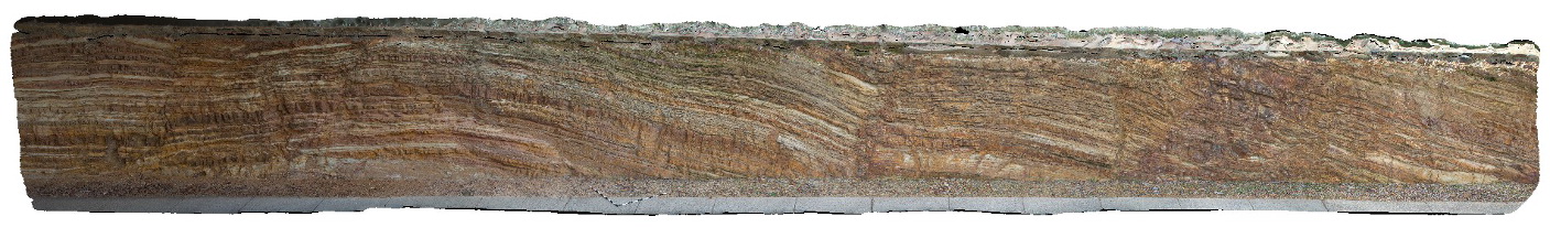
boulder of carbonate-cemented conglomerate / breccia from Tamala Limestone / gneiss basement unconformity with gneiss clasts. Bunker Bay, Cape Naturaliste. W.A. This unit may also be known as high grade metamorphic rocks 74341 |
1.20 |
-33.53728000000 |
115.03139000000 |
-9999.000 |
geological unconformity, Tamala Limestone, gneiss basement, conglomerate |
conglomerate |
BunkerBay3 Map
 |
0 |
05/15/2016 noon |
3D |
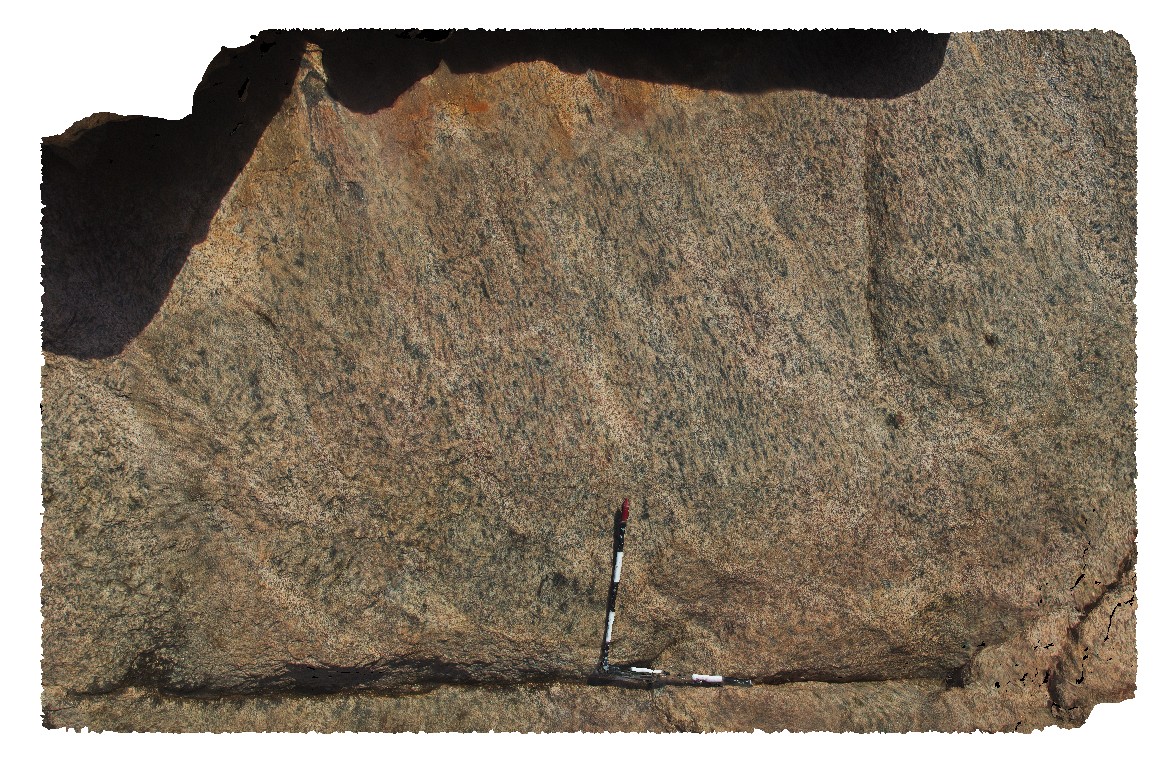
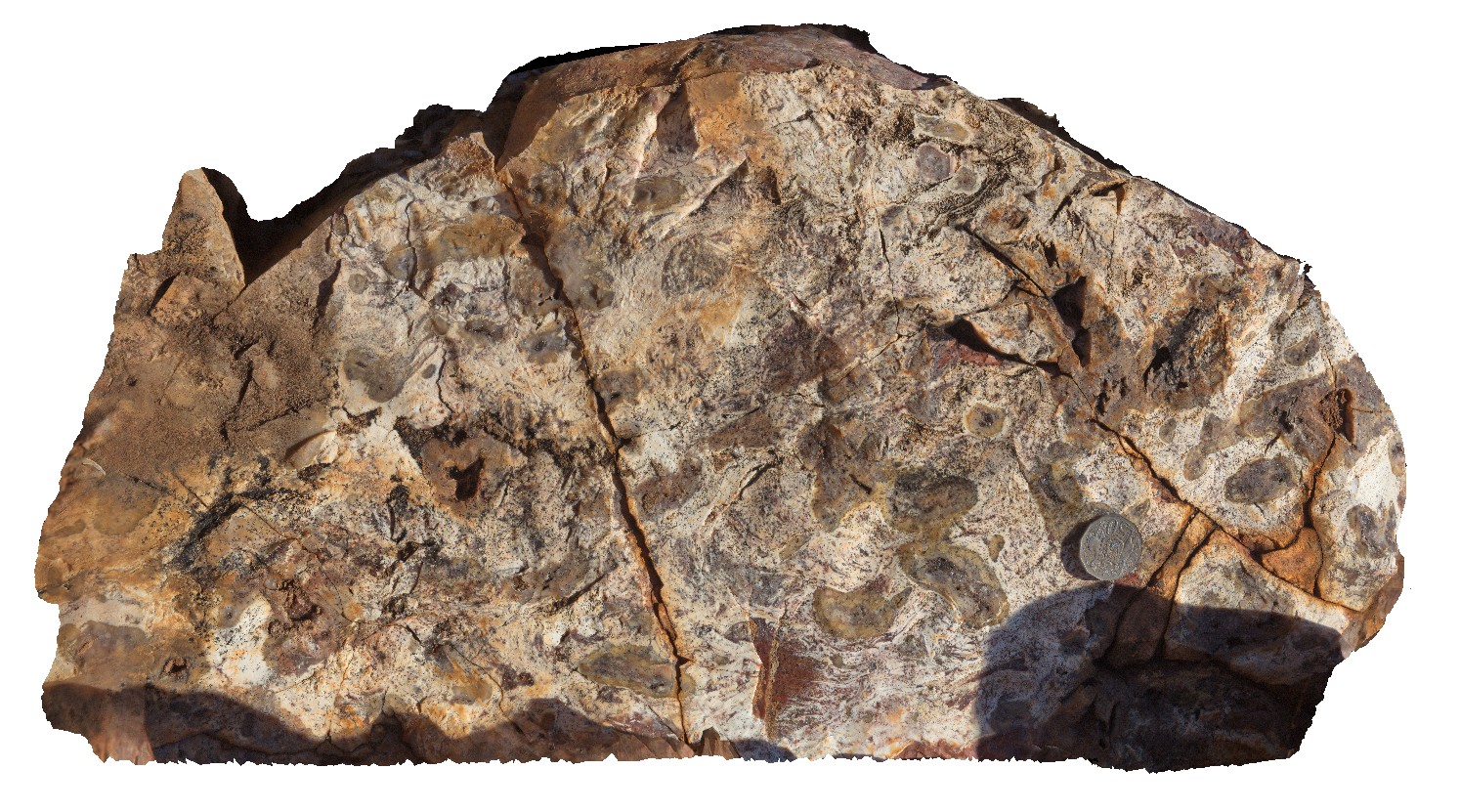
mineral stretching lineation on irregular north-dipping foliation surface in gneiss. Bunker Bay, Cape Naturaliste. W.A. This unit may also be known as high grade metamorphic rocks 74341 |
3.50 |
-33.53747000000 |
115.03257000000 |
-9999.000 |
mineral stretching lineation, foliation, gneiss, structure |
gneiss |
BunkerBay4 Map
 |
0 |
05/15/2016 noon |
3D |
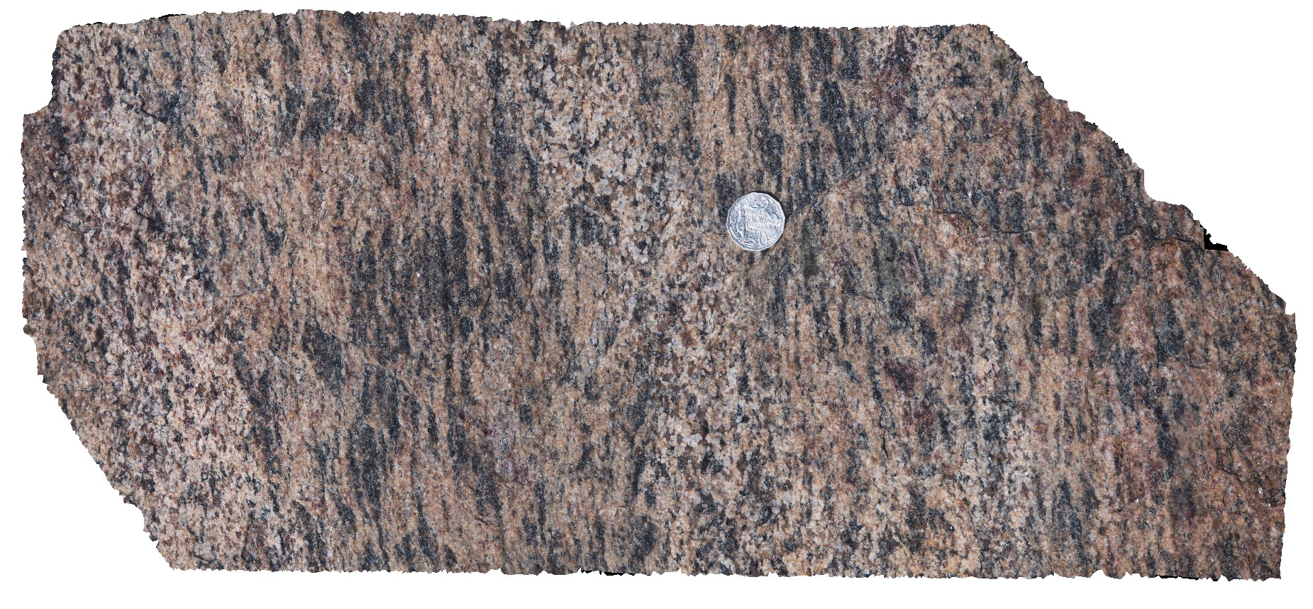
detailed view of mineral stretching lineation from site Bunkerbay3, showing aligned mafic minerals. Bunker Bay, Cape Naturaliste. W.A. This unit may also be known as high grade metamorphic rocks 74341 |
0.60 |
-33.53747000000 |
115.03257000000 |
-9999.000 |
mineral stretching lineation, structure, foliation, gneiss |
gneiss |
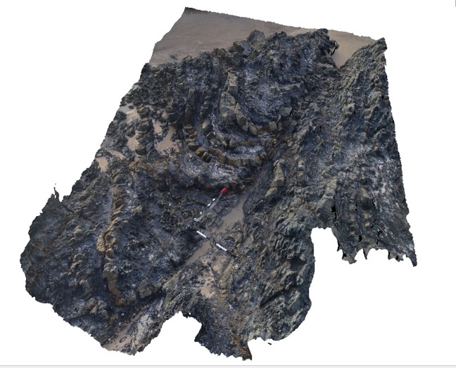
BunkerBay5 Map
 |
0 |
05/15/2016 noon |
3D |
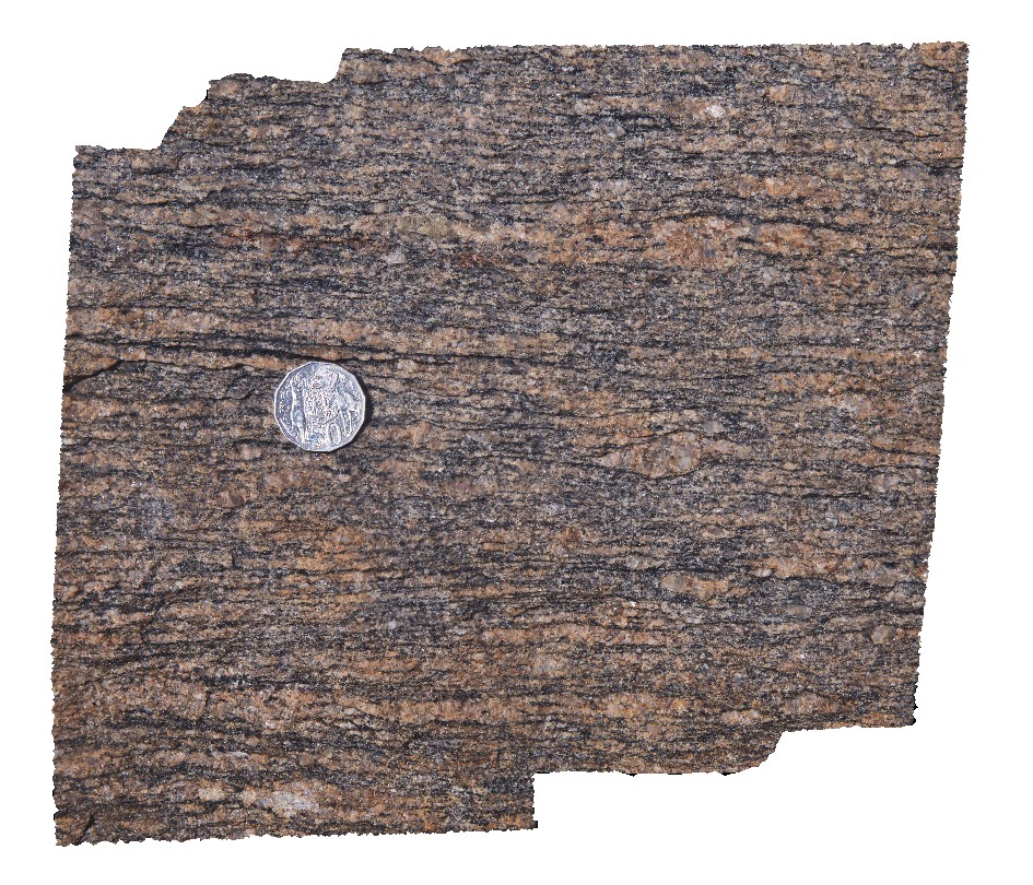
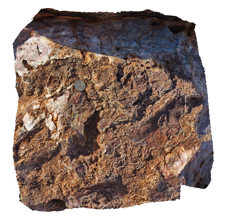
detailed view of foliation in gneiss showing sheared augen. Bunker Bay, Cape Naturaliste. W.A. This unit may also be known as high grade metamorphic rocks 74341 |
0.25 |
-33.53761000000 |
115.03266000000 |
-9999.000 |
augen, gneiss, shearing, structure |
gneiss |
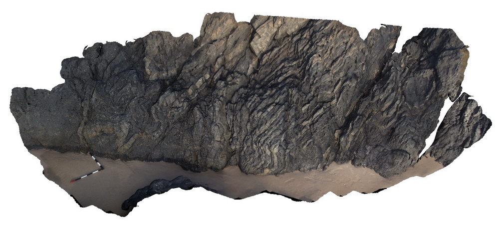
BunkerBayUAV1 Map
 |
0 |
05/15/2016 noon |
UAV |
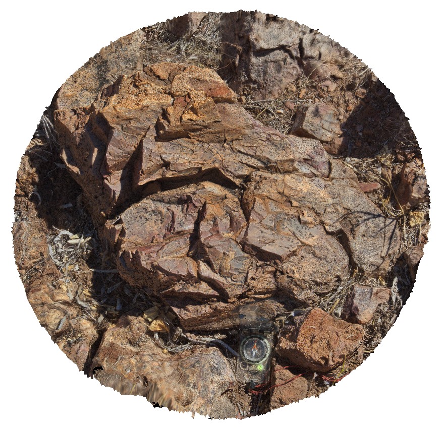
unconformity between basement gneiss and Tamala Limestone. Bunker Bay, Cape Naturaliste. W.A. gneiss unit may also be known as high grade metamorphic rocks 74341 |
50.00 |
-33.53685000000 |
115.03130000000 |
-9999.000 |
geological unconformity, gneiss, Tamala Limestone |
gneiss, limestone |
BurnieFSP1 Map
 |
5 |
01/01/9999 midnight |
FSP |
view of large quarry outcrop in quartzite? at the entrance to the township of Burnie. Burnie, north Tas. |
0.00 |
-41.06717200000 |
145.94652400000 |
-9999.000 |
quarry, quartzite |
quartzite |
BurnieUAV1 Map
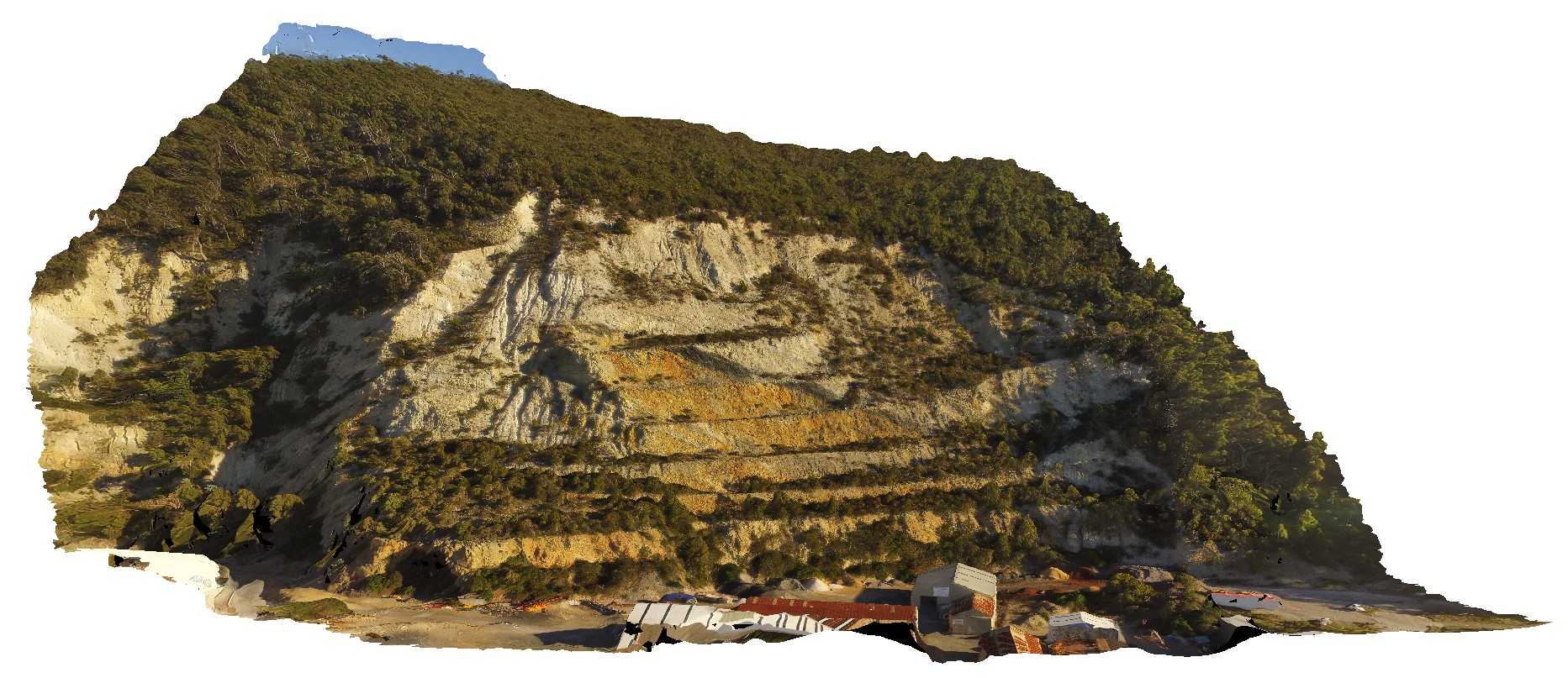 |
20 |
01/01/9999 midnight |
UAV |
view of large quarry outcrop in quartzite? At the entrance to the township of Burnie. Burnie, north Tas. |
430.00 |
-41.06717200000 |
145.94652400000 |
70.000 |
quarry, quartzite |
quartzite |
Byron1 Map
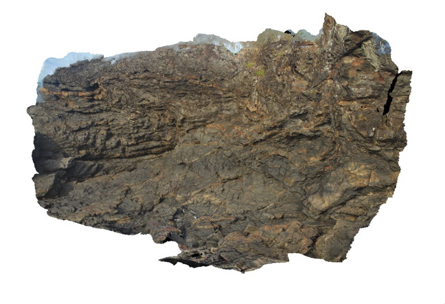 |
5 |
07/08/2015 10:18 a.m. |
3D |
folded and faulted fine grained, low grade metasediments of the Neranleigh-Fernvale Beds. Byron Bay, N.S.W. |
8.00 |
-28.63433000000 |
153.63599000000 |
1.000 |
metasediments, folds, faults, structure |
metasediments |
Byron2 Map
 |
5 |
07/08/2015 10:19 a.m. |
3D |
folded and faulted low-grade, fine grained metasediments of the Neranleigh-Fernvale Beds. Byron Bay, N.S.W. |
8.00 |
-28.63455000000 |
153.63579000000 |
1.000 |
metasediments, folds, faults, structure |
metasediments |
Byron3 Map
 |
5 |
07/08/2015 10:20 a.m. |
3D |
folded and faulted low-grade, fine grained metasediments of the Neranleigh-Fernvale Beds. Byron Bay, N.S.W. |
6.00 |
-28.63475000000 |
153.63560000000 |
1.000 |
metasediments, folds, faults, structure |
metasediments |
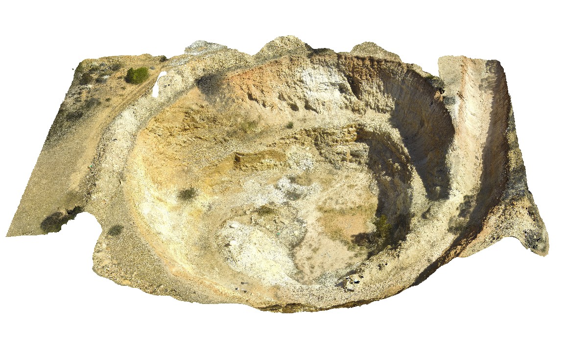
CalcalingMine1 Map
 |
5 |
05/25/2016 noon |
3D |
weathered, complex zoned pegmatite, near Quanta Cutting-Weira Rd. W.A. |
0.00 |
-30.91527600000 |
118.43186600000 |
-9999.000 |
zoned pegmatite, pegmatite, igneous rock |
pegmatite |
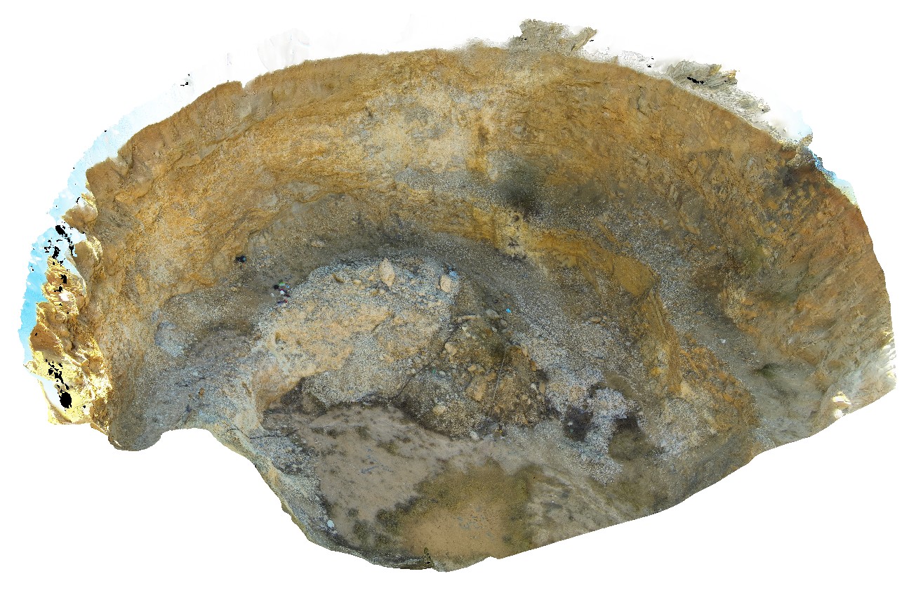
CalcalingMine2 Map
 |
5 |
05/25/2016 noon |
3D |
weathered, complex zoned pegmatite, near Quanta Cutting-Weira Rd. W.A. |
42.00 |
-30.91527600000 |
118.43186600000 |
-9999.000 |
open pit, pegmatite, zoned pegmatite, igneous rock |
pegmatite |
Camfield1 Map
 |
0 |
06/21/2016 noon |
3D |
flow banded volcanics with stretched vesicles. Camfield, Buntine Highway, N.T. |
1.40 |
-17.10740000000 |
131.25758000000 |
-9999.000 |
vesicles, volcanics, flow banded |
volcanics |
Camfield2 Map
 |
0 |
06/21/2016 noon |
3D |
drusy quartz-cemented, flow-banded volcanic clasts and chert clast breccia. Camfield, Buntine Highway, N.T. |
0.50 |
-17.10725000000 |
131.28761000000 |
-9999.000 |
drusy quartz, breccia, volcanics |
volcanics |
Camfield3 Map
 |
0 |
06/21/2016 noon |
3D |
amygdales with microcrystalline quartz rims and crystalline quartz cores within flow-banded volcanics. Camfield, Buntine Highway, N.T. |
0.40 |
-17.10718000000 |
131.28769000000 |
-9999.000 |
amygdales, flow-banded volcanics |
volcanics |
Camfield4 Map
 |
0 |
06/21/2016 noon |
3D |
semi-conchoidal fracture and mn-dendrites within silicified volcanics / chert. Camfield, Buntine Highway, N.T. |
0.80 |
-17.10715000000 |
131.28766000000 |
-9999.000 |
manganoan dendrite, silicified, volcanics |
volcanics |
CamfieldFSP1 Map
 |
0 |
06/21/2016 noon |
FSP |
view from hill of surrounding plateau. Hill comprising quartz / silica-cemented, flow-banded volcanic clasts and chert clast breccia. Camfield, Buntine Highway, N.T. |
2000.00 |
-17.10726000000 |
131.28775000000 |
-9999.000 |
volcanics, breccia, quartz cement |
volcanics |
Camperdown1 Map
 |
0 |
06/05/2016 10:37 a.m. |
3D |
view of Maar volcanic / pyroclastic deposits, showing layered beds and accretionary lapilli. Camperdown, Vic. |
2.00 |
-38.23459000000 |
143.09209000000 |
-9999.000 |
tuff, pyroclastics, maar volcano, volcanics, accretionary lapilli |
pyroclastic |
Camperdown2 Map
 |
0 |
06/05/2016 10:37 a.m. |
3D |
detailed view of layered volcaniclastic units, including fine ash and accretionary lapilli. Camperdown, Vic. |
0.40 |
-38.23459000000 |
143.09209000000 |
-9999.000 |
accretionary lapilli, volcaniclastic |
pyroclastic |
Camperdown3 Map
 |
0 |
06/05/2016 10:37 a.m. |
3D |
detail of layered pyroclastic units, showing bands of accretionary lapilli and finer material. Camperdown, Vic. |
0.70 |
-38.23456000000 |
143.09200000000 |
-9999.000 |
accretionary lapilli, pyroclastic, volcanics |
pyroclastic |
CamperdownFSP1 Map
 |
0 |
06/05/2016 10:37 a.m. |
FSP |
view from hill of volcanic landscape, showing lakes in the craters of extinct Maar volcanos. Camperdown, Vic. |
3000.00 |
-38.23573000000 |
143.09209000000 |
-9999.000 |
Maar volcano, volcanics |
pyroclastic |
Canberra1 Map
 |
5 |
06/20/2016 3:47 p.m. |
3D |
Open folds and faults in Silurian sandstone and mudstone at the Sate Circle in Canberra, A.C.T. |
10.00 |
-35.30408000000 |
149.12651000000 |
580.000 |
folds, faults, structure |
sandstone |
Canberra2 Map
 |
5 |
09/08/2015 3:34 p.m. |
3D |
Faults and folds in Silurian metasedimentary rocks of the Canberra Formation at the top and left of the view. There is an angular unconformity between these rocks and the underlying Silurian State Circle Shale. A.C.T. |
20.00 |
-35.30429000000 |
149.12701000000 |
580.000 |
folds, faults, structure, unconformity |
sandstone, shale |
Canberra3 Map
 |
5 |
09/08/2015 3:47 p.m. |
3D |
Faults and open folds in the Silurian Camp Hill Sandstone of the Canberra Formation. A.C.T. |
25.00 |
-35.30450000000 |
149.12740000000 |
580.000 |
folds, faults, structure, bedding, sedimentology |
sandstone |
Canberra4 Map
 |
5 |
10/08/2015 3:09 p.m. |
3D |
Faults and open folds in the Silurian Camp Hill Sandstone of the Canberra Formation. A.C.T. |
25.00 |
-35.30492000000 |
149.12816000000 |
580.000 |
|
sandstone |