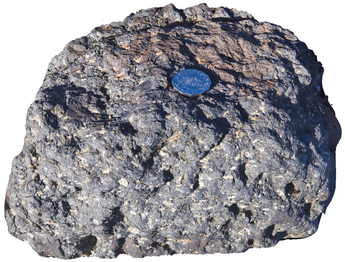
Bremer7 Map
 |
0 |
06/05/2016 10:43 a.m. |
3D |
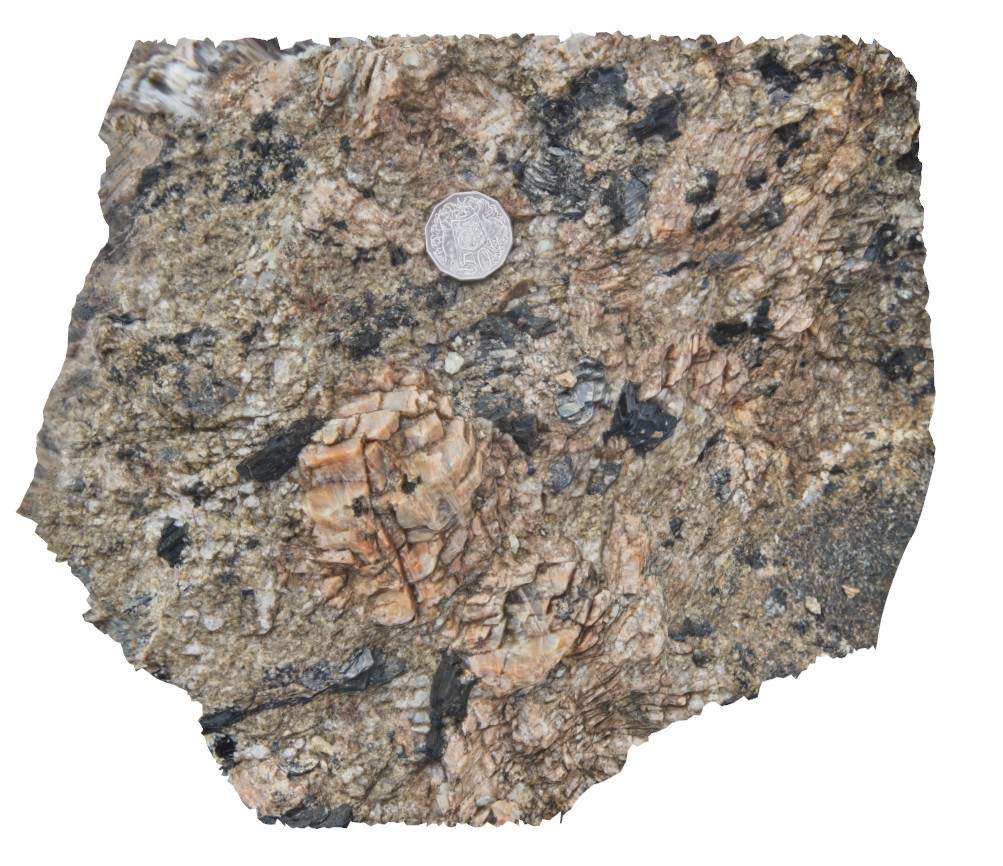
detail of pegmatite texture from site Bremer6, showing coarse-grained feldspar and biotite crystals. Bremer Bay, W.A. |
0.30 |
-34.45621000000 |
119.36196000000 |
-9999.000 |
pegmatite |
pegmatite |
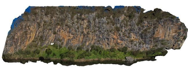
BremerFSP1 Map
 |
0 |
06/05/2016 10:43 a.m. |
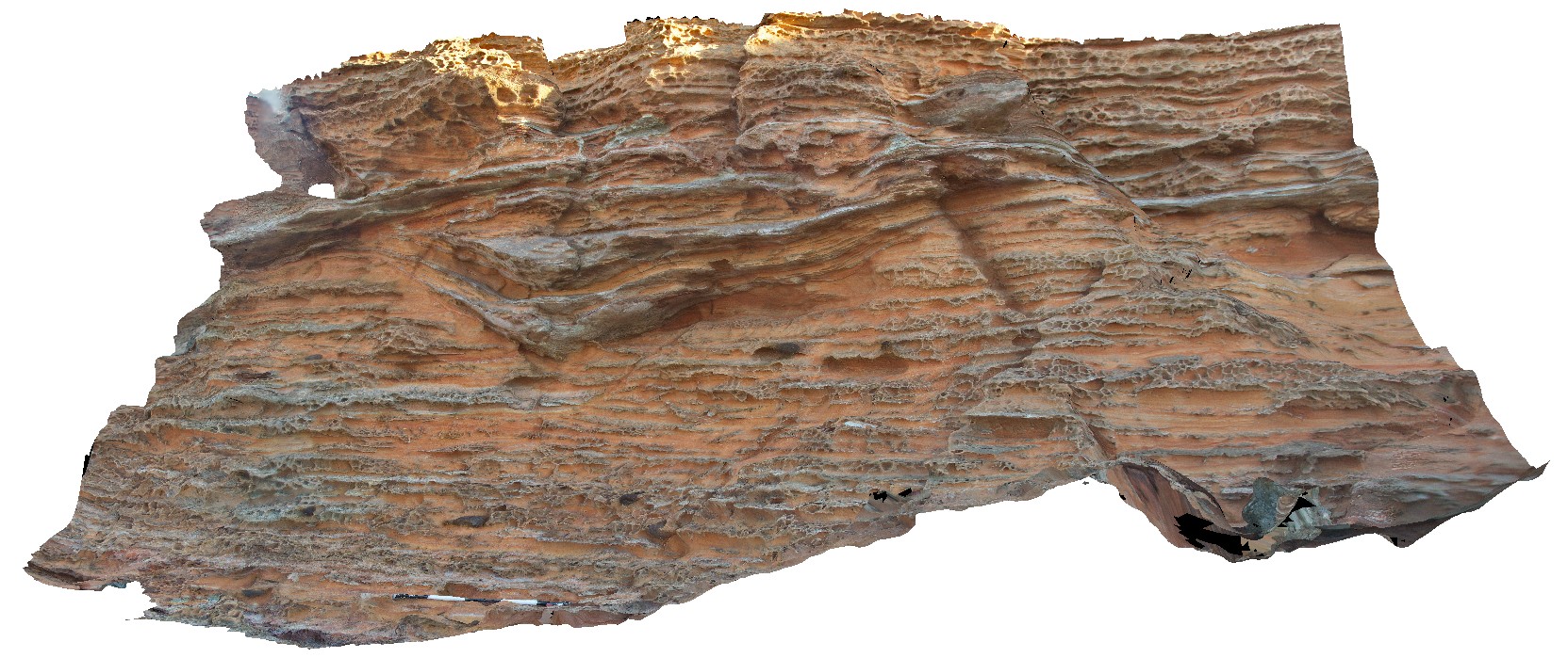
FSP |
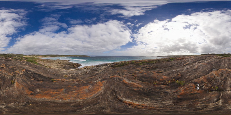
view of shoreline outcrop, showing banded gneiss and surrounding coastline. Bremer Bay. W.A. |
200.00 |
-34.45605000000 |
119.36204000000 |
-9999.000 |
banded gneiss |
gneiss |
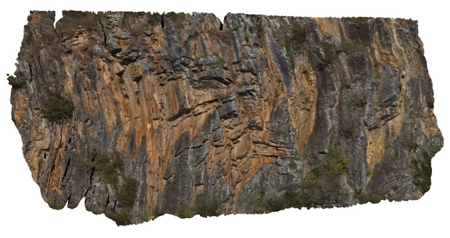
BremerFSP2 Map
 |
0 |
06/05/2016 10:43 a.m. |
FSP |
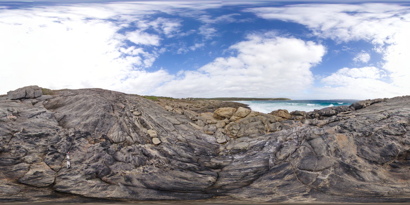
view of shoreline outcrop, showing banded gneiss and surrounding coastline. Bremer Bay. W.A. |
200.00 |
-34.45621000000 |
119.36177000000 |
-9999.000 |
banded gneiss |
gneiss |
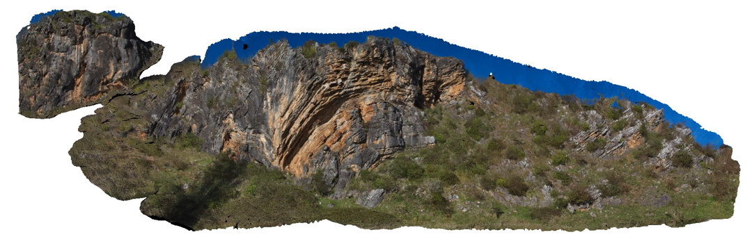
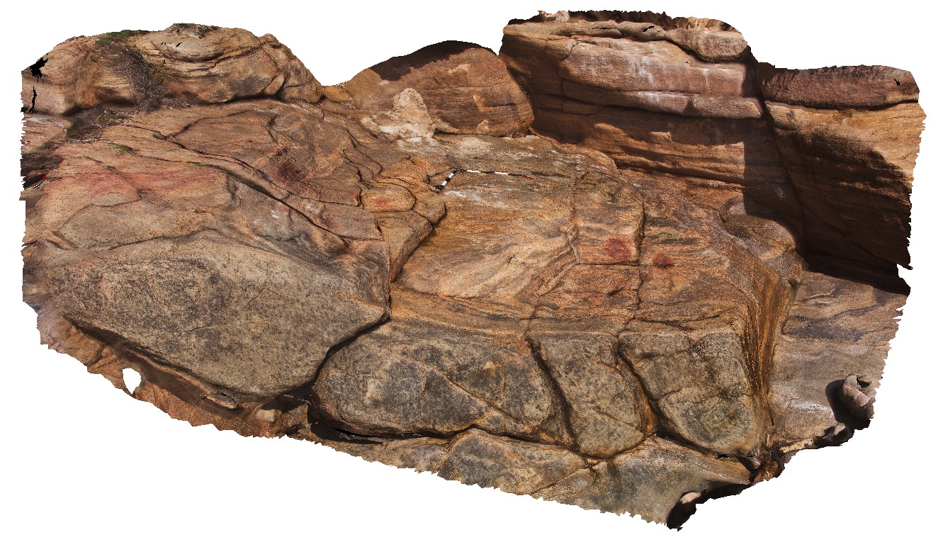
BremerFSP3 Map
 |
0 |
06/05/2016 10:43 a.m. |
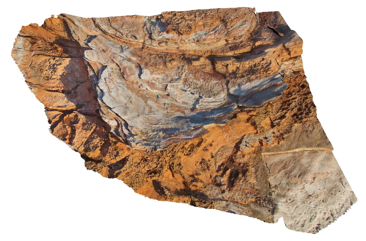
FSP |
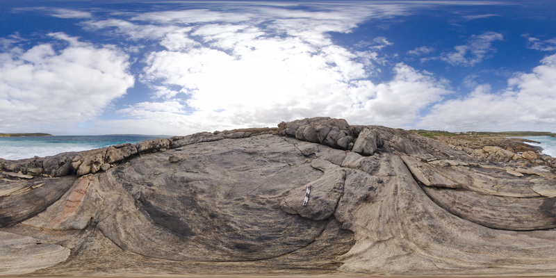
view of shoreline outcrop, showing banded gneiss and porphyry dyke? Bremer Bay. W.A. |
0.00 |
-34.45627000000 |
119.36192000000 |
-9999.000 |
banded gneiss |
gneiss |
BremerFSP4 Map
 |
0 |
06/05/2016 10:43 a.m. |
FSP |
view of shoreline outcrop, showing banded gneiss and porphyry dyke? Bremer Bay. W.A. |
200.00 |
-34.45621000000 |
119.36203000000 |
-9999.000 |
banded gneiss |
gneiss |
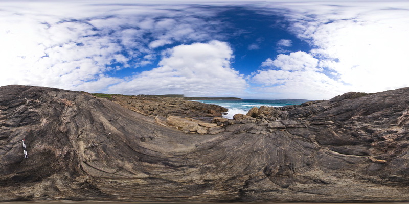
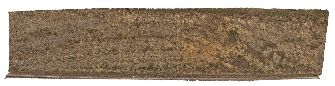
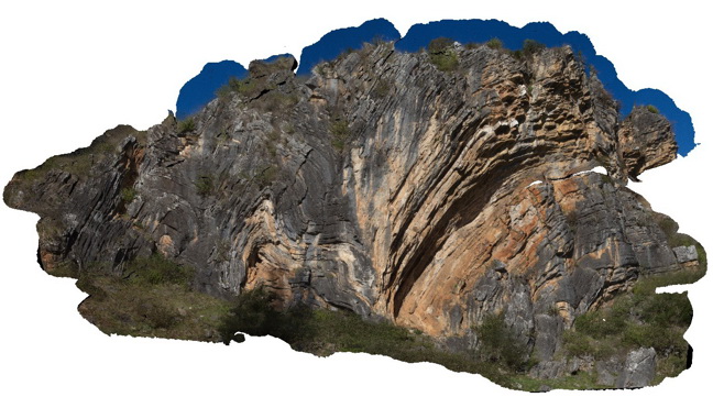
BremerUAV1 Map
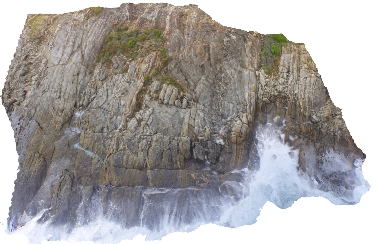 |
20 |
01/01/9999 midnight |
UAV |
aerial view of gneissic outcrop at Nature Dog Beach. Bremer Bay, W.A. |
20.00 |
-34.45622300000 |
119.36205000000 |
17.500 |
banded gneiss |
gneiss |
Brighton1 Map
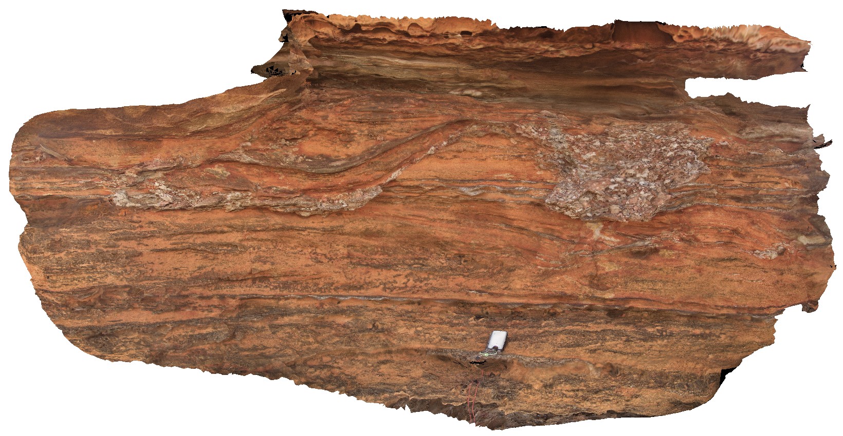
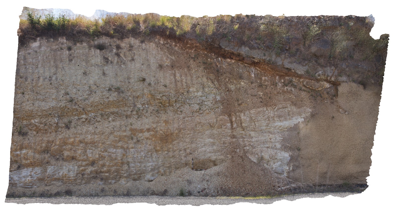 |
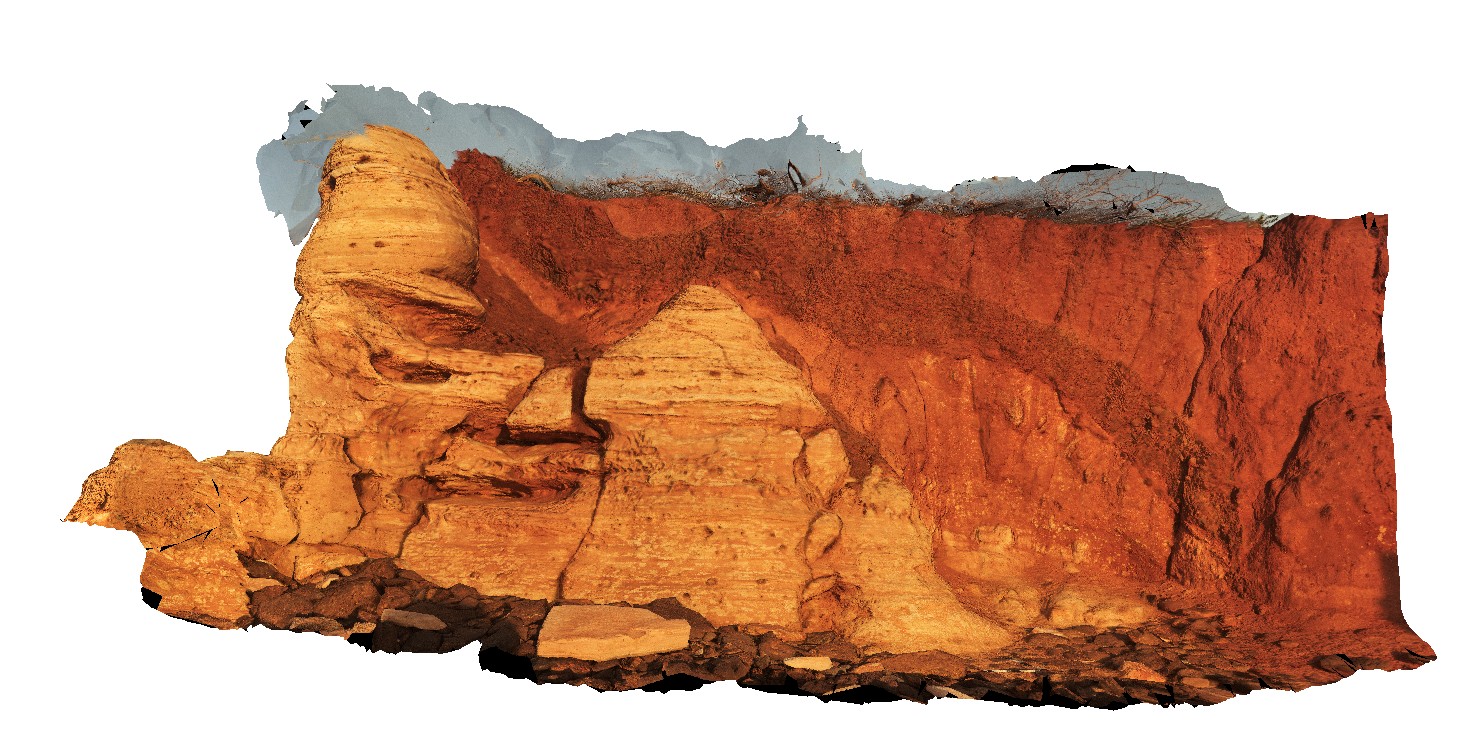
5 |
01/01/9999 midnight |
3D |
unconformable contact between Triassic sediments and Tertiary basalt - in paleo soil. Brighton, Tas. |
14.00 |
-42.69681000000 |
147.27692000000 |
-9999.000 |
unconformity, geological contact |
sandstone, basalt |
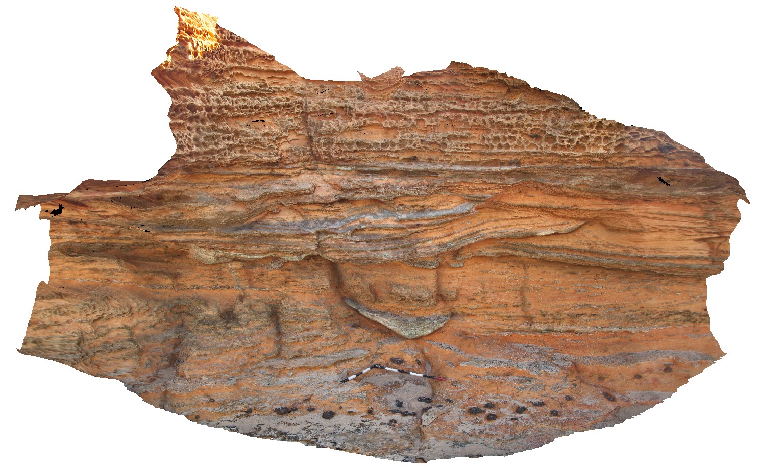
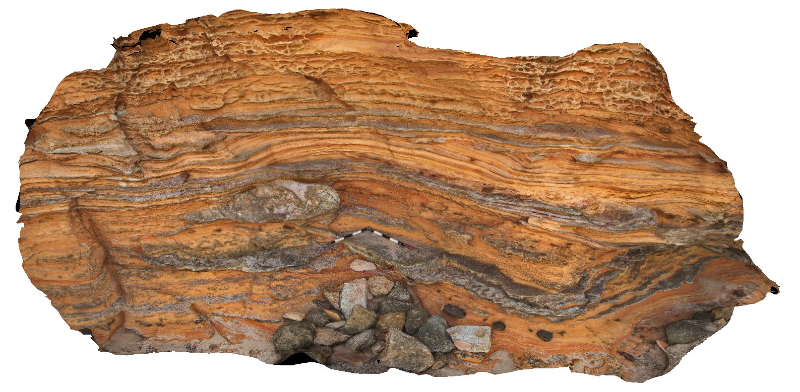
Brighton2 Map
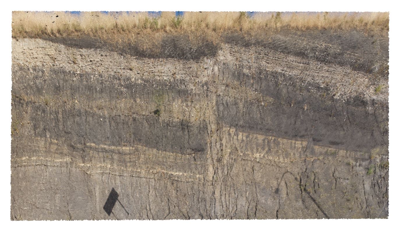 |
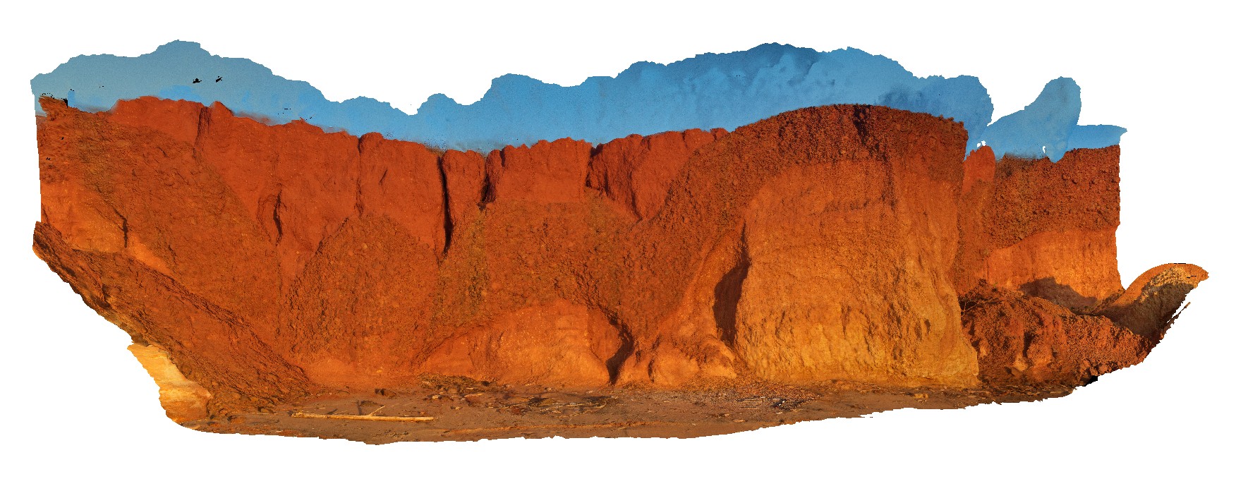
5 |
01/01/9999 midnight |
3D |
faulting in Triassic age rocks, with overall outcrop dipping towards the S/SW. Brighton, Tas. |
0.00 |
-42.70312000000 |
147.27122000000 |
-9999.000 |
fault, dip, structure |
siltstone |
Brighton3 Map
 |
5 |
01/01/9999 midnight |
3D |
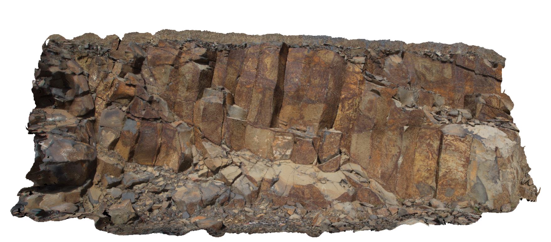
columnar jointing in Tertiary Basalt in road cutting. Brighton, Tas. |
8.00 |
-42.73004000000 |
147.23798000000 |
-9999.000 |
columnar jointing, joint, Tertiary basalt |
basalt |
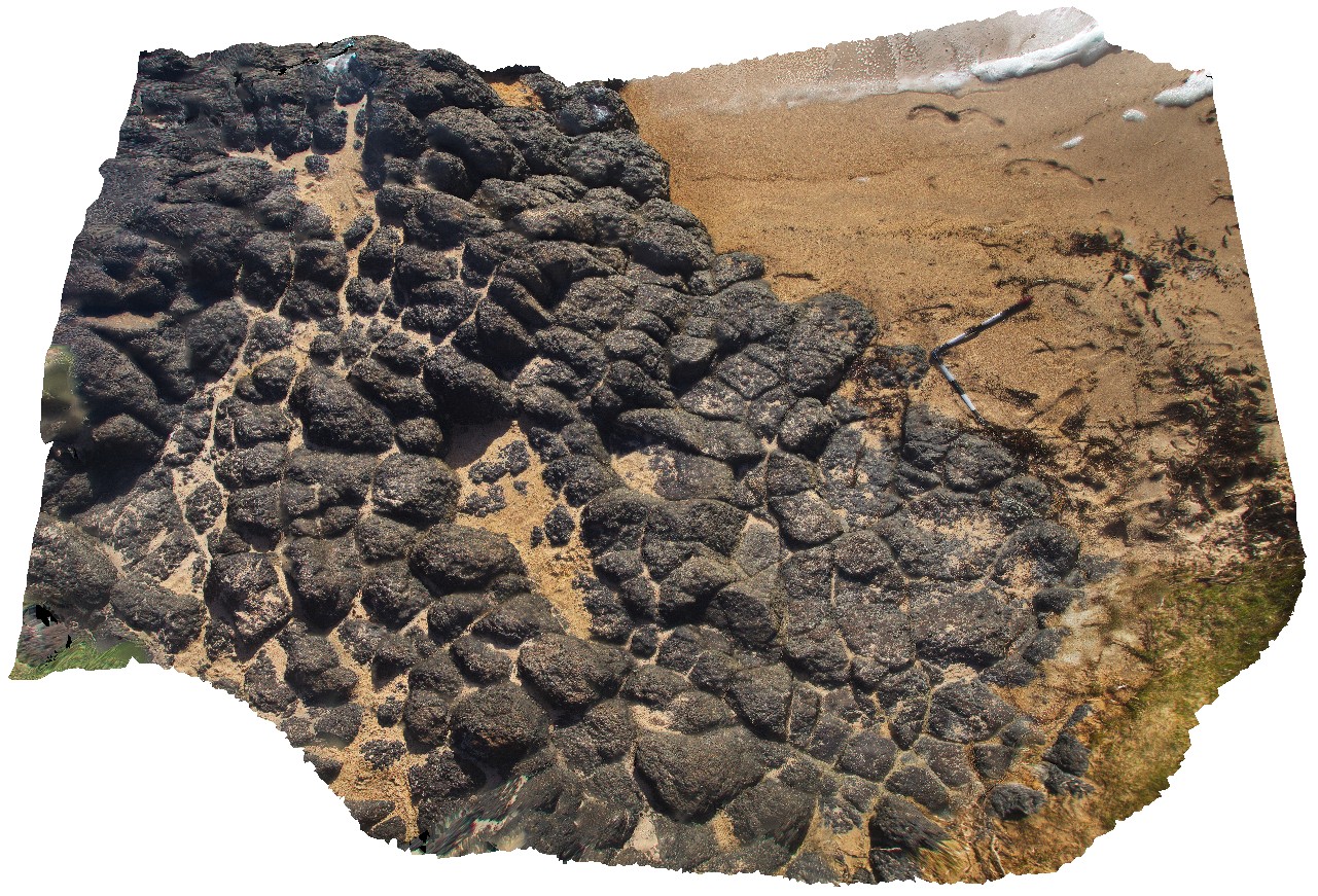
Broome1 Map
 |
0 |
06/03/2016 noon |
3D |
Mudstone rip-up clasts on the base of channels in fluvial sandstone, Broome, W.A. |
2.00 |
-18.00649000000 |
122.21097000000 |
-9999.000 |
rip-up clasts, sandstone, sedimentology |
sandstone |
Broome2 Map
 |
0 |
06/03/2016 noon |
3D |
channels cut into cross bedded and ripple marked sandstone with concretions, Broome, W.A. |
5.00 |
-18.00831000000 |
122.20945000000 |
-9999.000 |
cross bedding, ripple marks, sandstone, sedimentology |
sandstone |
Broome3 Map
 |
0 |
06/03/2016 noon |
3D |
truncated cross-beds overlain by ripple-marked sandstone with discrete grey channel deposits with rip-up clasts. Broome, W.A. |
6.00 |
-18.00823000000 |
122.20943000000 |
-9999.000 |
rip-up clasts, truncated crossbedding, ripple marks, sandstone, sedimentology |
sandstone |
Broome4 Map
 |
0 |
06/03/2016 noon |
3D |
channels and concretions in orange, cross-bedded sandstone. Broome, W.A. |
0.00 |
-18.00847000000 |
122.20957000000 |
-9999.000 |
sandstone, channels, cross-bedded, sedimentology |
sandstone |
Broome5 Map
 |
0 |
06/03/2016 noon |
3D |
large channel of grey sandstone exposed in three dimensions with ripple marks on bedding surface. Broome, W.A. |
7.00 |
-18.00866000000 |
122.20945000000 |
-9999.000 |
channel deposit, sandstone, ripple marks, sedimentology |
sandstone |
Broome6 Map
 |
0 |
06/03/2016 noon |
3D |
Cretaceous sandstone pinnacles draped by Quaternary regolith including cobble bed. Broome, W.A. |
1.00 |
-17.97371000000 |
122.18307000000 |
-9999.000 |
Cretaceous sandstone, cobbles, sedimentology, unconformity |
sandstone, sand |
Broome7 Map
 |
0 |
06/03/2016 noon |
3D |
in-situ regolith developed on Cretaceous sandstone, overlain by Quaternary cobble/boulder layer and aeolian red sands. Broome, W.A. |
16.00 |
-17.97445000000 |
122.18245000000 |
-9999.000 |
Cretaceous sandstone, Quaternary sediments, regolith profile, red sands, sedimentology |
sand |
Buchan1 Map
 |
5 |
07/21/2015 12:36 p.m. |
3D |
Open anticline in layered carbonate sediments of the Taravale Marlstone. Buchan, VIC. |
25.00 |
-37.49040000000 |
148.17535000000 |
-9999.000 |
marl, anticline, fold, structure |
marl |
Buchan2 Map
 |
10 |
07/21/2015 2 p.m. |
3D |
Large outcrop of steeply dipping Buchan Caves Limestone with gentle folds. Buchan, VIC. |
80.00 |
-37.49072000000 |
148.16913000000 |
-9999.000 |
limestone, folds, structure |
Limestone |
Buchan3 Map
 |
10 |
07/21/2015 3:20 p.m. |
3D |
Detail of parasitic fold in Buchan Caves Limestone as depicted in Buchan2. Buchan, VIC. |
20.00 |
-37.49072000000 |
148.16913000000 |
-9999.000 |
limestone, fold, structure |
limestone |
Buchan4 Map
 |
10 |
07/18/2015 2:58 p.m. |
3D |
Buchan thrust fault -Folding in the hanging wall in Buchan Caves Limestone. Buchan, VIC. |
100.00 |
-37.50776000000 |
148.21648000000 |
-9999.000 |
limestone, thrust fault, structure |
limestone |
Buchan5 Map
 |
10 |
07/28/2015 11:14 a.m. |
3D |
Detail of hanging wall folding above the Buchan Fault folds are in Buchan Caves Limestone. Buchan, VIC. |
40.00 |
-37.50776000000 |
148.21648000000 |
10.000 |
limestone, fold, thrust fault, structure |
limestone |
Bunbury1 Map
 |
0 |
05/15/2016 noon |
3D |
surface view of Bunbury basalt, showing irregular column tops at the beach. Bunbury, W.A. |
4.30 |
-33.32181000000 |
115.63129000000 |
-9999.000 |
basalt columns |
basalt |
Bunbury2 Map
 |
0 |
05/15/2016 noon |
3D |
detail of the porphyritic nature of the Bunbury Basalt, Bunbury, W.A. |
0.25 |
-33.32165000000 |
115.63119000000 |
-9999.000 |
basalt |
basalt |
Bungwahl1 Map
 |
5 |
06/20/2016 4:44 p.m. |
3D |
Reverse fault in sediments Carboniferous sediments of the Boolambayte Formation. Bungwahl, N.S.W. |
8.00 |
-32.38022000000 |
152.36542000000 |
-9999.000 |
sandstone, mudstone, reverse fault, structure |
sandstone |
BunkerBay1 Map
 |
5 |
05/15/2016 noon |
3D |
folded foliation in gneiss with mineral stretching lineation on foliation surface at the east end of outcrop. Bunker Bay, Cape Naturaliste. W.A. This unit may also be known as high grade metamorphic rocks 74341 |
5.00 |
-33.53685000000 |
115.03130000000 |
-9999.000 |
fold, foliation, gneiss, structure, mineral lineation |
gneiss |