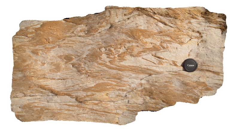
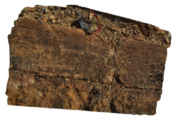
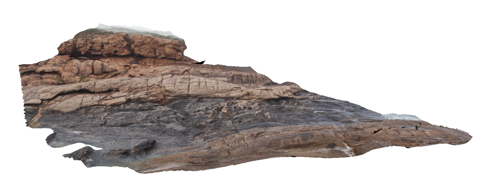
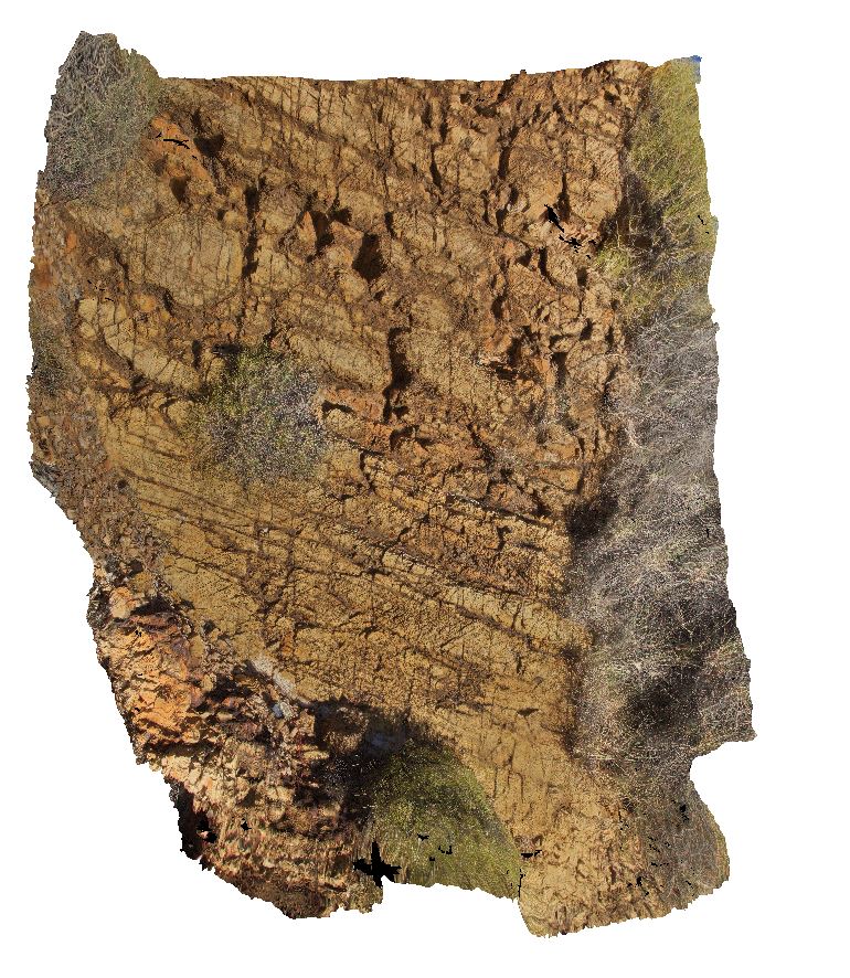
Eden8 Map
 |
5 |
07/09/2015 9:07 a.m. |
3D |
Tight folds in Ordovician Pinnak Sandstone. Eden, N.S.W. |
1.00 |
-37.07936000000 |
149.87646000000 |
2.000 |
sandstone, folds, faults, structure |
sandstone |
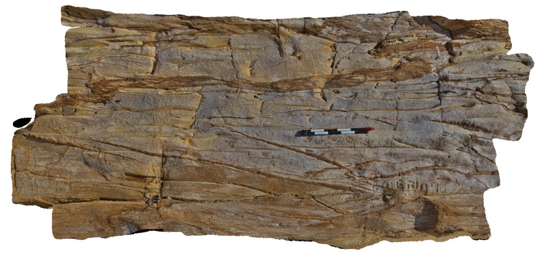
Eden9 Map
 |
5 |
07/09/2015 9:08 a.m. |
3D |
Cleavage - cross cutting disrupted coarser grained lithological units in sandstone of the Ordovician Pinnak Sandstone. Eden, N.S.W. |
3.00 |
-37.07940000000 |
149.87651000000 |
2.000 |
sandstone, cleavage, structure |
sandstone |
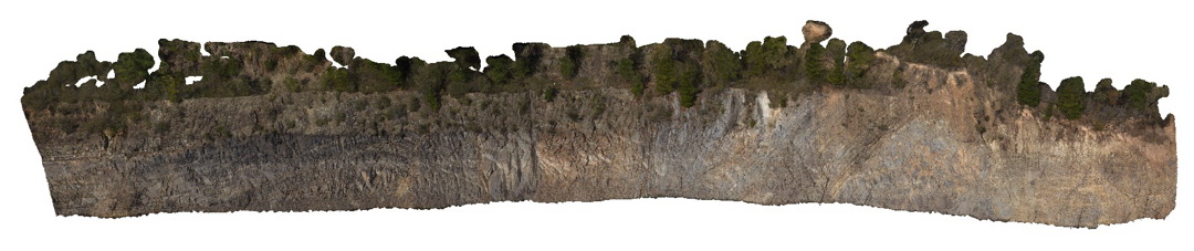
Eildon1 Map
 |
5 |
08/04/2015 11:57 a.m. |
3D |
folds in fine grained thinly bedded sandstone units of the Devonian Norton Gully Sandstone. Eildon, Vic. |
15.00 |
-37.20941000000 |
145.84427000000 |
590.000 |
fold, structure |
sandstone |
Eildon10 Map
 |
5 |
07/18/2015 3:32 p.m. |
3D |
large load casts on the base of a bedding plane in Devonian sandstone of the Eildon Sandstone. Eildon, Vic. |
1.50 |
-37.22460000000 |
145.93092000000 |
275.000 |
load casts, sedimentology |
sandstone |
Eildon11 Map
 |
5 |
07/18/2015 3:33 p.m. |
3D |
cross beds and soft sediment definition in sandstone beds. Eildon, Vic. |
1.00 |
-37.22462000000 |
145.93095000000 |
275.000 |
cross bedding, soft sediment deformation, slump folding, sedimentology |
sandstone |
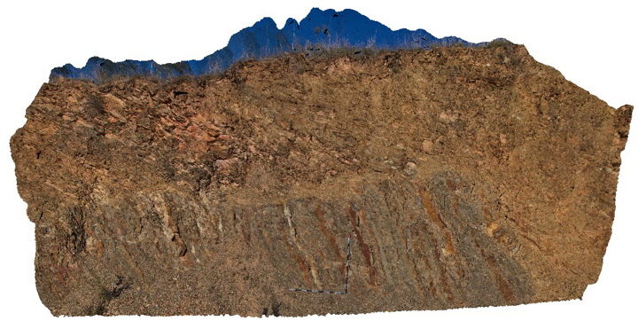
Eildon2 Map
 |
5 |
07/18/2015 3:26 p.m. |
3D |
bedding and folds in sandstone units of the Devonian Norton Gully Sandstone. Eildon, Vic. |
30.00 |
-37.20935000000 |
145.84427000000 |
590.000 |
folds, structure |
sandstone |
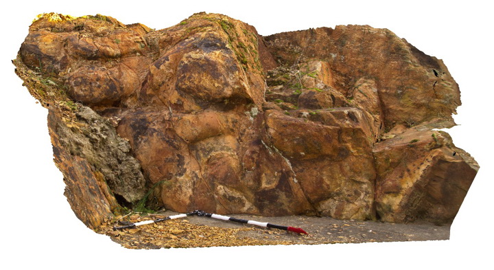
Eildon3 Map
 |
5 |
07/18/2015 3:27 p.m. |
3D |
downslope creep in surface sandstone beds of the Devonian Norton Gully Sandstone. Eildon, Vic. |
8.00 |
-37.22004000000 |
145.84851000000 |
530.000 |
creep |
sandstone |
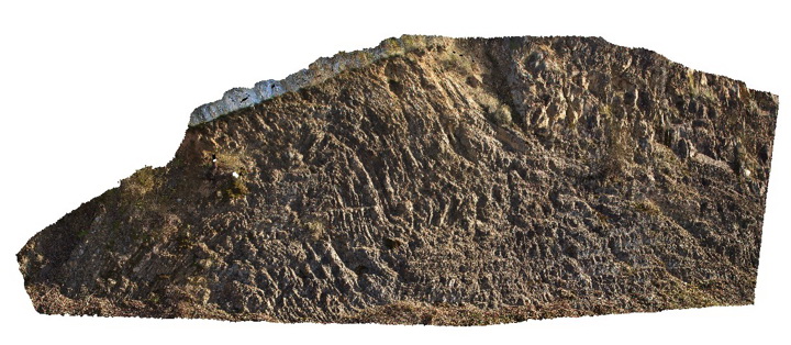
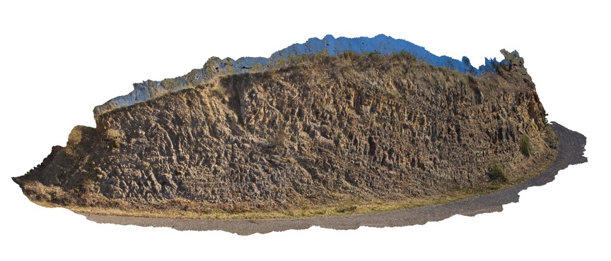
Eildon5 Map
 |
50 |
07/18/2015 3:28 p.m. |
3D |
Large anticline in sandstone units of the Devonian Eildon Sandstone. Poor visualisation due to limited vantage points. Eildon, Vic. |
150.00 |
-37.21855000000 |
145.91957000000 |
335.000 |
anticline, fold, structure |
sandstone |
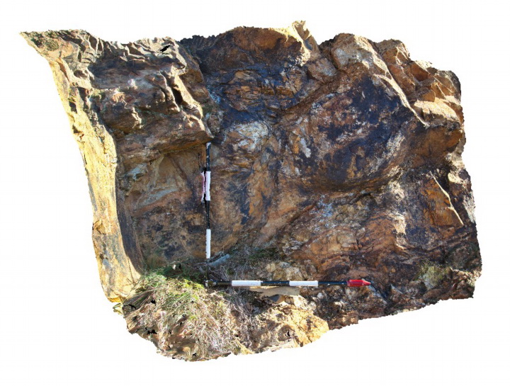
Eildon6 Map
 |
50 |
11/03/2015 2:39 p.m. |
3D |
folded and faulted sandstone of the Siluro-Devonian Jordon River Group. Eildon, Vic. |
200.00 |
-37.22475000000 |
145.93300000000 |
296.000 |
faults, folds, structure |
sandstone |
Eildon7 Map
 |
5 |
07/18/2015 3:29 p.m. |
3D |
Load casts in thickly bedded sandstone of the Devonian Eildon Sandstone. Eildon, Vic. |
1.50 |
-37.22447000000 |
145.93065000000 |
335.000 |
load casts, sedimentology |
sandstone |
Eildon8 Map
 |
5 |
07/18/2015 3:30 p.m. |
3D |
Load casts in thickly bedded sandstone of the Devonian Eildon Sandstone. Eildon, Vic. |
1.00 |
-37.22454000000 |
145.93071000000 |
335.000 |
load casts, sedimentology |
sandstone |
Eildon9 Map
 |
5 |
07/18/2015 3:31 p.m. |
3D |
large load casts in thickly bedded sandstone of the Devonian Eildon Sandstone. Eildon, Vic. |
1.50 |
-37.22460000000 |
145.93085000000 |
335.000 |
load casts, sedimentology |
sandstone |
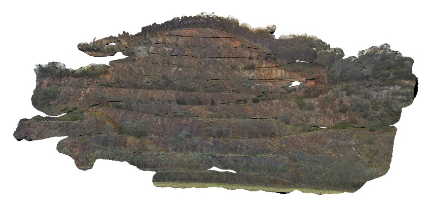
EildonFSP1 Map
 |
5 |
09/02/2015 2:59 p.m. |
FSP |
View of folded sandstone units of the Devonian Norton Gully Sandstone. Eildon, Vic. |
50.00 |
-37.20893000000 |
145.84412000000 |
590.000 |
folds, structure |
sandstone |
EildonFSP2 Map
 |
5 |
09/02/2015 2:59 p.m. |
FSP |
View of folded sandstone units of the Devonian Norton Gully Sandstone. Eildon, Vic. |
50.00 |
-37.20912000000 |
145.84433000000 |
590.000 |
folds, structure |
sandstone |
EildonFSP3 Map
 |
5 |
09/02/2015 2:59 p.m. |
FSP |
View of folded sandstone units of the Devonian Norton Gully Sandstone. Eildon, Vic. |
50.00 |
-37.20937000000 |
145.84433000000 |
590.000 |
folds, structure |
sandstone |
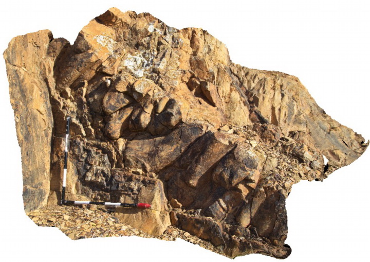
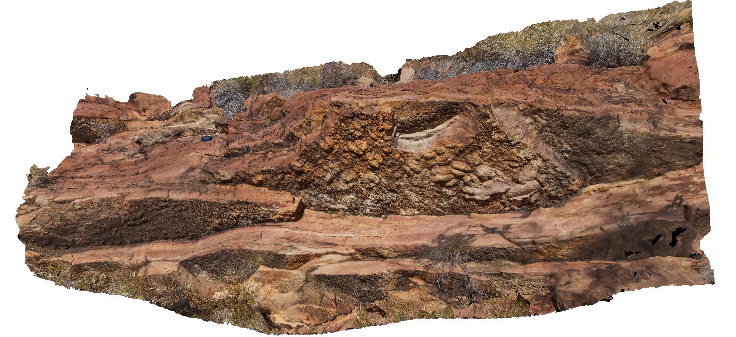
ElephantRock1 Map
 |
0 |
05/15/2016 noon |
3D |
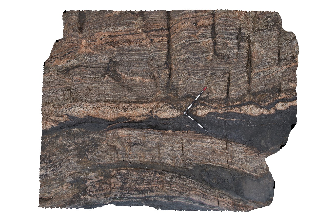
isoclinal folded gneiss with boudinaged pegmatite and amphibolite bands. Elephant Rock, W.A. |
5.00 |
-34.26623000000 |
115.03390000000 |
-9999.000 |
boudinage, gneiss, isoclinal fold |
gneiss, pegmatite |
ElephantRock2 Map
 |
0 |
05/15/2016 noon |
3D |
overview of thick amphibolite layer in gneiss, Elephant Rock, W.A. |
6.00 |
-34.26623000000 |
115.03390000000 |
-9999.000 |
amphibolite gneiss, metamorphic |
amphibolite gneiss, pegmatite |
ElephantRock3 Map
 |
0 |
05/15/2016 noon |
3D |
tight to isoclinal folds in thin amphibolite layers in gneiss. Elephant Rock, W.A. |
4.00 |
-34.26566000000 |
115.03399000000 |
-9999.000 |
isoclinal folding, gneiss, metamorphic |
gneiss |
ElephantRock4 Map
 |
0 |
05/15/2016 noon |
3D |
fold interference patterns in amphibolite layer in gneiss. Elephant Rock, W.A. |
1.40 |
-34.26561000000 |
115.03404000000 |
-9999.000 |
fold interference pattern, gneiss, structure |
gneiss |
ElephantRock5 Map
 |
0 |
05/15/2016 noon |
3D |
amphibolite layer that has been boudinaged and intruded by pegmatite and then shortened and folded. Elephant Rock, W.A. |
3.80 |
-34.27082000000 |
115.03548000000 |
-9999.000 |
structure, folding, boudinage |
gneiss |
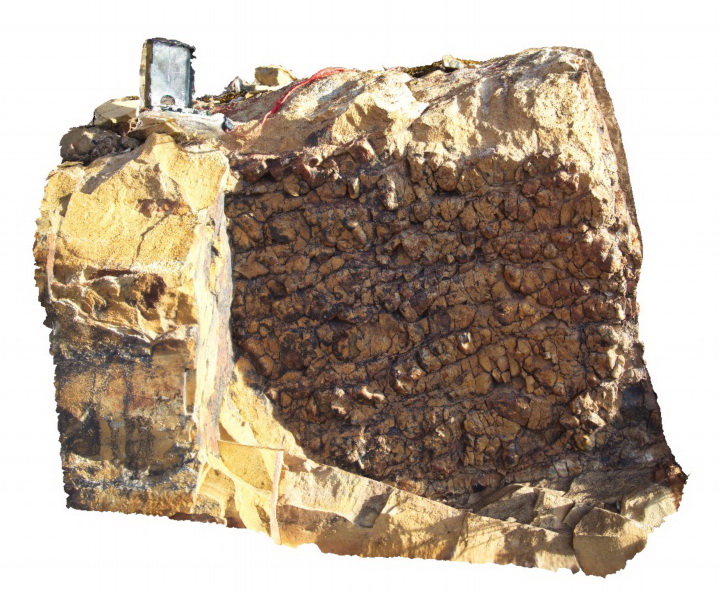
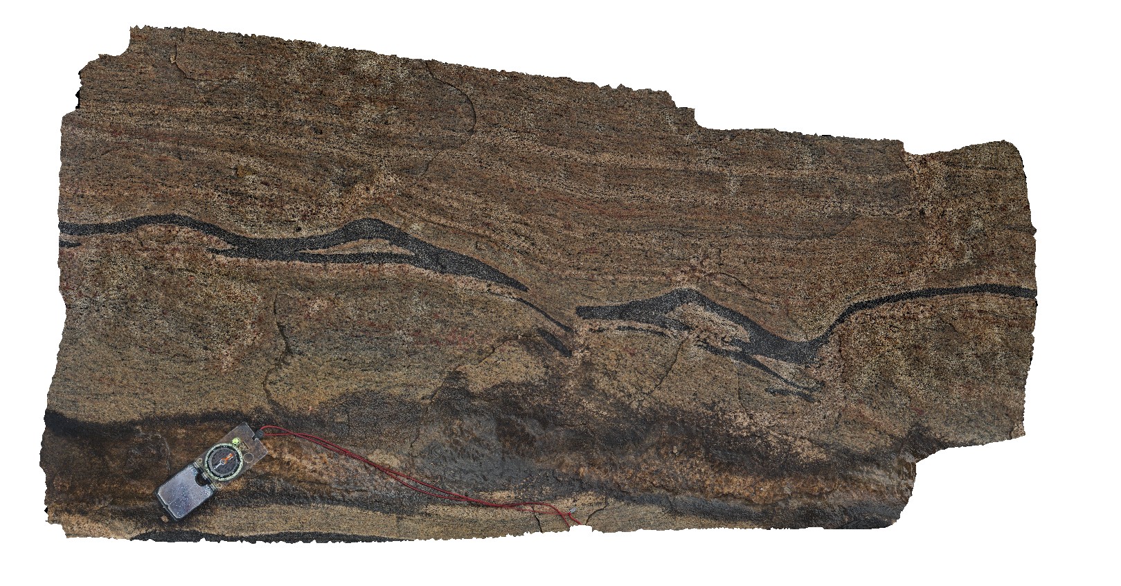
Elery1 Map
 |
5 |
08/02/2016 4:08 p.m. |
3D |
jointed and fractured dolostone layers west of Ellery Creek, Amadeus Basin. Ellery Creek Big Hole Dive. West MacDonnell National Park, N.T. |
2.50 |
-23.77911900000 |
133.06724100000 |
694.022 |
dolostone, sedimentology, Amadeus Basin, fracture, joint |
dolostone |
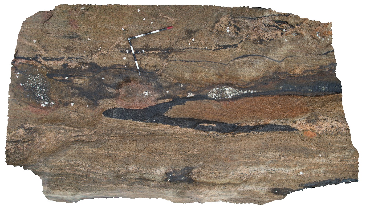
Elery10 Map
 |
5 |
01/01/9999 midnight |
3D |
possible vertical burrows / evaporite casts in sandstone outcrop. Ellery Creek Big Hole Dive. West MacDonnell National Park, N.T. |
4.00 |
-23.80827000000 |
133.06471000000 |
-9999.000 |
burrows, fossil, palaeontology, sedimentology |
sandstone |
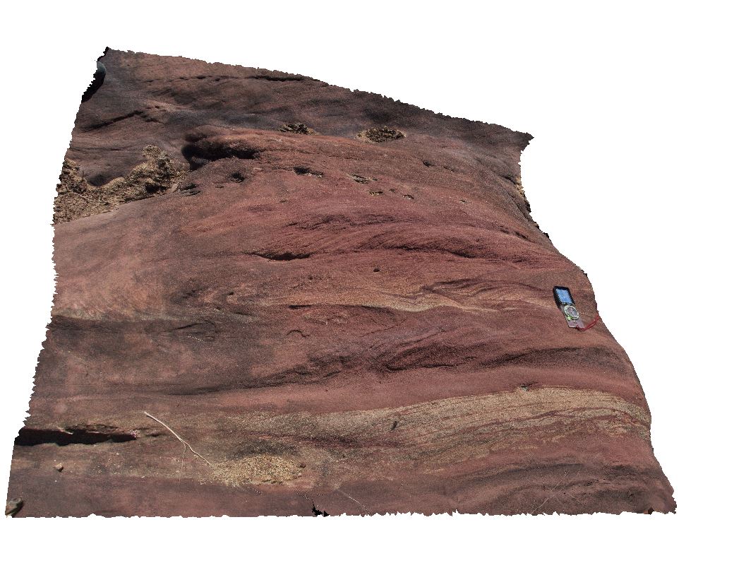
Elery11 Map
 |
5 |
01/01/9999 midnight |
3D |
cross bedded red sandstone in Ellery Creek. Ellery Creek Big Hole. West MacDonnell National Park, N.T. |
1.00 |
-23.79572000000 |
133.07445000000 |
-9999.000 |
cross bedding, sandstone, sedimentology |
sandstone |
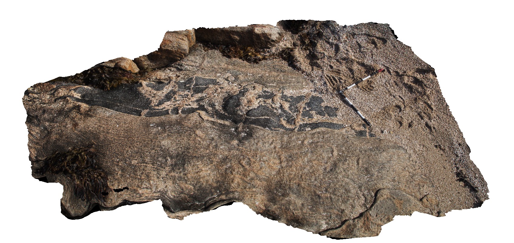
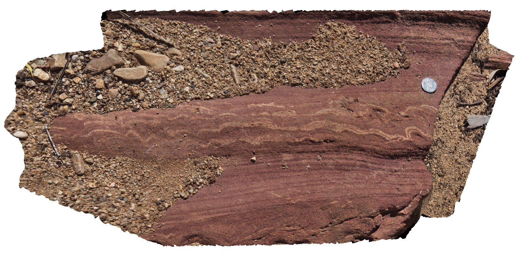
Elery12 Map
 |
5 |
01/01/9999 midnight |
3D |
cross bedded red sandstone in Ellery Creek. Ellery Creek Big Hole. West MacDonnell National Park, N.T. |
3.60 |
-23.79587000000 |
133.07449000000 |
-9999.000 |
cross bedding, sedimentology, sandstone |
sandstone |
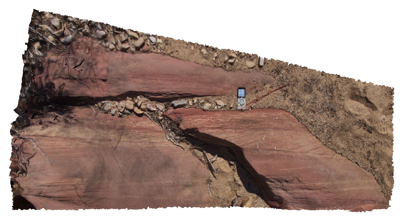
Elery13 Map
 |
5 |
01/01/9999 midnight |
3D |
de-watering structures in red sandstone. Ellery Creek Big Hole. West MacDonnell National Park, N.T. |
0.70 |
-23.79575000000 |
133.07437000000 |
-9999.000 |
de-watering structure, sedimentology, sandstone |
sandstone |