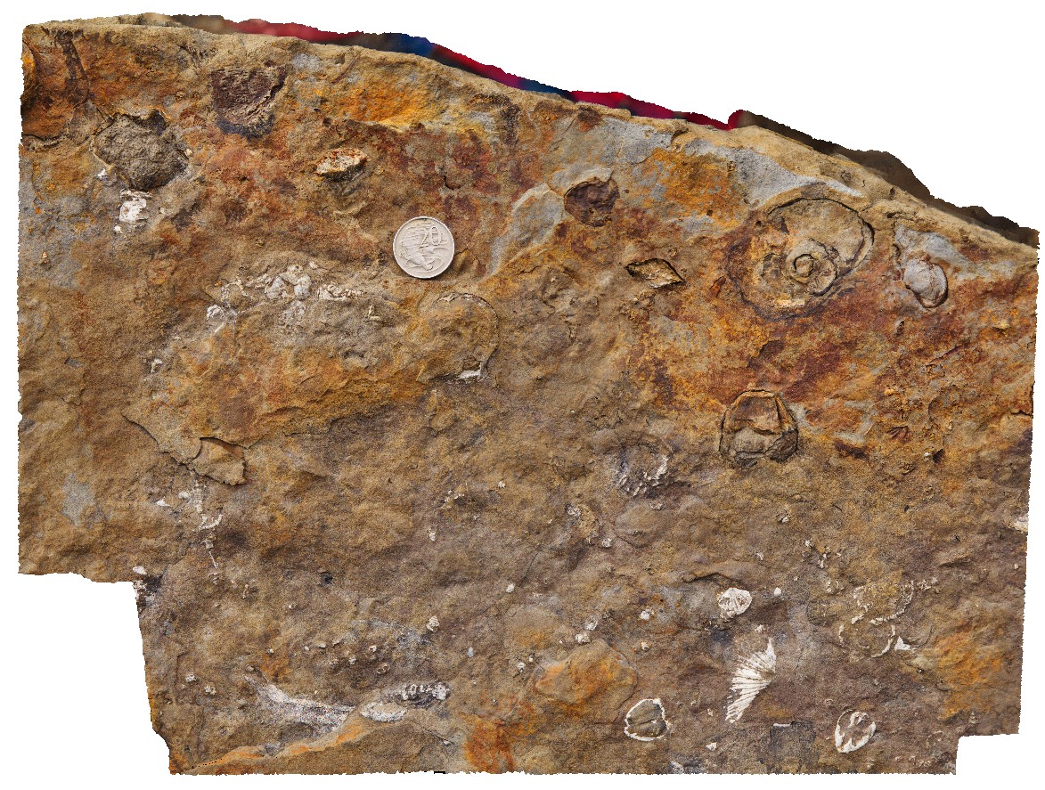
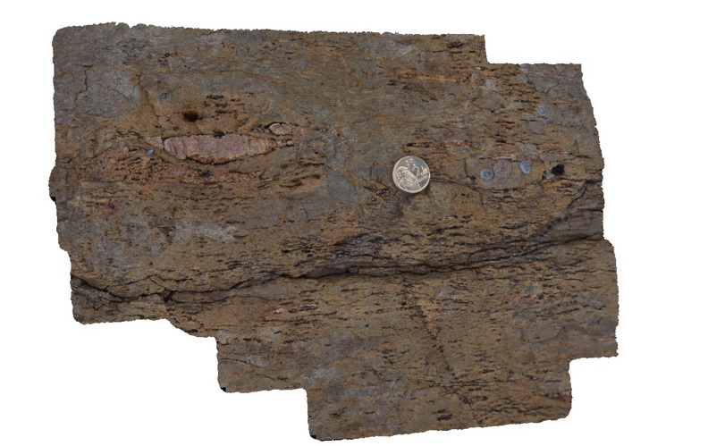
Eaglehawk3 Map
 |
5 |
01/01/9999 midnight |
3D |
detail of brachiopods, productids and gastropods in Permian sediment boulder. Eaglehawk Neck, Tasmania. |
0.50 |
-43.03429000000 |
147.94939000000 |
-9999.000 |
brachiopod, gastropod, fossil, palaeontology |
sandstone |
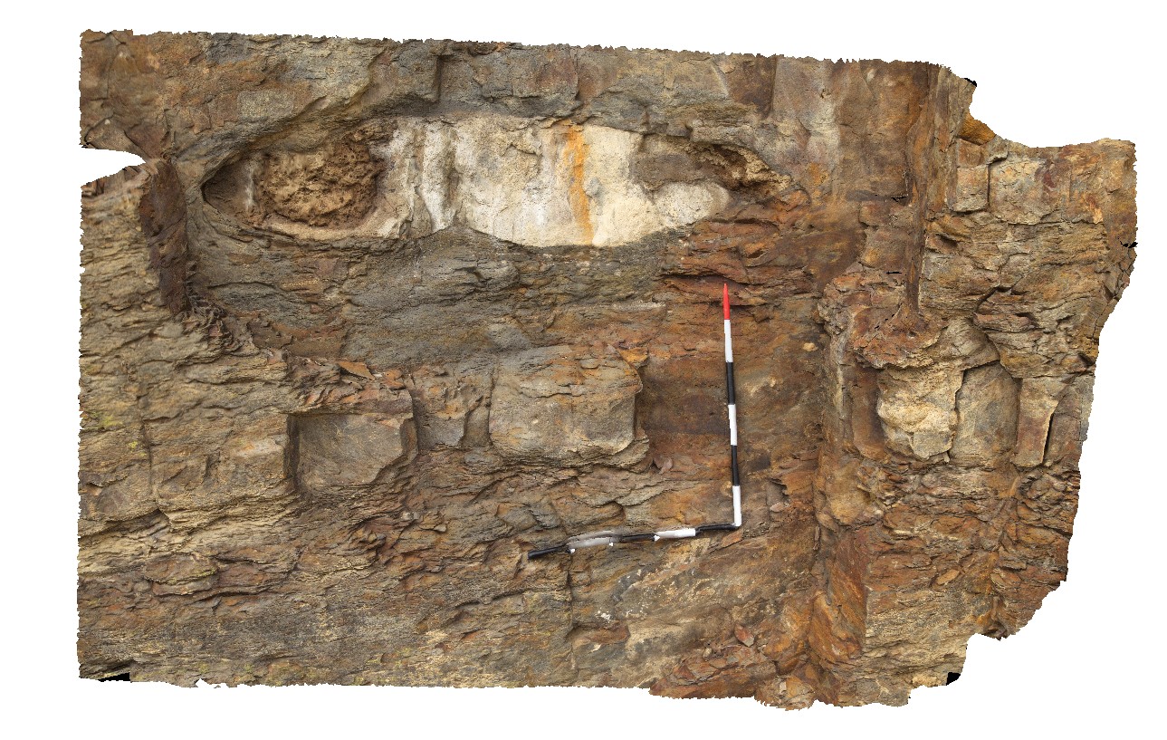
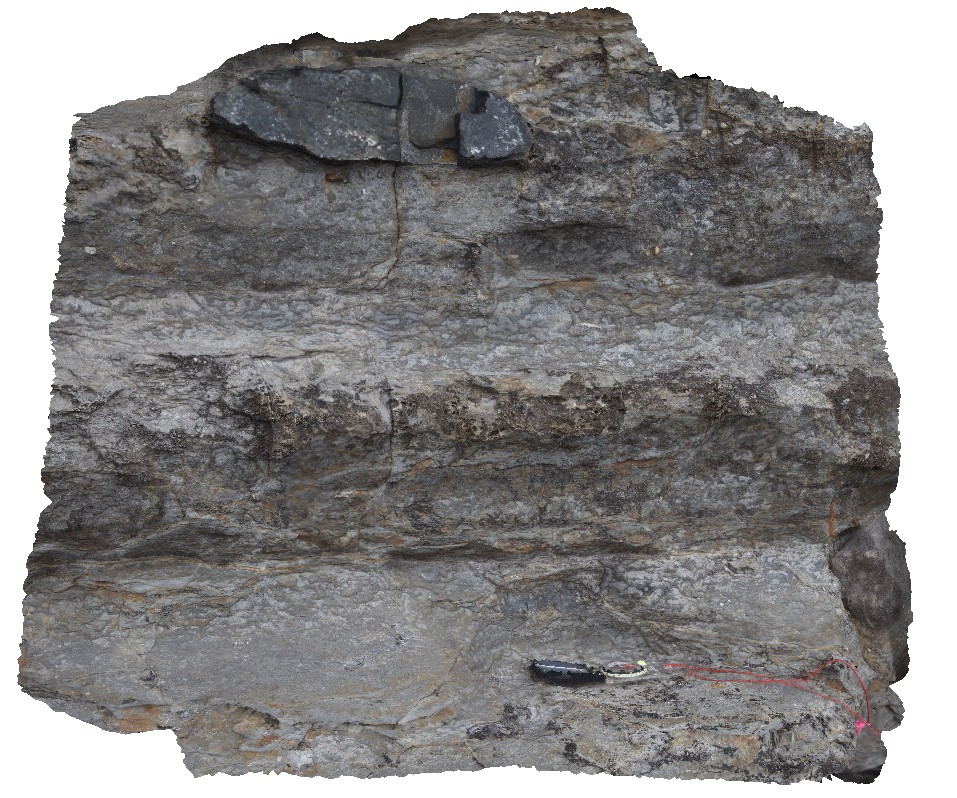
Eaglehawk4 Map
 |
5 |
01/01/9999 midnight |
3D |
elliptical concretion in Permian sediments. Eaglehawk Neck, Tasmania. |
2.30 |
-43.03431000000 |
147.94920000000 |
-9999.000 |
concretion, Permian sediment, sedimentology |
siltstone |
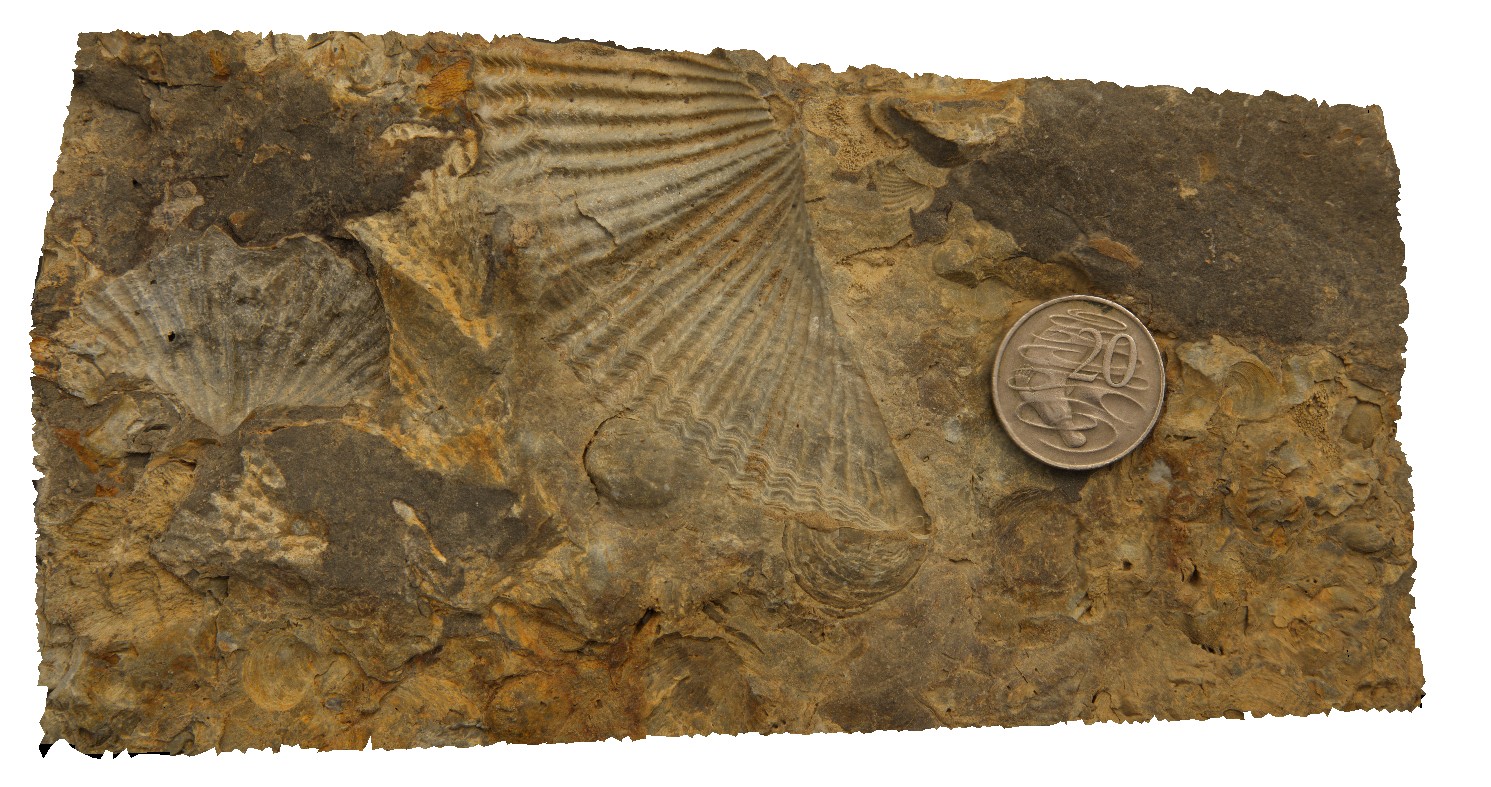
Eaglehawk5 Map
 |
5 |
01/01/9999 midnight |
3D |
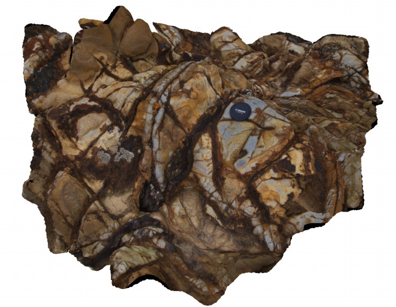
Spiriferid brachiopods and productids in loose boulders. Eaglehawk Neck, Tasmania. |
0.30 |
-43.03430000000 |
147.94918000000 |
-9999.000 |
Spiriferid brachiopods, Productids, brachiopods, fossil, Permian, palaeontology, fossiliferous |
siltstone |
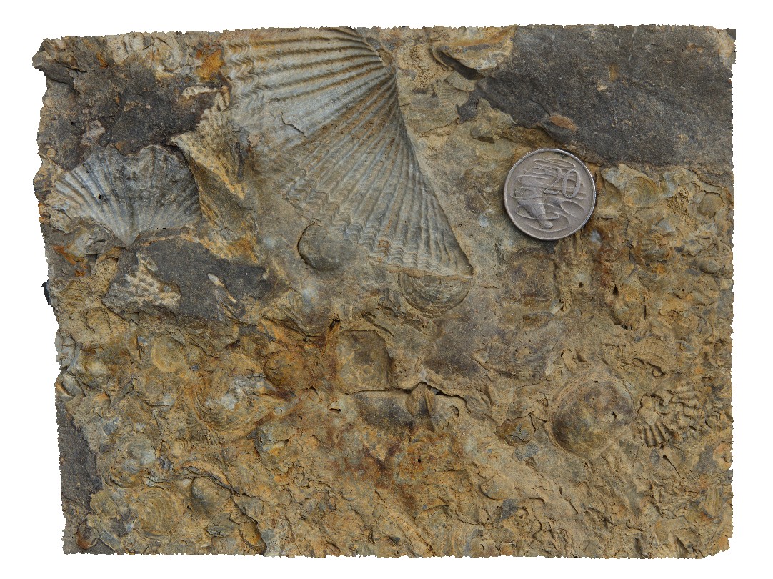
Eaglehawk6 Map
 |
5 |
01/01/9999 midnight |
3D |
detail of brachiopods from site Eaglehawk5, showing Spiriferid brachiopods and Productids. Eaglehawk Neck, Tasmania. |
0.25 |
-43.03430000000 |
147.94918000000 |
-9999.000 |
Spiriferid brachiopods, Productids, brachiopod, fossil, fossiliferous, palaeontology |
siltstone |
Eaglehawk7 Map
 |
5 |
01/01/9999 midnight |
3D |
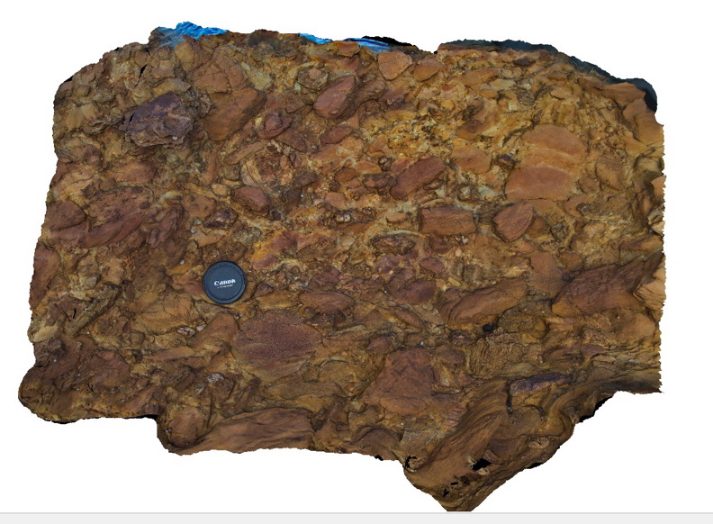
1m long concretion in Permian sediment layers. Eaglehawk Neck, Tasmania. |
6.00 |
-43.03387000000 |
147.94931000000 |
-9999.000 |
concretion, sedimentology |
siltstone |
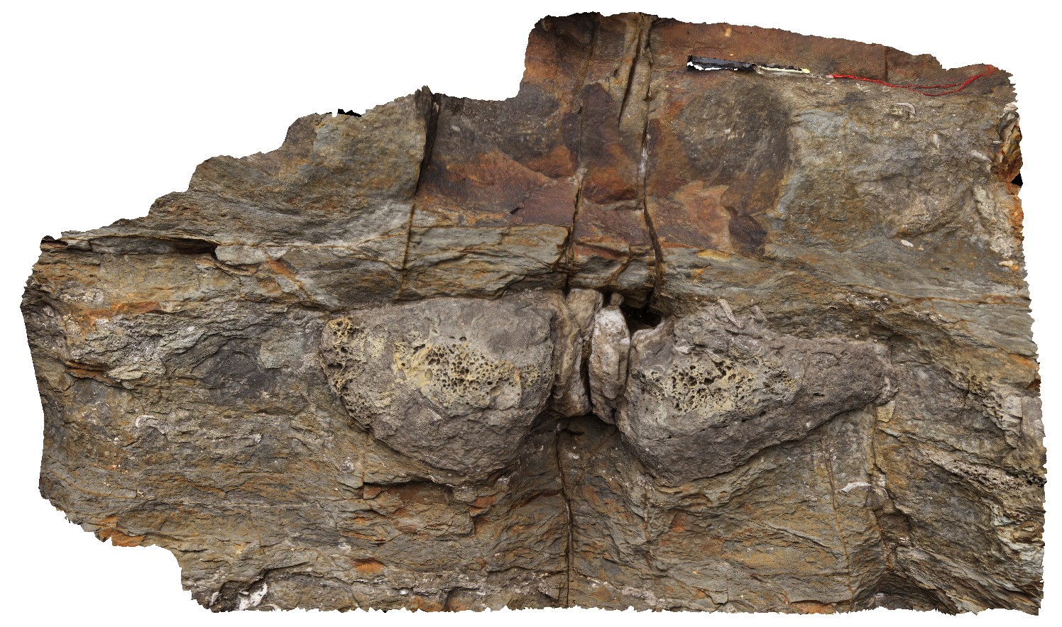
Eaglehawk8 Map
 |
5 |
01/01/9999 midnight |
3D |
detail of large concretion in site Eaglehawk7. Eaglehawk Neck, Tasmania. |
1.30 |
-43.03387000000 |
147.94931000000 |
-9999.000 |
concretion, Permian sediment, sedimentology |
siltstone |
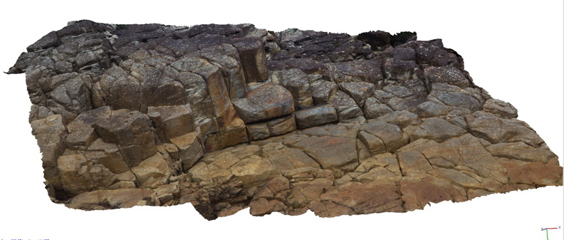
Eaglehawk9 Map
 |
5 |
01/01/9999 midnight |
3D |
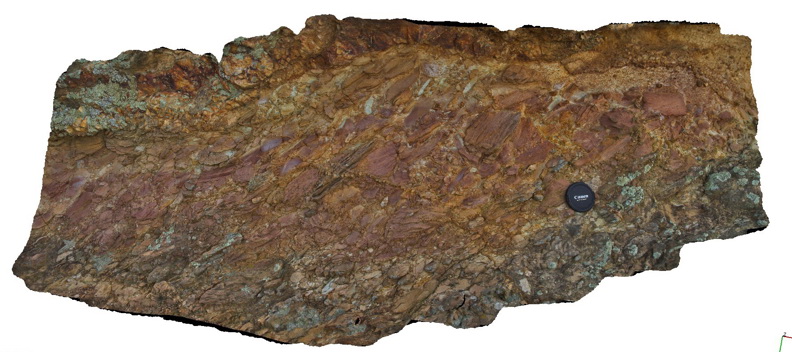
concretion and pebbly siltstone overlaying bioturbated Permian sediments with occasional thick shell fossils. Eaglehawk Neck, Tasmania. |
1.20 |
-43.03357000000 |
147.94931000000 |
-9999.000 |
concretion, bioturbation, Permian sediment, sedimentology, fossil, palaeontology |
siltstone |
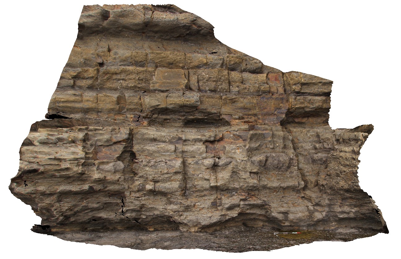
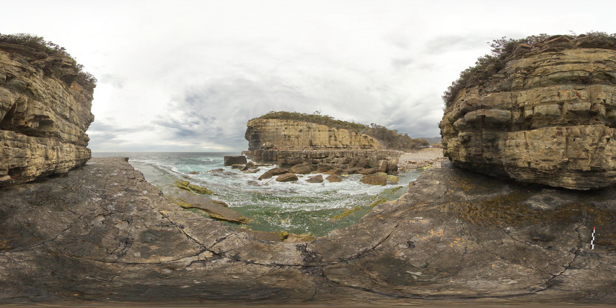
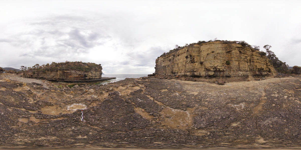
EaglehawkFSP1 Map
 |
5 |
01/01/9999 midnight |
FSP |
view from sea level platform of Permian pavement and layered buttress (Fossil Island). Eaglehawk Neck, Tasmania. |
1000.00 |
-43.03342000000 |
147.94910000000 |
-9999.000 |
Permian sediments, sedimentology |
siltstone |
EaglehawkFSP2 Map
 |
5 |
01/01/9999 midnight |
FSP |
view from sea level platform of Permian pavement and layered buttress (Fossil Island). Eaglehawk Neck, Tasmania. |
500.00 |
-43.03354000000 |
147.94933000000 |
-9999.000 |
Permian, fossils, Fossil Island, palaeontology |
siltstone |
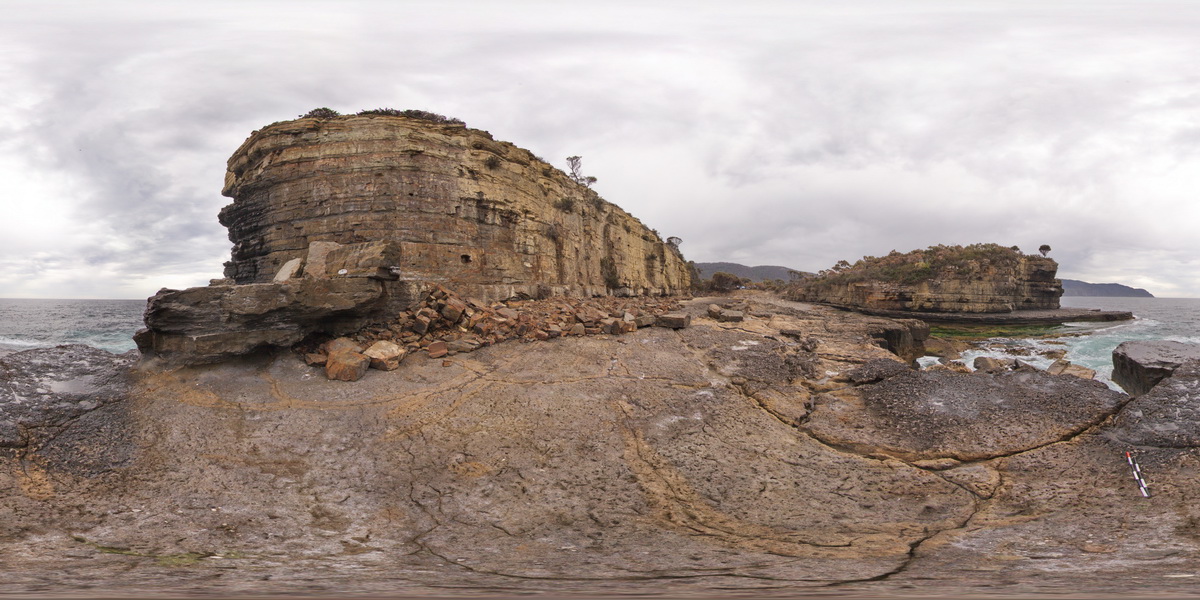
EaglehawkFSP3 Map
 |
5 |
01/01/9999 midnight |
FSP |
view from sea level platform of Permian pavement and layered buttress (Fossil Island). Eaglehawk Neck, Tasmania. |
500.00 |
-43.03371000000 |
147.94926000000 |
-9999.000 |
Permian, fossiliferous, Fossil Island |
siltstone |
EaglehawkFSP4 Map
 |
5 |
01/01/9999 midnight |
FSP |
view from sea level platform of Permian pavement and layered buttress (Fossil Island). Eaglehawk Neck, Tasmania. |
500.00 |
-43.03394000000 |
147.94908000000 |
-9999.000 |
Fossil Island, fossiliferous |
siltstone |
EaglehawkFSP5 Map
 |
5 |
01/01/9999 midnight |
FSP |
view from sea level platform of Permian conglomerate / tillite pavement and layered buttress (Fossil Island). Eaglehawk Neck, Tasmania. |
500.00 |
-43.03404000000 |
147.94878000000 |
-9999.000 |
Fossil Island, Permian, sedimentology |
siltstone |
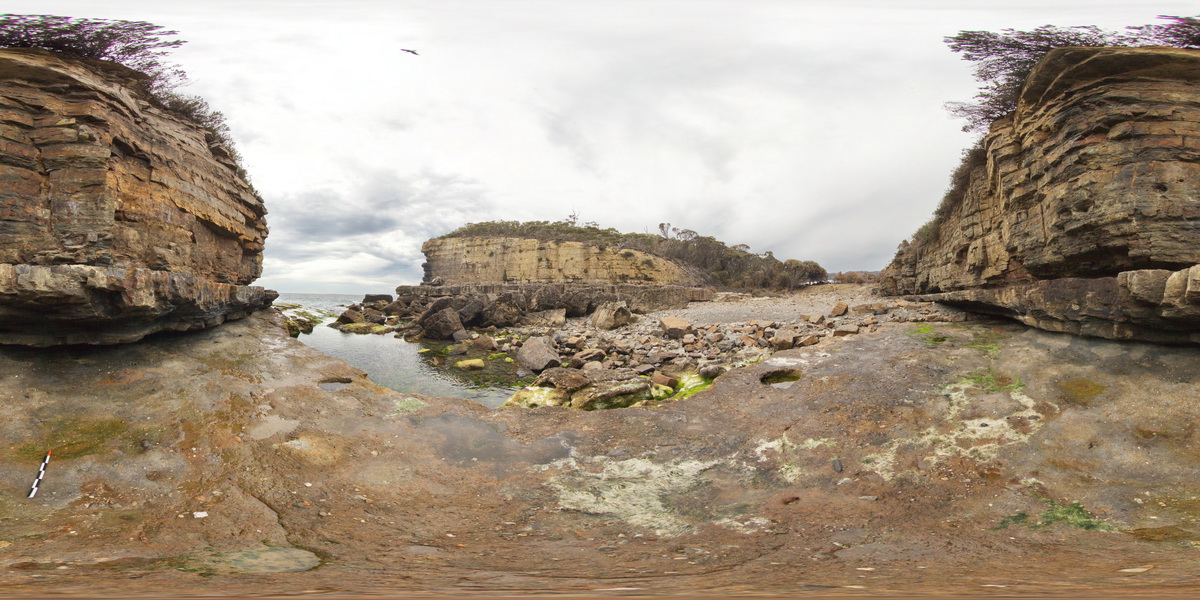
EaglehawkFSP6 Map
 |
5 |
01/01/9999 midnight |
FSP |
view from sea level platform of Permian pavement and layered buttress (Fossil Island). Eaglehawk Neck, Tasmania. |
500.00 |
-43.03429000000 |
147.94890000000 |
-9999.000 |
Permian sedimentary rocks, sedimentology |
siltstone |
EaglehawkFSP7 Map
 |
5 |
01/01/9999 midnight |
FSP |
view from sea level platform of Permian pavement and layered buttress (Fossil Island). Layered siltstones have large rounded dropstones. Eaglehawk Neck, Tasmania. |
200.00 |
-43.03424000000 |
147.94931000000 |
-9999.000 |
Permian sedimentary rocks, Fossil Island |
siltstone |
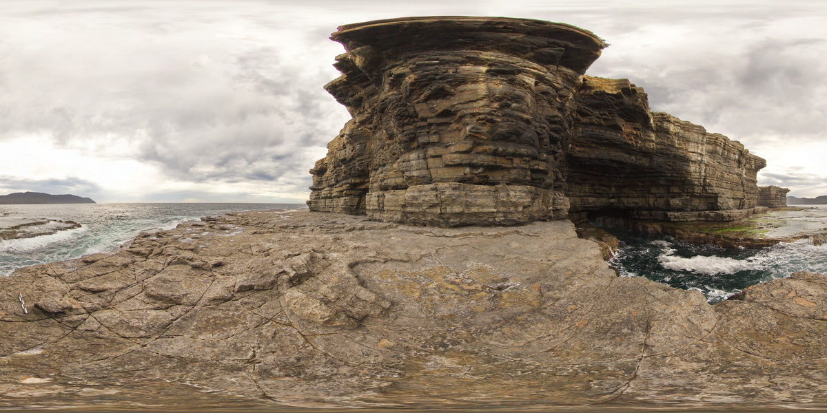
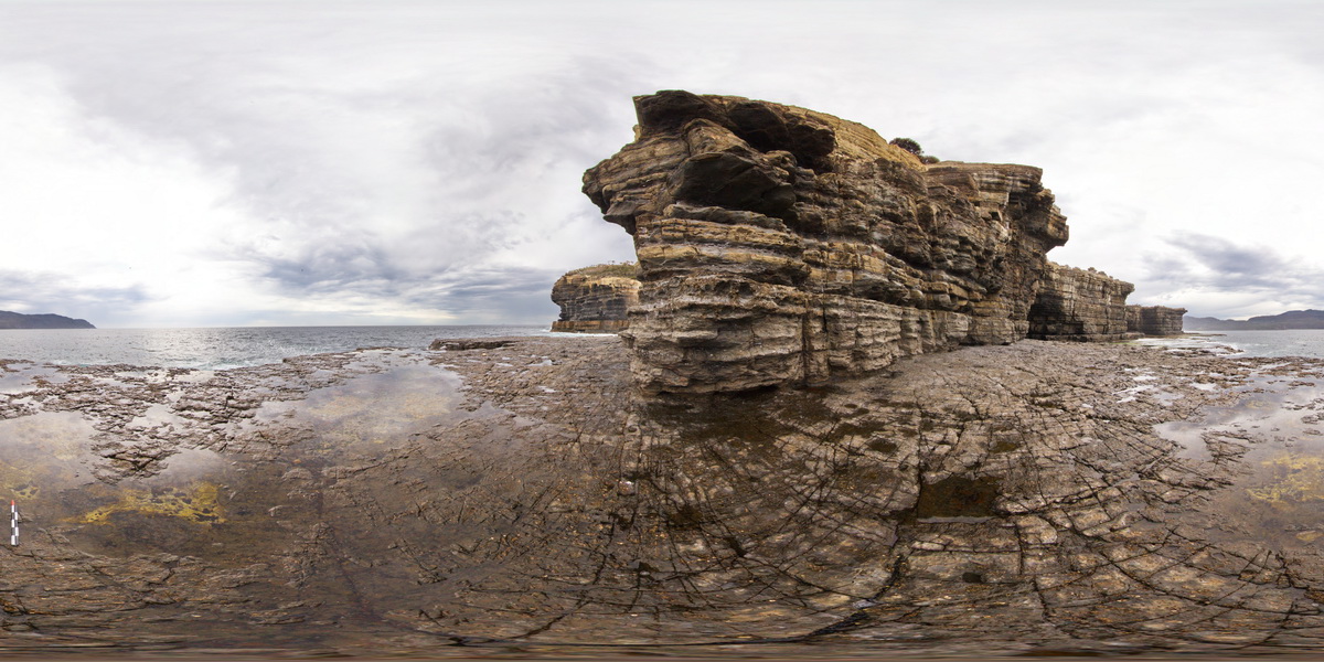
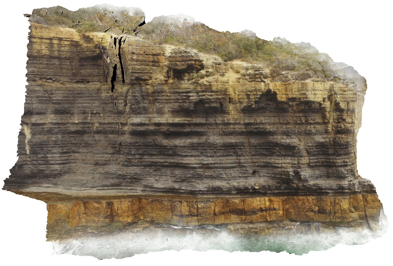
EaglehawkUAV1 Map
 |
20 |
01/01/9999 midnight |
UAV |
aerial view of Permian sea cliffs at Eaglehawk Neck, Tasmania. |
500.00 |
-43.03373200000 |
147.94973000000 |
94.070 |
sea cliff, Permian sediments |
sediments |
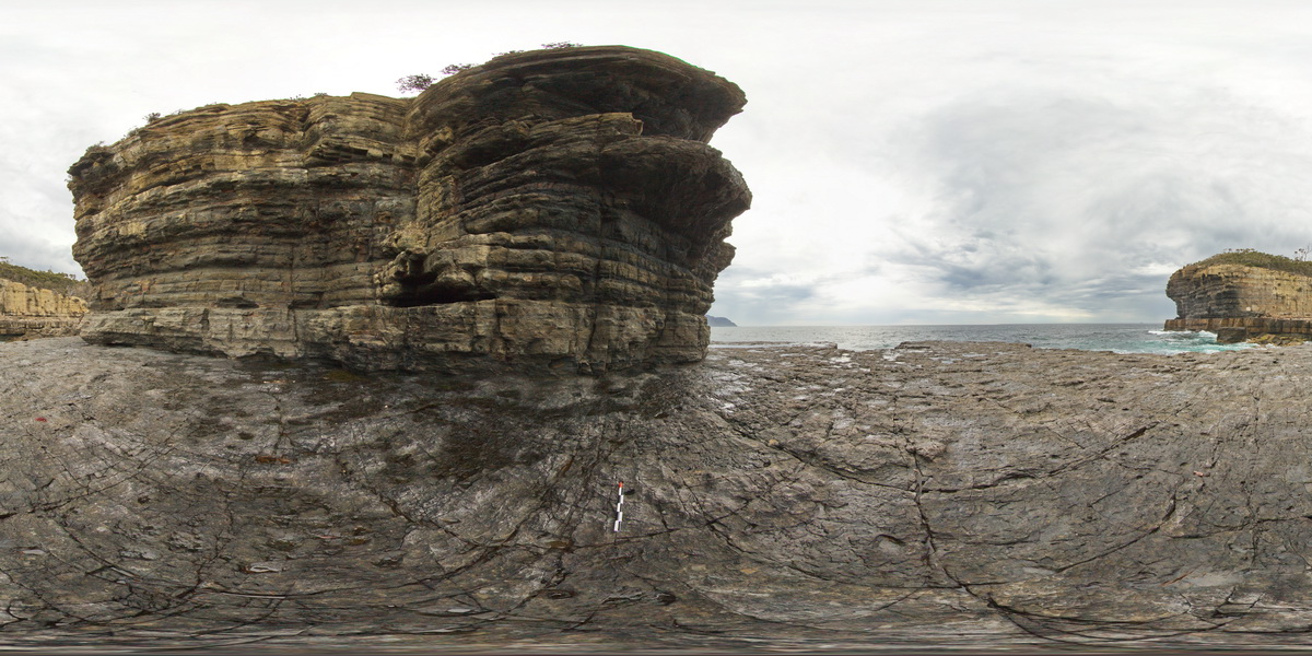
EaglehawkUAV2 Map
 |
20 |
01/01/9999 midnight |
UAV |
aerial view from the water of cliff, showing finely layered fine-grained mudstones / siltstones overlying blocky silt / sandstone beds. Eaglehawk Neck, Tasmania. |
120.00 |
-43.03425300000 |
147.94985100000 |
41.000 |
sedimentology, sediments, Parmeener Supergroup |
sediments |
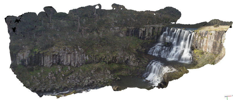
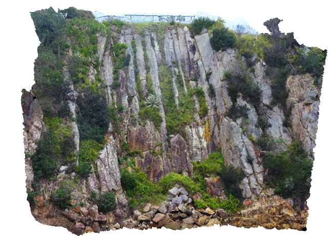
Ebor1 Map
 |
20 |
06/16/2015 5:35 p.m. |
3D |
Basalt columns forming the escarpment at Ebor falls. Ebor Falls, N.S.W. |
80.00 |
-30.40222000000 |
152.34140000000 |
1238.000 |
columnar basalt, igneous, geomorphology |
basalt |
Eden1 Map
 |
10 |
07/09/2015 8:59 a.m. |
3D |
cooling column in volcanics (rhyolite?). Eden, N.S.W. |
15.00 |
-37.07449800000 |
149.91533900000 |
2.000 |
columnar jointing, rhyolite, igneous, volcanology |
rhyolite |
Eden10 Map
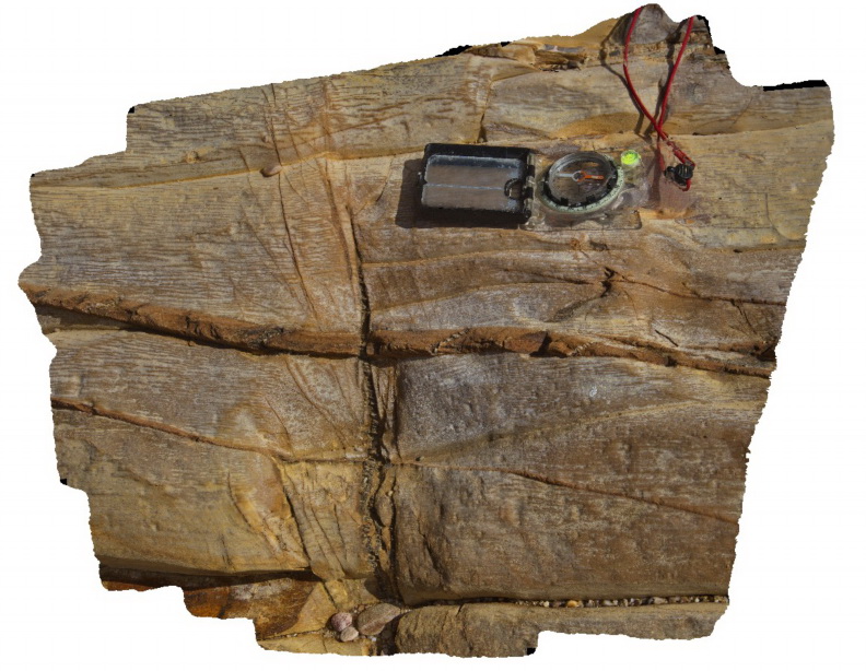 |
5 |
07/09/2015 9:08 a.m. |
3D |
Bedding, cleavage and quartz veins in fine grained sandstone of the Ordovician Pinnak Sandstone. Eden, N.S.W. |
0.50 |
-37.07940000000 |
149.87651000000 |
2.000 |
sandstone, cleavage, structure |
sandstone |
Eden2 Map
 |
5 |
07/09/2015 9 a.m. |
3D |
detail of volcanic textures in rhyolite of the Boyd Volcanic Complex. Flattened pumice? Or flow banding? Eden, N.S.W. |
0.30 |
-37.07510000000 |
149.91290000000 |
2.000 |
volcanics, pumice?, igneous, volcanology |
rhyolite |
Eden3 Map
 |
20 |
07/09/2015 9:04 a.m. |
3D |
Cooling columns at the base of B.R. volcanics. Eden, N.S.W. |
25.00 |
-37.07526500000 |
149.91372100000 |
0.000 |
rhyolite, columnar joints, igneous, volcanology |
rhyolite |
Eden4 Map
 |
5 |
07/09/2015 9:04 a.m. |
3D |
Iron oxide coated joints in felsic lava of the Devonian Boyd Volcanic Complex. Eden, N.S.W. |
1.50 |
-37.07536000000 |
149.91341000000 |
1.000 |
rhyolite, jointing, iron oxide, igneous, weathering |
rhyolite |
Eden5 Map
 |
5 |
07/09/2015 9:05 a.m. |
3D |
conglomerate with cobble sized angular clasts at the base of the Boyd Volcanic Complex. Eden, N.S.W. |
2.00 |
-37.07808000000 |
149.88478000000 |
2.000 |
conglomerate, sedimentology |
conglomerate |
Eden6 Map
 |
5 |
07/09/2015 9:06 a.m. |
3D |
conglomerate at the base of the Boyd River volcanics. Eden, N.S.W. |
1.50 |
-37.07814000000 |
149.88484000000 |
1.000 |
conglomerate, sedimentology |
conglomerate |
Eden7 Map
 |
5 |
07/09/2015 9:07 a.m. |
3D |
complex structures in sandstone unit of the Ordovician Pinnak Sandstone. Eden, N.S.W. |
0.50 |
-37.07926000000 |
149.87650000000 |
2.000 |
sandstone, folds, faults, structure |
sandstone |