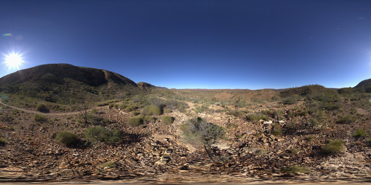
Elery2 Map
 |
5 |
08/02/2016 4:36 p.m. |
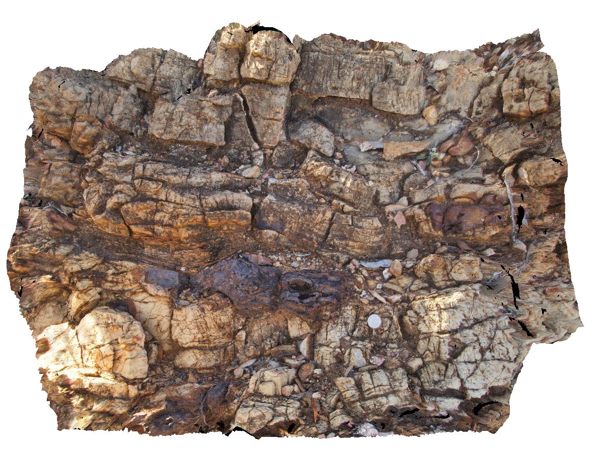
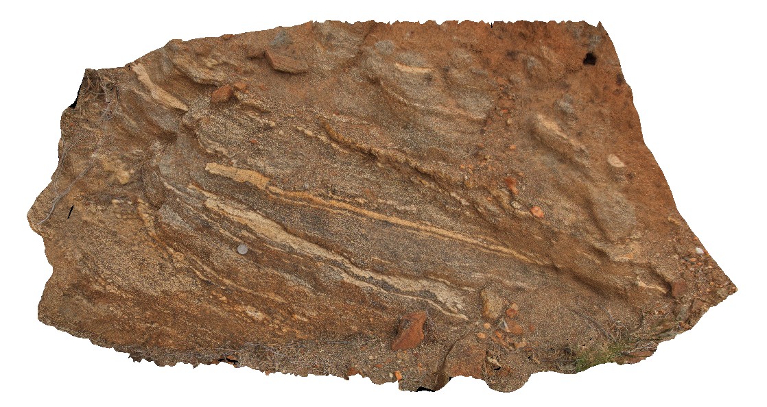
3D |
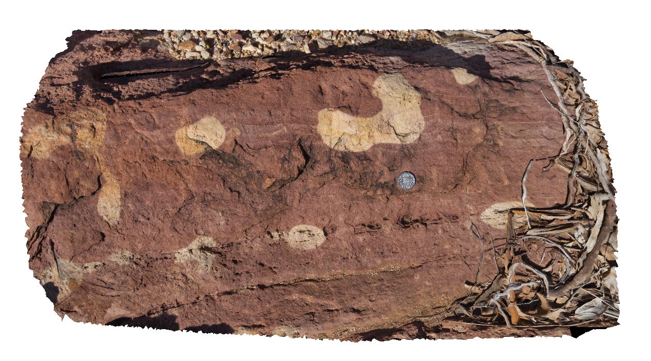
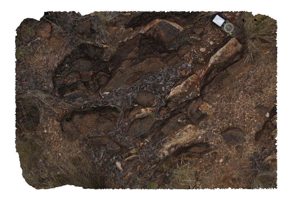
oxidised dropstone? between dolostone layers. Ellery Creek Big Hole Dive. West MacDonnell National Park, N.T. |
0.70 |
-23.77972800000 |
133.06480400000 |
713.319 |
dolostone, Ellery Creek Big Hole, sedimentology |
dolostone |
Elery3 Map
 |
0 |
08/02/2016 5 p.m. |
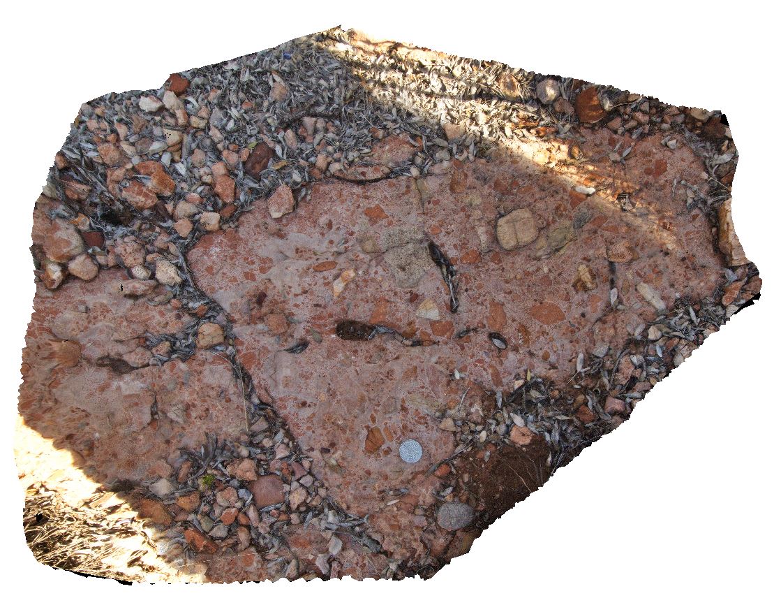
3D |
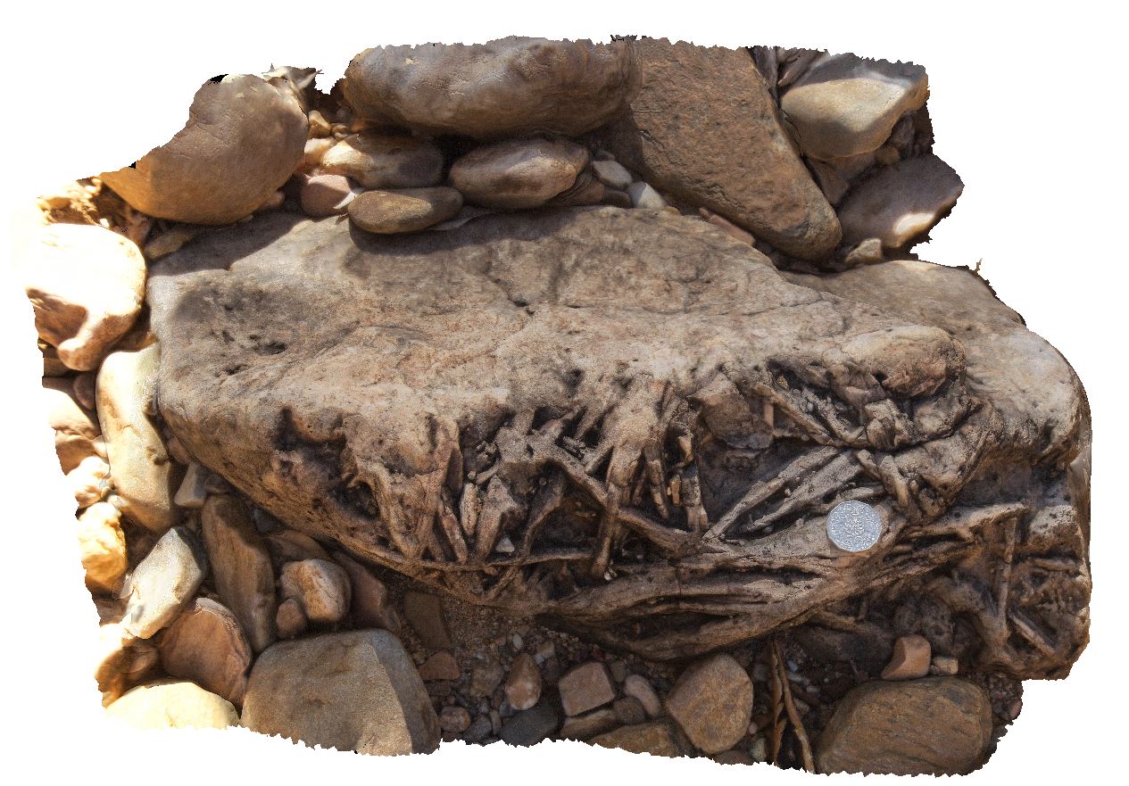
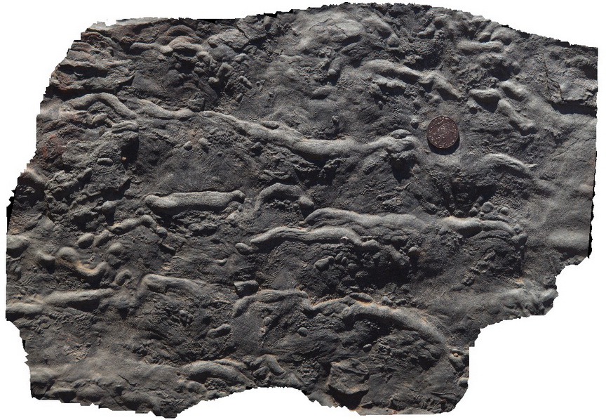
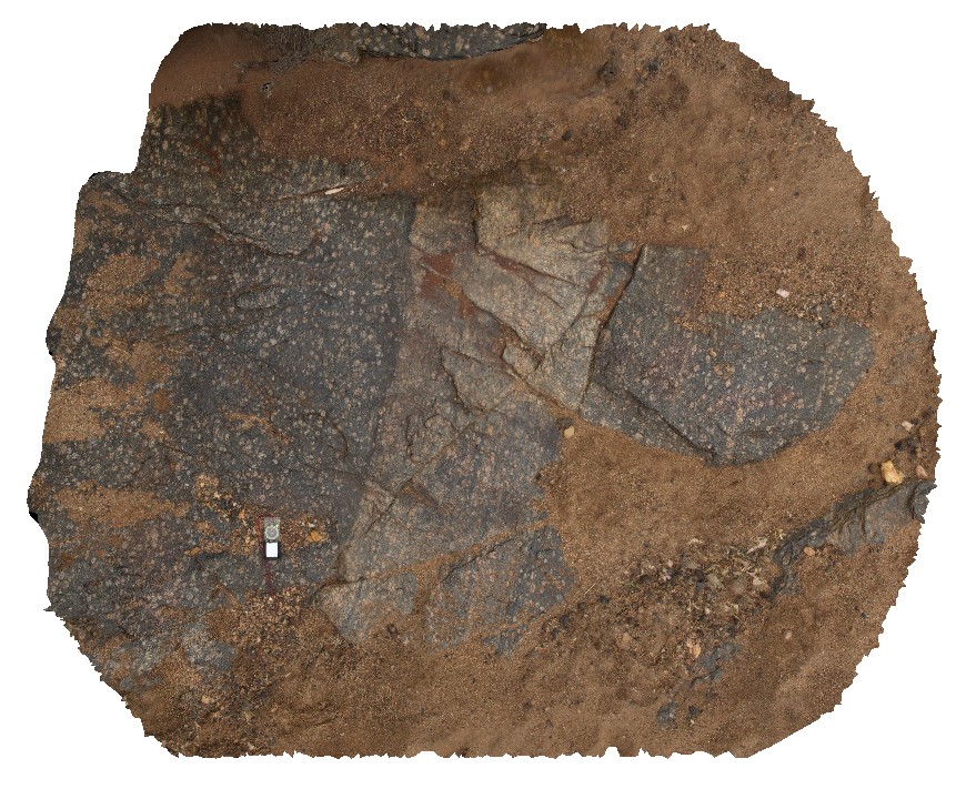
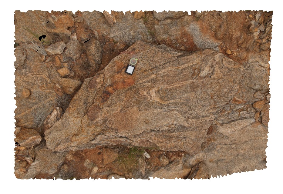
polymict diamictite / breccia of dolostone and siltstone. Ellery Creek Big Hole Dive. West MacDonnell National Park, N.T. |
0.60 |
-23.78352800000 |
133.07030200000 |
679.123 |
diamictite, polymict diamictite, sedimentology |
diamictite |
Elery4 Map
 |
5 |
08/02/2016 5:10 p.m. |
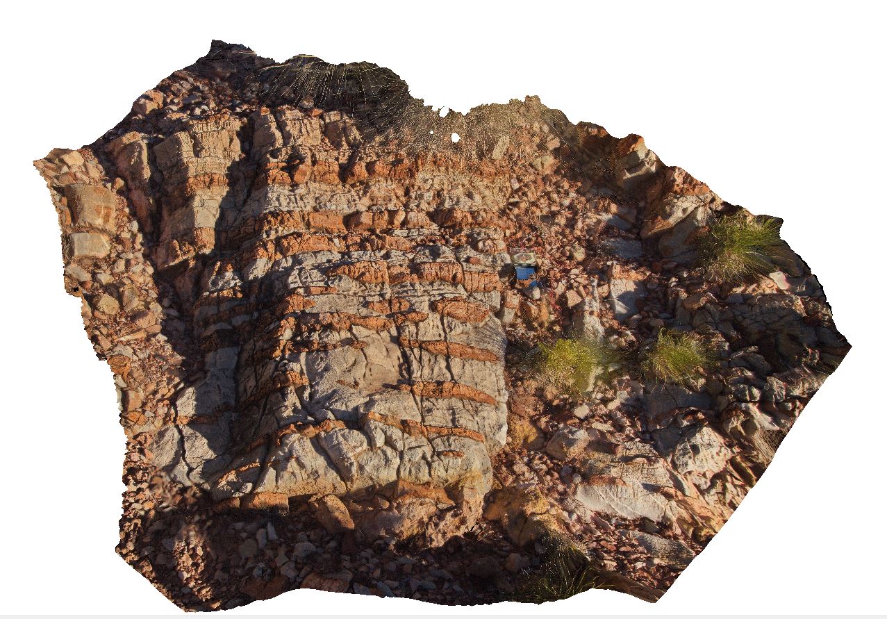
3D |
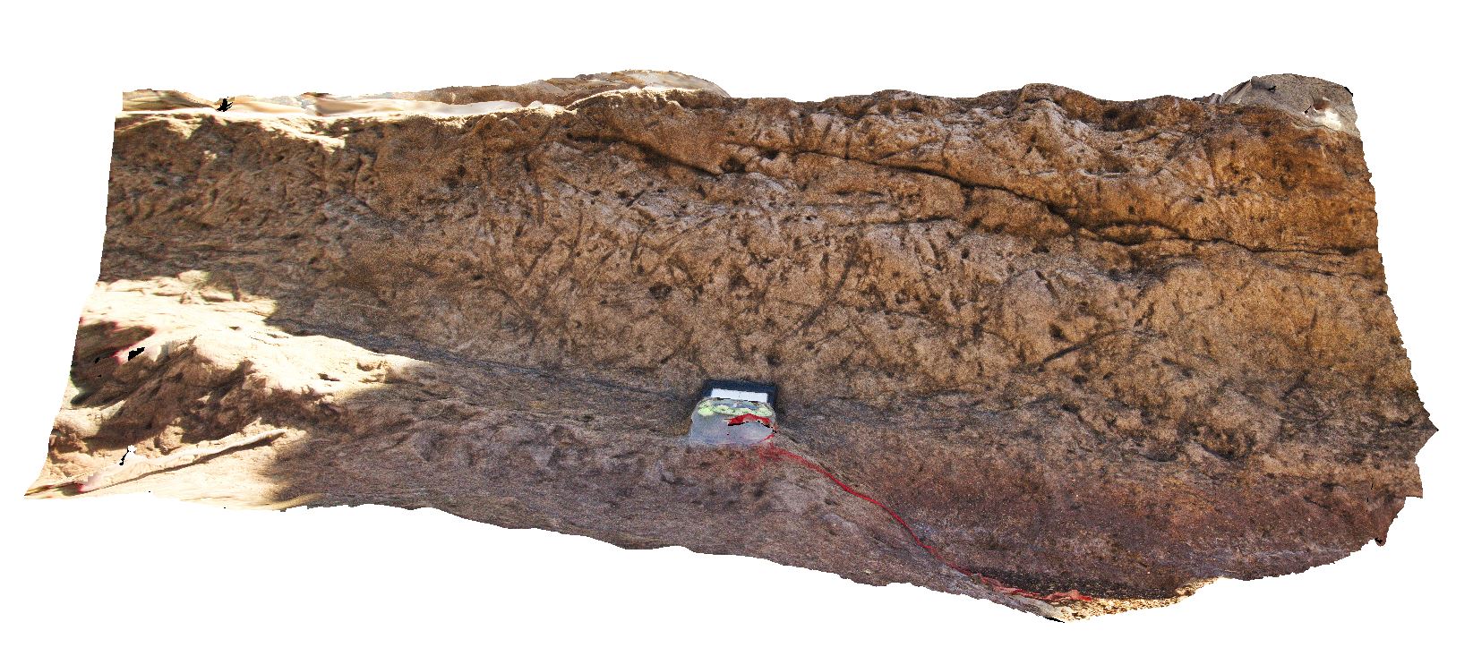
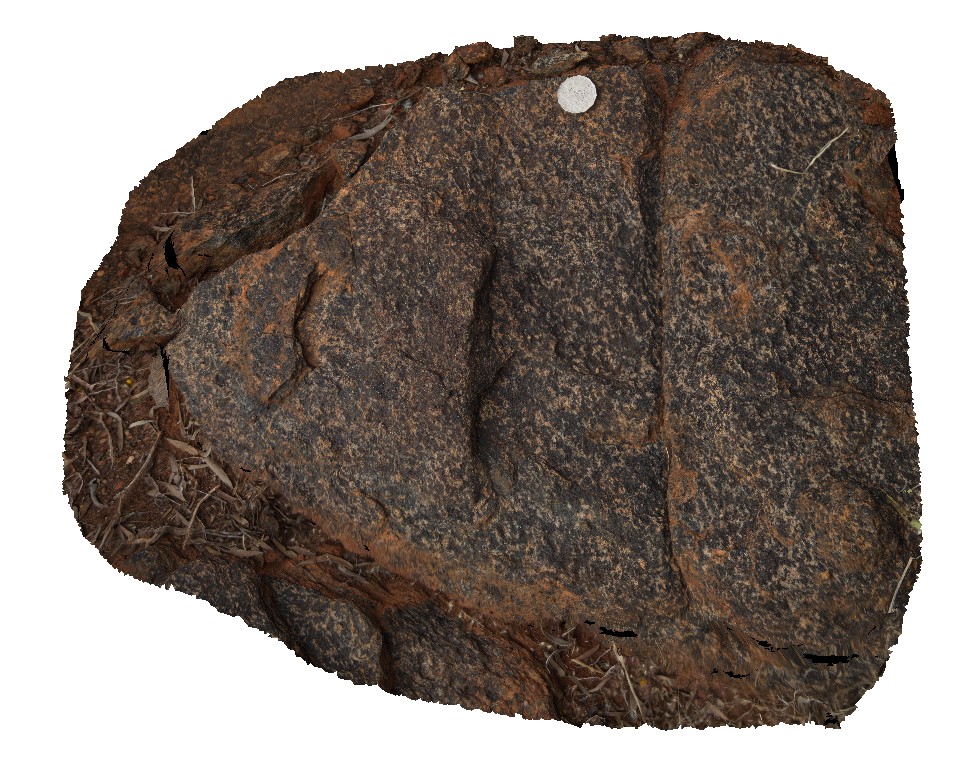
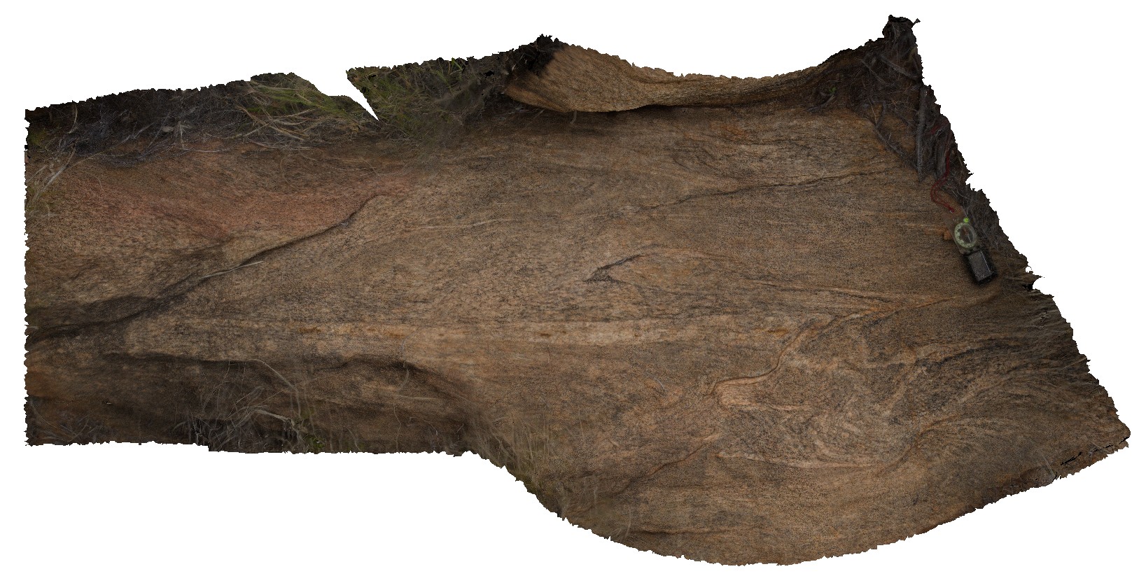
Fe-oxide rich layers in dolostone (blue rock). Ellery Creek Big Hole Dive. West MacDonnell National Park, N.T. |
2.00 |
-23.78378700000 |
133.07203600000 |
670.707 |
dolostone, Ellery Creek Big Hole, sedimentology |
dolostone |
Elery5 Map
 |
5 |
08/02/2016 5:17 p.m. |
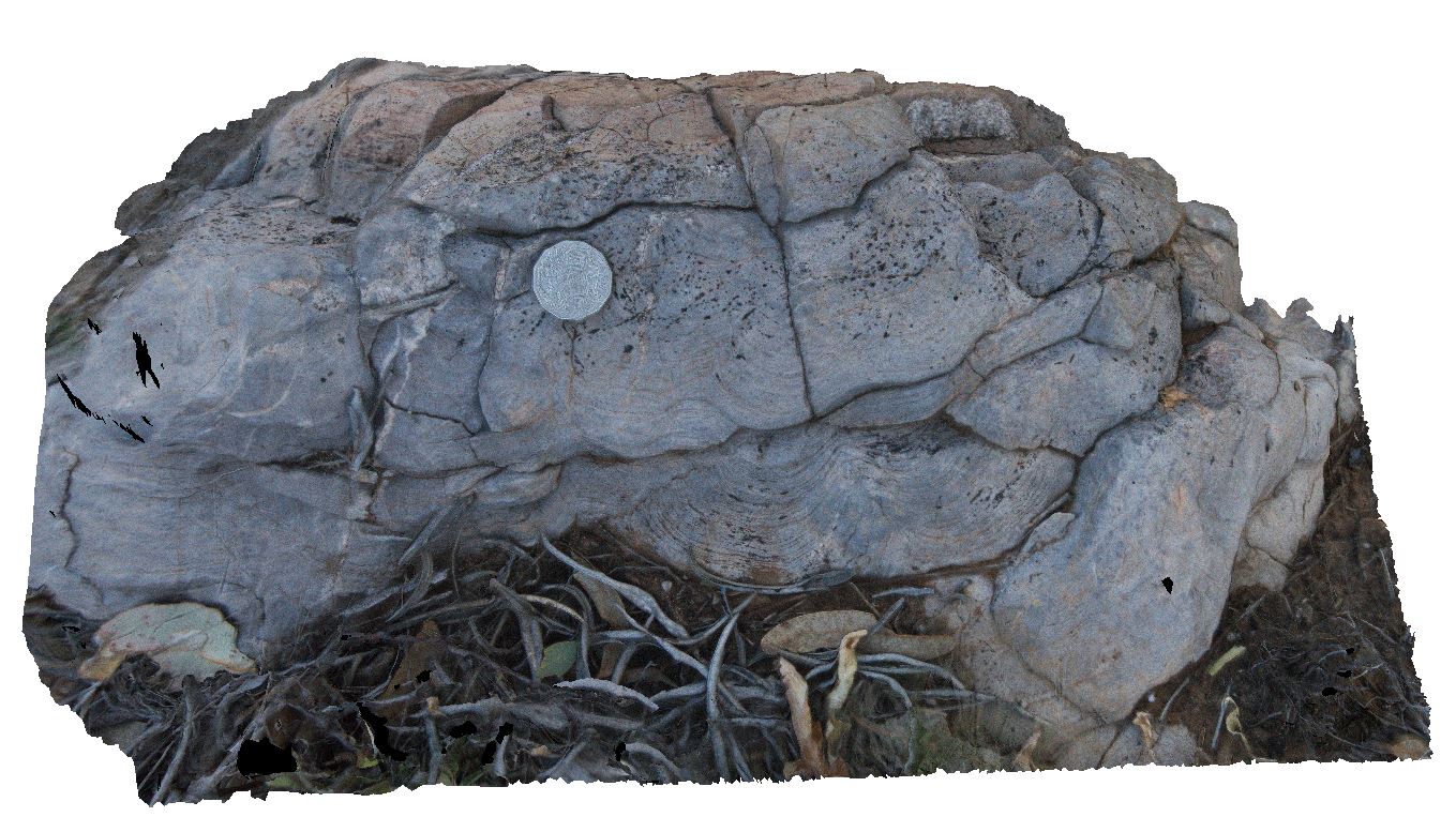
3D |
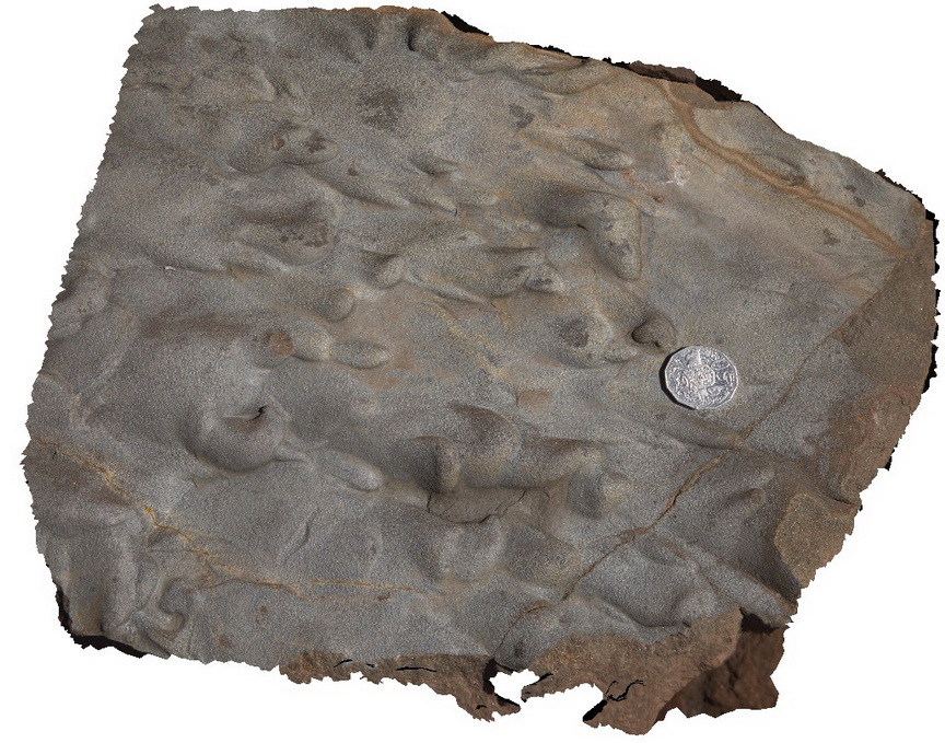
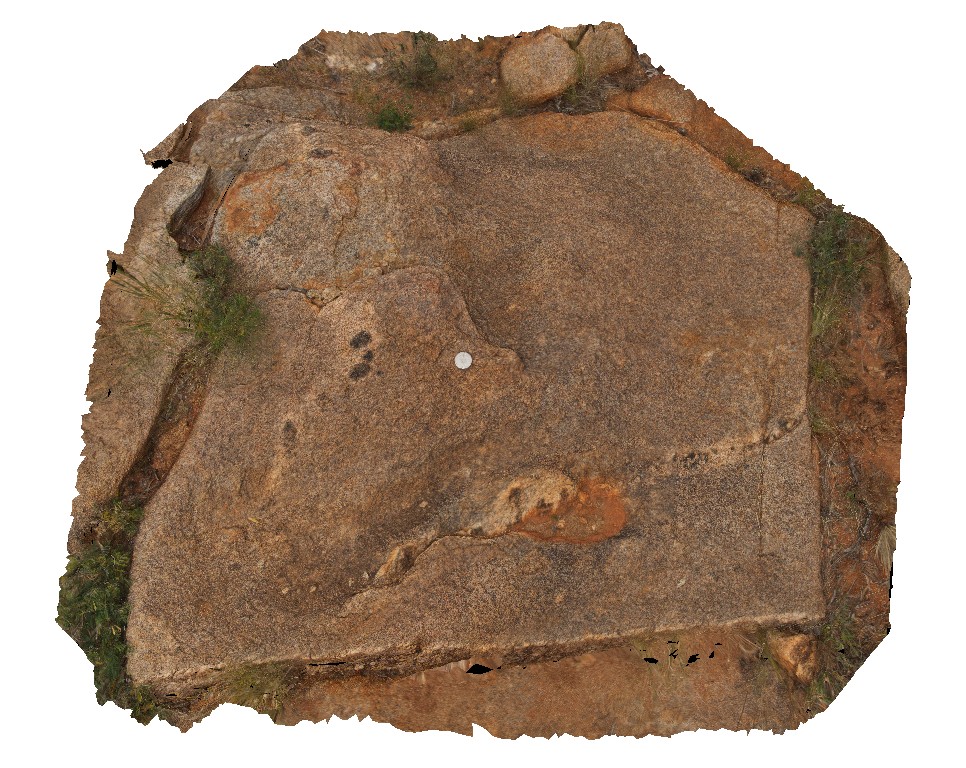
detail of domed stromatolites ? In dolostone float. Ellery Creek Big Hole Dive. West MacDonnell National Park, N.T. |
0.40 |
-23.78291900000 |
133.07212900000 |
663.622 |
stromatolite, fossil, Palaeontology, dolostone |
dolostone |
Elery6 Map
 |
5 |
01/01/9999 midnight |
3D |
kaolin-rich patches in red sandstone beds. South side of Ellery Creek. Ellery Creek Big Hole Dive. West MacDonnell National Park, N.T. |
0.80 |
-23.81715000000 |
133.06383000000 |
-9999.000 |
weathering, sedimentology |
sandstone |
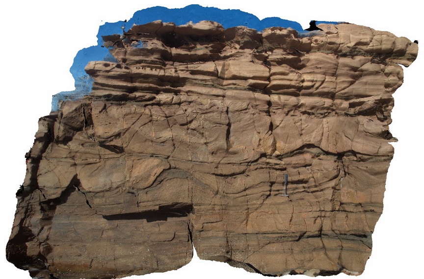
Elery7 Map
 |
5 |
01/01/9999 midnight |
3D |
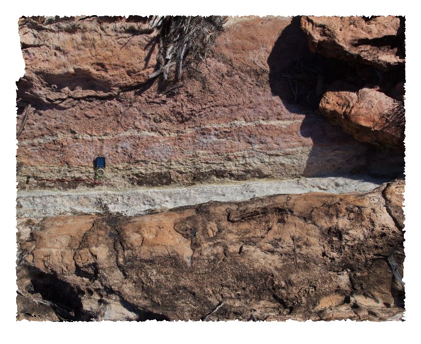
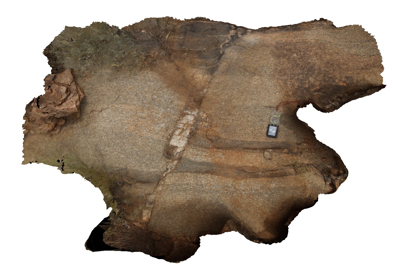
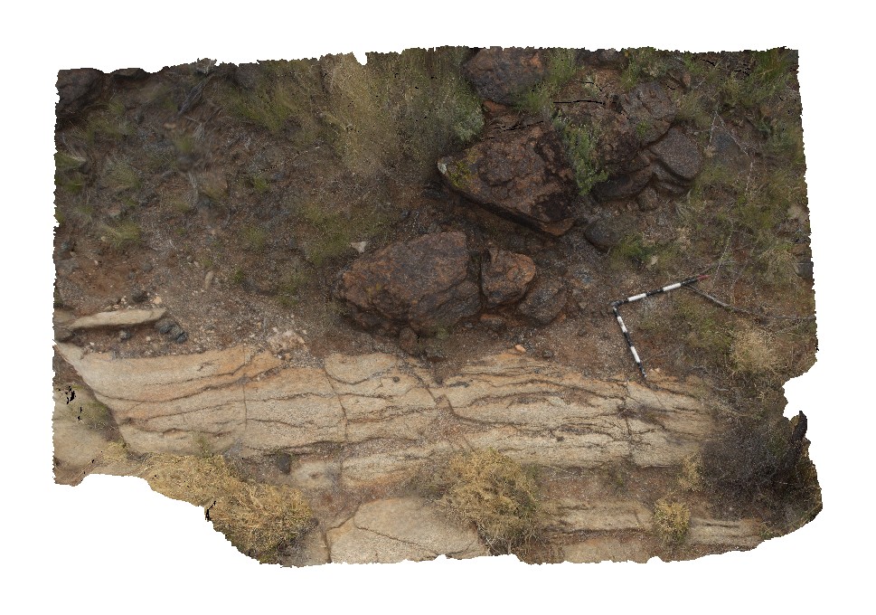
contact between dolostone (red, white) and sandstone (yellow) layers. Ellery Creek Big Hole Dive. West MacDonnell National Park, N.T. |
2.00 |
-23.81763000000 |
133.63610000000 |
-9999.000 |
geological contact, sedimentology |
sandstone, dolostone |
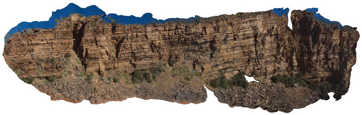
Elery8 Map
 |
5 |
01/01/9999 midnight |
3D |
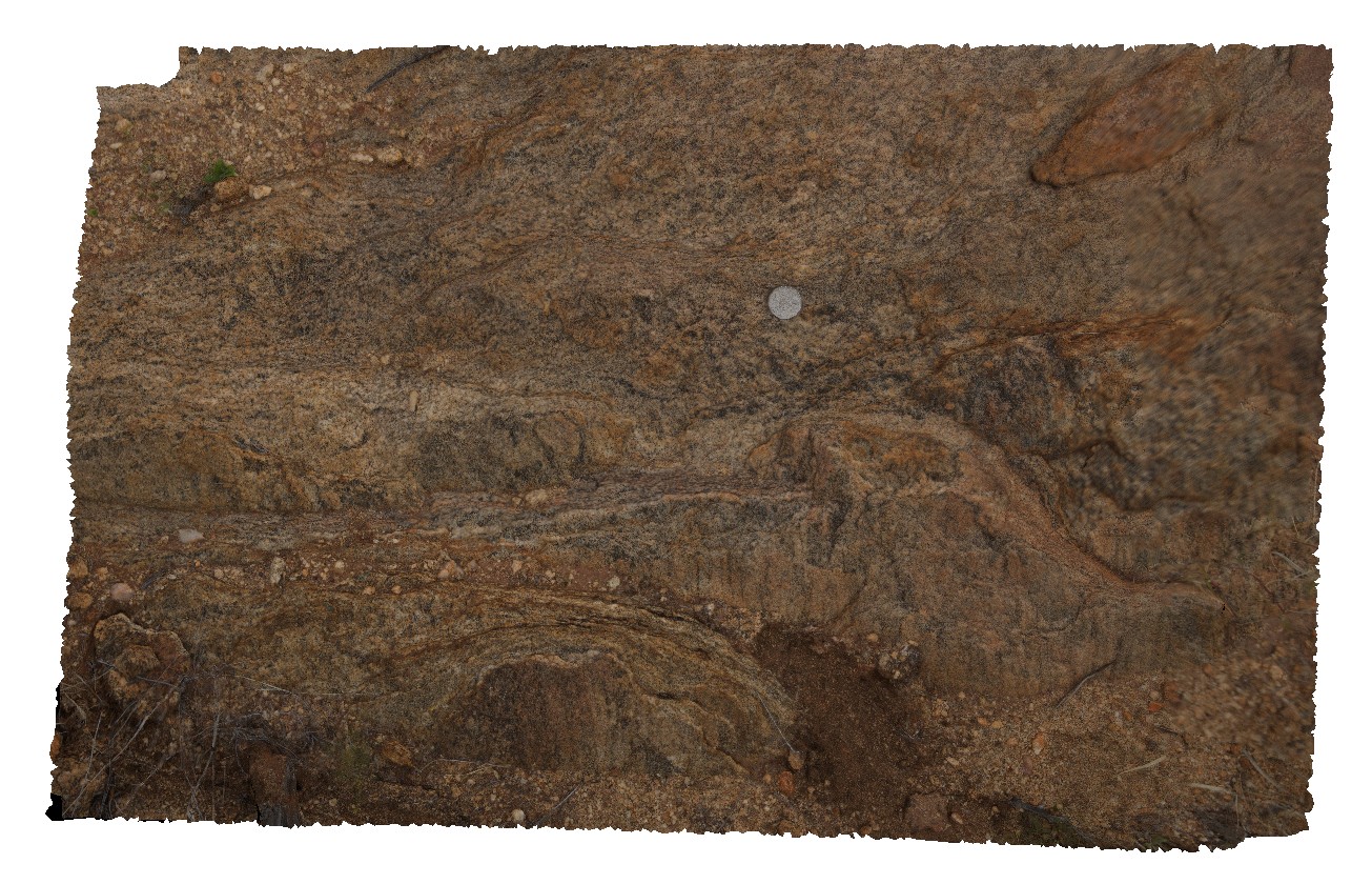
possible evaporite casts in sandstone float block. Ellery Creek Big Hole Dive. West MacDonnell National Park, N.T. |
0.50 |
-23.81728000000 |
133.06367000000 |
-9999.000 |
evaporite cast, evaporite, sedimentology |
sandstone |
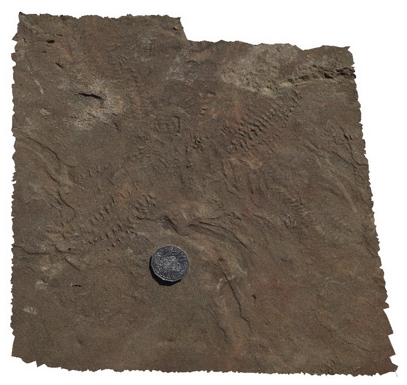
Elery9 Map
 |
5 |
01/01/9999 midnight |
3D |
possible chaotic burrows / evaporite casts in sandstone bed. Ellery Creek Big Hole Dive. West MacDonnell National Park, N.T. |
1.20 |
-23.81653000000 |
133.06400000000 |
-9999.000 |
burrow, fossil, palaeontology |
sandstone |
EleryFSP1 Map
 |
0 |
08/02/2016 4:25 p.m. |
FSP |
view of Heavitree Sandstone (N) and dolostone (along strike). Ellery Creek Big Hole Dive. West MacDonnell National Park, N.T. |
1000.00 |
-23.77944400000 |
133.06493400000 |
719.829 |
Heavitree Sandstone, Ellery Creek, sedimentology |
sandstone, dolostone |
Emu1 Map
 |
0 |
11/17/2015 10:35 a.m. |
3D |
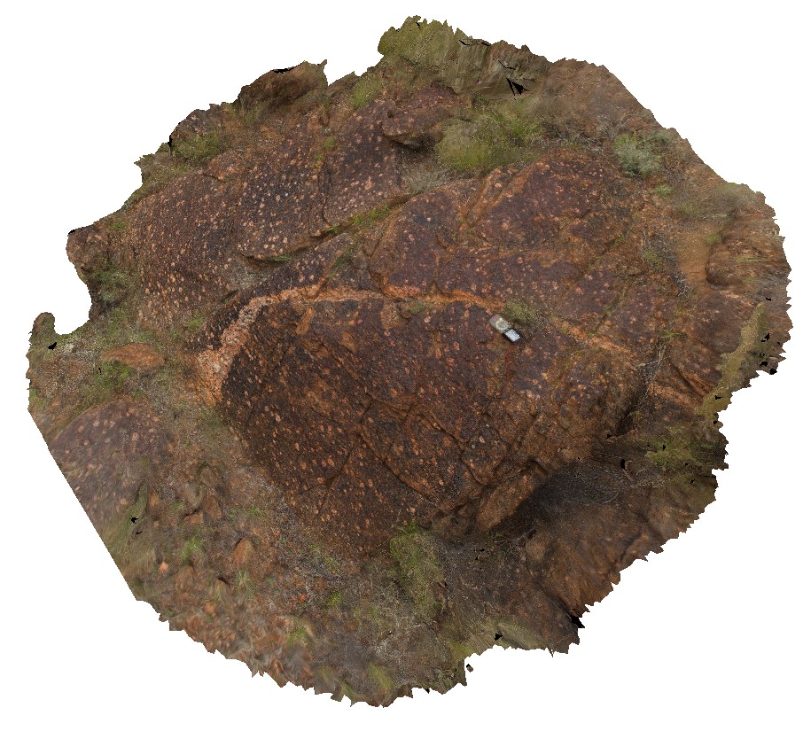
large cliff exposure, showing gently dipping and faulted beds of the Boxing Bay Formation, Emu Bay, Kangaroo Island. S.A. |
20.00 |
-35.56802000000 |
137.58672000000 |
-9999.000 |
sedimentology, fault, structure |
conglomerate |
Emu2 Map
 |
0 |
11/17/2015 10:37 a.m. |
3D |
soft sediment deformation in Boxing Bay Formation, Emu Bay, Kangaroo Island. S.A. |
4.00 |
-35.56952000000 |
137.57912000000 |
-9999.000 |
soft sediment deformation, sedimentology |
sandstone |
Emu3 Map
 |
0 |
11/17/2015 10:37 a.m. |
3D |
trilobite feeding trackways in Emu Bay Shale, Emu Bay, Kangaroo Island. S.A. |
0.30 |
-35.57017000000 |
137.57787000000 |
-9999.000 |
trilobite, shale, feeding track, fossil, palaeontology |
shale |
Emu4 Map
 |
0 |
11/17/2015 10:38 a.m. |
3D |
lode-casts on the up-turned base of a sandstone bed. Emu Bay, Kangaroo Island. S.A. |
0.30 |
-35.57024000000 |
137.57770000000 |
-9999.000 |
lode cast, sedimentology |
sandstone |
Emu5 Map
 |
0 |
11/11/2015 12:36 p.m. |
3D |
trilobite feeding tracks in shale, Emu Bay, Kangaroo Island. S.A. |
0.40 |
-35.57024000000 |
137.57770000000 |
-9999.000 |
trilobite feeding track, sedimentology, fossil, palaeontology |
shale |
ENTIA1 Map
 |
0 |
07/25/2016 1:51 p.m. |
3D |
view of intrusive relationship between Entia Gneiss Complex (light coloured rocks) and calc-silicate gneiss (dark) and faulted pegmatite. Enita Dome, East Harts Range, N.T. |
0.00 |
-23.04863200000 |
135.15582500000 |
594.330 |
gneiss, intrusive contact, pegmatite, harts range, Entia Gneiss |
gneiss, pegmatite |
ENTIA10 Map
 |
5 |
07/26/2016 11:21 a.m. |
3D |
outcrop of Bruna Gneiss, with quartz augen and cut by pegmatitic vein. Harts Range, N.T. |
3.40 |
-23.22561200000 |
135.32048500000 |
536.305 |
granite gneiss, metamorphic, augen, pegmatite vein |
granitic gneiss |
ENTIA11 Map
 |
0 |
07/26/2016 11:57 a.m. |
3D |
leucocratic and mylonitic layers with augens in Bruna Gneiss. Harts Range, N.T. |
3.20 |
-23.25939200000 |
135.26326600000 |
554.590 |
augen, Gruna gneiss, gneiss, leucosome, mylonite, metamorphic |
gneiss |
ENTIA2 Map
 |
5 |
01/01/9999 midnight |
3D |
Gabbro outcrop in west Entia Dome, Harts Range, N.T. |
0.50 |
-23.09465000000 |
135.15854000000 |
-9999.000 |
gabbro, igneous, metamorphic, Arunta Block |
gabbro |
ENTIA3 Map
 |
5 |
07/25/2016 4:10 p.m. |
3D |
contact between overlying Gabbro and the underlying Entia Gneiss Complex. Harts Range, N.T. |
3.70 |
-23.09488300000 |
135.15850500000 |
609.429 |
contact, gabbro, gneiss, structure, metamorphic |
gabbro, gneiss |
ENTIA4 Map
 |
5 |
07/25/2016 5:14 p.m. |
3D |
view of foliated minerals in orthogneiss of the Entia Gneiss Complex. Entia Dome. Harts Range, N.T. |
1.00 |
-23.03333900000 |
135.22426300000 |
597.140 |
orthogneiss, Entia Dome, metamorphic, Harts Range, foliation, structure |
gneiss |
ENTIA5 Map
 |
5 |
07/25/2016 5:24 p.m. |
3D |
quartz-feldspar leucocratic layers (tonalite?) in bt-gneiss of the Entia Gneiss Complex. Entia Dome. Harts Range, N.T. |
1.60 |
-23.03309300000 |
135.22411200000 |
593.067 |
leucocratic, metamorphic, gneiss, Entia Dome, Harts Range |
gneiss |
ENTIA6 Map
 |
5 |
07/25/2016 5:30 p.m. |
3D |
small-scale isoclinal folds in orthogneiss of the Entia Gneiss Complex. Entia Dome. Harts Range, N.T. |
2.00 |
-23.03303200000 |
135.22423100000 |
594.750 |
Entia Gneiss Complex, gneiss, metamorphic, harts range, isoclinal fold, fold, structure |
gneiss |
ENTIA7 Map
 |
5 |
07/26/2016 10:05 a.m. |
3D |
pods of mafic and felsic migmatite layers in Entia Gneiss Complex. Entia Dome. Harts Range, N.T. |
1.00 |
-23.13483100000 |
135.29648200000 |
583.262 |
gneiss, metamorphic, Entia Dome, Harts Range, migmatite |
gneiss |
ENTIA8 Map
 |
5 |
01/01/9999 midnight |
3D |
folded migmatitic bands in Entia Gneiss Complex orthogneiss. Harts Range, N.T. |
2.20 |
-23.13483100000 |
135.29648200000 |
583.262 |
orthogneiss, migmatite, structure, metamorphic, Harts Range |
gneiss |
ENTIA9 Map
 |
0 |
07/26/2016 10:47 a.m. |
3D |
view of amphibolite gneiss outcrop of the Entia Gneiss Complex. Harts Range, N.T. |
1.50 |
-23.16934200000 |
135.30153200000 |
590.790 |
amphibolite, metamorphic, Harts Range, Entia Gneiss Complex, gneiss |
gneiss |