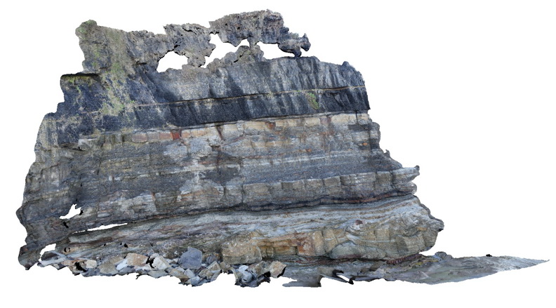
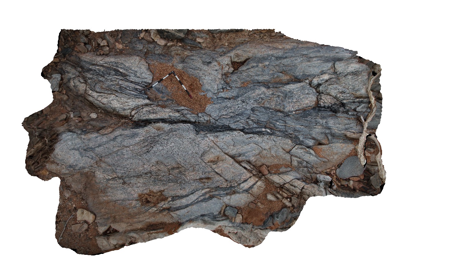
Dudley7 Map
 |
5 |
07/08/2015 11:29 a.m. |
3D |
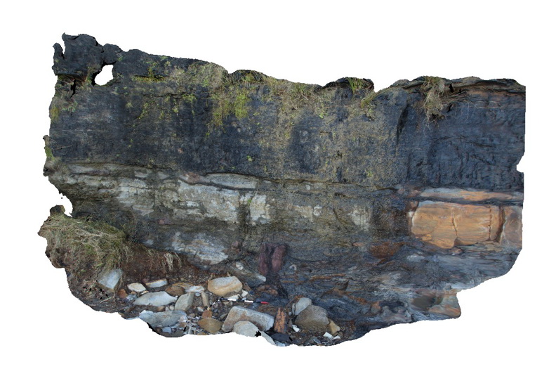
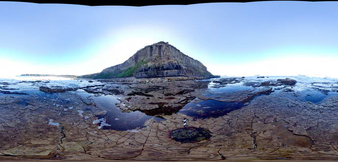
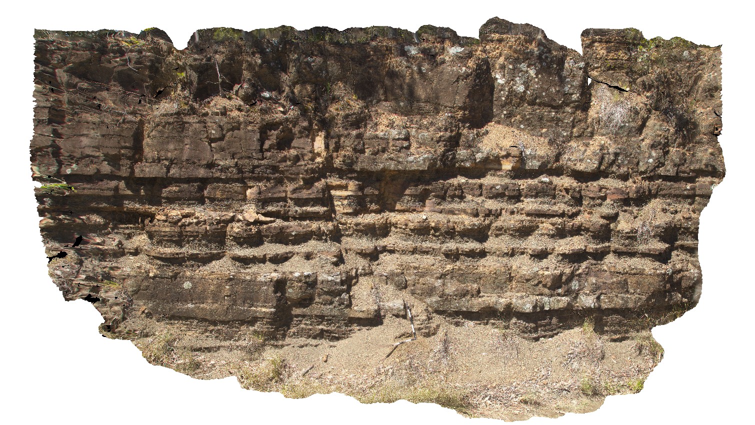
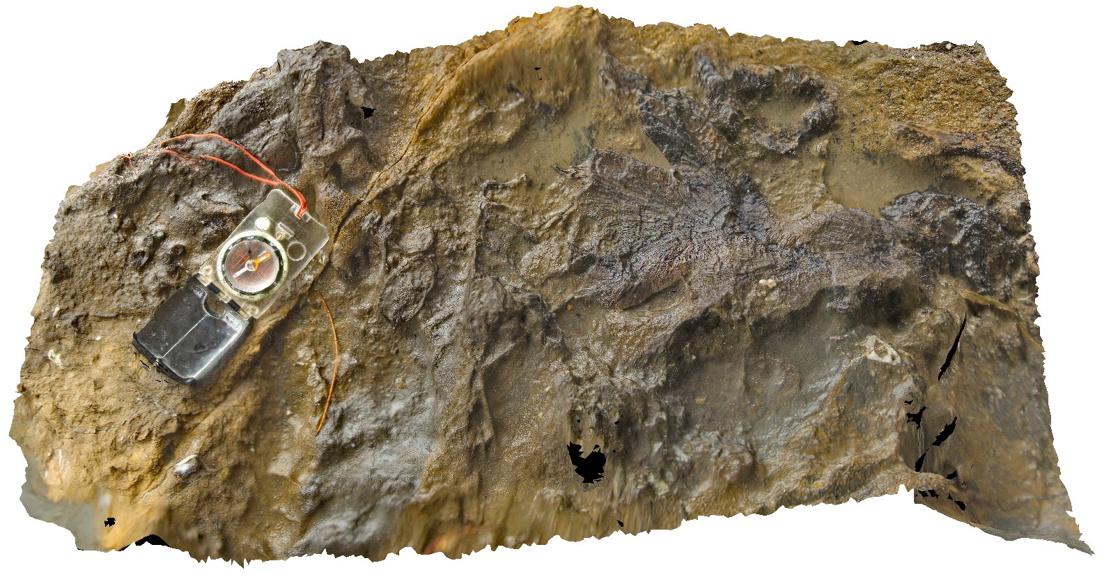
Bae of the Victoria Tunnel Coal seam with an underlying petrified/coalified tree stump in fine grained silty sandstone. Dudley Beach, N.S.W. |
6.00 |
-32.96753000000 |
151.73747000000 |
1.000 |
coal, petrified tree, coalified tree, sedimentology, palaeontology, fossil |
coal, sandstone |
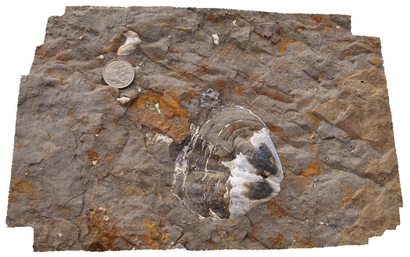
Dudley8 Map
 |
5 |
07/08/2015 11:30 a.m. |
3D |
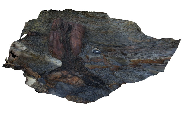
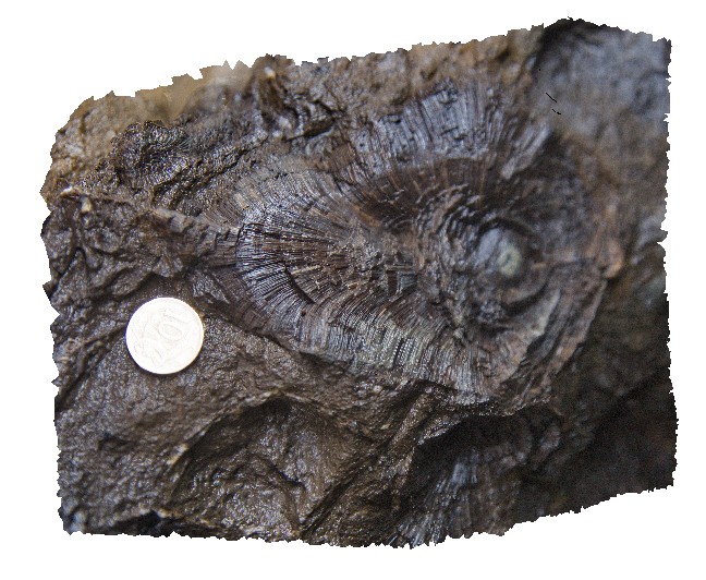
Detail of petrified / coalified tree in growth position immediately below the base of the Victoria Tunnel Coal seam. Dudley Beach, N.S.W. |
1.00 |
-32.96753000000 |
151.73747000000 |
1.000 |
petrified tree, coalified tree, sandstone, sedimentology, palaeontology, fossil |
sandstone |
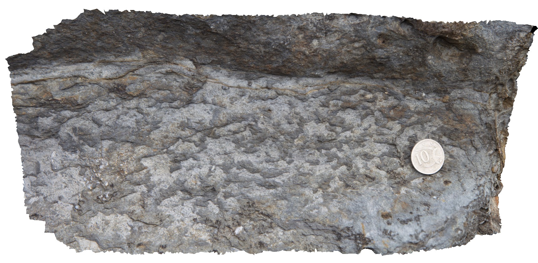
Dudley9 Map
 |
5 |
07/08/2015 11:31 a.m. |
3D |
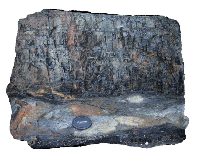
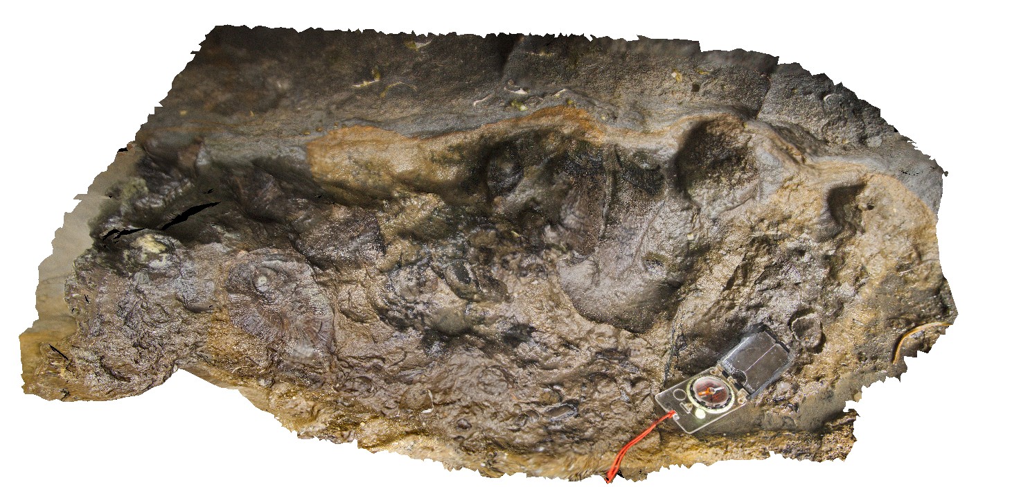
detail of bright coal at base of the Victoria Tunnel Coal Seam. Dudley Beach, N.S.W. |
0.70 |
-32.96753000000 |
151.73747000000 |
1.000 |
coal, sedimentology |
coal |
DudleyFSP1 Map
 |
5 |
08/27/2015 3:05 p.m. |
FSP |
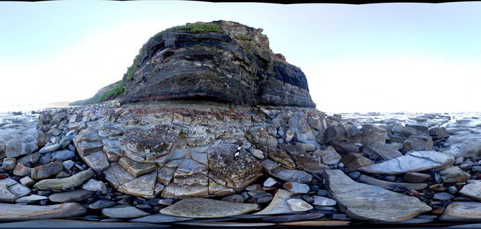
Outcrop of the Permian Victoria Tunnel Coal seam and associated floodplain sediments. Image taken from a platform composed of Nobbys Tuff. Poor image - extreme contrast. Dudley Beach, N.S.W. |
50.00 |
-32.96928000000 |
151.73616000000 |
0.000 |
sedimentology, fluvial, coal |
coal, tuff |
DudleyFSP2 Map
 |
5 |
08/27/2015 2:40 p.m. |
FSP |
Outcrop of the Permian Victoria Tunnel Coal seam and associated floodplain sediments. Image taken from a platform composed of Nobbys Tuff. Poor image - extreme contrast. Dudley Beach, N.S.W. |
50.00 |
-32.96932000000 |
151.73645000000 |
0.000 |
sedimentology, volcanology, coal |
coal, tuff |
DudleyFSP3 Map
 |
5 |
08/27/2015 2:56 p.m. |
FSP |
Outcrop of the Permian Victoria Tunnel Coal seam and associated floodplain sediments. Image taken from a platform composed of Nobbys Tuff. Poor image - extreme contrast. Dudley Beach, N.S.W. |
50.00 |
-32.96919000000 |
151.73634000000 |
0.000 |
sedimentology, volcanology, coal |
coal, tuff |
DudleyFSP4 Map
 |
5 |
08/27/2015 3:06 p.m. |
FSP |
Outcrop of the Permian Victoria Tunnel Coal seam and associated underlying floodplain sediments. Image taken from near the top of the Nobbys Tuff. Poor image - extreme contrast. Dudley Beach, N.S.W. |
50.00 |
-32.96912000000 |
151.73620000000 |
1.000 |
sedimentology, volcanology, coal |
coal, tuff |
DudleyFSP5 Map
 |
5 |
08/27/2015 3:06 p.m. |
FSP |
Outcrop of the Permian Victoria Tunnel Coal seam and associated underlying floodplain sediments. Image taken from the top of the Nobbys Tuff. Poor image - extreme contrast. Dudley Beach, N.S.W. |
50.00 |
-32.96910000000 |
151.73636000000 |
2.000 |
sedimentology, volcanology, floodplain, coal |
coal, mudstone, tuff |
DudleyFSP6 Map
 |
5 |
08/27/2015 3:05 p.m. |
FSP |
Outcrop of the Permian Victoria Tunnel Coal seam, associated underlying floodplain sediments and the top of the underlying Nobbys Tuff. Poor image - extreme contrast. Dudley Beach, N.S.W. |
50.00 |
-32.96907000000 |
151.73647000000 |
0.000 |
sedimentology, volcanology, coal |
coal, tuff |
DudleyFSP7 Map
 |
5 |
08/27/2015 3:07 p.m. |
FSP |
Outcrop of the Permian Victoria Tunnel Coal seam, associated underlying floodplain sediments and the top of the underlying Nobbys Tuff. Poor image - extreme contrast. Dudley Beach, N.S.W. |
50.00 |
-32.96900000000 |
151.73648000000 |
0.000 |
|
coal, tuff |
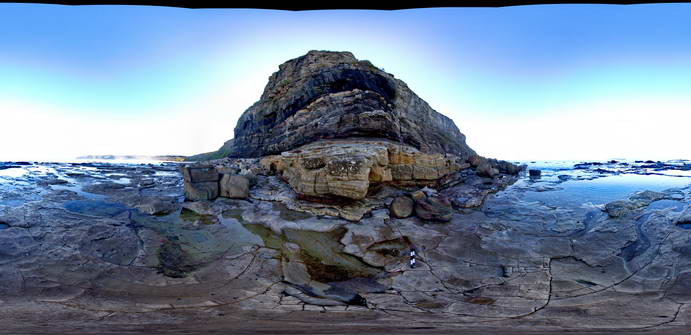
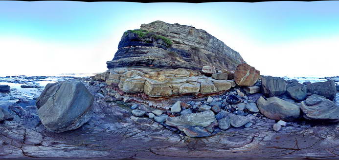
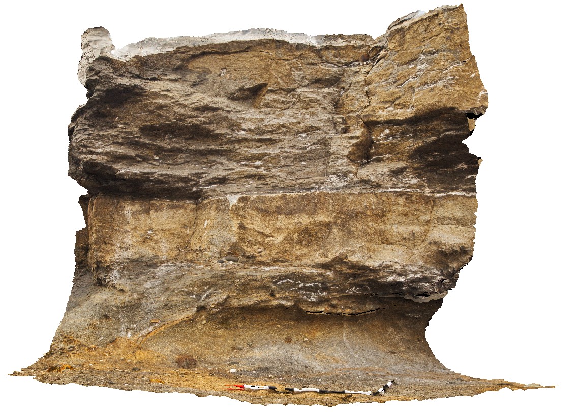
DudleyPole1 Map
 |
5 |
06/17/2015 10:15 a.m. |
3D |
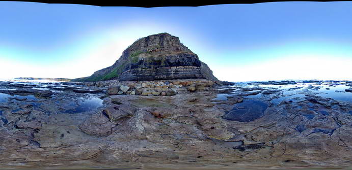
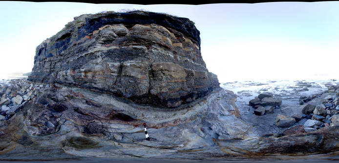
View of the Dudley cliff face showing the top of the Nobbys Tuff at the base, overlain by floodplain sediments and then the base of the Victoria Tunnel coal seam. Dudley Beach, N.S.W. |
10.00 |
-32.96896000000 |
151.73640000000 |
0.000 |
coal, fluvial, sedimentology, tuff |
coal, tuff, mudstone |
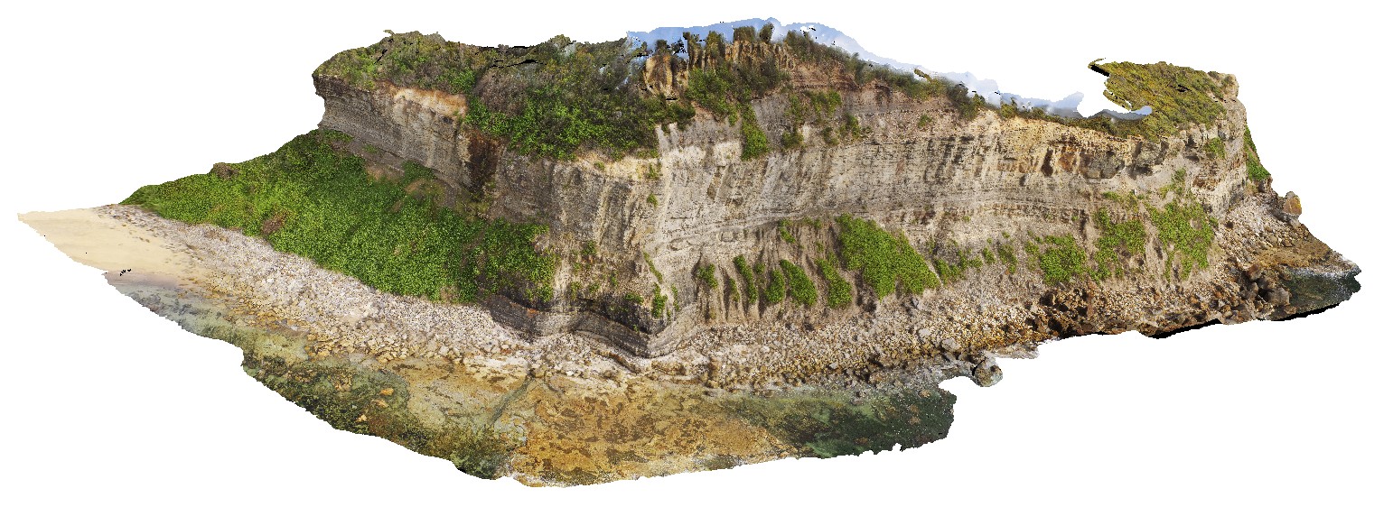
DudleyUAV1 Map
 |
20 |
01/01/9999 midnight |
UAV |
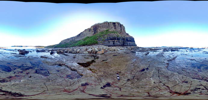
aerial overview of the Dudley outcrop, including Victoria's Tunnel Coal Seam. Dudley Beach, N.S.W. |
200.00 |
-32.96915300000 |
151.73652300000 |
9.600 |
Victoria's Tunnel Coal Seam, floodplain sediments, sedimentology |
sediments |
Dungog1 Map
 |
5 |
01/01/9999 midnight |
3D |
flat-lying Carboniferous sandstone and shale, Chichester Dam Rd, near Mulconda. N.S.W. |
0.00 |
-32.28273000000 |
151.71133000000 |
-9999.000 |
Carboniferous, sediments, sedimentology |
sandstone |
Dungog2 Map
 |
5 |
01/01/9999 midnight |
3D |
moderately dipping, planar, Carboniferous sediments on Sailsbury Rd. Near Mulconda. N.S.W. |
0.00 |
-32.23988000000 |
151.58795000000 |
-9999.000 |
Carboniferous, sedimentology, planar sediments, dip |
sediments |
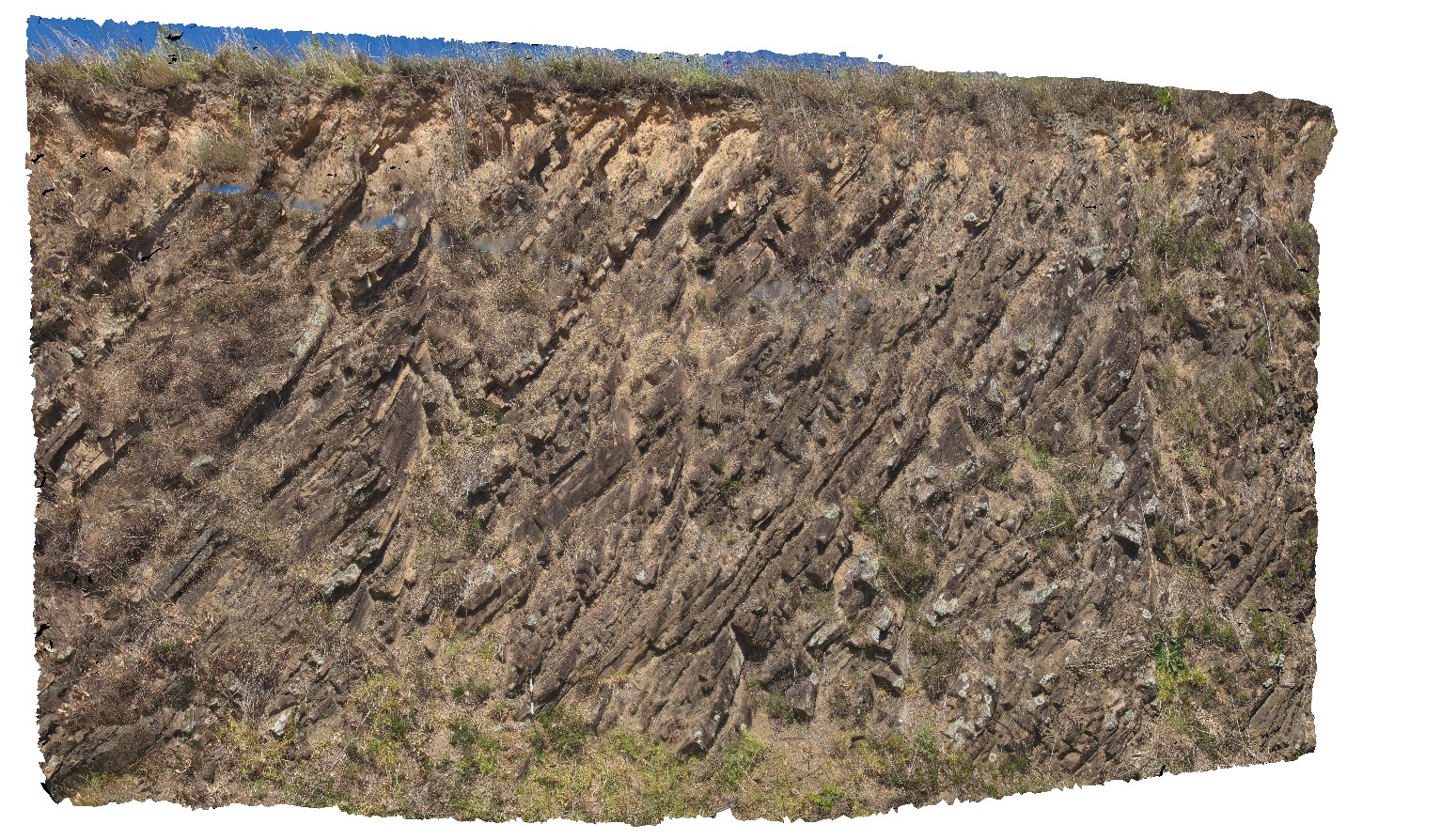
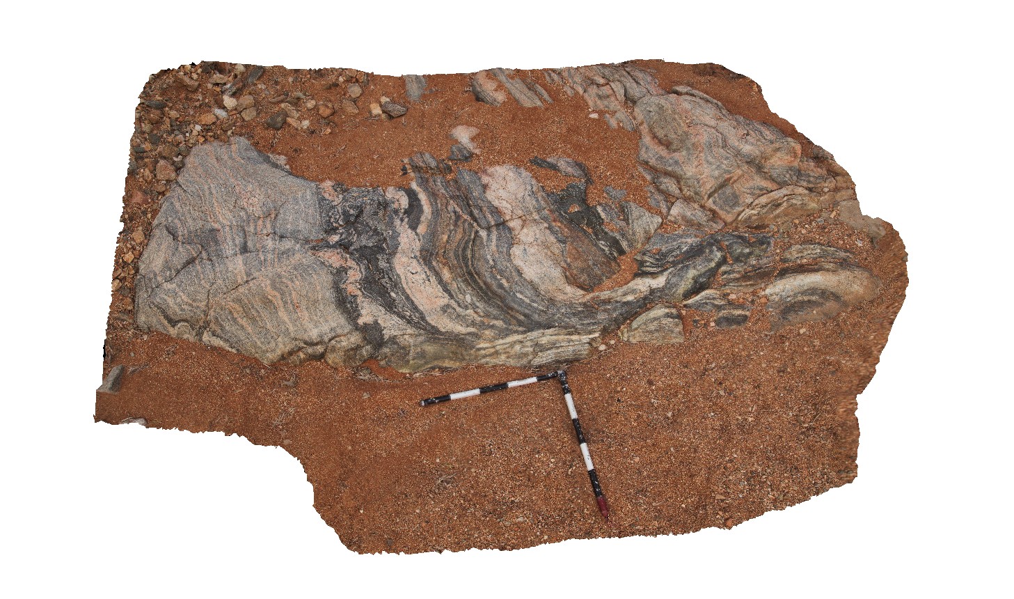
Dunnawah1 Map
 |
0 |
05/27/2016 noon |
3D |
folded and sheared gneissic layering and pegmatite veins of the Halfway Gneiss. Cobra-Dairy Creek Road, Gascoyne, W.A. |
2.70 |
-25.10137000000 |
116.02140000000 |
-9999.000 |
structure, folding, shearing |
gneiss |
Dunnawah2 Map
 |
0 |
05/27/2016 noon |
3D |
open folding of gneissic fabric in Halfway Gneiss. Cobra-Dairy Creek Road, Gascoyne, W.A. |
3.00 |
-25.10141000000 |
116.02138000000 |
-9999.000 |
fold, gneiss, structure |
gneiss |
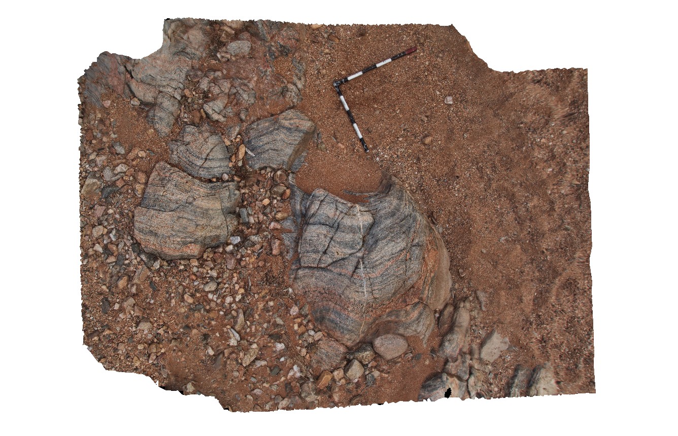
Dunnawah3 Map
 |
0 |
05/27/2016 noon |
3D |
felsic and intermediate gneiss and pegmatite cut by ductile shear and late brittle faults. Cobra-Dairy Creek Road, Gascoyne, W.A. |
4.00 |
-25.10135000000 |
116.02151000000 |
-9999.000 |
ductile shear, fault, gneiss, structure |
gneiss |
Eaglehawk1 Map
 |
5 |
01/01/9999 midnight |
3D |
view of Permian sandstone and mudstone, showing top of sandstone with rounded to semi-rounded pebbles. Eaglehawk Neck, Tasmania. |
2.50 |
-43.03422000000 |
147.94936000000 |
-9999.000 |
Permian sediments, Parmeener Supergroup |
sandstone |
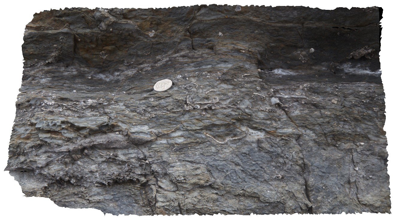
Eaglehawk10 Map
 |
5 |
01/01/9999 midnight |
3D |
detail of bioturbation from site Eaglehawk9 in Permian sedimentary rocks. Eaglehawk Neck, Tasmania. |
0.30 |
-43.03357000000 |
147.94931000000 |
-9999.000 |
bioturbation, Permian sediments, fossil, palaeontology |
siltstone |
Eaglehawk11 Map
 |
5 |
01/01/9999 midnight |
3D |
layer of broken shell material in Permian siltstone. Eaglehawk Neck, Tasmania. |
0.60 |
-43.03355000000 |
147.94917000000 |
-9999.000 |
shells, fossil, fossiliferous, palaeontology, Permian |
siltstone |
Eaglehawk12 Map
 |
5 |
01/01/9999 midnight |
3D |
detail of stenoporid bryozoans in Permian siltstone and fine-grained sandstone. Eaglehawk Neck, Tasmania. |
0.70 |
-43.03321000000 |
147.94772000000 |
-9999.000 |
stenoporid, Bryozoans, fossil, palaeontology, Permian |
siltstone |
Eaglehawk13 Map
 |
5 |
01/01/9999 midnight |
3D |
detail of stenoporid bryozoans in Permian sediments. Eaglehawk Neck, Tasmania. |
1.00 |
-43.03321000000 |
147.94772000000 |
-9999.000 |
stenoporid, Bryozoans, Permian sediments, fossil, palaeontology |
siltstone |
Eaglehawk14 Map
 |
5 |
01/01/9999 midnight |
3D |
cross-section detail of stenoporid bryozoans in Permian siltstone. Eaglehawk Neck, Tasmania. |
0.20 |
-43.03321000000 |
147.94772000000 |
-9999.000 |
stenoporid, Bryozoans, Permian sediments, fossil, palaeontology |
siltstone |
Eaglehawk15 Map
 |
5 |
01/01/9999 midnight |
3D |
rillenkarren weathering in calcareous Permian sandstone. Eaglehawk Neck, Tasmania. |
4.00 |
-43.03517000000 |
147.94751000000 |
-9999.000 |
rillenkarren, weathering, calcareous |
sandstone |
Eaglehawk2 Map
 |
5 |
01/01/9999 midnight |
3D |
detail of large brachiopod in Permian sediment boulder. Eaglehawk Neck, Tasmania. |
0.40 |
-43.03433000000 |
147.94939000000 |
-9999.000 |
bivalve mollusc, fossil, palaeontology |
sandstone |