Florina8 Map
 |
0 |
06/22/2016 noon |
3D |
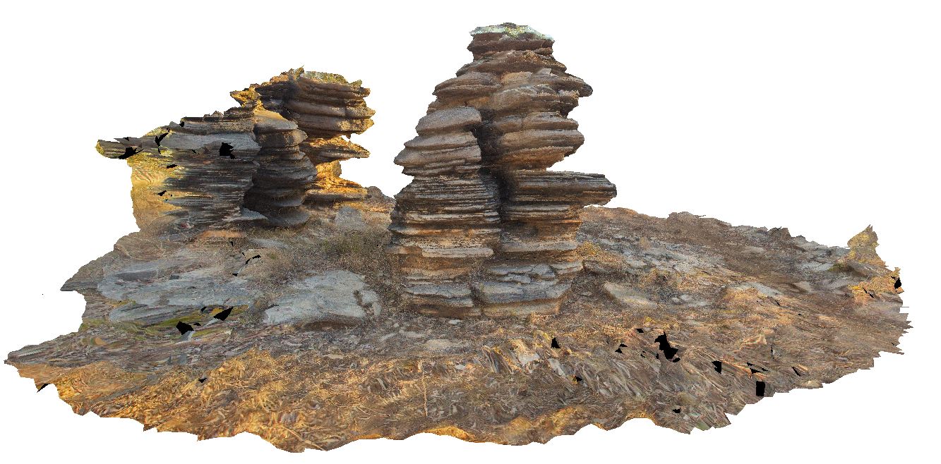
'pancake stacks' of finely bedded dolostone near Florina Homestead at Daly River, N.T. |
7.00 |
-14.54226000000 |
131.73149000000 |
-9999.000 |
pancake stack, dolostone, finely bedded, weathering feature |
dolostone |
Friendly1 Map
 |
5 |
03/31/2016 1:45 p.m. |
3D |
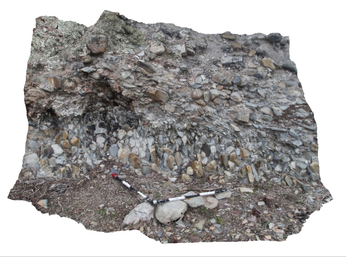
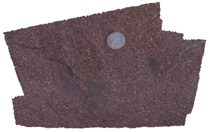
Permian conglomerate, with cobbles aligned vertically in lower layer, and imbricated in the upper layer. Friendly Beaches, Tasmania. |
2.00 |
-42.03901000000 |
148.28040000000 |
-9999.000 |
conglomerate, imbricated |
conglomerate |
Friendly2 Map
 |
5 |
02/29/2016 9:48 a.m. |
3D |
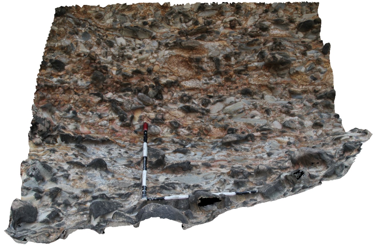
imbricated cobbles in Permian conglomerate, Friendly Beaches, Tasmania. |
1.20 |
-42.03881000000 |
148.28029000000 |
-9999.000 |
imbricated, conglomerate |
conglomerate |
FriendlyBeaches1 Map
 |
20 |
03/13/2015 9:03 a.m. |
3D |
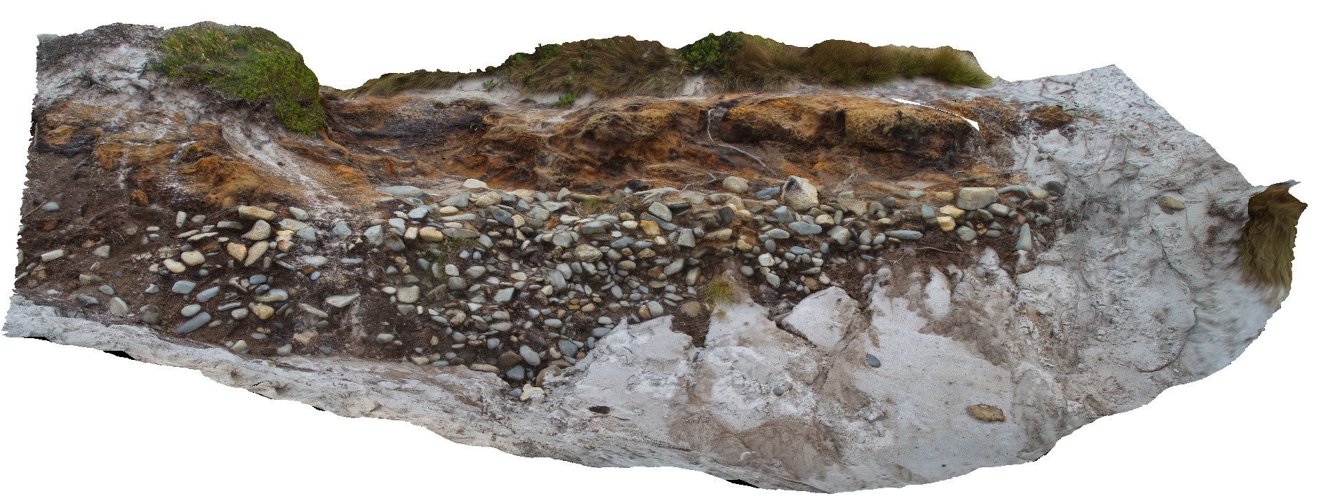
Quaternary, Pleistocene paleo pebble shore line. |
3.00 |
-41.98689826000 |
148.28862982000 |
4.000 |
Paleo shore line, pebble |
pebble |
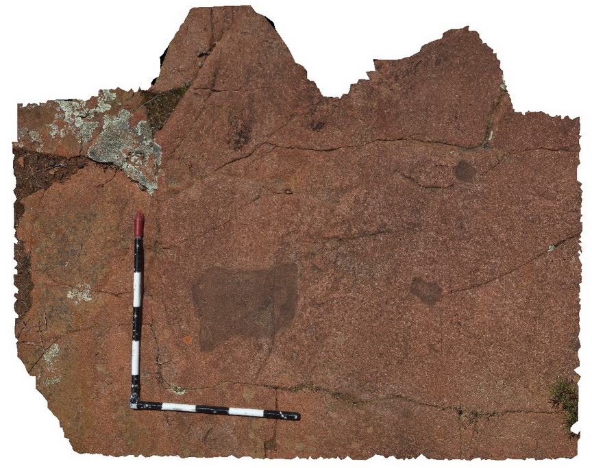
FriendlyBeaches2 Map
 |
20 |
03/13/2015 9:03 a.m. |
3D |
pegmatitic segregations within the upper portion of a granite. |
1.00 |
-41.98704566000 |
148.29016741000 |
0.000 |
unidirectional solidification texture, UST |
Granite |
FriendlyBeaches3 Map
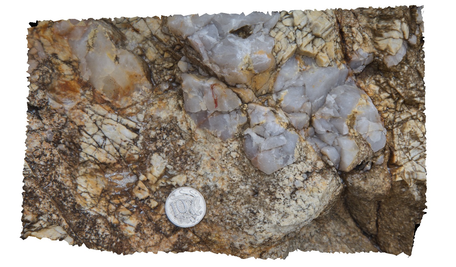 |
20 |
03/13/2015 9:03 a.m. |
3D |
pegmatitic segregations within the upper portion of a granite. Close up of terminating quartz crystals indicating growth into a void |
0.20 |
-41.98705373000 |
148.29020578000 |
0.000 |
unidirectional solidification texture, UST |
Granite |
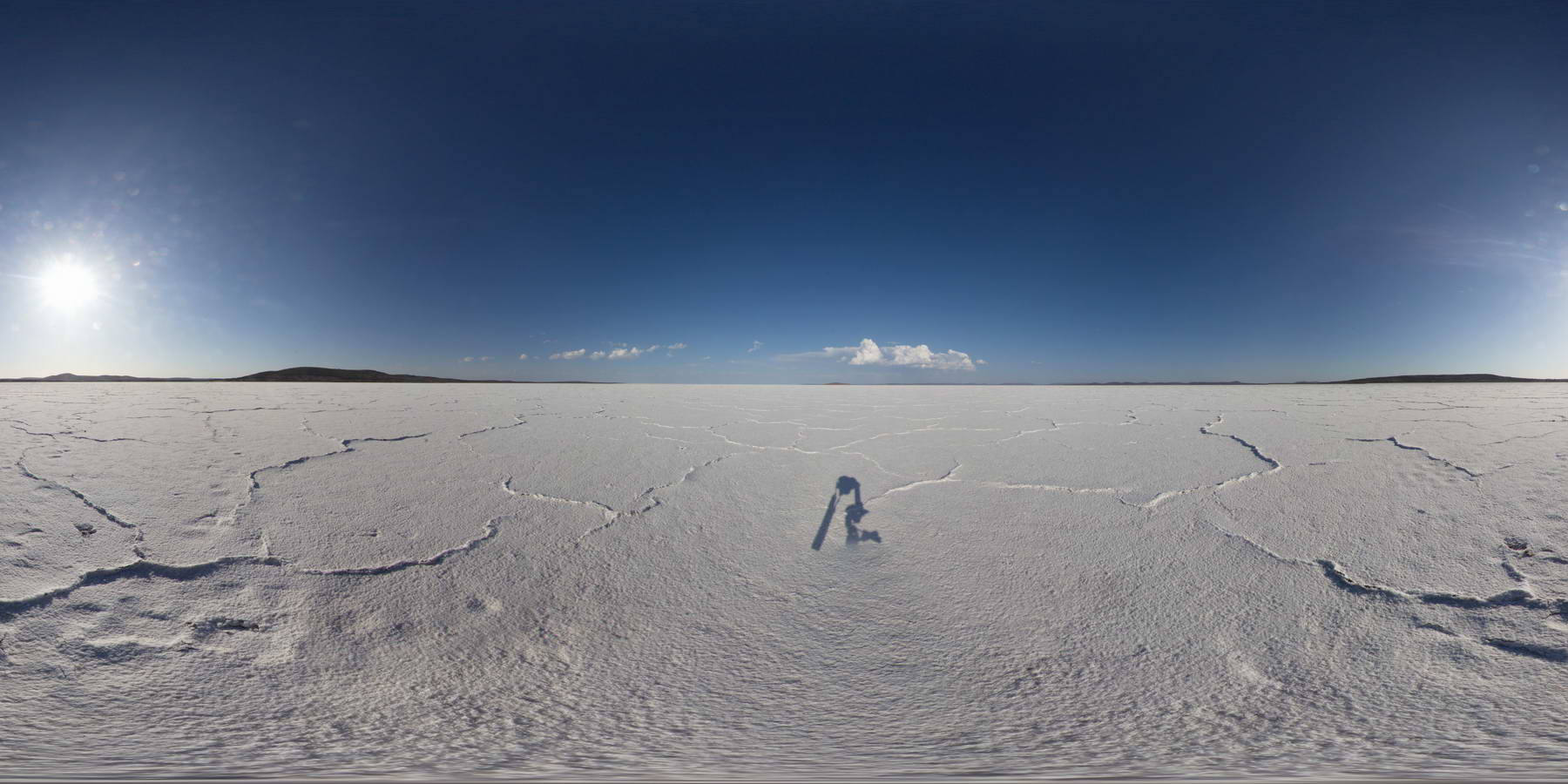
Gairdiner1 Map
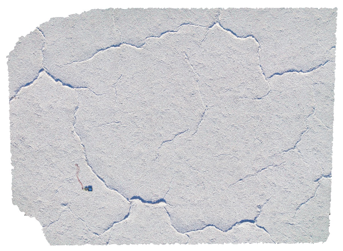 |
0 |
11/17/2015 10:20 a.m. |
3D |
view of salt-crust on Lake Gairdiner, showing 'mud-crack' texture, Lake Gairdiner. |
5.00 |
-32.12906000000 |
135.90393000000 |
-9999.000 |
evaporite, mud-crack texture |
evaporite |
Gairdiner2 Map
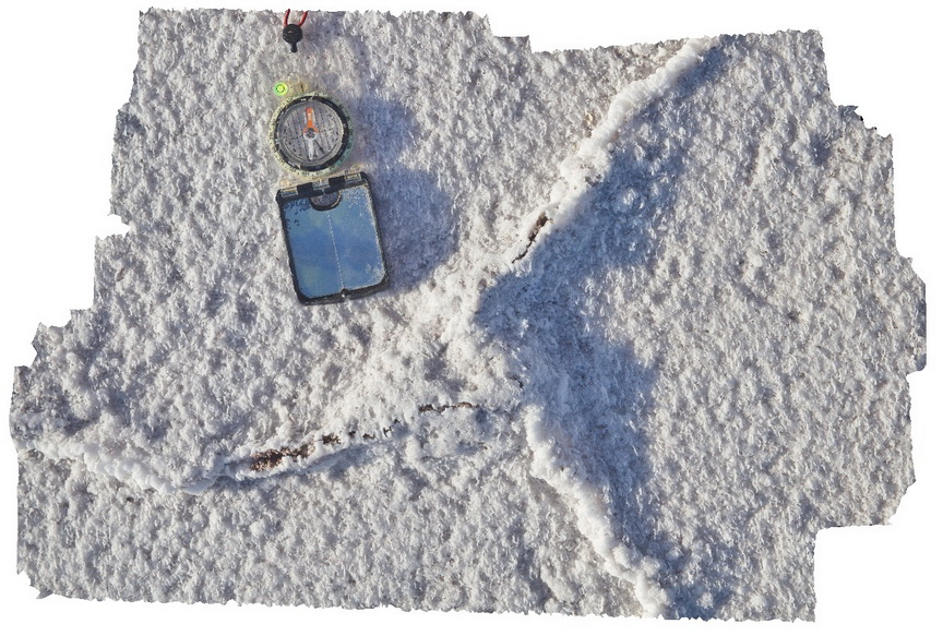 |
0 |
11/17/2015 10:21 a.m. |
3D |
detail of triple junction between salt crusts. Lake Gairdiner. |
0.30 |
-32.12910000000 |
135.90392000000 |
-9999.000 |
evaporite, salt lake, triple junction |
evaporite |
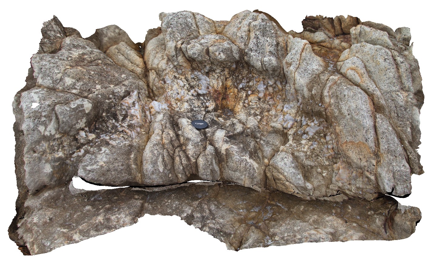
GairdinerFSP1 Map
 |
0 |
01/26/2016 3:54 p.m. |
FSP |
view across Lake Gairdiner, showing salt pan and surrounding hills. |
3000.00 |
-32.12901000000 |
135.90388000000 |
-9999.000 |
salt lake, evaporite |
evaporite |
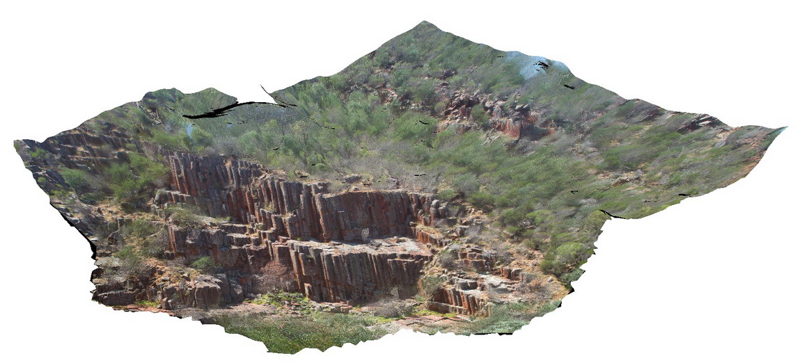
Gawler1 Map
 |
0 |
11/17/2015 10:23 a.m. |
3D |
view of Organ Pipes - columnar Rhyolite? In Organ pipe Gorge. Gawler Ranges. |
100.00 |
-32.53903300000 |
135.29649300000 |
-9999.000 |
columnar, joint, rhyolite |
dacite |
Gawler2 Map
 |
0 |
02/22/2016 9:27 a.m. |
3D |
view of toppling dacite columns, Organ pipe Gorge, Gawler Ranges. |
9.00 |
-32.53836000000 |
135.29599000000 |
-9999.000 |
columnar, dacite, joint |
dacite |
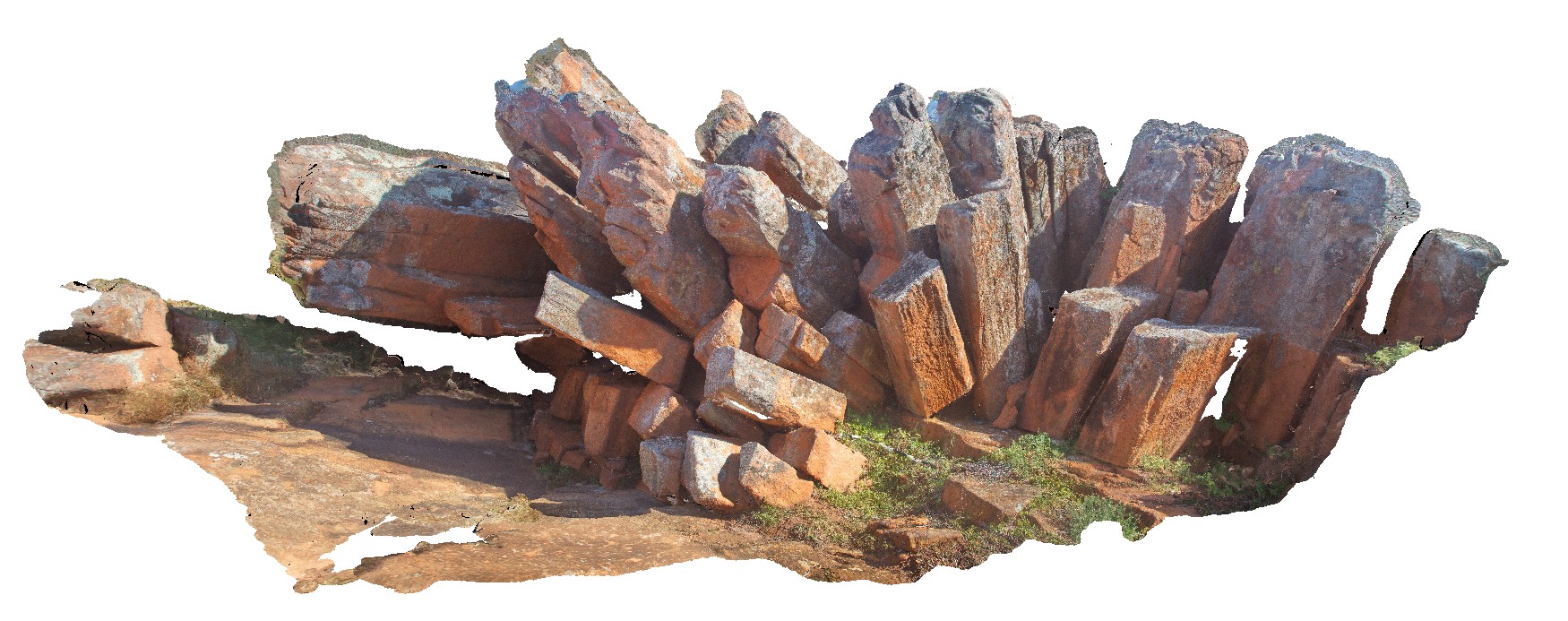
Gawler3 Map
 |
0 |
11/17/2015 10:27 a.m. |
3D |
3D of dacite columns, showing top and sides. Organ pipe Gorge, Gawler Ranges. |
7.00 |
-32.53859000000 |
135.29608000000 |
-9999.000 |
columnar, dacite, joint |
dacite |
Gawler4 Map
 |
0 |
11/17/2015 10:29 a.m. |
3D |
close up of dacite texture, showing phenocrysts. Yandinga Falls Road, Gawler Ranges. |
0.20 |
-32.55751000000 |
135.31975000000 |
-9999.000 |
dacite, phenocryst |
dacite |
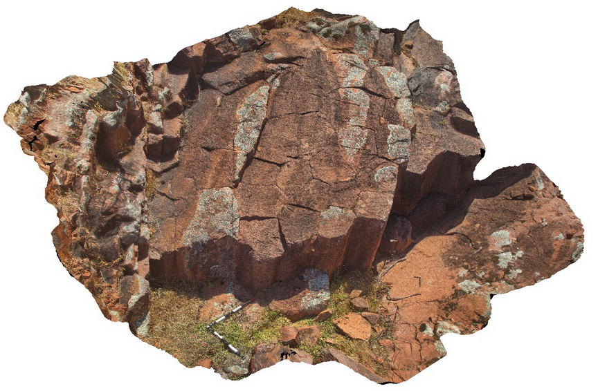
Gawler5 Map
 |
0 |
11/17/2015 10:32 a.m. |
3D |
cooling columns in dacite, flank of Mt Fairvies. Gawler Ranges. |
4.00 |
-32.56358000000 |
135.57603000000 |
-9999.000 |
cooling columns, dacite, joint, columnar |
dacite |
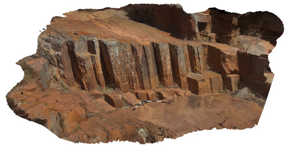
Gawler6 Map
 |
0 |
11/17/2015 10:32 a.m. |
3D |
outcrop of columnar dacite, near Mt Fairview, Gawler Ranges. |
10.00 |
-32.56343000000 |
135.57613000000 |
-9999.000 |
columnar, dacite, joint |
dacite |
Gawler7 Map
 |
0 |
11/17/2015 10:33 a.m. |
3D |
view of xenoliths in dacite, Mt Fairview, Gawler Ranges. |
1.50 |
-32.56333000000 |
135.57602000000 |
-9999.000 |
dacite, xenolith |
dacite |
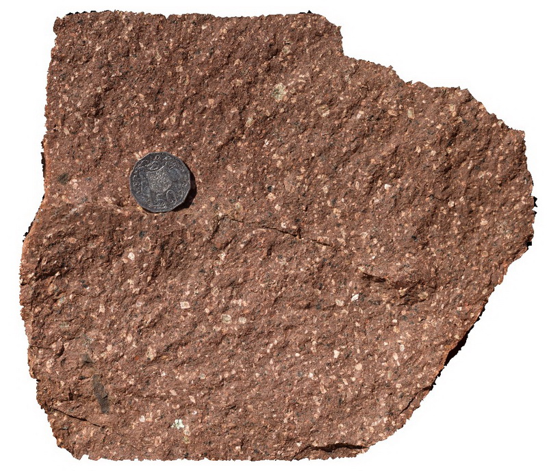
Gawler8 Map
 |
0 |
11/17/2015 10:34 a.m. |
3D |
detail of xenoliths and phenocrysts in dacite. Mt Fairview, Gawler Ranges. |
0.20 |
-32.56333000000 |
135.57602000000 |
-9999.000 |
xenolith, dacite, phenocryst |
dacite |
GawlerFSP1 Map
 |
0 |
01/26/2016 3:22 p.m. |
FSP |
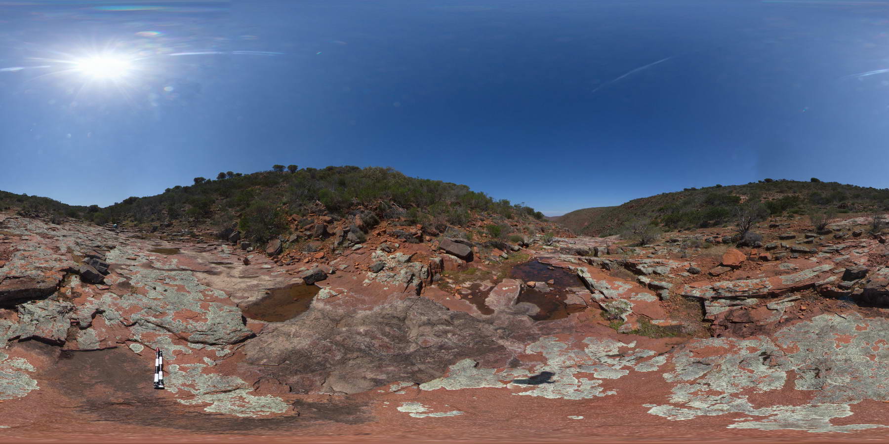
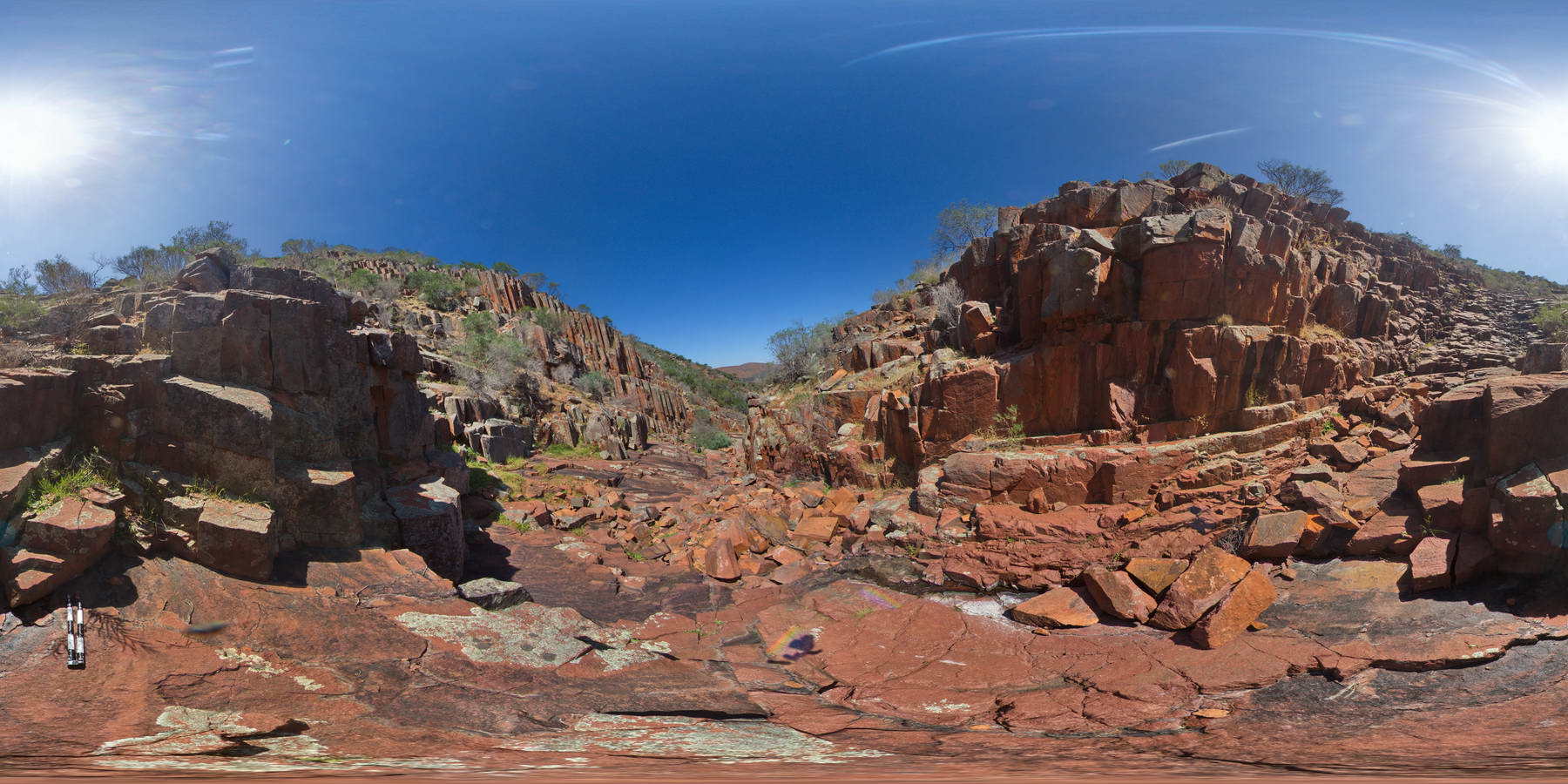
view looking down Organ Pipe Gorge, showing broken dacite columns and dacite pavement and ranges beyond. Organ pipe Gorge, Gawler Ranges. |
2000.00 |
-32.53795000000 |
135.29617000000 |
-9999.000 |
columnar, dacite, joint, pavement |
dacite |
GawlerFSP2 Map
 |
0 |
01/26/2016 3:23 p.m. |
FSP |
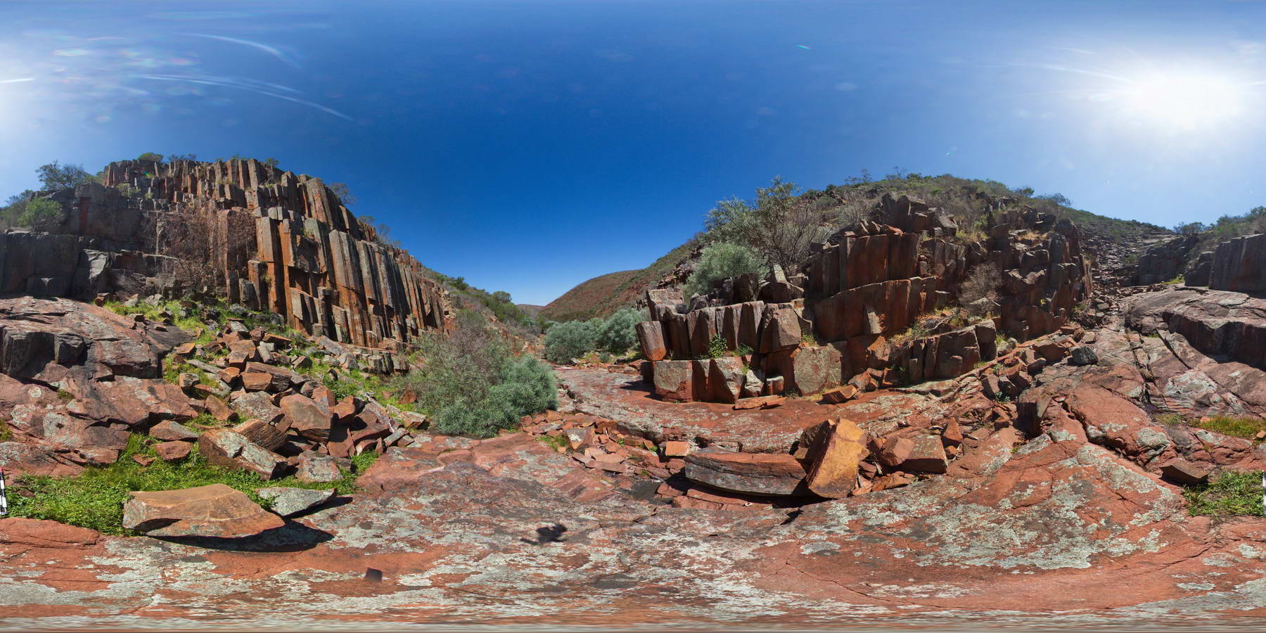
view looking down Organ Pipe Gorge, showing broken dacite columns and dacite pavement and ranges beyond. Organ pipe Gorge, Gawler Ranges. |
2000.00 |
-32.53830000000 |
135.29614000000 |
-9999.000 |
columnar, dacite, organ pipes, joint |
dacite |
GawlerFSP3 Map
 |
0 |
01/26/2016 3:24 p.m. |
FSP |
view looking down Organ Pipe Gorge, showing broken dacite columns and dacite pavement and ranges beyond. Organ pipe Gorge, Gawler Ranges. |
2000.00 |
-32.53860000000 |
135.29811000000 |
-9999.000 |
columnar, dacite, joint |
dacite |
GawlerFSP4 Map
 |
0 |
01/26/2016 3:25 p.m. |
FSP |
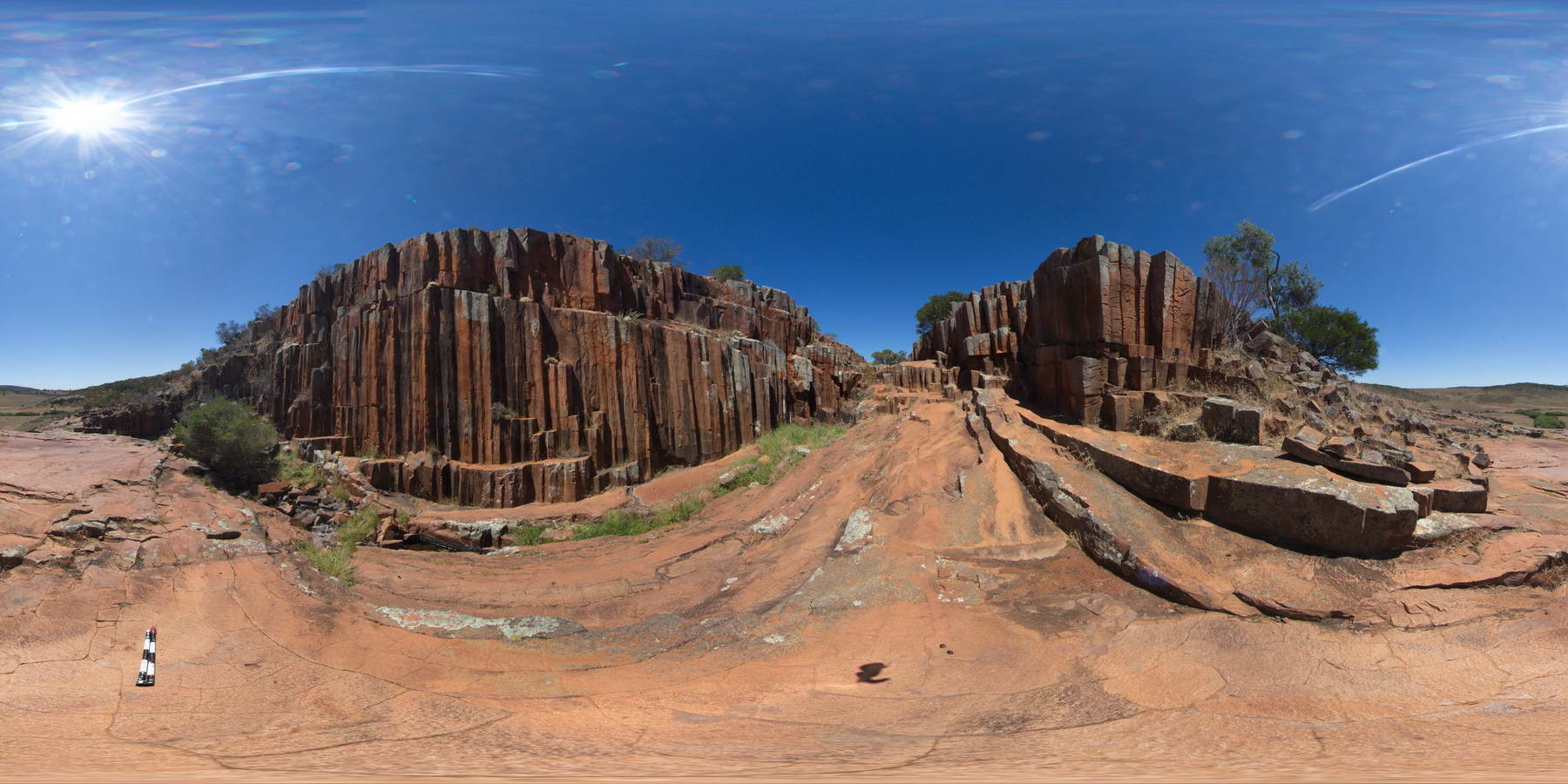
view of dacite columns in Organ pipe Gorge, Gawler Ranges. |
100.00 |
-32.53887000000 |
135.29628000000 |
-9999.000 |
columnar, dacite, joint |
dacite |
GawlerFSP5 Map
 |
0 |
01/26/2016 3:43 p.m. |
FSP |
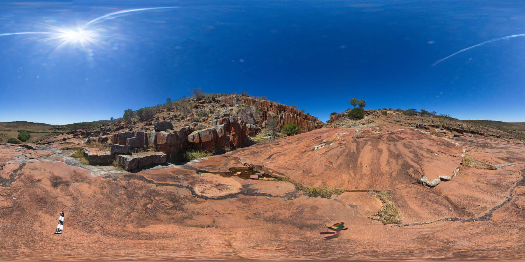
columnar dacite walls of 'Organ pipe' Gorge, Gawler Ranges. |
100.00 |
-32.53904000000 |
135.29643000000 |
-9999.000 |
columnar, dacite, joint |
dacite |
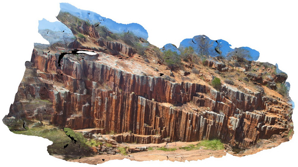
GawlerFSP6 Map
 |
0 |
01/26/2016 3:32 p.m. |
FSP |
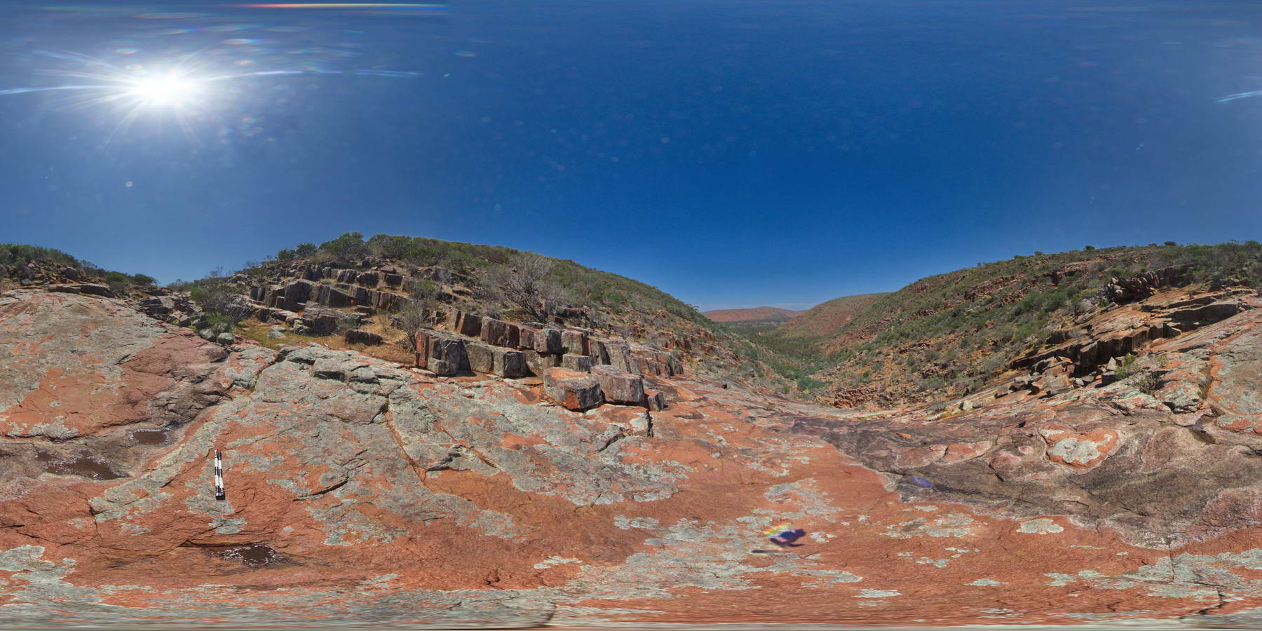
view of columnar dacite gorge from creek bed. Mt Fairview, Gawler Ranges. |
1000.00 |
-32.56337000000 |
135.57605000000 |
-9999.000 |
columnar, dacite, joint |
dacite |
GawlerFSP7 Map
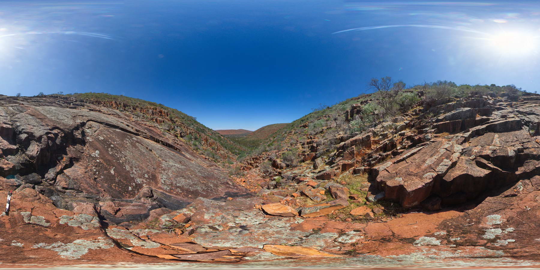
 |
0 |
01/26/2016 3:42 p.m. |
FSP |
view along creek bed showing exposed columnar dacite and underlying dacite. Mt Fairview, Gawler Ranges. |
1000.00 |
-32.56331000000 |
135.57611000000 |
-9999.000 |
dacite, columnar, joint |
dacite |
GawlerUAV1 Map
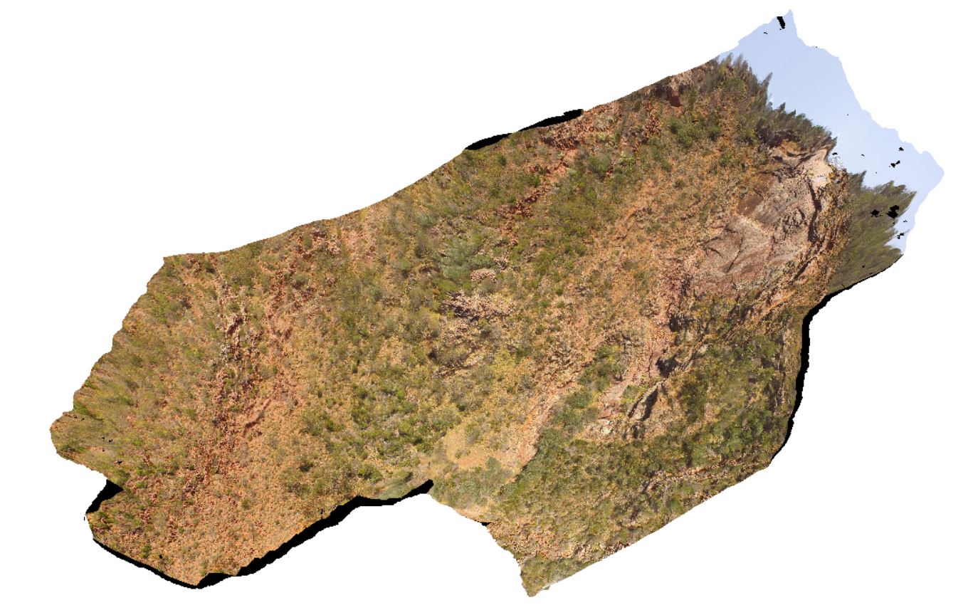 |
0 |
10/20/2015 4:07 p.m. |
UAV |
aerial view of gully, waterfall and organ pipes exposed on side of gully. Organ pipes Gorge. Gawler Ranges. |
200.00 |
-32.53903400000 |
135.29649400000 |
-9999.000 |
columnar, igneous, joint |
dacite |