GibbRiver4 Map
 |
0 |
06/06/2016 noon |
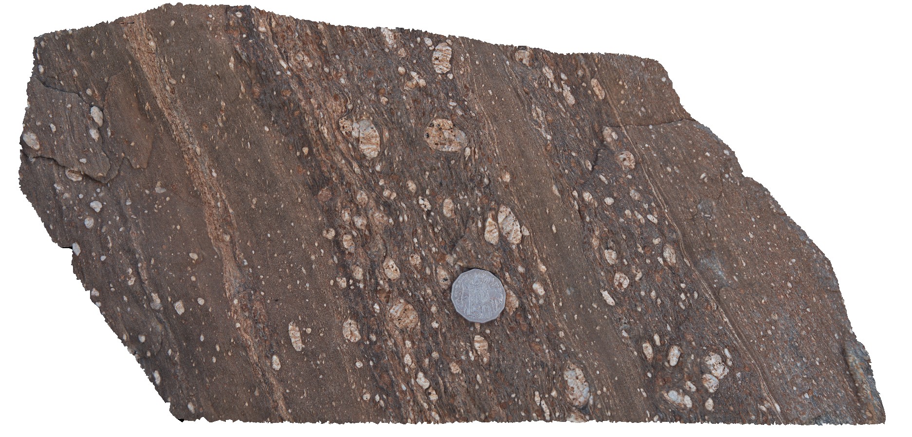
3D |
Thick mylonite zone in porphyritic granite, Gibb River Road, near Mount Amy. W.A. |
1.10 |
-17.22816000000 |
124.99636000000 |
-9999.000 |
mylonite zone, porphyritic granite, structure |
granite |
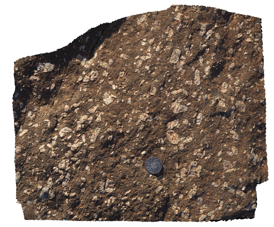
GibbRiver5 Map
 |
0 |
06/06/2016 noon |
3D |
detail of mylonite margin in porphyritic granite. Gibb River Road, near Mount Amy. W.A. |
0.60 |
-17.22816000000 |
124.99636000000 |
-9999.000 |
mylonitic margin, porphyritic granite, structure |
granite |
GibbRiver6 Map
 |
0 |
06/06/2016 noon |
3D |
detail of feldspar phenocrysts in granite. Gibb River Road, near Mount Amy. W.A. |
0.45 |
-17.22808000000 |
124.89636000000 |
-9999.000 |
phenocryst, granite |
granite |
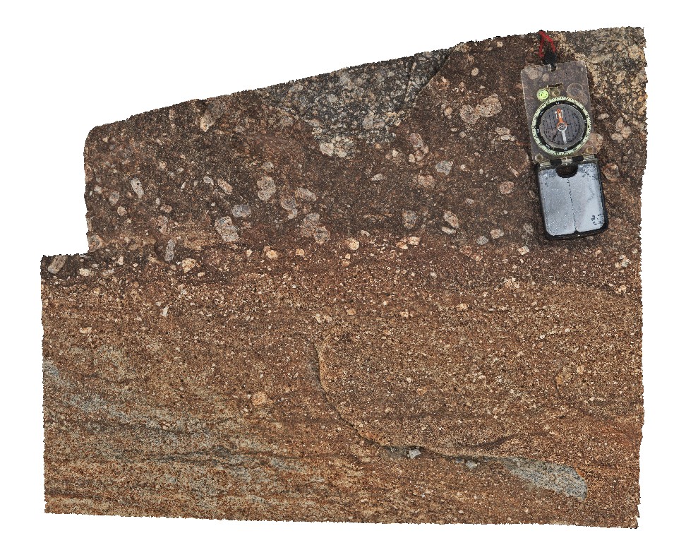
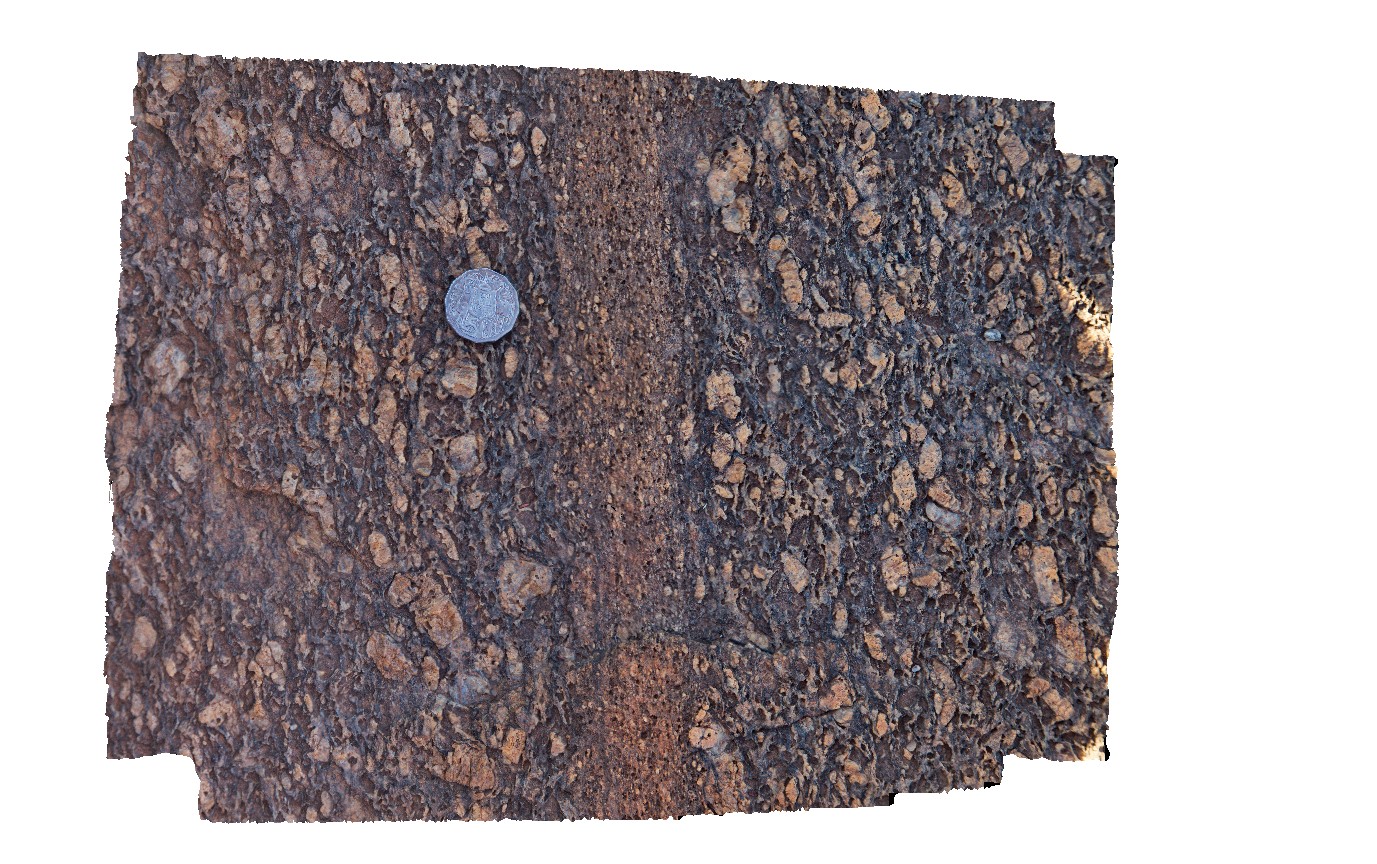
GibbRiver7 Map
 |
0 |
06/06/2016 noon |
3D |
mylonite zone in porphyritic granite. Gibb River Road, near Mount Amy. W.A. |
0.80 |
-17.22790000000 |
124.89618000000 |
-9999.000 |
porphyritic granite, mylonite zone |
granite |
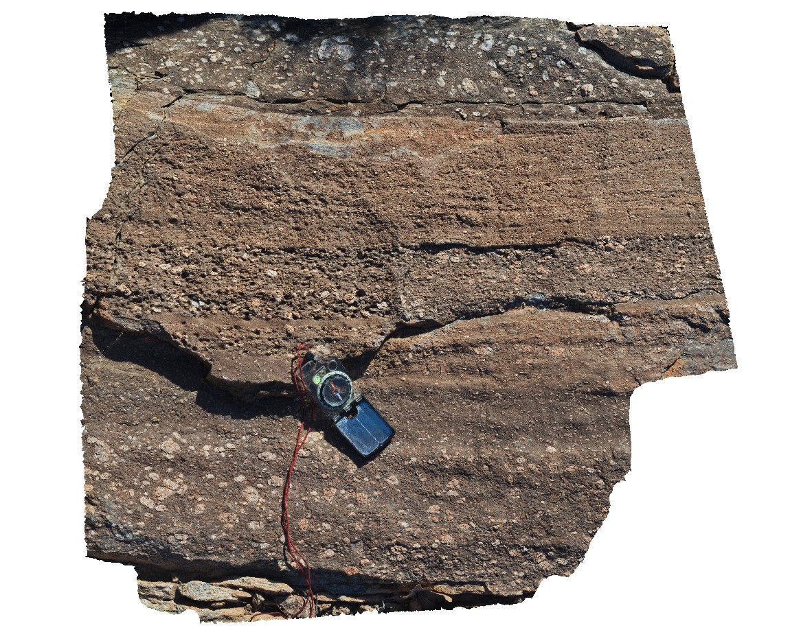
GibbRiver8 Map
 |
0 |
06/06/2016 noon |
3D |
narrow mylonite zone in feldspar porphyritic granite. Gibb River Road, near Mount Amy. W.A. |
0.40 |
-17.22777000000 |
124.89606000000 |
-9999.000 |
mylonite zone, porphyritic granite |
granite |
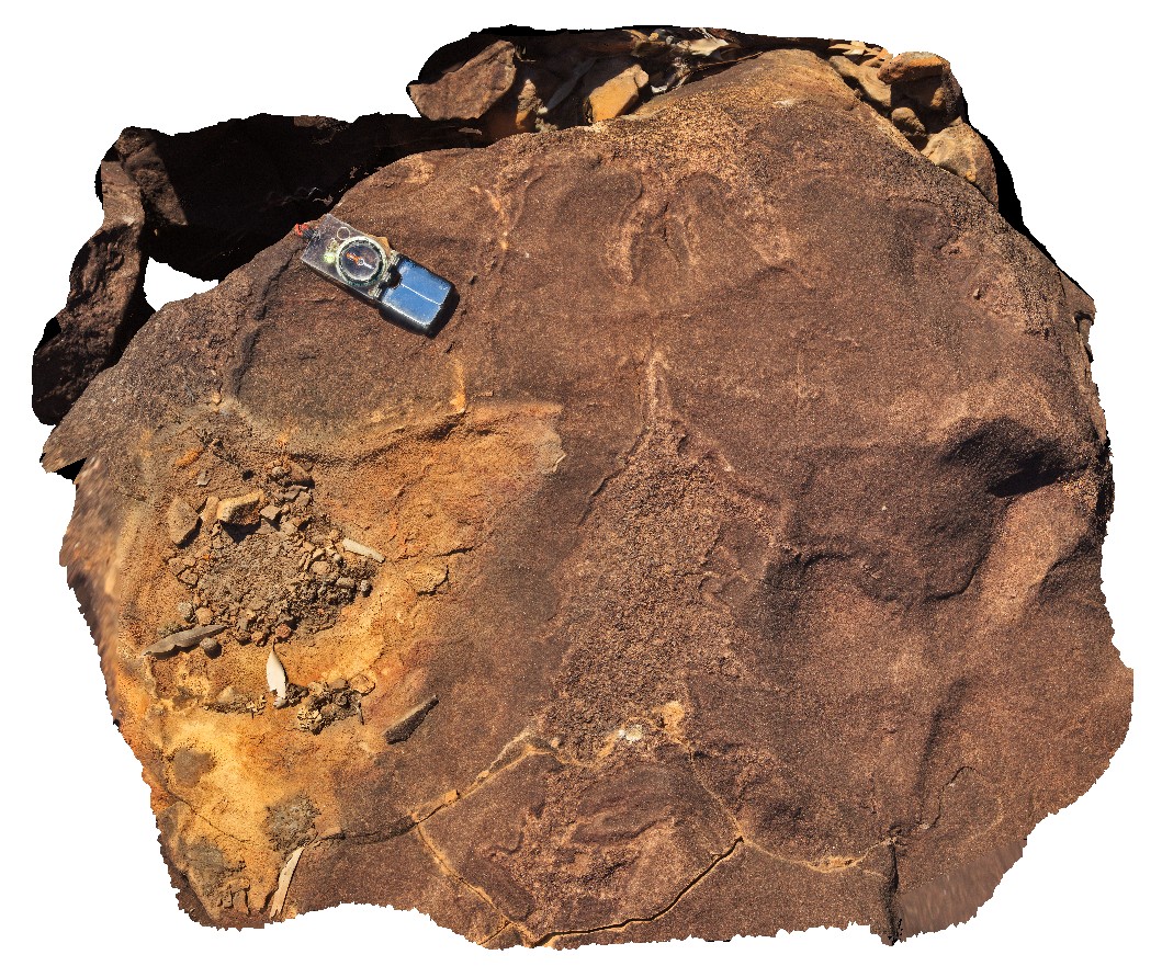
GibbRiver9 Map
 |
0 |
06/06/2016 noon |
3D |
Irregular felsic / granophyric segregations in gabbro. Gibb River Road, near Mount Amy. W.A. |
1.00 |
-17.20631000000 |
124.91576000000 |
-9999.000 |
igneous segregations, gabbro |
gabbro |
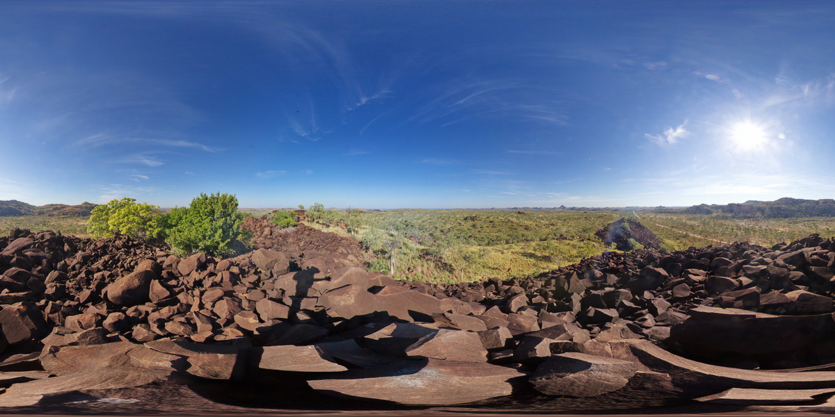
GibbRiverFSP1 Map
 |
0 |
06/06/2016 noon |
FSP |
view from gabbroic knoll of surrounding granite country. Gibb River Road, near Mount Amy. W.A. |
5000.00 |
-17.20575000000 |
124.91619000000 |
-9999.000 |
gabbro, granite |
gabbro |
GibbRiverFSP2 Map
 |
0 |
06/06/2016 noon |
FSP |
view from gabbroic knoll of surrounding granite country. Gibb River Road, near Mount Amy. W.A. |
5000.00 |
-17.20631000000 |
124.91576000000 |
-9999.000 |
gabbro, granite |
gabbro |
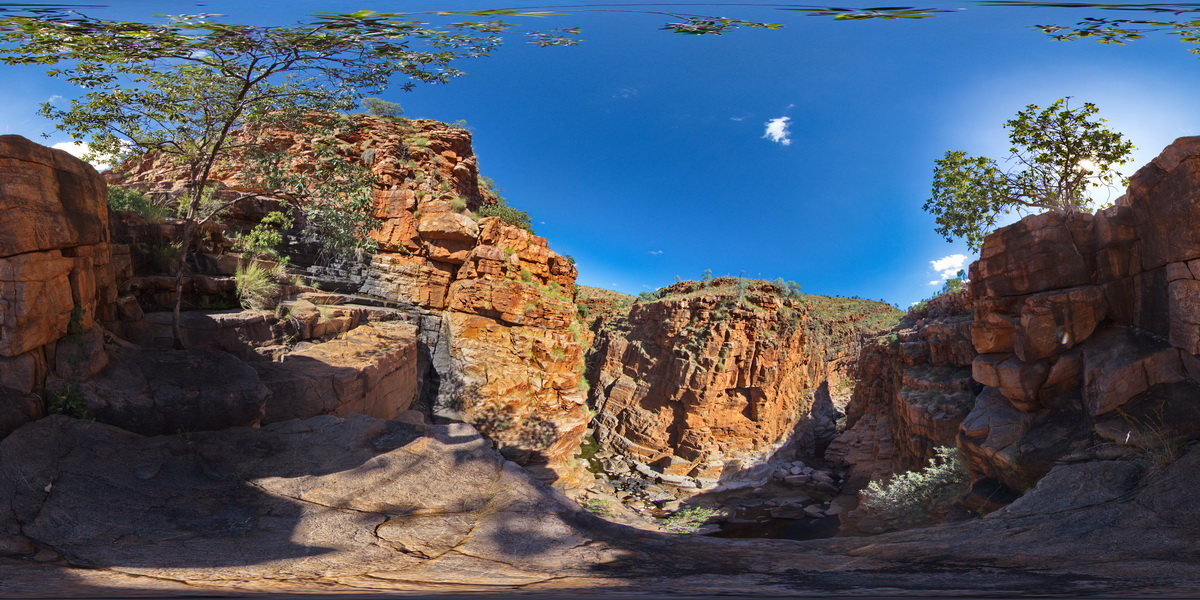
GibbRiverFSP3 Map
 |
0 |
06/06/2016 noon |
FSP |
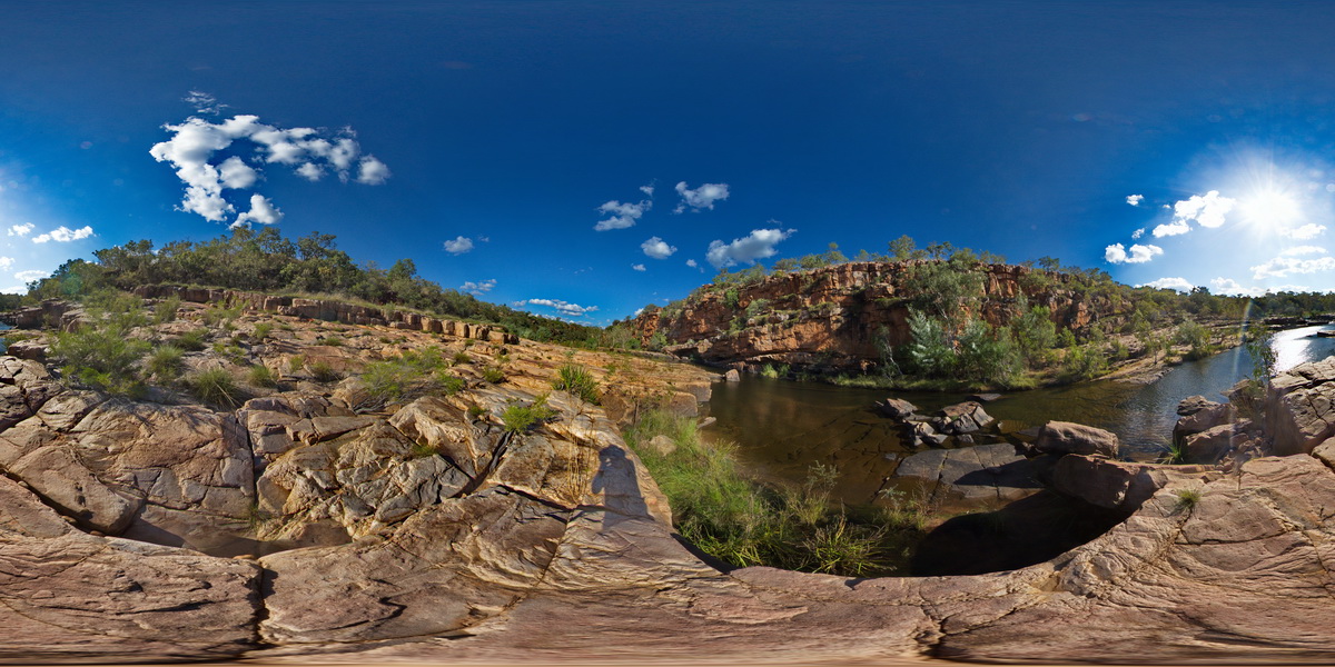
view along Lennard Gorge in the O'Donnell Formation sandstone. Lennard Gorge Road, W.A. |
500.00 |
-17.17692000000 |
125.19952000000 |
-9999.000 |
sandstone, gorge, sedimentology |
sandstone |
GibbRiverFSP4 Map
 |
0 |
06/06/2016 noon |
FSP |
view along and into Lennard Gorge in the O'Donnell Formation sandstone. Lennard Gorge Road, W.A. |
500.00 |
-17.17694000000 |
125.19958000000 |
-9999.000 |
O'Donnell Formation, sandstone, gorge, sedimentology |
sandstone |
GibbRiverFSP5 Map
 |
0 |
06/06/2016 noon |
FSP |
view of sandstone cliffs and ripple marks? In the Lennard Gorge. Lennard Gorge Road, W.A. |
500.00 |
-17.17666000000 |
125.19965000000 |
-9999.000 |
sandstone, ripple mark, sedimentology, gorge |
sandstone |
GibbRiverFSP6 Map
 |
0 |
06/06/2016 noon |
FSP |
view of cascades and gently dipping sandstone in Bell Creek Gorge. Derby - Gibb River Road, Kimberley, W.A. |
100.00 |
-16.99380000000 |
125.20454000000 |
-9999.000 |
gorge, dip, sandstone |
sandstone |
GibbRiverFSP7 Map
 |
0 |
06/06/2016 noon |
FSP |
view of pools and cascades over gently dipping sandstone in Bell Creek Gorge. Derby - Gibb River Road, Kimberley, W.A. |
100.00 |
-16.99340000000 |
125.20431000000 |
-9999.000 |
waterfall, sandstone, gorge, dip |
sandstone |
GibbRiverFSP8 Map
 |
0 |
06/06/2016 noon |
FSP |
view along the Barnett Gorge in the King Leopold Sandstone. Barnett Gorge. Derby - Gibb River Road, Kimberley, W.A. |
300.00 |
-16.52706000000 |
126.12495000000 |
-9999.000 |
Barnett Gorge, King Leopold Sandstone |
sandstone |
GibbRiverFSP9 Map
 |
0 |
01/01/9999 midnight |
FSP |
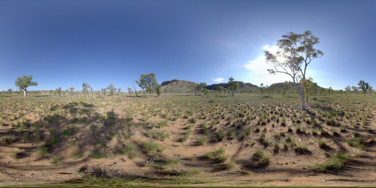
view to Cockburn Range near Emma Gorge. Kimberley. W.A. |
1000.00 |
-14.90996000000 |
128.12428000000 |
-9999.000 |
sandstone, weathering |
sandstone |
GibbRiverGIG1 Map
 |
0 |
06/06/2016 noon |
GIGA |
— |
0.00 |
-15.91240000000 |
128.17818000000 |
-9999.000 |
|
|
GibbRiverUAV1 Map
 |
0 |
06/06/2016 noon |
UAV |
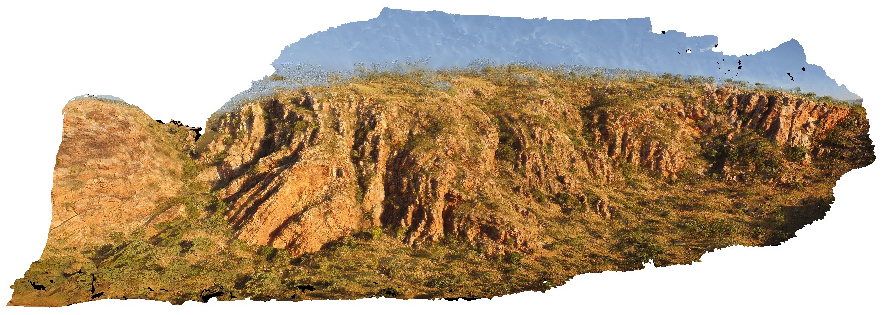
aerial view near Mount Bell, showing open, upright folded King Leopold sandstone. Derby-Gibb River Road, Kimberly, W.A. |
100.00 |
-17.17522100000 |
125.29286500000 |
-9999.000 |
open fold, sandstone, structure |
sandstone |
GibbRiverUAV2 Map
 |
0 |
06/06/2016 noon |
UAV |
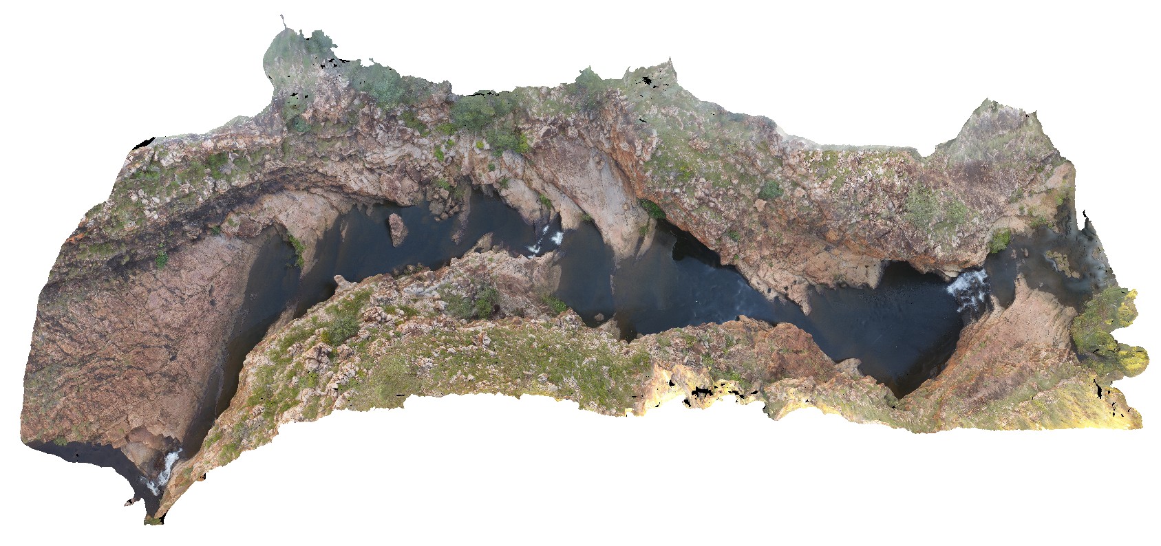
aerial view of Bell Creek Gorge, showing cascades over gently dipping sandstone beds. Bell Creek Gorge, Derby - Gibb River Road, Kimberly, W.A. |
100.00 |
-16.99212500000 |
125.20405400000 |
-9999.000 |
Bell Creek Gorge, dip, sandstone |
sandstone |
GoatIslandUAV1 Map
 |
50 |
01/01/9999 midnight |
UAV |
aerial over view of folded metamorphic sediments of the Burnie Formation (Oonah Formation) and Ulverstone Metamorphics, which includes the Goat Island Conglomerate. Goat Island, Ulverstone. North Tasmania. |
680.00 |
-41.13575600000 |
146.13587000000 |
55.000 |
metasediments, Burnie Formation, Ulverstone Metamorphics, geological contact |
metasediments, metasediments |
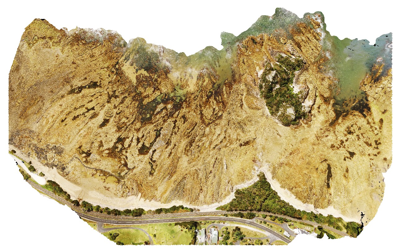
GordonDam1 Map
 |
20 |
04/07/2016 12:19 p.m. |
3D |
view of deformed and folded quartzite in the southern abutment of the Gordon Dam, Tasmania. |
200.00 |
-42.73044300000 |
145.97555560000 |
-9999.000 |
folded, quartzite, structure |
quartzite |
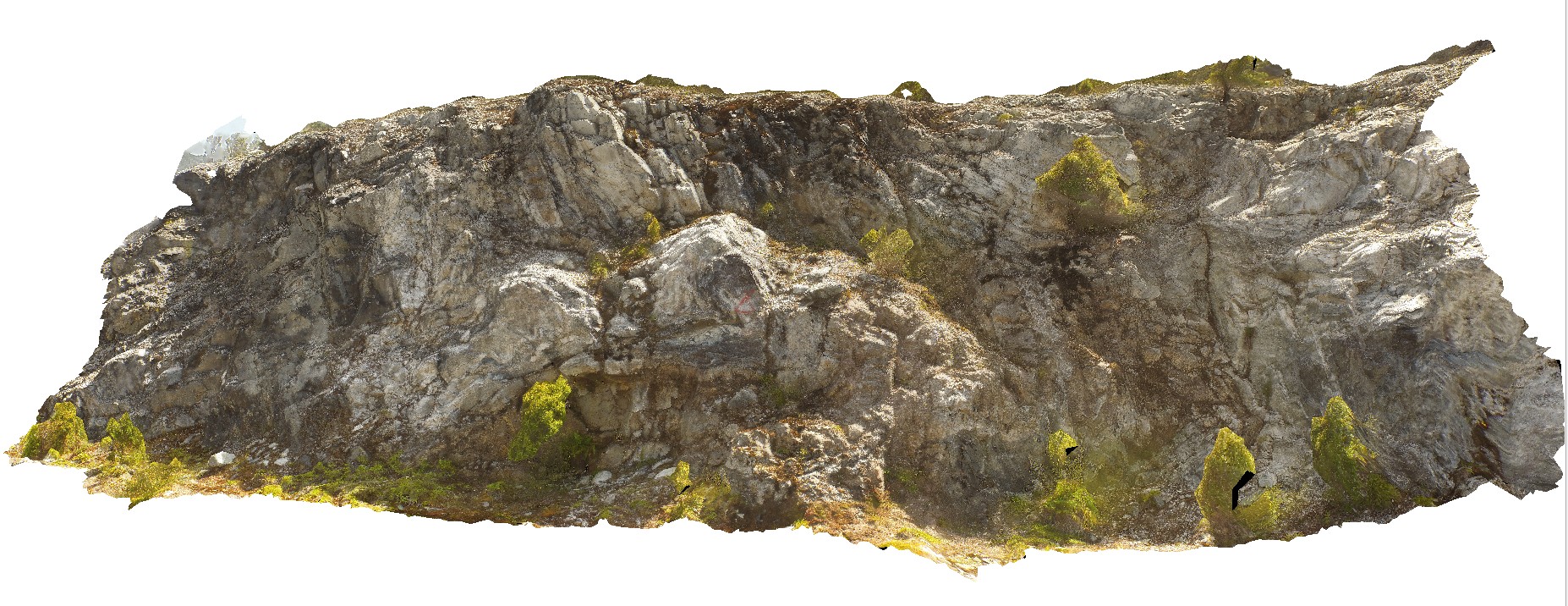
GordonDam2 Map
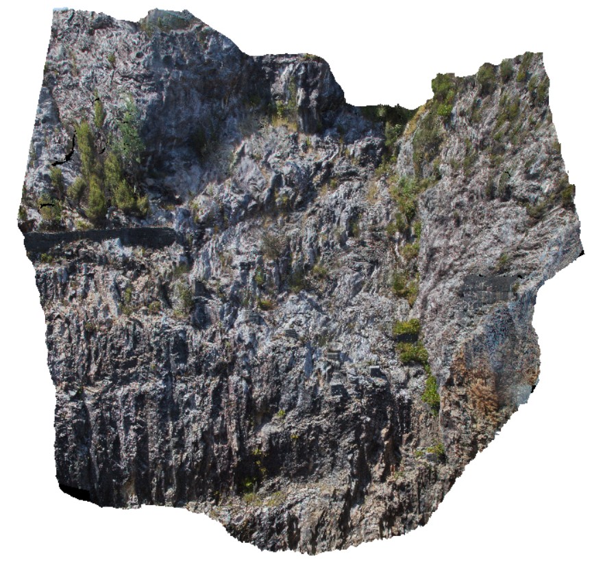 |
20 |
04/12/2016 9:02 a.m. |
3D |
view of upstream part of the southern abutment of the Gordon Dam, showing folded and deformed quartzites and phyllites. Gordon Dam, Tasmania. |
20.00 |
-42.73044300000 |
145.97555560000 |
-9999.000 |
folding, structure, quartzite |
quartzite |
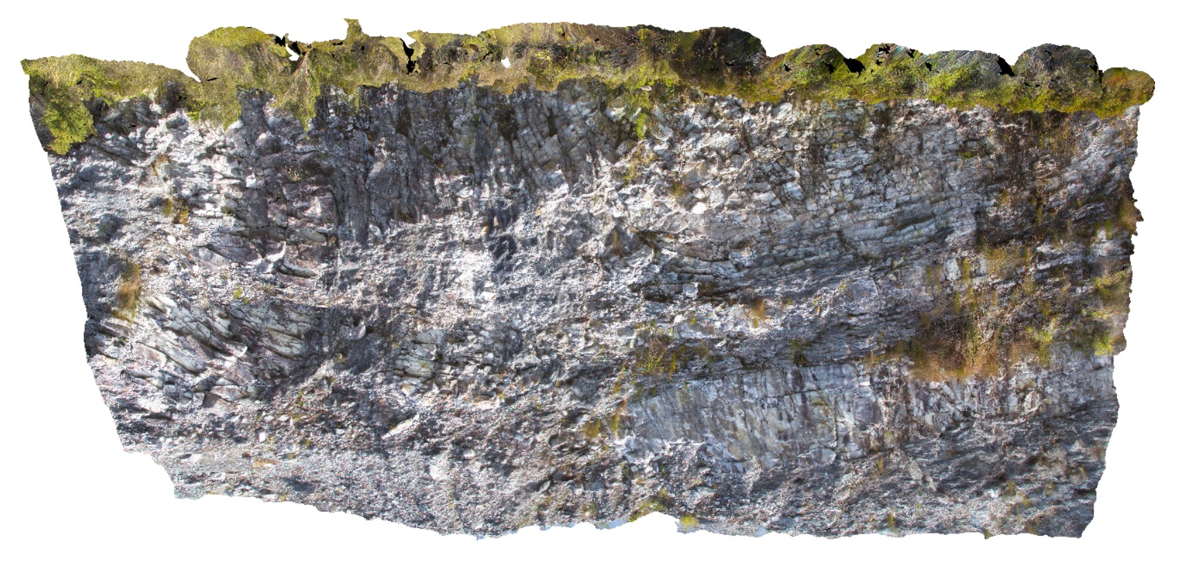
GordonDam3 Map
 |
20 |
02/29/2016 9:51 a.m. |
3D |
view of northern abutment of the Gordon Dam, showing folded and deformed beds of quartzite and phyllite. Tasmania. |
200.00 |
-42.73044300000 |
145.97555560000 |
-9999.000 |
fold, quartzite, deformation |
quartzite |
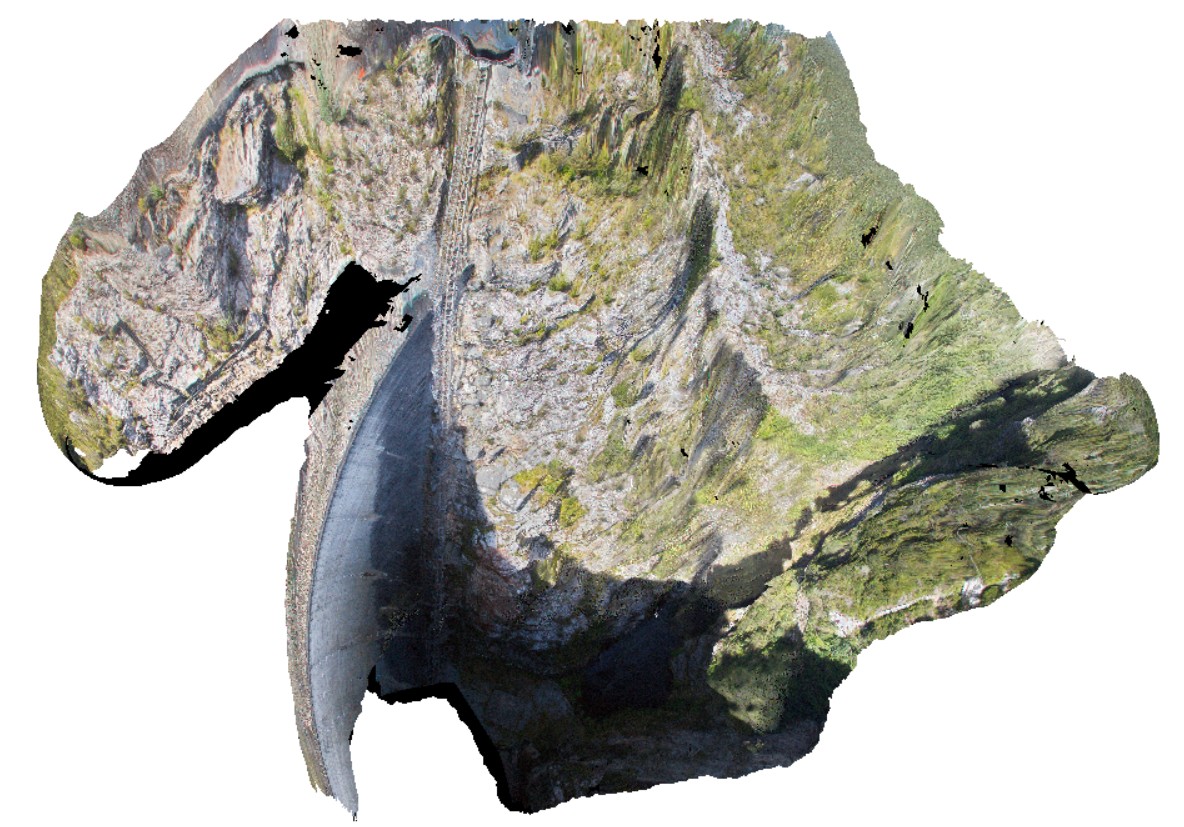
GordonDamUAV1 Map
 |
20 |
02/23/2016 9:14 a.m. |
UAV |
folded quartzite and phyllite in south abutment of Gordon Dam. Gordon Dam Road, near Gordon Dam. Tasmania. |
200.00 |
-42.73044300000 |
145.97555560000 |
-9999.000 |
folding, structure, phyllite, quartzite |
quartzite |
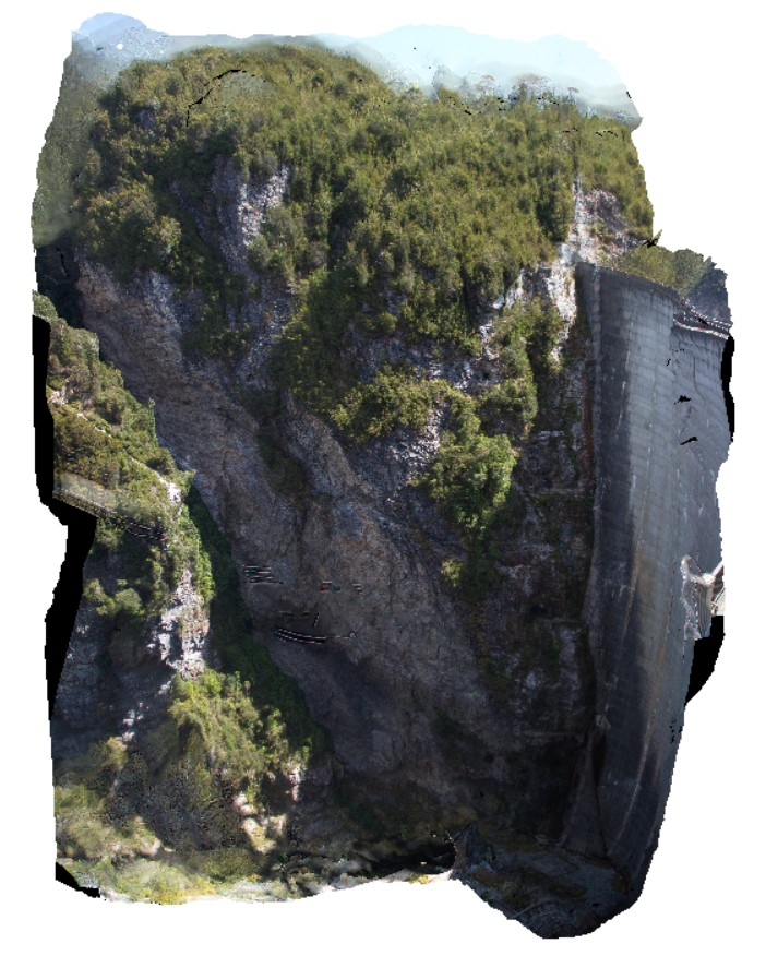
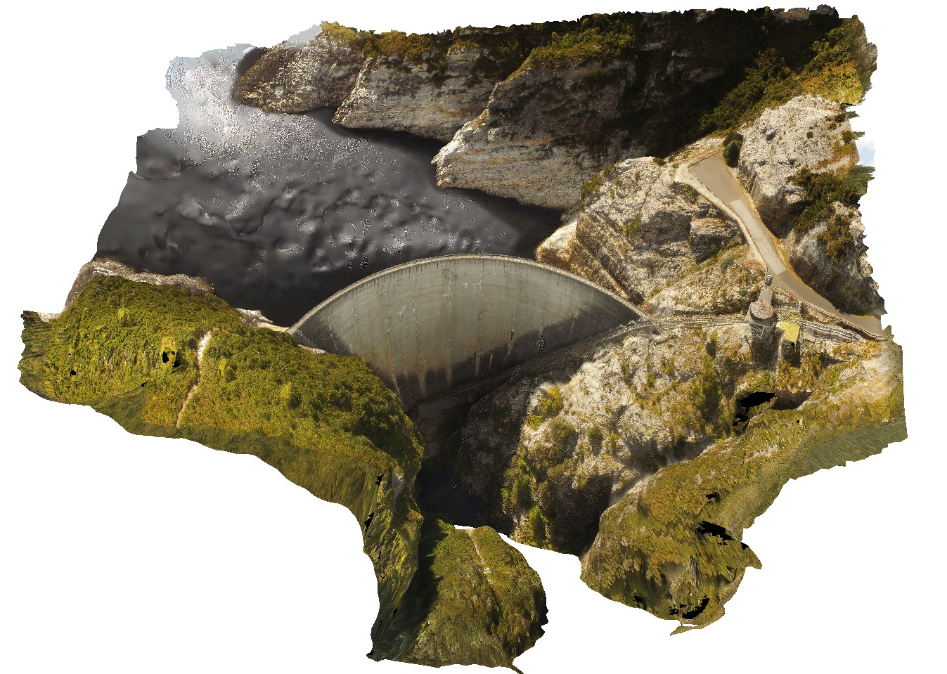
GordonDamUAV2 Map
 |
20 |
02/23/2016 9:14 a.m. |
UAV |
Aerial view of the Gordon Dam, showing folded quartzite and phyllite metasediments outcrop. Gordon Dam. Tasmania. |
200.00 |
-42.73044300000 |
145.97555560000 |
-9999.000 |
dam, quartzite, phyllite, structure |
quartzite |
GordonRd1 Map
 |
0 |
02/29/2016 1:37 p.m. |
3D |
open asymmetric fold in bedded quartzite. Gordon Dam Road, near Gordon Dam. Tasmania. |
10.00 |
-42.73655000000 |
145.97487000000 |
-9999.000 |
fold, quartzite, asymmetric fold, structure |
quartzite |