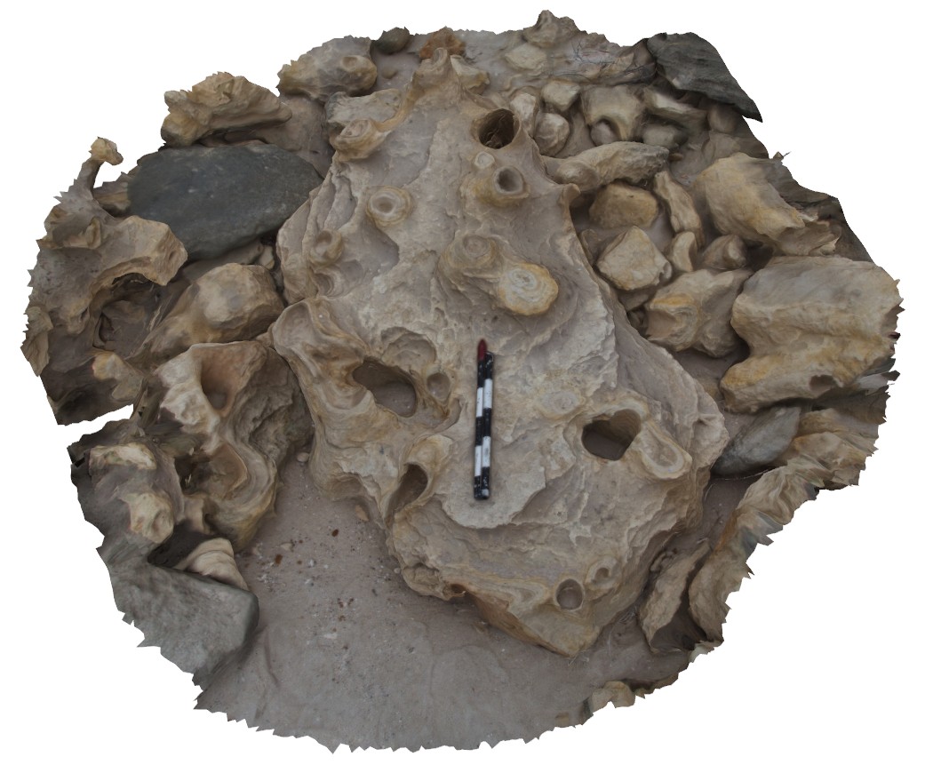
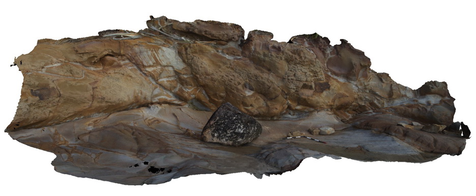
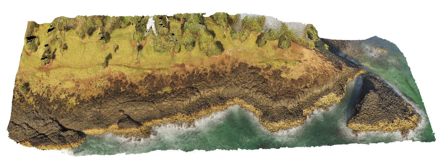
Esperance6 Map
 |
0 |
06/10/2016 2:25 p.m. |
3D |
picture of a loose boulder at the foot of a cliff, showing 3D exposure through concentrically ringed solution tubes. Esperance, W.A. |
3.00 |
-33.89653000000 |
121.77335000000 |
-9999.000 |
solution tubes, calcareous deposits |
calcareous sand |
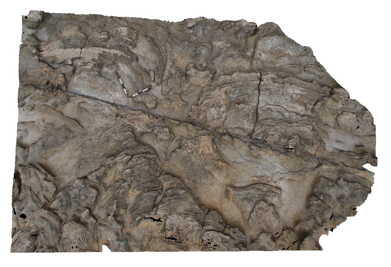
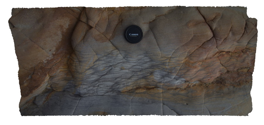
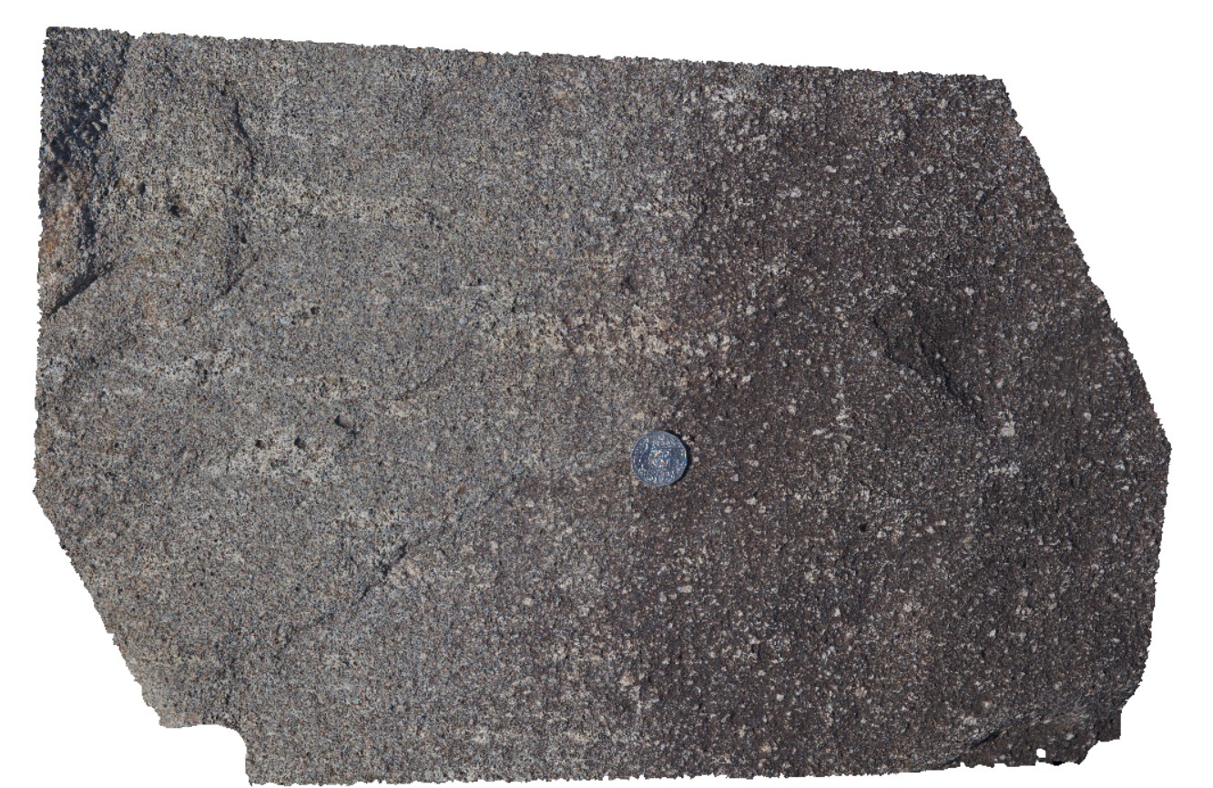
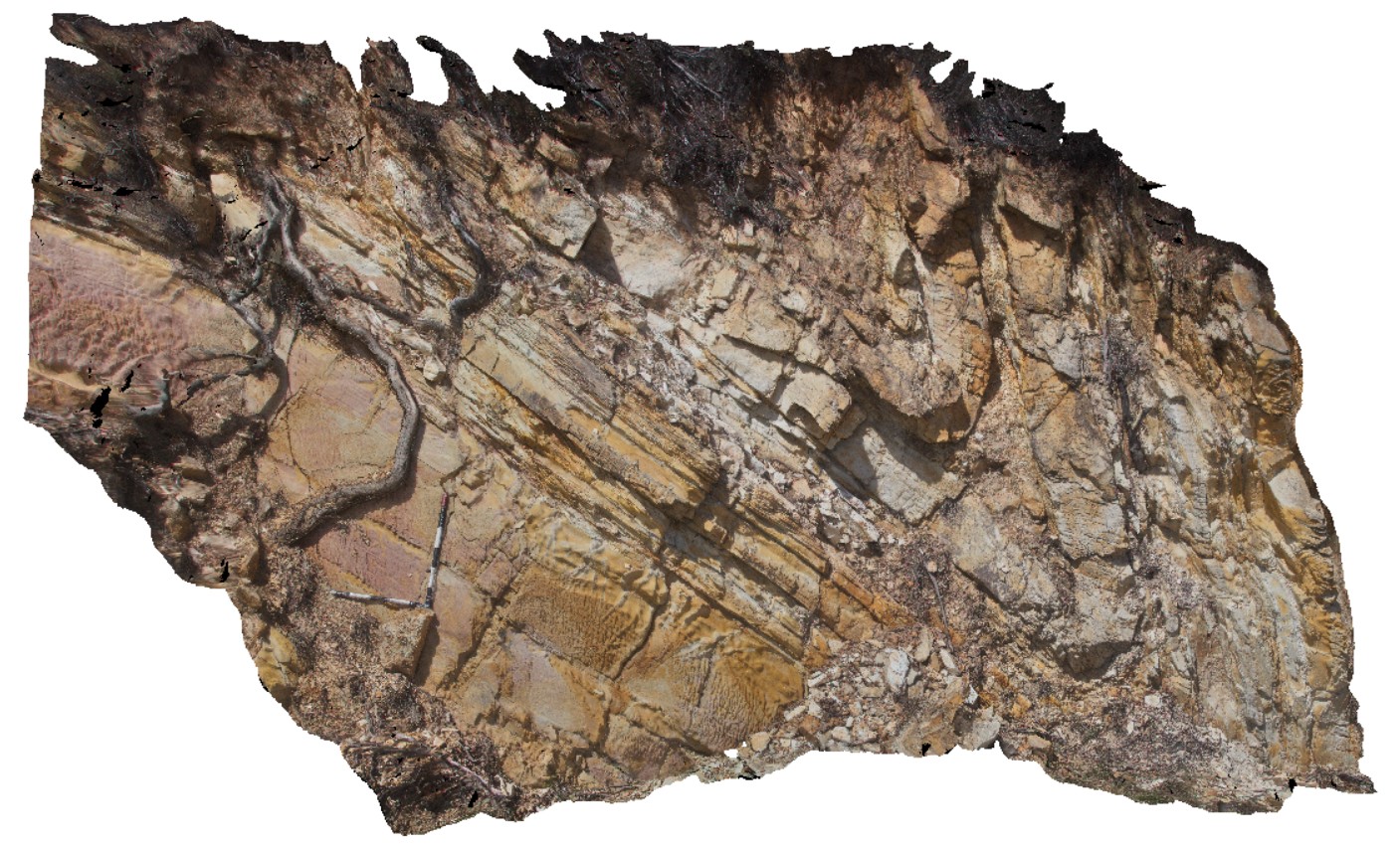
Esperance7 Map
 |
0 |
06/05/2016 10:45 a.m. |
3D |
view of lithified, cross bedded Quaternary aeolian sandstone. Esperance, W.A. |
5.00 |
-33.89653000000 |
121.77309000000 |
-9999.000 |
cross bedding, aeolian sandstone |
sandstone |
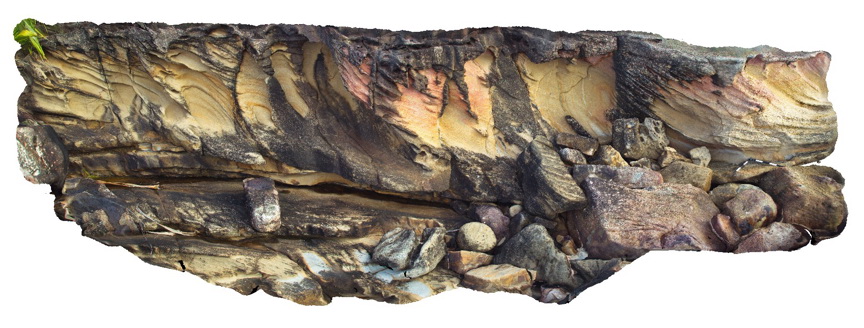
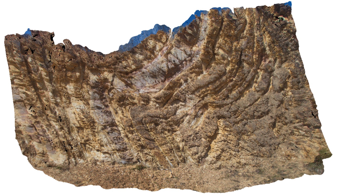
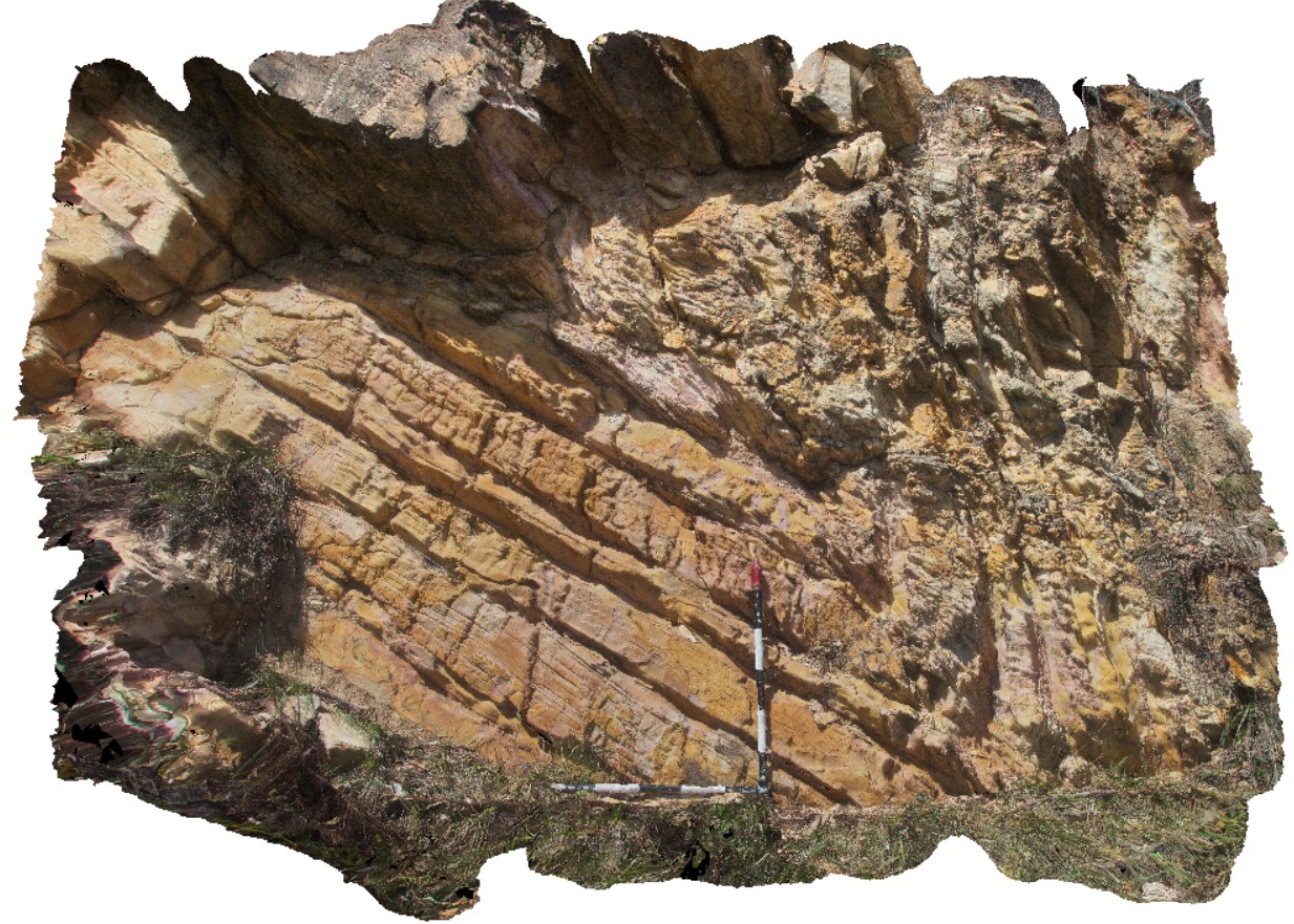
Evans1 Map
 |
5 |
07/09/2015 9:13 a.m. |
3D |
Large scale cross bedding in fluvial sandstone of the Triassic Ipswich Coal Measures. Evens Head, N.S.W. |
10.00 |
-29.11441000000 |
153.43927000000 |
1.000 |
cross bedding, fluvial, sedimentology |
sandstone |
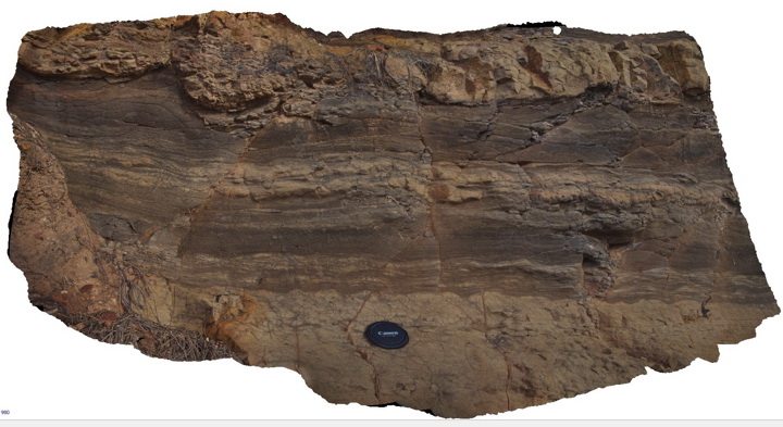
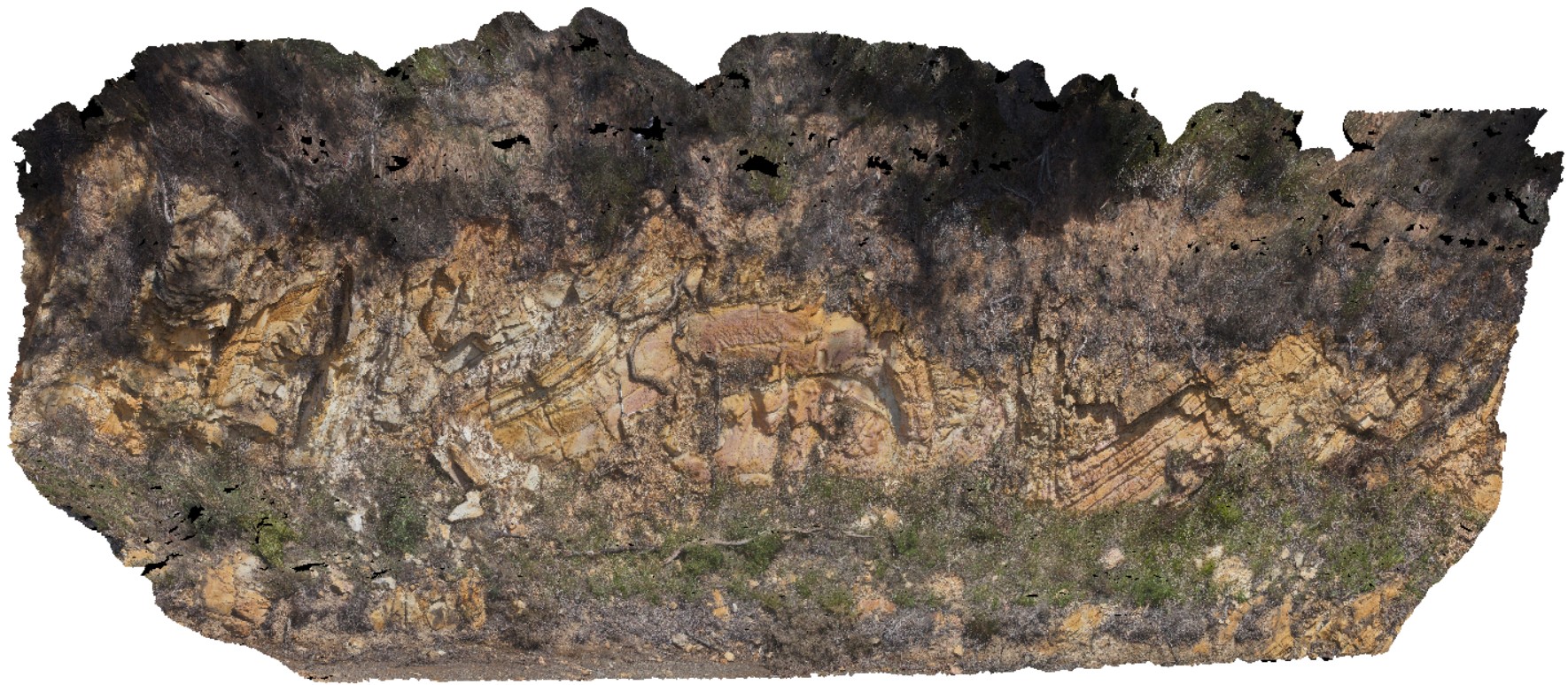
Evans2 Map
 |
5 |
07/09/2015 9:14 a.m. |
3D |
flood plain sediments consisting of laminated siltstone with ripple marks and thin fine-grained sand lenses. Triassic Ipswich Coal Measures. Evens Head, N.S.W. |
1.00 |
-29.11441000000 |
153.43919000000 |
1.000 |
ripple marks, floodplain, sedimentology |
siltstone, sandstone |
Evans3 Map
 |
1 |
07/09/2015 9:15 a.m. |
3D |
Fine grained (silty) laminated sediments overlain by medium to coarse grained quartz sandstone. The contact is irregular and erosional. Evens Head, N.S.W. |
10.00 |
-29.11441000000 |
153.43889000000 |
-9999.000 |
channel, sedimentology, erosional contact |
sandstone |
Evans4 Map
 |
5 |
07/09/2015 9:15 a.m. |
3D |
ripple marks in fine grained silty sandstone. Ipswich Coal Measures. Evens Head, N.S.W. |
1.00 |
-29.11447000000 |
153.43883000000 |
1.000 |
ripple marks, sedimentology |
sandstone |
Evans5 Map
 |
5 |
07/09/2015 9:16 a.m. |
3D |
Poorly sorted landslide deposits derived from the Ipswich Coal Measures. Evens Head, N.S.W. |
10.00 |
-29.11460000000 |
153.43761000000 |
1.000 |
landslide |
landslip |
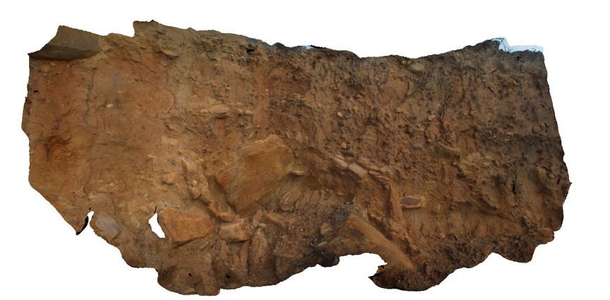
Falmouth1 Map
 |
0 |
03/22/2016 10:41 a.m. |
3D |
fiamme textures in St Mary's Porphyrite. Fulmouth, Tasmania. |
0.30 |
-41.50288000000 |
148.27066000000 |
-9999.000 |
fiamme texture, porphyrite |
porphyrite |
Falmouth2 Map
 |
0 |
02/29/2016 9:33 a.m. |
3D |
fiamme textures in St Mary's Porphyrite. Fulmouth, Tasmania. |
0.50 |
-41.50291000000 |
148.27057000000 |
-9999.000 |
fiamme texture, porphyrite |
porphyrite |
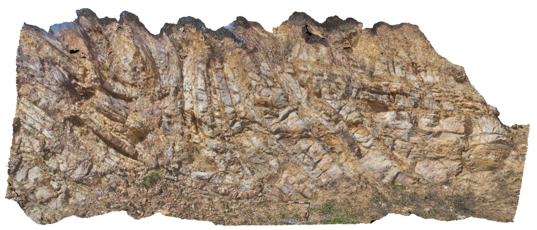
FingalNSW2 Map
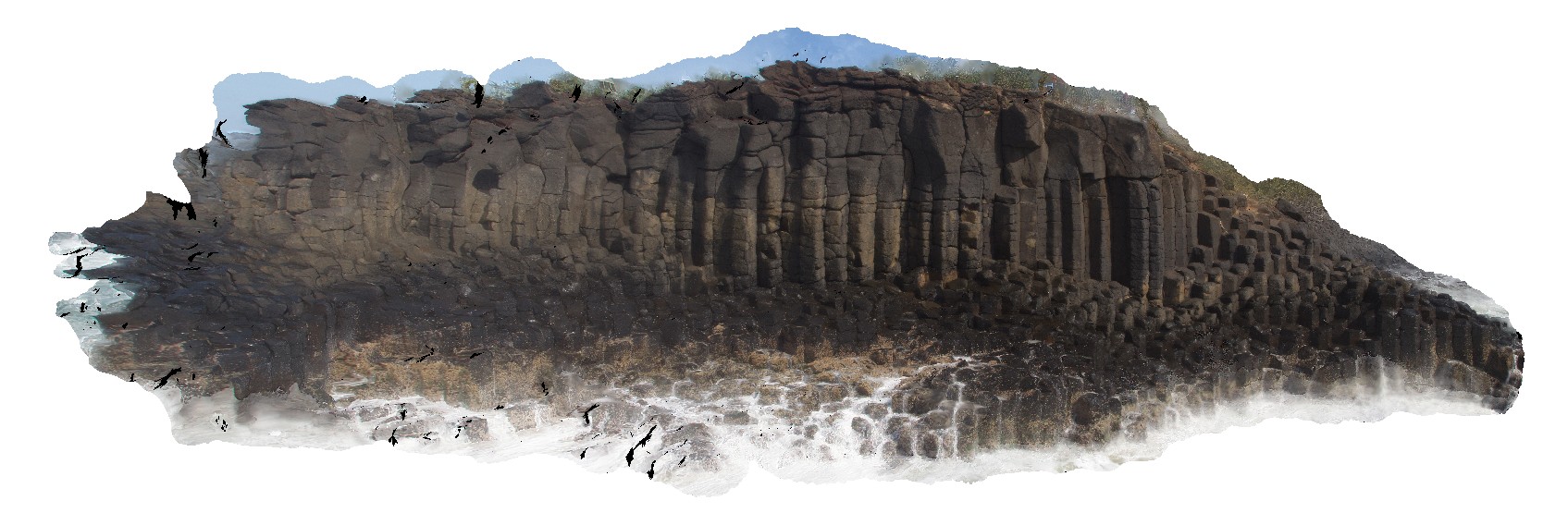 |
5 |
01/01/9999 midnight |
3D |
Columnar basalt exposed at Fingal Head, QLD |
30.00 |
-28.19903000000 |
153.57137000000 |
2.000 |
columnar basalt, cooling columns, cooling joints, igneous |
basalt |
FingalNSW3 Map
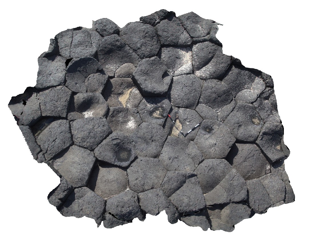 |
5 |
01/01/9999 midnight |
3D |
View down onto cooling columns in Tertiary Basalt at Fingal Head, QLD |
3.00 |
-28.13908000000 |
153.57141000000 |
2.000 |
cooling columns, cooling joints, igneous |
basalt |
FingalNSWFSP1 Map
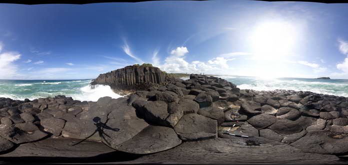 |
5 |
01/01/9999 midnight |
FSP |
View of cooling columns in Tertiary Basalt at Fingal Head, QLD |
50.00 |
-28.13908000000 |
153.57410000000 |
2.000 |
cooling columns, cooling joints, igneous |
basalt |
FingalNSWUAV1 Map
 |
0 |
01/01/9999 midnight |
UAV |
View of polygonal cooling columns in Tertiary Basalt at Fingal Head, QLD |
100.00 |
-28.13908000000 |
153.57410000000 |
-9999.000 |
columnar basalt, basalt, flow, volcanic |
basalt |
FingalTas1 Map
 |
0 |
01/01/9999 midnight |
3D |
folds with well defined cleavage in Mathinna Group sediments, Esk Highway. Fingal, Tas. |
8.00 |
-41.65031000000 |
147.93181000000 |
-9999.000 |
fold, cleavage |
sandstone |
FingalTas2 Map
 |
0 |
01/01/9999 midnight |
3D |
detail of inclined antiform in sandstone layers. Mathinna Group sediments. Fingal, Tas. |
4.00 |
-41.65031000000 |
147.93181000000 |
-9999.000 |
anticline, inclined fold |
sandstone |
FingalTas3 Map
 |
0 |
01/01/9999 midnight |
3D |
folds with inclined axial surfaces in Mathinna Group sediments. Esk Highway, Tasmanian. |
8.00 |
-41.65028000000 |
147.93211000000 |
-9999.000 |
inclined fold, axial surface |
sandstone |
FingalTas4 Map
 |
0 |
01/01/9999 midnight |
3D |
view of Chris Powell's folds at Tallochgoren. Esk Highway, Tasmania. |
15.00 |
-41.65804000000 |
147.91606000000 |
-9999.000 |
fold, synform, antiform |
sandstone |
FingalTas5 Map
 |
0 |
01/01/9999 midnight |
3D |
detail of antiform fold, with inclined axial plane, in road cutting. Esk Highway, Tasmania. From image Fingal4. |
6.00 |
-41.65804000000 |
147.91606000000 |
-9999.000 |
axial plane, fold, structure |
sandstone |
FingalTas6 Map
 |
0 |
01/01/9999 midnight |
3D |
detail of synform fold, with inclined axial plane, in road cutting. Esk Highway, Tasmania. From image Fingal4. |
6.50 |
-41.65800000000 |
147.91608000000 |
-9999.000 |
inclined fold, axial plane |
sandstone |
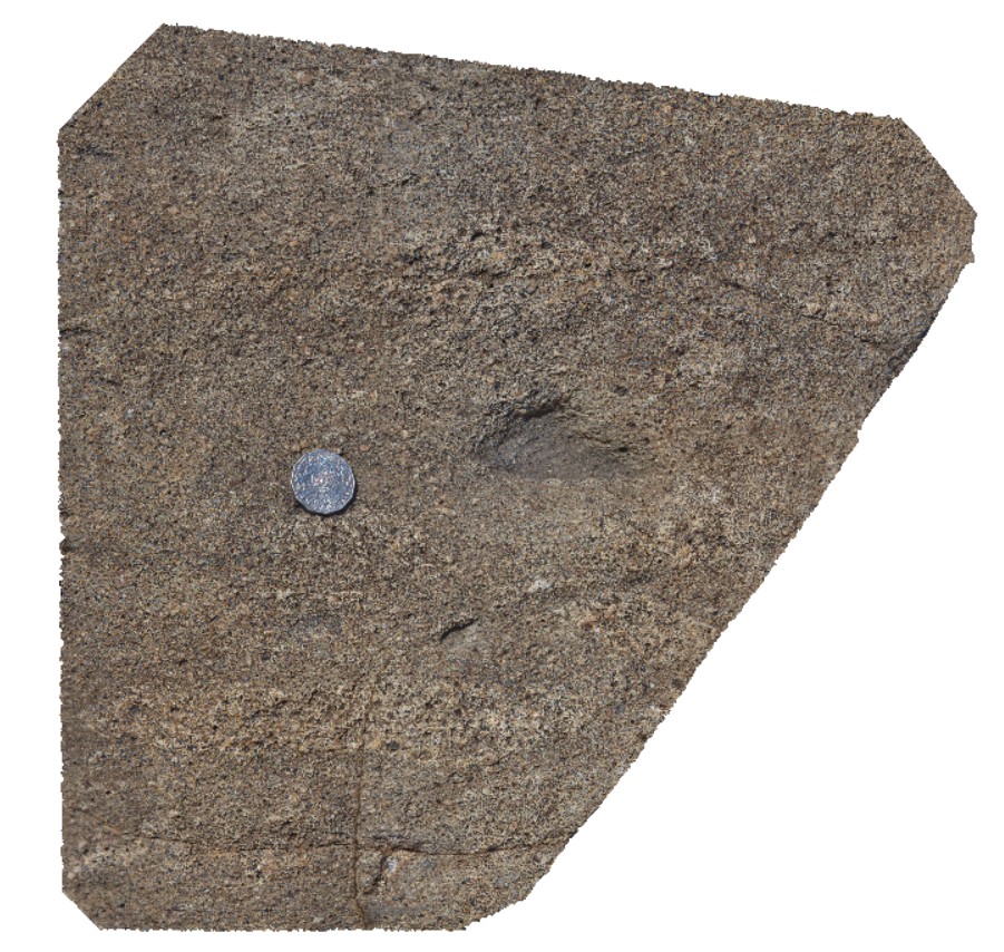
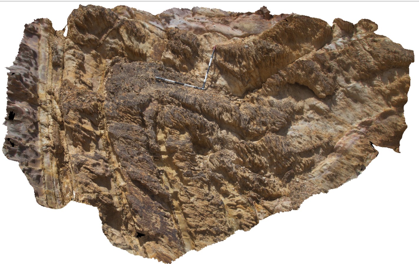
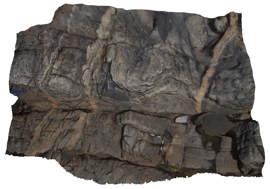
FishermansRocks1 Map
 |
5 |
01/01/9999 midnight |
3D |
major F1 fold nearly recumbent with overprinted south-plunging F2 folds, numerous D2 faults. Mallacoota, Vic. |
30.00 |
-37.59847800000 |
149.73163400000 |
-9999.000 |
fold, recumbent fold, structure, F1, fold plunge |
turbidite |
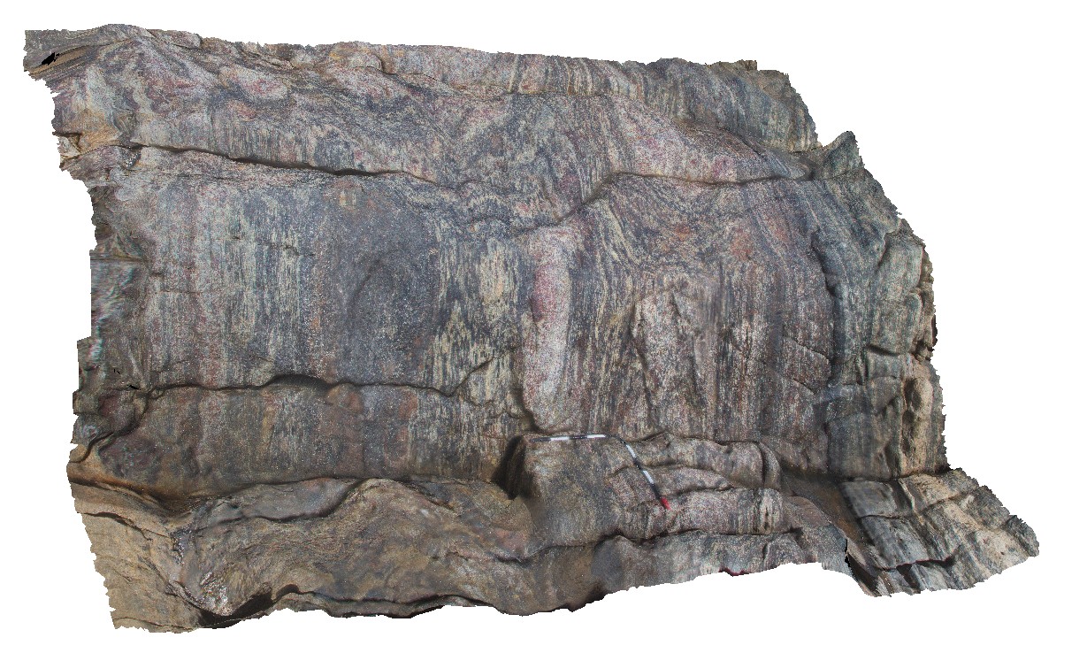
Fishery1 Map
 |
0 |
11/10/2015 9:29 a.m. |
3D |
pavement of folded and sheared garnet-bearing gneiss. Fishery Bay, S.A. |
5.00 |
-34.91369000000 |
135.69206000000 |
-9999.000 |
garnet gneiss, folding |
gneiss |
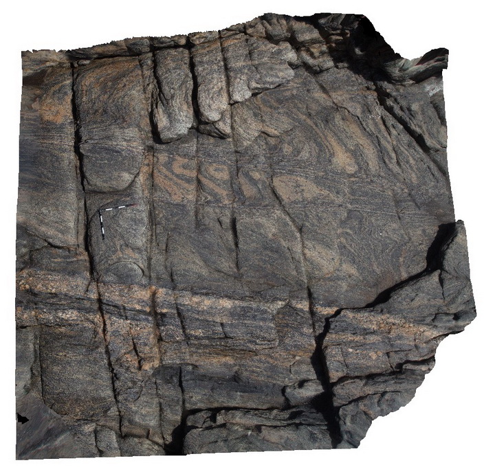
Fishery10 Map
 |
0 |
11/06/2015 9:53 a.m. |
3D |
folded and sheared garnet bearing meta-beds. Fishery Bay, S.A. |
4.00 |
-34.91372000000 |
135.69217000000 |
-9999.000 |
metasediments, garnet porphyroblast |
gneiss |
Fishery11 Map
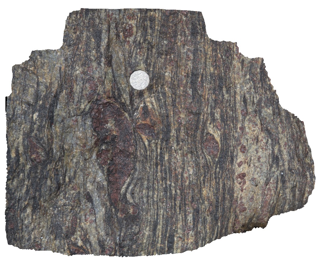 |
0 |
04/28/2016 10:15 a.m. |
3D |
details of garnet porphyroblasts in sheared gneiss. Fishery Bay, S.A. |
0.40 |
-34.91372000000 |
135.69217000000 |
-9999.000 |
porphyroblast, garnet, shear zone |
gneiss |
Fishery12 Map
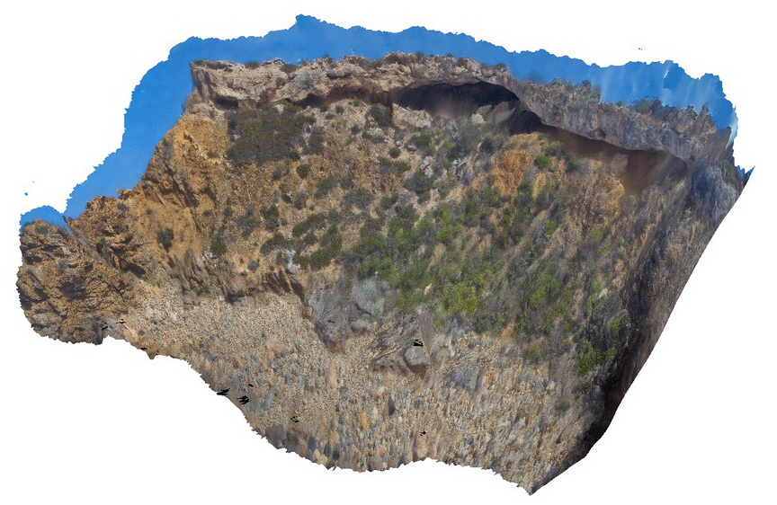 |
0 |
02/15/2016 11:34 a.m. |
3D |
View of Tertiary unconformity, showing weathered gneiss truncated and overlain by Tertiary deposits. Fishery Bay, S.A. |
8.00 |
-34.91291400000 |
135.69209100000 |
-9999.000 |
geological unconformity, metamorphics |
gneiss, sediment |
Fishery13 Map
 |
0 |
11/06/2015 9:56 a.m. |
3D |
folds and shearing of intruding dykes in gneiss. Fisherys Bay, S.A. |
0.00 |
-34.91346000000 |
135.69218000000 |
-9999.000 |
folding, shearing, intrusive contact |
gneiss, felsic |