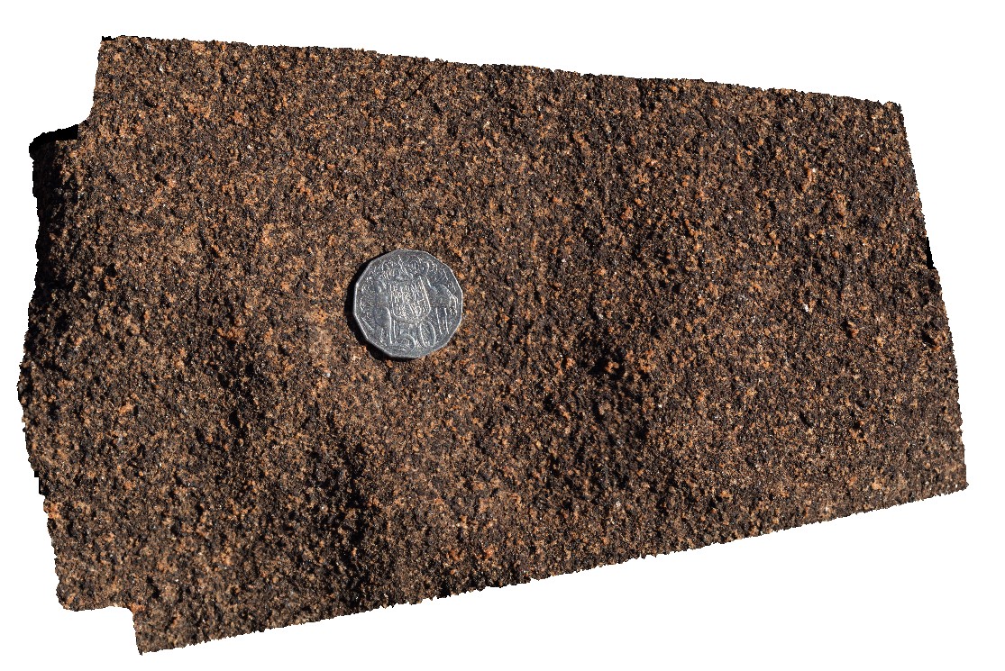
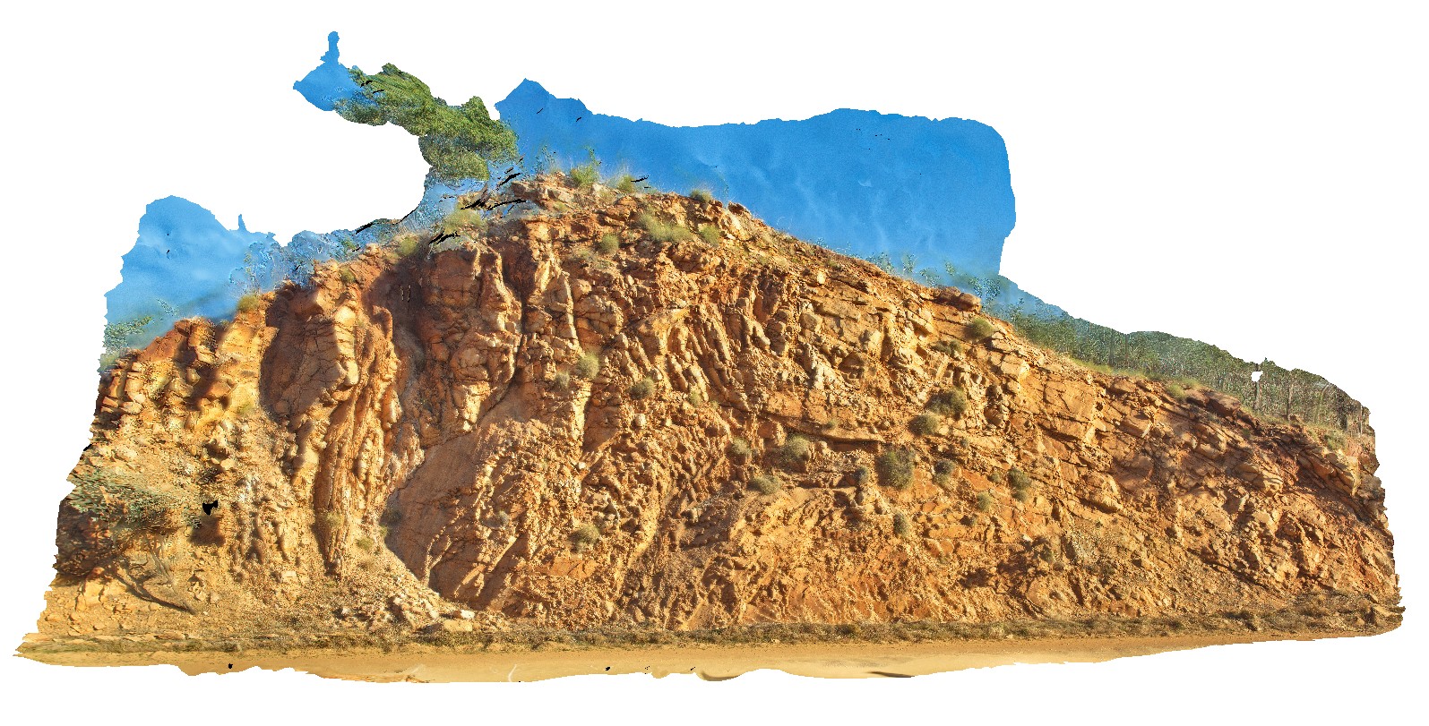
GawlerUAV2 Map
 |
0 |
10/20/2015 4:08 p.m. |
UAV |
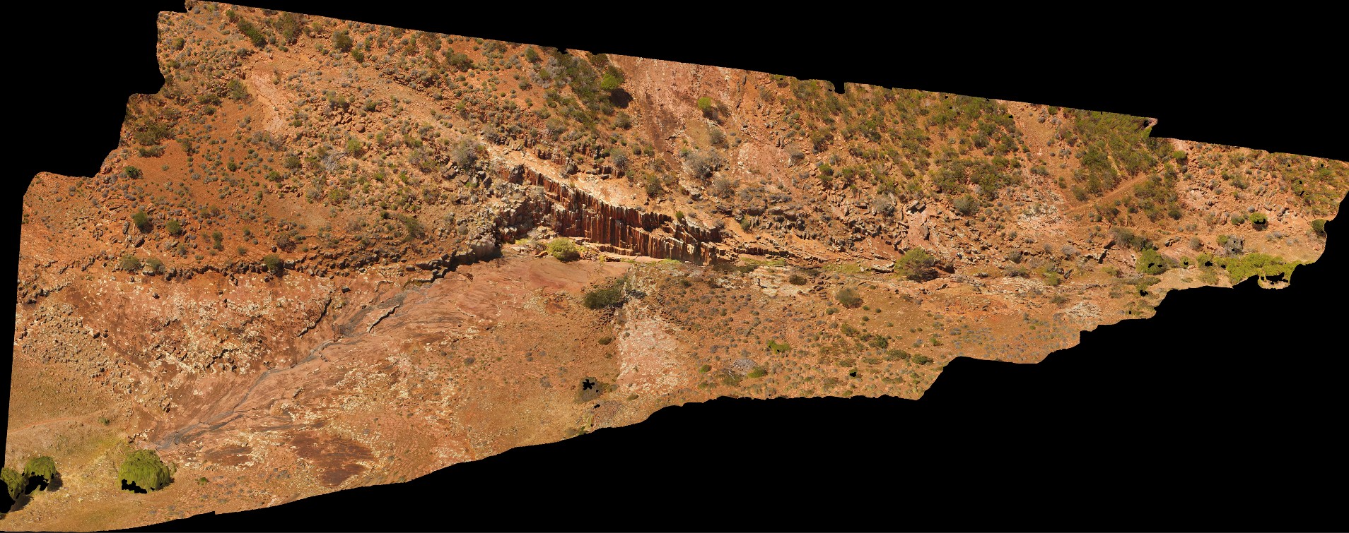
aerial view of Kolar Falls, showing columnar dacite. Mount Fairview, Gawler Ranges. |
500.00 |
-32.56346300000 |
135.57600000000 |
-9999.000 |
columnar, joint, dacite |
dacite |
GibbRiver1 Map
 |
0 |
06/05/2016 noon |
3D |
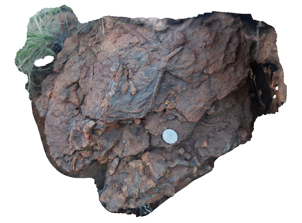
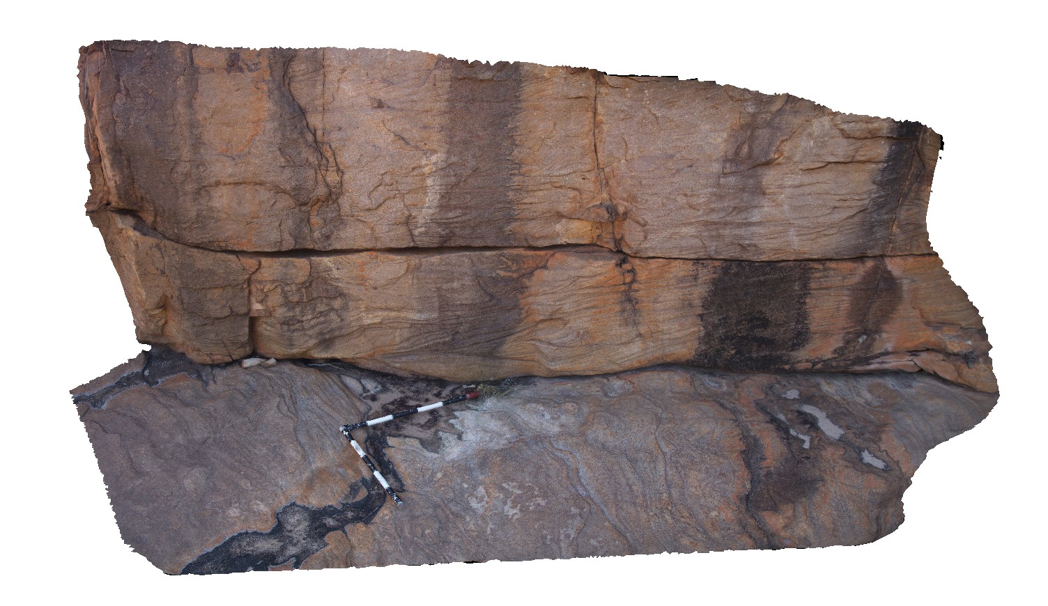
andalusite porphyroblasts in pelitic schist, Gibb River Road, near Napier Downs Airport. W.A. |
0.45 |
-17.32181000000 |
124.83582000000 |
-9999.000 |
andalusite, pelitic schist, porphyroblast |
pelitic schist |
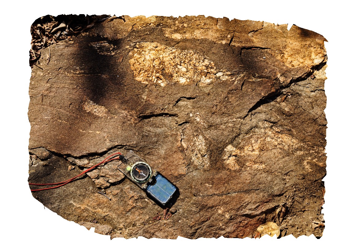
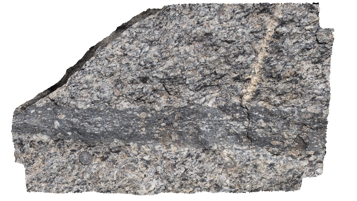
GibbRiver10 Map
 |
0 |
06/06/2016 noon |
3D |
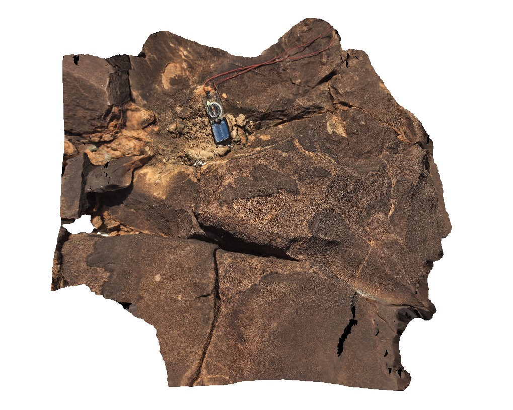
Irregular felsic / granophyric segregations in gabbro. Gibb River Road, near Mount Amy. W.A. |
1.00 |
-17.20634000000 |
124.91590000000 |
-9999.000 |
granophyric segregations, gabbro |
gabbro |
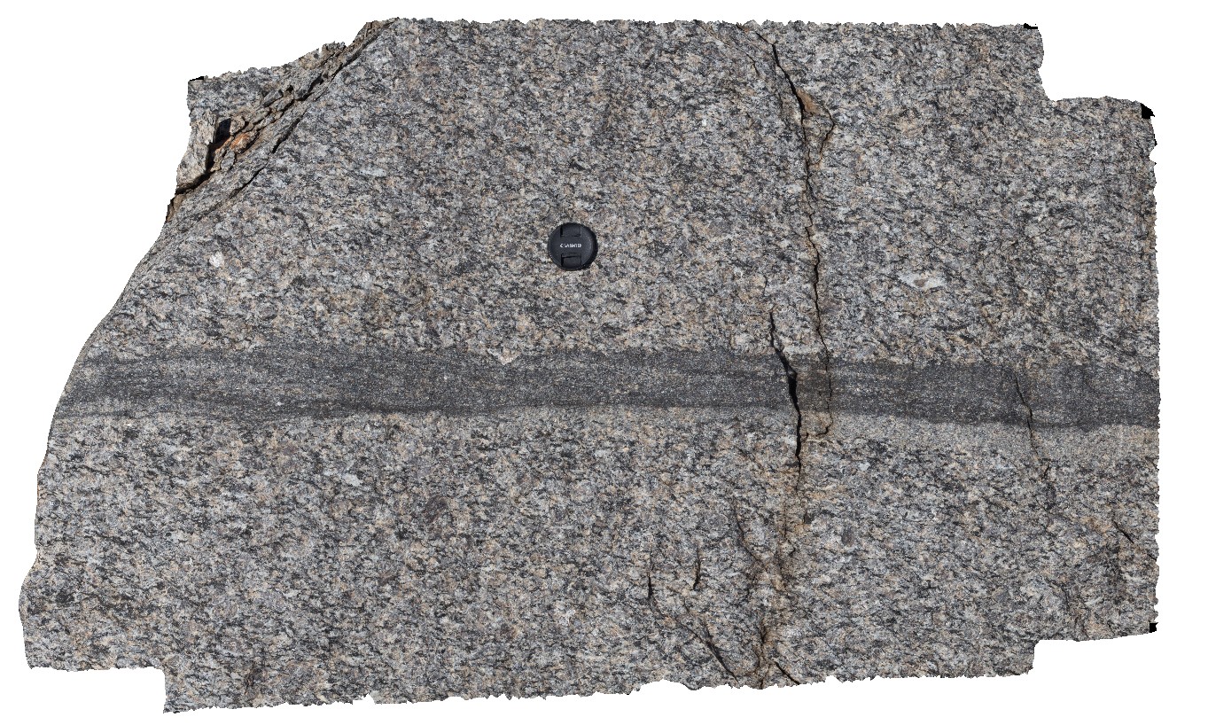
GibbRiver11 Map
 |
0 |
06/06/2016 noon |
3D |
coarse graded, feldspar phyric granodiorite segregations in medium to fine-grained gabbro. Gibb River Road, near Mount Amy. W.A. |
0.80 |
-17.20640000000 |
124.91614000000 |
-9999.000 |
segregations in gabbro |
gabbro |
GibbRiver12 Map
 |
0 |
06/06/2016 noon |
3D |
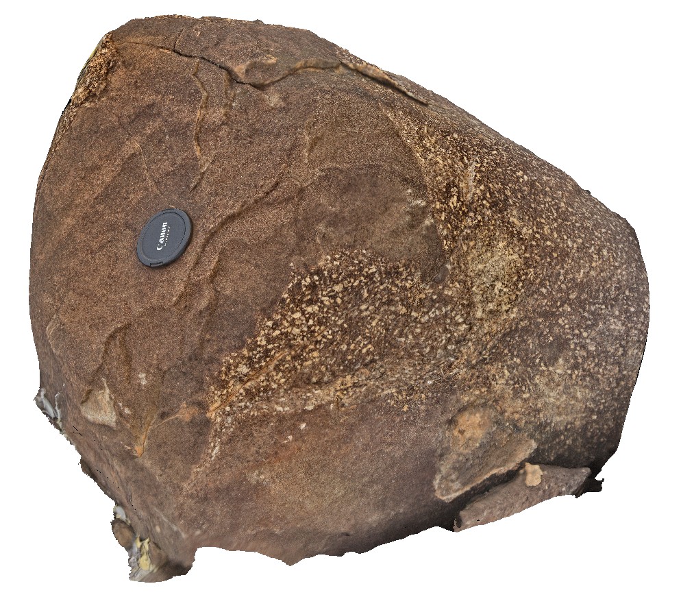
detail of typical weathering surface of medium to fine-grained gabbro. Gibb River Road, near Mount Amy. W.A. |
0.20 |
-17.20654000000 |
124.91680000000 |
-9999.000 |
gabbro, weathering surface |
gabbro |
GibbRiver13 Map
 |
0 |
06/06/2016 noon |
3D |
xenolith / boudin of porphyritic granite in foliated gabbro. Gibb River Road, near Mount Amy. W.A. |
0.80 |
-17.20688000000 |
124.91716000000 |
-9999.000 |
xenolith, gabbro |
gabbro |
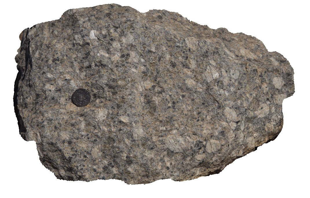
GibbRiver14 Map
 |
0 |
06/06/2016 noon |
3D |
close-up view of coarse-grained granodiorite in quarry. Gibb River Road, near Mount Amy. W.A. |
0.00 |
-17.22889000000 |
124.90460000000 |
-9999.000 |
granodiorite |
granodiorite |
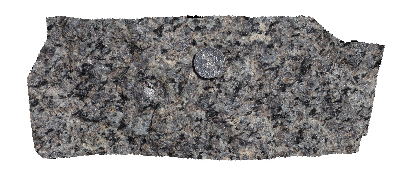
GibbRiver15 Map
 |
0 |
06/06/2016 noon |
3D |
shear fabric in coarse-grained granodiorite in large block at quarry. Gibb River Road, near Mount Amy. W.A. |
0.00 |
-17.22854000000 |
124.90450000000 |
-9999.000 |
shear fabric, shear, granodiorite |
granodiorite |
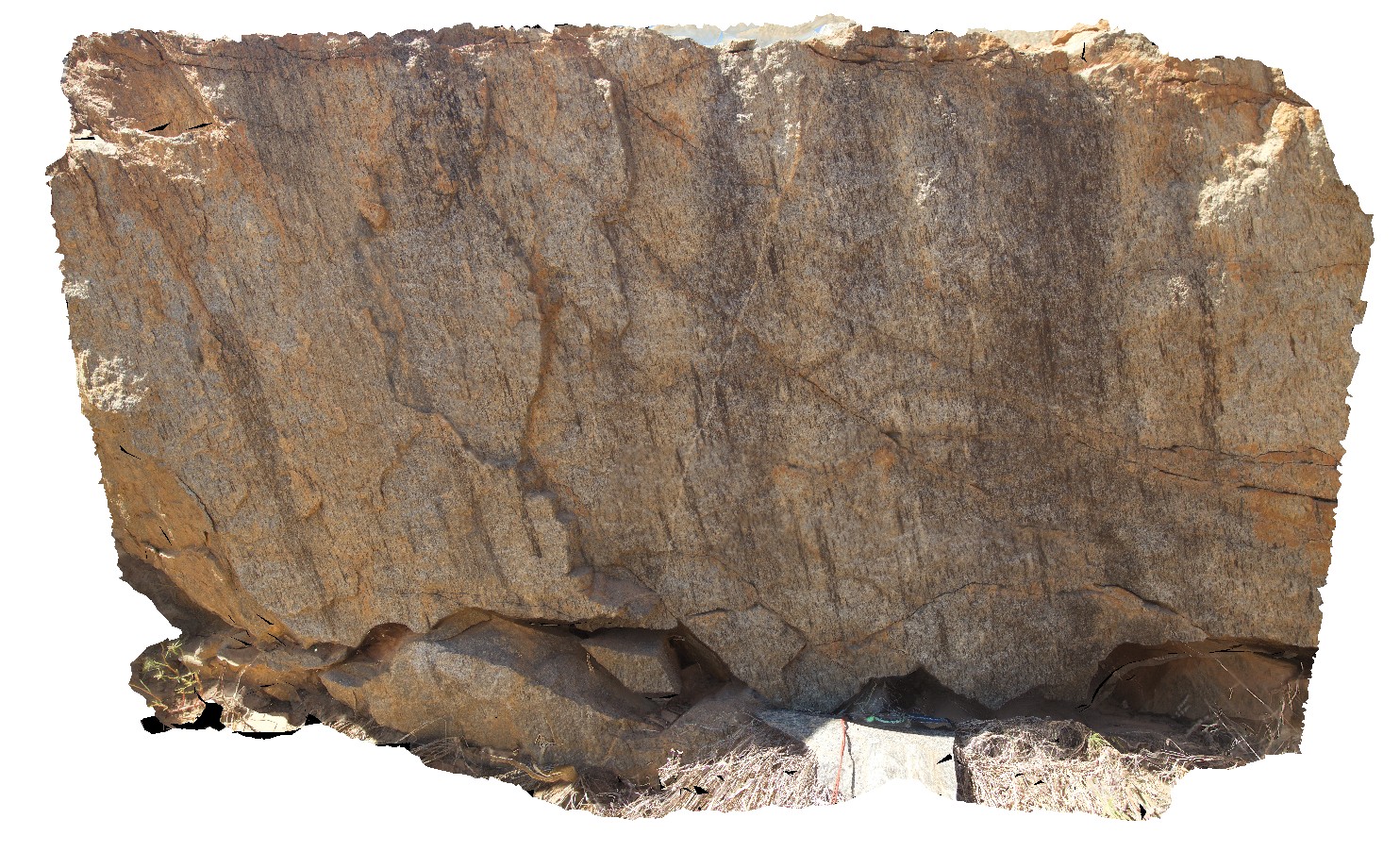
GibbRiver16 Map
 |
0 |
06/06/2016 noon |
3D |
view of mylonite zone in coarse-grained granite block. Gibb River Road, near Mount Amy. W.A. |
0.80 |
-17.22855000000 |
124.90468000000 |
-9999.000 |
mylonite, granite |
granite |
GibbRiver17 Map
 |
0 |
06/06/2016 noon |
3D |
view of mylonite zone in coarse-grained granite block. Gibb River Road, near Mount Amy. W.A. |
0.80 |
-17.22855000000 |
124.90468000000 |
-9999.000 |
mylonite, granite, structure |
granite |
GibbRiver18 Map
 |
0 |
06/06/2016 noon |
3D |
view of mylonite zone in coarse-grained granite block. Gibb River Road, near Mount Amy. W.A. |
1.00 |
-17.22855000000 |
124.90468000000 |
-9999.000 |
mylonite, granite, structure |
granite |
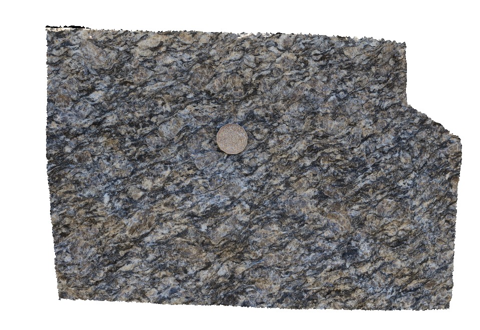
GibbRiver19 Map
 |
0 |
06/06/2016 noon |
3D |
steeply plunging lineations on foliation / fault surface in mylonitised granite. Gibb River Road, W.A. |
5.00 |
-17.18072000000 |
124.92310000000 |
-9999.000 |
lineation, foliation, mylonite, granite, structure |
granite |
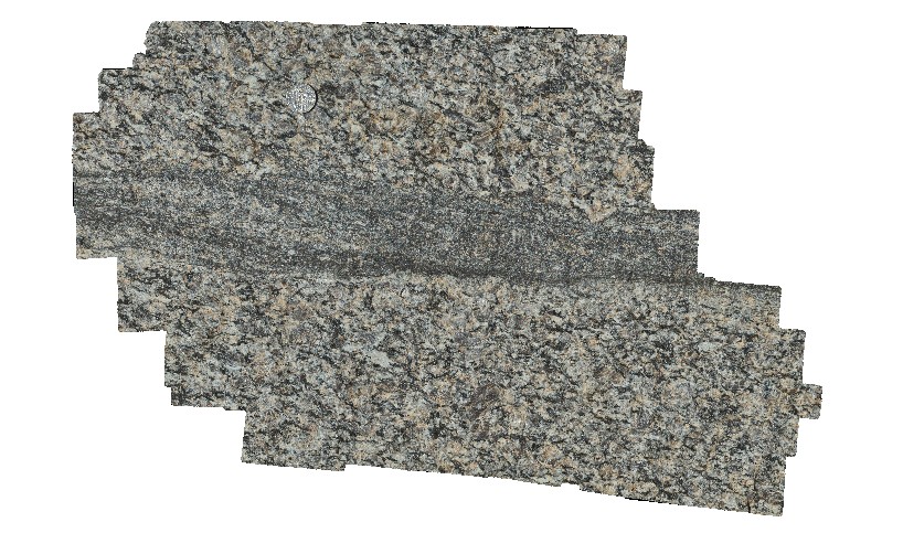
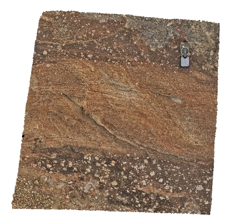
GibbRiver2 Map
 |
0 |
06/06/2016 noon |
3D |
detail of mylonitic texture. Gibb River Road, Mount Amy. W.A. |
0.90 |
-17.22812000000 |
124.89615000000 |
-9999.000 |
mylonite bands, mylonite |
mylonite |
GibbRiver20 Map
 |
0 |
06/06/2016 noon |
3D |
detail of steeply plunging lineations on foliation / fault surface in mylonitised granite. Gibb River Road, W.A. |
1.00 |
-17.18072000000 |
124.92310000000 |
-9999.000 |
mylonite, structure, lineation, foliation |
mylonite |
GibbRiver21 Map
 |
0 |
06/06/2016 noon |
3D |
foliated and stretched felsic? Volcanics of the White water Formation? Gibb River Road, W.A. |
2.00 |
-17.16595000000 |
124.94277000000 |
-9999.000 |
volcanics, structure, foliation |
volcanics |
GibbRiver22 Map
 |
0 |
06/06/2016 noon |
3D |
coarse-grained to porphyry granite. Gibb River Road, W.A. |
0.60 |
-17.11776000000 |
125.15099000000 |
-9999.000 |
porphyritic, granite, igneous textures |
granite |
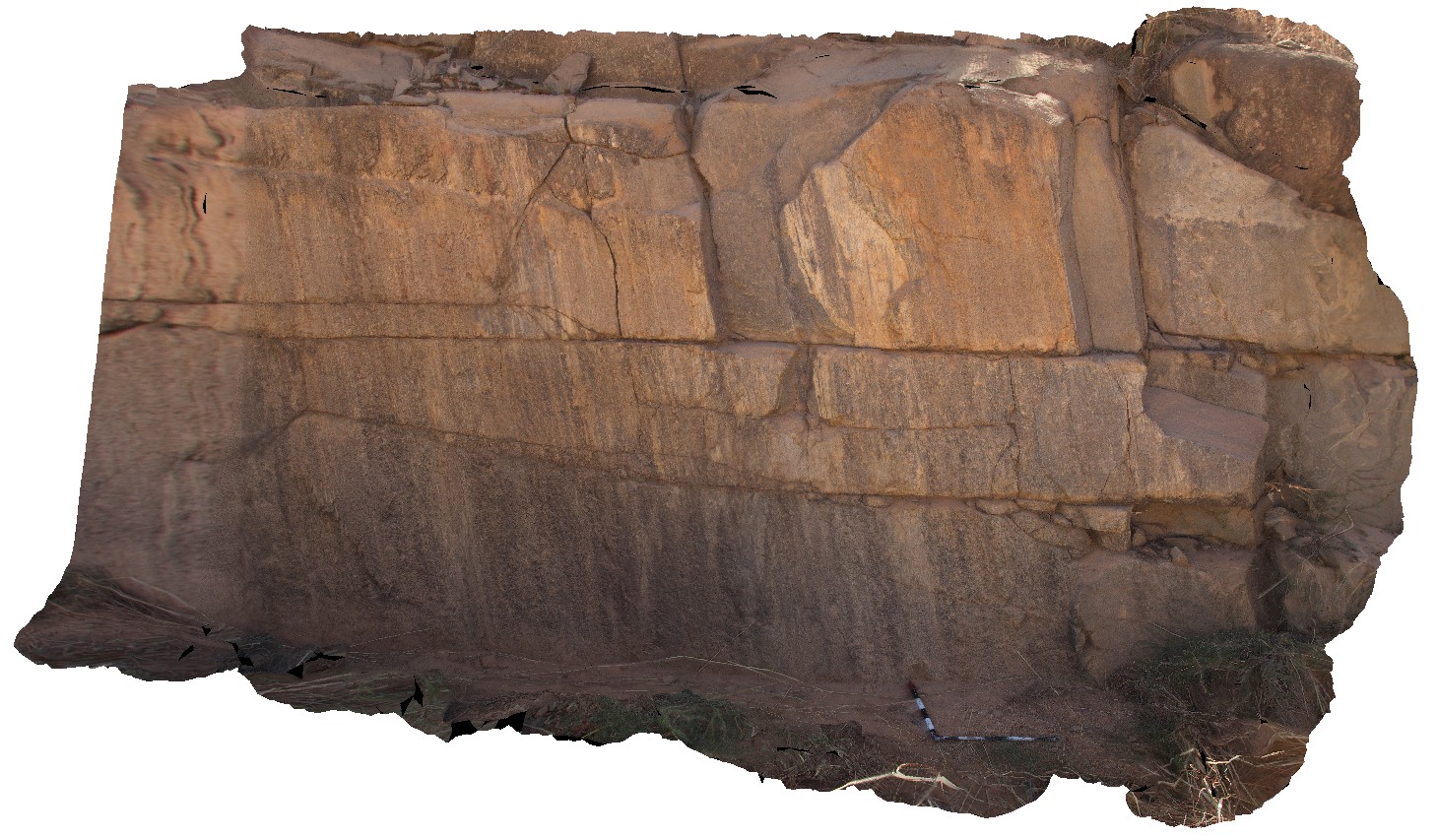
GibbRiver23 Map
 |
0 |
06/06/2016 noon |
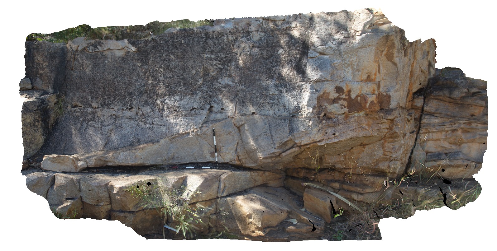
3D |
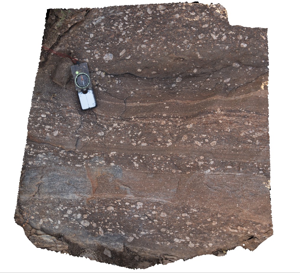
folding and faulting of sandstone beds, associated with the Broadhurst thrust Fault. Derby - Gibb River Road, W.A. |
25.00 |
-17.12448000000 |
125.24685000000 |
-9999.000 |
fault, fold, structure, Broadhurst Fault, sandstone |
sandstone |
GibbRiver24 Map
 |
0 |
06/06/2016 noon |
3D |
pillows and relief pillows in basaltic breccia. Road to Mount House, Derby - Gibb River Road, Kimberly, W.A. |
1.80 |
-17.04594000000 |
125.67287000000 |
-9999.000 |
pillow basalt, basalt breccia |
basalt |
GibbRiver25 Map
 |
0 |
06/06/2016 noon |
3D |
in-tact basalt pillow in basaltic breccia. Road to Mount House, Derby - Gibb River Road, Kimberly, W.A. |
1.20 |
-17.04657000000 |
125.67353000000 |
-9999.000 |
pillow basalt, basalt breccia, volcanics |
basalt |
GibbRiver26 Map
 |
0 |
06/06/2016 noon |
3D |
basaltic breccia in Carson Volcanics. Road to Mount House, Derby - Gibb River Road, Kimberly, W.A. |
1.90 |
-17.04642000000 |
125.67374000000 |
-9999.000 |
basaltic breccia, volcanics |
basalt |
GibbRiver27 Map
 |
0 |
06/06/2016 noon |
3D |
small outcrop of King Leopold Sandstone, showing cross beds and bar depositional features. Derby - Gibb River Road, Kimberly, W.A. |
5.50 |
-16.92616000000 |
125.77892000000 |
-9999.000 |
bar, cross bedding, sedimentology |
sandstone |
GibbRiver28 Map
 |
0 |
06/06/2016 noon |
3D |
outcrop of King Leopold Sandstone, showing cross bedding, including overturned cross beds. Barnett Gorge. Derby - Gibb River Road, Kimberly, W.A. |
3.00 |
-16.52694000000 |
126.12454000000 |
-9999.000 |
cross bedding, overturned cross beds, sedimentology, sandstone |
sandstone |
GibbRiver29 Map
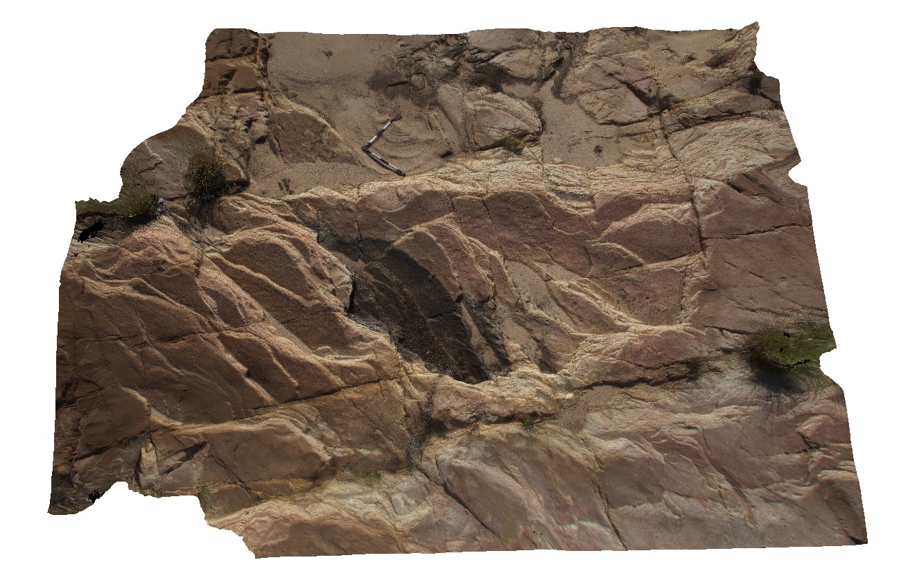 |
0 |
06/06/2016 noon |
3D |
pavement of cross beds in gently dipping King Leopold Sandstone. Barnett Gorge. Derby - Gibb River Road, Kimberly, W.A. |
5.50 |
-16.52726000000 |
126.12468000000 |
-9999.000 |
sandstone, cross bedding, sedimentology |
sandstone |
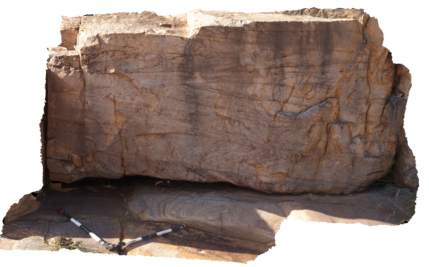
GibbRiver3 Map
 |
0 |
06/06/2016 noon |
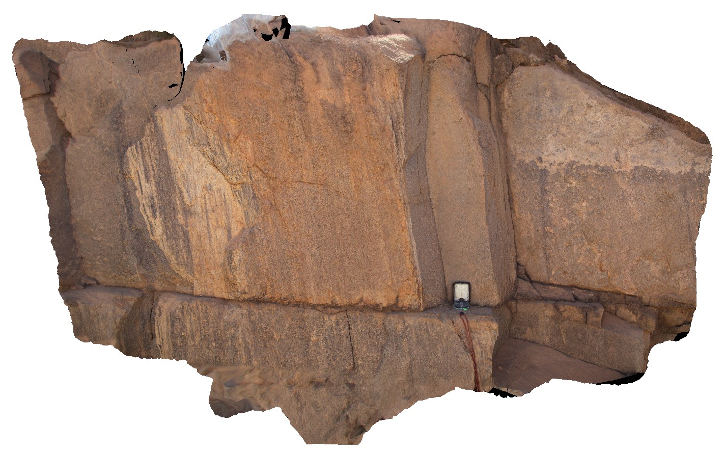
3D |
thick mylonite zone in porphyritic granite. Gibb River Road, Mount Amy. W.A. |
0.45 |
-17.22812000000 |
124.89615000000 |
-9999.000 |
mylonite, structure, porphyritic granite |
granite |
GibbRiver30 Map
 |
0 |
06/06/2016 noon |
3D |
cross beds in the King Leopold Sandstone. Barnett Gorge. Derby - Gibb River Road, Kimberly, W.A. |
4.00 |
-16.52708000000 |
126.12494000000 |
-9999.000 |
cross bedding, sandstone, sedimentology, King Leopold Sandstone |
sandstone |