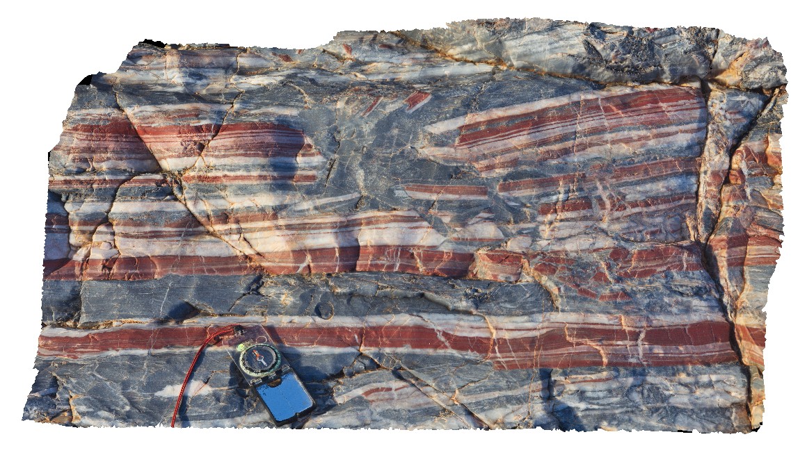
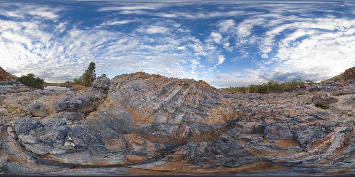
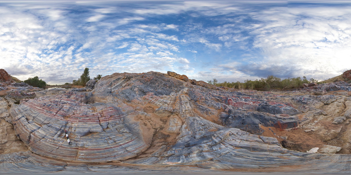
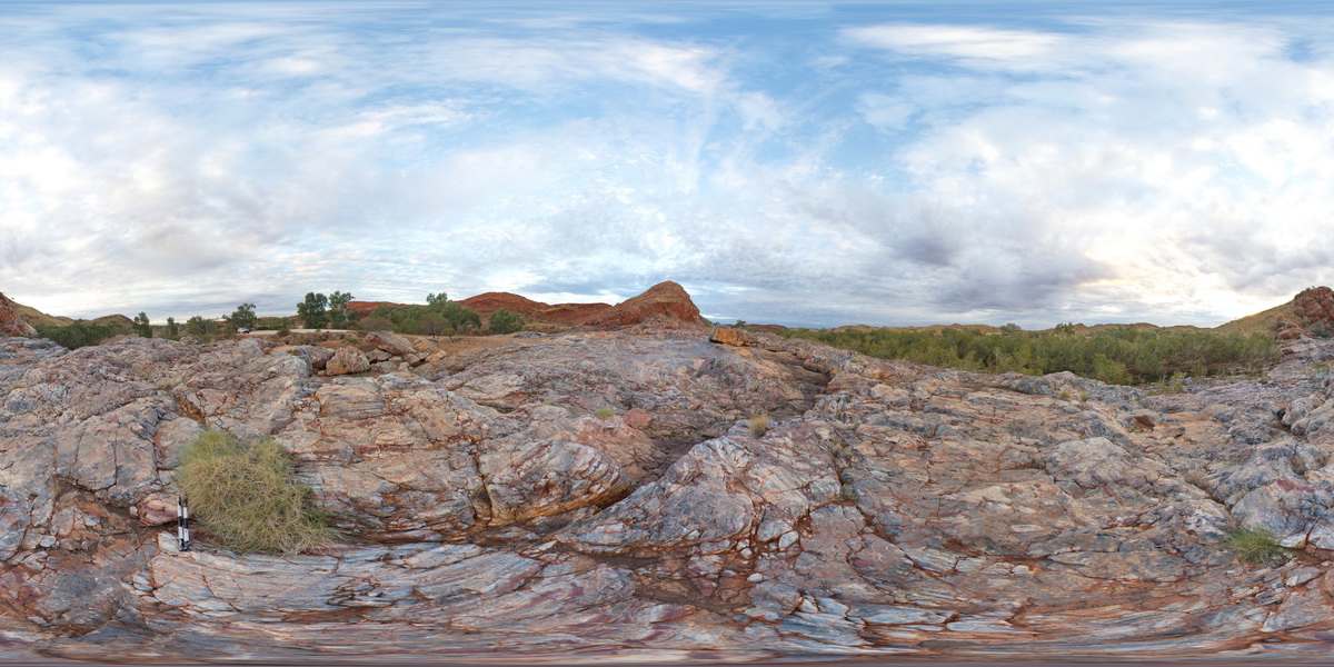
MarbleBar3 Map
 |
0 |
06/01/2016 noon |
3D |
grey chert intruding layered chert, cut by silica vein. Coongan River. Marble Bar, W.A. |
1.30 |
-21.18648000000 |
119.71177000000 |
-9999.000 |
Marble Bar Chert Member, chert |
chert |
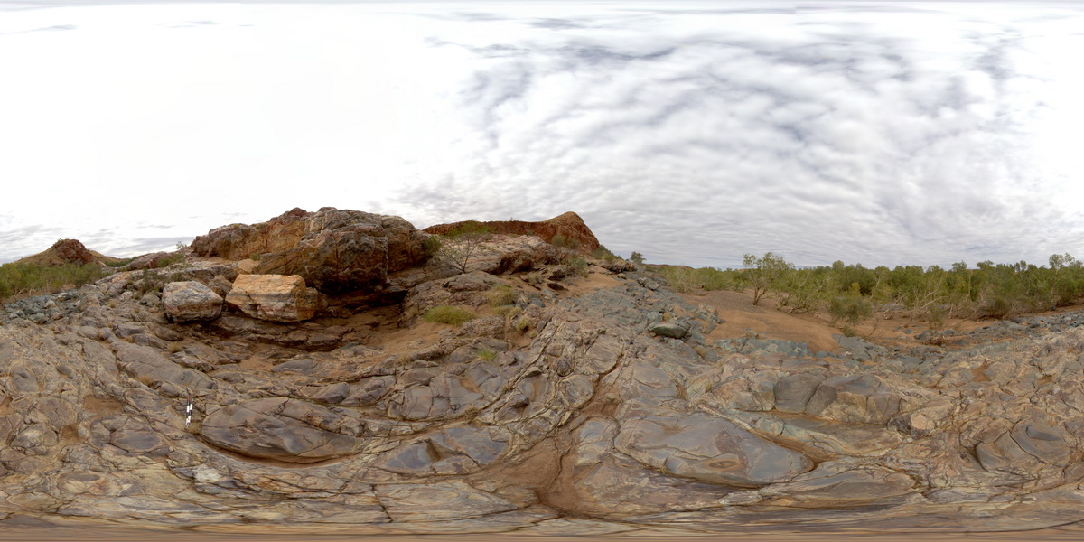
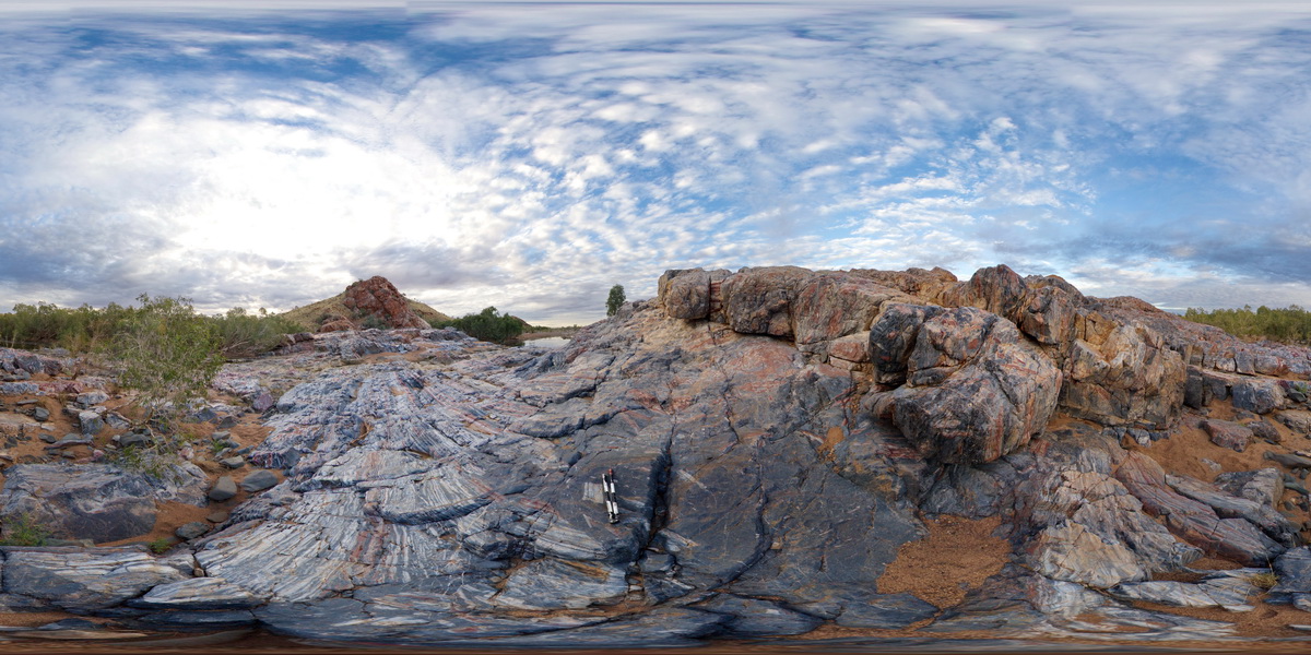
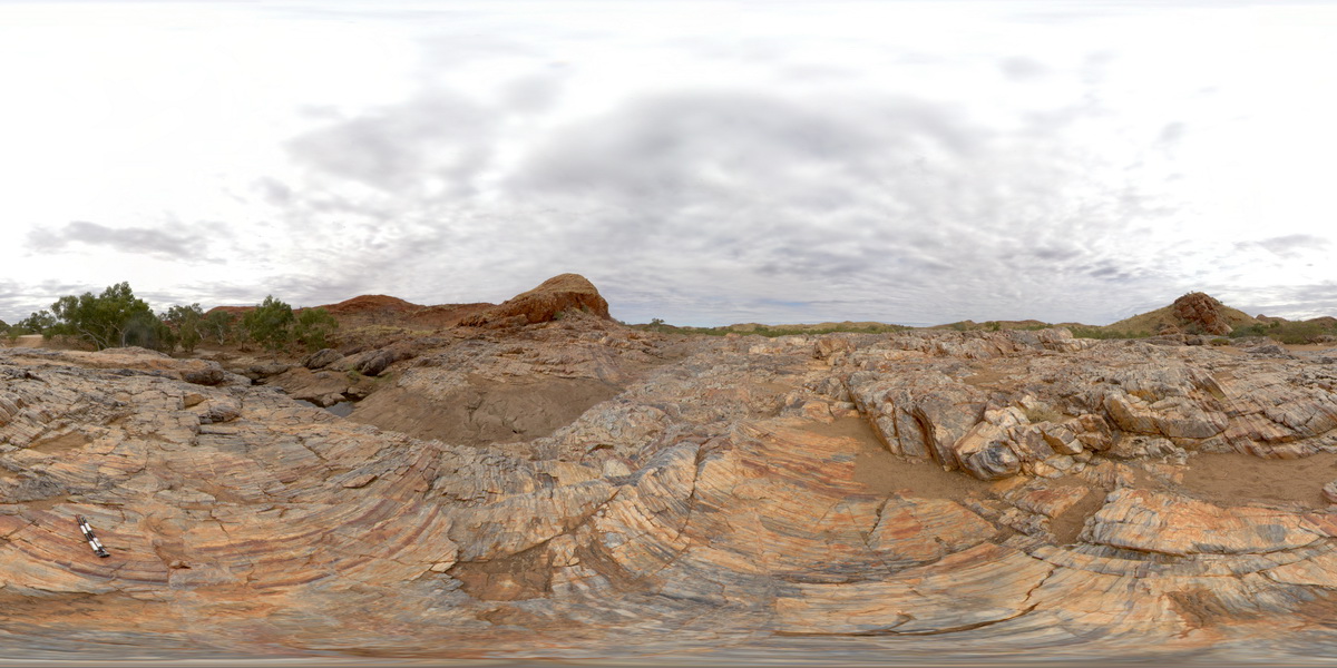
MarbleBar4 Map
 |
0 |
06/01/2016 noon |
3D |
detail of grey chert intruding layered chert from site Marblebar3. Coongan River. Marble Bar, W.A. |
0.60 |
-21.18648000000 |
119.71177000000 |
-9999.000 |
chert, Marble Bart Chert Member |
chert |
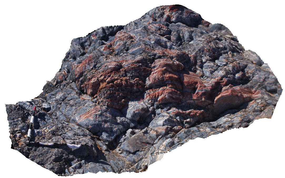
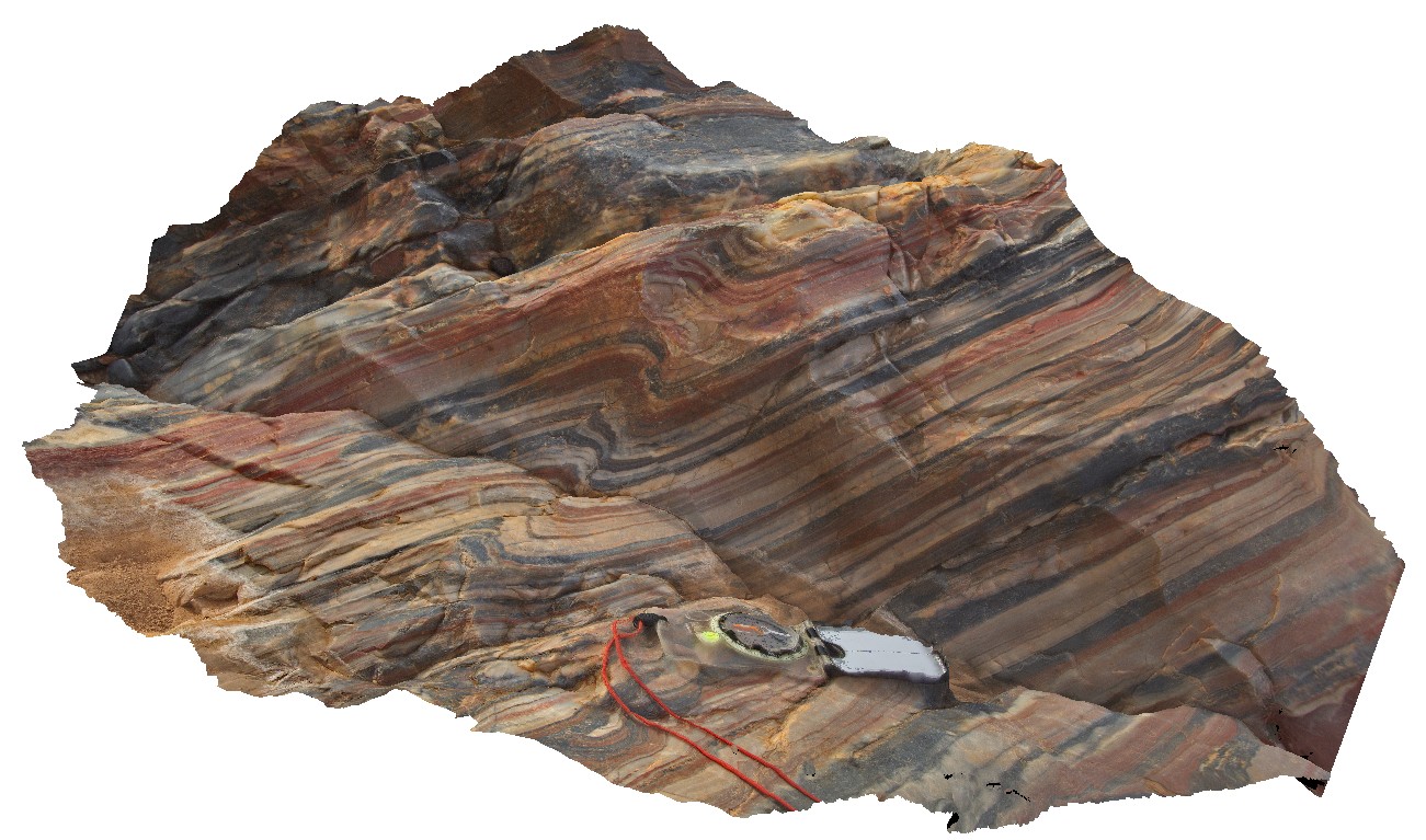
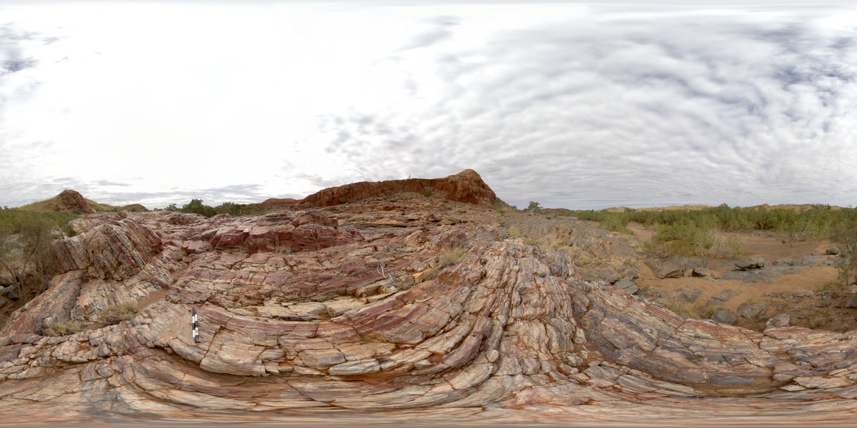
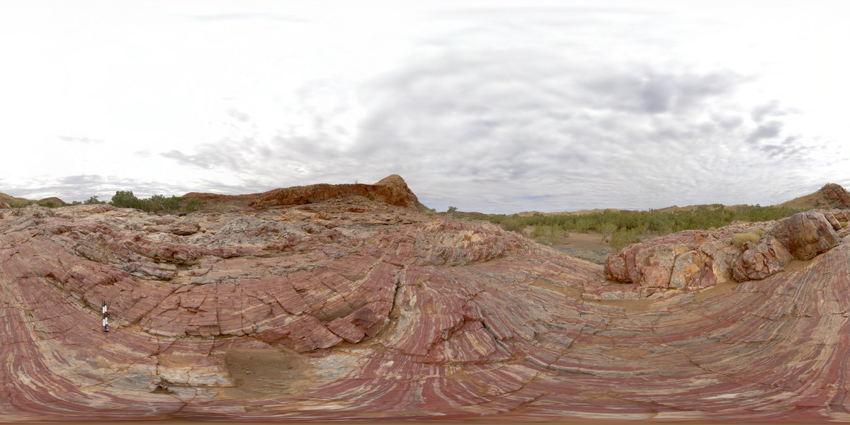
MarbleBar5 Map
 |
0 |
06/01/2016 noon |
3D |
large fragments of layered chert in grey chert. Coongan River. Marble Bar, W.A. |
2.80 |
-21.18655000000 |
119.71175000000 |
-9999.000 |
breccia, Marble Bar Chert Member, chert |
chert |
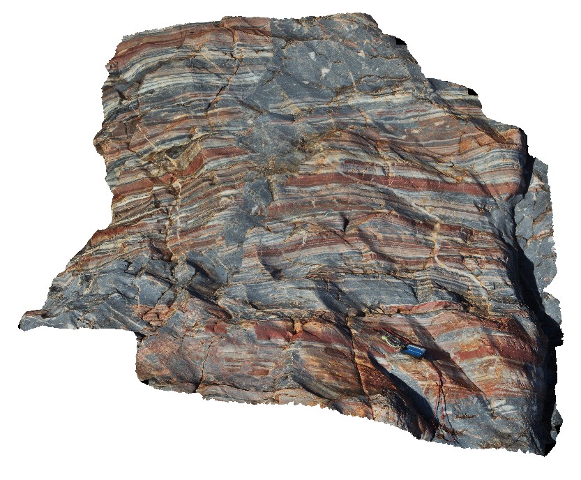
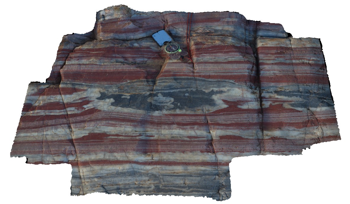
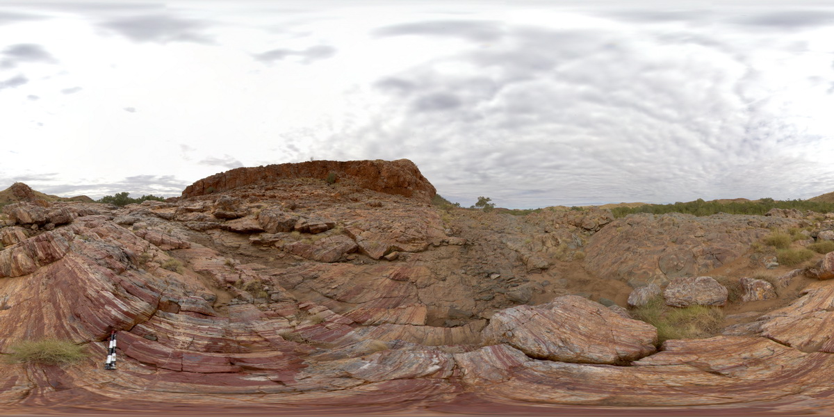
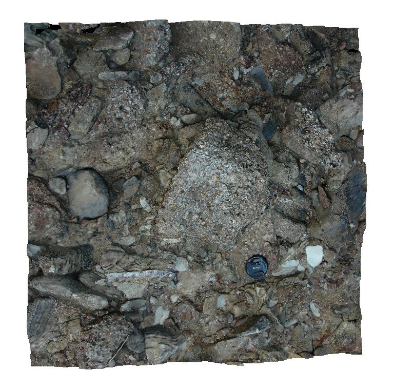
MarbleBar6 Map
 |
0 |
06/01/2016 noon |
3D |
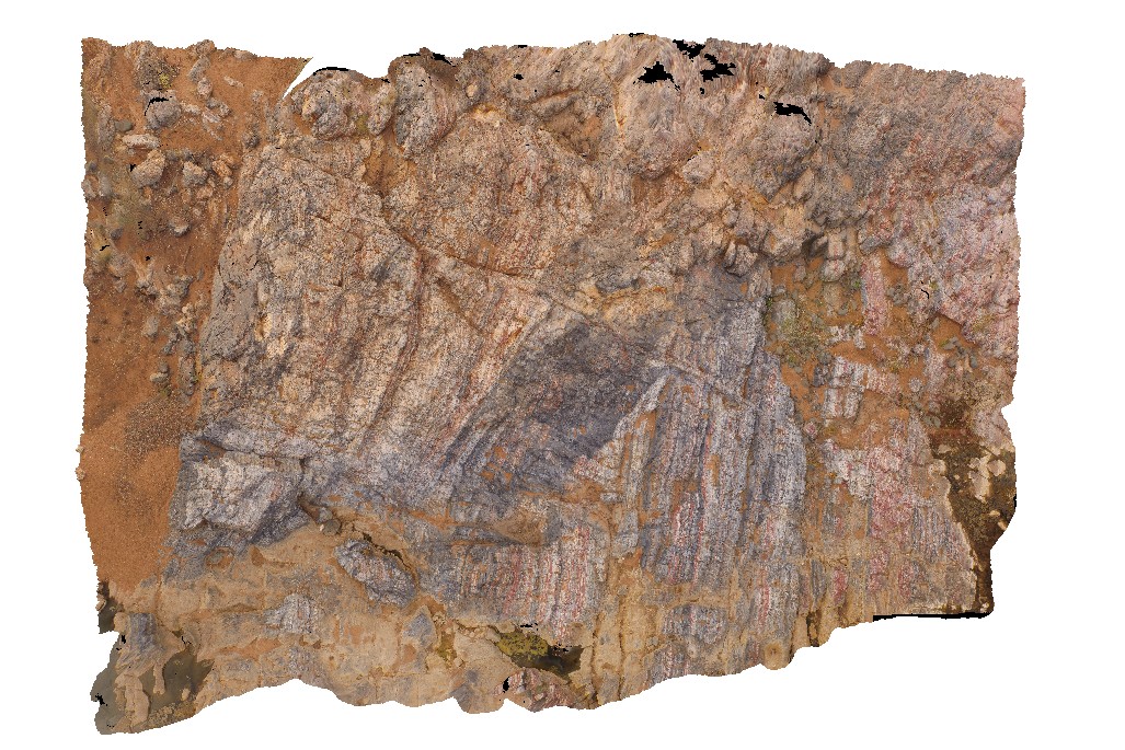
grey chert intruding and brecciating layered chert. Coongan River. Marble Bar, W.A. |
0.00 |
-21.18658000000 |
119.71175000000 |
-9999.000 |
Marble Bar Chert Member, chert, breccia |
chert |
MarbleBar7 Map
 |
0 |
06/01/2016 noon |
3D |
layering in chert with grey 'blob' with white 'botryoidal' margins. Coongan River. Marble Bar, W.A. |
1.00 |
-21.18644000000 |
119.71171000000 |
-9999.000 |
chert, botryoidal, Marble Bar Chert Member |
chert |
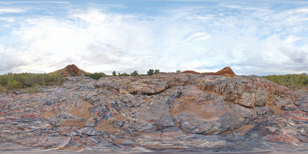
MarbleBar8 Map
 |
0 |
06/01/2016 noon |
3D |
folding in banded chert. Marble Bar, Coongan River, W.A. |
0.80 |
-21.18643000000 |
119.71169000000 |
-9999.000 |
folds, banded chert, Marble Bar Chert Member |
chert |
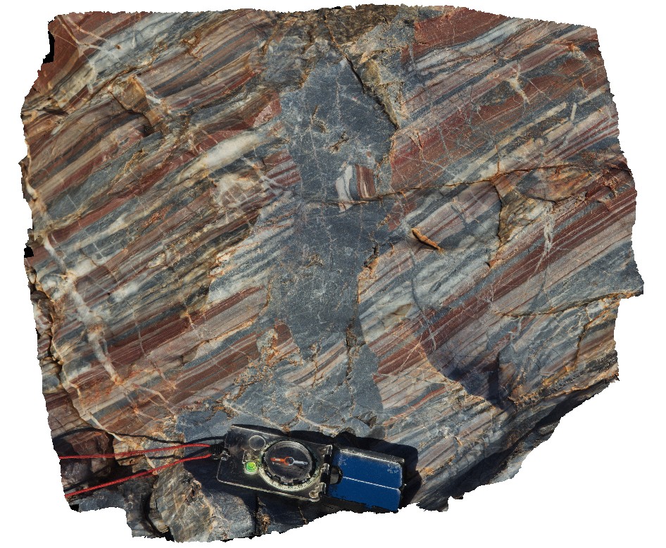
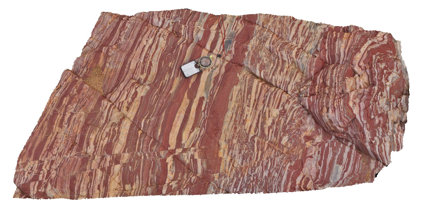
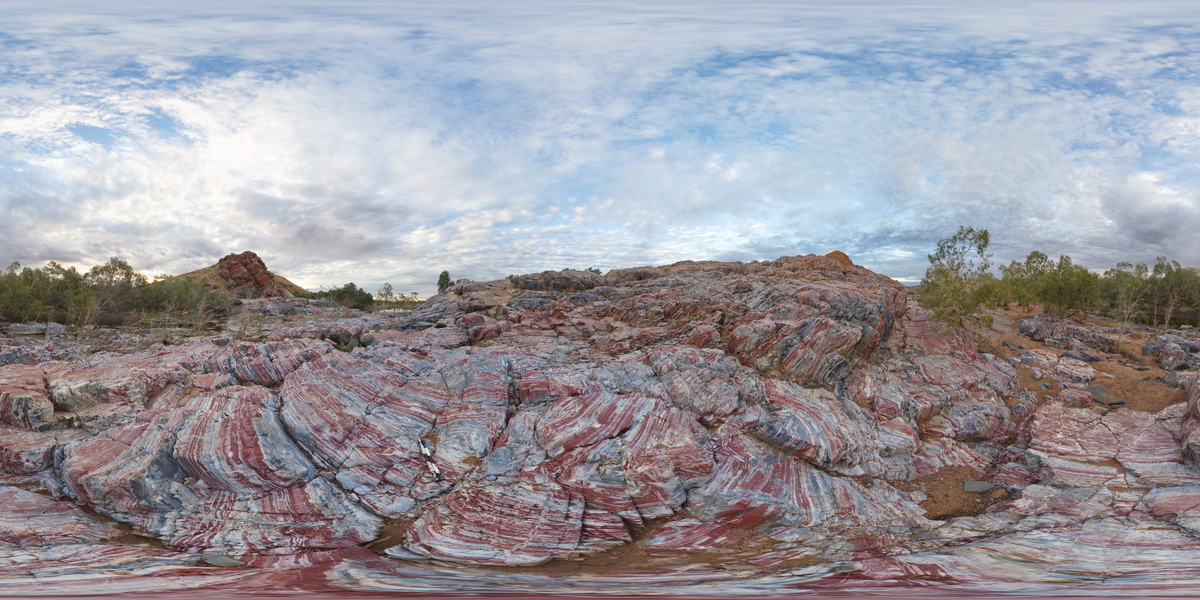
MarbleBar9 Map
 |
0 |
06/01/2016 noon |
3D |
red and white banded chert, with intraformational breccia and cross-cutting faults. Marble Bar, Coongan River, W.A. |
1.30 |
-21.18673000000 |
119.71166000000 |
-9999.000 |
banded chert, fault, Marble Bar Chert Member |
chert |
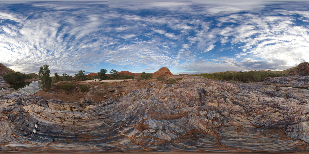
MarbleBarFSP1 Map
 |
0 |
06/01/2016 noon |
FSP |
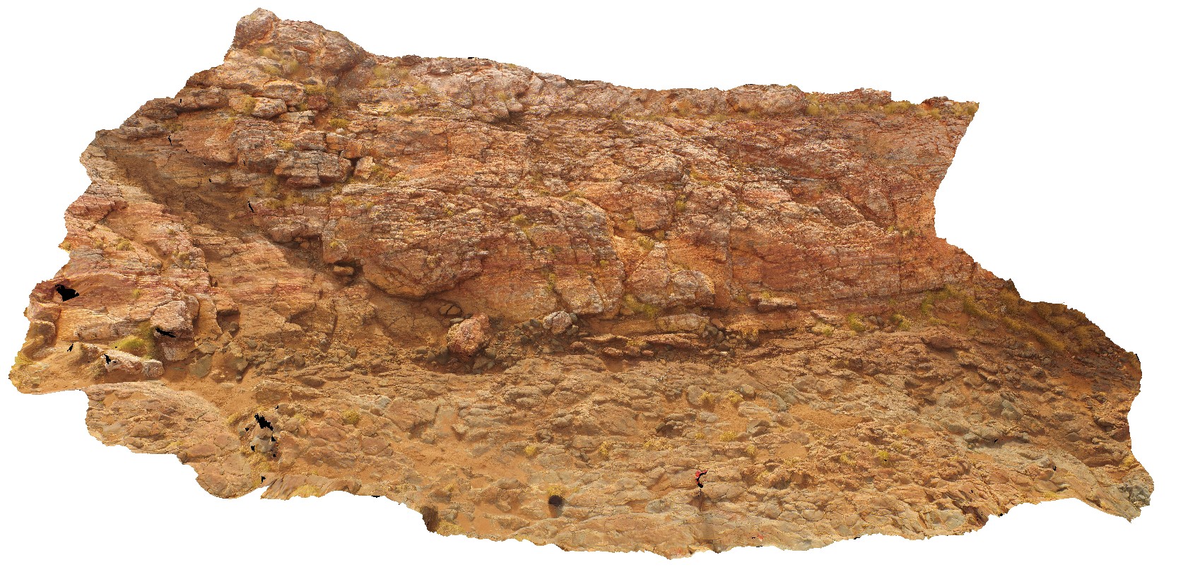
view of the Marble Bar across the Coongan River. Layered chert. Marble Bar, W.A. |
1000.00 |
-21.18630000000 |
119.71178000000 |
-9999.000 |
Marble Bar Chert Member |
chert |
MarbleBarFSP10 Map
 |
0 |
01/01/9999 midnight |
FSP |
view of red, white and grey banded chert layers at Marble Bar, W.A. |
1000.00 |
-21.18780000000 |
119.71243000000 |
-9999.000 |
Marble Bar Chert Member, chert |
chert |
MarbleBarFSP11 Map
 |
0 |
01/01/9999 midnight |
FSP |
view of contact between banded red, white and grey chert and basalt. Marble Bar, W.A. |
1000.00 |
-21.18757000000 |
119.71223000000 |
-9999.000 |
chert, Marble Bar, basalt, geological contact |
basalt, chert |
MarbleBarFSP12 Map
 |
0 |
01/01/9999 midnight |
FSP |
view of contact between banded red, white and grey chert and basalt. Marble Bar, W.A. |
1000.00 |
-21.18748000000 |
119.71201000000 |
-9999.000 |
chert, basalt, geological contact |
chert, basalt |
MarbleBarFSP2 Map
 |
0 |
06/01/2016 noon |
FSP |
view of moderately dipping layered chert of the Marble Bar across the Coongan River. Marble Bar, W.A. |
1000.00 |
-21.18642000000 |
119.71173000000 |
-9999.000 |
banded chert, Marble Bar Chert Member |
chert |
MarbleBarFSP3 Map
 |
0 |
06/01/2016 noon |
FSP |
view of grey, homogenous chert intruding and brecciating banded chert of the Marble Bar. Marble Bar, W.A. |
1000.00 |
-21.18649000000 |
119.71172000000 |
-9999.000 |
banded chert, Marble Bar Chert Member |
chert |
MarbleBarFSP4 Map
 |
20 |
06/01/2016 noon |
FSP |
view of grey, homogenous chert intruding and brecciating banded chert of the Marble Bar. Marble Bar, W.A. |
1000.00 |
-21.18663000000 |
119.71176000000 |
-9999.000 |
breccia, chert, Marble Bar Chert Member |
chert |
MarbleBarFSP5 Map
 |
0 |
06/01/2016 noon |
FSP |
view of grey, homogenous chert intruding and brecciating banded chert of the Marble Bar. Marble Bar, W.A. |
0.00 |
-21.18677000000 |
119.71172000000 |
-9999.000 |
chert, brecciated, Marble Bar Chert Member |
chert |
MarbleBarFSP6 Map
 |
0 |
06/01/2016 noon |
FSP |
view of grey, homogenous chert intruding and brecciating banded chert of the Marble Bar. Marble Bar, W.A. |
1000.00 |
-21.18683000000 |
119.71181000000 |
-9999.000 |
chert, brecciated, Marble Bar Chert Member |
chert |
MarbleBarFSP7 Map
 |
0 |
06/01/2016 noon |
FSP |
view of grey, homogenous chert intruding and brecciating banded chert of the Marble Bar. Marble Bar, W.A. |
1000.00 |
-21.18683000000 |
119.71181000000 |
-9999.000 |
chert, banded chert, Marble Bar Chert Member |
chert |
MarbleBarFSP8 Map
 |
0 |
06/01/2016 noon |
FSP |
view of banded chert layers at Marble Bar, W.A. |
1000.00 |
-21.18705000000 |
119.71231000000 |
-9999.000 |
Marble Bar, banded chert, sedimentology |
chert |
MarbleBarFSP9 Map
 |
0 |
06/01/2016 noon |
FSP |
view of red, white and grey banded chert layers at Marble Bar, W.A. |
1000.00 |
-21.18741000000 |
119.71218000000 |
-9999.000 |
banded chert, Marble Bar, sedimentology |
chert |
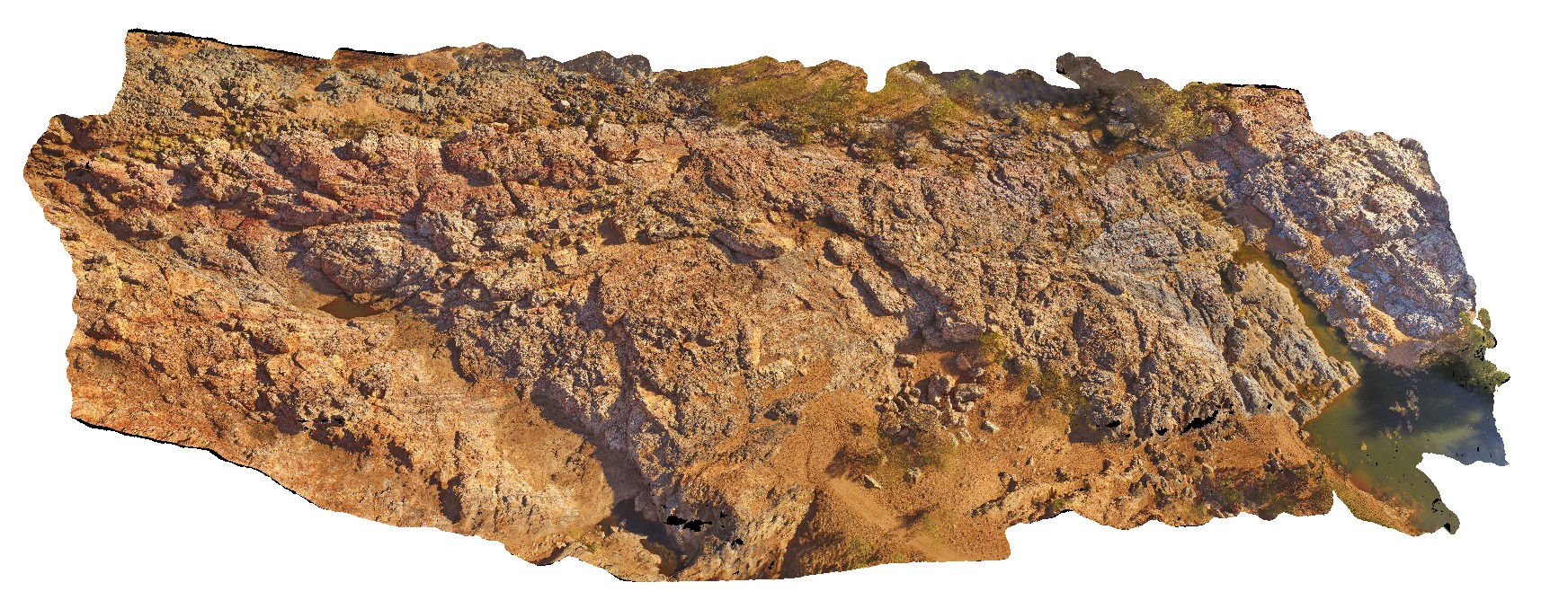
MarbleBarUAV1 Map
 |
0 |
06/01/2016 noon |
UAV |
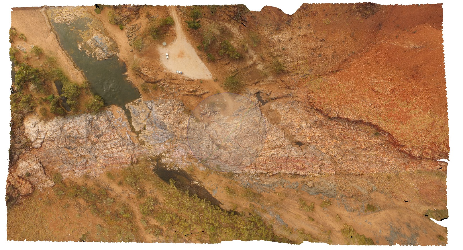
aerial view of chert layers east of Coongan River. Marble Bar, W.A. |
50.00 |
-21.18658320000 |
119.71182720000 |
-9999.000 |
layered chert, Marble Bar Chert Member |
chert |
MarbleBarUAV2 Map
 |
0 |
06/01/2016 noon |
UAV |
aerial view of grey homogenous chert, 'intruding / brecciating' moderately dipping layered chert. The Marble Bar, Coongan River, W.A. |
100.00 |
-21.18658320000 |
119.71182720000 |
-9999.000 |
layered chert, Marble Bar Chert Member, brecciated |
chert |
MarbleBarUAV3 Map
 |
0 |
06/01/2016 noon |
UAV |
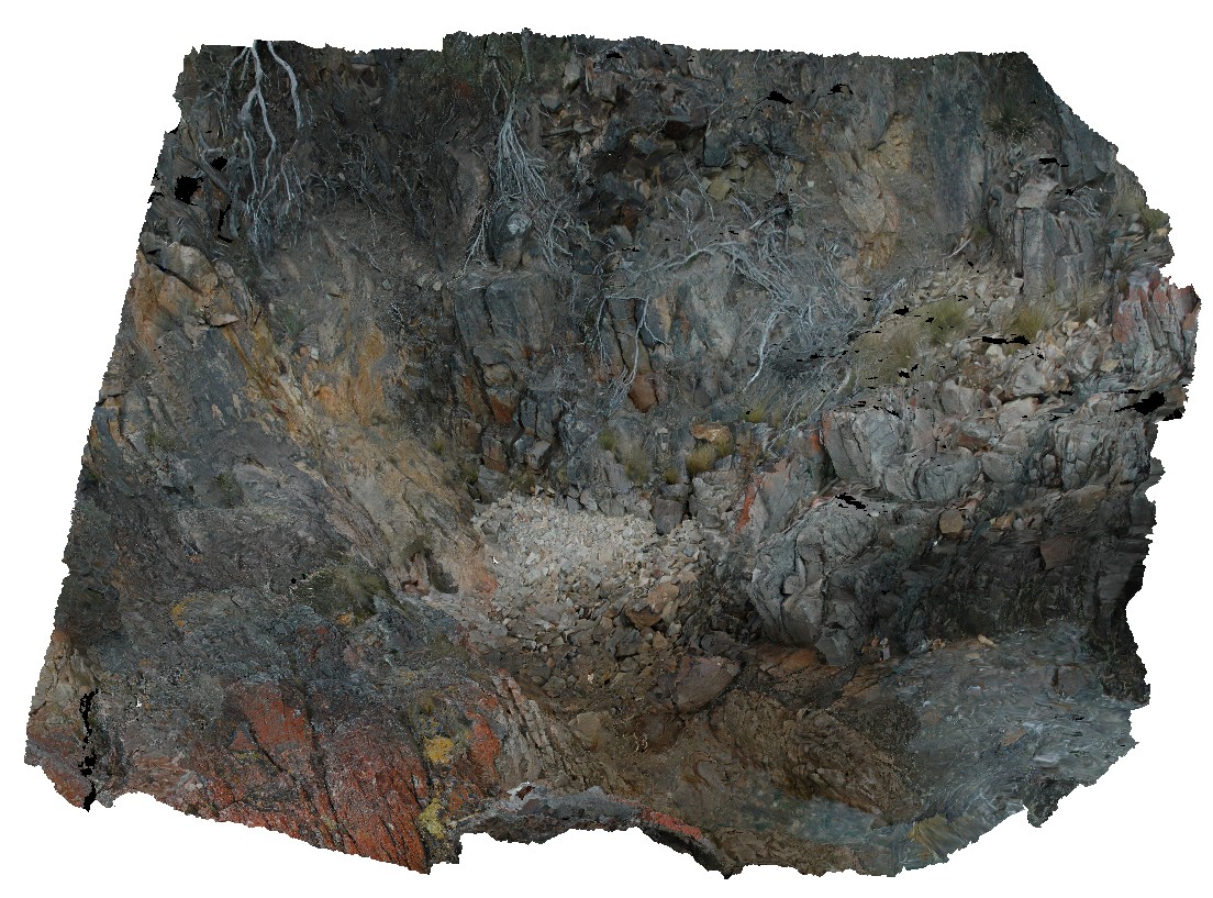
aerial view of contact between Marble Bar Chert Member and pillow basalt. The Marble Bar, Coongan River, W.A. |
25.00 |
-21.18658320000 |
119.71182720000 |
-9999.000 |
geological contact, chert, pillow basalt |
chert, basalt |
MarbleBarUAV4 Map
 |
0 |
06/01/2016 noon |
UAV |
high aerial view of The Marble Bar and surrounding geology, including the Apex basalt and Duffer Formation. Marble Bar, Coongan River, W.A. |
100.00 |
-21.18658320000 |
119.71182720000 |
-9999.000 |
geological contact, basalt, chert, conformable contact |
chert, basalt, volcanics |
Maria1 Map
 |
20 |
03/16/2015 2:30 p.m. |
3D |
'The Great Unconformity'. Contact between metamorphic psammite and spotted pelite and Permian sediments. Maria Island, Tas. |
7.00 |
-42.68504467000 |
148.08062372000 |
0.000 |
contact, structure, unconformity |
pelite, siltstone |
Maria10 Map
 |
20 |
03/16/2015 2:31 p.m. |
3D |
Porphyritic granite boulder. Maria Island, Tas. |
0.40 |
-42.66116768000 |
148.10437289000 |
1.000 |
porphyritic, granite |
granite |