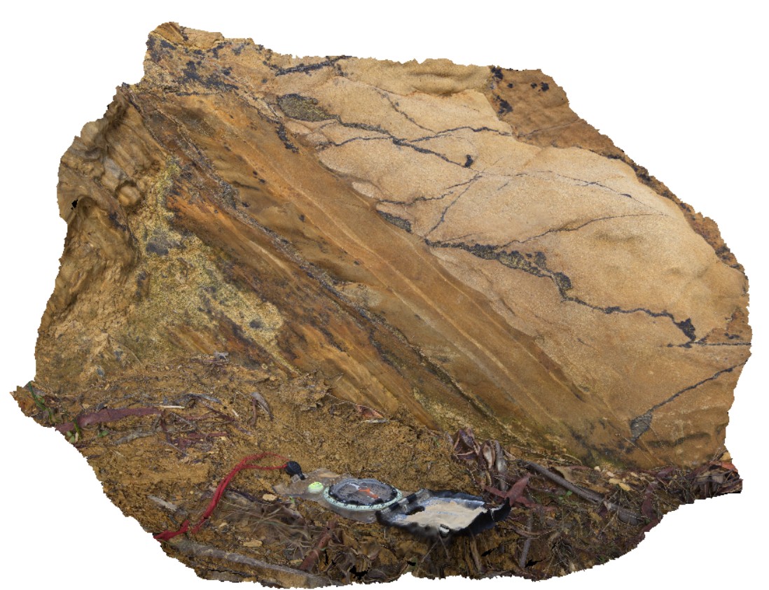
Maria11 Map
 |
20 |
04/27/2015 11:54 a.m. |
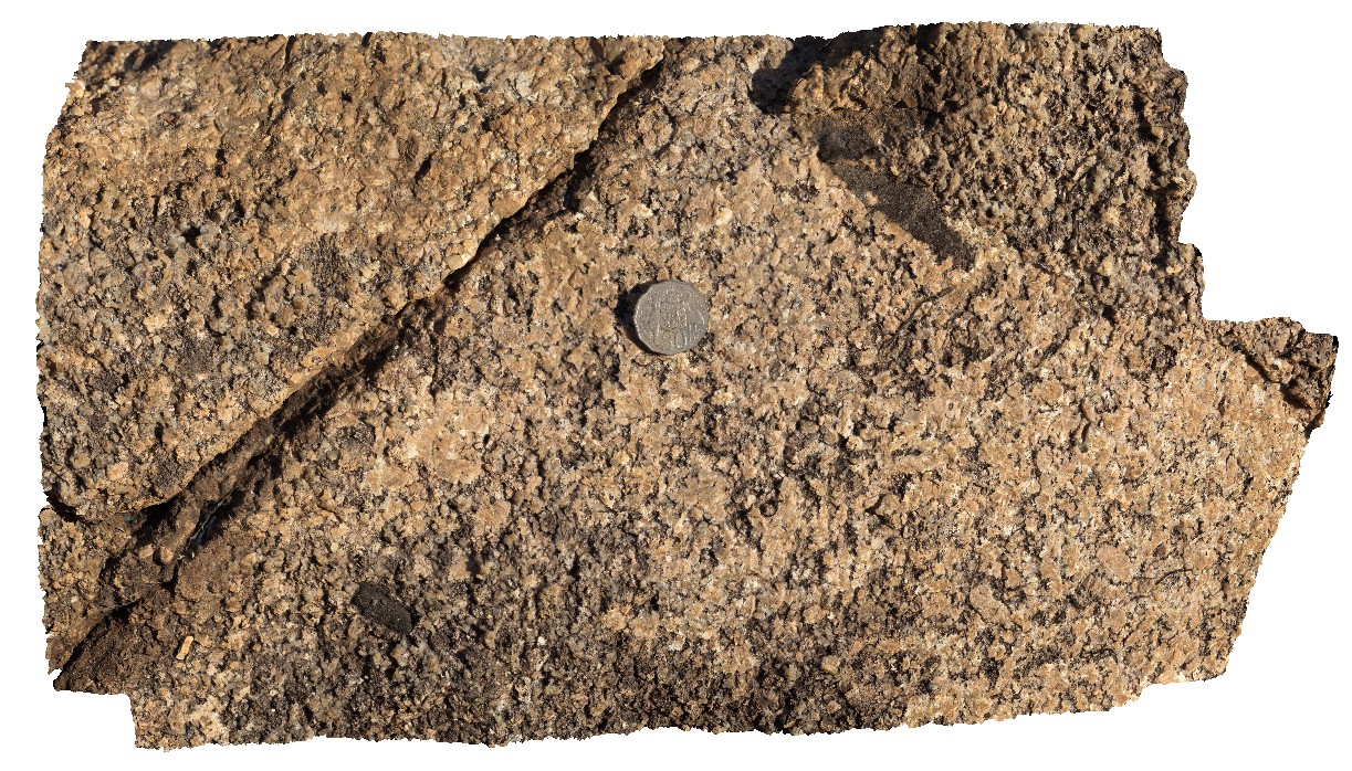
3D |
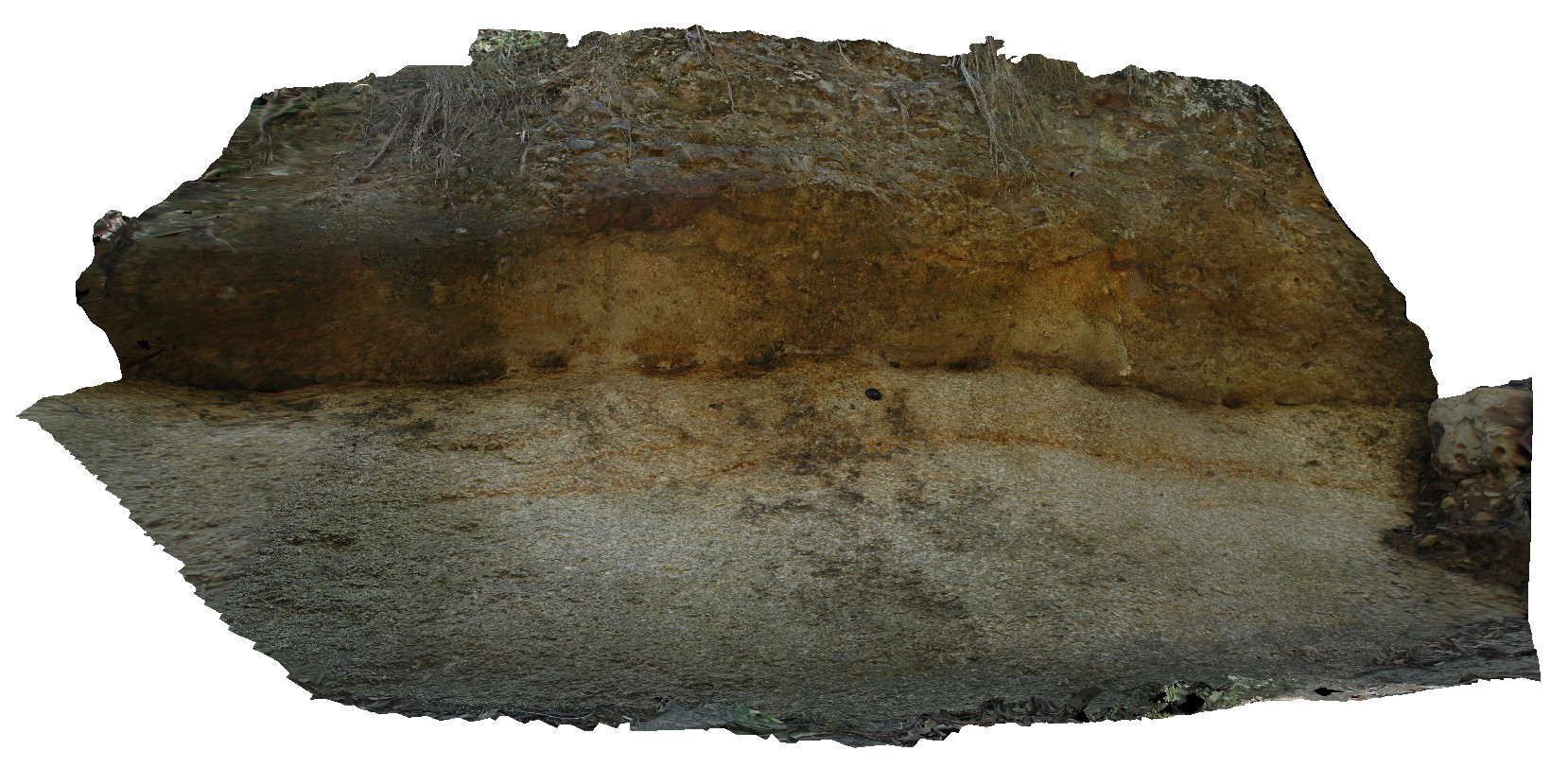
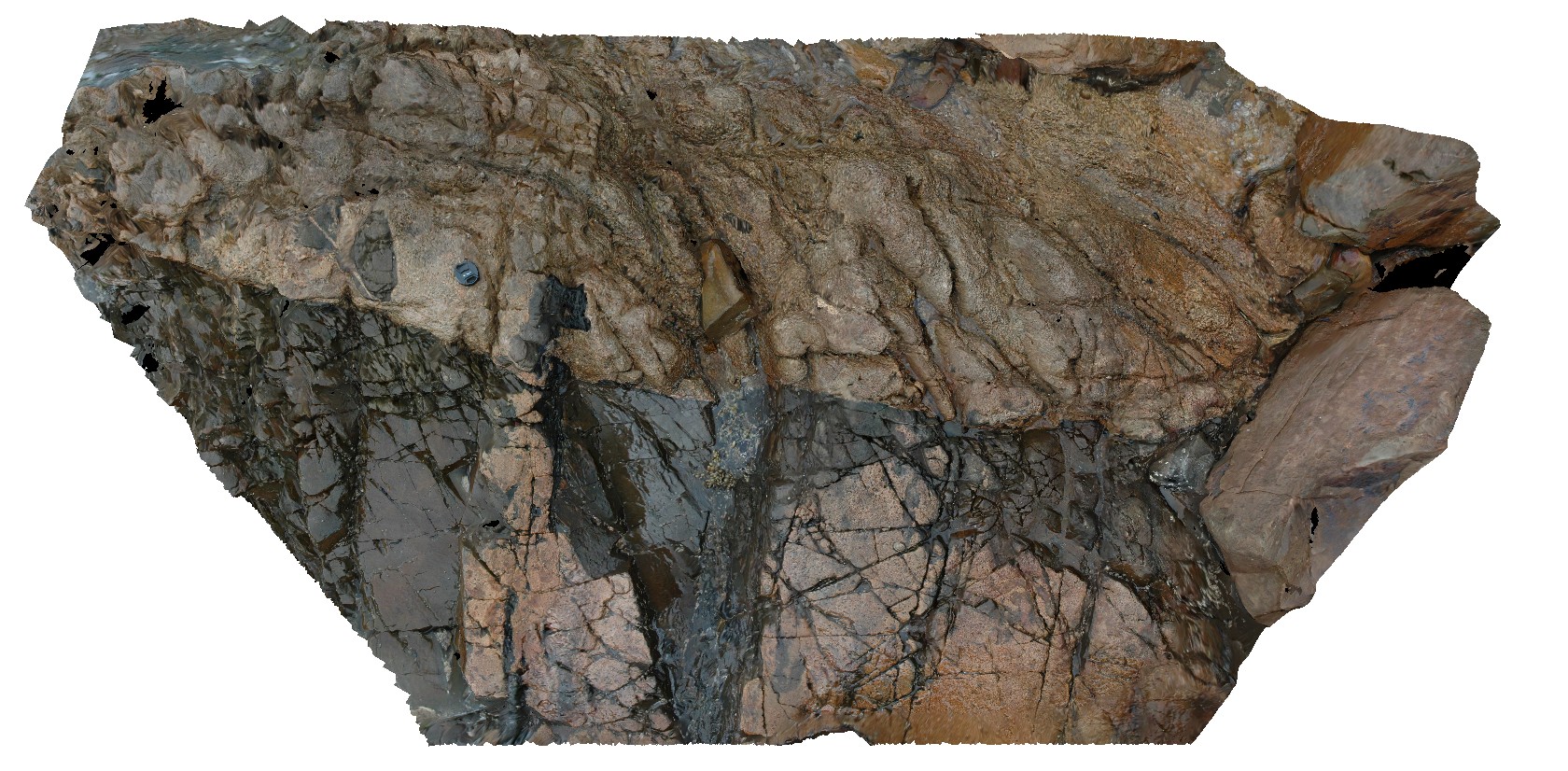
contact between granite basement and overlying basal Permian conglomerate. Maria Island, Tas. |
3.00 |
-42.65806526000 |
148.11054913000 |
5.000 |
contact |
granite, tillite |
Maria12 Map
 |
20 |
03/16/2015 2:31 p.m. |
3D |
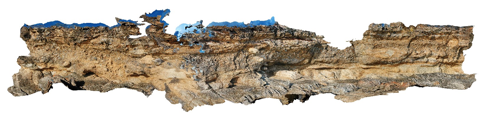
unconformity between basement porphyritic granite and Permian basal tillite / conglomerate. Maria Island, Tas. |
4.00 |
-42.68581998000 |
148.08240742000 |
2.000 |
unconformity, sedimentological |
granite, tillite |
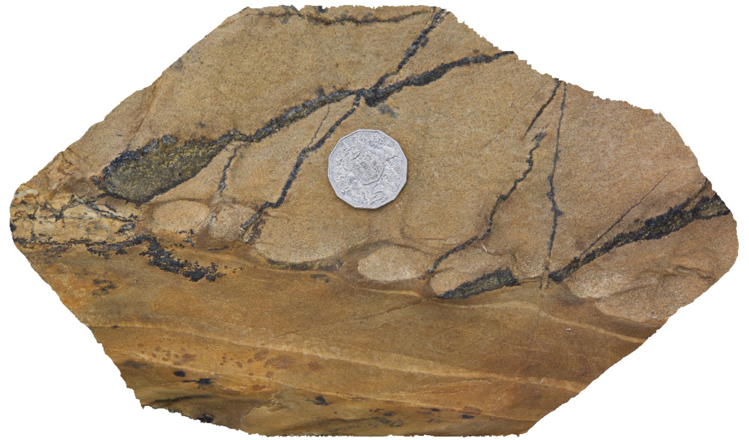
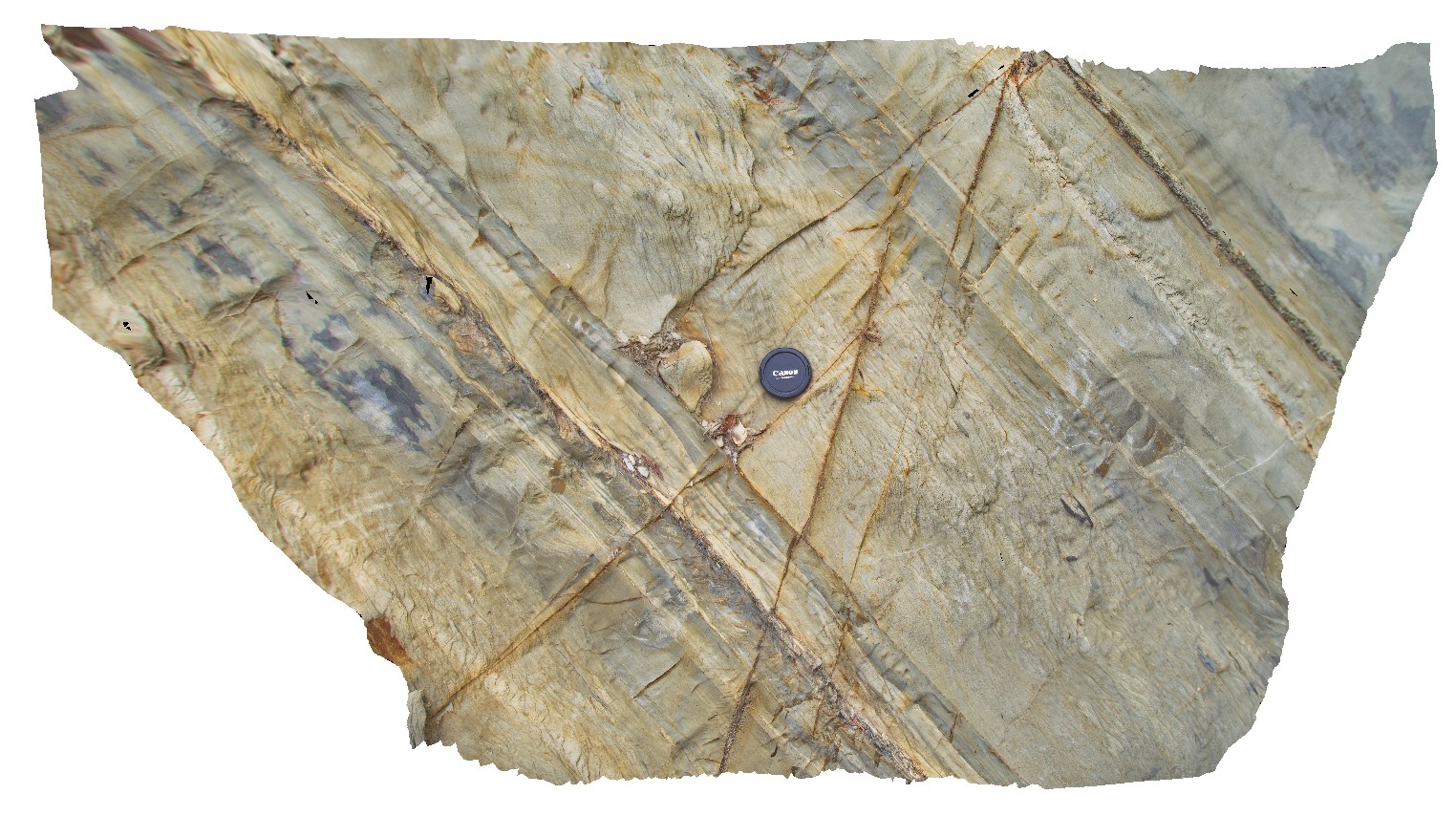
Maria13 Map
 |
20 |
03/16/2015 2:31 p.m. |
3D |
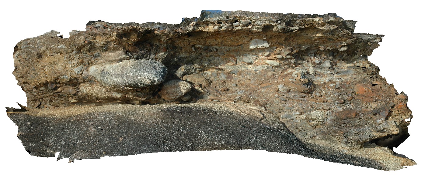
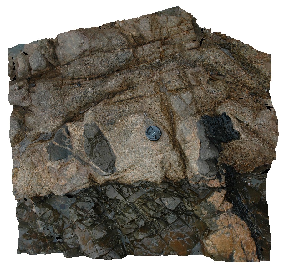
Unconformity and basal contact showing rip-up clasts of the underlying basement granite incorporated into the overlying tillite. Maria Island, Tas. |
8.00 |
-42.68598066000 |
148.08261102000 |
1.000 |
unconformity, tillite, granite |
granite, tillite |
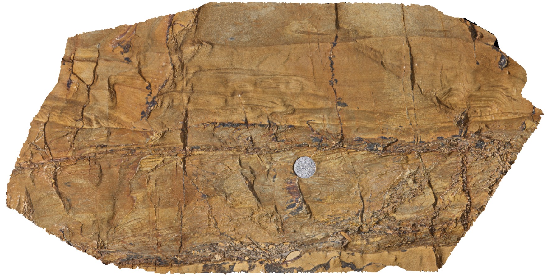
Maria14 Map
 |
20 |
03/16/2015 2:31 p.m. |
3D |
Unconformity and basal contact showing rip-up clasts of the underlying basement granite incorporated into the overlying tillite. Maria Island, Tas. |
5.00 |
-42.68617478000 |
148.08275828000 |
5.000 |
unconformity, tillite |
granite, tillite |
Maria2 Map
 |
20 |
03/16/2015 2:32 p.m. |
3D |
dolerite igneous intrusion into basement psammites and pelites with abundant jointing. Maria Island, Tas. |
3.00 |
-42.68498498000 |
148.08069893000 |
1.000 |
igneous intrusion, metasediments, jointing |
dolerite, psammite |
Maria3 Map
 |
20 |
03/16/2015 2:32 p.m. |
3D |
Jurassic dolerite dyke intruding granite basement. Maria Island, Tas. |
1.00 |
-42.68494814000 |
148.08071719000 |
1.000 |
dyke, intrusion |
granite, dolerite |
Maria4 Map
 |
20 |
03/16/2015 2:32 p.m. |
3D |
igneous contact between the fine grained Jurassic dolerite and coarse grained granite. Maria Island, Tas. |
2.00 |
-42.68495836000 |
148.08074554000 |
2.000 |
igneous contact, dolerite |
dolerite, granite |
Maria5 Map
 |
20 |
03/16/2015 2:32 p.m. |
3D |
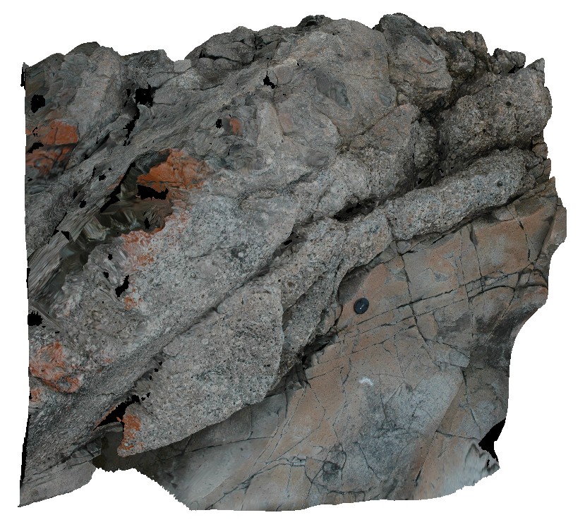
igneous contact between granite and hornfels Siluro-Devonian sediments. Maria Island, Tas. |
2.00 |
-42.68485460000 |
148.08078901000 |
5.000 |
igneous contact, igneous intrusion, hornfels |
metasediments |
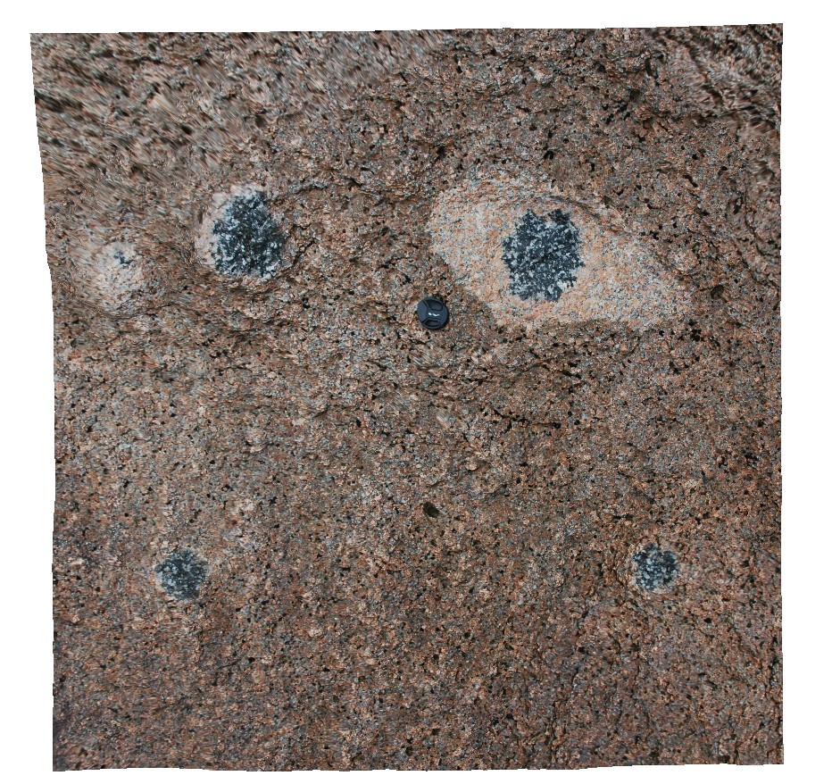
Maria6 Map
 |
20 |
03/16/2015 2:32 p.m. |
3D |
tourmaline aggregates in granite. Maria Island, Tas. |
1.00 |
-42.66200672000 |
148.09867370000 |
5.000 |
mineralogy, tourmaline |
granite |
Maria7 Map
 |
20 |
03/16/2015 2:32 p.m. |
3D |
tourmaline aggregates in fine-grained bleb in coarse-grained granite. Maria Island, Tas. |
1.00 |
-42.66205155000 |
148.09875694000 |
0.000 |
granite, tourmaline aggregate |
granite |
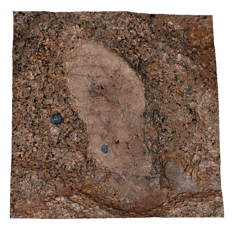
Maria8 Map
 |
20 |
03/16/2015 2:32 p.m. |
3D |
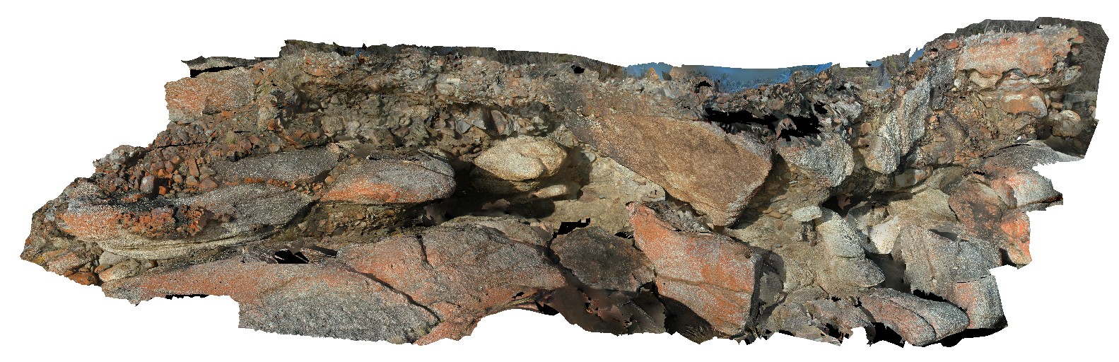
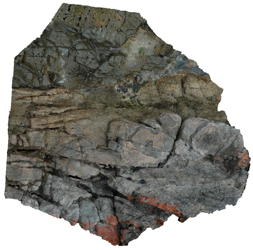
view of Unconformity between underlying Maria Island Granite and overlying flat-lying sediments of the Parmeener Supergroup. Maria Island, Tas. |
10.00 |
-42.66130222000 |
148.09977179000 |
5.000 |
unconformity, granite |
granite, sandstone |
Maria9 Map
 |
20 |
03/16/2015 2:33 p.m. |
3D |
matrix supported Pleistocene talus deposit with predominantly dolerite clasts. Maria Island, Tas. |
5.00 |
-42.66113564000 |
148.10395542000 |
2.000 |
talus deposit, Pleistocene |
talus |
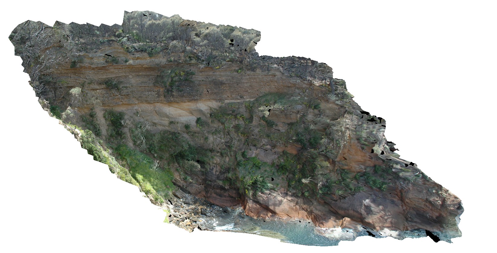
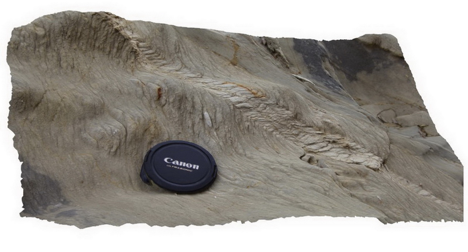
MaryRiver1 Map
 |
0 |
06/23/2016 noon |
3D |
open fold in banded chert, with lenticular horizons. Hill above Mary River Wilderness Retreat. Mary River, N.T. |
1.70 |
-12.89174000000 |
131.63213000000 |
-9999.000 |
open fold, chert, structure, lenticular |
chert |
MaryRiver2 Map
 |
0 |
06/23/2016 noon |
3D |
weathered granite with tabular xenoliths. Next to Arnhem Highway, Mary River, N.T. |
0.00 |
-12.90025000000 |
131.62051000000 |
-9999.000 |
granite, xenoliths, weathering |
granite |
MaryRiver3 Map
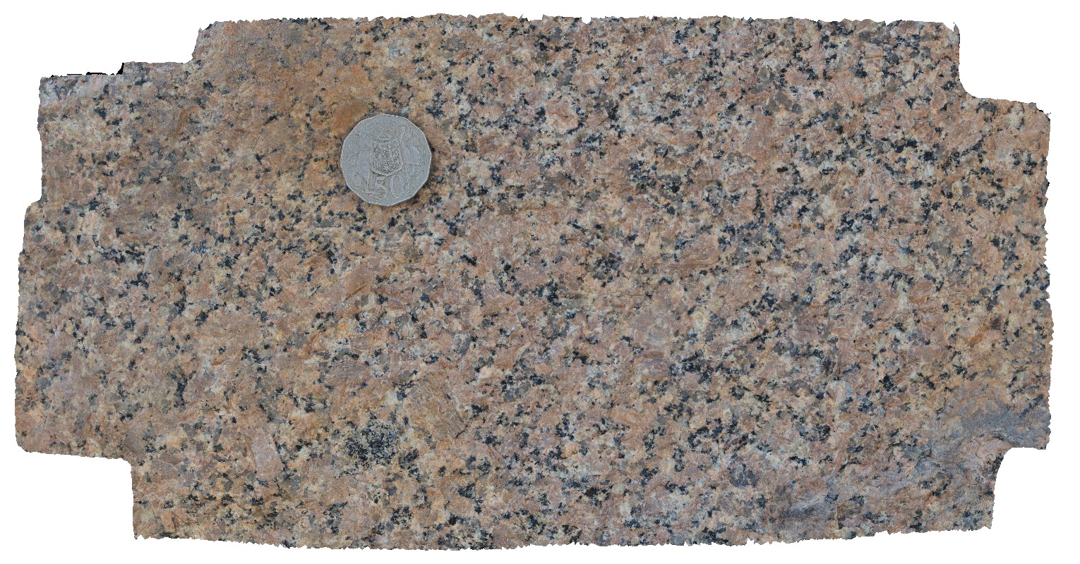 |
0 |
06/23/2016 noon |
3D |
macro view of fresh surface of biotite granite. Next to Arnhem Highway, Mary River, N.T. |
0.35 |
-12.90025000000 |
131.62051000000 |
-9999.000 |
biotite granite, granite, coarse-grained |
granite |
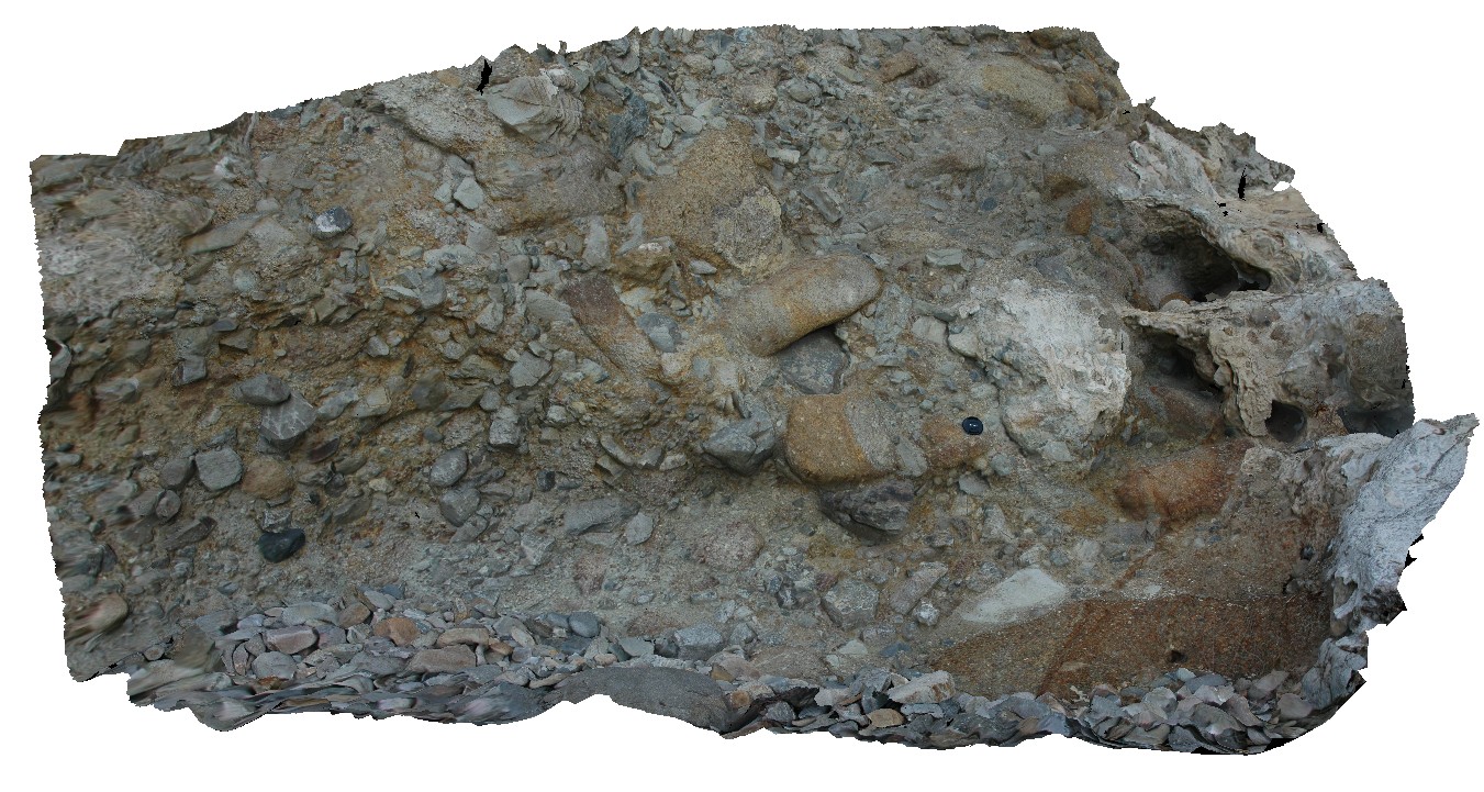
Mathinna1 Map
 |
5 |
03/13/2015 9:01 a.m. |
3D |
outcrop of proximal turbidite in Mathinna Group sediments, with shear kink band. Mathinna Rd. Tasmania. |
1.00 |
-41.47834957000 |
147.95035485000 |
-9999.000 |
kink band, shear, structure, turbidite |
turbidite |
Mathinna10 Map
 |
5 |
02/23/2016 9:23 a.m. |
3D |
outcrop of proximal turbidite in Mathinna Group sediments, Mathinna Rd. Tasmania. |
8.00 |
-41.47897000000 |
147.95349000000 |
-9999.000 |
turbidite |
turbidite |
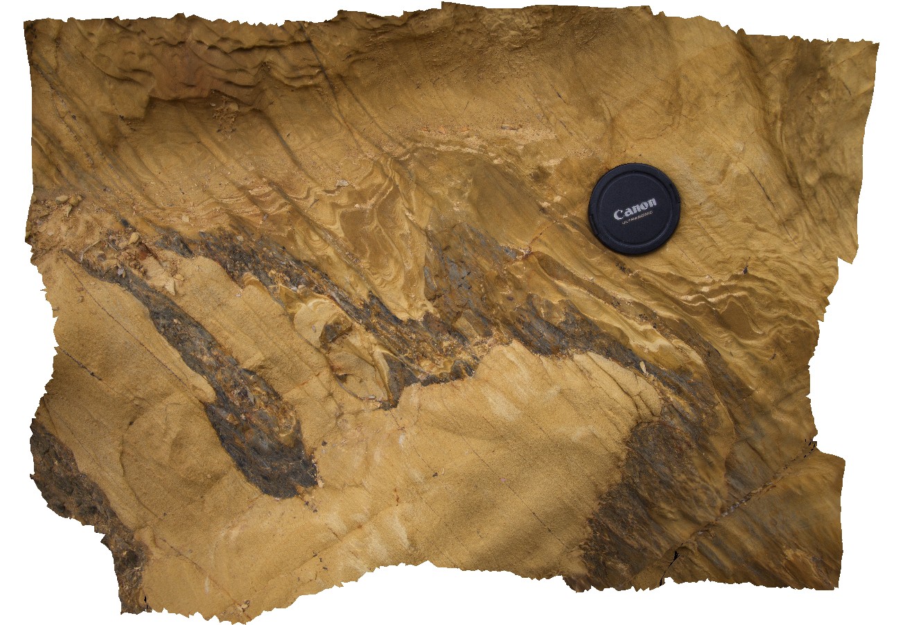
Mathinna11 Map
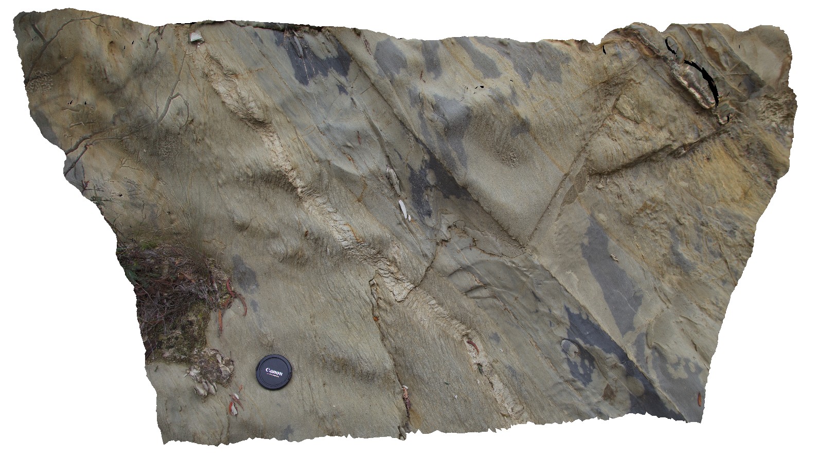
 |
5 |
02/23/2016 9:23 a.m. |
3D |
detail of flame structures in Mathinna Group sediments, Mathinna Rd, Tasmania. |
0.30 |
-41.47898000000 |
147.95345000000 |
-9999.000 |
flame structure, sedimentology |
turbidite |
Mathinna12 Map
 |
5 |
02/23/2016 9:23 a.m. |
3D |
close view of flame structures in Mathinna Group sediments. Mathinna Td, Tasmania. |
0.40 |
-41.47898000000 |
147.95345000000 |
-9999.000 |
flame structure, sedimentology |
turbidite |
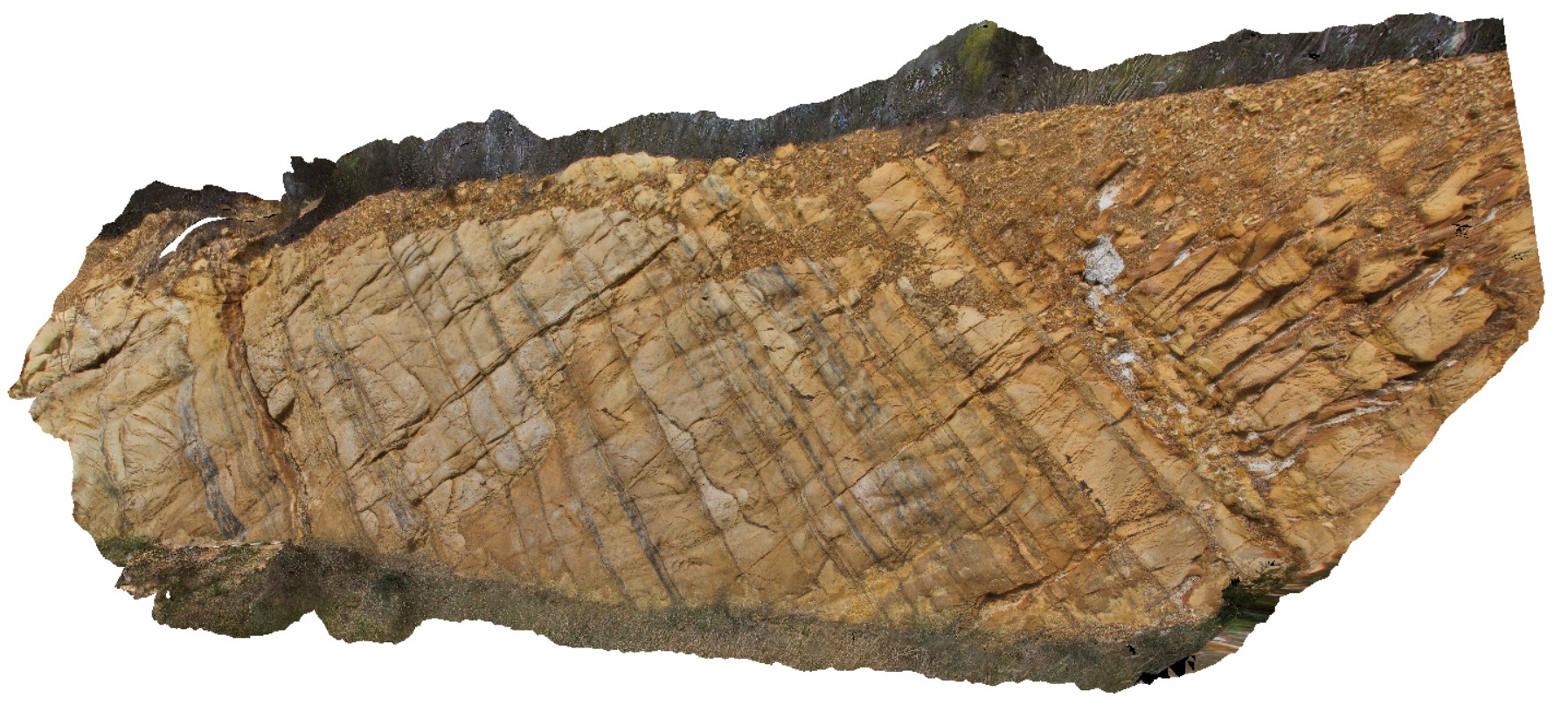
Mathinna13 Map
 |
5 |
02/23/2016 9:23 a.m. |
3D |
detail of cross-bedding and convoluted bedding at the top of a turbidite bed in the Mathinna Group sediments. Mathinna Rd. Tasmania. |
0.50 |
-41.47897000000 |
147.95343000000 |
-9999.000 |
turbidite, cross bedding, convoluted bedding |
turbidite |
Mathinna2 Map
 |
5 |
03/13/2015 9:01 a.m. |
3D |
outcrop of proximal turbidite in Mathinna Group sediments, with shear kink band. Mathinna Rd. Tasmania. |
0.40 |
-41.47836900000 |
147.95039171000 |
-9999.000 |
turbidite, kink band, shear, structure |
turbidite |
Mathinna3 Map
 |
5 |
03/13/2015 9:01 a.m. |
3D |
outcrop of proximal turbidite in Mathinna Group sediments, with graded bedding in muddy siltstones and fine-grained sandstone layers. Image also shows penetrating cleavage. |
1.00 |
-41.47838007000 |
147.95048318000 |
-9999.000 |
cleavage, structure, turbidite, graded bedding |
turbidite |
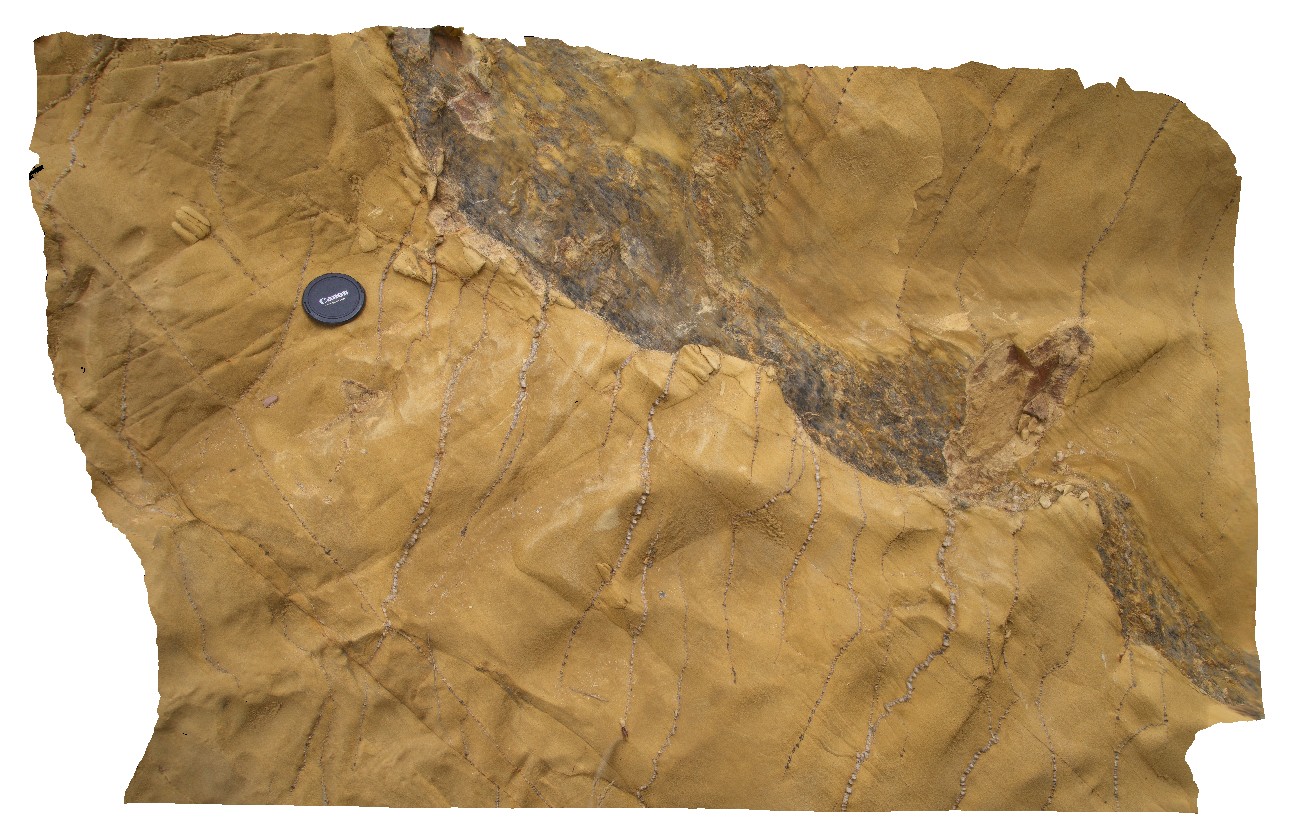
Mathinna4 Map
 |
5 |
03/13/2015 9:01 a.m. |
3D |
outcrop of folded proximal turbidite in Mathinna Group sandstone layers with spaced cleavage and ferruginous altered quartz vein. Mathinna Road, Tas. |
0.40 |
-41.47861506000 |
147.95137381000 |
-9999.000 |
ferruginous, quartz vein, structure, fold, turbidite |
sandstone |
Mathinna5 Map
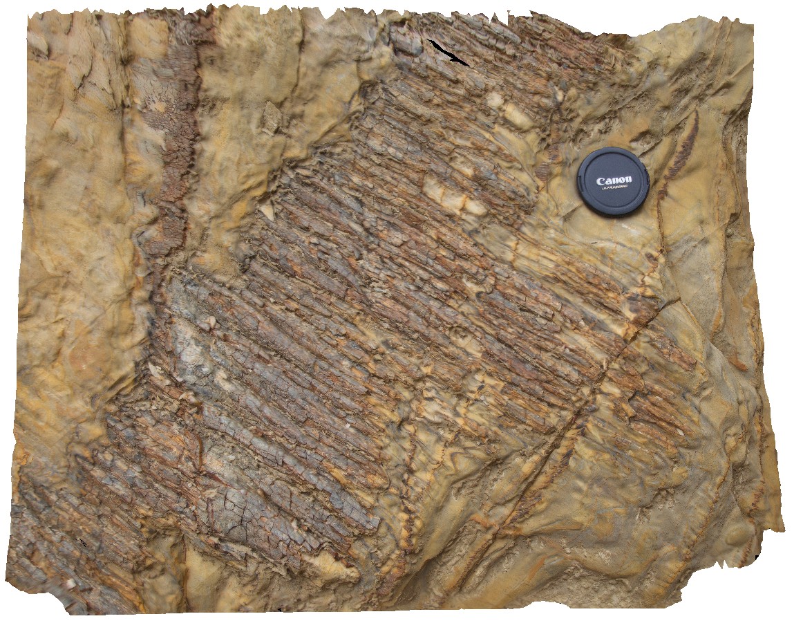 |
5 |
03/13/2015 9:01 a.m. |
3D |
'rod' shaped quartz vein boudins in deformed Mathinna Supergroup sandstone. Mathinna Road, Tas. |
0.40 |
-41.47868108000 |
147.95142611000 |
-9999.000 |
turbidite, boudinage, boudin, rod, quartz vein |
sandstone |
Mathinna6 Map
 |
5 |
03/13/2015 9:01 a.m. |
3D |
outcrop of folded proximal turbidite in Mathinna Group sandstone layers with ferruginous altered quartz vein and sheeted / en echelon quartz vein set . Mathinna Road, Tas. |
1.00 |
-41.47871562000 |
147.95149417000 |
-9999.000 |
quartz vein, ferruginous, sheeted vein set, en-echelon vein, turbidite, structure |
turbidite |