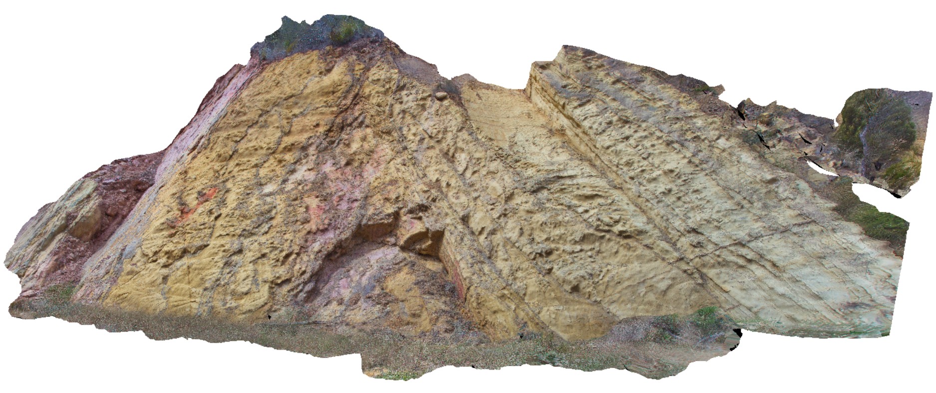
Mathinna7 Map
 |
5 |
02/23/2016 9:23 a.m. |
3D |
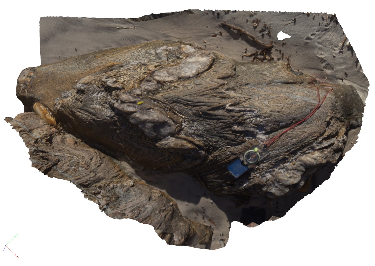
large fold in Mathinna sediments, Mathinna Rd, Tasmania. |
9.00 |
-41.47830000000 |
147.95050000000 |
-9999.000 |
fold plunge, fold, anticline |
sandstone |
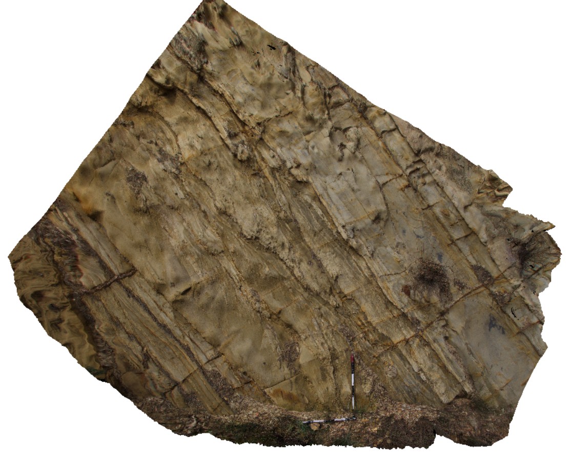
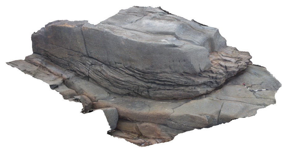
Mathinna8 Map
 |
5 |
02/23/2016 9:24 a.m. |
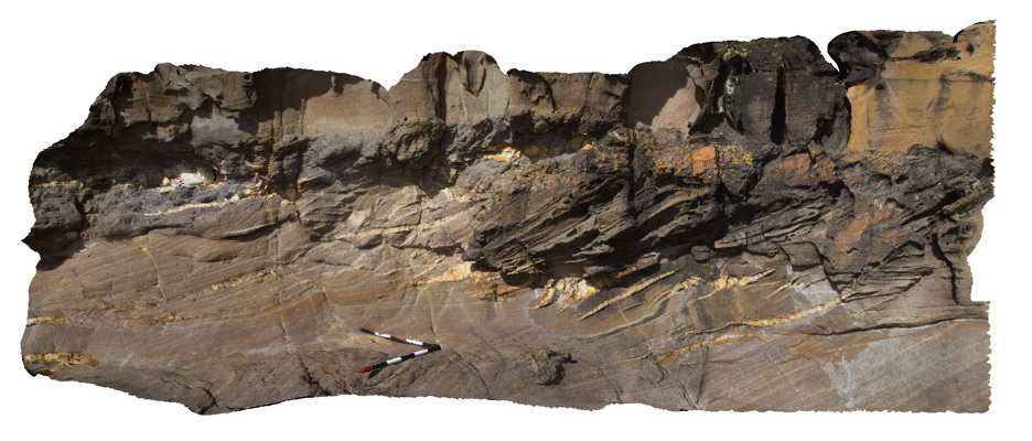
3D |
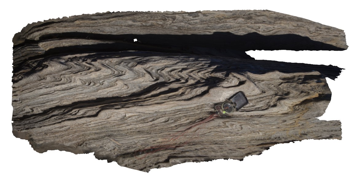
thrust fault in fine-grained turbidites of the Mathinna Group. Mathinna Rd, Tasmania. |
3.50 |
-41.47831000000 |
147.95035000000 |
-9999.000 |
turbidite, thrust fault |
turbidite |
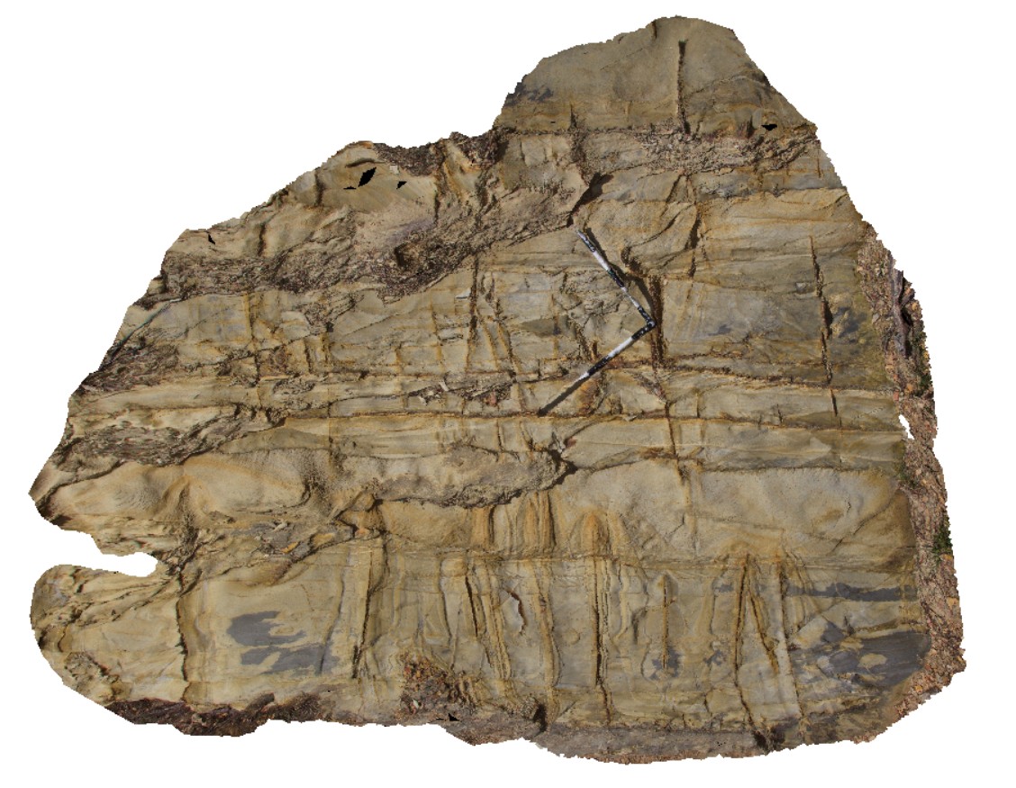
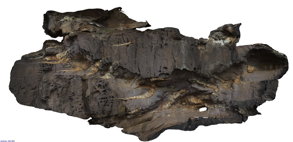
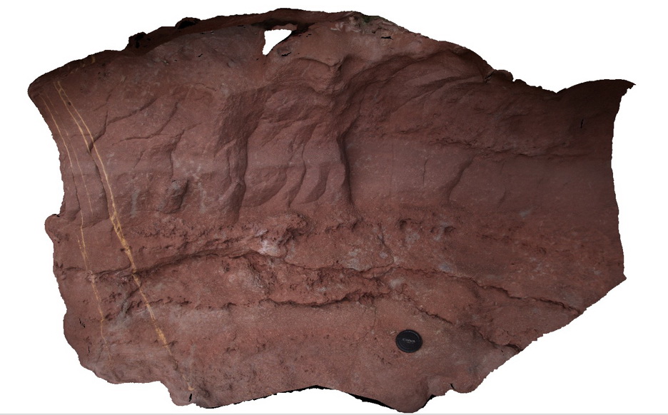
Mathinna9 Map
 |
5 |
01/01/9999 midnight |
3D |
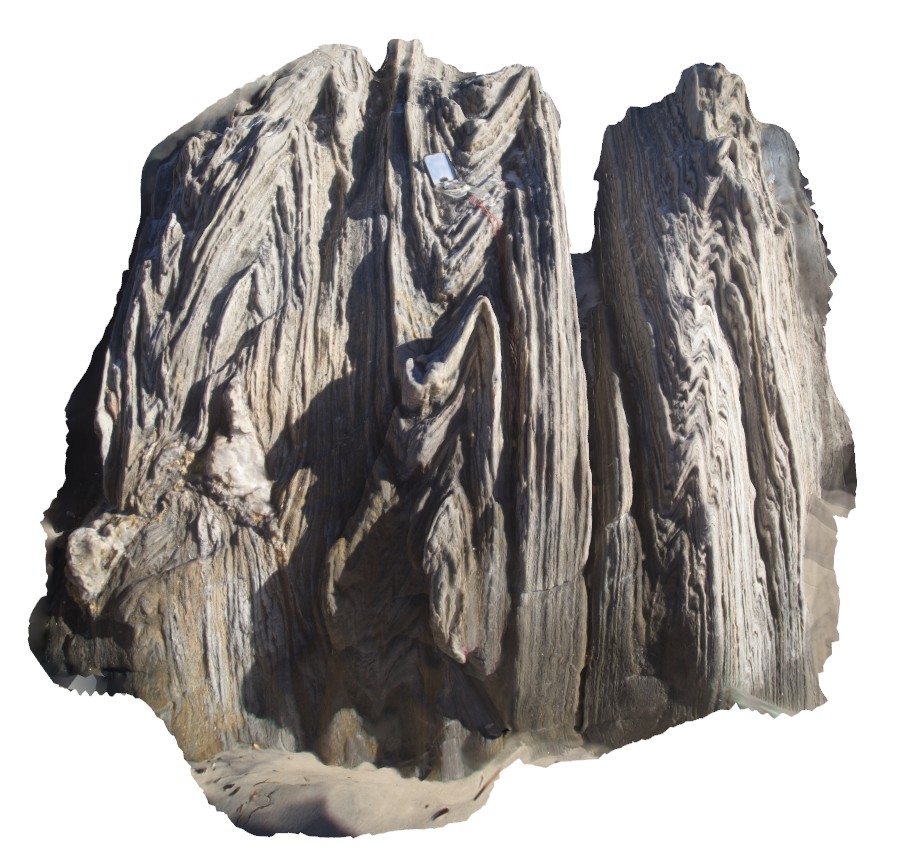
complex outcrop with bedding, cleavage, veins and liesegang banding in Mathinna Group sediments. Mathinna Rd, Tasmania. |
3.00 |
-41.47831000000 |
147.95035000000 |
-9999.000 |
cleavage, veins, liesegang banding |
turbidite |
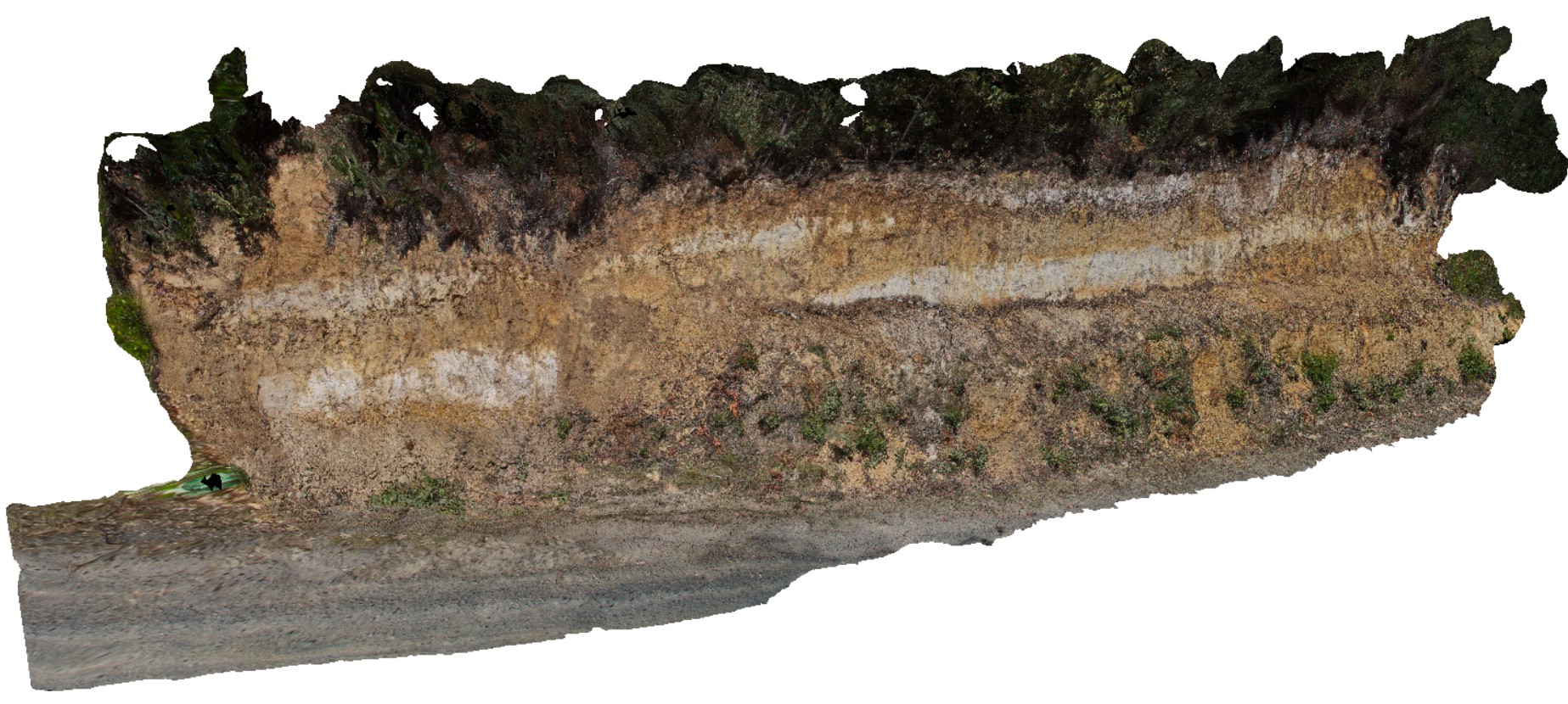
MaynesJct1 Map
 |
0 |
02/23/2016 9:24 a.m. |
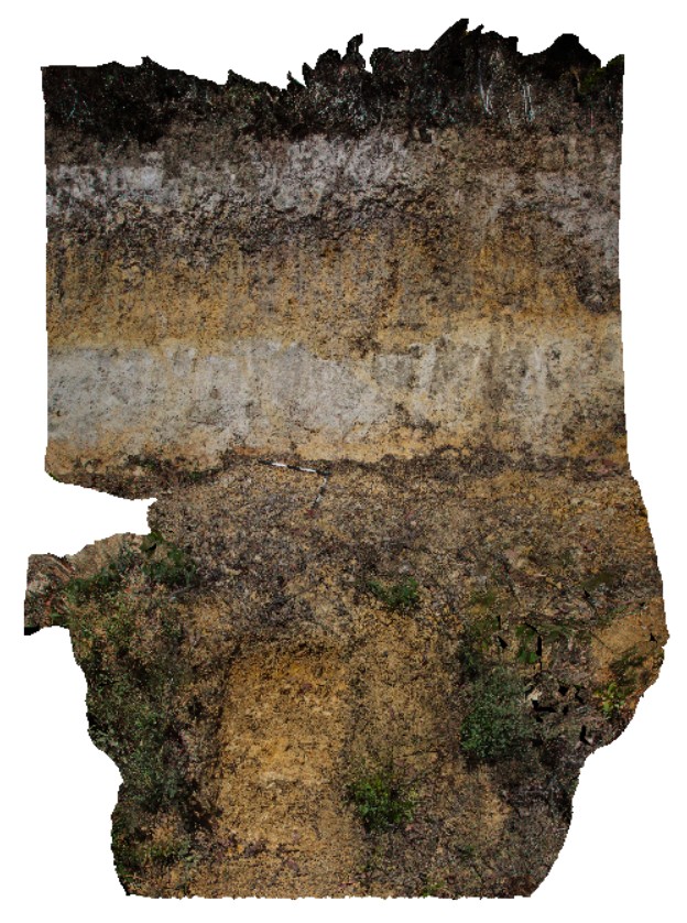
3D |
road cutting showing regolith profile with alternating white and brown layers. Styx road, Tasmania. |
10.00 |
-42.77855000000 |
146.59097000000 |
-9999.000 |
regolith profile, weathering |
silt |
MaynesJct2 Map
 |
0 |
02/23/2016 9:25 a.m. |
3D |
detail of location MaynesJct1, showing middle of image of banded regolith profile. Styx road, Tasmania. |
4.00 |
-42.77855000000 |
146.59097000000 |
-9999.000 |
regolith |
silt |
MaynesJct3 Map
 |
5 |
02/23/2016 9:25 a.m. |
3D |
detail of location MaynesJct1, showing banded regolith. Styx road, Tasmania. |
3.00 |
-42.77855000000 |
146.59097000000 |
-9999.000 |
regolith |
regolith |
Merimbula1 Map
 |
5 |
05/18/2015 1:21 p.m. |
3D |
en-echelon quartz veins in cross bedded sandstone. Merimbula, N.S.W. |
5.00 |
-36.88414000000 |
149.93306000000 |
2.000 |
cross beds, quartz vein, en-echelon, structure |
sandstone |
Merimbula10 Map
 |
5 |
05/18/2015 1:21 p.m. |
3D |
very irregular contact between yellow cross bedded sandstone and red sandstone. Merimbula, N.S.W. |
10.00 |
-36.89641000000 |
149.93002000000 |
2.000 |
bedding, erosional contact, cross bedding, sedimentology |
sandstone |
Merimbula11 Map
 |
20 |
01/01/9999 midnight |
3D |
overview of large cliff face, showing layered sandstone beds. Merimbula, N.S.W. |
10.00 |
-36.89641000000 |
149.93002000000 |
2.000 |
sandstone, sedimentology, bedding |
sandstone |
Merimbula2 Map
 |
5 |
05/18/2015 1:22 p.m. |
3D |
en echelon quartz veins in medium-coarse grained cross-bedded sandstones. Merimbula, N.S.W. |
5.00 |
-36.88403000000 |
149.93391000000 |
2.000 |
quartz veins, en-echelon, structure |
sandstone |
Merimbula3 Map
 |
5 |
05/18/2015 1:22 p.m. |
3D |
en-echelon quartz veins in medium to coarse cross bedded sandstones. Merimbula, N.S.W. |
5.00 |
-36.88396000000 |
149.93465000000 |
2.000 |
quartz veins, en-echelon, structure |
sandstone |
Merimbula4 Map
 |
5 |
05/18/2015 1:23 p.m. |
3D |
cross beds in medium grained sandstone. Merimbula, N.S.W. |
5.00 |
-36.88585000000 |
149.93343000000 |
2.000 |
cross bedding, sedimentology |
sandstone |
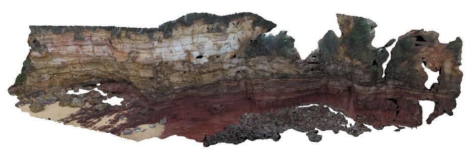
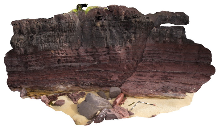
Merimbula5 Map
 |
5 |
05/18/2015 1:24 p.m. |
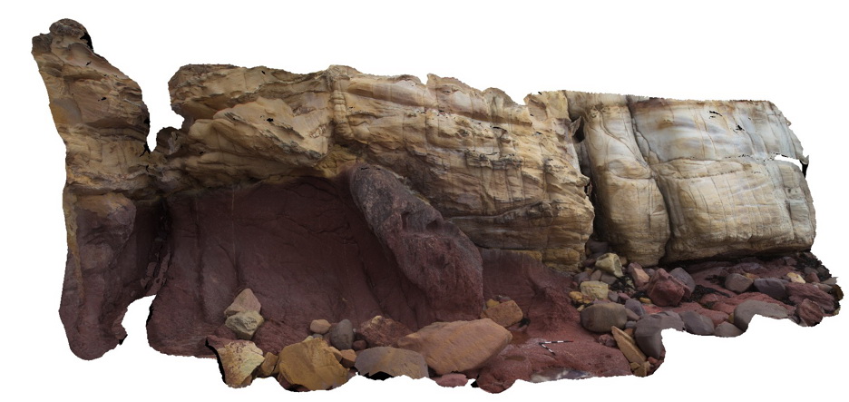
3D |
large coastal outcrop with red sandstone (red bed) overlain by yellow cross bedded sandstone. The contact between the two units is erosional. Merimbula, N.S.W. |
30.00 |
-36.88851000000 |
149.93022000000 |
2.000 |
cross bedding, erosional contact, sedimentology, stratigraphy |
sandstone |
Merimbula6 Map
 |
5 |
05/18/2015 1:25 p.m. |
3D |
detailed view of the medium to coarse grained redbed sandstone depicted in Merimbula5. Merimbula, N.S.W. |
1.00 |
-36.88815600000 |
149.93033000000 |
2.000 |
sedimentology |
sandstone |
Merimbula7 Map
 |
5 |
05/18/2015 1:25 p.m. |
3D |
Detail of bedding in medium to fine-grained red sandstone. Mottled zones of light coloured leaching are also apparent. Merimbula, N.S.W. |
1.00 |
-36.88820000000 |
149.93033000000 |
2.000 |
sedimentology, bedding |
sandstone |
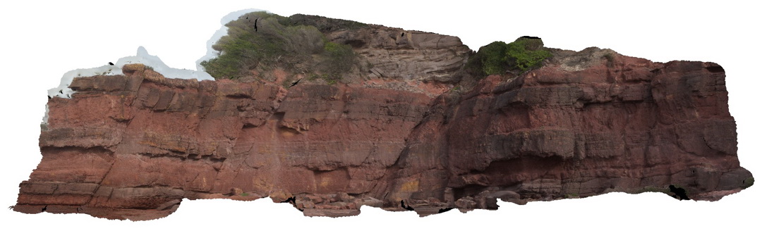
Merimbula8 Map
 |
5 |
05/18/2015 1:26 p.m. |
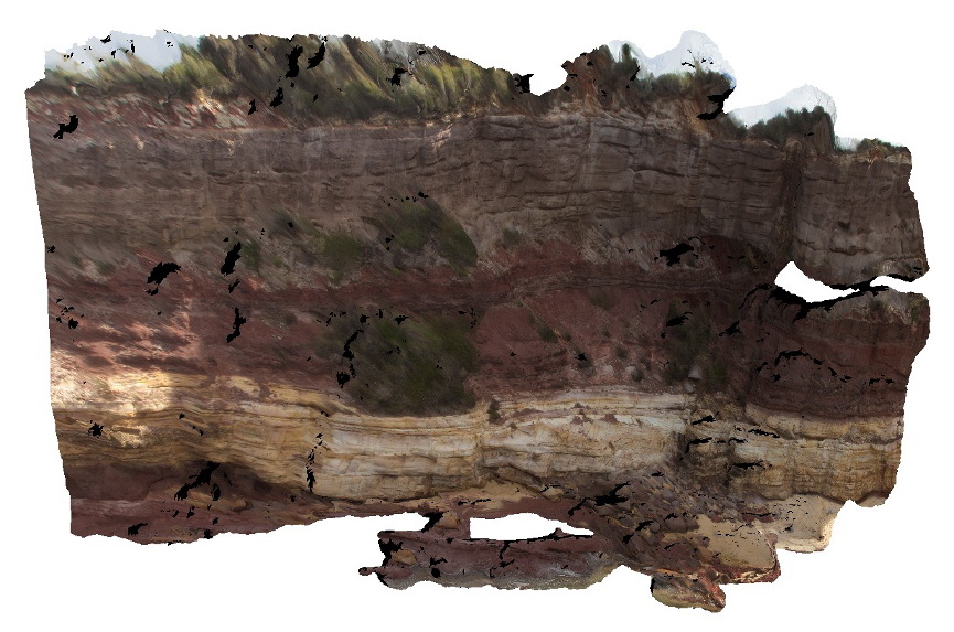
3D |
Devonian red bed sandstone cliff displaying alternations between fine and medium grainsize. Rock unit is thin to thickly bedded. Merimbula, N.S.W. |
6.00 |
-36.89697000000 |
149.93036000000 |
2.000 |
bedding, sedimentology |
sandstone |
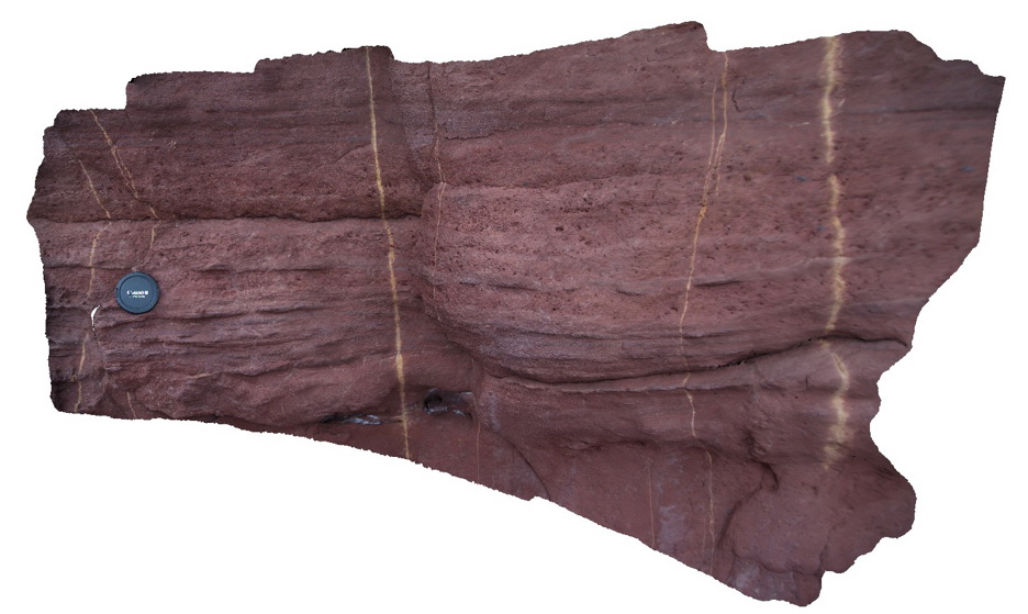
Merimbula9 Map
 |
5 |
05/18/2015 1:26 p.m. |
3D |
Thickly bedded red sandstone. Coarse grained units have irregular erosional lower contacts and planar upper contacts. Merimbula, N.S.W. |
15.00 |
-36.89839000000 |
149.93224000000 |
2.000 |
bedding, erosional contact, sedimentology |
sandstone |
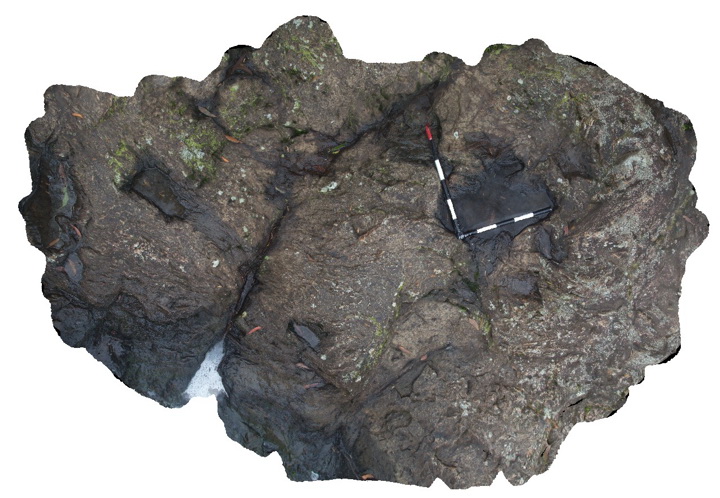
Miley1 Map
 |
5 |
06/05/2016 10:41 a.m. |
3D |
view of large folded outcrop, showing tight to isoclinal, steeply plunging folds in finely layered metasediment. Miley, W.A. |
6.00 |
-33.93476000000 |
120.00719000000 |
-9999.000 |
isoclinal fold, tight fold, fold plunge, structure |
psammite |
Miley2 Map
 |
5 |
06/05/2016 10:41 a.m. |
3D |
detail of folds from site Miley1, showing parasitic, tight to isoclinal folds in finely laminated metasediments with steeply plunging fold hinges. Miley, W.A. |
1.20 |
-33.93473000000 |
120.00716000000 |
-9999.000 |
fold, fold plunge, parasitic fold, structure, metasediment |
metasediment |
Miley3 Map
 |
5 |
06/05/2016 10:41 a.m. |
3D |
detail of folds from site Miley1and Miley 2, showing parasitic, tight to isoclinal folds in finely laminated metasediments with steeply plunging fold hinges. Miley, W.A. |
1.20 |
-33.93473000000 |
120.00716000000 |
-9999.000 |
folding, structure, metasediment |
metasediment |
Miley4 Map
 |
5 |
06/05/2016 10:42 a.m. |
3D |
view of vertical to reclined, tightly folded metasediments and quartz veins. Miley, W.A. |
1.20 |
-33.93468000000 |
120.00725000000 |
-9999.000 |
fold, metasediments, structure |
metasediments |
Miley5 Map
 |
5 |
06/05/2016 10:39 a.m. |
3D |
larger wavelength, tight and reclined folding in quartzite unit, Miley, W.A. |
3.50 |
-33.93473000000 |
120.00729000000 |
-9999.000 |
tight fold, reclined fold, quartzite |
quartzite |
Miley6 Map
 |
5 |
06/05/2016 10:39 a.m. |
3D |
parasitic, reclined to vertical folds in finely laminated metasediments. Miley, W.A. |
2.50 |
-33.93470000000 |
120.00674000000 |
-9999.000 |
parasitic fold |
metasediment |
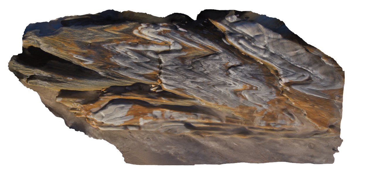
Minyon1 Map
 |
5 |
06/16/2015 4:36 p.m. |
3D |
Flow banding in rhyolite, Minyon N.S.W. |
2.00 |
-28.61271000000 |
153.38986000000 |
325.000 |
flow banding, volcanology, igneous |
rhyolite |
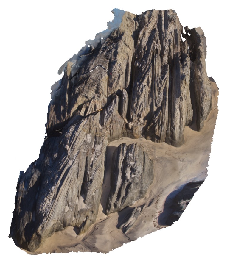
MinyonFSP1 Map
 |
1 |
06/16/2015 4:38 p.m. |
FSP |
Columnar jointed rhyolite at Minyon Falls - Miocene Ninbin Rhyolite. Minyon N.S.W. |
50.00 |
-28.61254000000 |
153.39600000000 |
325.000 |
columnar jointing, igneous |
rhyolite |