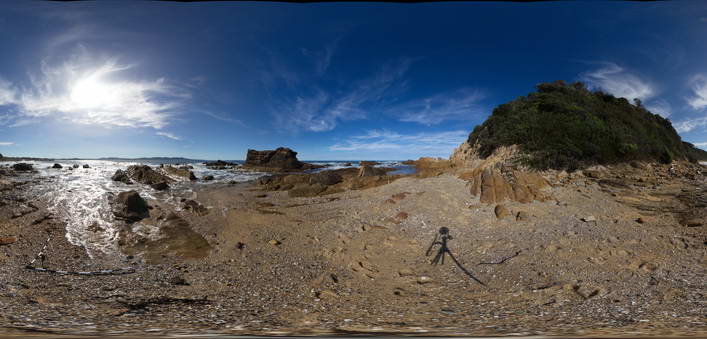
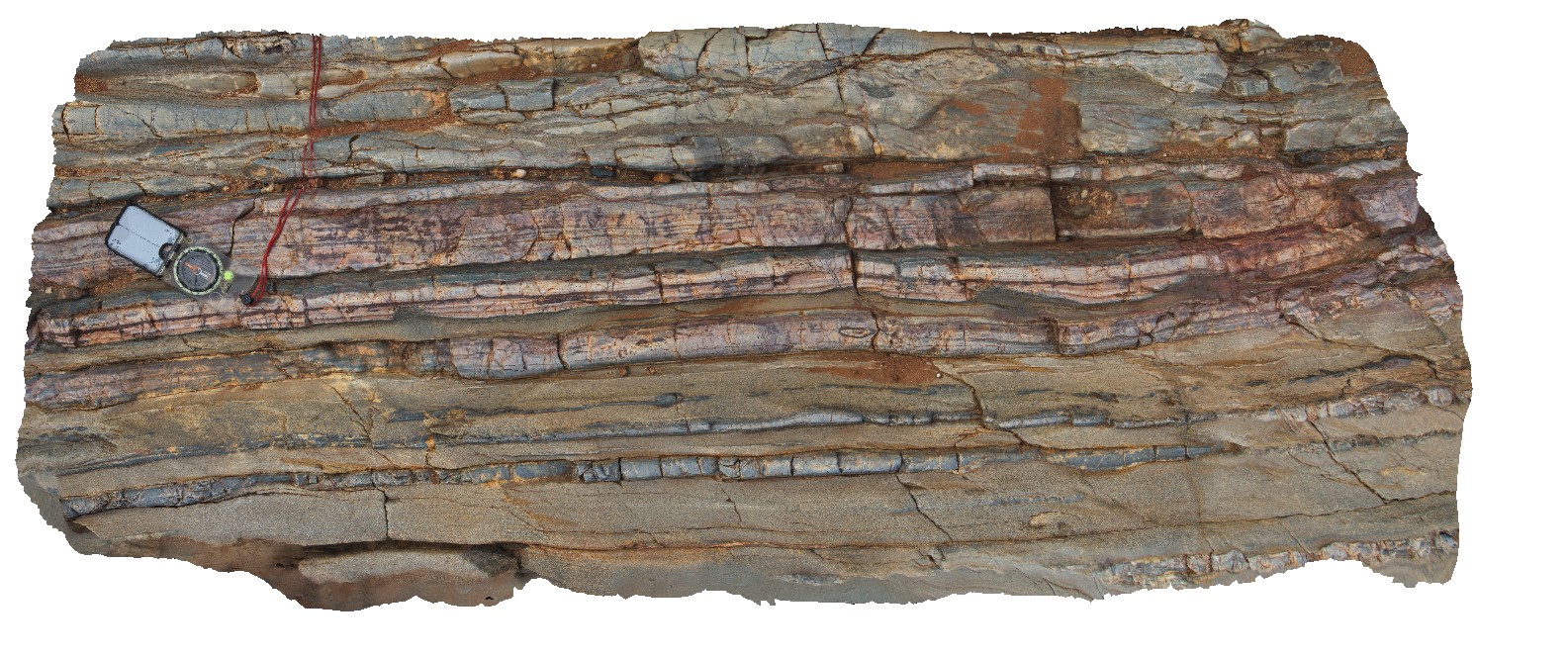
MallacootaFSP4 Map
 |
5 |
05/18/2015 2 p.m. |
FSP |
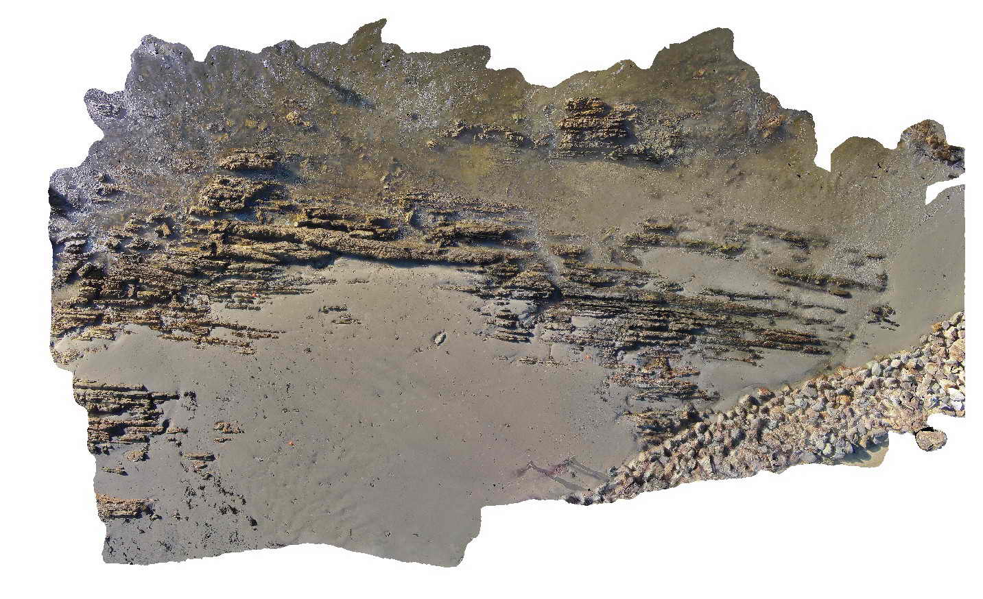
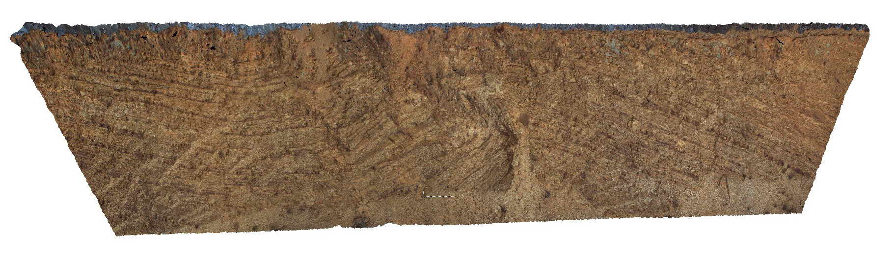
Well bedded turbidites of the Ordovician Adaminaby Group. Mallacoota, Vic. |
50.00 |
-37.57314000000 |
149.76550000000 |
1.000 |
turbidite |
turbidite |
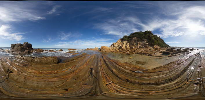
MallacootaFSP5 Map
 |
5 |
05/18/2015 2 p.m. |
FSP |
Well bedded turbidites of the Ordovician Adaminaby Group. Mallacoota, Vic. |
50.00 |
-37.57331000000 |
149.76561000000 |
1.000 |
turbidite, structure, sedimentology |
turbidite |
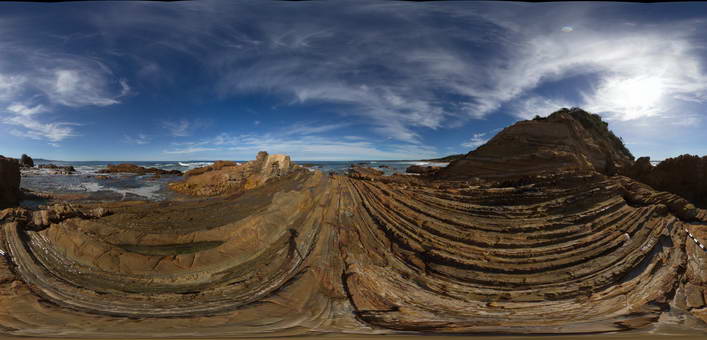
MallacootaFSP6 Map
 |
5 |
05/18/2015 2:01 p.m. |
FSP |
Well bedded turbidites of the Ordovician Adaminaby Group. Mallacoota, Vic. |
50.00 |
-37.57352000000 |
149.76544000000 |
1.000 |
turbidite, structure, sedimentology |
turbidite |
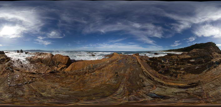
MallacootaFSP7 Map
 |
5 |
05/18/2015 2:01 p.m. |
FSP |
Well bedded turbidites of the Ordovician Adaminaby Group. Mallacoota, Vic. |
50.00 |
-37.57370000000 |
149.76555000000 |
1.000 |
turbidite, structure, sedimentology |
turbidite |
MallacootaGiga1 Map
 |
0 |
05/18/2015 2:01 p.m. |
GIGA |
location inferred from nearby images. Mallacoota, Vic. |
0.00 |
-37.57225000000 |
149.76472000000 |
-9999.000 |
|
|
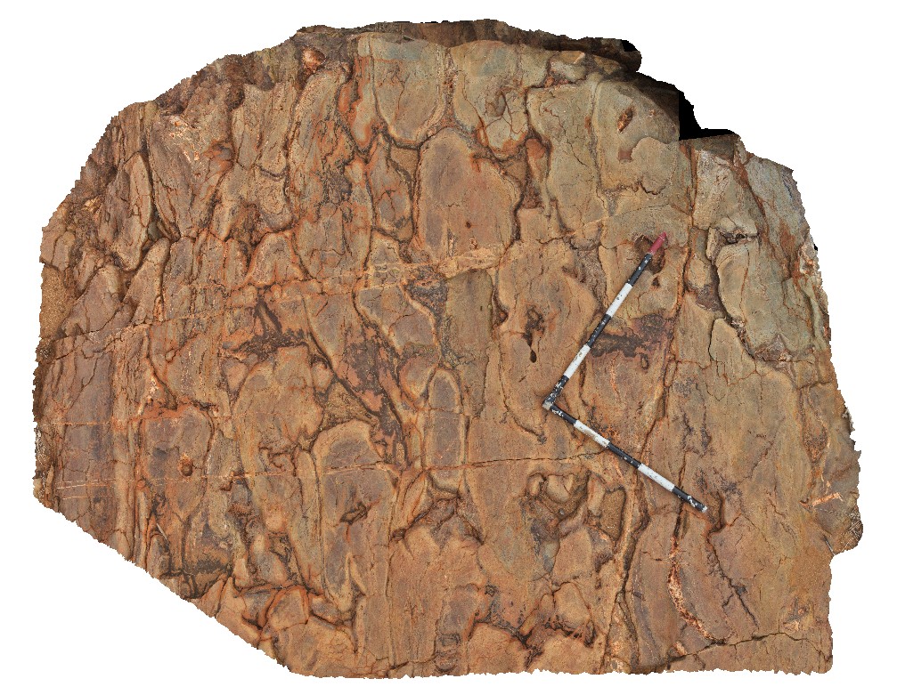
MallacootaUAV1 Map
 |
5 |
06/20/2016 5:14 p.m. |
UAV |
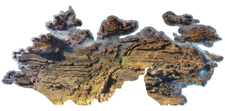
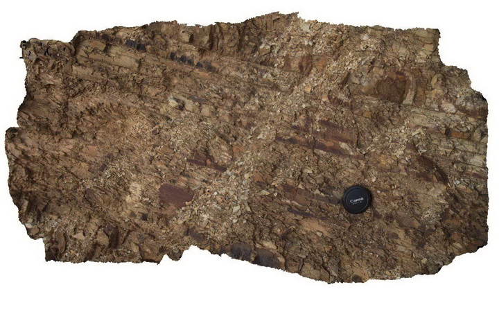
anticline in folded and faulted turbiditic metasediments of the Ordovician Adaminaby Group. Mallacoota, Vic. |
40.00 |
-37.57137000000 |
149.76407000000 |
8.000 |
sandstone, siltstone, chert, anticline, structure |
turbidite |
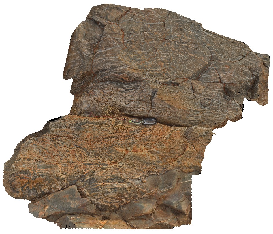
MallacootaUAV2 Map
 |
5 |
05/26/2015 8:31 a.m. |
UAV |
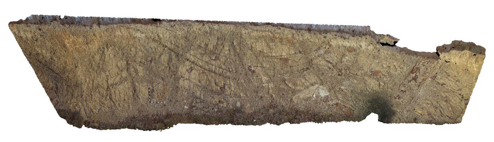
fault zone cross-cutting folded turbiditic metasediments of the Ordovician Adaminaby Group. Mallacoota, Vic. |
60.00 |
-37.57313000000 |
149.76552000000 |
1.000 |
sandstone, siltstone, chert, fault, structure |
turbidite |
MansfieldRd1 Map
 |
5 |
06/17/2015 10:24 a.m. |
3D |
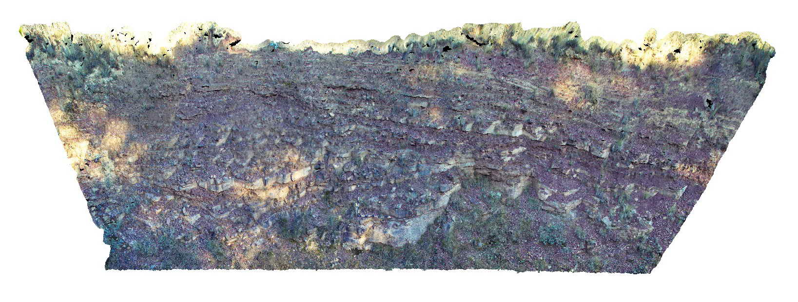
low angle fault in bedded sandstone and mudstone of the Devonian to Carboniferous Snowy Plains Formation. Mansfield Road, Vic. |
15.00 |
-36.88522000000 |
146.30833000000 |
900.000 |
fault, structure, sedimentology |
sandstone, mudstone |
MansfieldRd2 Map
 |
5 |
06/17/2015 10:25 a.m. |
3D |
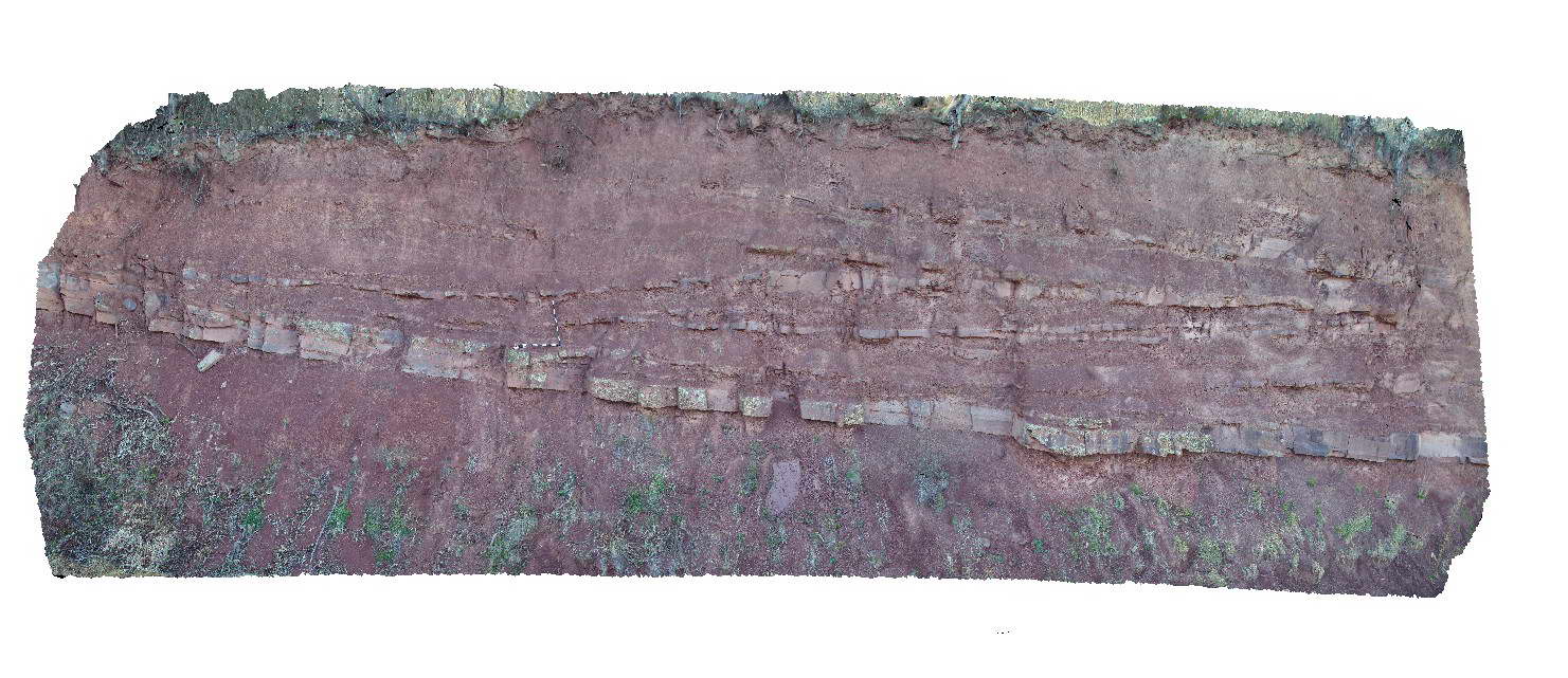
Large scale cross stratification in interbedded sandstone and mudstone of the Devonian-Carboniferous Snowy Plains Formation. Mansfield Road, Vic. |
20.00 |
-36.93927000000 |
146.20639000000 |
900.000 |
cross stratification, sedimentology |
mudstone, sandstone |
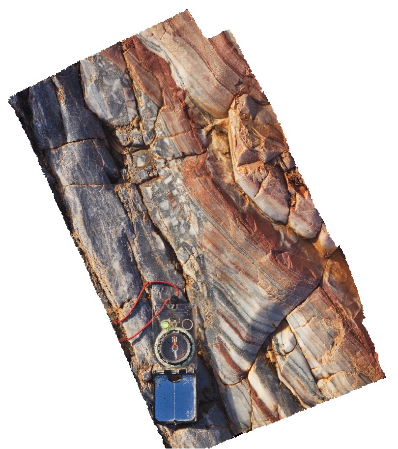
MansfieldRd3 Map
 |
5 |
06/17/2015 10:26 a.m. |
3D |
folded and faulted sandstone units of the Devonian Norton Gully Sandstone. Mansfield Road, Vic. |
20.00 |
-37.02679000000 |
145.95461000000 |
337.000 |
folds, faults, structure |
sandstone |
MansfieldRd4 Map
 |
5 |
06/17/2015 10:28 a.m. |
3D |
detail of bedding/cleavage relationship in Devonian Norton Gully Sandstone. Mansfield Road, Vic. |
1.50 |
-37.02679000000 |
145.95461000000 |
337.000 |
cleavage, bedding, structure |
sandstone |
MansfieldRd5 Map
 |
5 |
06/17/2015 10:29 a.m. |
3D |
open fold in bedded sandstone of the Devonian Norton Gully Sandstone. Mansfield Road, Vic. |
20.00 |
-37.02049000000 |
145.89662000000 |
332.000 |
fold, structure |
sandstone |
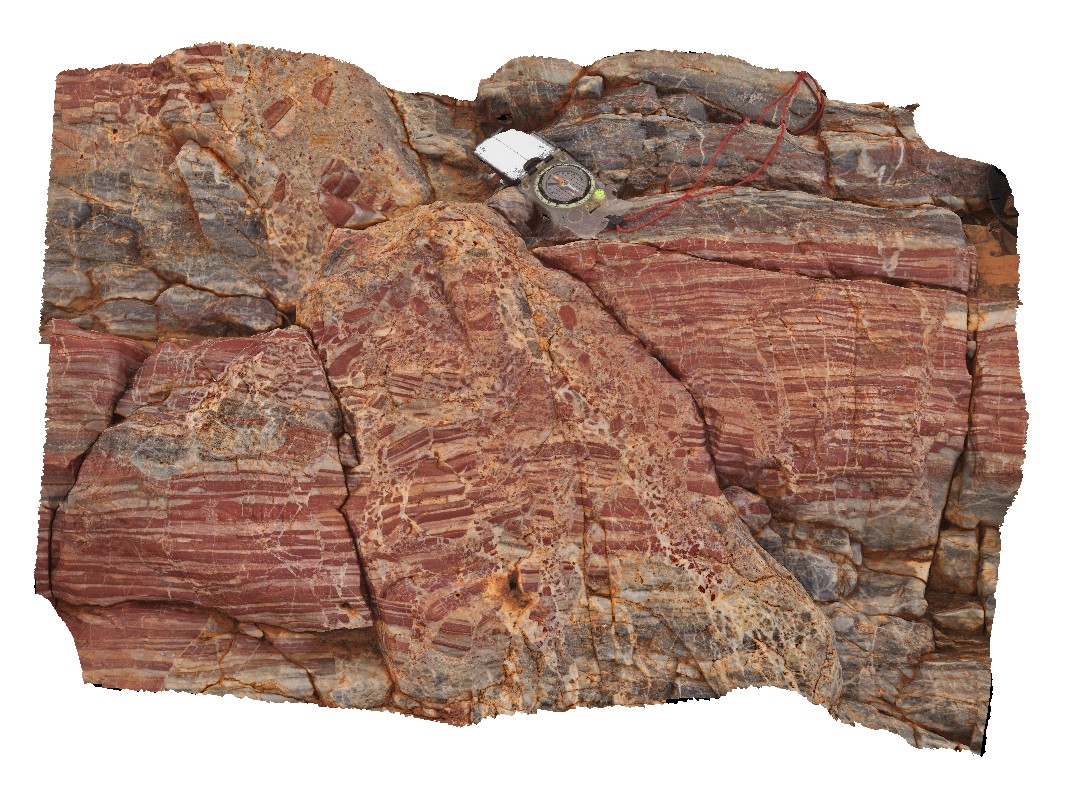
MarbleBar1 Map
 |
0 |
06/01/2016 noon |
3D |
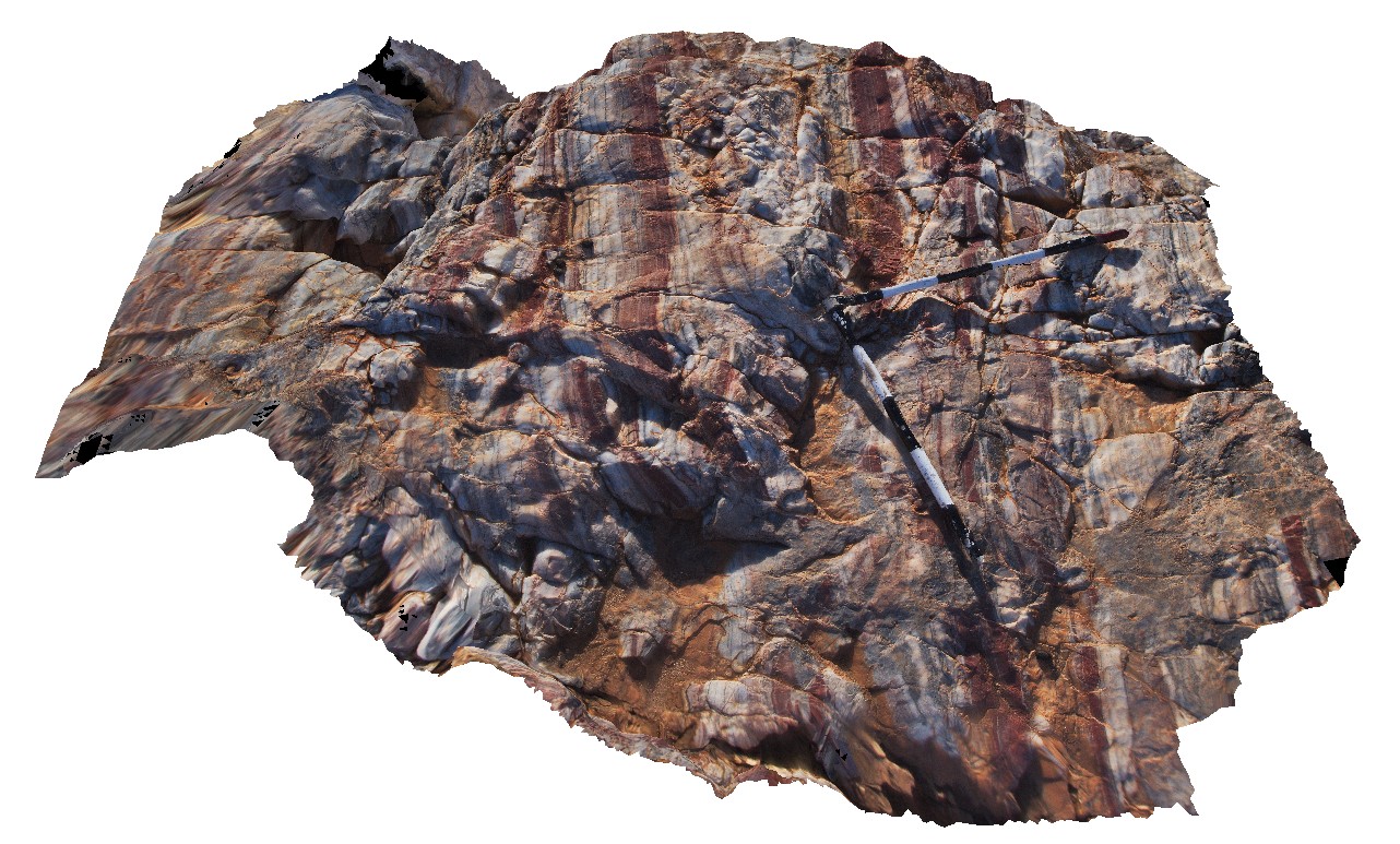
moderately dipping, layered white, red and grey chert. Coongan River. Marble Bar, W.A. |
1.80 |
-21.18649000000 |
119.71179000000 |
-9999.000 |
banded chert, Marble Bar Chert |
chert |
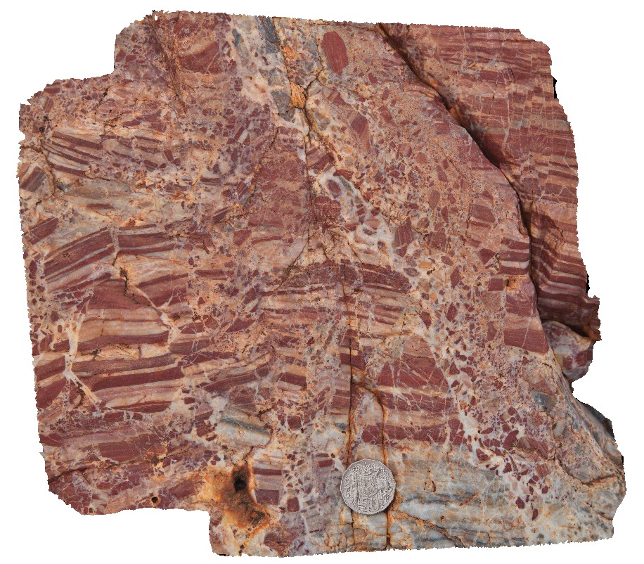
MarbleBar10 Map
 |
0 |
06/01/2016 noon |
3D |
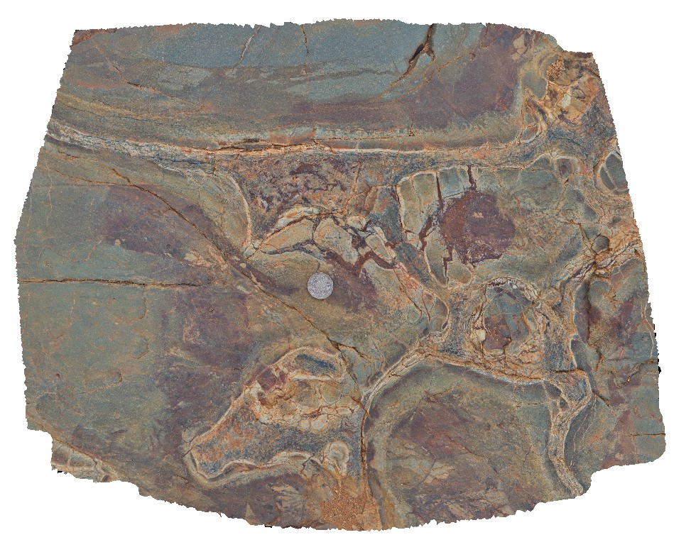
detail of fault and hydrothermal breccia in red and white chert. Marble Bar, Coongan River, W.A. |
0.00 |
-21.18712000000 |
119.71192000000 |
-9999.000 |
Marble Bar Chert Member, chert, breccia |
chert |
MarbleBar11 Map
 |
0 |
06/01/2016 noon |
3D |
detail of fault and hydrothermal breccia in red and white chert. Marble Bar, Coongan River, W.A. |
0.30 |
-21.18712000000 |
119.71192000000 |
-9999.000 |
Marble Bar Chert Member, chert, breccia, fault |
chert |
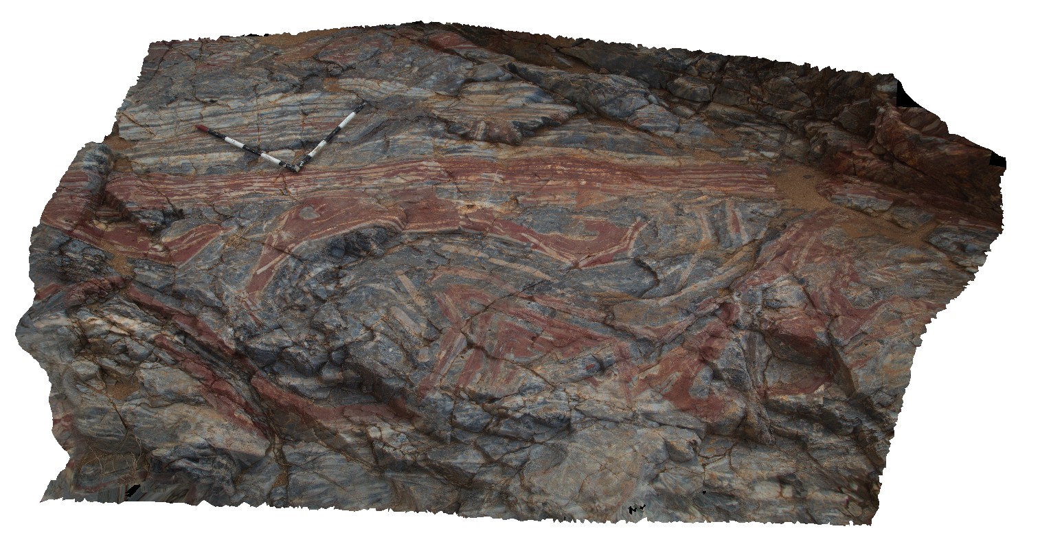
MarbleBar12 Map
 |
0 |
06/01/2016 noon |
3D |
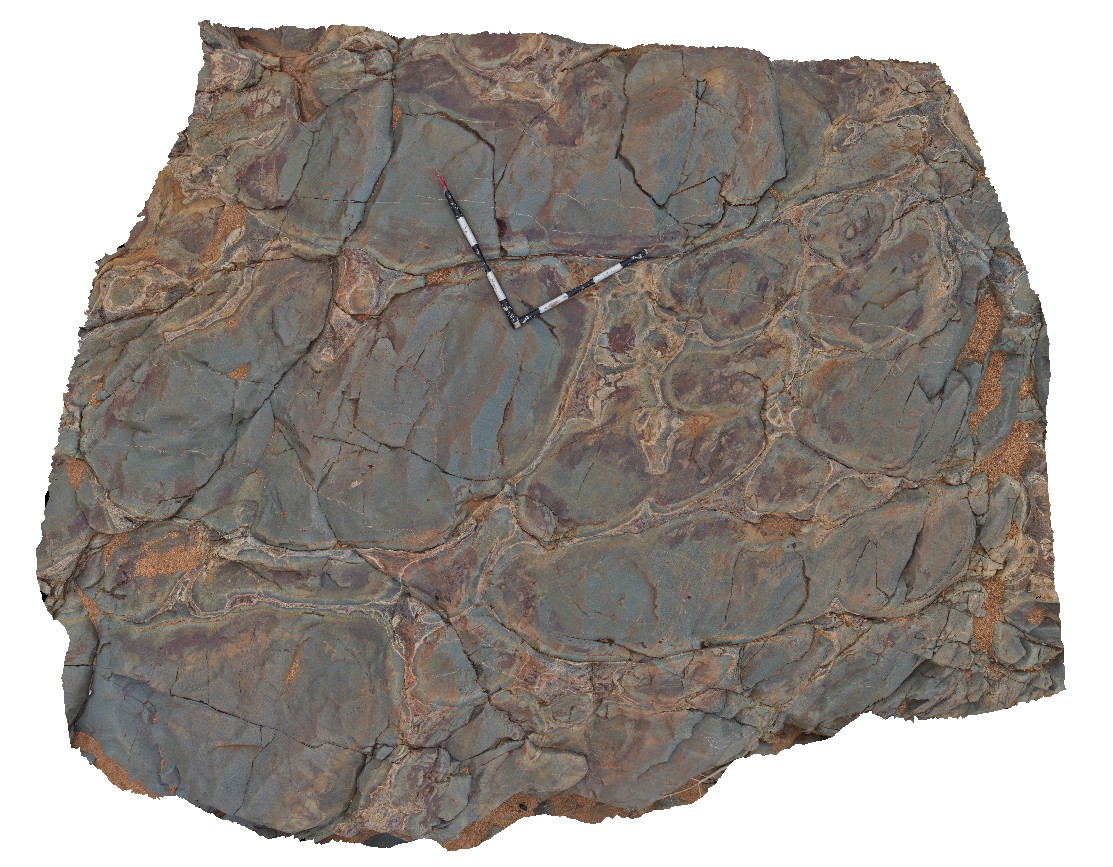
large folded rafts of red chert in grey chert, overlain by layered red and white chert. Possible syndepositional folding? Marble Bar, Coongan River, W.A. |
3.30 |
-21.18705000000 |
119.71185000000 |
-9999.000 |
folds, banded chert, Marble Bar Chert Member |
chert |
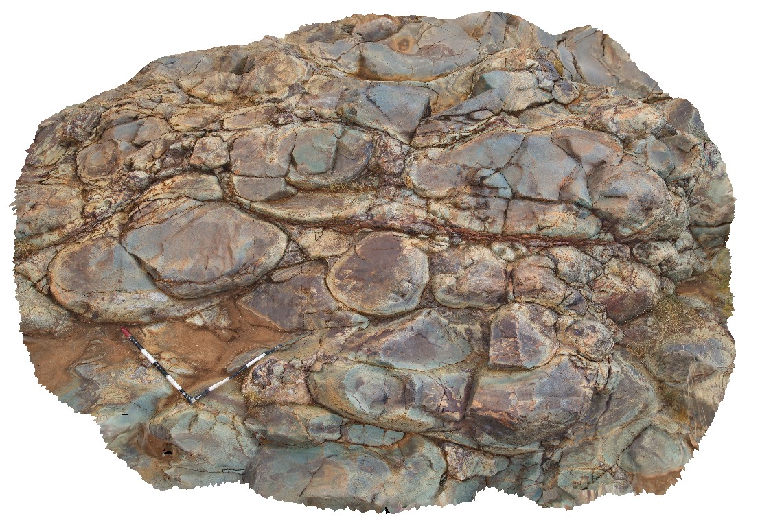
MarbleBar13 Map
 |
0 |
06/01/2016 noon |
3D |
view of pillow basalt underlying the Marble Bar Chert Member. Marble Bar, Coongan River, W.A. |
3.00 |
-21.18747000000 |
119.71198000000 |
-9999.000 |
pillow basalt |
basalt |
MarbleBar14 Map
 |
0 |
06/01/2016 noon |
3D |
pavement showing section through large pillows of basalt, with interpillow sediments and pillow margins. Marble Bar, Coongan River, W.A. |
3.00 |
-21.18754000000 |
119.71208000000 |
-9999.000 |
pillow basalt, basalt flow |
basalt |
MarbleBar15 Map
 |
0 |
06/01/2016 noon |
3D |
detailed view of pillow margins showing chill features and interpillow sediments. Marble Bar, Coongan River, W.A. |
0.70 |
-21.18754000000 |
119.71208000000 |
-9999.000 |
pillow basalt, interpillow sediments, pillow chill margins |
basalt |
MarbleBar16 Map
 |
0 |
06/01/2016 noon |
3D |
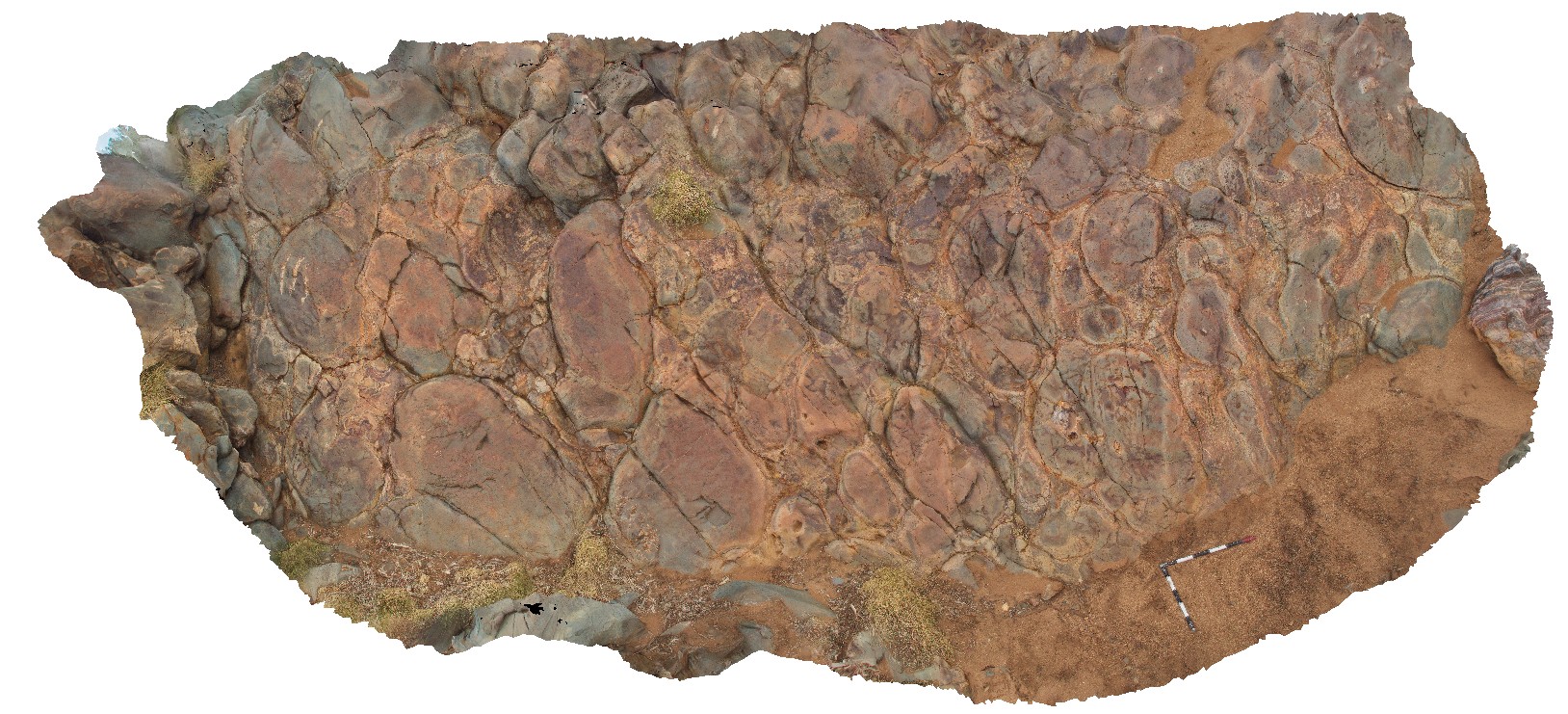
large pillows exposed in oblique section, with interpillow sediments. Marble Bar, Coongan River, W.A. |
6.00 |
-21.18782000000 |
119.71238000000 |
-9999.000 |
pillow basalt, interpillow sediments |
basalts |
MarbleBar17 Map
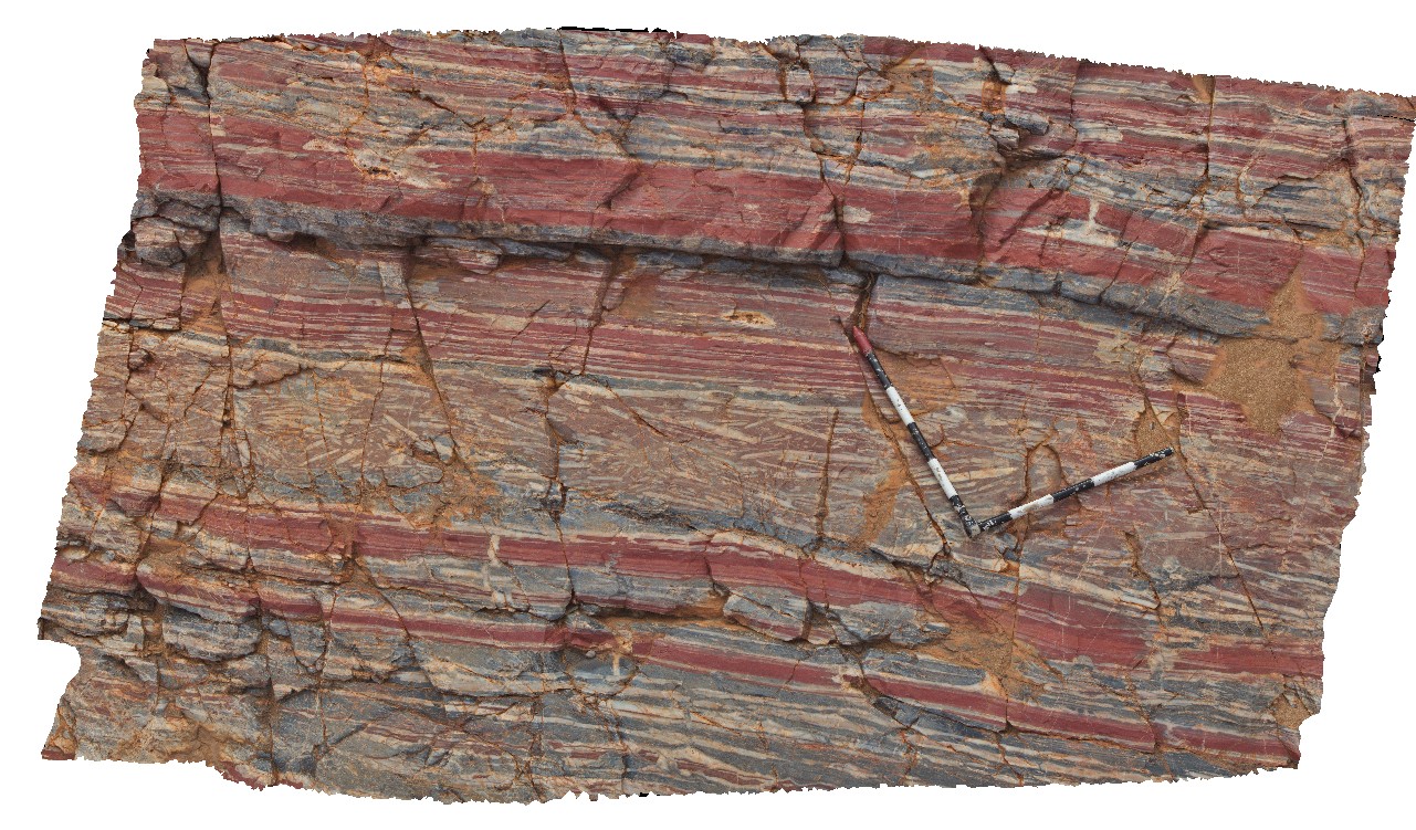 |
0 |
06/01/2016 noon |
3D |
layer of brecciated chert in layered red, white and grey chert. |
2.70 |
-21.18743000000 |
119.71218000000 |
-9999.000 |
layered chert, brecciation, Marble Bar Chert Member |
chert |
MarbleBar18 Map
 |
0 |
06/01/2016 noon |
3D |
small, tightly packed, pillows of komatiitic basalt with interpillow sediments and chill margins. Marble Bar, W.A. |
2.20 |
-21.18517000000 |
119.71249000000 |
-9999.000 |
pillow basalt, komatiitic basalt, interpillow sediment |
komatiitic basalt |
MarbleBar19 Map
 |
0 |
06/01/2016 noon |
3D |
intense stockwork veining in dolerite? With multiple phases of veining and hydrothermal brecciation. Coongan River, Marble Bar, W.A. |
1.40 |
-21.18096000000 |
119.71256000000 |
-9999.000 |
stockwork veining, hydrothermal brecciation |
dolerite |
MarbleBar2 Map
 |
0 |
06/01/2016 noon |
3D |
brecciated contact between layered chert and grey chert. Coongan River. Marble Bar, W.A. |
0.60 |
-21.18647000000 |
119.71181000000 |
-9999.000 |
breccia, Marble Bar Chert Member, chert |
chert |
MarbleBar20 Map
 |
0 |
06/01/2016 noon |
3D |
chert layers in volcanogenic sandstone. Scours into chert layers show bedding is overturned. Coongan River, Marble Bar, W.A. |
1.30 |
-21.18081000000 |
119.71261000000 |
-9999.000 |
chert, overturned bedding, volcanogenic |
sandstone |