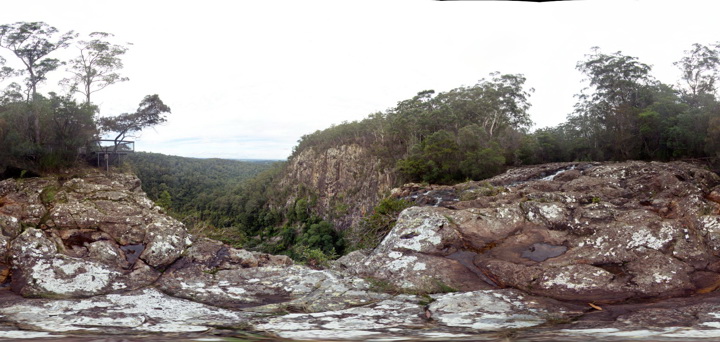
MinyonFSP2 Map
 |
5 |
06/16/2015 4:38 p.m. |
FSP |
Rhyolite cliffs. Minyon N.S.W. |
50.00 |
-28.61254000000 |
153.39600000000 |
325.000 |
columnar jointing |
rhyolite |
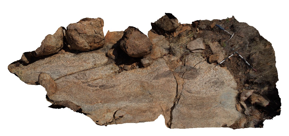
Mirima1 Map
 |
5 |
06/15/2016 noon |
3D |
shallowly-dipping, cross-bedded arenite in cliff exposure at end of Mirima NP track. Mirima National Park, Kununurra W.A. |
2.00 |
-15.76253000000 |
128.75208000000 |
-9999.000 |
arenite, cross-beds, sedimentology |
arenite |
Mirima2 Map
 |
5 |
06/15/2016 noon |
3D |
view of very thick cross-bedded arenite, truncated by medium cross-bedded arenite. End of Mirima NP track. Mirima National Park, Kununurra W.A. |
0.60 |
-15.76176000000 |
128.75098000000 |
-9999.000 |
arenite, cross-bedding, sedimentology |
arenite |
MistakeCreek1 Map
 |
0 |
06/11/2016 noon |
3D |
pegmatite pod (biotite-k-feldspar-quartz) and disaggregated mafic (K-feldspar phyric) porphyritic dyke? In granite. Mistake Creek, Great Northern Highway, north of Warmun Roadhouse. W.A. |
5.10 |
-16.94435000000 |
128.24112000000 |
-9999.000 |
pegmatite, granite, mafic dyke, igneous relationships |
granite |
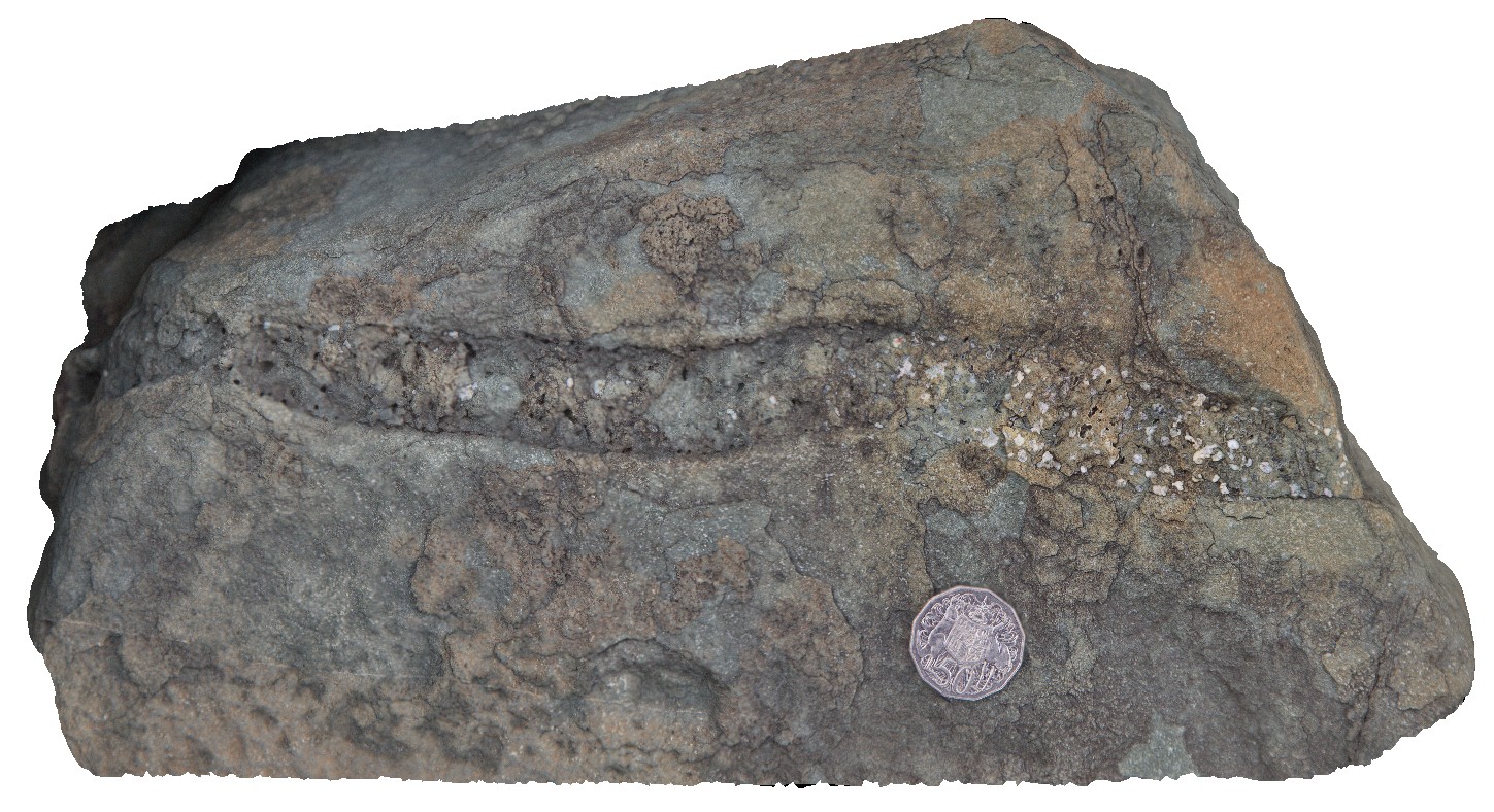
MistakeCreek2 Map
 |
0 |
06/11/2016 noon |
3D |
mafic, amoeboid and pegmatitic pods in granite. Mistake Creek, Great Northern Highway, north of Warmun Roadhouse. W.A. |
1.00 |
-16.94450000000 |
128.24121000000 |
-9999.000 |
granite, mafic amoeboid pod, pegmatite pod |
granite |
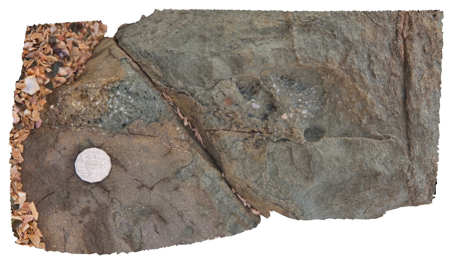
MistakeCreek3 Map
 |
0 |
06/11/2016 noon |
3D |
mylonitic zone in K-feldspar phyric granite. Mistake Creek, Great Northern Highway, north of Warmun Roadhouse. W.A. |
3.50 |
-16.94350000000 |
128.24083000000 |
-9999.000 |
mylonitic, granite, structure |
granite |
MistakeCreekFSP1 Map
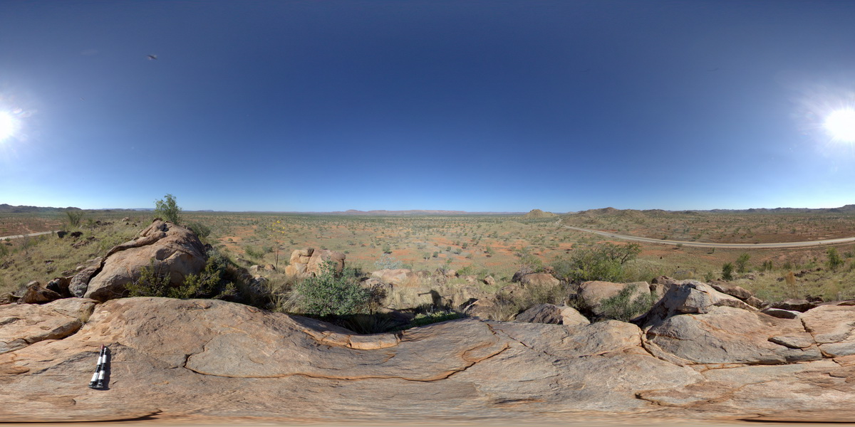 |
0 |
06/11/2016 noon |
FSP |
view from granite outcrop at surrounding plane. Mistake Creek, Great Northern Highway, north of Warmun Roadhouse. W.A. |
3000.00 |
-16.94494000000 |
128.24110000000 |
-9999.000 |
granite |
granite |
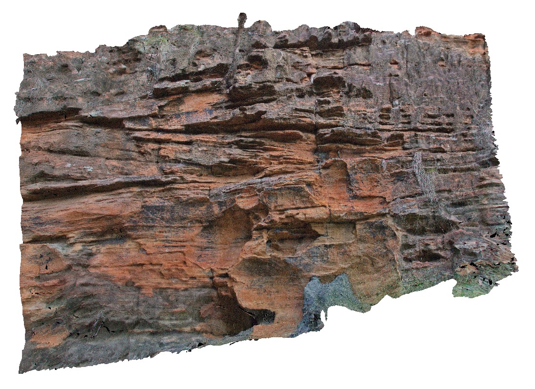
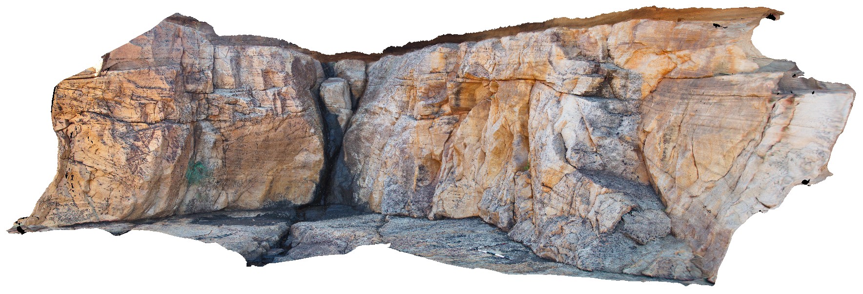
Mitchell1 Map
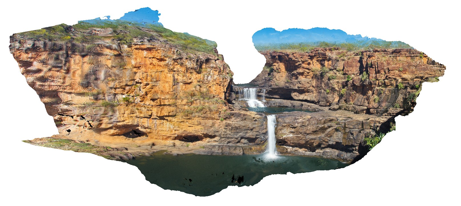 |
0 |
06/08/2016 noon |
3D |
overview of Mitchell Falls, Mitchell River, Kimberley. W.A. |
75.00 |
-14.82099000000 |
125.69496000000 |
-9999.000 |
water fall, Mitchell Falls, King Leopold Sandstone |
sandstone |
Mitchell10 Map
 |
0 |
06/08/2016 noon |
3D |
polygonal jointing and large amygdales in Carson Vale basalt block. Port Warrender Road, Kimberley. W.A. |
0.60 |
-14.56892000000 |
125.84583000000 |
-9999.000 |
basalt, polygonal jointing, amygdale |
basalt |
Mitchell11 Map
 |
0 |
06/08/2016 noon |
3D |
large amygdales filled with opaline silica at the intersection of polygonal joints. Port Warrender Road, Kimberley. W.A. |
0.30 |
-14.56892000000 |
125.84583000000 |
-9999.000 |
amygdale, opaline silica, polygonal joints |
basalt |
Mitchell12 Map
 |
0 |
06/08/2016 noon |
3D |
Carson Volcanics basalt with tube vesicles. Port Warrender Road, Kimberley. W.A. |
1.30 |
-14.56894000000 |
125.84576000000 |
-9999.000 |
vesicles, basalt |
basalt |
Mitchell13 Map
 |
0 |
06/08/2016 noon |
3D |
Carson Volcanics basalt with tube vesicles. Port Warrender Road, Kimberley. W.A. |
0.20 |
-14.56894000000 |
125.84576000000 |
-9999.000 |
tube vesicles, basalt, Carson Volcanics |
basalt |
Mitchell14 Map
 |
0 |
06/08/2016 noon |
3D |
detail of tube vesicles in long section. Port Warrender Road, Kimberley. W.A. |
0.30 |
-14.56894000000 |
125.84576000000 |
-9999.000 |
vesicles, basalt, Carson Volcanics |
basalt |
Mitchell15 Map
 |
0 |
06/08/2016 noon |
3D |
long section detail of tube vesicles in basalt block. Port Warrender Road, Kimberley. W.A. |
0.45 |
-14.56887000000 |
125.84565000000 |
-9999.000 |
vesicle, basalt, Carson Volcanics |
basalt |
Mitchell16 Map
 |
0 |
06/08/2016 noon |
3D |
small scale cross beds in King Leopold Sandstone and surveyors pool. Mitchell Plateau, Kimberley, W.A. |
1.50 |
-14.67411000000 |
125.73260000000 |
-9999.000 |
cross bedding, King Leopold Sandstone, surveyors pool |
sandstone |
Mitchell17 Map
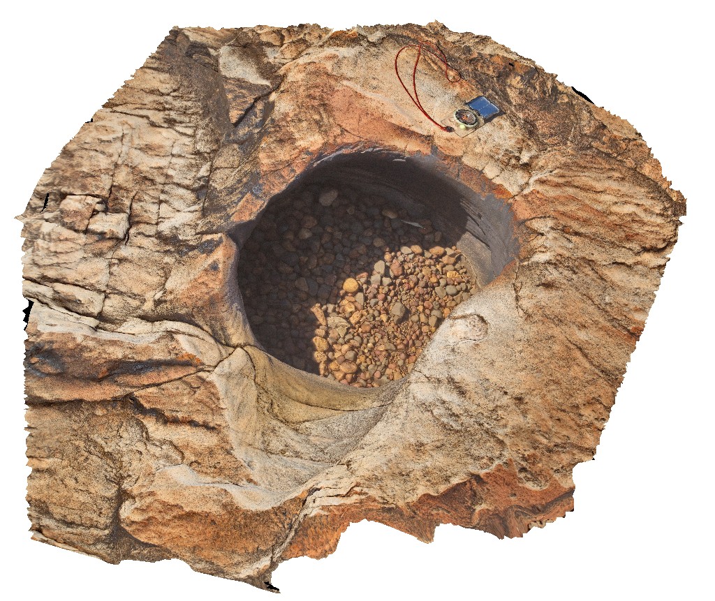 |
0 |
06/08/2016 noon |
3D |
pot hole with small rounded grind stones. Surveyors pool. Mitchell Plateau, Kimberley, W.A. |
0.00 |
-14.67411000000 |
125.73239000000 |
-9999.000 |
sandstone, King Leopold Sandstone, pot hole, grind stone |
sandstone |
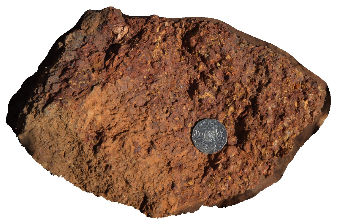
Mitchell18 Map
 |
0 |
06/08/2016 noon |
3D |
Ferruginous laterite, showing individual round pisoliths - weathered surface on a loose block. East of Kaniwal. Mitchell Plateau, Kimberley, W.A. |
0.20 |
-14.83894000000 |
125.87528000000 |
-9999.000 |
Ferruginous laterite, Mitchell Plateau, pisolith |
laterite |
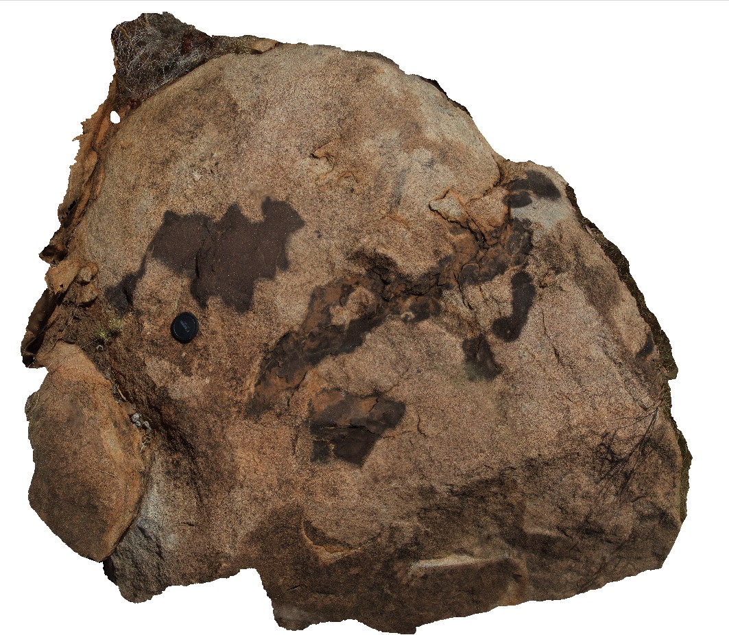
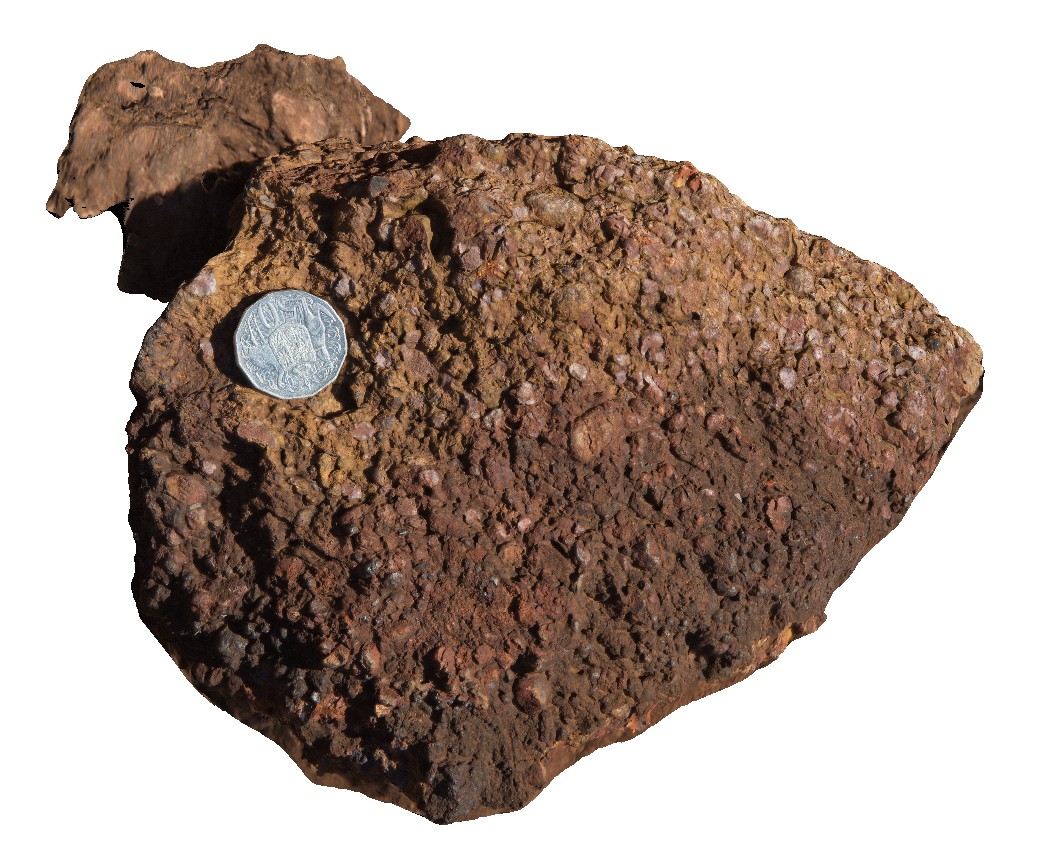
Mitchell19 Map
 |
0 |
06/08/2016 noon |
3D |
broken surface of Ferruginous laterite from site Mitchell18. East of Kaniwal. Mitchell Plateau, Kimberley, W.A. |
0.20 |
-14.83894000000 |
125.87528000000 |
-9999.000 |
Ferruginous laterite, Mitchell Plateau, pisolith |
laterite |
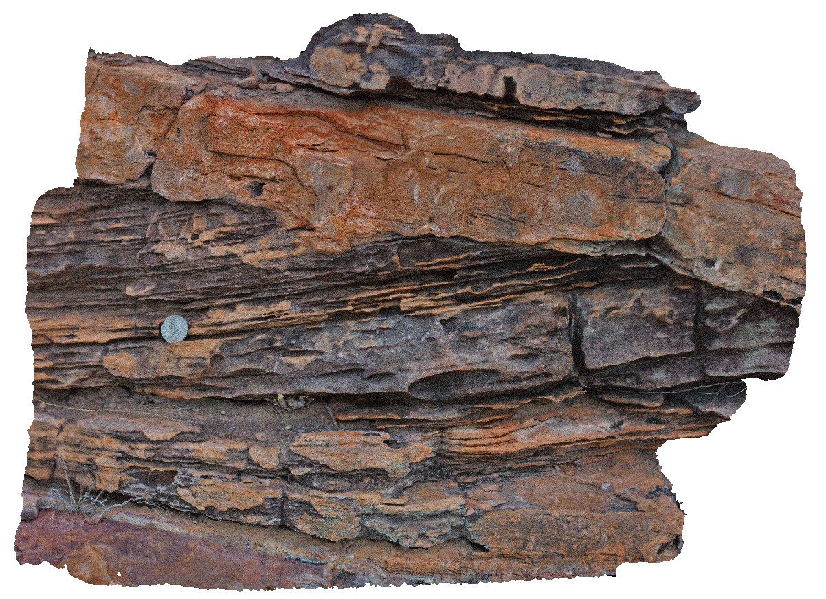
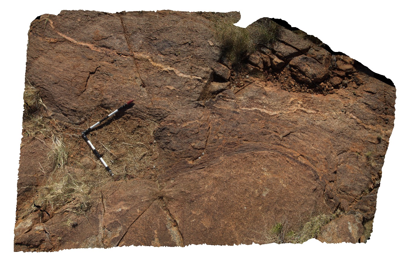
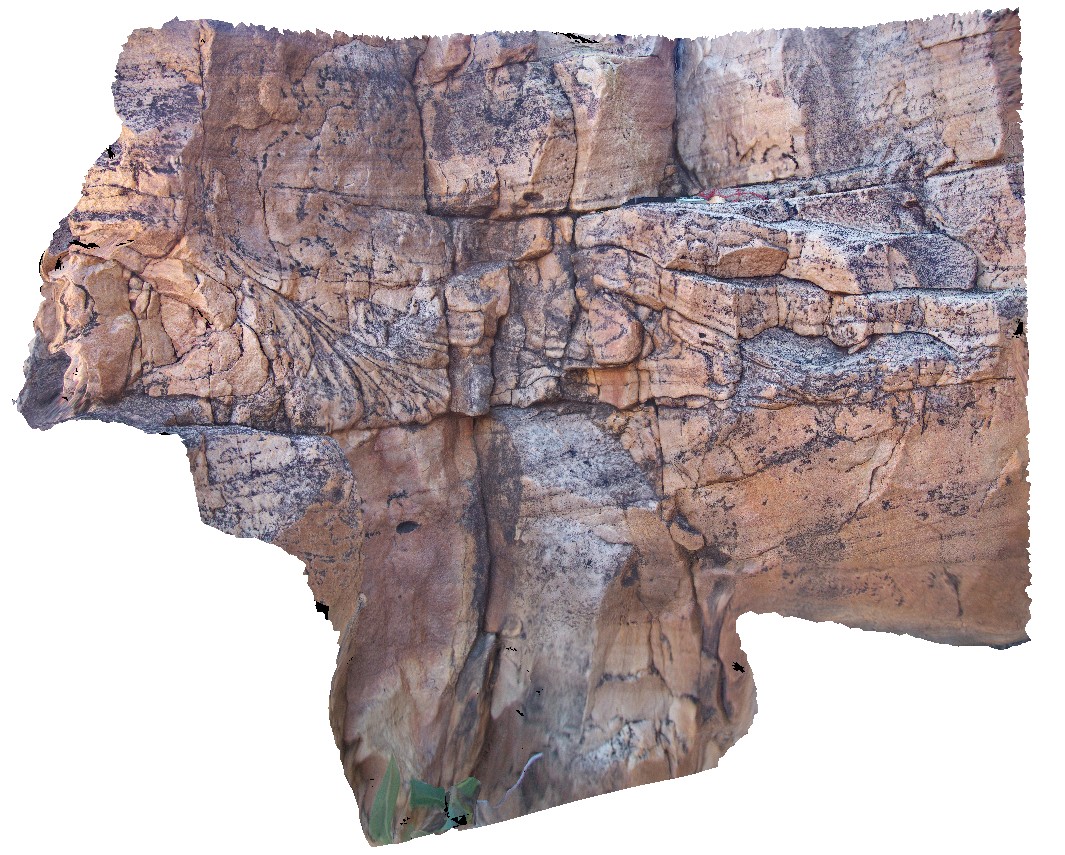
Mitchell2 Map
 |
0 |
06/08/2016 noon |
3D |
bedforms in King Leopold Sandstone, including cross beds and convoluted bedding. Mitchell Falls, Mitchell River, Kimberley. W.A. |
7.50 |
-14.82099000000 |
125.69496000000 |
-9999.000 |
King Leopold Sandstone, cross bedding, convoluted bedding |
sandstone |
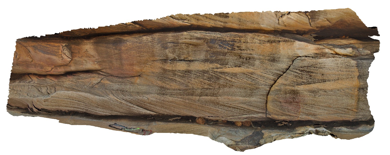
Mitchell3 Map
 |
0 |
06/08/2016 noon |
3D |
detail of convoluted / slumped beds in King Leopold Sandstone. Mitchell Falls, Mitchell River, Kimberley. W.A. |
1.40 |
-14.82101000000 |
125.69493000000 |
-9999.000 |
King Leopold Sandstone, convoluted bedding, slumped beds |
sandstone |
Mitchell4 Map
 |
0 |
06/08/2016 noon |
3D |
cross beds in King Leopold Sandstone. Mitchell Falls, Mitchell River, Kimberley. W.A. |
5.00 |
-14.82103000000 |
125.69504000000 |
-9999.000 |
King Leopold Sandstone, sandstone, sedimentology, cross bedding |
sandstone |
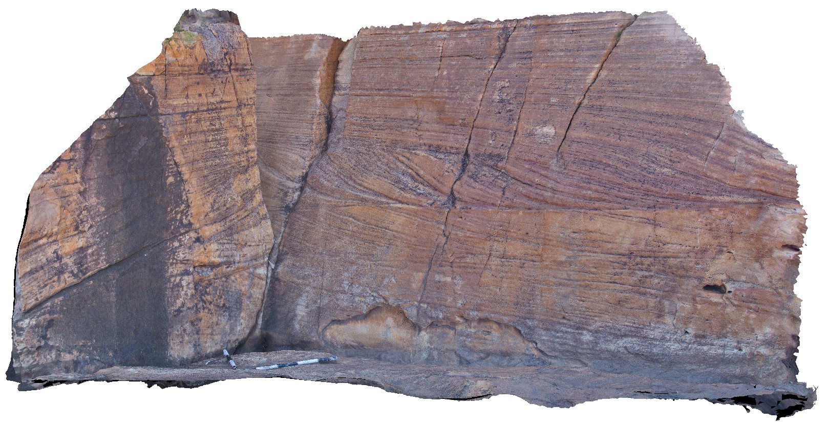
Mitchell5 Map
 |
0 |
06/08/2016 noon |
3D |
rock art at the Little Mertens Waterfall. Mitchell Falls, Mitchell River, Kimberley. W.A. |
3.00 |
-14.82103000000 |
125.69504000000 |
-9999.000 |
rock art, sandstone |
sandstone |
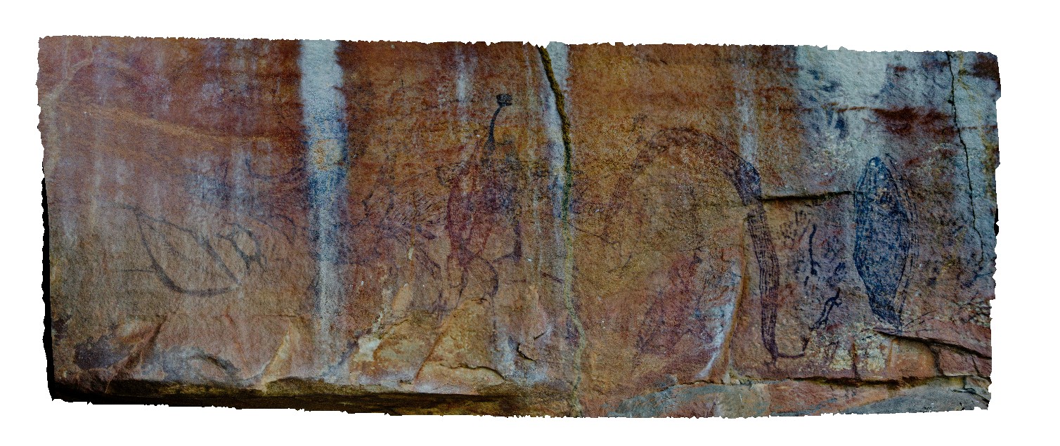
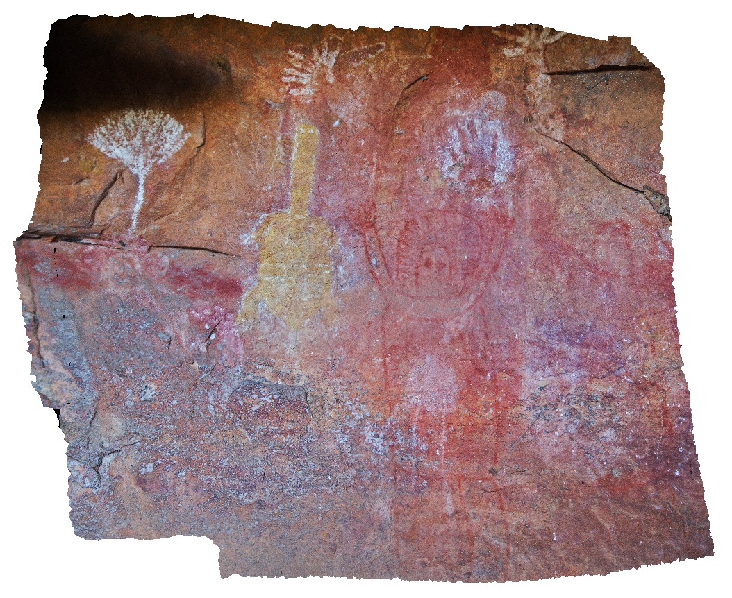
Mitchell6 Map
 |
0 |
06/08/2016 noon |
3D |
rock art at the Little Mertens Waterfall. Mitchell Falls, Mitchell River, Kimberley. W.A. |
5.00 |
-14.82103000000 |
125.69504000000 |
-9999.000 |
rock art, sandstone, Mitchell Falls |
sandstone |
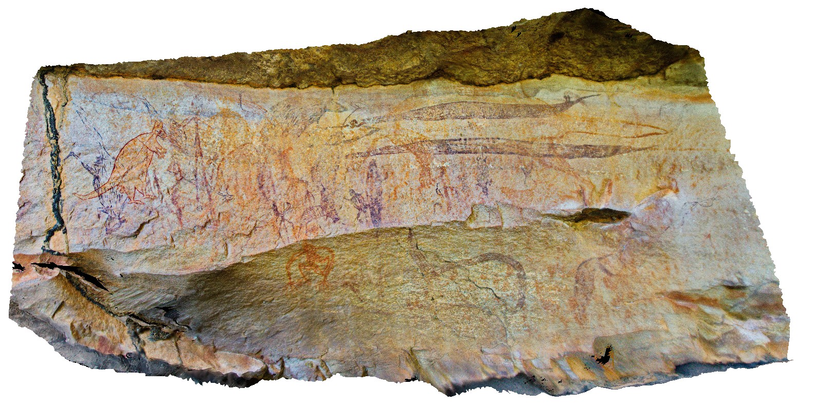
Mitchell7 Map
 |
0 |
06/08/2016 noon |
3D |
rock art at the Little Mertens Waterfall. Mitchell Falls, Mitchell River, Kimberley. W.A. |
0.00 |
-14.82103000000 |
125.69504000000 |
-9999.000 |
rock art, King Leopold Sandstone, Mitchell Falls |
sandstone |
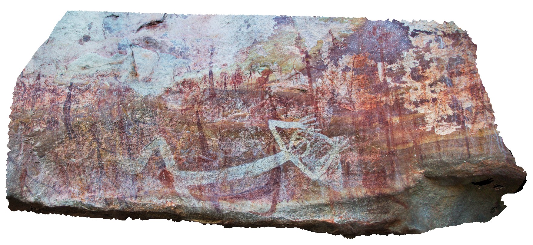
Mitchell8 Map
 |
0 |
06/08/2016 noon |
3D |
rock art at the Little Mertens Waterfall. Mitchell Falls, Mitchell River, Kimberley. W.A. |
1.50 |
-14.82103000000 |
125.69504000000 |
-9999.000 |
sandstone, rock art, Mitchell Falls |
sandstone |