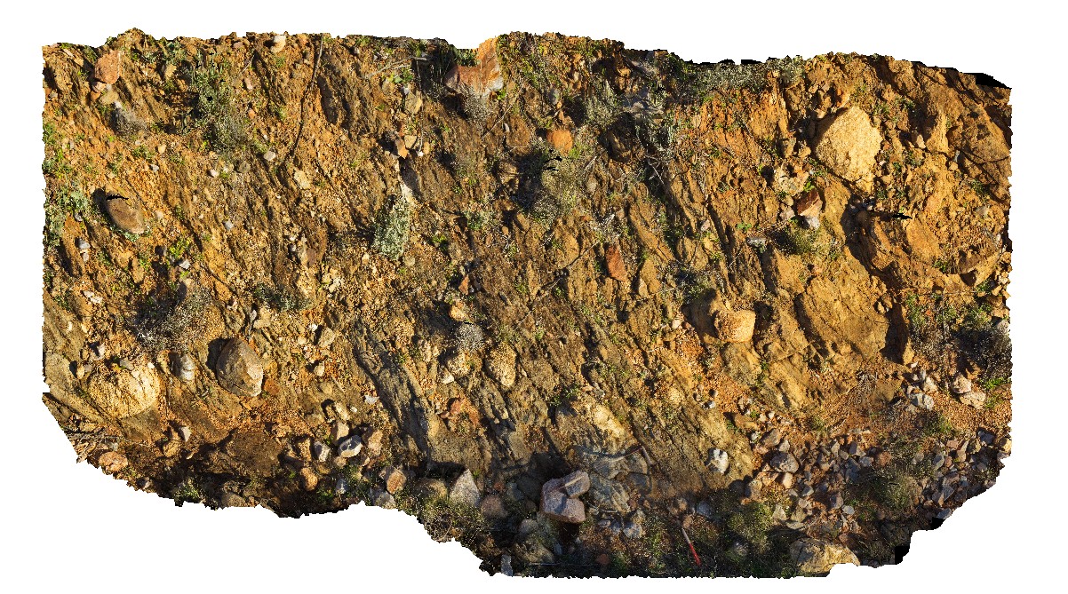
MtGipps4 Map
 |
0 |
06/25/2016 noon |
3D |
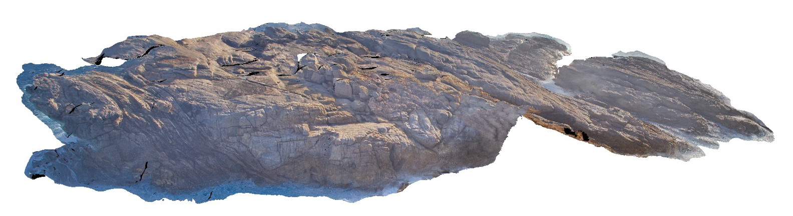
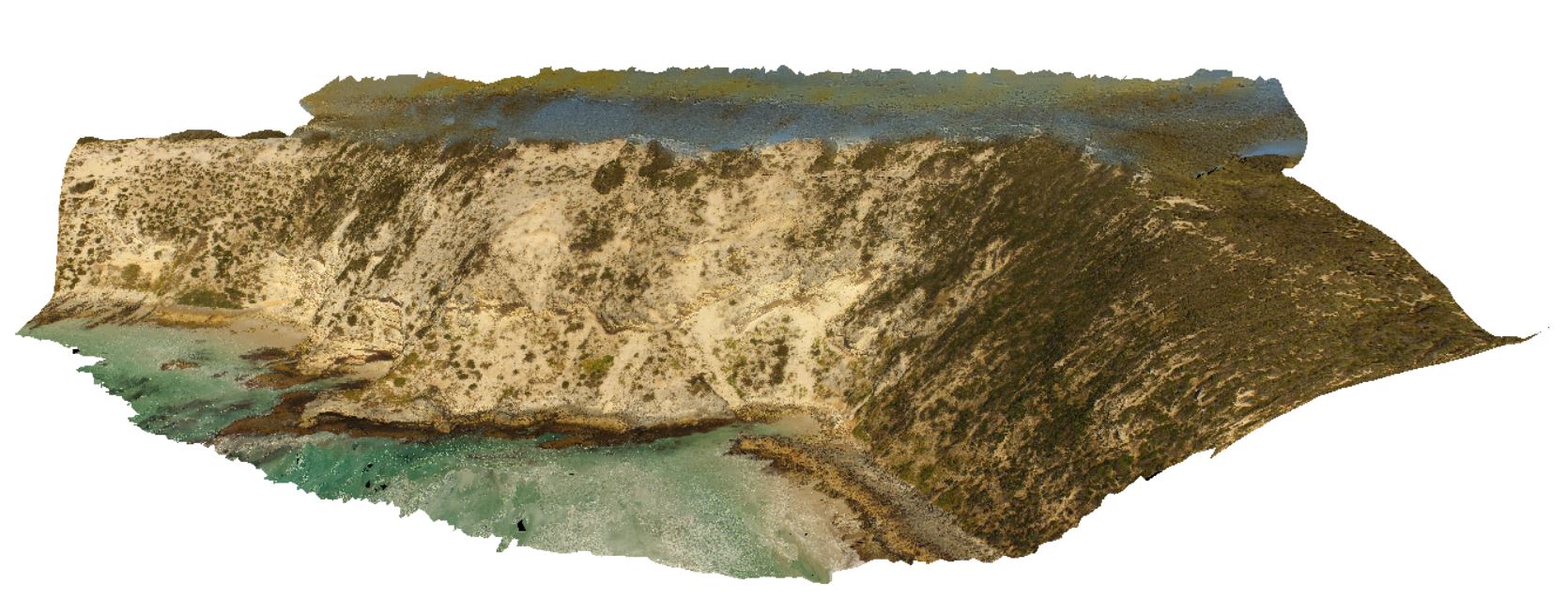
Adelaidean diamictite. Mount Gipps, N.S.W. |
0.00 |
-31.60959000000 |
141.52582000000 |
-9999.000 |
diamictite, Adelaidean, structure |
diamictite |
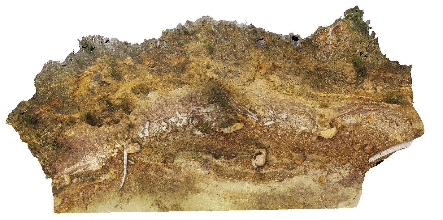
ParkersUAV1 Map
 |
20 |
01/01/9999 midnight |
UAV |
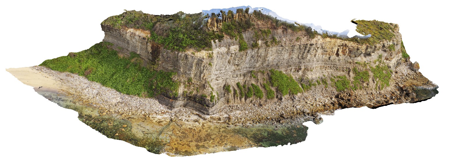
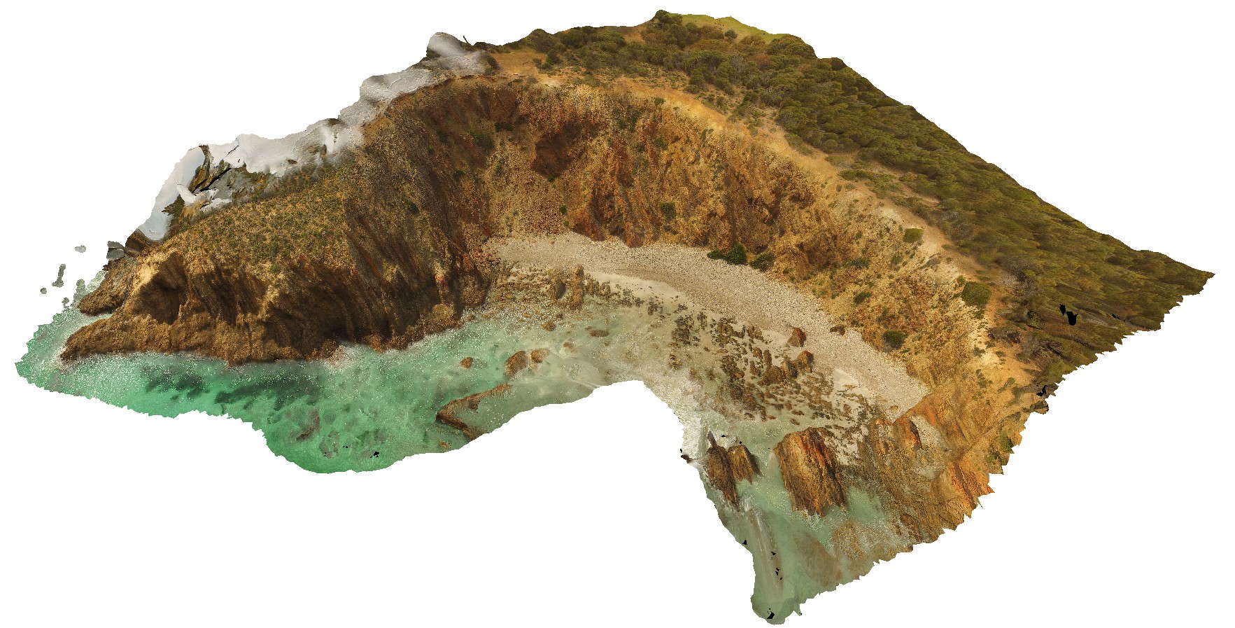
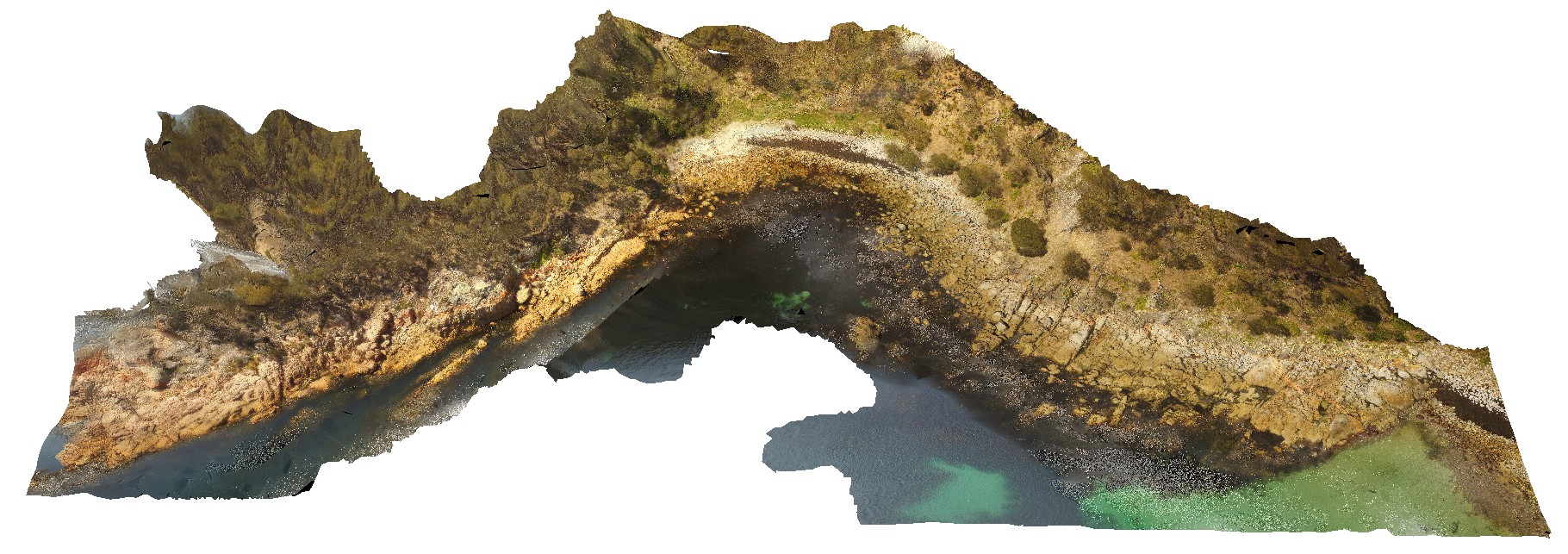
aerial overall view of Triassic outcrop, showing fluvial and floodplain sediments. Parkers Beach, Nubeena Tasmania. |
65.00 |
-43.04808900000 |
147.79449400000 |
27.000 |
fluvial, flood plain, sedimentology, Triassic |
sandstone |
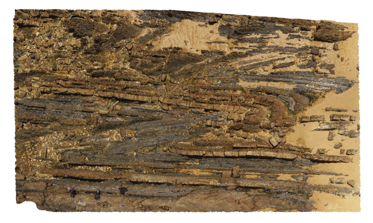
BellinghamUAV1 Map
 |
20 |
01/01/9999 midnight |
UAV |
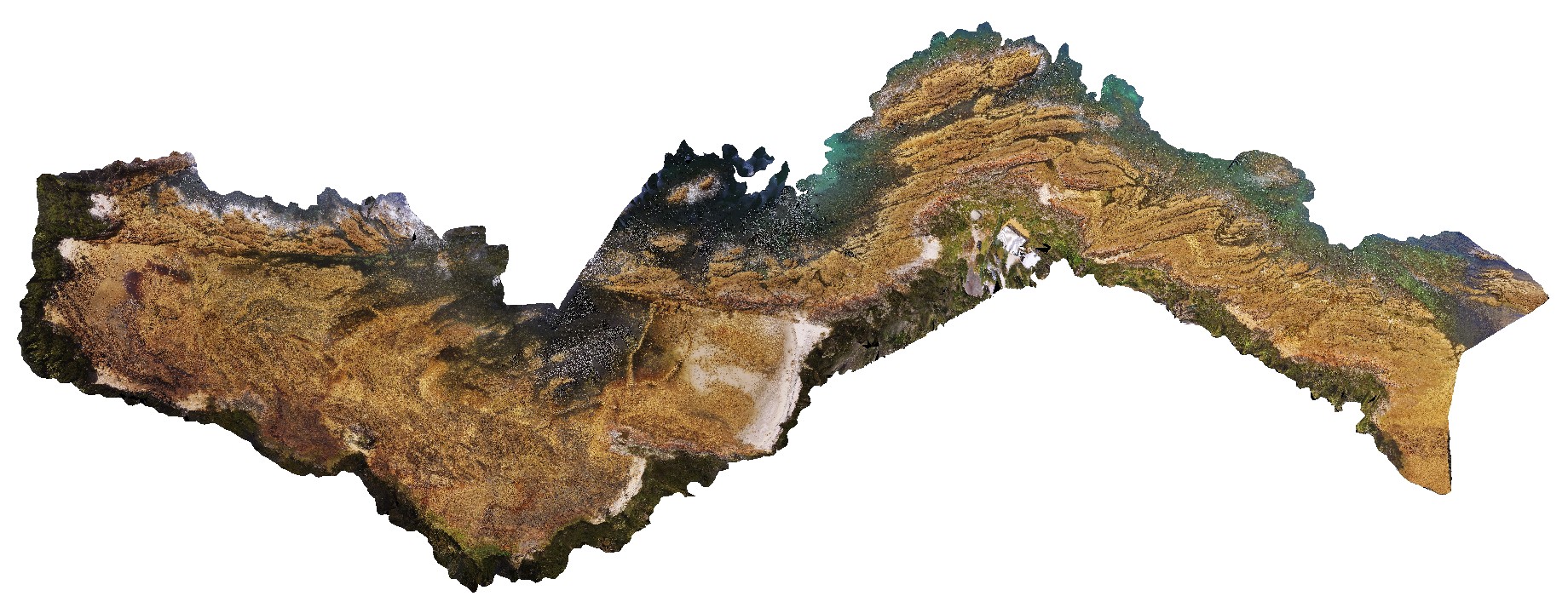
aerial overview of folded and faulted, thick turbidite package at Bellingham, NE Tasmania. View taken from 60m above the ground. |
500.00 |
-41.00721400000 |
147.16257300000 |
186.700 |
structure, turbidite package, fold, fault |
turbidite |
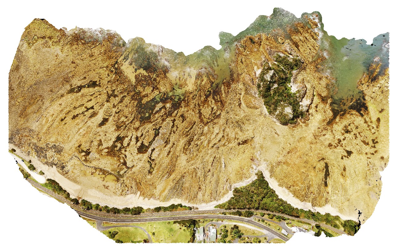
GoatIslandUAV1 Map
 |
50 |
01/01/9999 midnight |
UAV |
aerial over view of folded metamorphic sediments of the Burnie Formation (Oonah Formation) and Ulverstone Metamorphics, which includes the Goat Island Conglomerate. Goat Island, Ulverstone. North Tasmania. |
680.00 |
-41.13575600000 |
146.13587000000 |
55.000 |
metasediments, Burnie Formation, Ulverstone Metamorphics, geological contact |
metasediments, metasediments |
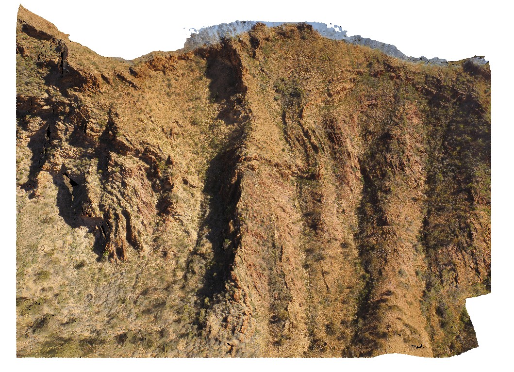
DudleyUAV1 Map
 |
20 |
01/01/9999 midnight |
UAV |
aerial overview of the Dudley outcrop, including Victoria's Tunnel Coal Seam. Dudley Beach, N.S.W. |
200.00 |
-32.96915300000 |
151.73652300000 |
9.600 |
Victoria's Tunnel Coal Seam, floodplain sediments, sedimentology |
sediments |
BellinghamUAV3 Map
 |
20 |
01/01/9999 midnight |
UAV |
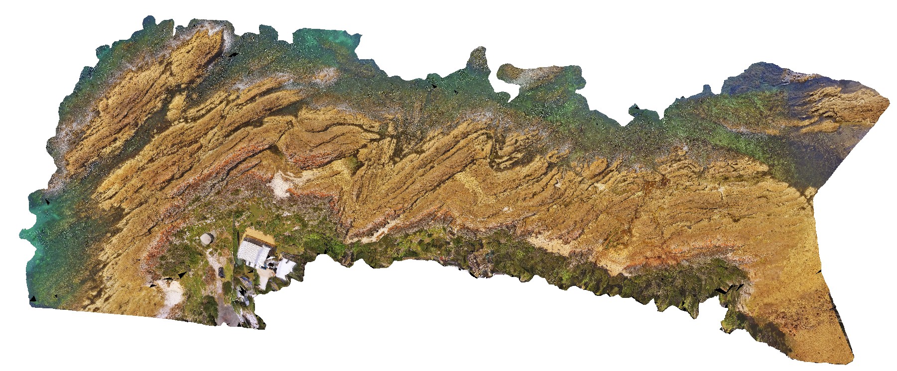
aerial overview of tightly folded parasitic folds in turbidites of the Retreat Formation. View is larger than the earlier UAV images. Bellingham, NE Tasmania. |
173.00 |
-41.00787600000 |
147.16153900000 |
20.000 |
parasitic folds, fold, structure, turbidite, sedimentology, tight fold |
turbidite |
IronstonePtUAV1 Map
 |
20 |
01/01/9999 midnight |
UAV |
aerial view around Ironstone Point and basaltic flows and associated volcanics. Ironstone Point. Tasmania. |
200.00 |
-42.97061200000 |
147.73363000000 |
35.300 |
basalt flow, basalt, volcanics |
basalt |
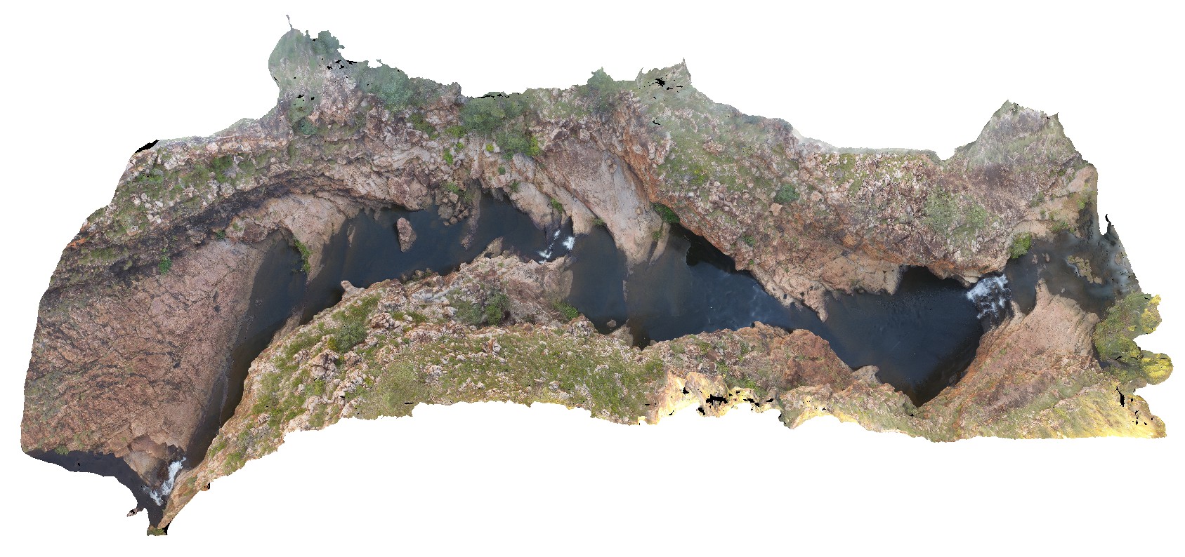
EaglehawkUAV2 Map
 |
20 |
01/01/9999 midnight |
UAV |
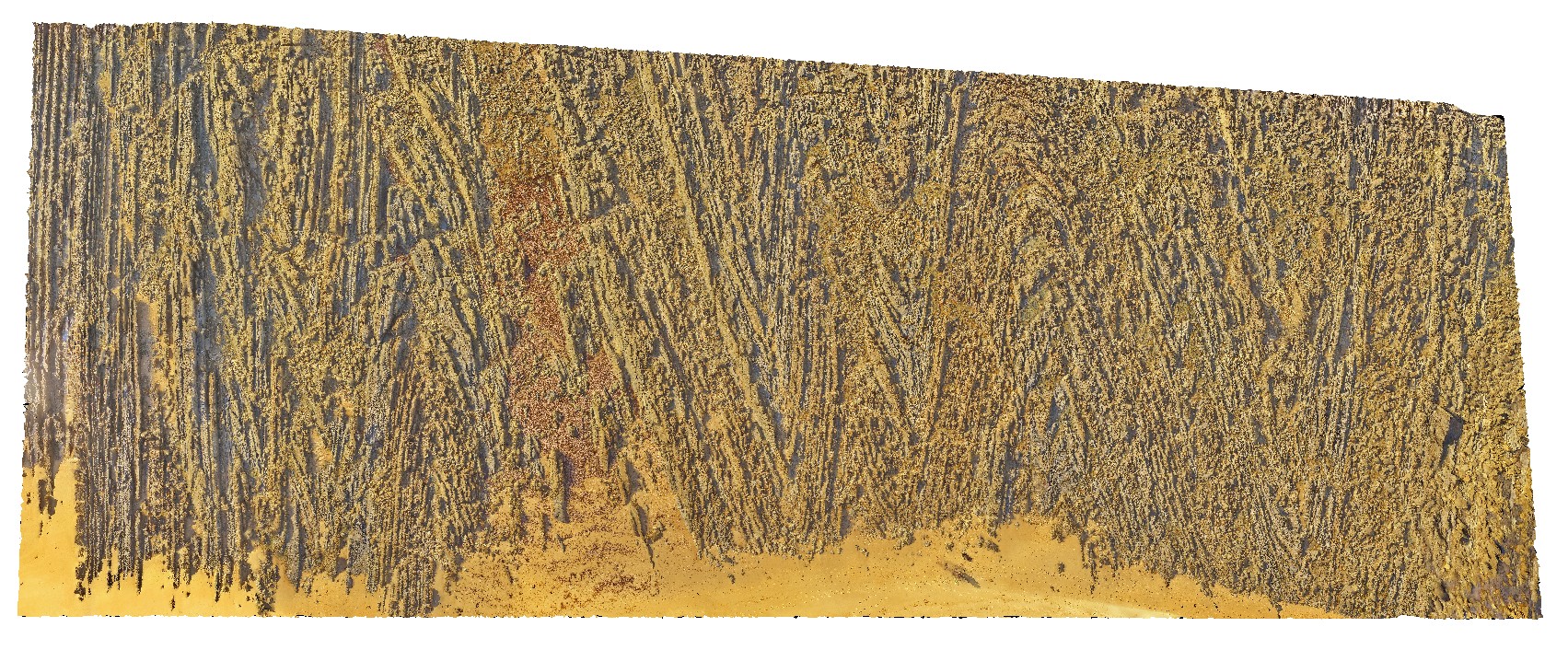
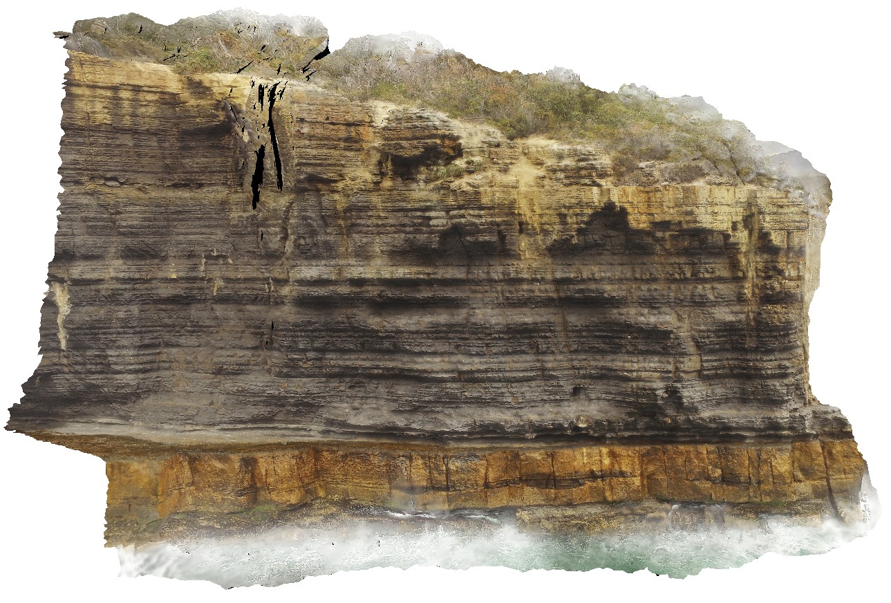
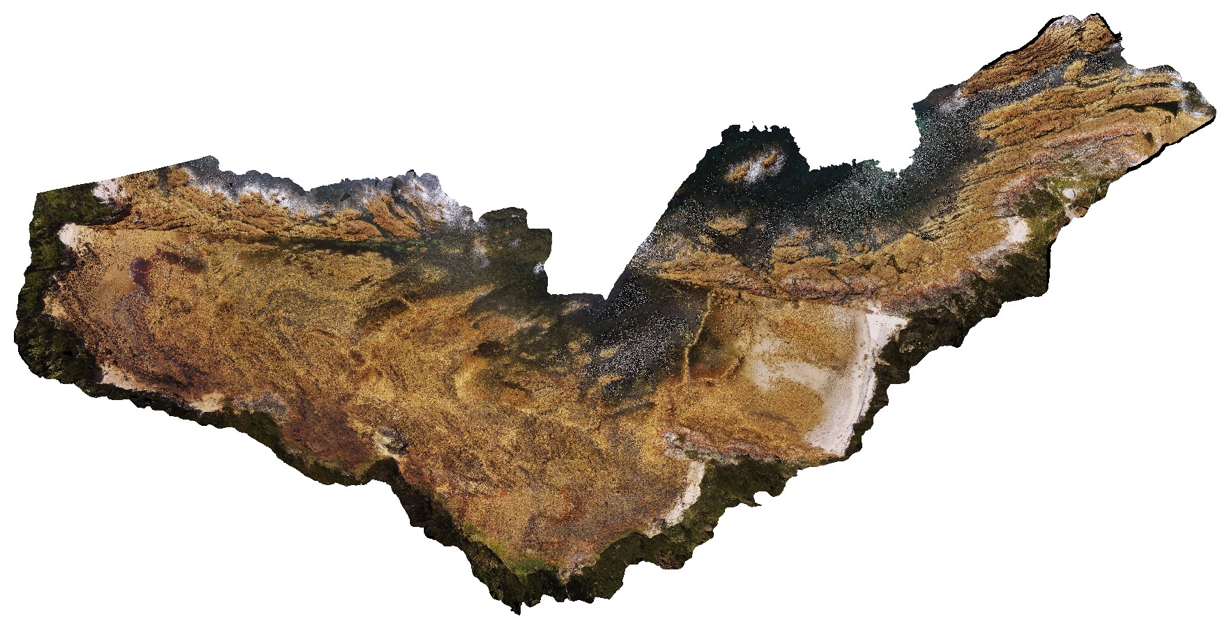
aerial view from the water of cliff, showing finely layered fine-grained mudstones / siltstones overlying blocky silt / sandstone beds. Eaglehawk Neck, Tasmania. |
120.00 |
-43.03425300000 |
147.94985100000 |
41.000 |
sedimentology, sediments, Parmeener Supergroup |
sediments |
Carnot10 Map
 |
20 |
10/29/2015 9:46 a.m. |
3D |
Aerial view, looking back toward Cape Carnot, showing banded gneiss / shear zone. Cape Carnot. S.A. |
50.00 |
-34.94329600000 |
135.61994200000 |
-9999.000 |
gneiss, shear zone |
gneiss |
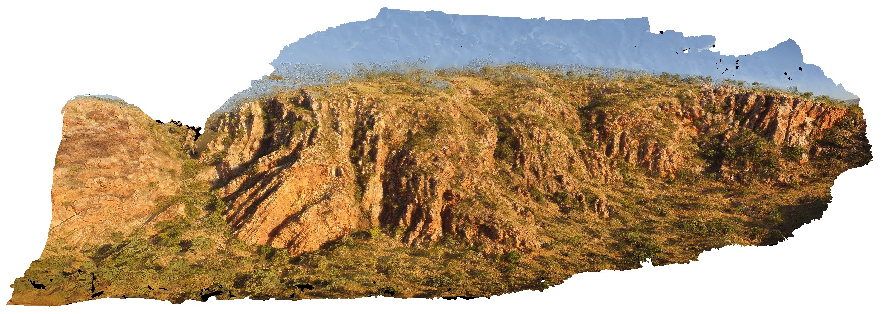
GibbRiverUAV1 Map
 |
0 |
06/06/2016 noon |
UAV |
aerial view near Mount Bell, showing open, upright folded King Leopold sandstone. Derby-Gibb River Road, Kimberly, W.A. |
100.00 |
-17.17522100000 |
125.29286500000 |
-9999.000 |
open fold, sandstone, structure |
sandstone |
MtGippsUAV1 Map
 |
0 |
06/27/2016 noon |
UAV |
aerial view of Adeladiean Contact. Near Corona Road, Mount Gipps Station. Broken Hill. N.S.W. |
200.00 |
-31.61151600000 |
141.52838700000 |
-9999.000 |
geological unconformity |
metasediments |
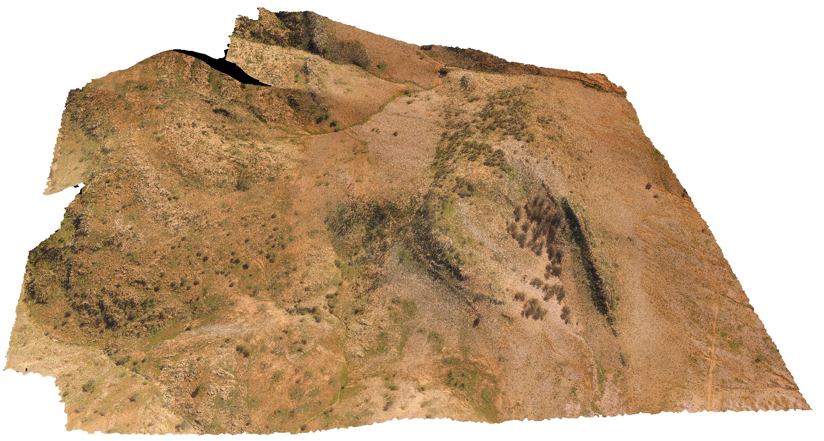
TableHillUAV1 Map
 |
0 |
05/28/2016 noon |
UAV |
aerial view of a Mesa, capped by calcrete - Tertiary land surface. Ashburton Downs - Meekatharra Road, W.A. |
100.00 |
-23.64748200000 |
117.45549200000 |
-9999.000 |
mesa, tertiary land surface |
sediments, calcrete |
LimebayUAV3 Map
 |
20 |
01/01/9999 midnight |
UAV |
Aerial view of basaltic volcanic breccia and volcanic deposits intruded by multiple, thin basaltic dykes. Lime Bay, Tasmania. |
300.00 |
-42.94014400000 |
147.69268800000 |
18.000 |
volcanics, basalt dyke, dyke |
basalt, basalt |
StokesUAV1 Map
 |
20 |
01/01/9999 midnight |
UAV |
aerial view of bedded sandstone, showing very open folding / kinks in steeply dipping beds. King George Bay, Kangaroo Island. |
200.00 |
-35.65456700000 |
137.11588900000 |
-9999.000 |
bedding, fold, kink fold, structure |
sandstone |
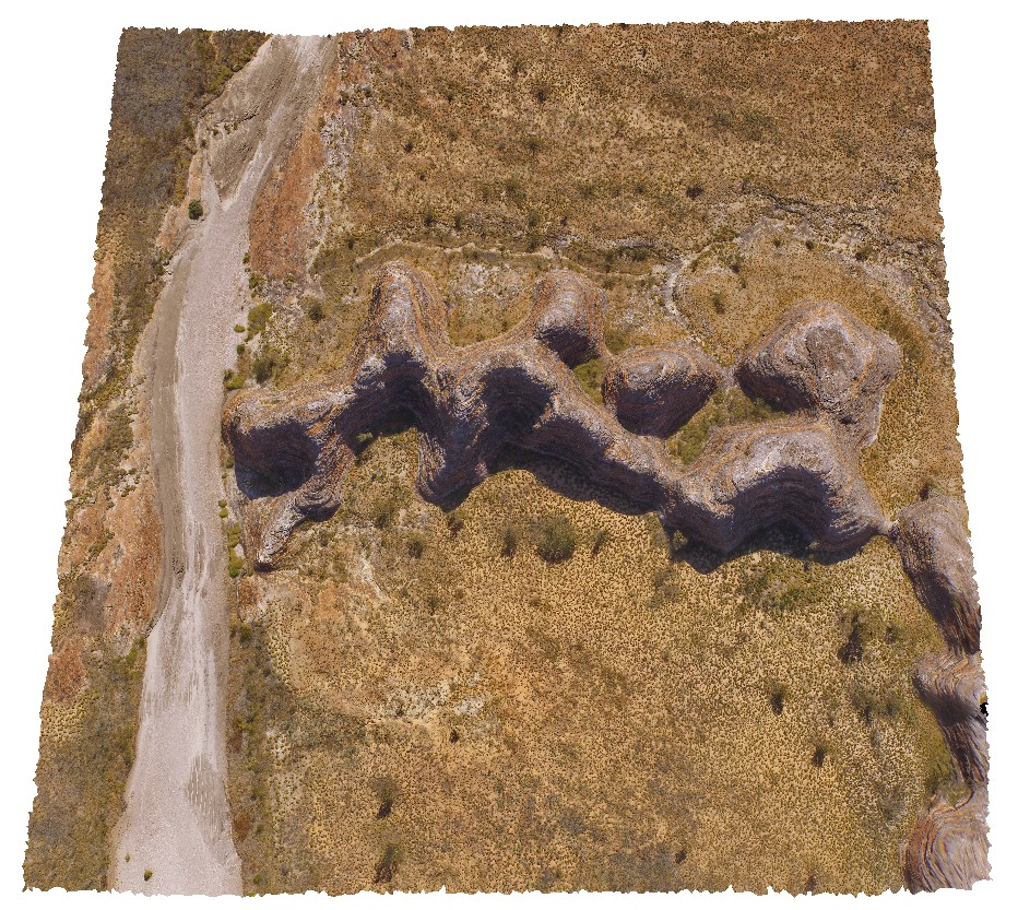
PurnululuUAV1 Map
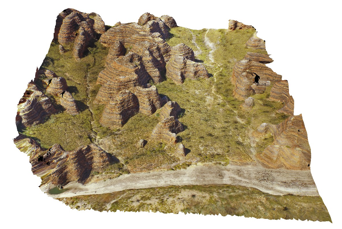 |
0 |
06/12/2016 noon |
UAV |
aerial view of 'bee Hive' formations at the Bungle Bungles. Purnululu National Park, W.A. |
50.00 |
-17.48400500000 |
128.38151400000 |
-9999.000 |
Bee Hive, Bungle Bungles, weathering formation, sandstone |
sandstone |
PurnululuUAV2 Map
 |
0 |
06/12/2016 noon |
UAV |
aerial view of 'bee Hive' formations at the Bungle Bungles. Purnululu National Park, W.A. |
50.00 |
-17.48472000000 |
128.37810600000 |
-9999.000 |
weathering feature, Bungle Bungles, Purnululu |
sandstone |
GibbRiverUAV2 Map
 |
0 |
06/06/2016 noon |
UAV |
aerial view of Bell Creek Gorge, showing cascades over gently dipping sandstone beds. Bell Creek Gorge, Derby - Gibb River Road, Kimberly, W.A. |
100.00 |
-16.99212500000 |
125.20405400000 |
-9999.000 |
Bell Creek Gorge, dip, sandstone |
sandstone |
BluestoneUAV1 Map
 |
20 |
01/01/9999 midnight |
UAV |
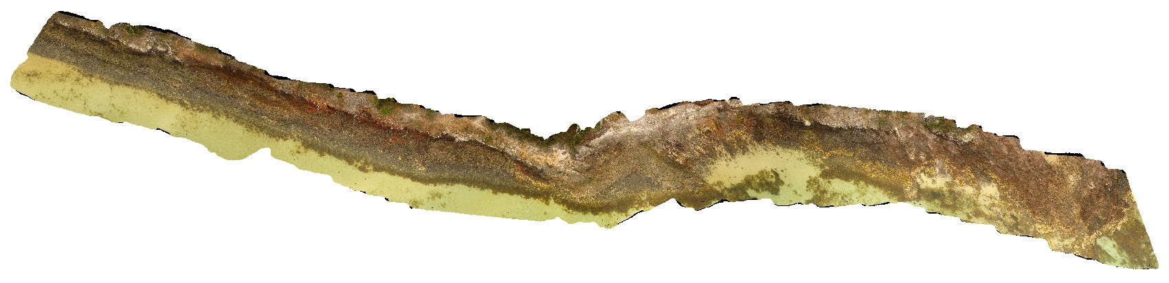
aerial view of Bluestone Bay granodiorite shore exposure, Freycinet. Tasmania. |
200.00 |
-42.10529100000 |
148.33442900000 |
24.700 |
granite |
granodiorite |
NTasUAV6 Map
 |
20 |
01/01/9999 midnight |
UAV |
aerial view of Boat Harbour foreshore, combine NTasUAVs 4 & 5 |
0.00 |
-40.92560000000 |
145.61093300000 |
-9999.000 |
|
|
NTasUAVFSP2 Map
 |
20 |
01/01/9999 midnight |
UAV |
aerial view of Boat Harbour foreshore, showing macro-scale folding in moderately dipping rocks. Boat Harbour, north Tasmania. |
0.00 |
-40.92531200000 |
145.61275600000 |
-9999.000 |
fold, structure, bedding |
quartzite |
NTasUAV4 Map
 |
20 |
01/01/9999 midnight |
UAV |
aerial view of Boat Harbour foreshore, showing macro-scale folding in moderately dipping rocks. Boat Harbour, north Tasmania. |
100.00 |
-40.92489400000 |
145.61249400000 |
-9999.000 |
fold, dip, structure |
quartzite |
NTasUAV5 Map
 |
20 |
01/01/9999 midnight |
UAV |
aerial view of Boat Harbour foreshore, showing macro-scale folding in moderately dipping rocks. Boat Harbour, north Tasmania. |
200.00 |
-40.92560000000 |
145.61093300000 |
-9999.000 |
fold, metamorphic rock |
quartzite |
PenningtonUAV1 Map
 |
0 |
10/20/2015 3:34 p.m. |
UAV |
aerial view of calcarenite cliff at Pennington, Kangaroo Island. |
100.00 |
-35.85815100000 |
137.73509800000 |
-9999.000 |
calcarenite, cliff |
calcarenite |
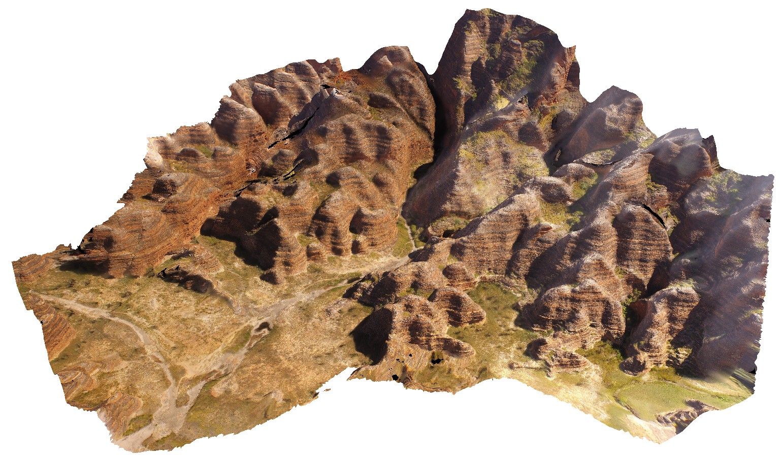
PurnululuUAV3 Map
 |
0 |
06/12/2016 noon |
UAV |
aerial view of 'C' group of 'bee Hive' formations at the Bungle Bungles, near Piccaninny Creek. Purnululu National Park, W.A. |
50.00 |
-17.49130800000 |
128.38355900000 |
-9999.000 |
Bee Hive, weathering features, sandstone, Bungle Bungles |
sandstone |
AMADUAV1 Map
 |
5 |
07/27/2016 11:20 a.m. |
UAV |
aerial view of chaotic folded sediments from the Bitter Springs Group. Bitter Springs Gorge, N.T. |
500.00 |
-23.54199600000 |
134.46085000000 |
534.638 |
chaotic folding, sediments, fold, structure, Bitter Springs |
sediments |