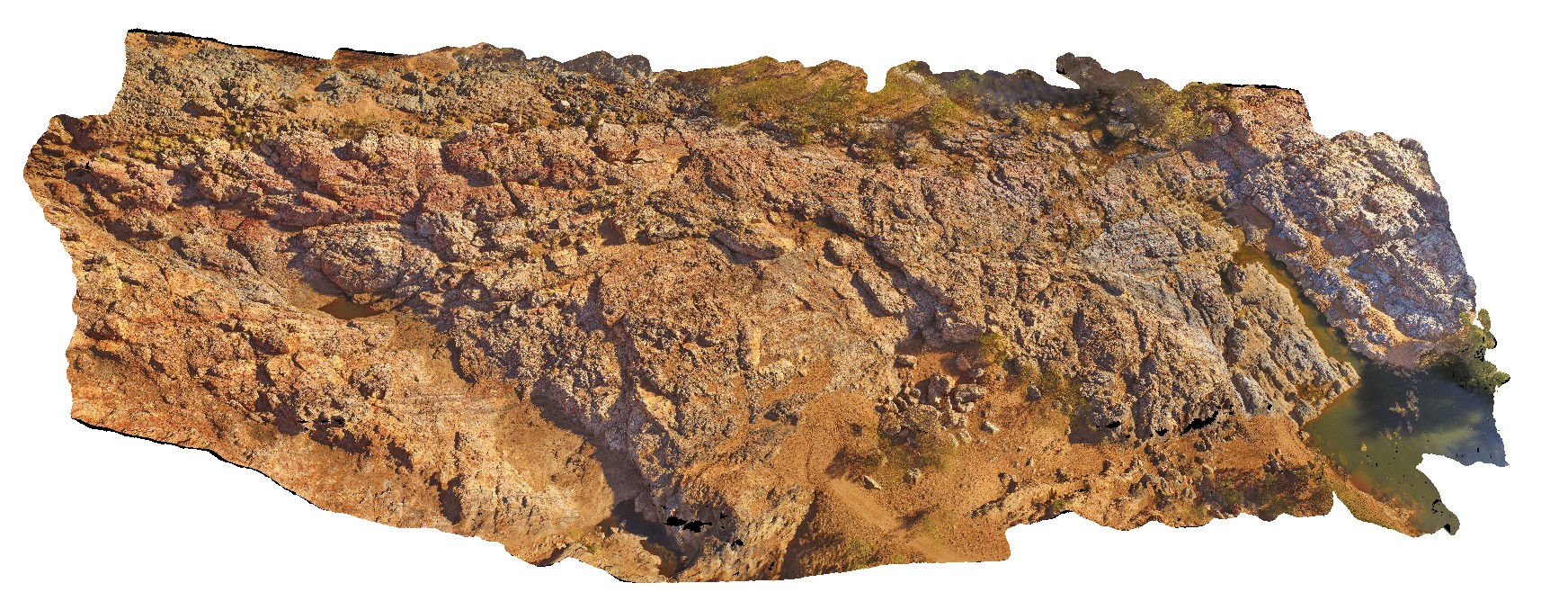
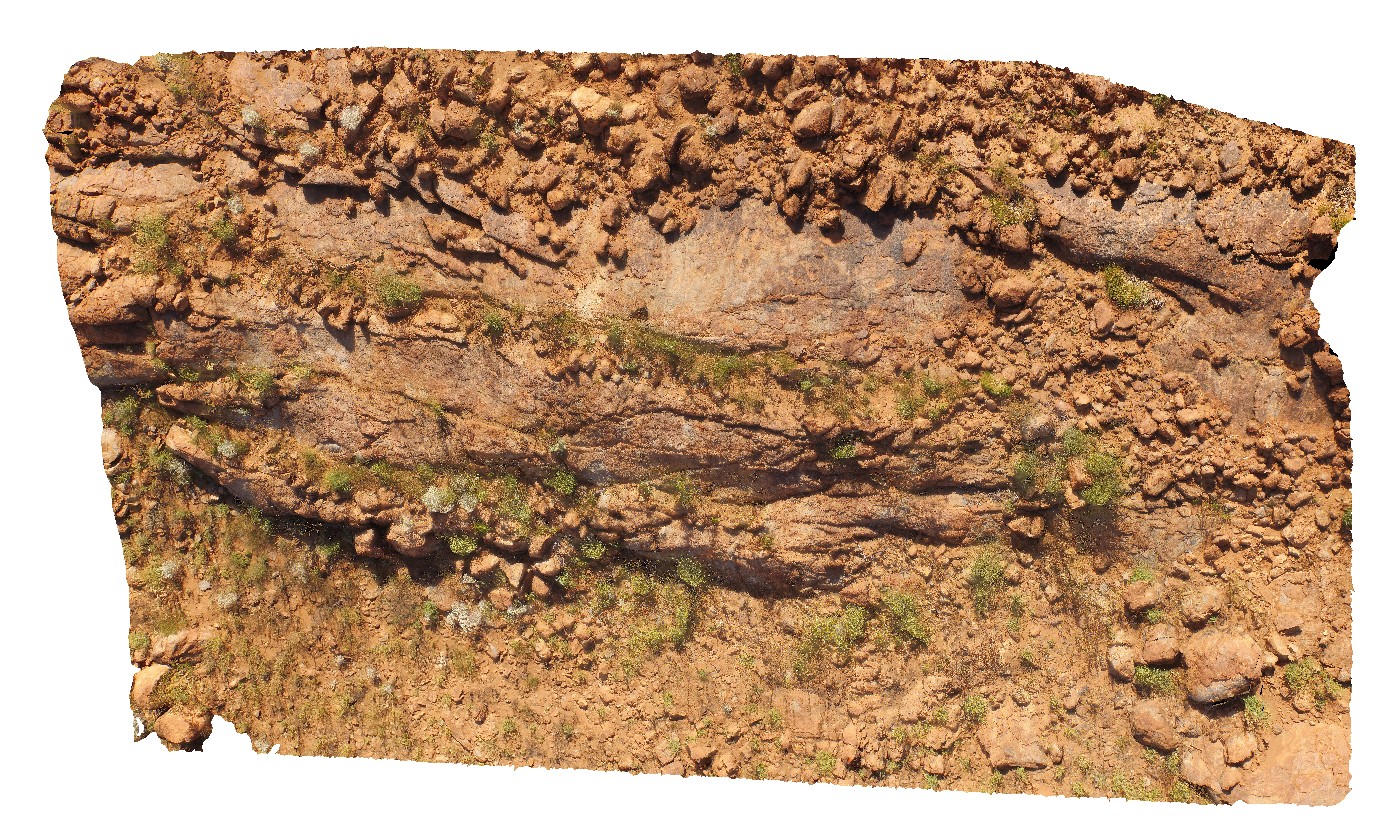
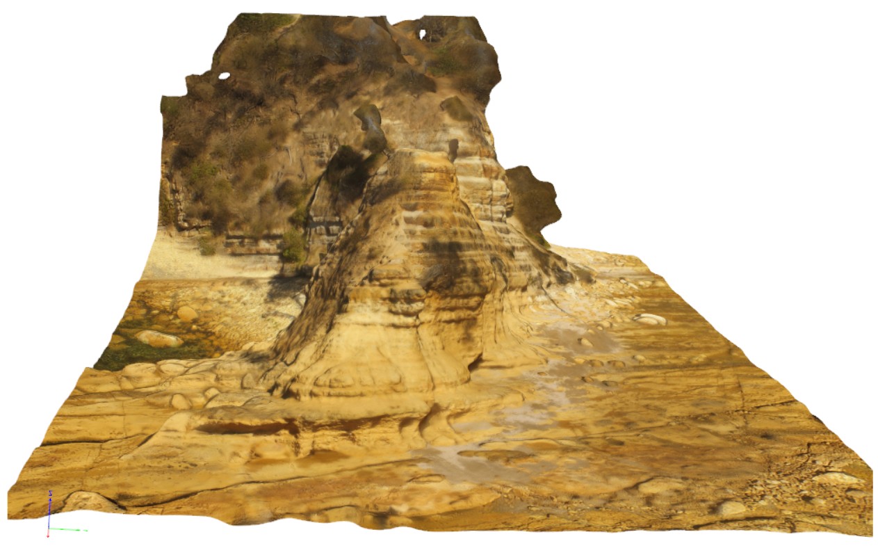
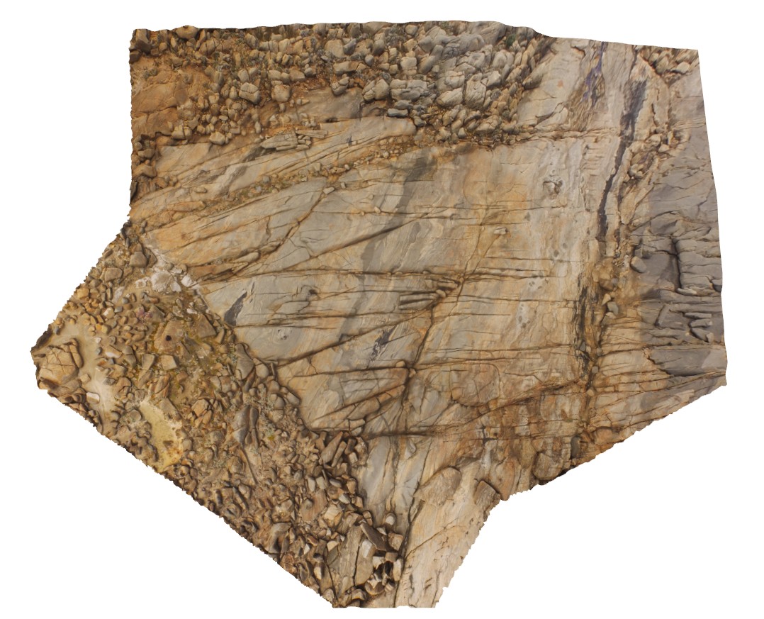
MarbleBarUAV1 Map
 |
0 |
06/01/2016 noon |
UAV |
aerial view of chert layers east of Coongan River. Marble Bar, W.A. |
50.00 |
-21.18658320000 |
119.71182720000 |
-9999.000 |
layered chert, Marble Bar Chert Member |
chert |
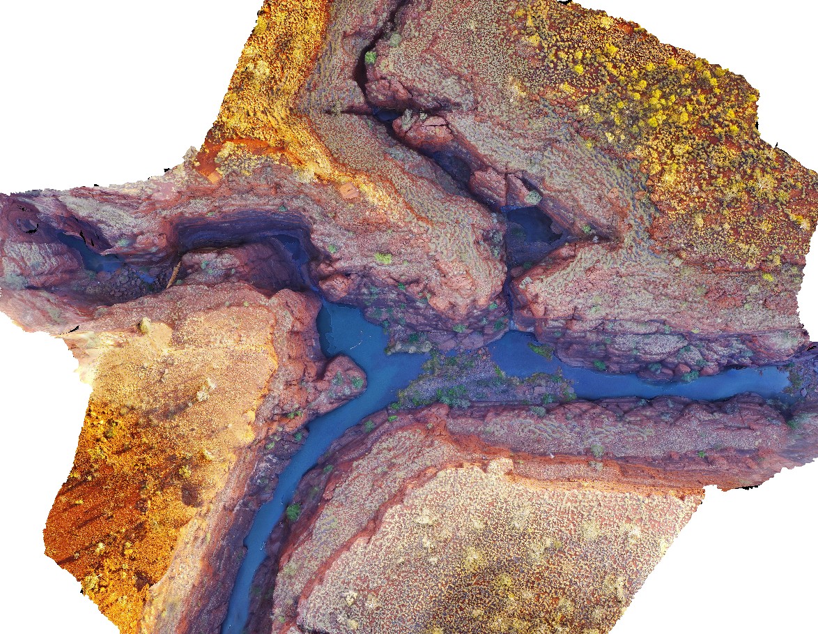
KarijiniUAV2 Map
 |
0 |
05/29/2016 noon |
UAV |
aerial view of confluence of Handcock and Weano gorges. Brockman Iron Formation. Karijini National Park. W.A. |
1000.00 |
-22.36123000000 |
118.28945000000 |
-9999.000 |
Banded Iron Formation, sedimentology, Brockman Iron Formation |
BIF |
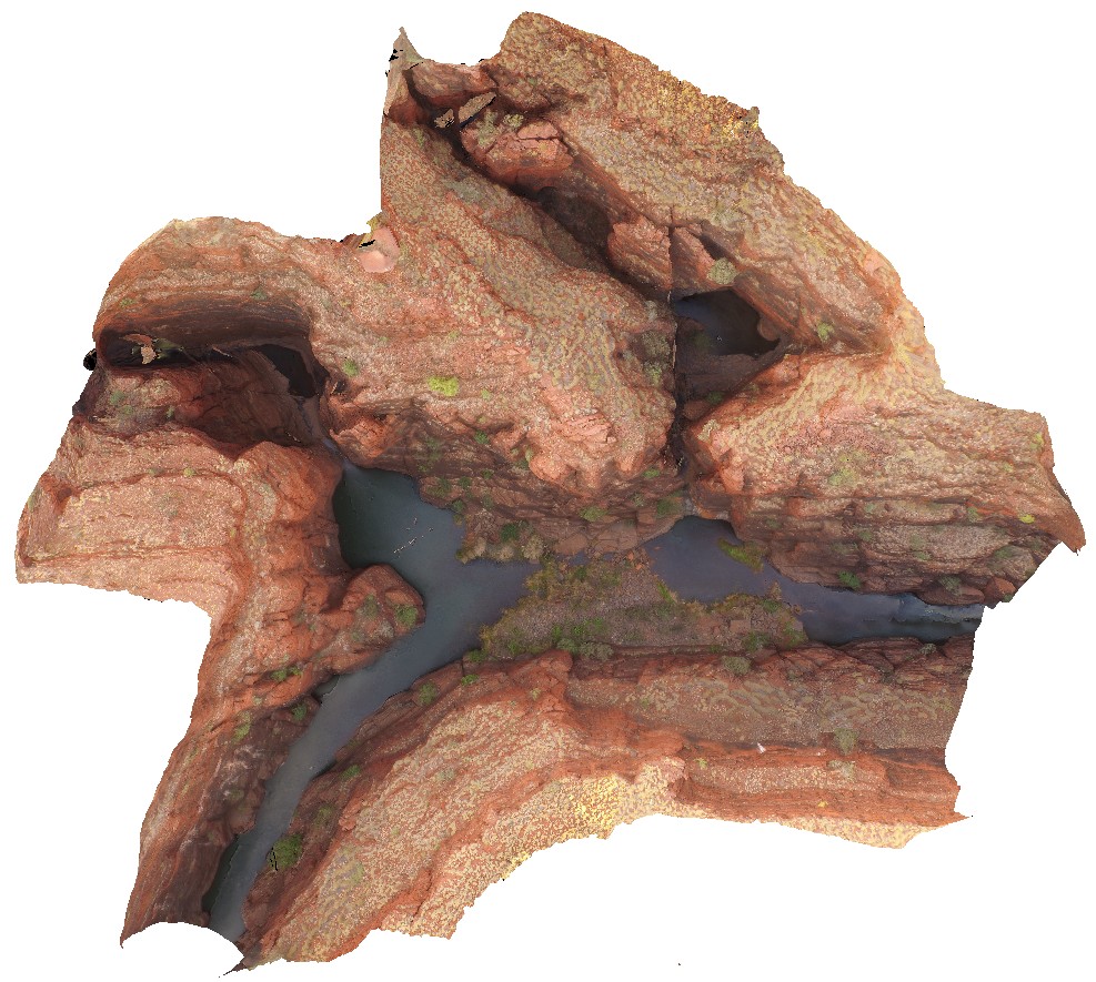
KarijiniUAV1 Map
 |
0 |
05/29/2016 noon |
UAV |
aerial view of confluence of Handcock and Weano gorges. Brockman Iron Formation. Karijini National Park. W.A. |
1000.00 |
-22.36102700000 |
118.28921700000 |
-9999.000 |
gorge, Brockman Iron Formation, banded iron formation, sedimentology |
BIF |
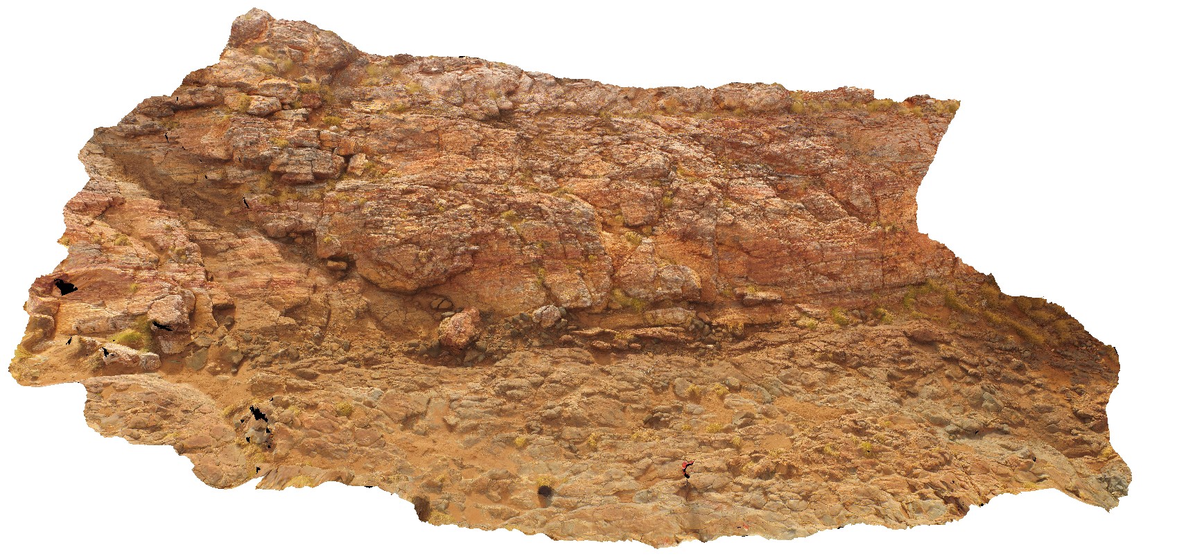
MarbleBarUAV3 Map
 |
0 |
06/01/2016 noon |
UAV |
aerial view of contact between Marble Bar Chert Member and pillow basalt. The Marble Bar, Coongan River, W.A. |
25.00 |
-21.18658320000 |
119.71182720000 |
-9999.000 |
geological contact, chert, pillow basalt |
chert, basalt |
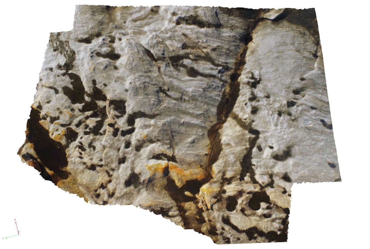
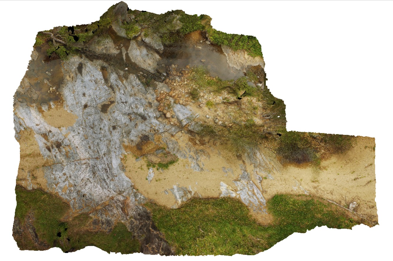
PtEllenUAV1 Map
 |
0 |
10/20/2015 3:47 p.m. |
UAV |
aerial view of deformed Kanmantoo metasediments, with cross cutting dykes. Point Ellen, Kangaroo Island. |
300.00 |
-35.99885900000 |
137.18634400000 |
-9999.000 |
metasediments, dyke |
sediments |
DevmUAV1 Map
 |
5 |
07/22/2016 12:22 p.m. |
UAV |
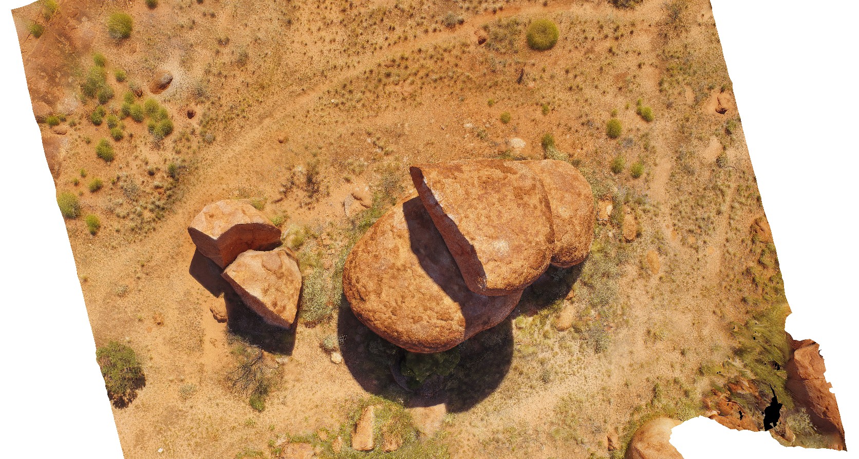
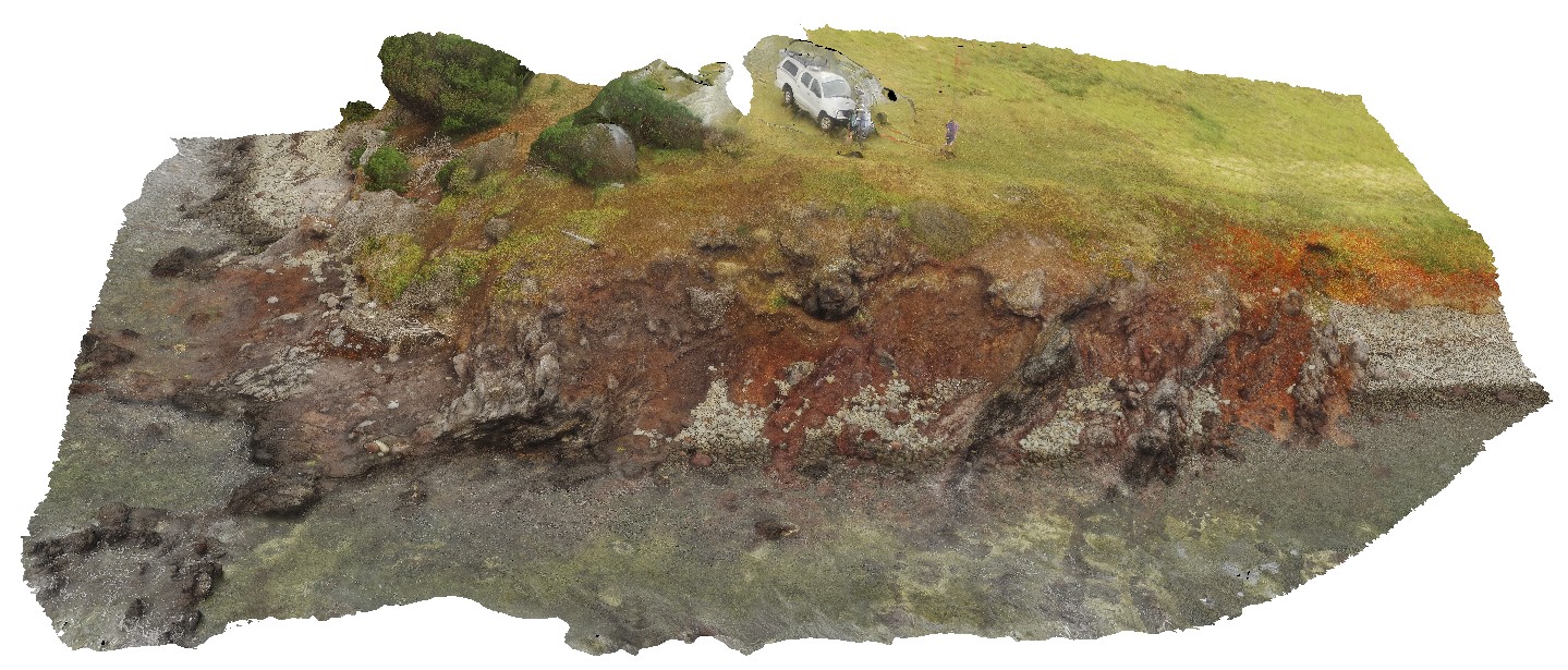
aerial view of Devil's Marbles granite outcrop. Karlu Karlu / Devils Marbles Conservation Reserve. N.T. |
50.00 |
-20.55873500000 |
134.26646600000 |
410.176 |
Devils Marbles, granite, weathering |
granite |
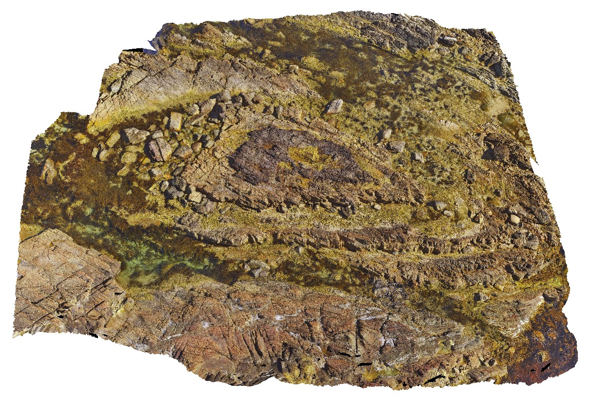
CapeLeGrandeUAV1 Map
 |
0 |
01/01/9999 midnight |
UAV |
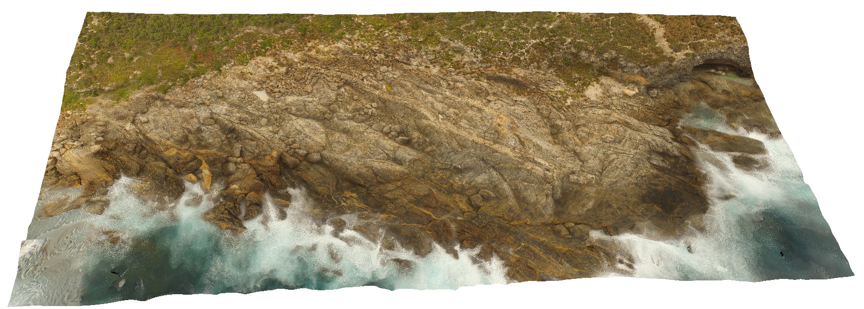
aerial view of disaggregated mafic dykes in gneiss, Cape Le Grande. South coast W.A. |
100.00 |
-34.00378000000 |
122.16901000000 |
-9999.000 |
disaggregated mafic dyke, gneiss |
gneiss, mafic |
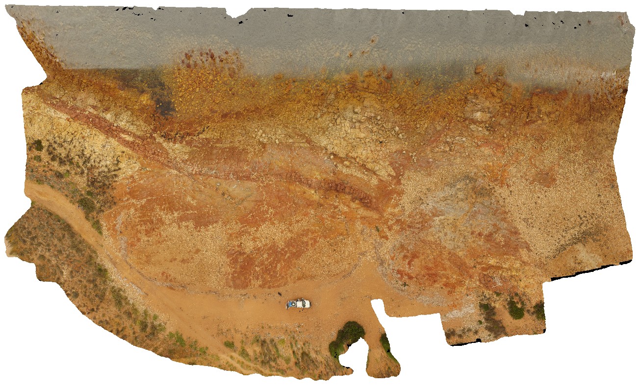
ParkersUAV3 Map
 |
20 |
01/01/9999 midnight |
UAV |
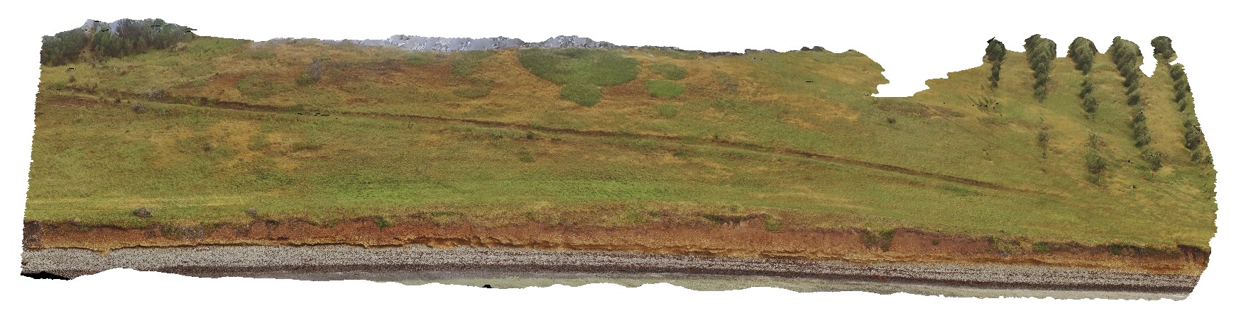
aerial view of entire Parkers Beach outcrop of fluvial and flood plain Triassic sediments. Parkers Beach, Nubeena Tasmania. |
385.00 |
-42.94254100000 |
147.69614700000 |
19.000 |
fluvial, floodplain, sedimentology, Triassic |
sandstone |
BlackjackUAV1 Map
 |
20 |
01/01/9999 midnight |
UAV |
aerial view of exposed layered volcanic package, including basalt lava flows and volcanic breccias. Black Jack Hills, Tas. |
100.00 |
-42.99280500000 |
147.65259900000 |
-9999.000 |
breccia, lava flow, basalt, volcanics, volcanic package |
basalt |
BlackjackUAV2 Map
 |
20 |
01/01/9999 midnight |
UAV |
aerial view of exposed modern paleo-beach deposits of flat cobble shingles. Black Jack Hills, Tas. |
50.00 |
-42.99353100000 |
147.65130500000 |
70.729 |
paleo-beach deposit, paleo land form, shingles |
conglomerate |
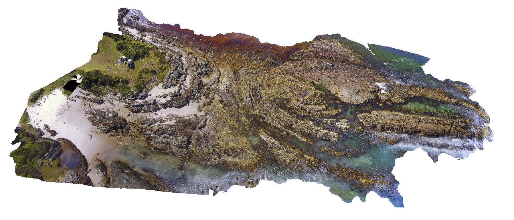
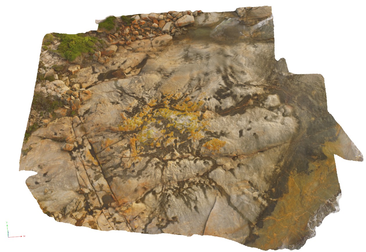
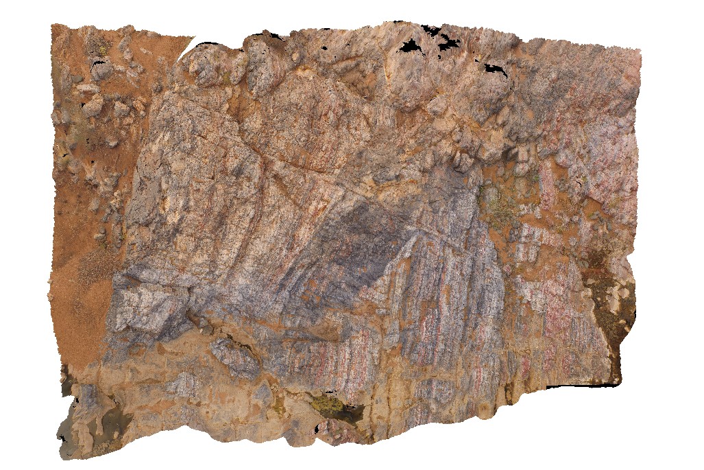
KirtonUAV1 Map
 |
20 |
10/20/2015 3:07 p.m. |
UAV |
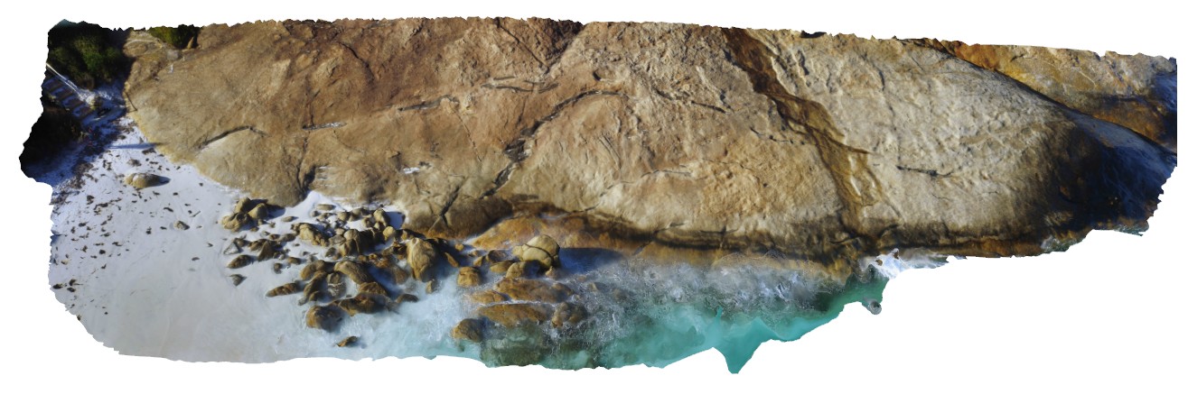
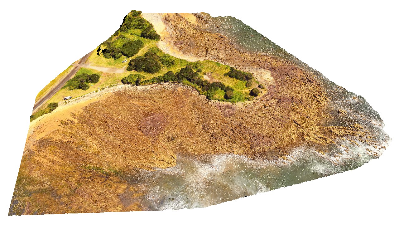
aerial view of exposed shore platform, showing Kirton Point and the Colbert Granite/ granite gneiss, with mafic intrusives? Port Lincoln. S.A. |
300.00 |
-34.72473000000 |
135.88480000000 |
-9999.000 |
granite gneiss |
granite |
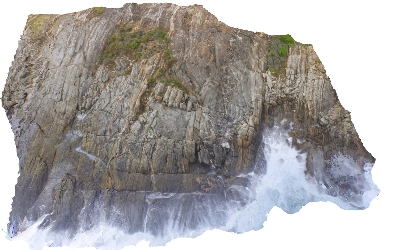
HallPointUAV1 Map
 |
20 |
01/01/9999 midnight |
UAV |
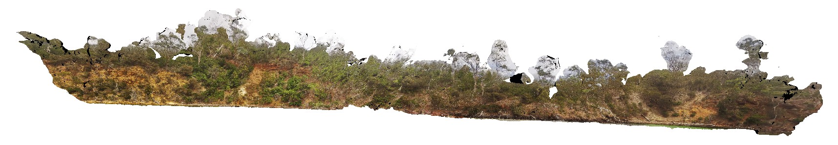
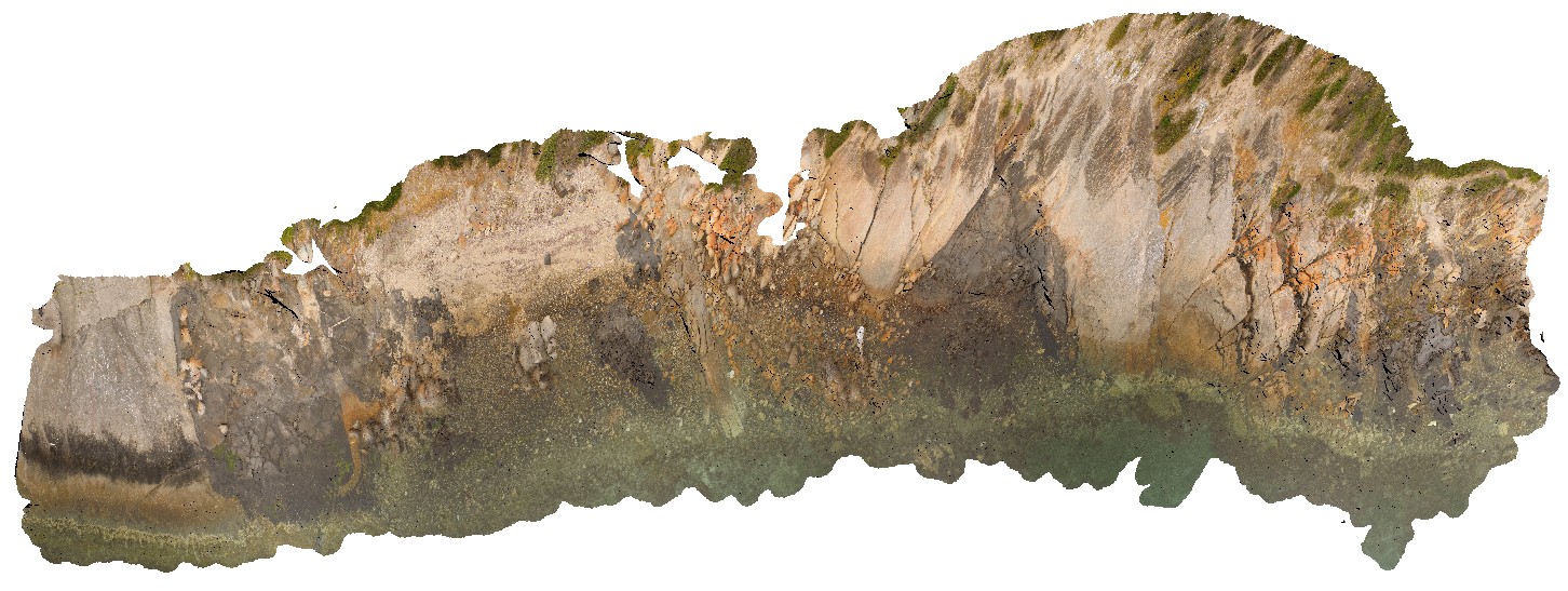
aerial view of folded and deformed Precambrian quartzites of the Rocky Cape Group. Hall Point, Sulphur Creek. Tasmania. |
335.00 |
-41.09298700000 |
146.02833200000 |
76.000 |
structure, Precambrian quartzite, fold |
quartzite |
CapeAridUAV3 Map
 |
0 |
01/01/9999 midnight |
UAV |
aerial view of folded and sheared gneissic layering and leucosomes, Cape Arid. W.A. |
8.00 |
-33.90668000000 |
123.35332000000 |
-9999.000 |
fold, shear |
gneiss |
REYNUAV1 Map
 |
0 |
07/24/2016 12:20 p.m. |
UAV |
aerial view of folded migmatitic ortho gneiss with parasitic, isoclinal folds. North West side of Mount Boothby, Reynolds Range. Next to Stuart Highway. N.T. |
20.00 |
-22.57896100000 |
133.29551700000 |
848.040 |
metamorphic, gneiss, fold, structure |
gneiss, gneiss |
CapeAridUAV2 Map
 |
20 |
01/01/9999 midnight |
UAV |
aerial view of folded pegmatite and gneissic layers. Cape Arid, W.A. |
200.00 |
-33.90626600000 |
123.35366500000 |
5.800 |
pegmatite, gneiss |
gneiss, pegmatite |
WTasUAV4 Map
 |
5 |
01/01/9999 midnight |
UAV |
aerial view of folds in sandstone and siltstone Silurian aged rocks. Duck Creek, west coast, Tasmania. |
100.00 |
-41.76811000000 |
145.00443100000 |
-9999.000 |
fold, structure |
sandstone |
WTasUAV5 Map
 |
5 |
01/01/9999 midnight |
UAV |
aerial view of folds in sandstone and siltstone Silurian aged rocks with detail of small basin. Duck Creek, west coast, Tasmania. |
20.00 |
-41.76892000000 |
145.00370700000 |
-9999.000 |
fold, basin, structure, multiple folds |
sandstone |
BlackmansBayUAV2 Map
 |
0 |
04/22/2016 3:17 p.m. |
UAV |
aerial view of gently dipping Permian strata at southern end of Blackmans Bay, at Flower Pot Point. Tasmania. |
50.00 |
-43.00787000000 |
147.32793000000 |
-9999.000 |
strata |
sandstone |
BremerUAV1 Map
 |
20 |
01/01/9999 midnight |
UAV |
aerial view of gneissic outcrop at Nature Dog Beach. Bremer Bay, W.A. |
20.00 |
-34.45622300000 |
119.36205000000 |
17.500 |
banded gneiss |
gneiss |
CapeAridUAV1 Map
 |
0 |
06/05/2016 10:37 a.m. |
UAV |
aerial view of gneissic rocks with thick compositional layering and shears. Cape Arid, W.A. |
0.00 |
-33.90596000000 |
123.35376000000 |
-9999.000 |
gneiss, shear, compositional layering |
gneiss |
RileyUAV1 Map
 |
0 |
10/20/2015 4:25 p.m. |
UAV |
aerial view of granite shore exposure with intruding dykes. Point Riley. |
40.00 |
-33.87572300000 |
137.60184900000 |
-9999.000 |
granite, intrusive contact |
granite |
AlbanyUAV2 Map
 |
20 |
01/01/9999 midnight |
UAV |
aerial view of granitic rocks with mafic pods intruded by granodiorite at 'The Gap, Albany, W.A. |
50.00 |
-35.11831000000 |
117.89304000000 |
-9999.000 |
granitic gneiss, granodiorite, mafic dyke, igneous intrusion |
granitic gneiss, granodiorite |
PiccaninnyUAV Map
 |
20 |
03/16/2015 2:36 p.m. |
UAV |
aerial view of granodiorite intruding thick package of turbidite beds. Piccaninny Point, eastern Tasmania. |
50.00 |
-41.69264700000 |
148.29592000000 |
50.000 |
intrusive contact, turbidite, granodiorite |
turbidite, granodiorite |
BellthorpeUAV1 Map
 |
50 |
01/01/9999 midnight |
UAV |
Aerial view of granodiorite with multiple intrusive phases and metasediment xenoliths. Bellthorpe, QLD. |
100.00 |
-26.82770700000 |
152.62270000000 |
2.000 |
granodiorite, intrusive contact |
granodiorite |
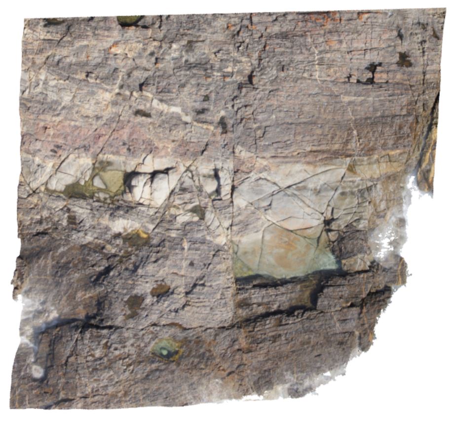
MarbleBarUAV2 Map
 |
0 |
06/01/2016 noon |
UAV |
aerial view of grey homogenous chert, 'intruding / brecciating' moderately dipping layered chert. The Marble Bar, Coongan River, W.A. |
100.00 |
-21.18658320000 |
119.71182720000 |
-9999.000 |
layered chert, Marble Bar Chert Member, brecciated |
chert |