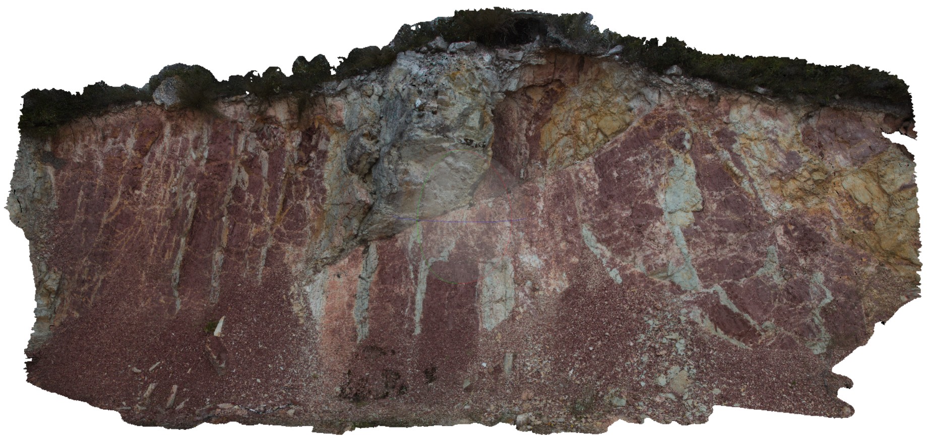
Scamander6 Map
 |
5 |
03/13/2015 9 a.m. |
3D |
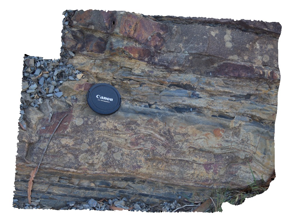
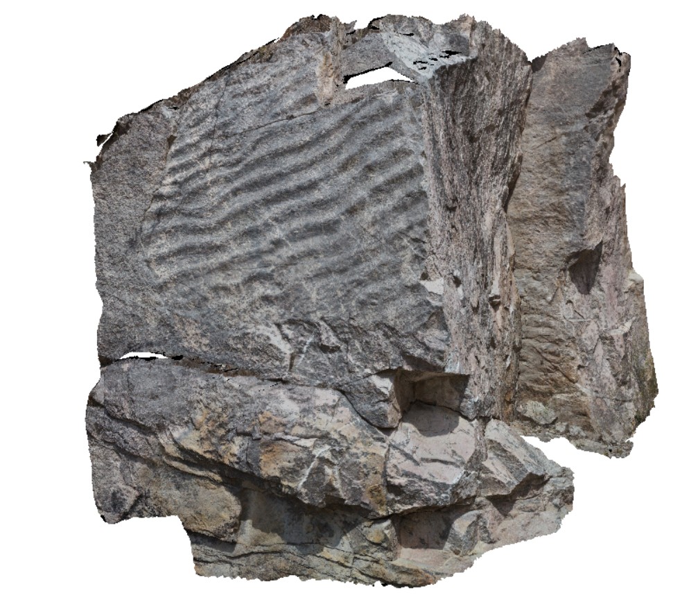
turbidite sandstone grading upwards to siltstone with undulating bedding. Upper Scamander Rd, near Scamander River. Eastern Tasmania. |
0.80 |
-41.45844778000 |
148.23026011000 |
-9999.000 |
undulating bedding, turbidite, sedimentology |
turbidite |
Scamander7 Map
 |
5 |
03/13/2015 9 a.m. |
3D |
load casts on lower sandstone contact with finer silty mudstone layer below. Upper Scamander Rd, near Scamander River. Eastern Tasmania. |
0.80 |
-41.45837554000 |
148.23018277000 |
-9999.000 |
load casts, sedimentology, turbidite |
turbidite |
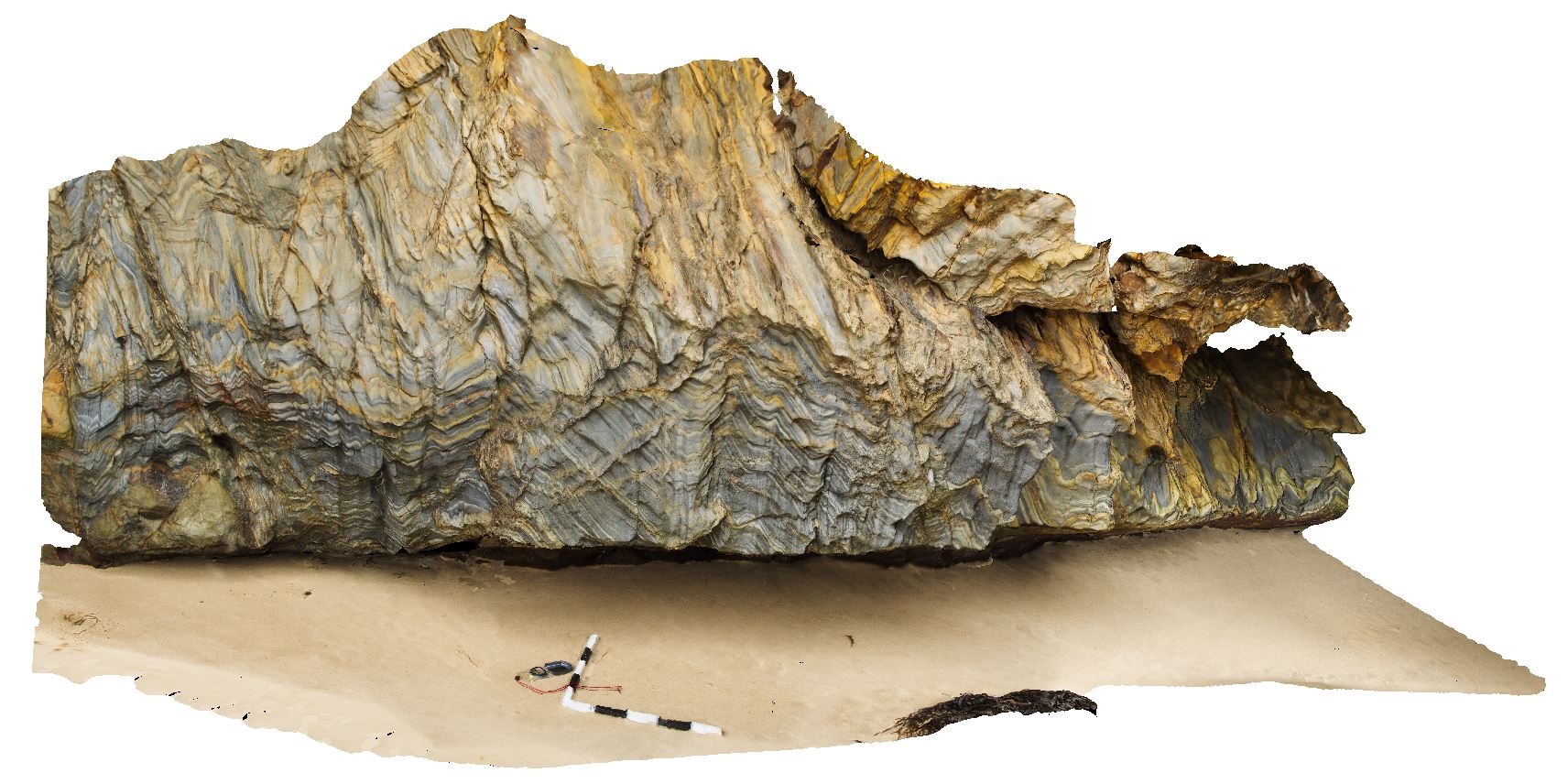
Scamander8 Map
 |
5 |
03/13/2015 9 a.m. |
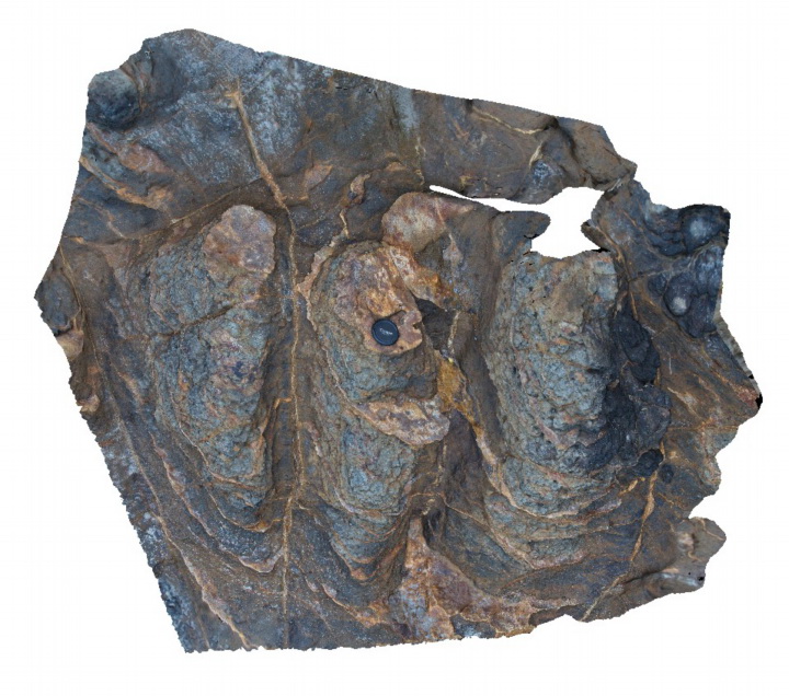
3D |
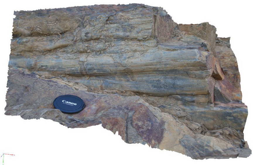
view of underside of bouma sequence, showing load cast? Structures. Upper Scamander Rd, near Scamander River. Eastern Tasmania. |
0.90 |
-41.45835793000 |
148.23014347000 |
-9999.000 |
bouma sequence, turbidite, load cast, sedimentology |
turbidite |
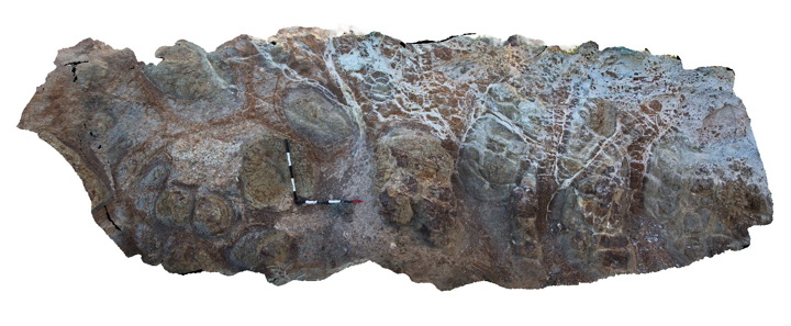
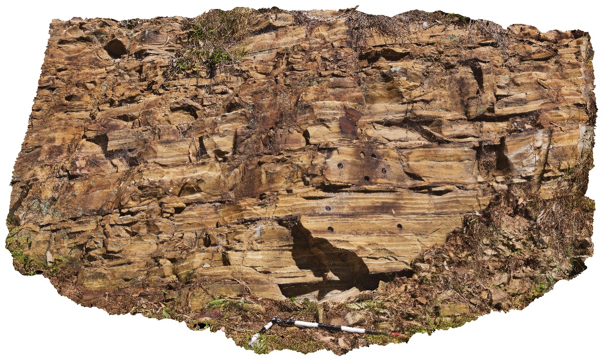
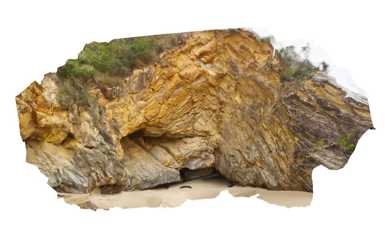
Scamander9 Map
 |
5 |
03/13/2015 9:01 a.m. |
3D |
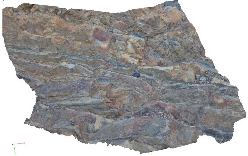
view of bouma sequences in turbidite package, showing massive sandstone at the base and fining upwards to silty mudstones. Upper Scamander Rd, near Scamander River. Eastern Tasmania. |
2.00 |
-41.45837554000 |
148.23018277000 |
-9999.000 |
bouma sequence, turbidite, sedimentology |
turbidite |
Schanck1 Map
 |
5 |
05/18/2015 1:35 p.m. |
3D |
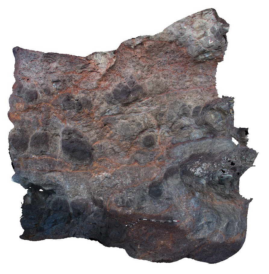
Black, vesicular columnar basalt flow underlain by a layer of brown matrix supported volcanic breccia. Cape Schanck, Vic. |
5.00 |
-38.49791000000 |
144.88953000000 |
3.000 |
columnar basalt, vesicular basalt, volcanic breccia, volcanology, igneous |
basalt, breccia |
Schanck2 Map
 |
5 |
05/18/2015 1:36 p.m. |
3D |
Brown volcanic breccia layer. This is a detailed view of a portion of the Schanck1 visualisation. Cape Schanck, Vic. |
0.50 |
-38.49791000000 |
144.88953000000 |
3.000 |
volcanic breccia, volcanology |
breccia |
Schanck3 Map
 |
5 |
05/18/2015 1:36 p.m. |
3D |
Flow boundary between a lower sparsely vesicular basalt and an upper densely vesicular basalt. Cape Schanck, Vic. |
5.00 |
-38.49907000000 |
144.88911000000 |
2.000 |
vesicular basalt, volcanology, igneous |
basalt |
Schanck4 Map
 |
5 |
05/18/2015 1:37 p.m. |
3D |
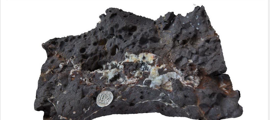
Detail of zeolite veins in vesicular basalt. Detail of veins shown in Schanck3. Cape Schanck, Vic. |
0.30 |
-38.49907000000 |
144.88911000000 |
2.000 |
vesicular basalt, zeolite, volcanology, igneous |
basalt |
Schanck5 Map
 |
5 |
05/18/2015 1:37 p.m. |
3D |
Large outcrop showing multiple layers of basaltic lava flows and pyroclastic layers. Cape Schanck, Vic. |
30.00 |
-38.49773000000 |
144.88753000000 |
0.000 |
basalt flows, pyroclastic, volcanology, igneous |
basalt |
Schanck6 Map
 |
5 |
05/18/2015 1:38 p.m. |
3D |
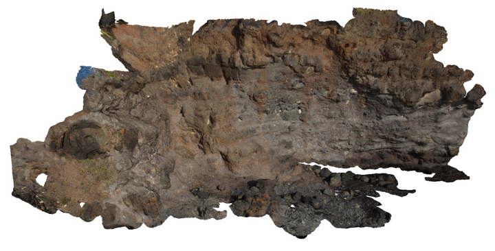
Spheroidal weathering of basalt. Cape Schanck, Vic. |
2.00 |
-38.49649000000 |
144.88792000000 |
15.000 |
basalt, spheroidal weathering, regolith, volcanology |
basalt |
Schanck7 Map
 |
5 |
05/18/2015 1:38 p.m. |
3D |
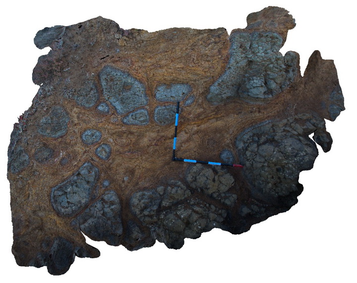
Spheroidal weathering of basalt with carbonate veins from overlying calcarenite. Cape Schanck, Vic. |
2.00 |
-38.49611000000 |
144.88782000000 |
15.000 |
basalt, spheroidal weathering, carbonate veins, volcanology |
basalt |
Schanck8 Map
 |
5 |
05/18/2015 1:39 p.m. |
3D |
Weathered basalt with prominent sub-horizontal and vertical 'zeolite' veins. Cape Schanck, Vic. |
1.50 |
-38.48315000000 |
145.02116000000 |
0.000 |
basalt, zeolite veins, weathering, igneous |
basalt |
ScottsPk1 Map
 |
0 |
02/23/2016 9:28 a.m. |
3D |
ripple marks in steeply dipping quartzite. Scott's Peak Dam road, Tasmania. |
1.50 |
-42.92569000000 |
146.34703000000 |
-9999.000 |
ripple mark, quartzite |
quartzite |
ScottsPk2 Map
 |
0 |
02/23/2016 9:28 a.m. |
3D |
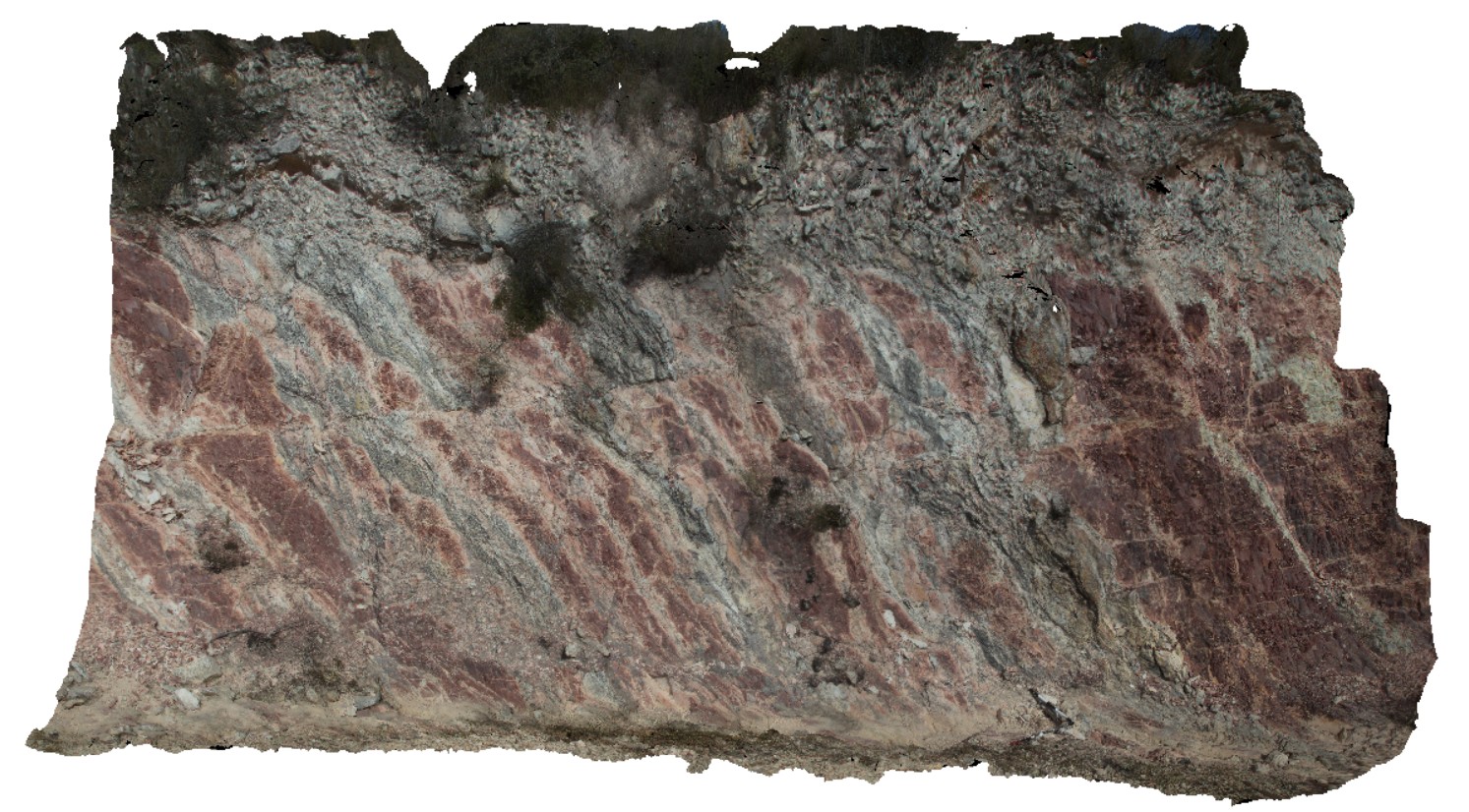
steeply dipping red mudstone and thin sandstone beds with small off-setting, sub horizontal faults. Scots Peak Dam road. Tasmania. |
8.00 |
-43.03230000000 |
146.33516000000 |
-9999.000 |
fault, structure |
mudstone |
ScottsPk3 Map
 |
0 |
02/23/2016 9:29 a.m. |
3D |
interbedded, steeply dipping / sub-vertical red mudstone, fine sandstone and thin sandstone units. Package has been faulted. Scots Peak Dam road, Tasmania. |
10.00 |
-43.03024000000 |
146.34120000000 |
-9999.000 |
mudstone, fault, structure |
mudstone |
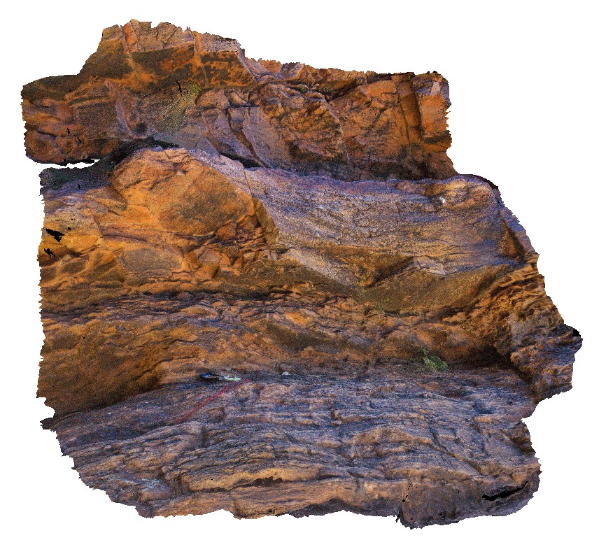
Seaham1 Map
 |
5 |
01/01/9999 midnight |
3D |
varved shales of the Seaham Formation with paleomag holes. Seaham, N.S.W. |
0.00 |
-32.66433000000 |
151.72768000000 |
-9999.000 |
varved, annual sediments, sedimentology, paleomagnetic dating |
shale |
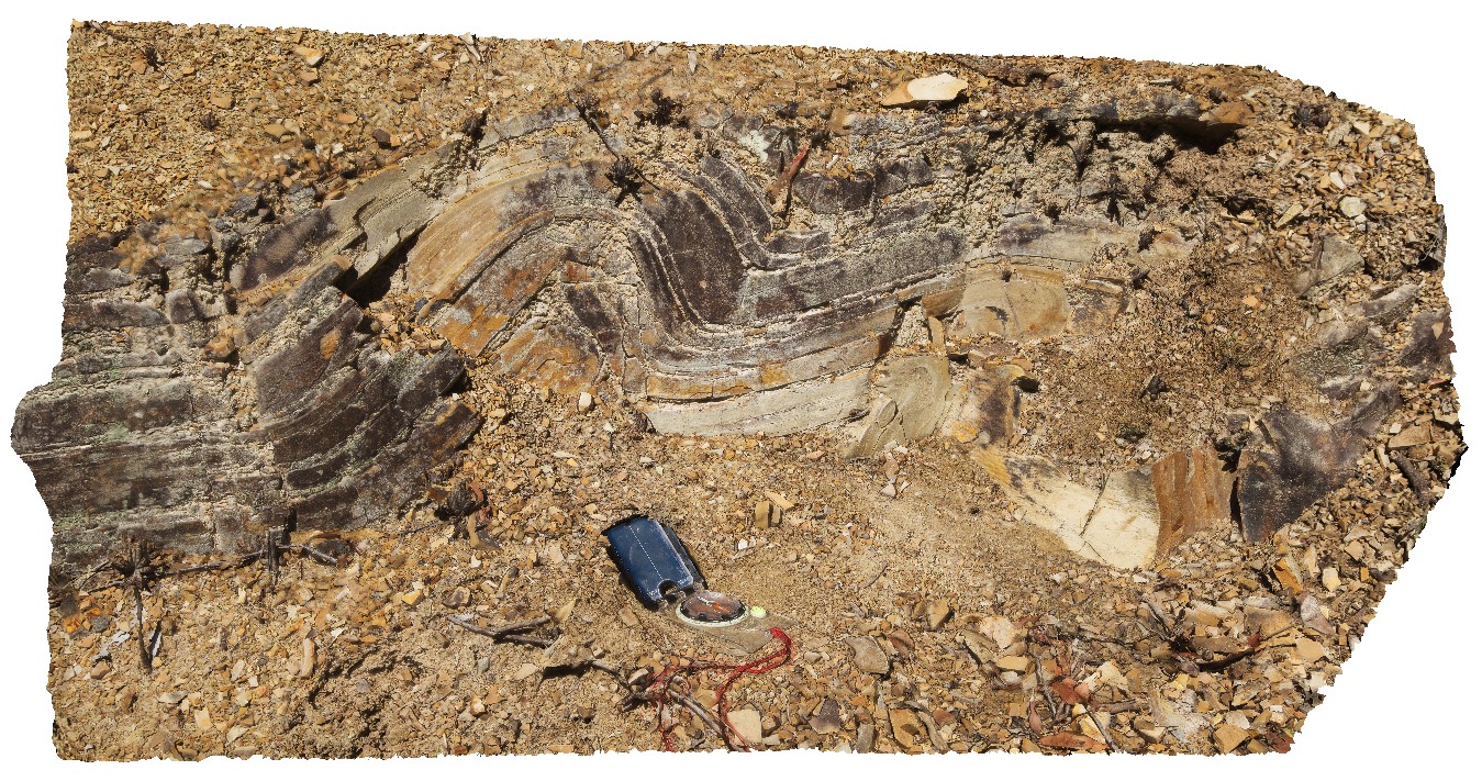
Seaham2 Map
 |
5 |
01/01/9999 midnight |
3D |
convoluted bedding in varved shales of the Seaham Formation. Seaham, N.S.W. |
0.00 |
-32.66301000000 |
151.72682000000 |
-9999.000 |
convoluted bedding, varved sediments, varved, annual, sedimentology |
shale |
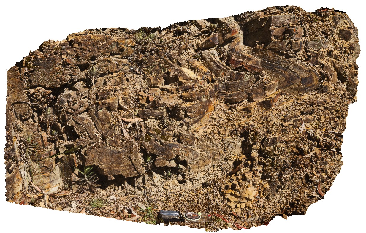
Seaham3 Map
 |
5 |
01/01/9999 midnight |
3D |
convoluted bedding in varved shales of the Seaham Formation. Seaham, N.S.W. |
0.00 |
-32.66299000000 |
151.72681000000 |
-9999.000 |
convoluted bedding, varved sediments, annual sediments, sedimentology |
shale |
SecretBeach1 Map
 |
5 |
01/01/9999 midnight |
3D |
refolded folds in Mallacoota beds. Mallacoota, Vic. |
25.00 |
-37.60815400000 |
149.72156800000 |
-9999.000 |
refolded folds, fold, structure |
turbidite |
SecretBeach2 Map
 |
5 |
01/01/9999 midnight |
3D |
refolded folds in Mallacoota beds - S2 crenulation cleavage and F2 folds. Mallacoota, Vic. |
10.00 |
-37.60801000000 |
149.72158500000 |
-9999.000 |
cleavage, fold, structure, refolded fold |
turbidite |
SecretBeach3 Map
 |
5 |
01/01/9999 midnight |
3D |
boudinaged sandstone of Mallacoota Beds. Mallacoota, Vic. |
2.00 |
-37.60810200000 |
149.72147600000 |
-9999.000 |
boudinage, structure |
turbidite |
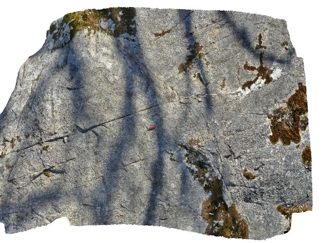
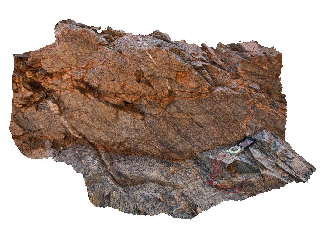
Serpentine1 Map
 |
5 |
07/09/2016 noon |
3D |
Brittle shear zone in gneiss. Serpentine River, W.A. |
3.50 |
-32.35991500000 |
116.04854500000 |
-9999.000 |
gneiss, shear zone, structure, brittle |
gneiss |
Serpentine2 Map
 |
5 |
01/01/9999 midnight |
3D |
Brittle and ductile shear zone in gneiss. Serpentine River, W.A. |
0.80 |
-32.35991500000 |
116.04854500000 |
-9999.000 |
gneiss, shear zone, brittle shear, ductile shear, structure |
gneiss |
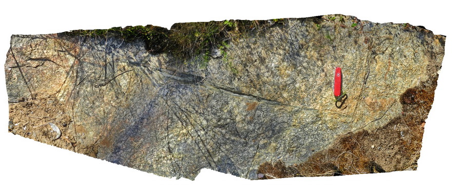
Simpg1 Map
 |
5 |
01/01/9999 midnight |
3D |
quartz-feldspar gneiss, part of Simpson Gap Metasediments. Simpsons Gap. N.T. |
1.30 |
-23.67477000000 |
133.71884000000 |
-9999.000 |
metasediments, gneiss, metamorphic, structure |
gneiss |
Simpg2 Map
 |
5 |
01/01/9999 midnight |
3D |
contact between Simpson Gap Metasediments and Heavitree Sandstone. Simpsons Gap. N.T. |
1.60 |
-23.67458000000 |
133.71924000000 |
-9999.000 |
unconformity, metasediments, sandstone |
metasediments, sandstone |