Splitpoint11 Map
 |
5 |
06/17/2015 10:44 a.m. |
3D terrestrial photogrammetric model |
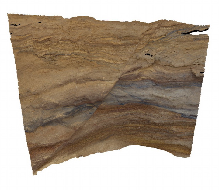
small normal fault in fine grained pyroclastic deposits of the Oligocene Angahook Formation. Split Point, Vic. |
1.50 |
-38.46346000000 |
144.10806000000 |
1.000 |
normal fault, pyroclastic, volcanology |
tuff |
Splitpoint12 Map
 |
5 |
06/17/2015 10:44 a.m. |
3D terrestrial photogrammetric model |
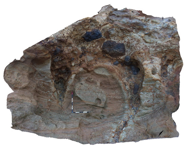
Fissures infilled by pyroclastic? Material in layered pyroclastic rocks of the Oligocene Angahook Formation. Split Point, Vic. |
5.00 |
-38.46310000000 |
144.10857000000 |
1.000 |
fissures, volcanology, pyroclastic |
tuff |
Splitpoint13 Map
 |
58 |
06/17/2015 10:45 a.m. |
3D terrestrial photogrammetric model |
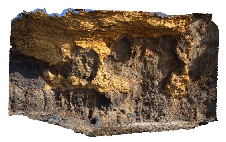
Basalt of the Oligocene Angahook Formation disconformably overlain by bedded sandy limestone of the Torquay Group. Irregularities/fissures in the upper surface of the basalt have been infilled by the overlying limestone. Split Point, Vic. |
13.00 |
-38.46855000000 |
144.10698000000 |
1.000 |
volcanology, fissures |
basalt, limestone |
Splitpoint14 Map
 |
5 |
06/17/2015 10:48 a.m. |
3D terrestrial photogrammetric model |
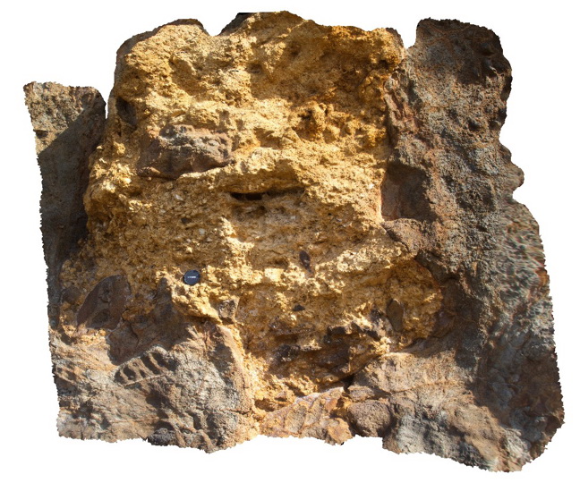
detailed view of bioclastic limestone of the Torquay Group infilling fissures in the underlying basalt of the Oligocene Angahook Formation. Split Point, Vic. |
2.00 |
-38.46855000000 |
144.10698000000 |
2.000 |
volcanology, fissure infill |
limestone, basalt |
Splitpoint15 Map
 |
5 |
06/17/2015 10:48 a.m. |
3D terrestrial photogrammetric model |
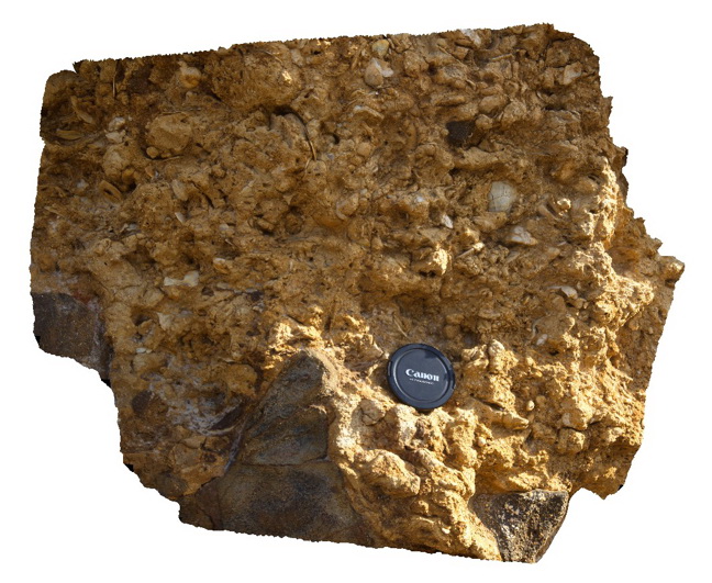
Detailed view of bioclastic limestone infill in a basalt fissure. Torquay Group. Split Point, Vic. |
0.80 |
-38.46855000000 |
144.10698000000 |
2.000 |
palaeontology, sedimentology |
limestone |
Splitpoint16 Map
 |
5 |
06/17/2015 10:49 a.m. |
3D terrestrial photogrammetric model |
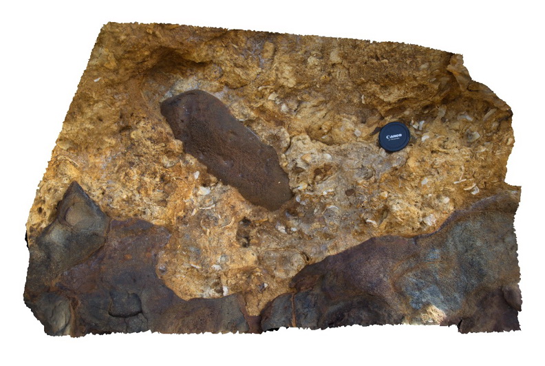
Detailed view of the disconformable contact between basalt of the Oligocene Angahook Formation and bioclastic limestone of the Oligocene-Miocene Torquay Group. Split Point, Vic. |
0.00 |
-38.46855000000 |
144.10698000000 |
-9999.000 |
palaeontology, disconformity, volcanology, sedimentology |
basalt, limestone |
Splitpoint17 Map
 |
20 |
06/17/2015 10:49 a.m. |
3D terrestrial photogrammetric model |
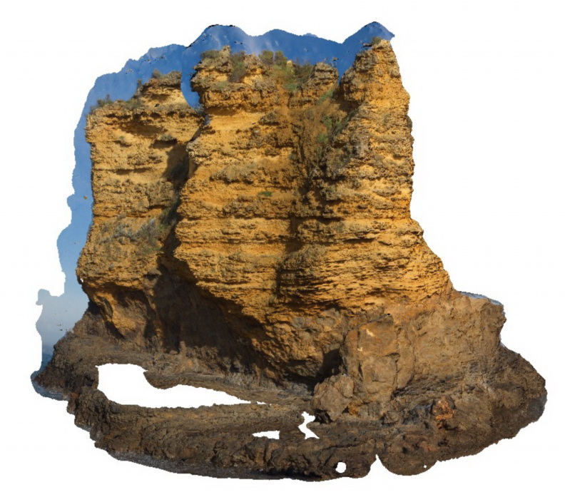
sea stack showing bedded limestone of the Torquay Group disconformably overlying basalt of the Oligocene Angahook Formation. Split Point, Vic. |
30.00 |
-38.46854000000 |
144.10675000000 |
-9999.000 |
disconformity, volcanology, sedimentology |
limestone, basalt |
Splitpoint18 Map
 |
20 |
06/17/2015 10:51 a.m. |
3D terrestrial photogrammetric model |
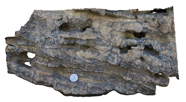
detail of thinly bedded limestone of the Torquay Group showing cross beds, shell fossils and the effects of differential weathering. Split Point, Vic. |
1.00 |
-38.46777000000 |
144.10634000000 |
2.000 |
palaeontology, cross bedding, sedimentology |
limestone |
Splitpoint19 Map
 |
5 |
06/17/2015 10:52 a.m. |
3D terrestrial photogrammetric model |
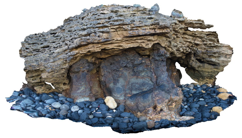
Detailed view of the disconformable contact between basalt of the Oligocene Angahook Formation and bioclastic limestone of the Oligocene-Miocene Torquay Group. Split Point, Vic. |
6.00 |
-38.46793000000 |
144.10576000000 |
1.000 |
disconformity, volcanology, sedimentology |
limestone, basalt |
Splitpoint2 Map
 |
5 |
06/17/2015 10:53 a.m. |
3D terrestrial photogrammetric model |
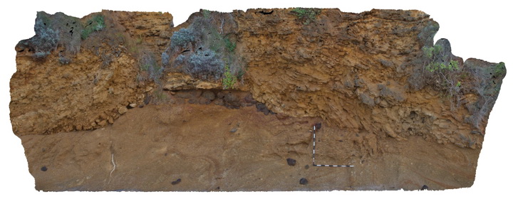
Pyroclastics rocks of the Oligocene Angahook Formation disconformably overlain by bedded Oligocene-Miocene sandy limestone of the Torquay Group. Split Point, Vic. |
6.00 |
-38.46484000000 |
144.10742000000 |
1.000 |
pyroclastic, volcanology, disconformity |
tuff, limestone |
Splitpoint3 Map
 |
5 |
06/17/2015 10:55 a.m. |
3D terrestrial photogrammetric model |
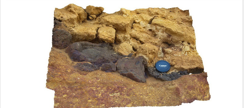
detail of the contact between tuffaceous rocks of the Oligocene-Miocene Angahook Formation and the overlying limestone of the Torquay Group. Basalt clasts to 0.25m in the tuffaceous rocks. Split Point, Vic. |
1.00 |
-38.46484000000 |
144.10742000000 |
1.000 |
disconformity, volcanology, pyroclastic |
tuff, limestone |
Splitpoint4 Map
 |
5 |
06/17/2015 10:55 a.m. |
3D terrestrial photogrammetric model |
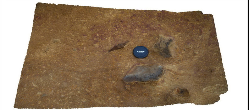
detail of pyroclastic material within the Oligocene Angahook Formation. Split Point, Vic. |
1.00 |
-38.46484000000 |
144.10742000000 |
0.000 |
pyroclastic, volcanology |
tuff |
Splitpoint5 Map
 |
5 |
06/17/2015 10:56 a.m. |
3D terrestrial photogrammetric model |
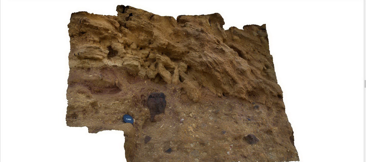
detailed view of pyroclastic material of the Oligocene Angahook Formation and overlying limestone of the Torquay Group. Split Point, Vic. |
2.00 |
-38.46484000000 |
144.10742000000 |
1.000 |
disconformity, pyroclastic, volcanology, carbonate, sedimentology |
tuff, limestone |
Splitpoint6 Map
 |
10 |
06/17/2015 10:56 a.m. |
3D terrestrial photogrammetric model |
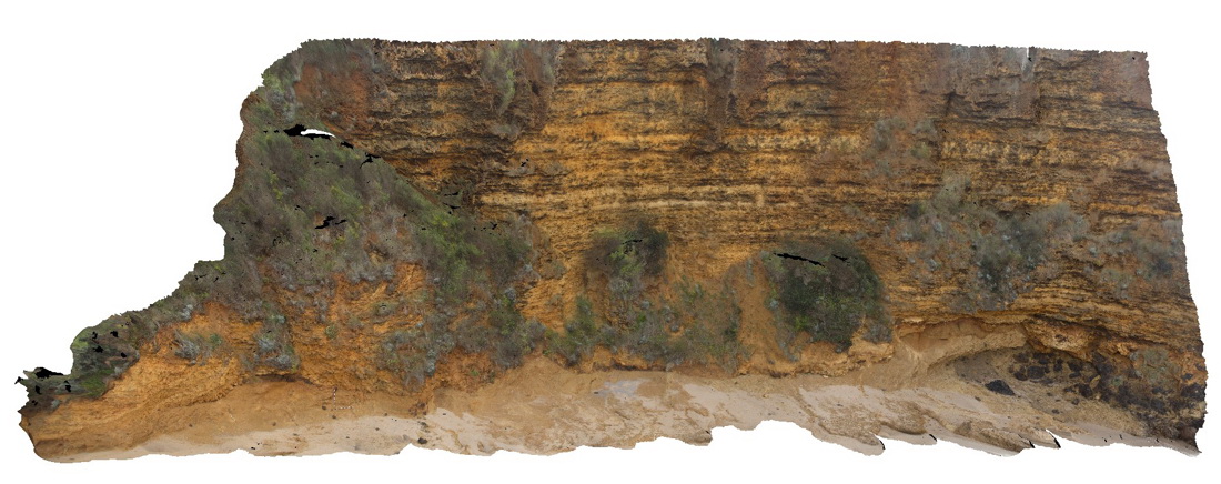
Bedded limestone of the Torquay Group disconformably overlying pyroclastic rocks of the Oligocene Angahook Formation. Split Point, Vic. |
30.00 |
-38.46460000000 |
144.10770000000 |
-9999.000 |
disconformity, carbonate sedimentology, pyroclastic, volcanology |
limestone, tuff |
Splitpoint7 Map
 |
5 |
06/17/2015 10:59 a.m. |
3D terrestrial photogrammetric model |
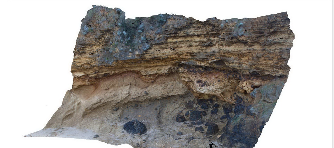
Bedded limestone of the Torquay Group disconformably overlying pyroclastic rocks of the Oligocene Angahook Formation. Split Point, Vic. |
10.00 |
-38.46469000000 |
144.10783000000 |
1.000 |
pyroclastic, volcanology, disconformity |
limestone, tuff |
Splitpoint8 Map
 |
5 |
06/17/2015 11:01 a.m. |
3D terrestrial photogrammetric model |
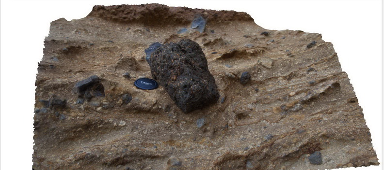
detail of pyroclastic material showing large basalt clast in Oligocene pyroclastic deposits of the Angahook Formation. Split Point, Vic. |
1.50 |
-38.46469000000 |
144.10783000000 |
1.000 |
pyroclastic, volcanology |
tuff |
Splitpoint9 Map
 |
5 |
06/17/2015 11:02 a.m. |
3D terrestrial photogrammetric model |
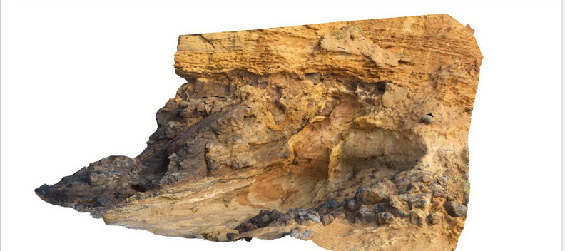
Bedded limestone of the Torquay Group disconformably overlying pyroclastic rocks of the Oligocene Angahook Formation. Split Point, Vic. |
15.00 |
-38.46451000000 |
144.10812000000 |
1.000 |
pyroclastic, volcanology, disconformity |
limestone, tuff |
SplitpointFSP1 Map
 |
5 |
06/17/2015 11:04 a.m. |
Full Spherical Panorama |
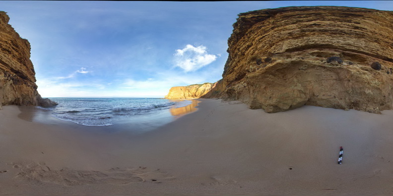
Flat lying, thinly bedded, sandy limestone of the Oligocene-Miocene Torquay Group disconformably overlying poorly sorted pyroclastic rocks of the Oligocene Angahook Formation. Split Point, Vic. |
50.00 |
-38.46307000000 |
144.10860000000 |
0.000 |
disconformity, pyroclastic, sedimentology, volcanology |
limestone, tuff |
SplitpointFSP10 Map
 |
5 |
06/17/2015 11:04 a.m. |
Full Spherical Panorama |
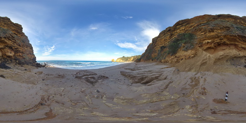
Flat lying, thinly bedded, sandy limestone of the Oligocene-Miocene Torquay Group nonconformably overlying basalt, basaltic breccias and pyroclastic rocks of the Oligocene Angahook Formation. Split Point, Vic. |
50.00 |
-38.46467000000 |
144.10777000000 |
1.000 |
nonconformity, basalt, pyroclastic, sedimentology, volcanology |
limestone, basalt, tuff |
SplitpointFSP11 Map
 |
5 |
06/17/2015 11:04 a.m. |
Full Spherical Panorama |
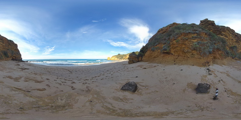
Flat lying, thinly bedded, sandy limestone of the Oligocene-Miocene Torquay Group nonconformably overlying basalt, basaltic breccias and pyroclastic rocks of the Oligocene Angahook Formation. Split Point, Vic. |
50.00 |
-38.46487000000 |
144.10747000000 |
1.000 |
basalt, pyroclastic, sedimentology, volcanology, nonconformity |
limestone, tuff, basalt |
SplitpointFSP12 Map
 |
5 |
06/17/2015 11:05 a.m. |
Full Spherical Panorama |
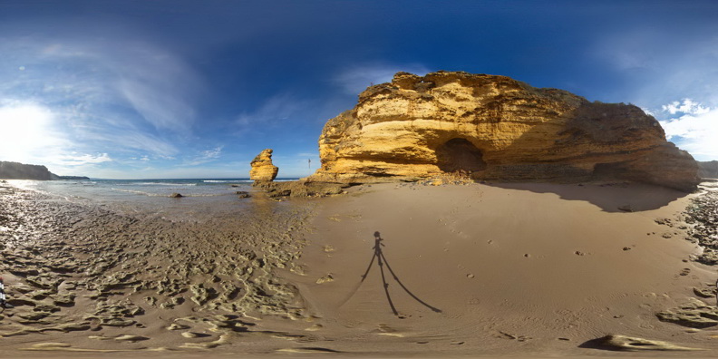
Flat lying, thinly bedded, sandy limestone of the Oligocene-Miocene Torquay Group. Split Point, Vic. |
50.00 |
-38.46670000000 |
144.10686000000 |
1.000 |
limestone, sedimentology |
limestone |
SplitpointFSP13 Map
 |
5 |
06/17/2015 11:05 a.m. |
Full Spherical Panorama |
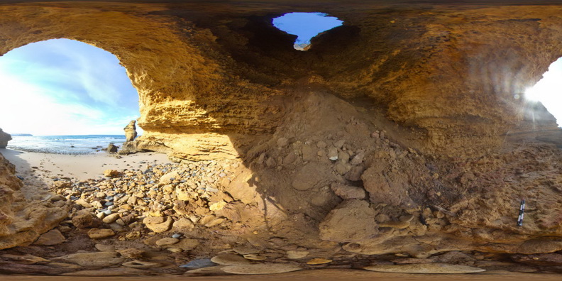
4m doline within flat lying, thinly bedded, sandy limestone of the Oligocene-Miocene Torquay Group. Split Point, Vic. |
50.00 |
-38.46674000000 |
144.10675000000 |
1.000 |
limestone, doline, sedimentology |
limestone |
SplitpointFSP14 Map
 |
5 |
06/17/2015 11:06 a.m. |
Full Spherical Panorama |
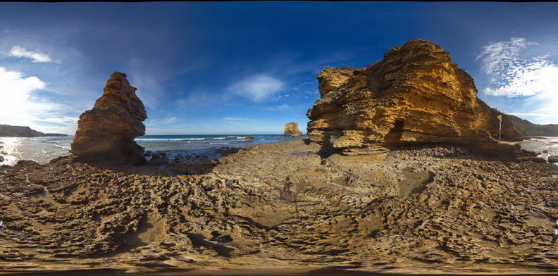
Flat lying, thinly bedded, sandy limestone of the Oligocene-Miocene Torquay Group nonconformably overlying basalt of the Oligocene Angahook Formation. Sea stack in background displays the irregularity of the basalt surface. Split Point, Vic. |
50.00 |
-38.46686000000 |
144.10709000000 |
1.000 |
basalt, limestone, sedimentology, volcanology, nonconformity |
limestone, basalt |
SplitpointFSP15 Map
 |
5 |
06/17/2015 11:06 a.m. |
Full Spherical Panorama |
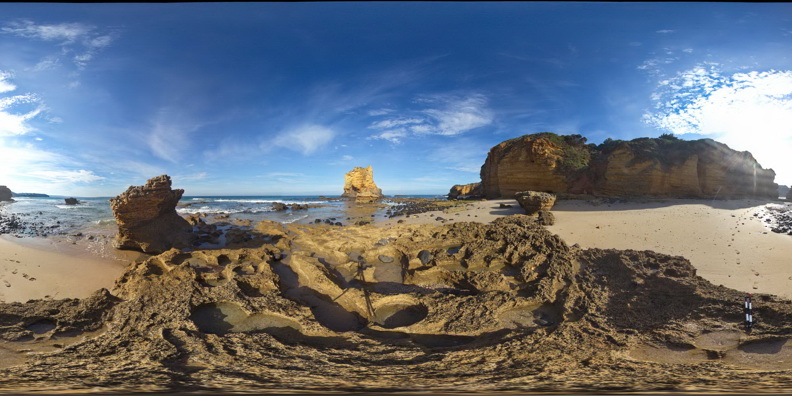
Flat lying, thinly bedded, sandy limestone of the Oligocene-Miocene Torquay Group nonconformably overlying basalt of the Oligocene Angahook Formation. Sea stack in background displays the irregularity of the basalt surface. Split Point, Vic. |
50.00 |
-38.46752000000 |
144.10681000000 |
1.000 |
basalt, nonconformity, volcanology, sedimentology, limestone |
limestone, basalt |
SplitpointFSP16 Map
 |
5 |
06/17/2015 11:06 a.m. |
Full Spherical Panorama |
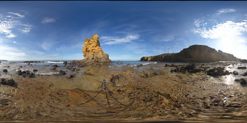
Flat lying, thinly bedded, sandy limestone of the Oligocene-Miocene Torquay Group nonconformably overlying basalt of the Oligocene Angahook Formation, exposed at the base of the sea stack. Split Point, Vic. |
50.00 |
-38.46816000000 |
144.10663000000 |
1.000 |
basalt, limestone, nonconformity, sedimentology, volcanology, spheroidal weathering |
limestone, basalt |
 AusGeol.org