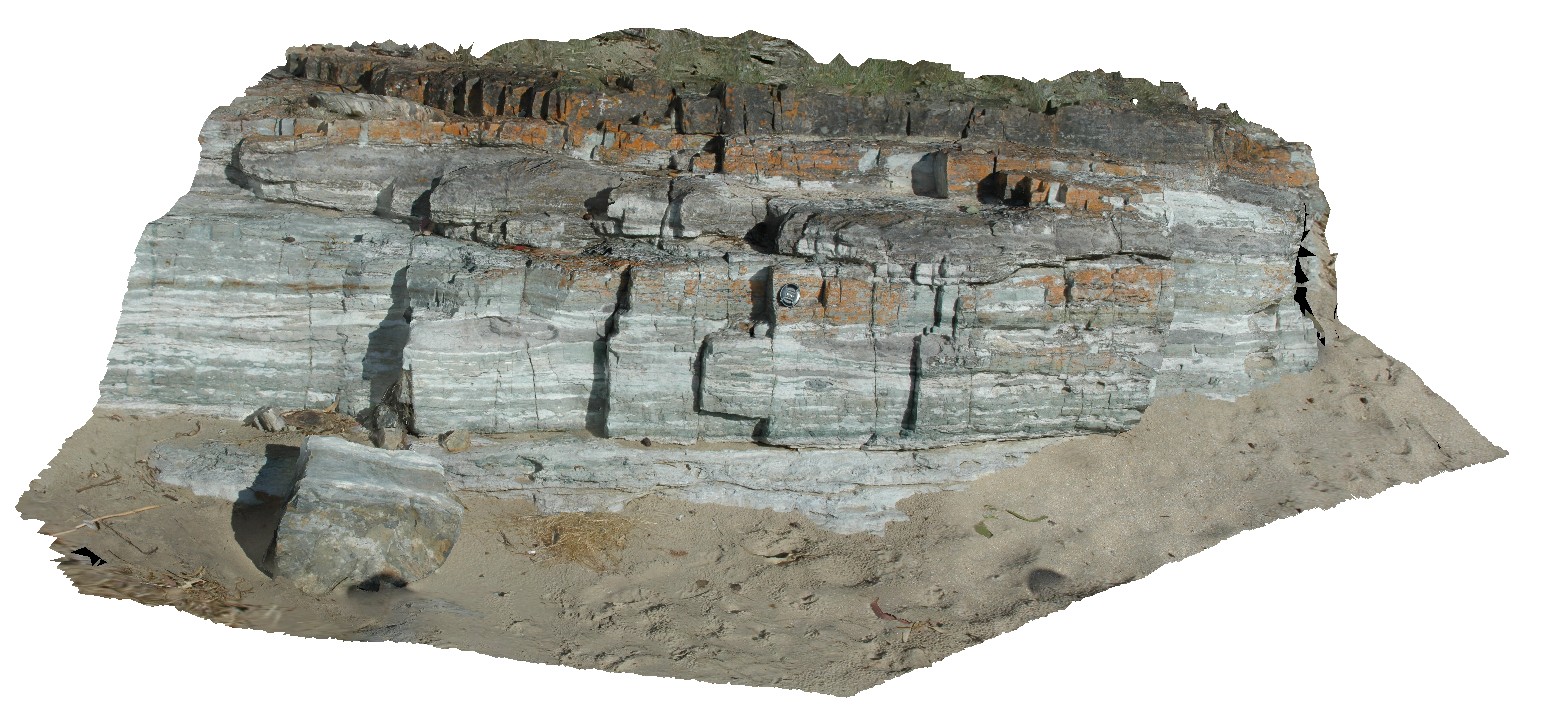
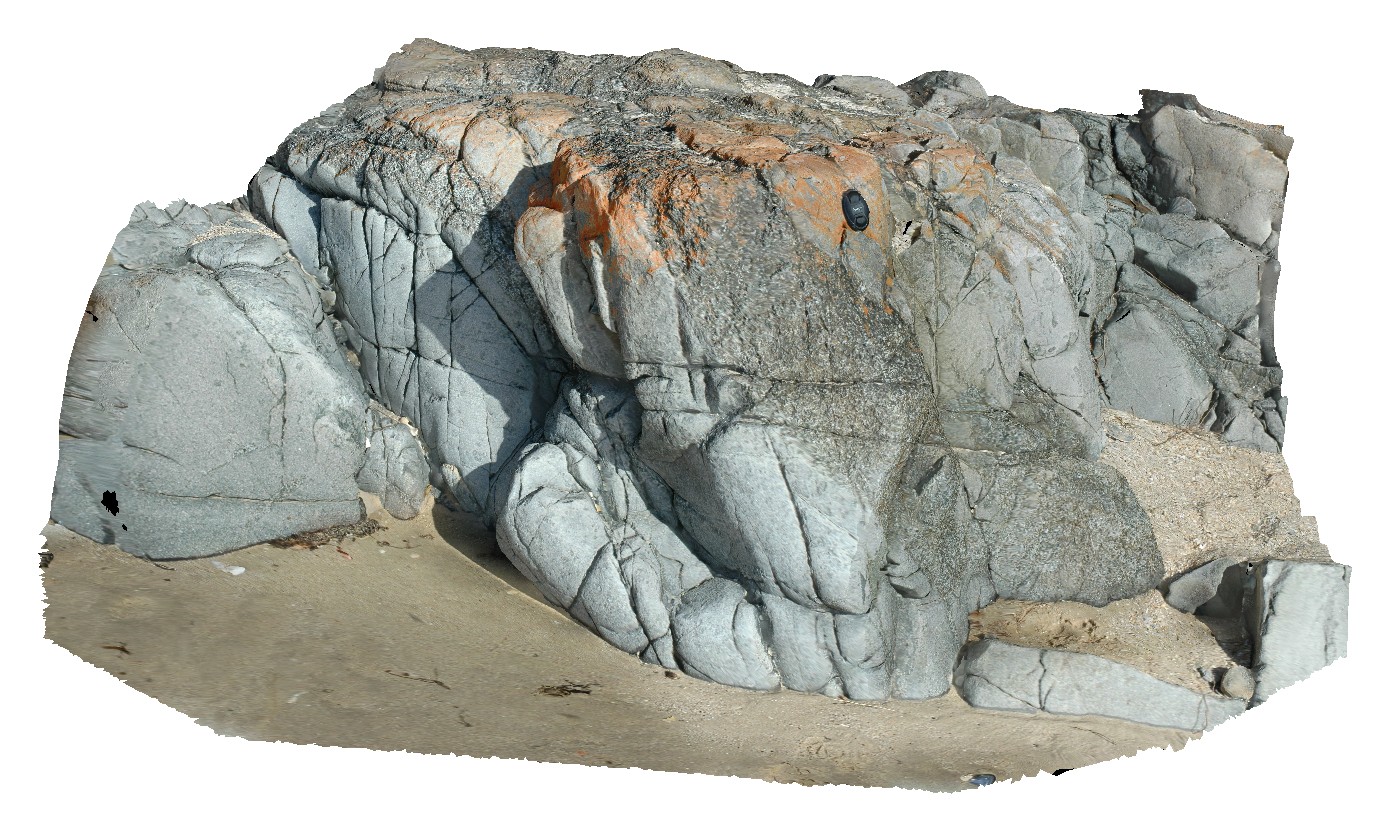
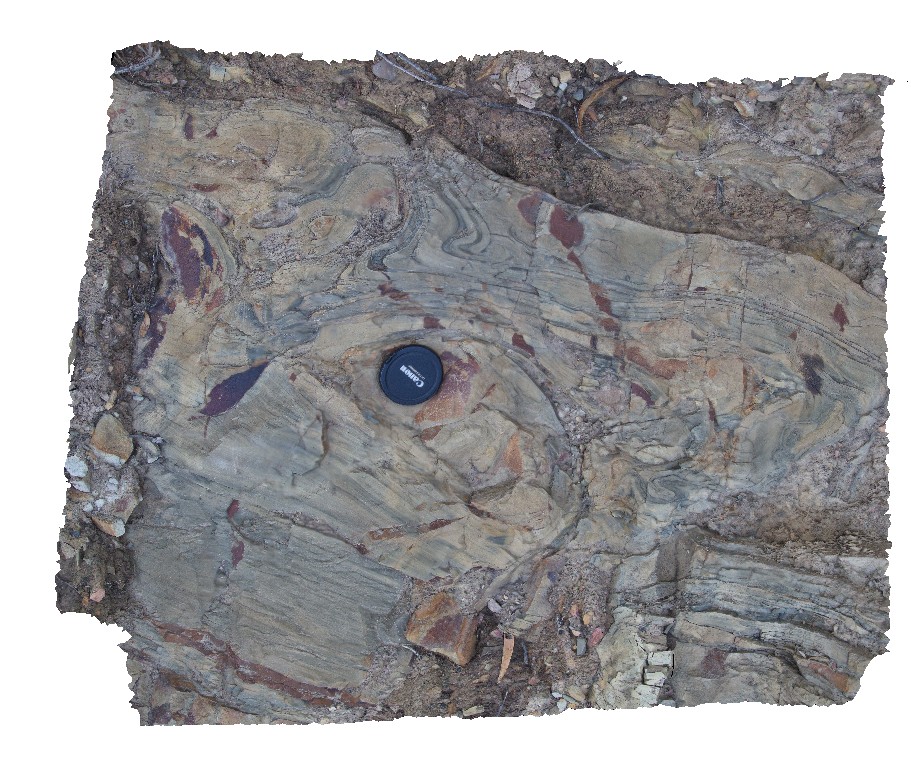
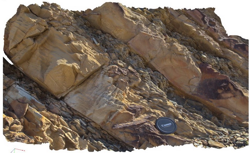
Roches2 Map
 |
5 |
03/16/2015 2:21 p.m. |
3D |
view of Permian siltstone beds with concretions and disrupted bedding. Roches Beach, Tasmania. |
5.00 |
-42.88365826000 |
147.50552434000 |
5.000 |
disrupted bedding, hornfels, sedimentology |
siltstone |
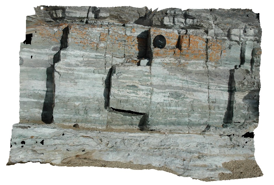
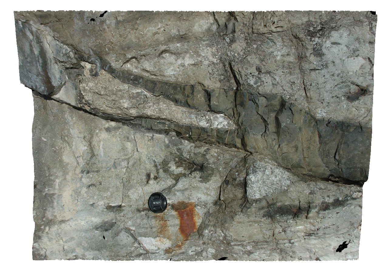
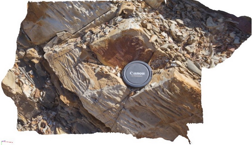
Roches3 Map
 |
5 |
03/16/2015 2:21 p.m. |
3D |
view of Permian siltstone beds with concretions and disrupted bedding. Roches Beach, Tasmania. |
1.50 |
-42.88367544000 |
147.50554050000 |
-9999.000 |
disrupted bedding, sedimentology, concretion |
siltstone |
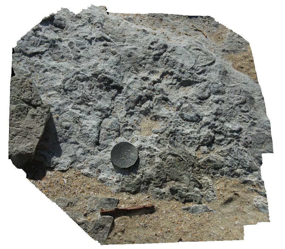
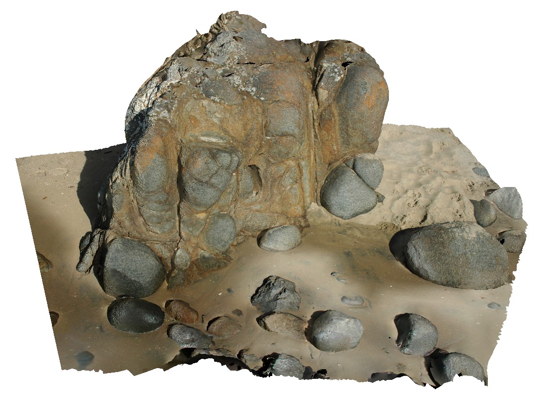
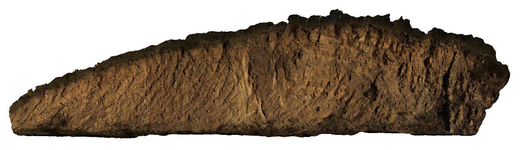
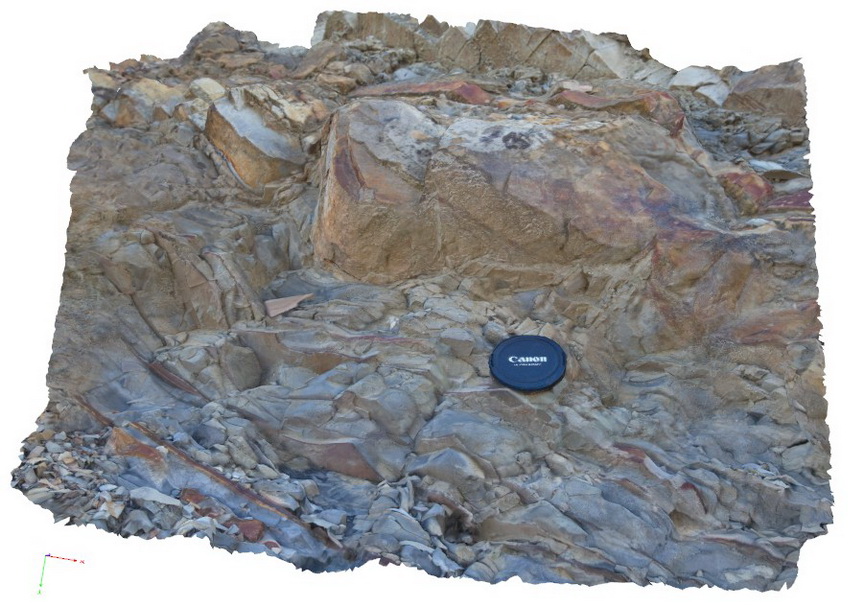
Roches4 Map
 |
5 |
03/16/2015 2:21 p.m. |
3D |
detail of bioturbation and possible fossil casts on bedding plane in Permian siltstones. Roches Beach, Tasmania. |
0.25 |
-42.88366922000 |
147.50549163000 |
5.000 |
bioturbation, sedimentology, siltstone |
siltstone |
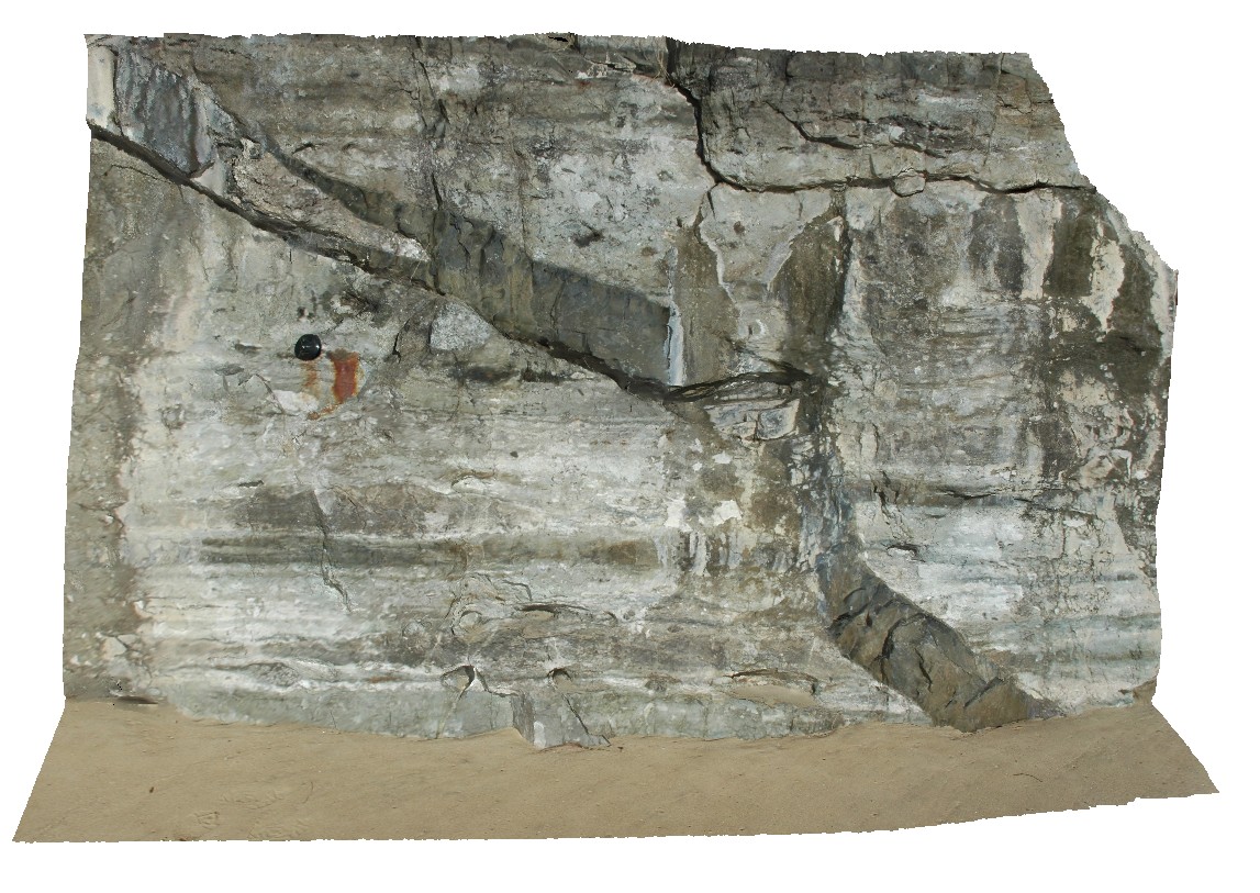
Roches5 Map
 |
5 |
03/16/2015 2:21 p.m. |
3D |
view of bifurcating dolerite dyke intruding Permian siltstone. Roches Beach, Tasmania. |
0.00 |
-42.88362383000 |
147.50543178000 |
5.000 |
dyke, intrusive contact, igneous |
siltstone, dolerite |
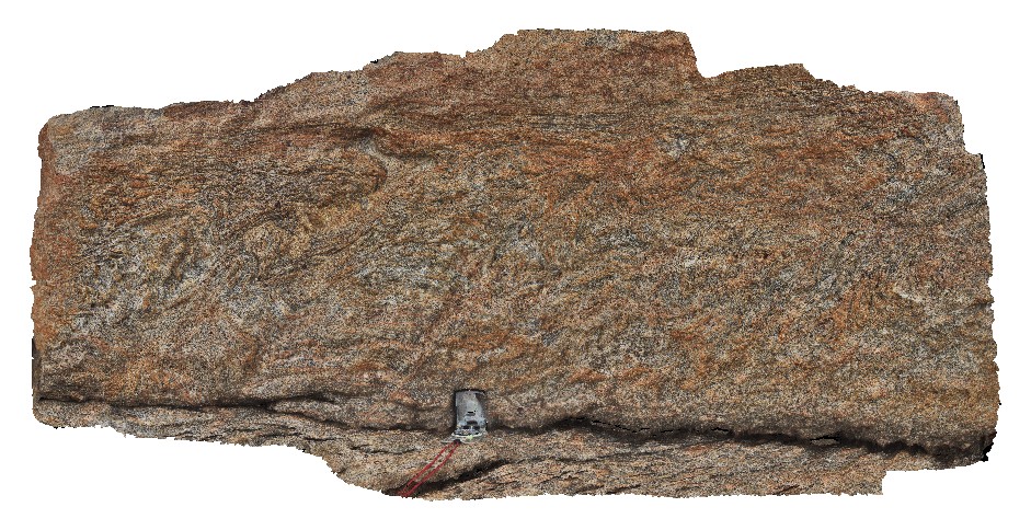
Roches6 Map
 |
5 |
03/16/2015 2:21 p.m. |
3D |
close-up view of bifurcating dolerite dyke, showing metamorphic aureole / hornfelse in hosting siltstone. Roches Beach, Tasmania. |
0.60 |
-42.88362259000 |
147.50542203000 |
5.000 |
metamorphic aureole, hornfels, igneous intrusion, dyke |
siltstone, dolerite |
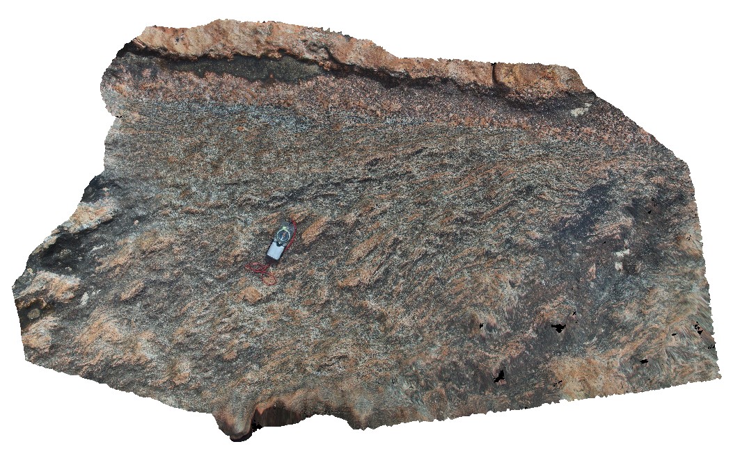
Roches7 Map
 |
5 |
03/16/2015 2:21 p.m. |
3D |
dolerite outcrop, showing coarse and fine-grained segregations / zones and blocky jointing. Roches Beach, Tasmania. |
1.00 |
-42.88414512000 |
147.50540867000 |
2.000 |
grain size, dolerite |
dolerite |
Roches8 Map
 |
5 |
03/16/2015 2:21 p.m. |
3D |
spheroidal weathering of dolerite. Roches Beach, Tasmania. |
1.00 |
-42.88418779000 |
147.50532785000 |
1.000 |
spheroidal weathering, dolerite |
dolerite |
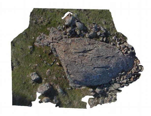
RochesMontane Map
 |
1 |
06/17/2015 11:10 a.m. |
3D |
Roche moutonnée developed in massive sandstone of the Castlemaine Group on the unconformity surface with the overlying Permo-Carboniferous Baccus Marsh Formation. Heathcote-Spring Plains Rd. VIC. |
5.00 |
-36.99953000000 |
144.64200000000 |
-9999.000 |
Roche moutonnée, geomorphology, glacial landform |
sandstone |
RoseRiver1 Map
 |
5 |
06/17/2015 10:39 a.m. |
3D |
folds and faults thickly bedded sandstone of the Silurian Cobbabbah Group. Rose River road, VIC. |
20.00 |
-36.82015000000 |
146.58731000000 |
365.000 |
folds, faults, structure |
sandstone |
RoundRock1 Map
 |
0 |
05/15/2016 noon |
3D |
detail of early foliation developed by aligned leucosomes cut by later gently east dipping foliation. Gneiss has garnet porphyroblasts. Boranup, Western Australia. |
0.60 |
-34.09013000000 |
114.99658000000 |
-9999.000 |
foliation, leucosome, garnet porphyroblasts |
gneiss |
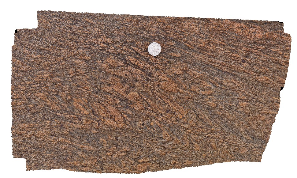
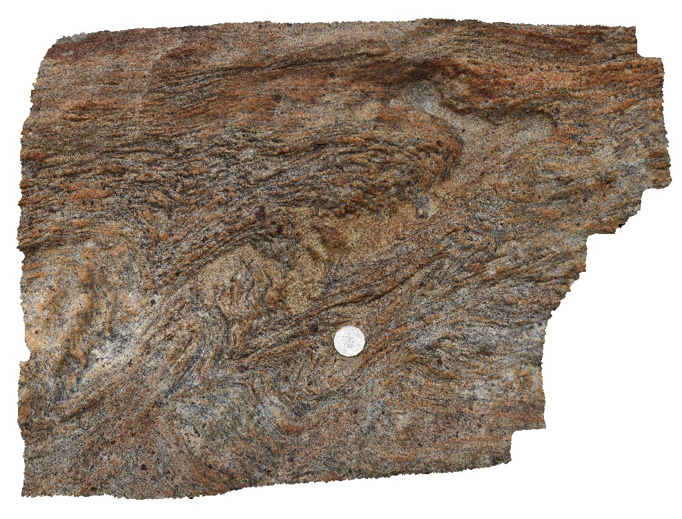
RoundRock2 Map
 |
0 |
05/15/2016 noon |
3D |
deformed gneissic foliation in garnet bearing gneiss. Round Rock, W.A. Boranup, Western Australia. |
2.00 |
-34.09002000000 |
114.99660000000 |
-9999.000 |
deformed foliation, foliation, garnet gneiss |
gneiss |
RoundRock3 Map
 |
0 |
05/15/2016 noon |
3D |
tight folds in folded zone in garnet bearing gneiss, Round Rock. W.A. Boranup, Western Australia. |
1.60 |
-34.09007000000 |
114.99669000000 |
-9999.000 |
tight folds, garnet gneiss, structure |
garnet gneiss |
RoundRock4 Map
 |
0 |
05/15/2016 noon |
3D |
detailed view of folds and foliation in garnet bearing gneiss. Boranup, Western Australia. |
0.50 |
-34.09007000000 |
114.99669000000 |
-9999.000 |
foliation, garnet bearing gneiss, fold |
gneiss |
SandyCape1 Map
 |
5 |
01/01/9999 midnight |
3D |
unconformity between the Pedder River Siltstone and the Lagoon River Quartzite. Wild Wave River, West Tasmania. |
10.00 |
-41.36165000000 |
144.84297000000 |
-9999.000 |
unconformity, siltstone, quartzite |
quartzite, siltstone |
SandyCape2 Map
 |
5 |
01/01/9999 midnight |
3D |
Unidirectional solidification texture in granite. Sandy Cape, West Tasmania. |
4.00 |
-41.42201000000 |
144.74716000000 |
-9999.000 |
Unidirectional solidification texture, granite |
granite |
SandyCape3 Map
 |
5 |
01/01/9999 midnight |
3D |
Unidirectional solidification texture in granite. Sandy Cape, West Tasmania. |
5.00 |
-41.42201000000 |
144.74716000000 |
-9999.000 |
Unidirectional solidification texture, granite, igneous textures |
granite |
SandyCape4 Map
 |
5 |
01/01/9999 midnight |
3D |
Moderately dipping, low amplitude open fold comprising interbedded to finely interlaminated mid-dark grey siltstone and pale quartz siltstone-fine quartz sandstone, with common erosional structures, grading and cross lamination. Near Pedder River, W Tas. |
5.00 |
-41.42579000000 |
144.83099000000 |
-9999.000 |
open fold, sedimentology, structure |
siltstone |
SandyCape5 Map
 |
5 |
01/01/9999 midnight |
3D |
Moderately dipping interbedded to finely interlaminated mid-dark grey siltstone and pale quartz siltstone-fine quartz sandstone, with common erosional structures, grading and cross lamination. Wild Wave River, West Tasmania. |
6.00 |
-41.36858000000 |
144.84298000000 |
-9999.000 |
bedding, sedimentology |
siltstone |
SBay1 Map
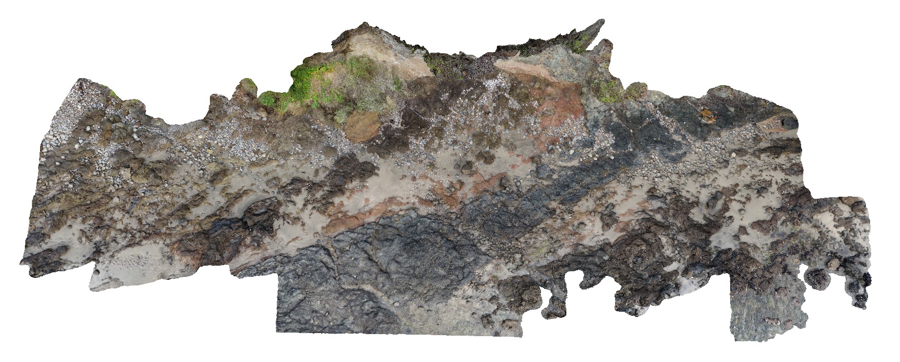 |
20 |
03/13/2015 9:17 a.m. |
3D |
Pole photography of the Charles Darwin Cliff at Sandy Bay. Tertiary basaltic lava flows and pyroclastic material deposited from a small volcanic vent approximately 200m to the west |
25.00 |
-42.91649600000 |
147.36026000000 |
-9999.000 |
basalt, tuff, agglomerate, volcanology, igneous |
basalt, tuff |
Scamander1 Map
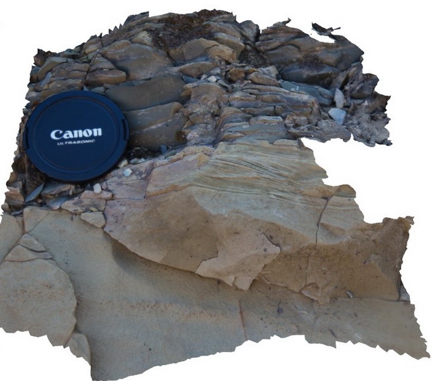 |
10 |
03/13/2015 9:16 a.m. |
3D |
detailed view of small cross beds in top of sandstone bed, overlain by blocky siltstone and cut by strong cleavage. Upper Scamander Rd, near Scamander River. Eastern Tasmania. |
0.20 |
-41.45960602000 |
148.23073954000 |
1.000 |
cross bedding, turbidite, sedimentology |
turbidite |
Scamander10 Map
 |
5 |
03/13/2015 9:01 a.m. |
3D |
turbidite beds, with soft sediment folding. Upper Scamander Rd, near Scamander River. Eastern Tasmania. |
0.80 |
-41.45949135000 |
148.23076806000 |
-9999.000 |
soft sediment deformation, turbidite, sedimentology |
turbidite |
Scamander2 Map
 |
5 |
03/13/2015 9:16 a.m. |
3D |
bedded turbidite sequence, with sandstone beds grading upwards to siltstones. Upper Scamander Rd, near Scamander River. Eastern Tasmania. |
0.80 |
-41.45931402000 |
148.23066259000 |
-9999.000 |
turbidite, bouma sequence |
turbidite |
Scamander3 Map
 |
5 |
03/13/2015 9 a.m. |
3D |
turbiditic sandstone with cross bedding. Upper Scamander Rd, near Scamander River. Eastern Tasmania. |
0.50 |
-41.45928471000 |
148.23059931000 |
-9999.000 |
bouma sequence, cross bedding, sedimentology |
turbidite |
Scamander4 Map
 |
5 |
03/13/2015 9 a.m. |
3D |
turbidite sequence, with load casts and flame structures. Upper Scamander Rd, near Scamander River. Eastern Tasmania. |
1.00 |
-41.45857777000 |
148.23035562000 |
-9999.000 |
load cast, flame structure, sedimentology, turbidite |
turbidite |
Scamander5 Map
 |
5 |
03/13/2015 9 a.m. |
3D |
turbidite sandstones and mudstones with load cast and flame structures. Upper Scamander Rd, near Scamander River. Eastern Tasmania. |
0.80 |
-41.45854544000 |
148.23027686000 |
-9999.000 |
load cast, flame structure, sedimentology, turbidite |
turbidite |